
“Everyone should believe in something. I believe I'll go hiking.”
–Ted
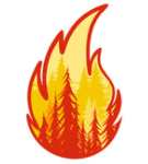 |
The recent forest fires (2021 mostly) have decimated much of the northern
Sierra playground. Affected areas are flagged on the page. As they become known, further details will be posted in the hiking journals. |
just photographs of the prettiest places you cannot drive to

find a hike on these searchable pages


hikes in chronological sequence

569-

#565-568

#553-564

#528-552

#500-527

#487-499

#467-486

#434-466

#386-433

#326-385

#298-325

#278-297

#226-277

#192-225

#138-191

#104-137

#75-103

#45-74

#26-44

#2-25

#1
ABOUT THE RATINGS
Hikes are evaluated subjectively, based upon actual experiences.
Criteria include scenery, climatic conditions, status of wildflowers and
stream flow, companionship, and relative success of cross-country
ventures. Barring an injury, virtually every hike is worthwhile;
any non-zero rating indicates that some enjoyment was had.
Call it a "fun factor".
Be aware that hikes are rated "on the curve" as it were, so do not be put off
by what might seem to be a lower ranking. Any 5-rated hike, for example,
features beautiful scenery and merits a visit; it just happens to score lower than
a lot of other walks, because I try to visit the best of the best along with all
the others.
Be also aware that I am partial to running water and alpine environments, so outings with those features do earn higher ratings. Conversely, deer hunters, mosquitoes, bad weather, and particularly rough trails cause downgrades. Unless otherwise specified, all trails are in California, mostly in the Sierra Nevada.
REPEAT VISITS
Repeat outings are included only when significant new material is available. Any page that substantially duplicates a previous walk is flagged with the [ID#] of the most recent prior visit.
ELEVATION STATISTICS
When available, lake and mountain peak elevation designations reflect the latest
data as published by the North American Vertical Datum of 1988 (NAVD88), a product
of the National Geodetic Survey. Modern adjustments can differ from the specs
on older maps by as much as several dozens of feet. U.S.G.S. Topo Map
data still are used as necessary for unnamed high-points; otherwise, most
elevation data can be obtained by your internet browser.
Note: NAVD88 itself has been officially updated as of 2022, because it is known to be skewed by as much as half a meter globally. That fix, however, does not seem sufficiently important to merit adjustments to existing web pages.
VIEWING THE PAGES AND GRAPHICS
In order to ensure top-quality image presentation, no thumbnail graphics are used. This means that pages will load somewhat more slowly than might otherwise be the case. Please be patient; it's in a good cause.
Utilize your browser's full-screen feature (F11) for viewing.
Most images can be be enlarged to 1024×768 or greater pixel
resolution, and saved as such if so desired. Just Left-Click
once or twice as necessary to expand a picture, or Right-Click
to save it. (It is unnecesary to enlarge before saving.)
Graphics labeled with a "⇔" have a greater resolution —
up to 2000×.
"⇔⇔" indicates a different view 'behind' the first one.
