
Valley of Fire State Park, Nevada
|
A Three-Part Odyssey Valley of Fire State Park, Nevada |
January 20, 2015
I have traveled 600 miles to visit this park as the start of a planned
multi-day hiking excursion. Having driven through here once
without bothering to stop and enjoy the scenery, I am hoping to be able to
enjoy it today despite a solid cloud cover, and despite the fact that my one
good eye is badly in need of cataract surgery. Just one old pair of
eyeglasses currently enables me to have any meaningful life at all.
A ten-dollar entry fee gets me a map of the park. After checking out the very nice Visitor Center and watching most of the ongoing movie, I head up the road behind it toward today's activities. Since the three planned walks are short and closely situated, they have been combined on this page as a single grand excursion.

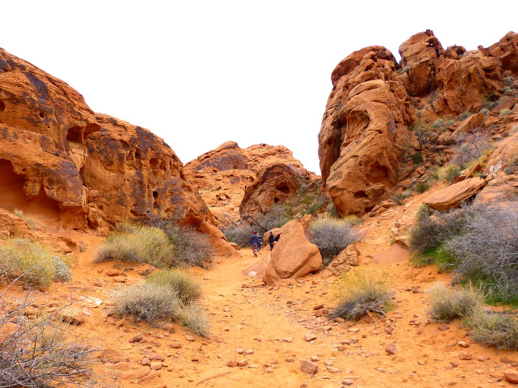
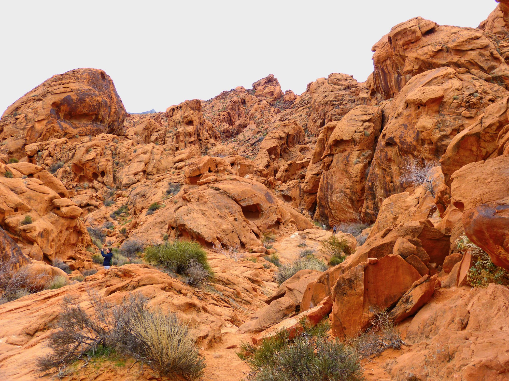
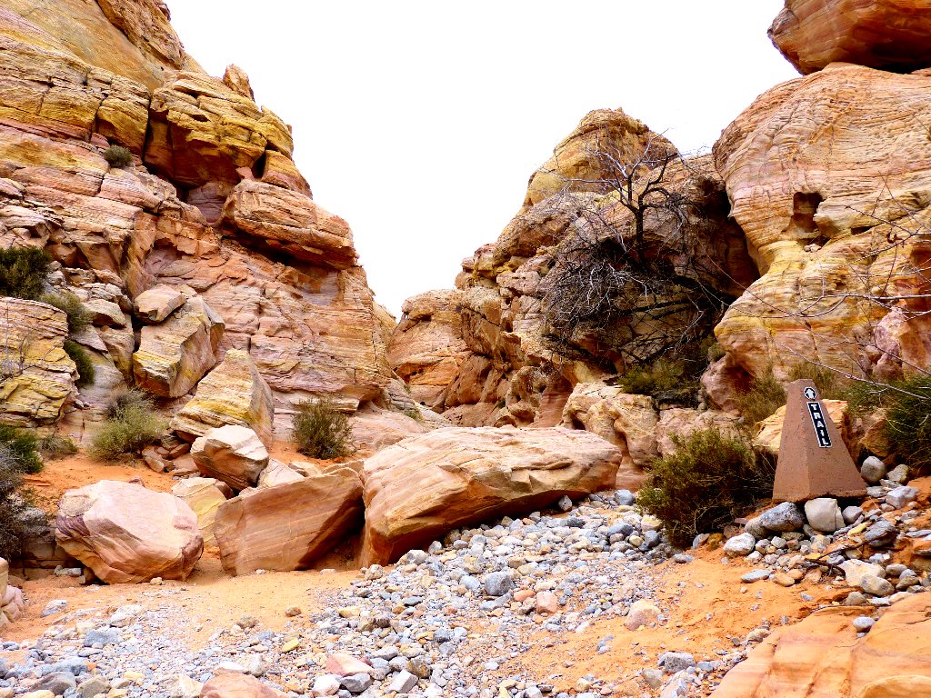
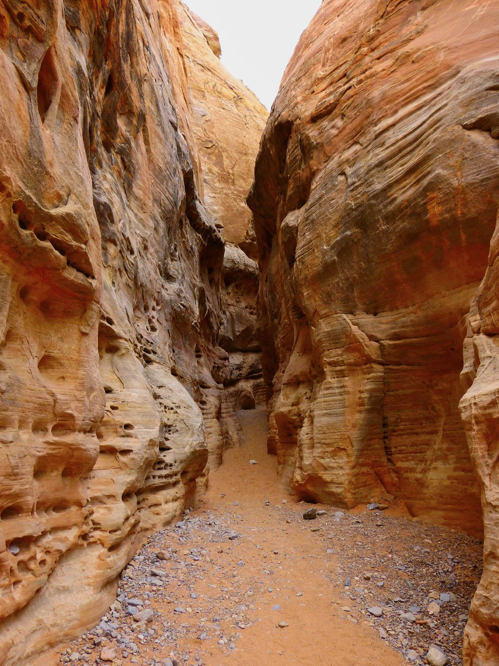
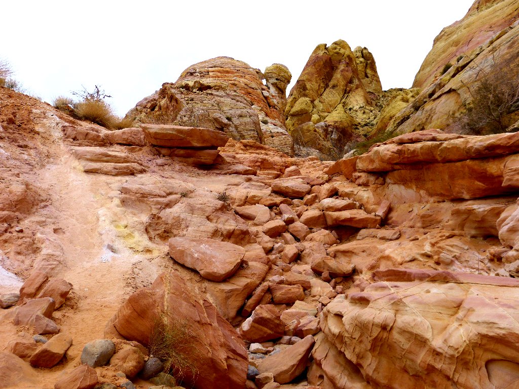
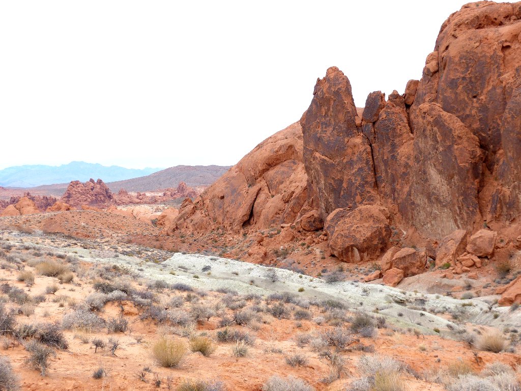
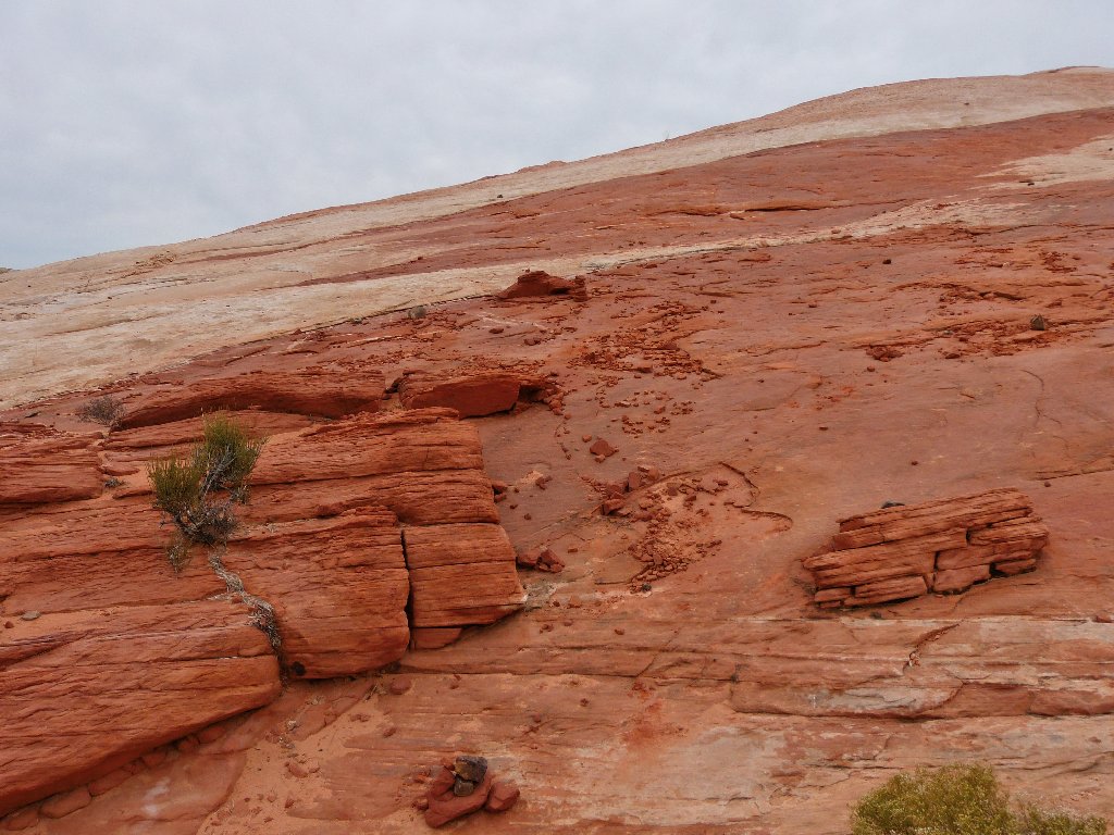
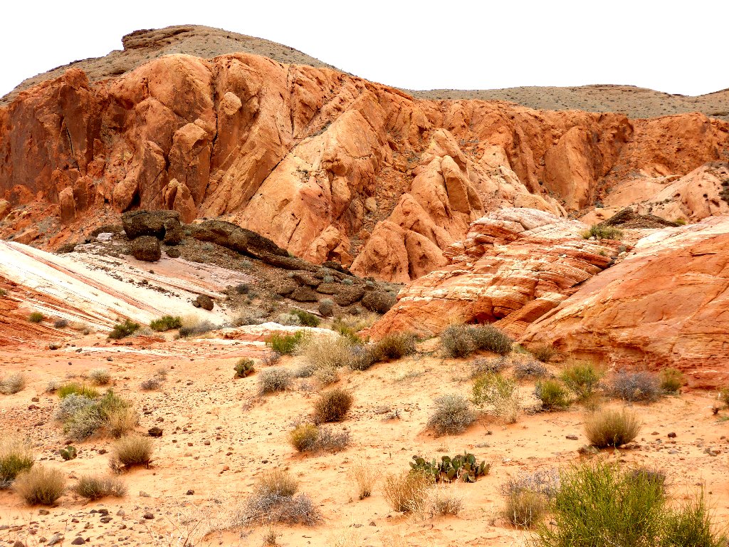
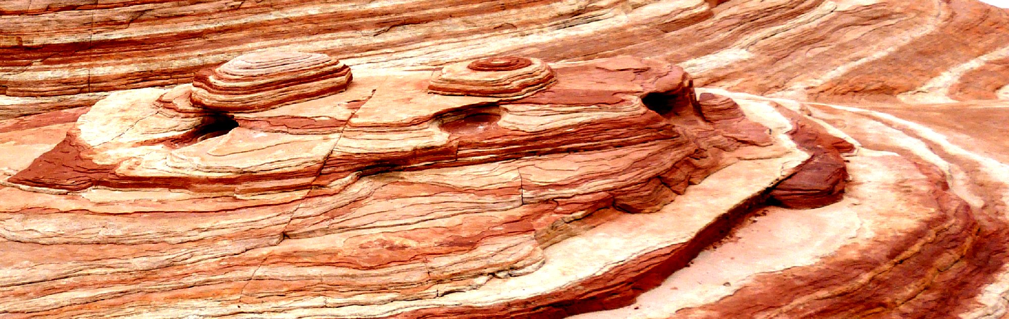
Petroglyph Canyon a.k.a. Mouse's Tank
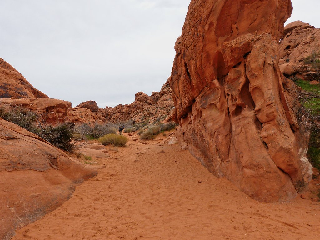
Entrance to Petroglyph Canyon
Within a few yards, the attractions begin to appear.
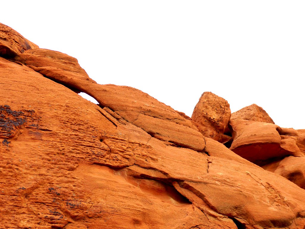
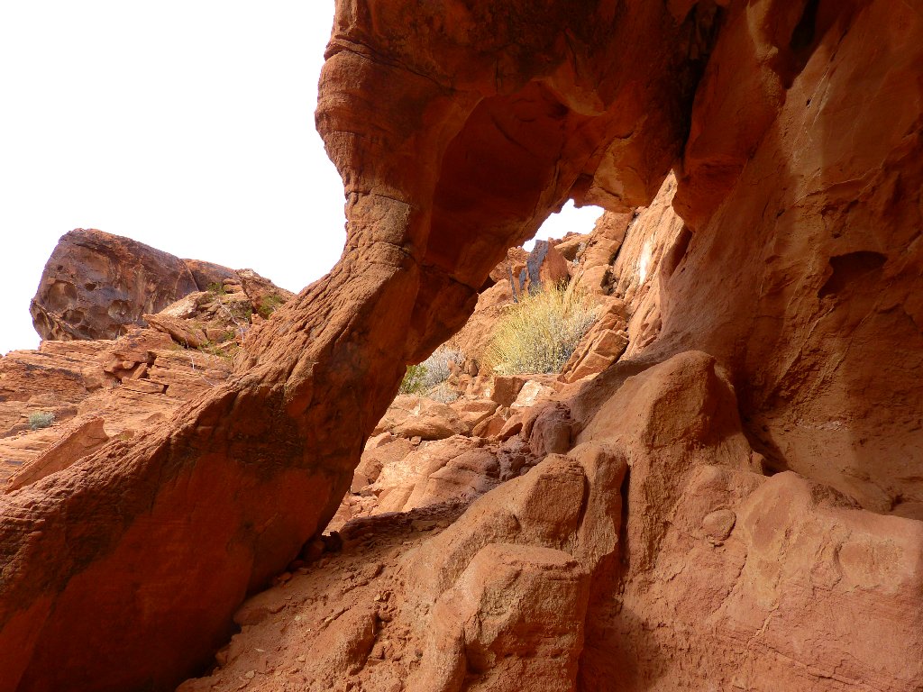
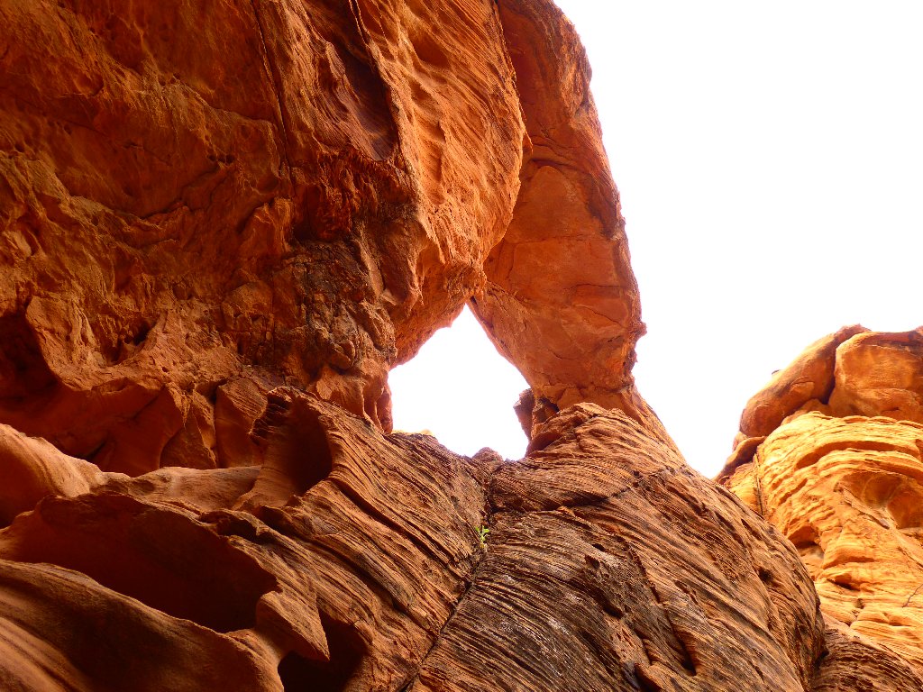
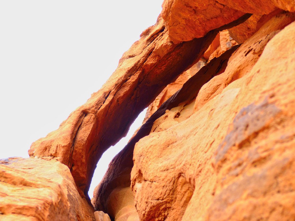
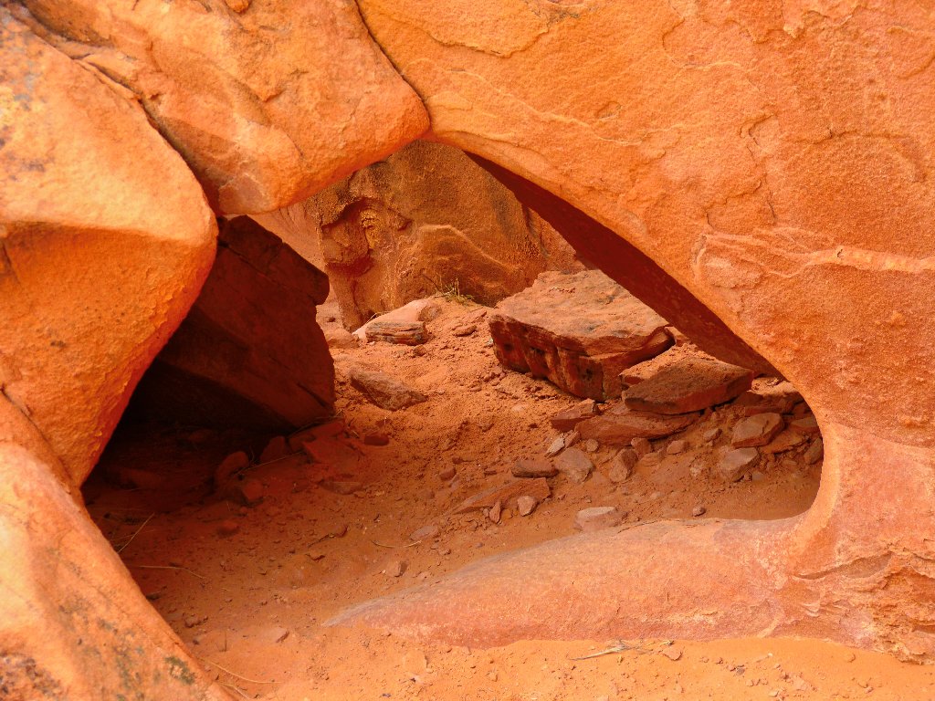
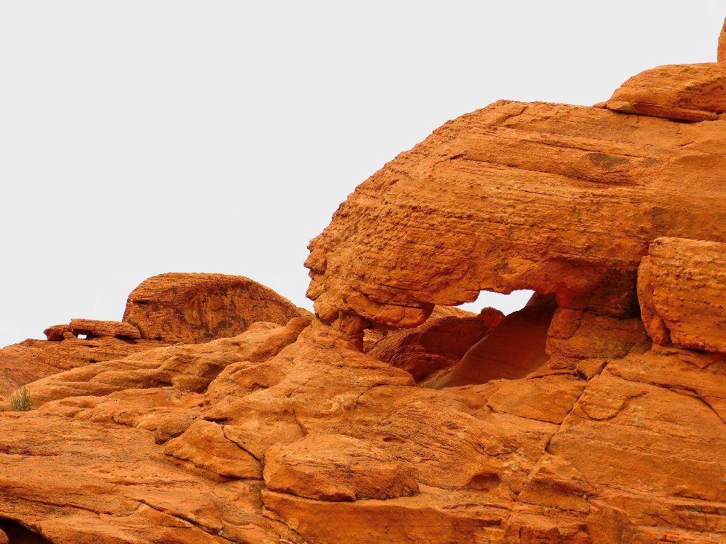
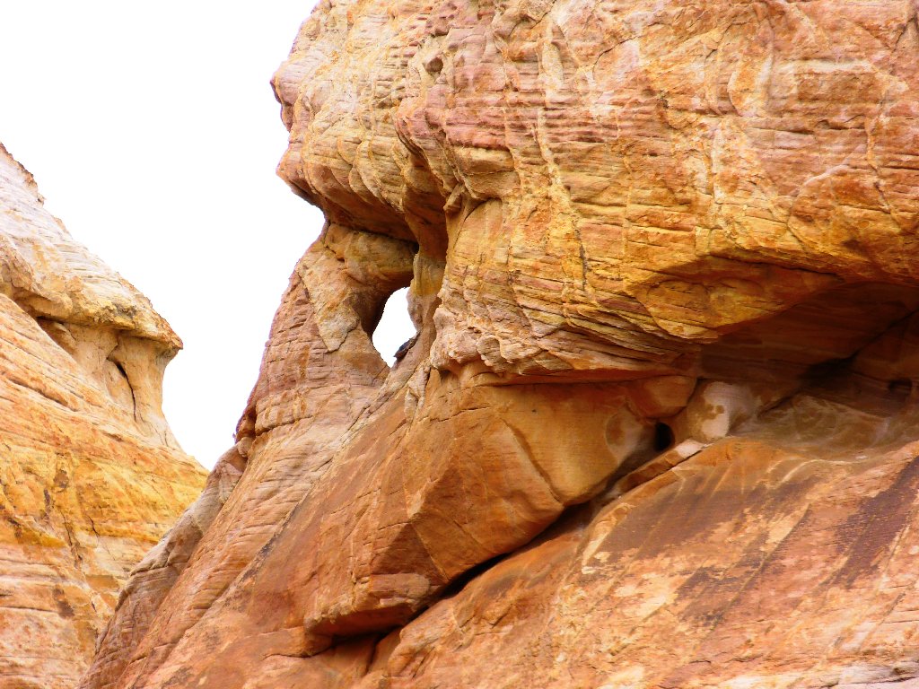
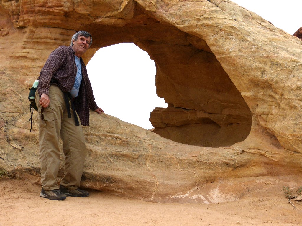
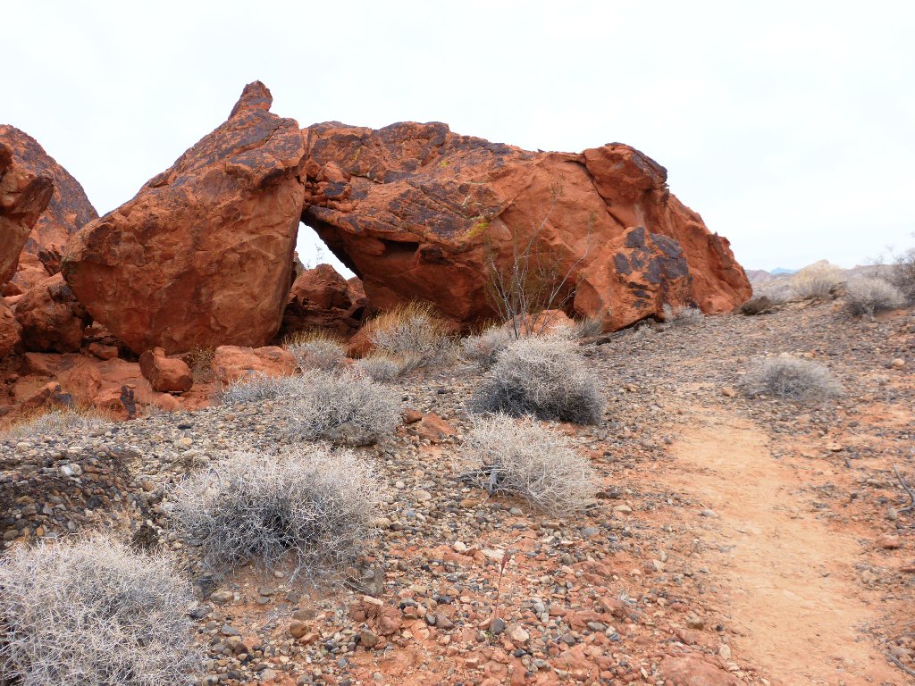
A mini-arch
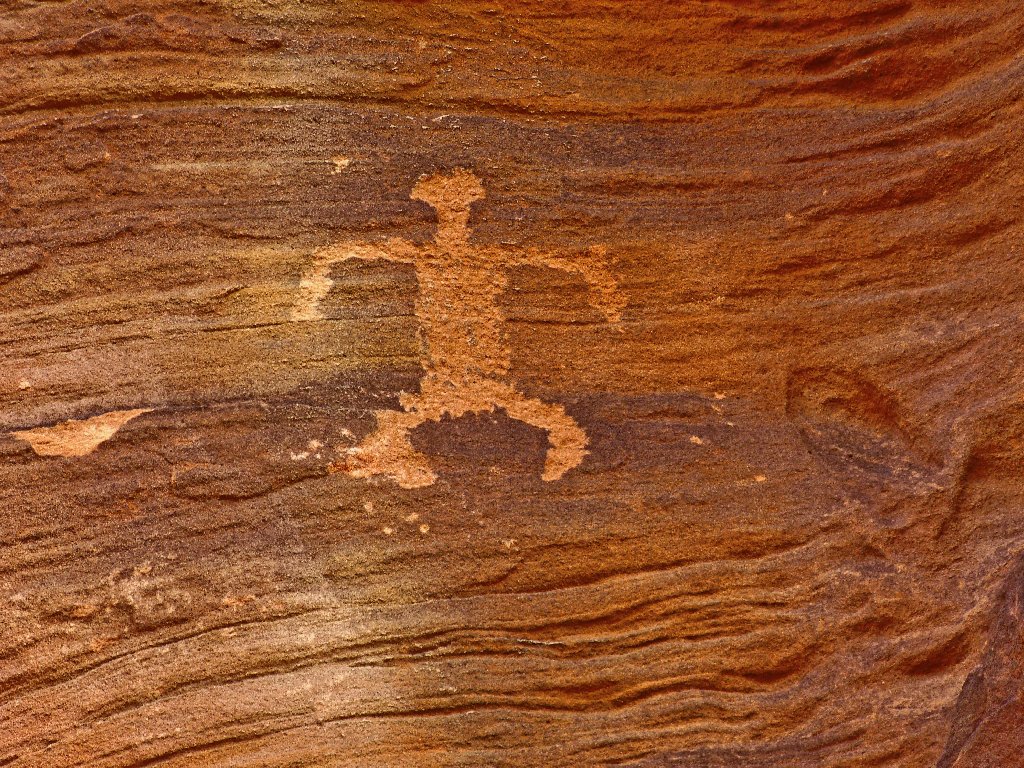
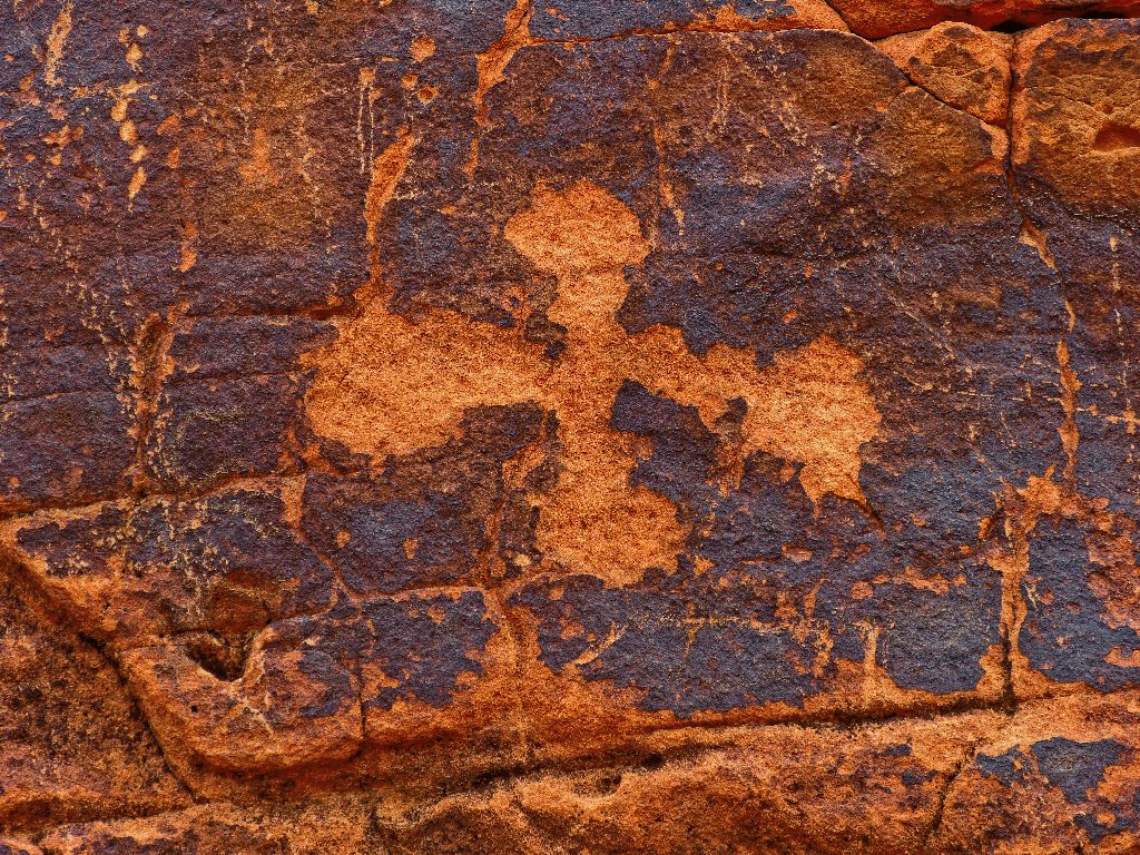
It doesn't take long to spot some petroglyphs on the rock walls, for they are all over the place.
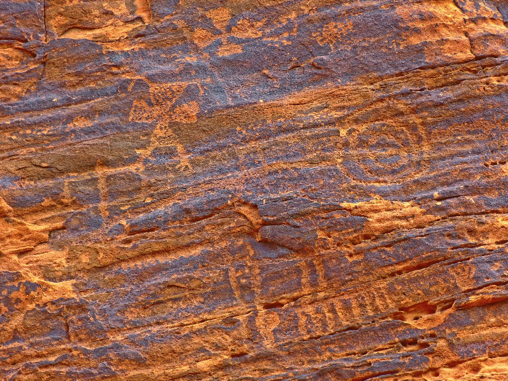
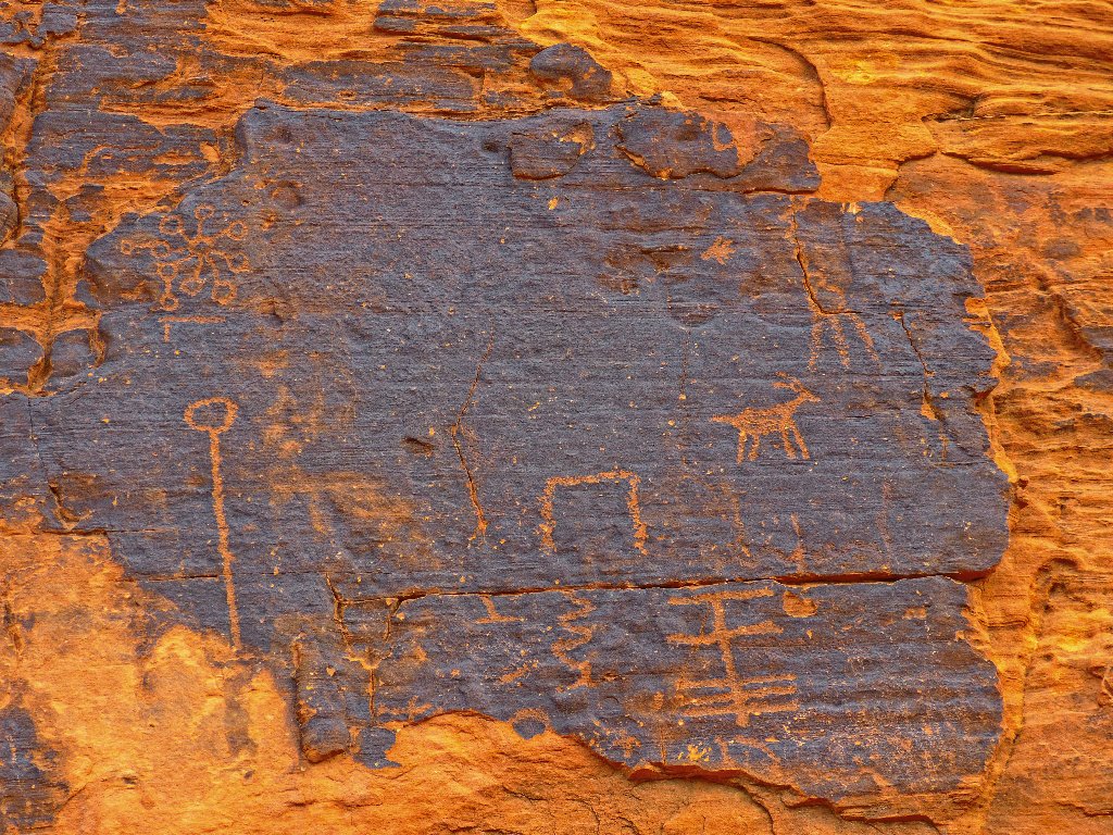
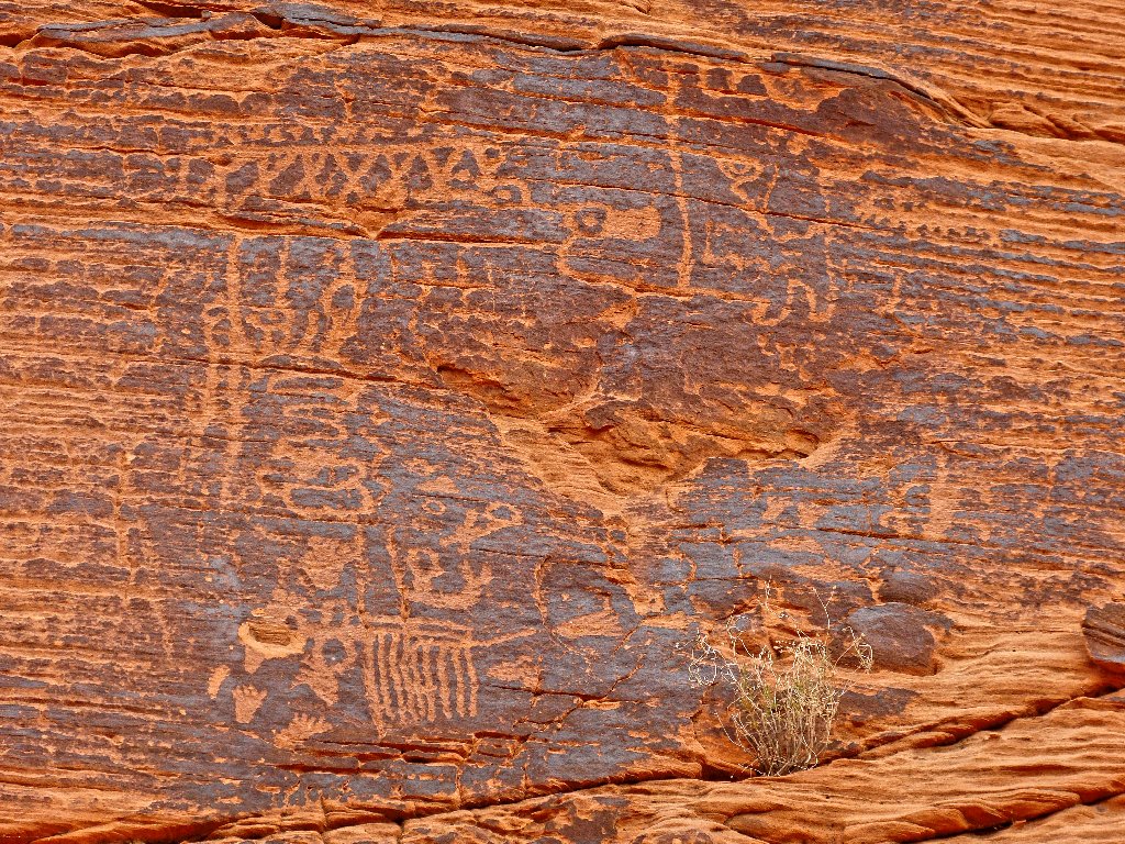
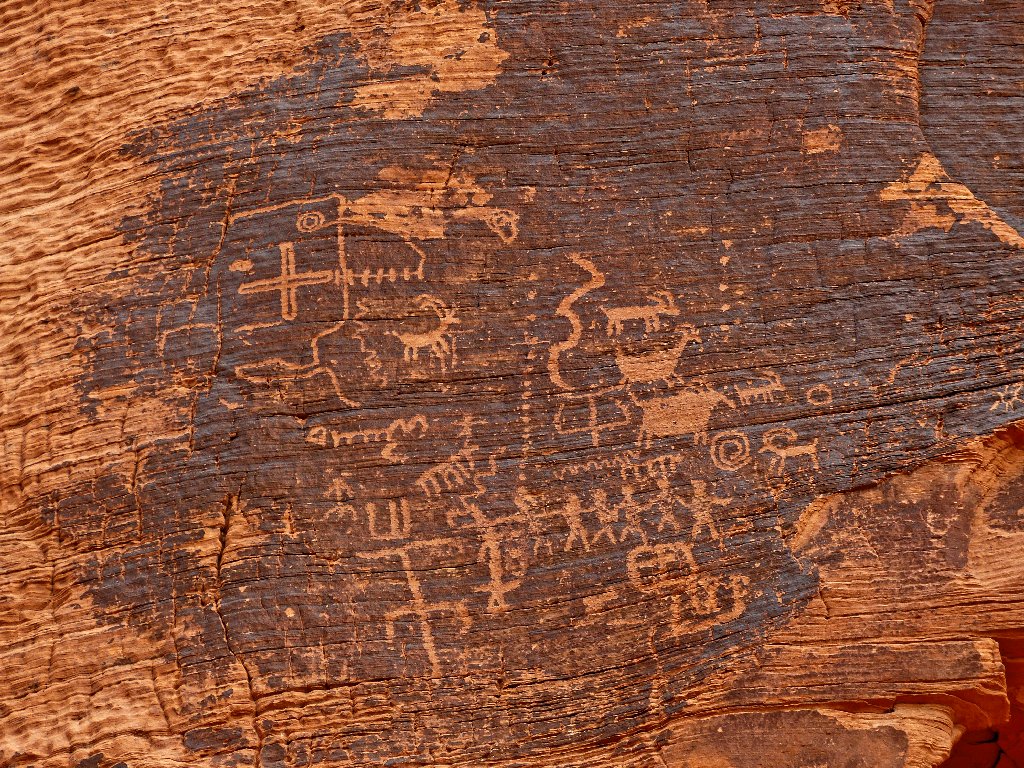
What does it all mean?
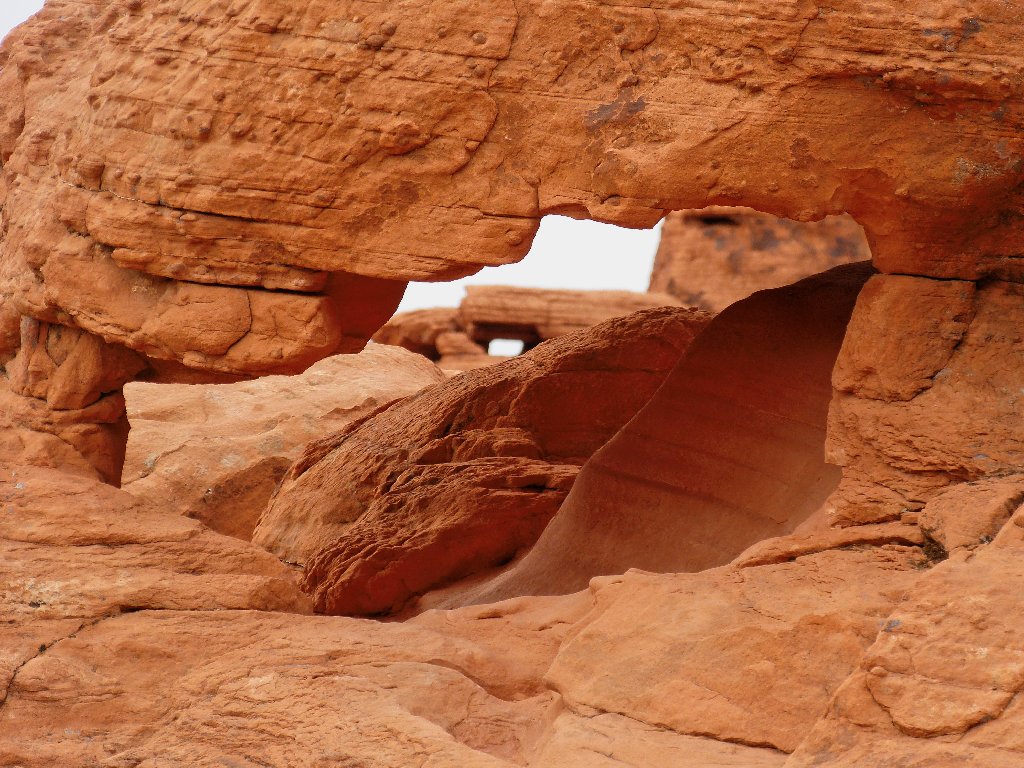
A minor scramble lets me photograph a good-sized arch from both sides. A couple of nearby hikers don't even notice the formation until I point it out.
Front side
Back side
All too soon, a signpost points leftward to an abrupt end of the trail. The small water repository below is unfortunately, but not unexpectedly, empty today.
Mouse's Tank
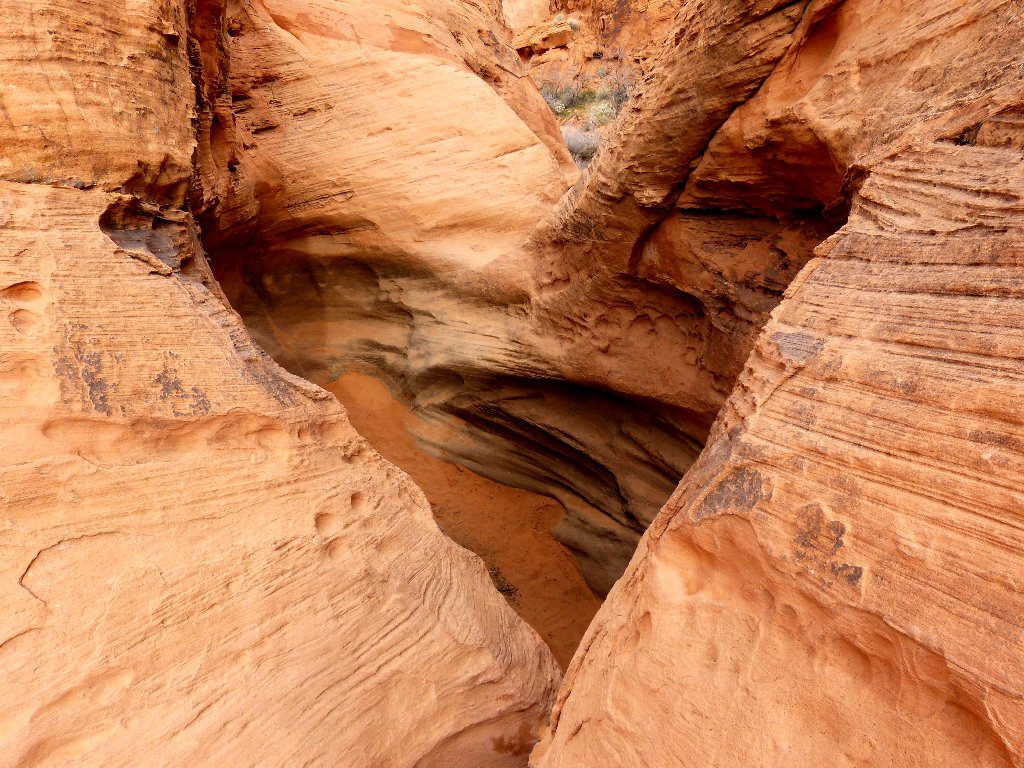
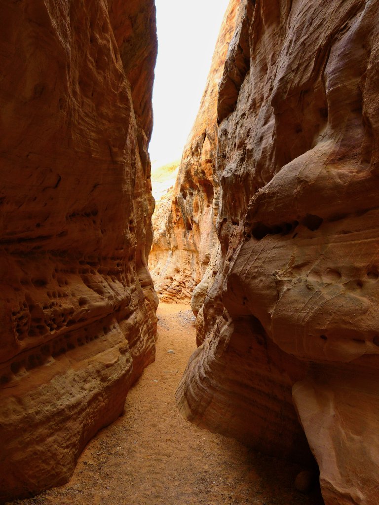
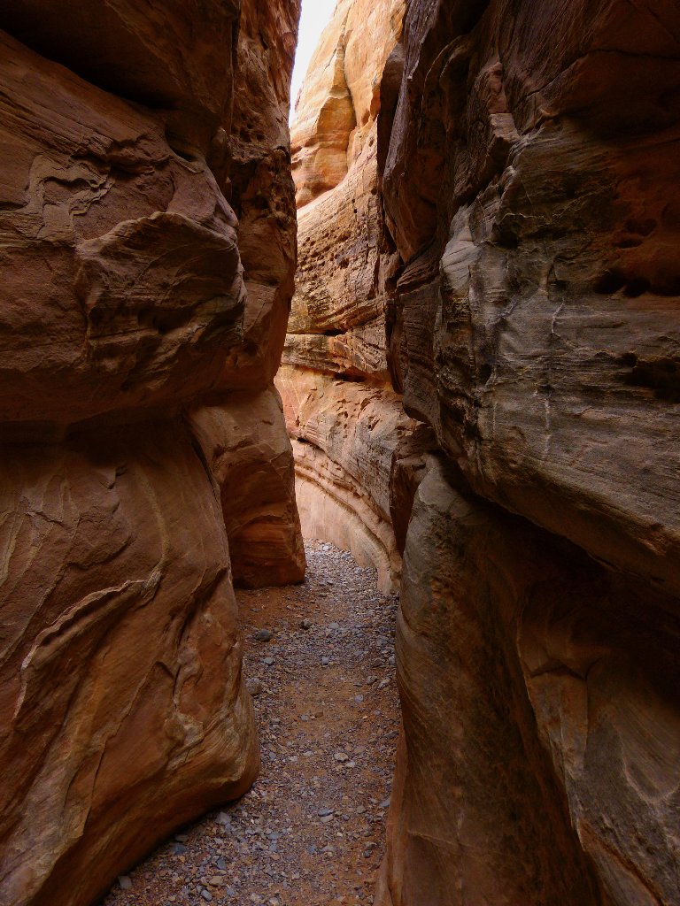
Back at the signpost, a little slot passage is too intriguing to ignore:
Doubtless a dead-end, but it must be explored
I look up to the right just in time to see a couple of hikers making their way through a big opening:
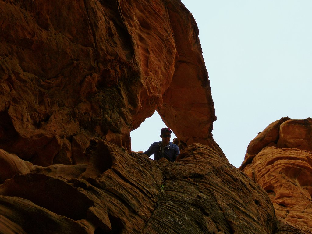
Now you see him...
Now you don't
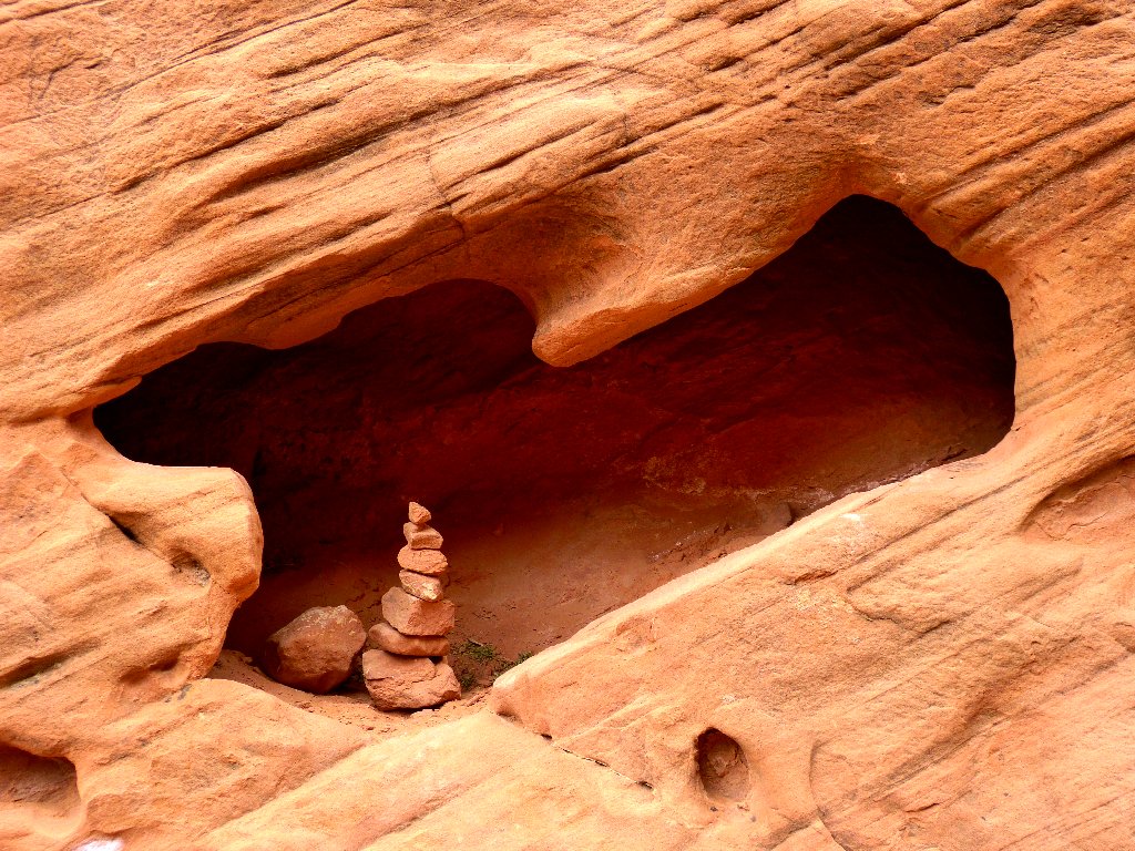
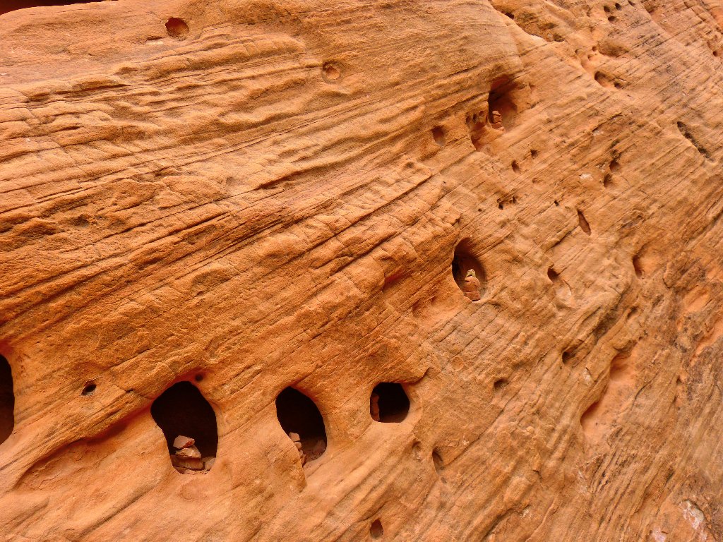
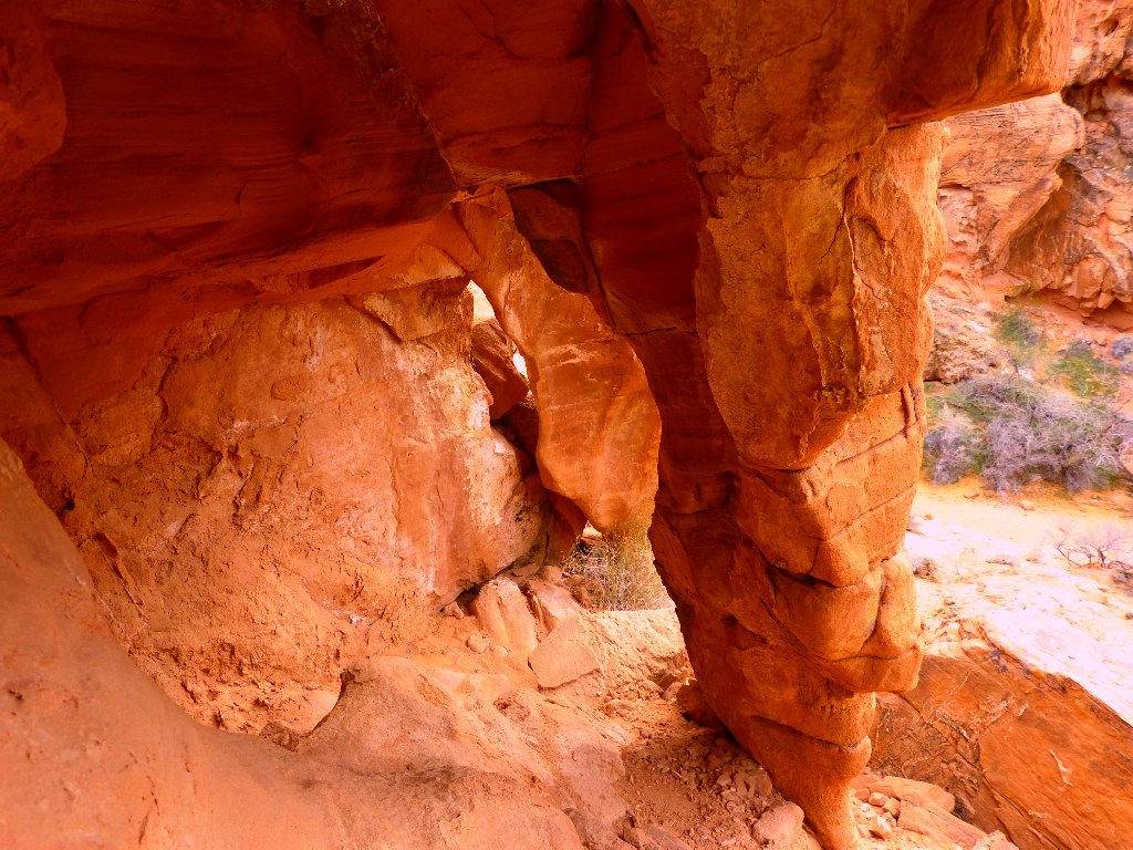
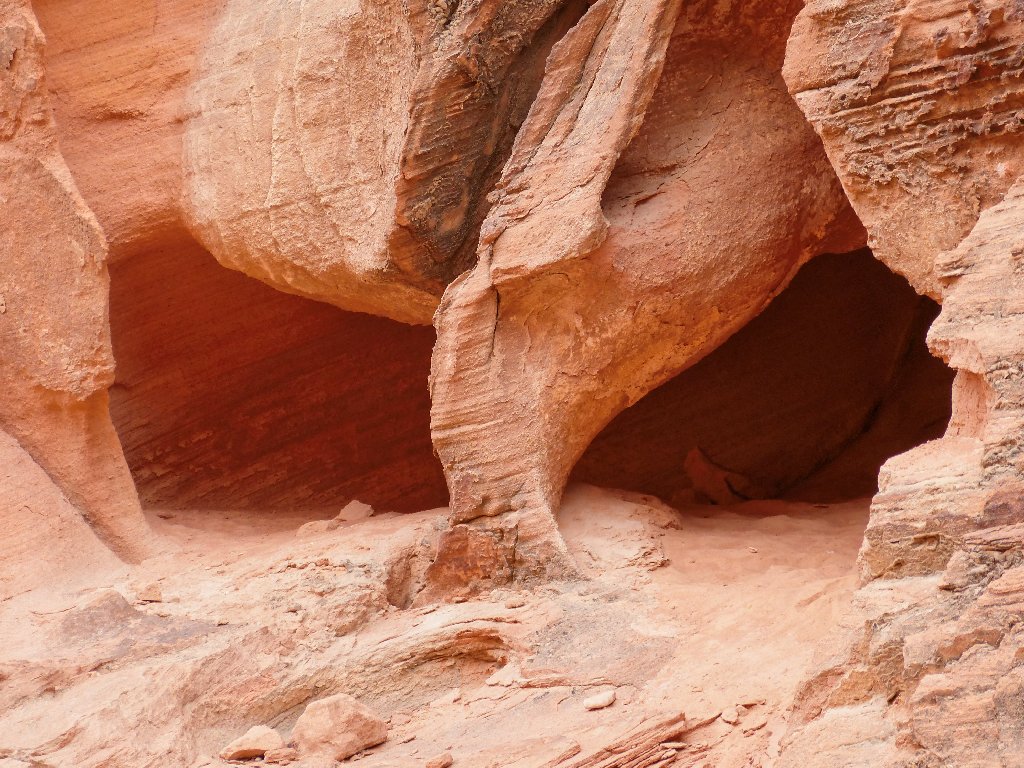
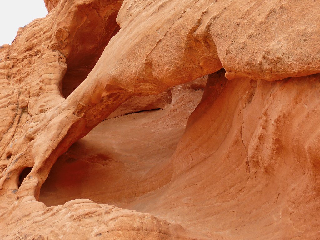
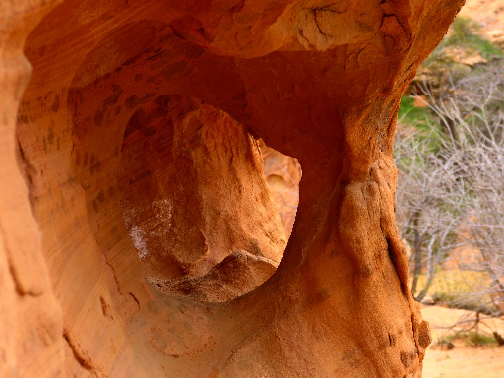
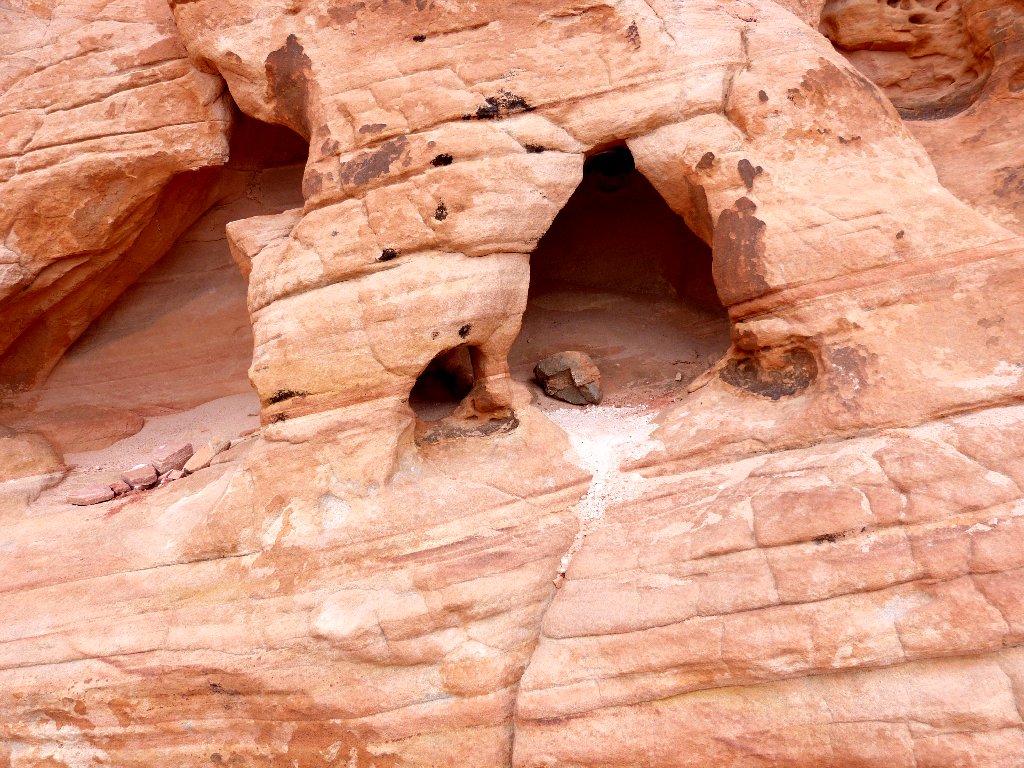
Somebody has filled all the holes with piles of rock
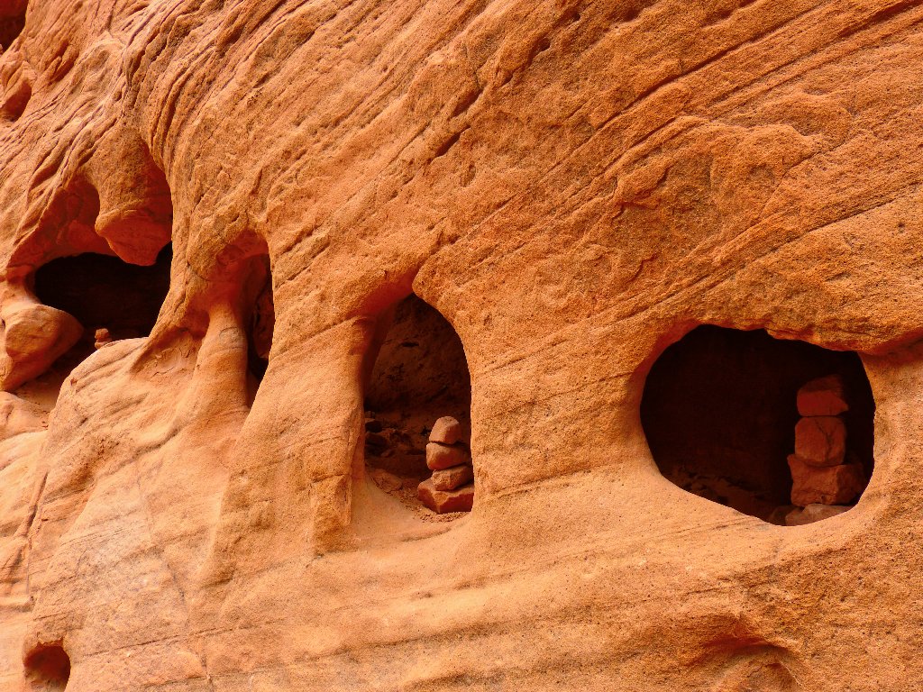
This actually is a quadruple arch; for all the holes are connected
The little cairns, albeit cute, really don't belong here. Anyone hoping for a natural experience won't find it in this alcove (see Addendum).
Mouse's Buttress is what those two folk were climbing through
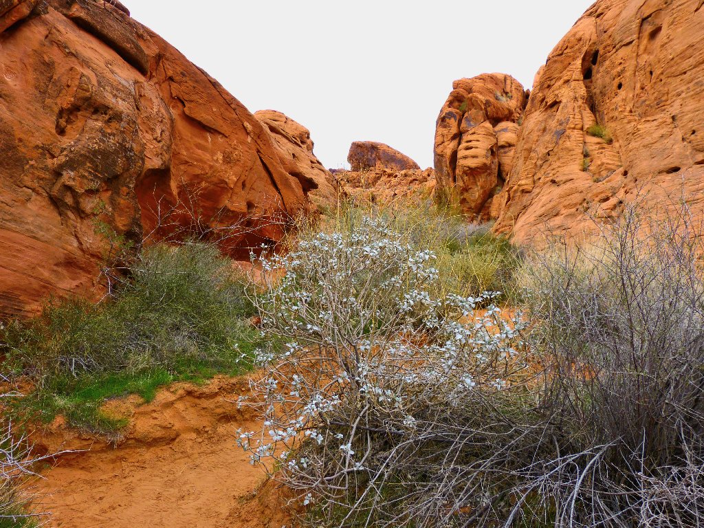
Some plants, but no flowers
A classic jughandle formation
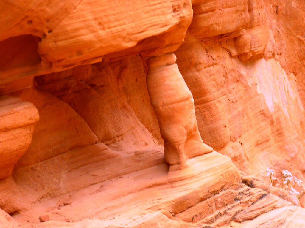
I dub thee Table Leg Arch
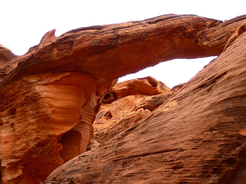
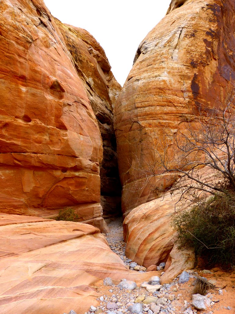
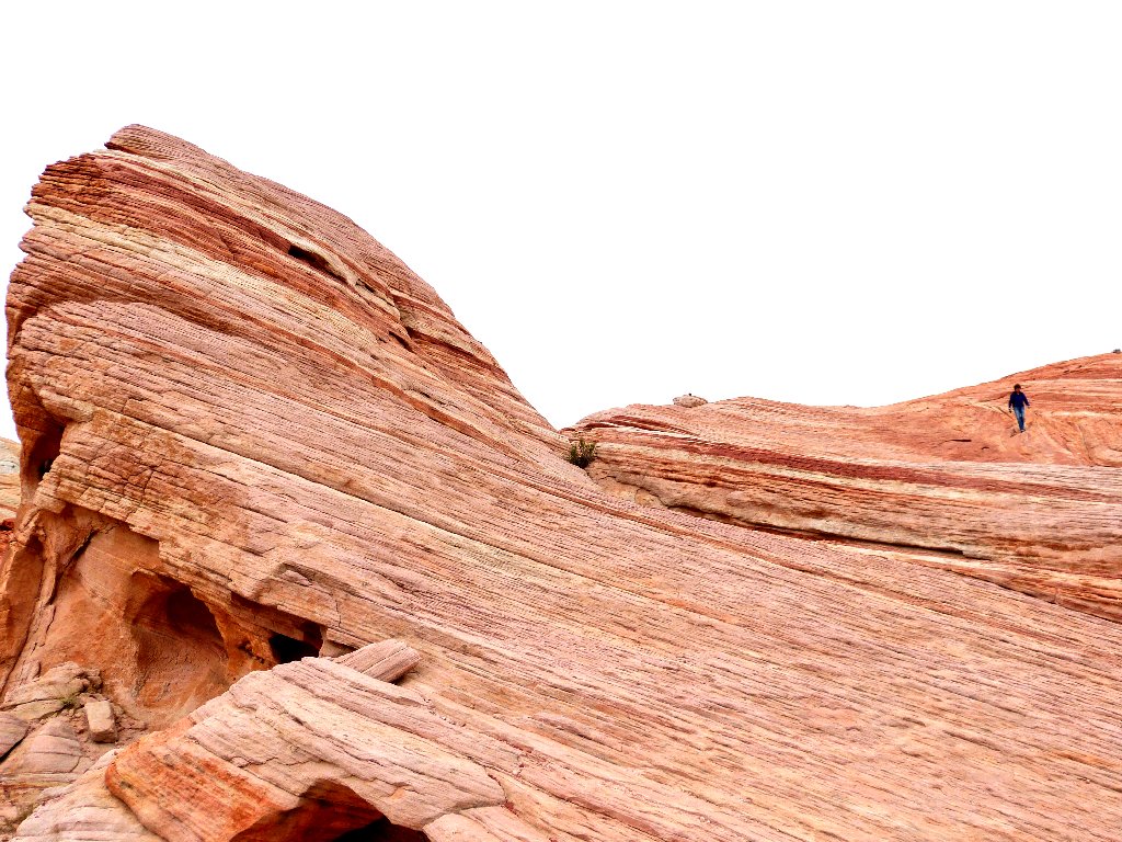
A faint spur trail leads to the right up a side canyon; a few hundred feet along I find yet another arch, at ground level. Because the rock is cracked at the top, this span technically is 'broken'.
I'll call this one Broken Tunnel Arch
Can you spot the three hikers in this
scene? ⇔
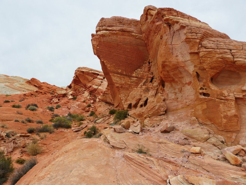
Near the end of the trail two arches appear up to the left. One of them actually is about a quarter of a mile distant.
The park road runs between them
A judicious camera angle provides an uncommon opportunity for a memorable shot:
This is why I go hiking
That distant arch actually overlooks the parking lot, whereas these last two spans are right beside the trail:
Near the parking lot
§: What an exquisite setting! I photographed more than a dozen
arches and more than a dozen petroglyph panels in less than a mile of incredible
rock formations. This walk has been understated by other writers.
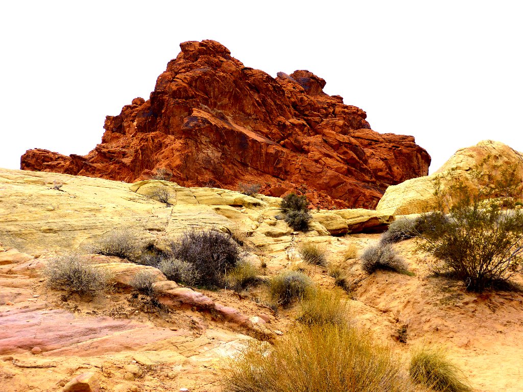
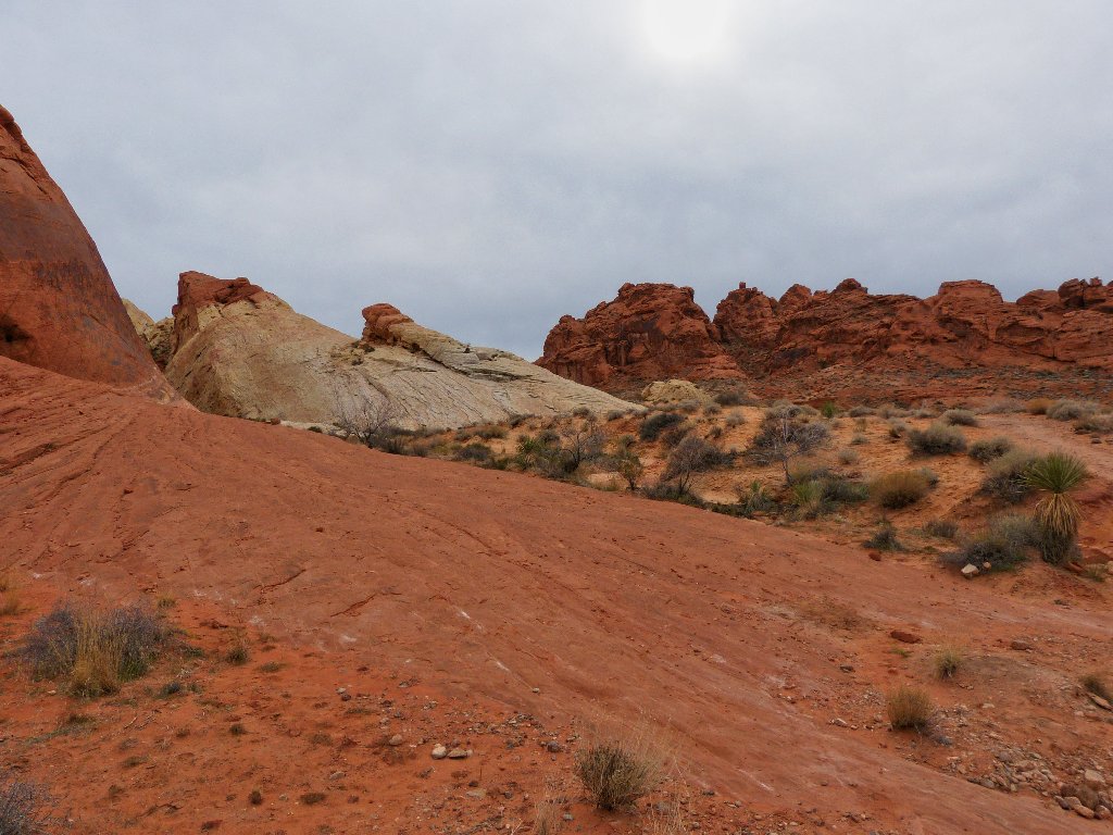
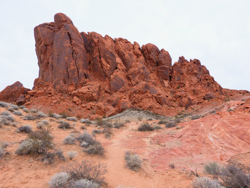
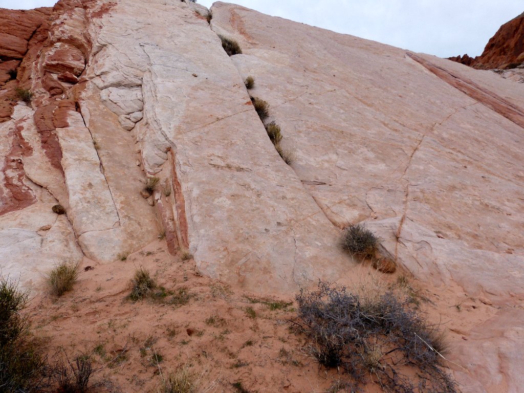
White Domes Loop
This parking lot is at the northern tip of the beautiful little
park road, which does a lot of 'whoopsie-style' ups and downs.
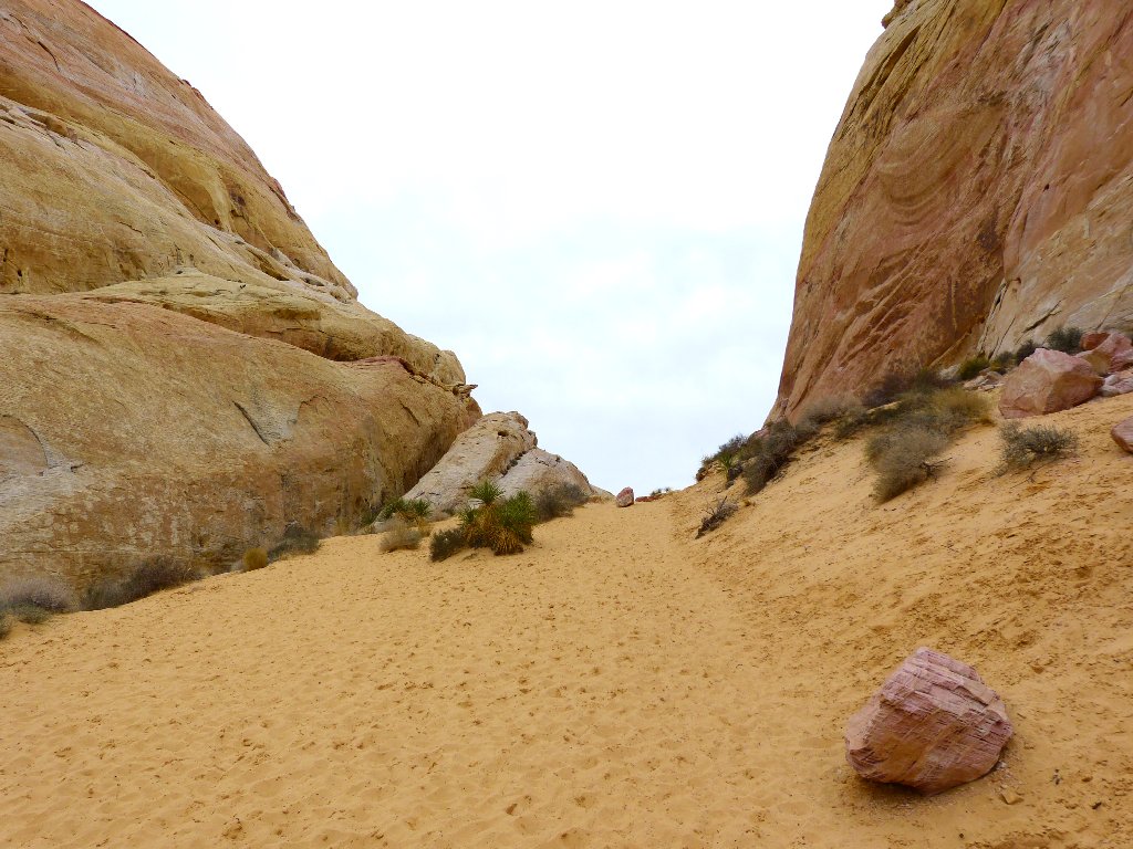
Not much to see yet
As the trail starts downward, a dazzling scene unfolds. Because of my bad eyes, I cannot even focus it clearly; I trust, however, that the camera can:
Zoom in on the incredible colors ⇔
The trail is steep and rough, but who cares?
At the bottom of the canyon is a testimonial to the first of many movies that have been shot in this area.
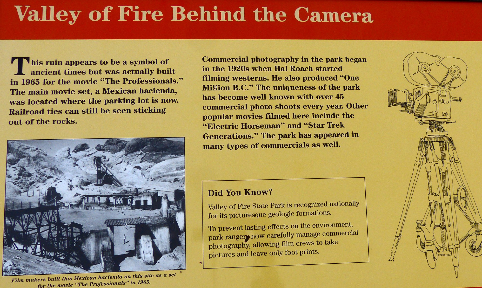
I had always wondered where one was
filmed ⇔
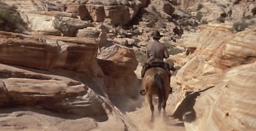
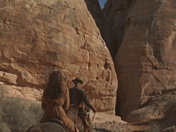
Gene Hackman rides through in Bite the Bullet
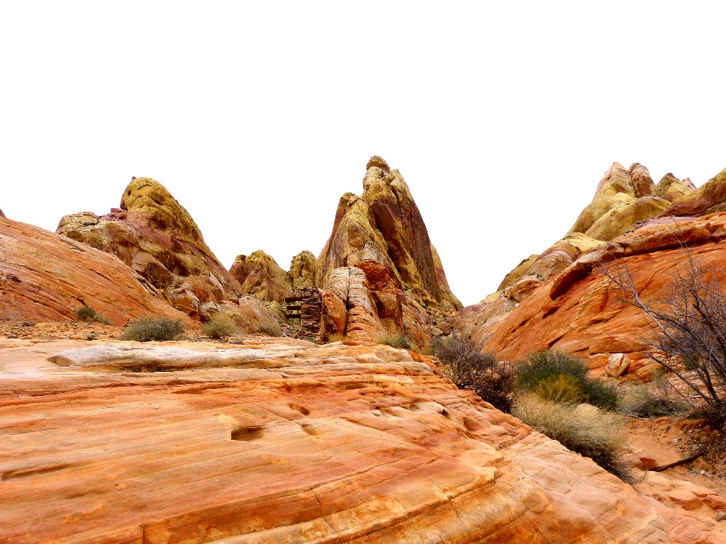
Overlooking the slot canyon where the movie heroes rigged a dynamite blast is a little arch that is clearly seen in a different film.
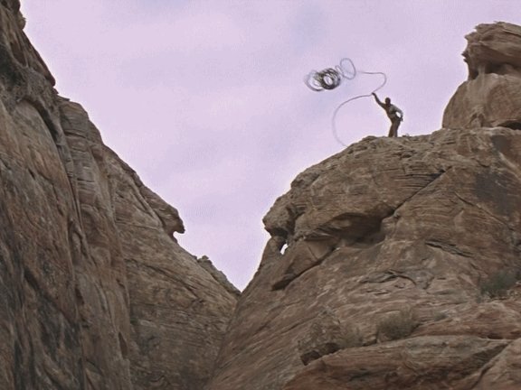
Woody Strode throws a rope to Burt Lancaster in The Professionals
The arch overlooks the slot canyon's entrance
Claudia Cardinale and Lee Marvin approach the slot in The Professionals
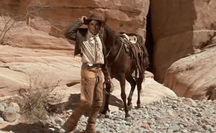
Mario Arteaga at the slot in Bite the Bullet
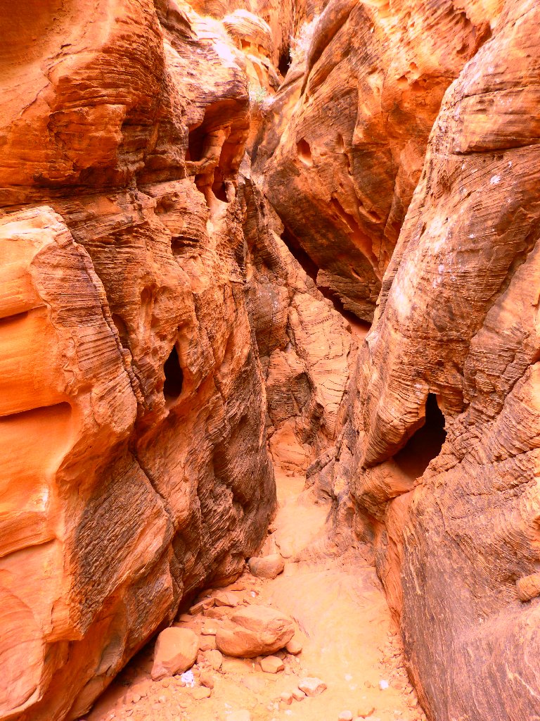
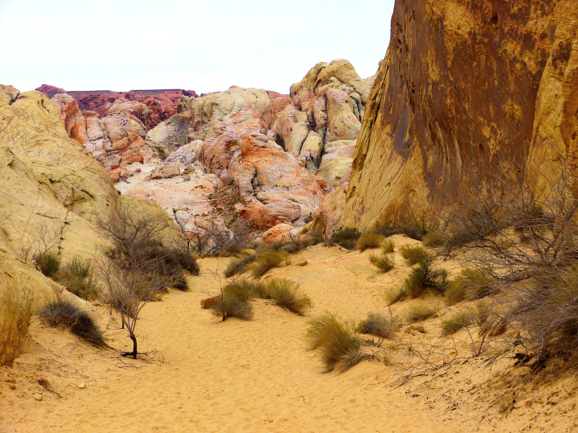
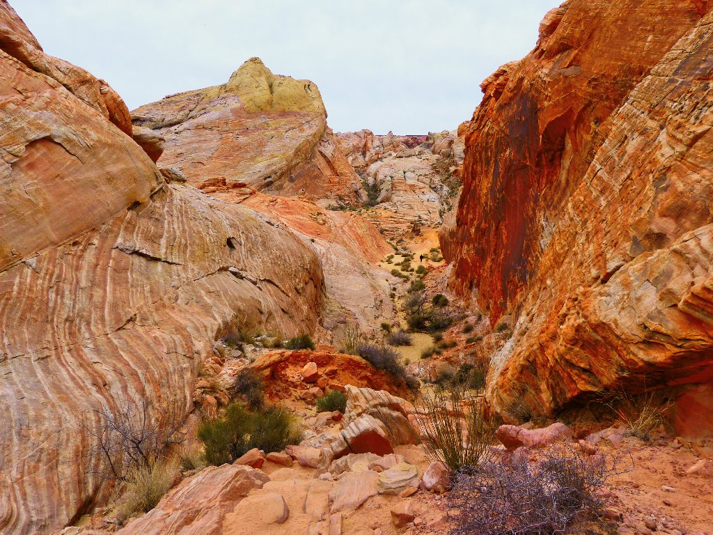
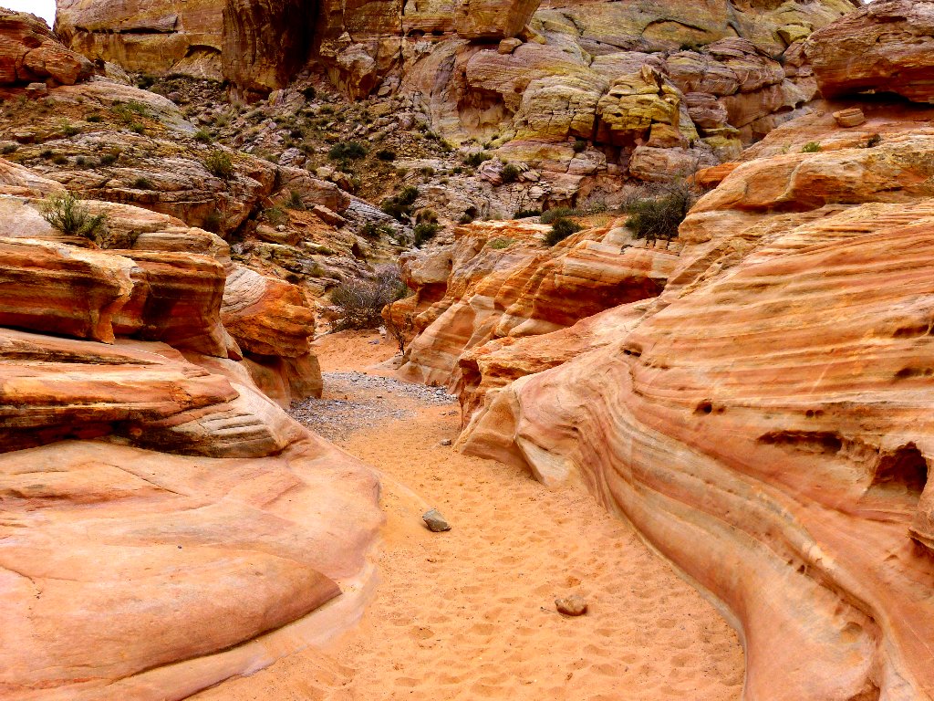
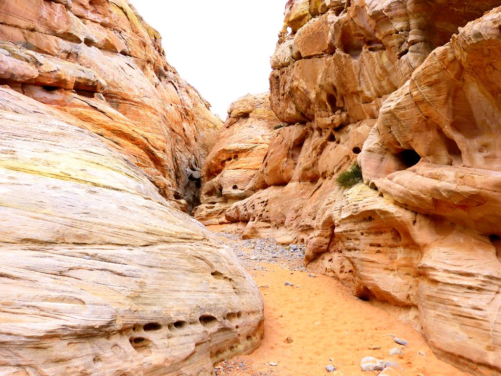
An optional cross-country detour offers a good chance to explore this popular area in relative solitude:
A shuttle would be needed
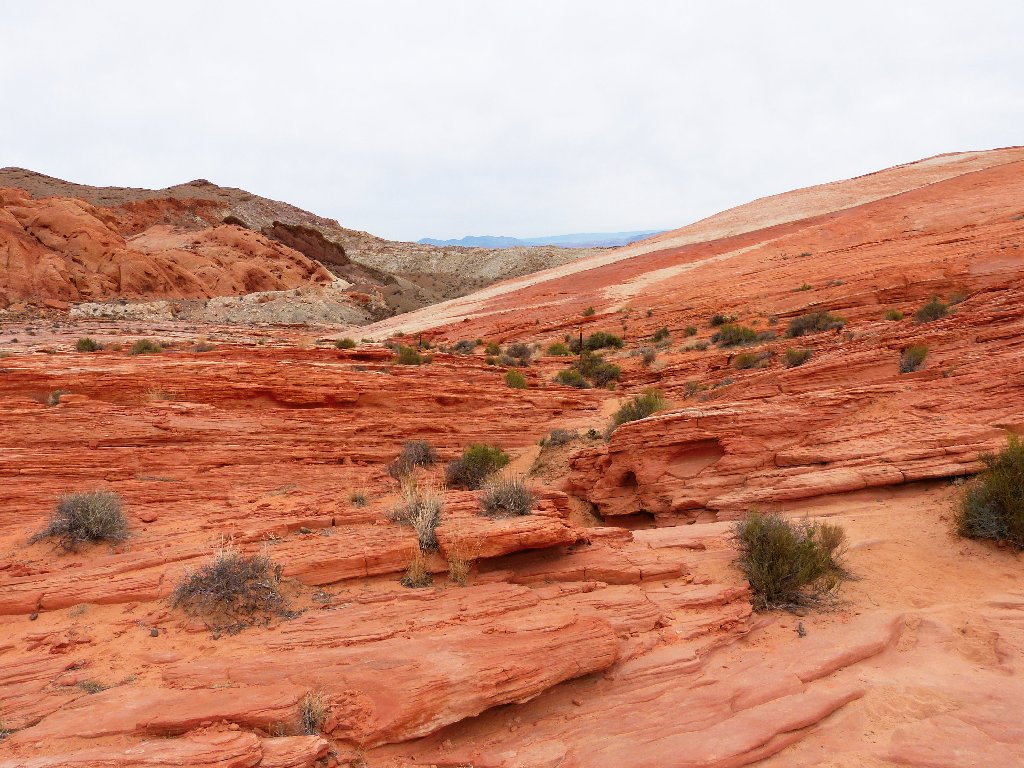
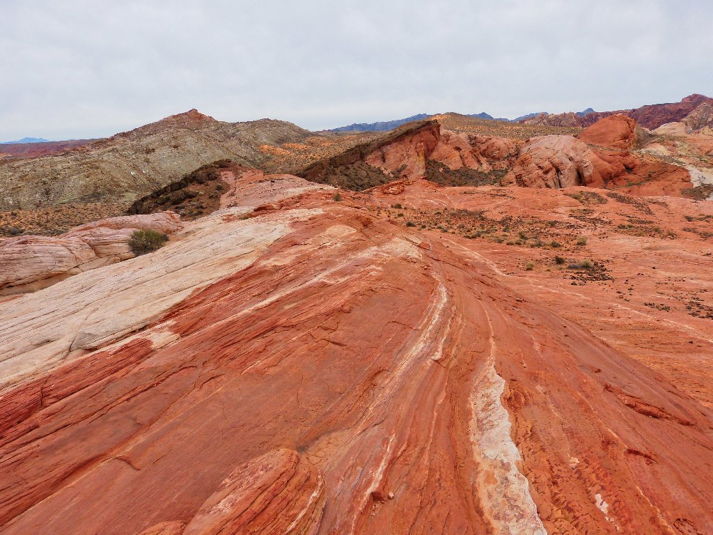
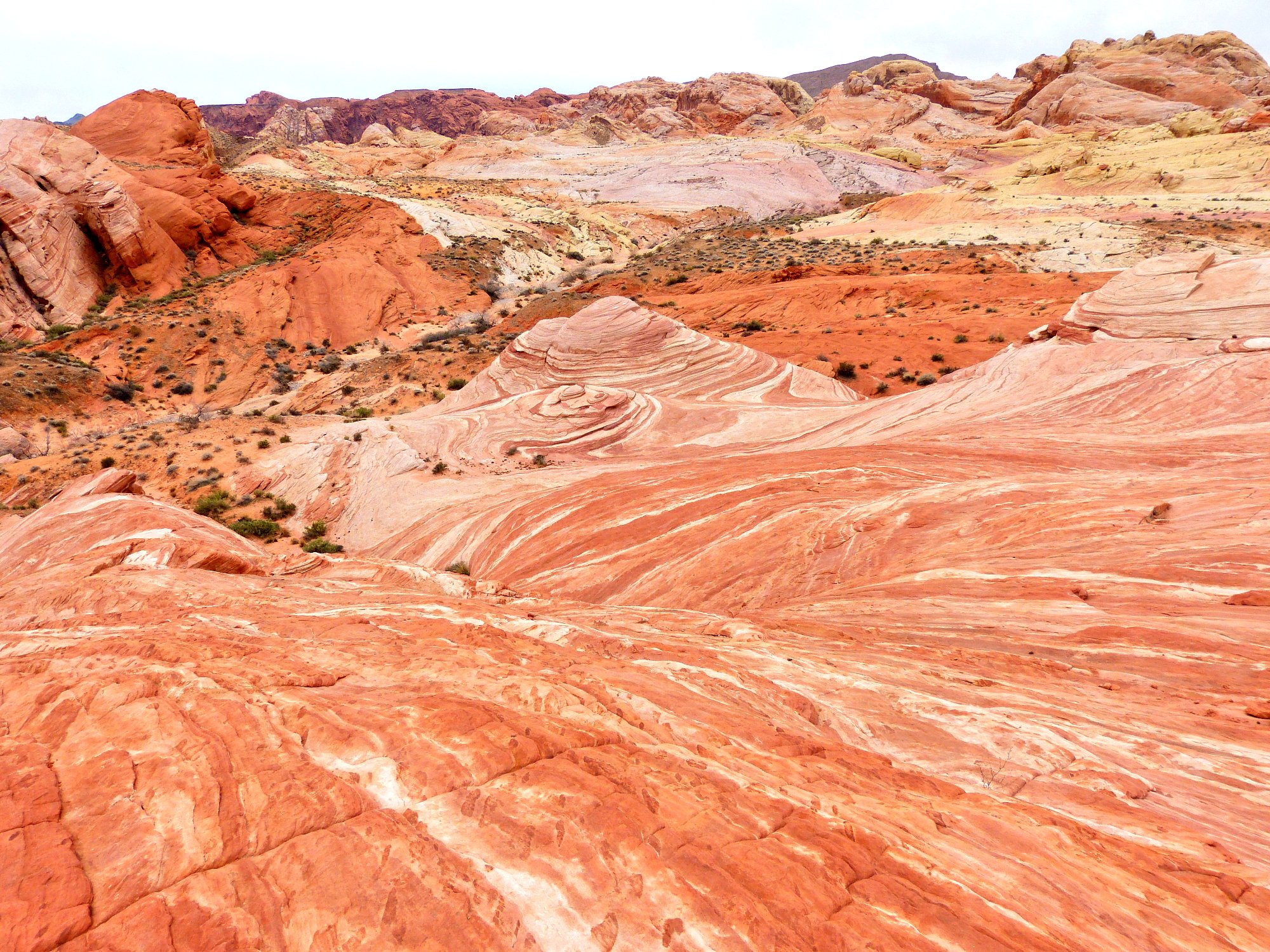
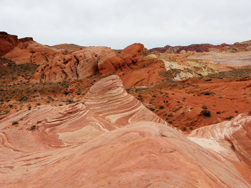
The route becomes more colorful all the time
Around the next corner my jaw drops to the ground as I encounter a view so stunning that I am compelled to stop, sit down, and take it in:
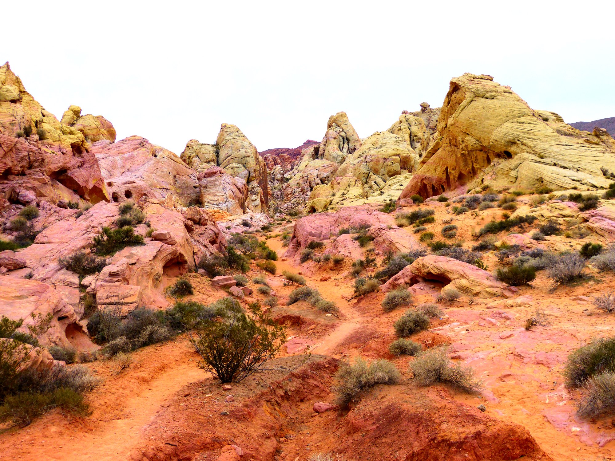
This must be the most colorful spot in Nevada today ⇔
It seems that this park might be more appropriately named the Valley of Color.
Today's lack of direct sunlight helps to bring out the hues
A selfie at White Domes Arch One
Colors or not, it would be better if the skies were blue
Approaching the highway
§: What an unexpected treat! It is no wonder that
certain movie producers have been so fond of this area. I got my
uncommon experience today in the most colorful place that I ever could
hope to see.
The other bloggers all write about the rock formations and petroglyphs,
and some talk about the more easily accessible arches; yet virtually no one
mentions the fantastic and exquisite coloration of this valley. Zion,
Bryce Canyon, and Cedar Breaks combined cannot match this place for color
variety and intensity — at least, not today. It's incredible.
Although there were half a dozen cars in the parking lot, I have no idea where their erstwhile occupants were. They certainly weren't sharing the trail with me; perhaps they will do so on my next visit.
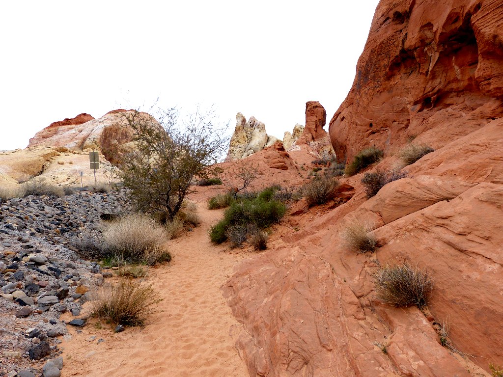
Fire Wave
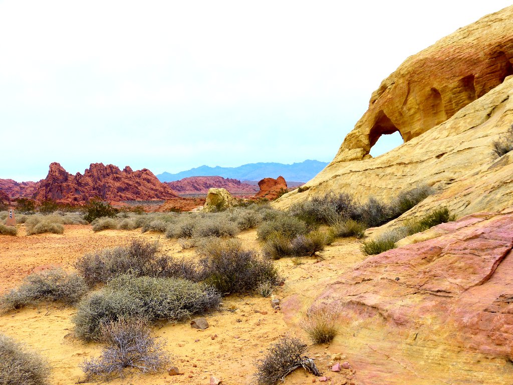
Just a mile from the White Domes area is the start of a relatively new
trail — one that remains unpublished in the park brochures
and which apparently was an official secret for quite some time.
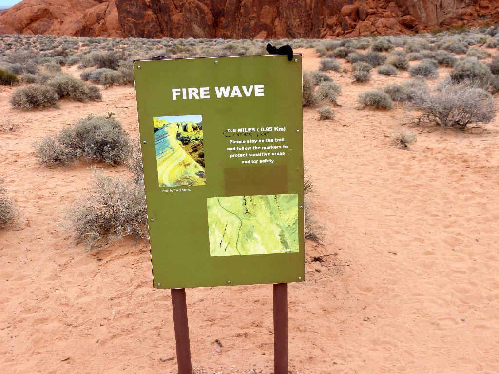
The sign advises me not to hike here in mid-summer
Of course, that same admonishment of high temperatures is valid anywhere in the Las Vegas area; but I guess they had to put something on the signpost.
Starting left; but the trail turns to the right
A spur route leads over to a promising gap in the rocks, but that's all it is.
No arches around here
Even though I can see trail markers over to the right, there are cairns inviting me up the slickrock slope; so I follow them. Whenever one of the options is to head uphill, I tend to go for it.
This looks like a fun way to go.
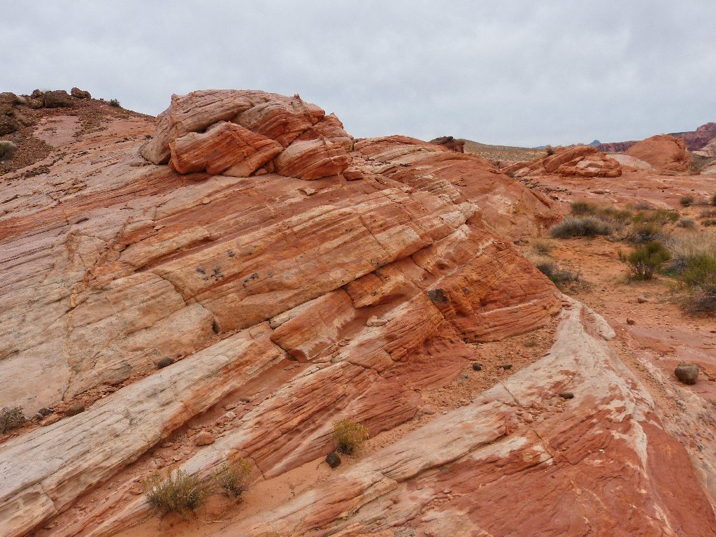
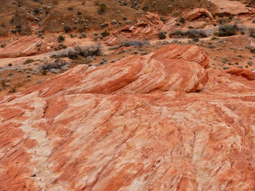
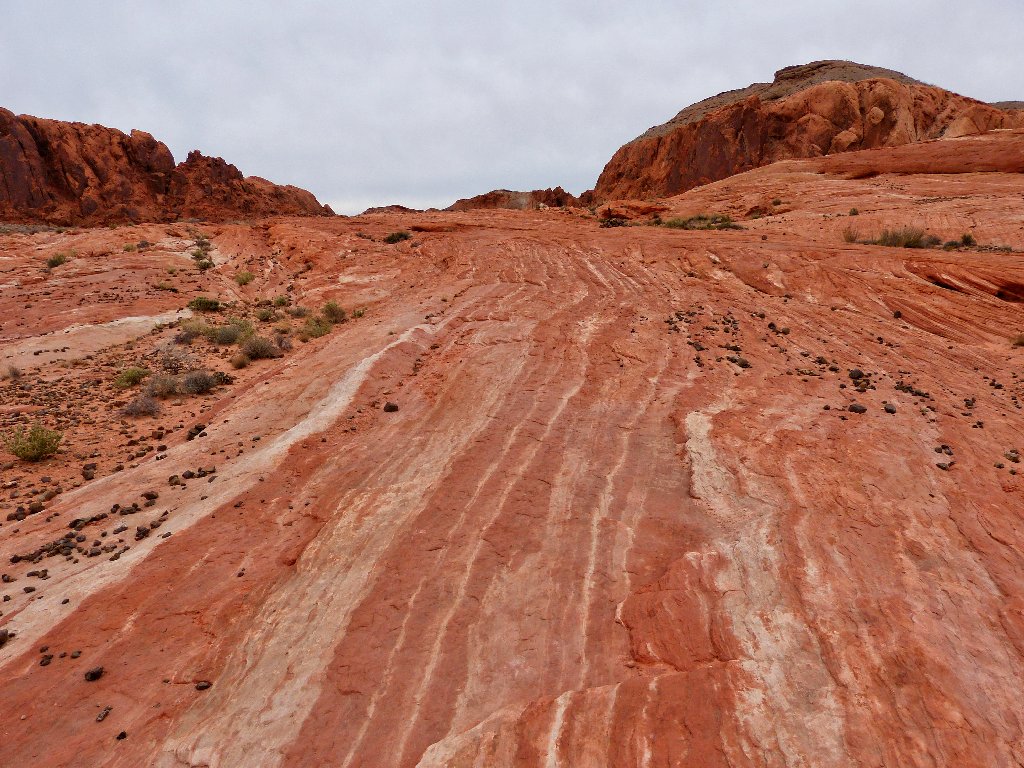
Shortly I find myself atop a long strip of red and white Aztec Sandstone. I will follow it to the other end and see what develops. If a backtrack proves necessary, so be it.
There is a way down the far side, so all is well.
My route down
A field of black rocks litters the flat pink slab. This scattering resembles the collections of moqui rocks found over in southern Utah, but these stones have unremarkable centers and doubtless lack spiritual significance as well.
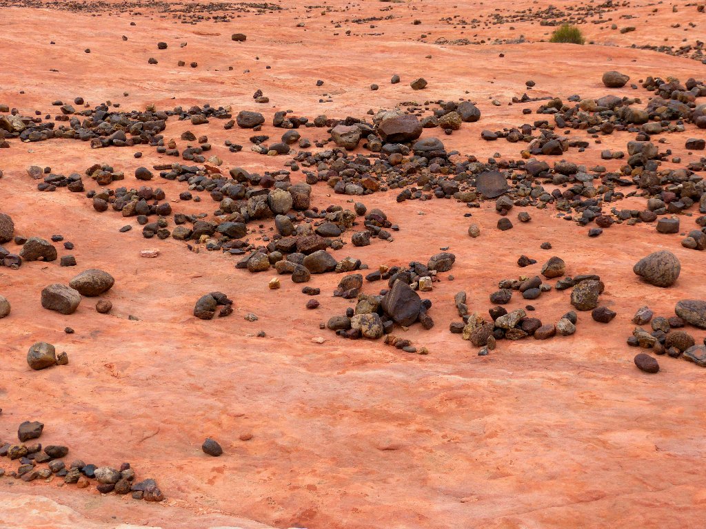
They're just rocks after all
There are nice wave-like patterns here; but somehow I feel that there must be something more.
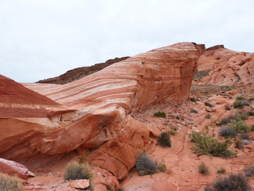
Finally, I reach a high-point and get a first view of the main attraction:
Fire Wave ⇔
Wow! Despite a plethora of landscape hues, the cute little wave formation stands out by being a lighter color than its neighbors.

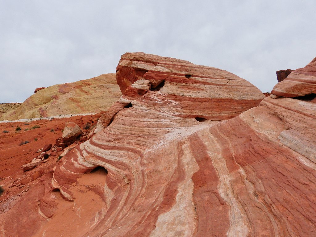
A closer view
Nifty patterns ⇔
After allowing time for three other hikers to take photographs, I plunge down onto the rock itself.
Oops! The Fire Wave is only half there!
This rock is reminiscent of a movie set or a downtown Virginia City
storefront — a nice facade, but nothing in the back.
A mini-arch
A plan to walk all the away around the formation doesn't work out, so I must retrace my steps.
Backside view
I would summit the rock, and that would be easy enough;
but since no one is around to take my photo, I see little point in it.
A final shot of the Fire Wave
On the way back I am catching up with a woman hiker. When she notices that fact, she quickens her pace so as to ensure that I don't overtake her just a few yards from the parking lot.
Heading back
§: I must admit that the camera has made this area look better than
the weather conditions permitted, but I felt the need to compensate somewhat.
Visiting the Fire Wave was a pleasant way to end my hiking day.
| Scenery |  |
| Difficulty |  |
| Personality |  |
| Adventure |  |
| Solitude | |
Today I saw twenty arches, a dozen petroglyph panels, movie sets, wave formations, and rocks of a thousand colors. The Valley of Fire is in a class of its own, and there remains a lot of unfinished business here.
The overcast served to dampen my spirits somewhat, though. Next time
I will try to find a relatively cool day in the springtime when some flowers
are out and the sun is shining — and when I can see better.

ADDENDUM
On October 21, I did go back when the sun was shining; yet the lighting and my photographs weren't nearly as good. In particular, the trail segment that I touted as the most colorful spot ever wasn't even recognized the second time around. It seems that visiting the Valley of Fire on an overcast day could be best after all, especially if photographs are an important consideration.
Also, I am pleased to announce that all of the decorative cairns at Mouse's Tank had been cleaned out. Check out this article on that topic:
