
Yosemite National Park
|
Columbia Finger Loop Yosemite National Park |
August 28, 2012
Having anticipated this outing for two years, I sure hope that it works out. The plan is to visit a unique and remarkable formation that most people have never even heard of, by way of an unorthodox route.
In an attempt to save some mileage, I start by taking a back way into Cathedral
Lakes, ignoring the John Muir Trailhead on the Tioga Road. In fact, the master
plan calls for this to be primarily a cross-country experience.

Picnic area at the east end of Tenaya Lake
This is not the closest parking lot for beginning the trek; but it is one of the Tuolumne Meadows Shuttle stops, which fact should come in handy later.
The map shows a pack trail running north beside Tenaya Creek. I head down the obvious path toward the Tenaya Lake beach, hoping to find a junction. Unable to spot anything over there, I return to the picnic area, then strike out through the forest and up the meadow. The easiest path through here is the stream bottom itself, as is confirmed by all the boot prints in the sand.

The easiest way to go

There's the trail
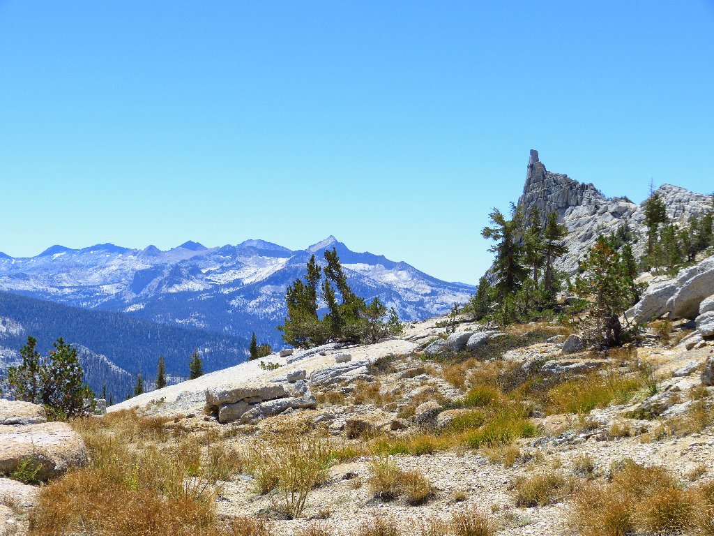
I am heading toward Medlicott Dome, an area popular with rock climbers.
I had expected there to be a reasonably well-established use trail in
here. Finally, one does appear; it seems that I would have run into it
much sooner by proceeding due east from the car in the first place.
I'll do that next time.
I cannot remain on this trail indefinitely, however. In fact, the optimal cutoff point for heading up into the canyon seems to have been missed; so I do that now.

It is time to start uphill

What I find
Numerous trail segments appear, then disappear as I progress up the granite slabs and through the forest. The going never is particularly difficult, however.

Looking back at Tenaya Lake
At a clearing in the trees I spot the high place that needs to be accessed,
still somewhat behind me. Gee, I might have wasted nearly half a mile
already on this semi-detour.

Go that way, dummy
Ah, this is better. I am up on the expanse of granite slabs where
a cascade is supposed to be. In early season this would be a delightful
place, but today it is bone-dry. Although that is a disappointment,
the absence of wet rock does make the going a lot easier.

Medlicott Dome

Where the water should be

A nifty step shortens the route
Now there is a problem — the slabs have become uncomfortably steep. There must be a reasonably safe route up through here, although I might not find it.

Heading toward the dry waterway looks like a plan
In retrospect, I should have veered away from the creek area, which never would be passable anyway if water were present; yet here I am, over on the waterway itself.

Not the best choice
This looks like a reasonable way to go, but I run into a horrible
situation. Grabbing onto convenient tree branches seems
okay — that is, unless they are dead and break off
easily. At one point, being unwilling to venture out onto the
slippery slab unprotected, I am compelled to kick away some branches
from a dead tree so as to slide underneath it to the relative safety
of a live plant.
Perhaps that maneuver was unnecessary, but I just don't trust the soles of these Keen boots. That was not quite a "Don't tell my wife" scenario, but it was a bit scary anyway. After that, no further difficulties are encountered; and soon I am relieved by the sounds of human voices near the first objective.

Lower Cathedral Lake

Farewell to Tenaya Lake, for a while

That amazing rampart has no name

Cathedral Peak, 10912', to the east
I must check out that summit block with a telephoto view because,
ever since John Muir made the first-known ascent and proclaimed
it his favorite place in Yosemite, it also has been a haven for other
climbers. Lo and behold! There is a man up there
seemingly posing for a photo, so I accommodate him.

⇔ enlarge me ⇔
The pathway out of this basin heads northeast over to the John Muir Trail; but the next objective lies in the opposite direction, just on the other side of that imposing granite wall. As per the plan, I skirt the rock face until the hill can be climbed without much difficulty.

That cliff is in the way
Made it. Although this ploy did save some walking distance,
it might not have saved on energy-consumption.

Lower Cathedral Lake, and Mount Hoffman at the very center of the park
My water supply must be replenished. Normally I would grab some
from a spring or a creek; but today none of those are around, so my
great carbon-filter bottle is filled from the lake itself.

Upper Cathedral Lake and Tresidder Peak, 10620'
Donald B. Tresidder was president of the Yosemite Park & Curry Company from 1925 to 1948. During that time he built the Ahwahnee Hotel, the Camp Curry dining facilities, and the Big Trees Lodge in Mariposa Grove. He also began a park skiing program and constructed the High Sierra Camps. To that most impressive list of accomplishments must be added that from 1943 to 1948, Mr. Tresidder also served as president of Stanford University!


A nifty solar setup provides water for a trail maintenance crew

Eichorn Pinnacle and Cathedral Peak

Echo Peaks, 11160'
The crux of the mission is at hand. Heading south on the JMT to a minor pass, I get a first glimpse of the primary objective.

Peekaboo view of Columbia Finger
It so happens that I did photograph that rock from a distance during my Budd Lake loop (Hike #61); but at the time, I didn't appreciate what I was seeing.

Just over Cathedral Pass
Somewhere in here I must leave the trail and scale the hill to the right; but as long as the JMT keeps going upward, it seems right to stay on it. Just as the trail starts downward, I cut up the steep embankment.
Immediately, I spot a spectacular pointed peak above and behind me. Oh, no! Have I passed it? Reason soon prevails however, upon realizing that I am viewing a new angle of Tresidder Peak. That mountain has an amazing range of personalities.

Southeast face of Tresidder
By climbing a couple hundred feet, I finally get my long-awaited
reward. Oh, my!

Columbia Finger, 10360' ⇔
There even are a couple of hikers on the ridge top. I must get up there, but not before grabbing a few more photos.
Overseeing the Clark Range
The hiker pair morphs into a family threesome, exploring from their camp at nearby Echo Lake. Dad offers to take my picture before they leave.

I wore my favorite walking shirt for this one

They are headed for Tresidder Peak

This is why I go hiking
Originally named "Columbia's Finger" by Lieutenant McClure on his maps
of 1895-1896, that logical designation was rejected by the United
States Board of Geographical Names. It seems that maps can feature
names such as Molly's Nipple, but apparently not Columbia's Finger.
Well, guess which finger I offer in support of that policy.

Clouds Rest and Half Dome to the southwest
Hello! A woman hiker has appeared near the summit, adding some perspective to the scene:

I will await her descent; perhaps she would be interested in some of these photos.

Her name is Pearl, from Bend, Oregon by way of Boston, and it was her husband who just took my picture. I am most gratified to observe that the three guys were willing to leave mom alone on the rock, confident that she could take care of herself.

You mean I could have driven up here?
The 360-degree view here is awesome. I take a movie panorama of
it all, plus some more still-shots of the fascinating Cathedral Range.

Matthes Crest, 10923'

Echo Peaks and a bit of Cockscomb

Yet another face of Tresidder
Okay, what's next? I could descend to Long Meadow, then over that low point behind it to Mildred Lake; but the map suggests that there is a cliff in the way that might be unpassable. I also could access Sunrise Lakes from the meadow, then take the established route; but it has been in my heart to visit Mildred Lake, and remaining off the trail invariably is more fun. Sticking to that plan, I will circle around to the north of Long Meadow, maintaining as much elevation as possible in the process. There should be a way down after that.

Long Meadow to the west

Columbia's digit is less impressive from this direction
The going is easy, and in no time I have traveled over near the lip of a high cliff, which provides an unexpected treat:

Not only is a pretty corner of Tenaya Lake in view, but a section of my parking lot is visible as well.

More than 2,000 feet below

My car is hidden in the trees

I cannot spot a single hiker over on Mount Hoffman today

An amazing collection of little domes
Scaling nearby Tenaya Peak was considered an option, but I already have put in a lot of miles today. Because the remainder of the trek doesn't rate to be easy, I will pass on the summit attempt.

Tenaya Peak is right over there somewhere
Moving on to the task at hand, the next attraction is some 600 feet below. Getting down there should be easy enough.

Nice textures

Mildred Lake

Clouds Rest

Columbia Finger, and the Lyell Glacier
Incredible though it might seem from this vantage point, a maintained trail goes right over the top of Clouds Rest. I was up there in 1978 with my late wife and little brother, struggling with a heavy backpack in a stiff breeze on a path just three feet wide.

Halfway down
At the lake, a few folk are fishing on a little beach below a high cliff that would indeed have been impassable.

Mildred Lake

No trail exists to this lovely place
At the south end of the lake, two rangers are photographing and cleaning up a spot where a campfire clearly went out of control.

It is lucky that this one was quickly contained

From here, hikers are visible on the cable route ⇔
Although it is only 1,400 feet down, the Tioga Road is farther away!

For a change, I choose to bypass the slabs.

It could be worthwhile to return here for the early-season spectacle

A nifty passage
Suddenly the rangers reappear on their way to Sunrise Lakes. We part company for another ten minutes, then I find them just ahead of me once again. I approach to within twenty feet without being seen, just in time to hear the woman say to her companion, "Gee, I hope that man doesn't get into trouble". I can only respond, "You mean this one?" She was referring to a cliffy section over to the right, where she thought I might have gone.

Carting out garbage from the offending campsite
I depart the couple's company for good when my GPS says to turn
40 degrees in a different direction. I don't know why those
guys are way over here anyway, adding a couple of seemingly unnecessary
miles to a reasonable route to Sunrise Lakes.
After bushwhacking a thick forest for a time, I do locate the Sunrise Trail exactly where it is expected to be. From here, it is another twenty minutes to the highway. Rather than walk the final two miles behind Tenaya Lake, I opt for the free shuttle which shows up right on time.

Trail to Sunrise Lakes and Clouds Rest
This photo from the highway shows the venue of today's trek.
It started way over to the left by the lake. Mildred Lake is behind
the low point in the right-center of the picture. Columbia
Finger and all the high peaks are out of sight.

Today's venue
§: Since this was my grandest off-trail adventure ever,
I must award this hike a top rating, although it would have been even
better a month or two earlier. In any case, I am mighty pleased
with myself right now.
It turns out that the accrued mileage to Lower Cathedral Lake was such that it would have been little farther and rather easier just to have begun the trek on the John Muir Trail from Tuolumne Meadows. That section of trail is pretty boring though, and my route was anything but that. Next time I will detour into the forest and around the dangerous spot in the Cathedral Lakes drainage.
I also am resolved to plan another outing that will include a southern approach to Columbia Finger. Research indicates that the views from that angle are quite spectacular as well.
| Scenery |  |
| Difficulty |  |
| Personality |  |
| Adventure | |
| Solitude | |

The route (clockwise)
Note: A portion of it has been corrected by the blue line.
