
Palmer to Valdez
|
The Best Drive in Alaska Palmer to Valdez |
July 12, 2006
On our 24-day auto tour to our northernmost state, My Barbara and I already have driven the top sides of the 'big triangle' from Tok to Fairbanks to Wasilla. We also dipped down through Anchorage and all the way to Homer, then over and down to Seward as well. Heading generally homeward now, there remains one more major stretch of highway to explore.

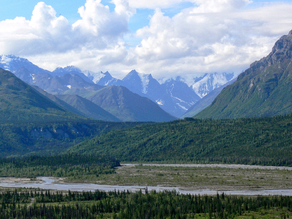
Heading east from Palmer on Highway-1 along the Matanuska River
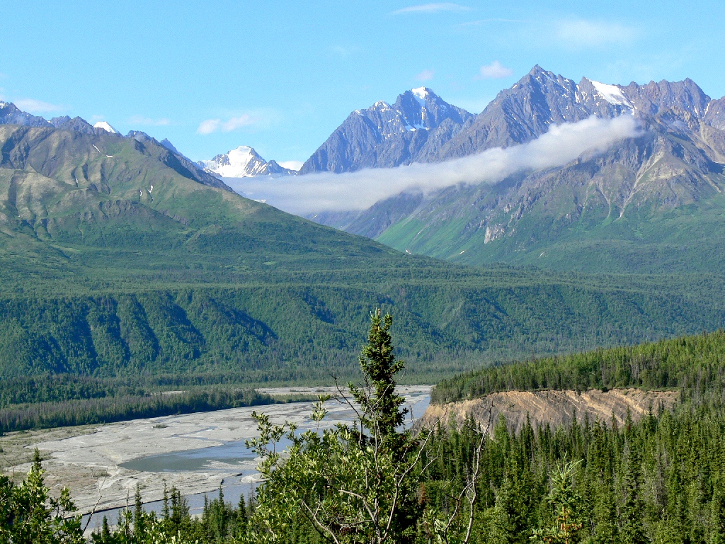
The low-hanging clouds are most photogenic
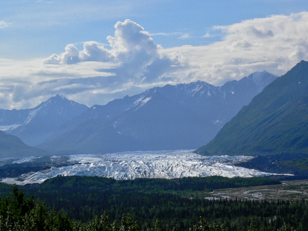
The Matanuska Glacier is in view for quite a while
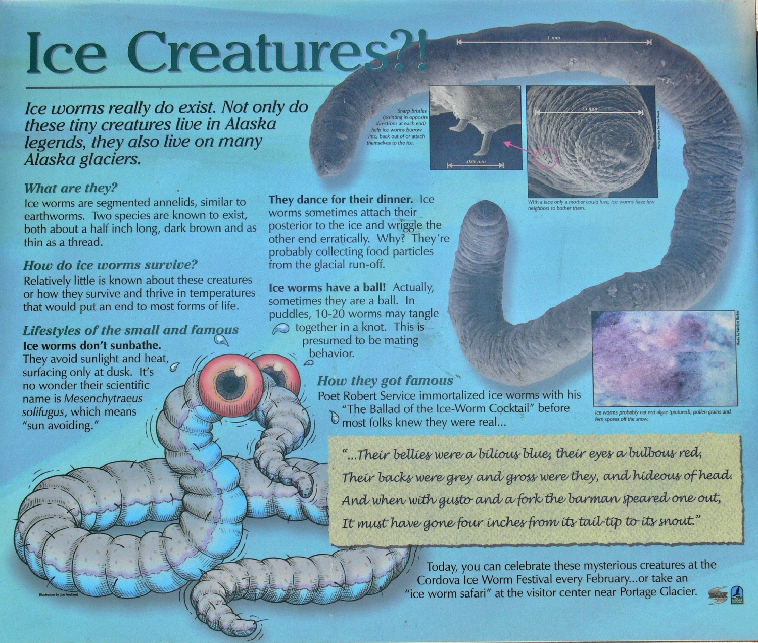
I bet you didn't know about these guys ⇔
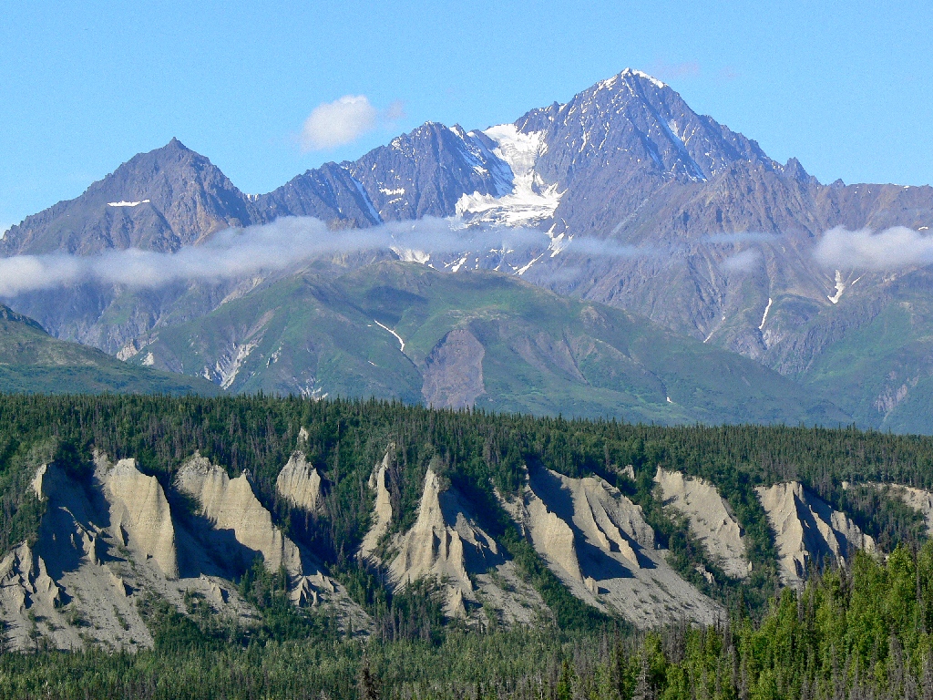
Marvelous
There isn't much to do through here except drive, but a beautiful route it
is. At Glenallen we turn south onto SR-4, the Richardson Highway,
which is the only road to Valdez.
Now we're following the Copper River
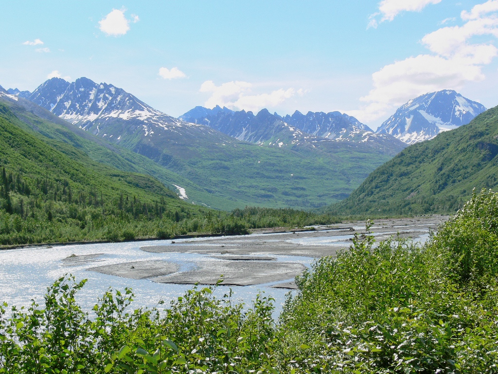
Thompson Pass is up there somewhere
Whoa! What's this?

Something special is up ahead
Omigod! This is one of most beautiful places I ever have seen.

Worthington Glacier
I am unaware of a more magnificent glacial display that one can drive to.

Worthington Cascade


There's a trail up there. We really should walk it.
Shortly beyond the glacier we reach Thompson Pass, the snowiest place in
Alaska. It averages about 700 feet of snow annually, and it once
recorded 90 inches in a single day!

The most spectacular range I have seen on this trip

South of the pass, two nice waterfalls plunge down right beside the pavement.

Bridalveil Falls
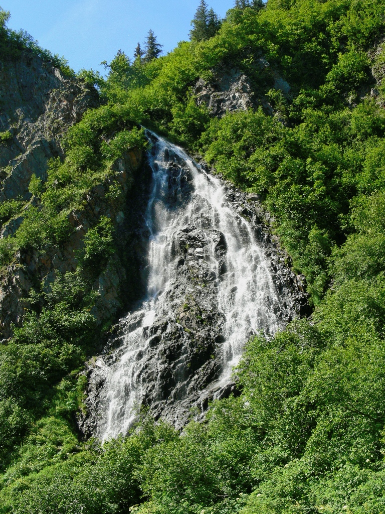
Horsetail Falls

At the end of the highway is Valdez, which is more interested in fishing boats than in automobile tourists. There isn't even a bowling alley or a movie theater here, even though this also is the northern terminus of the lengthy ferry route from Juneau.

Nicknamed Little Switzerland, Valdez sports the finest skyline of any town I have seen.

Valdez Harbor


The views are 360 degrees' worth


The Seagulls' Dining Hall

The next morning, our steps must be retraced northward to Glenallen. The scenery should be largely different in this direction.

Horsetail

Bridalveil

Blueberry Lake

Back at Thompson Pass

There is one other thing that keeps Valdez on the map. It also is the port from which all the oil from Prudhoe Bay is shipped.
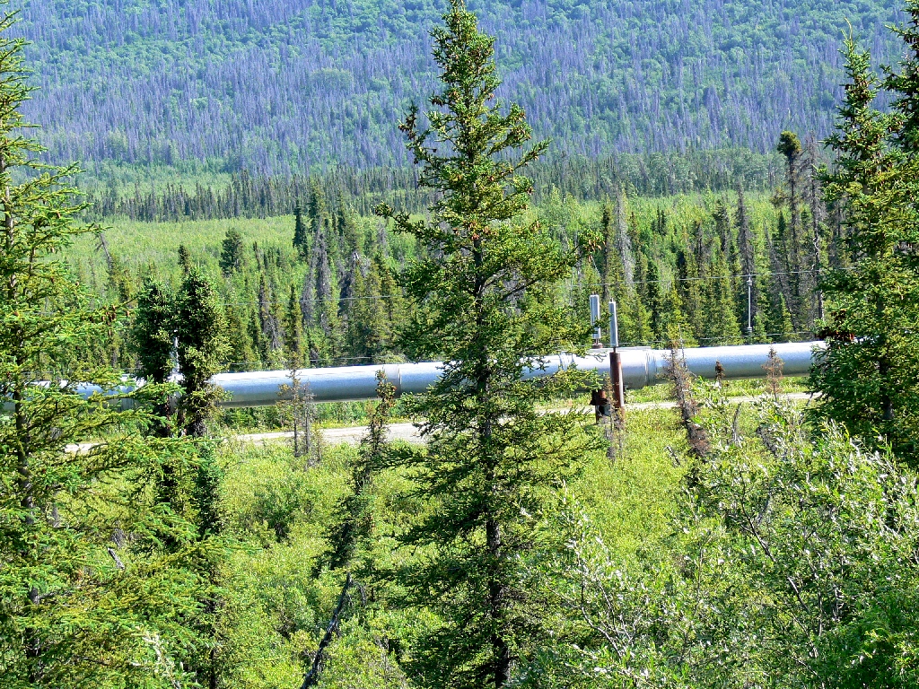
Our first view of the oil pipeline
Thinking that we might like to venture up to the long-defunct Kennecott Copper Mine, we take the detour over to Chitina, which proves rather smaller than expected.
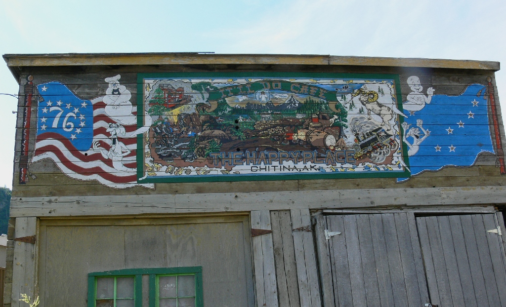
This cafe is decorated with ghosts


I presume that the murals commemorate the closing of the nearby Kennecott Mine in 1938, which effectively made Chitina a ghost town.
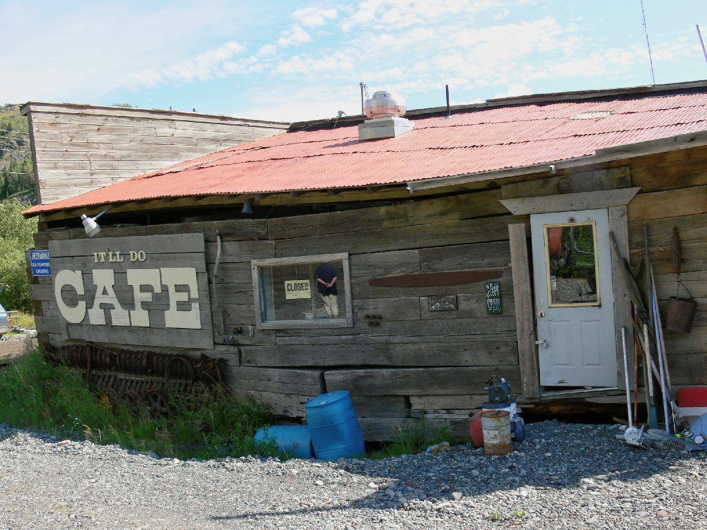
I guess that it is open during the fishing season

The rest of the downtown area
The hotel actually is open, and the art gallery next door is not your typical tourist trap. Is seems that the proprietor is a pretty amazing guy. Read more about the Spirit Mountain Artworks Gallery here:
<http://www.spiritmountainalaska.com/article.html>
The little road out of town to the east takes us over to an unusual place.


Fish wheels on the Copper River enable the fisherman to be somewhere else
A fish wheel functions like a waterwheel in that the river flow drives it in
ferris-wheel fashion. The wheel has one or two big baskets designed
to scoop up any salmon that happen to venture over that way. Only an Alaska
resident can own or operate a fish wheel, and it can be used only for the express
purpose of catching salmon.
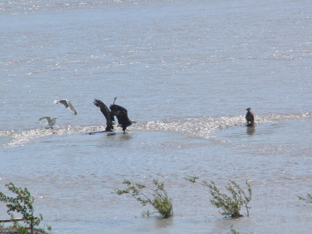
Bald eagles and seagulls fight for the morsels that 'got away'
My interest is in another direction, however. This is one of those times
when a photographer must be ready for whatever comes along — especially
if it is America's national symbol:

This is why I go traveling ⇔
From here it is an all-gravel road up to Kennecott, which also has been a ghost
town for some seventy years. Partly because tonight's motel room still is
some 200 miles distant, we opt to forgo that venture.

Back to Chitina

Liberty Falls

Mount Drum, 12011'
That mountain is just inside our country's biggest national park —
the Wrangell-Saint Elias Preserve, which is nearly four times the size of
Yellowstone.
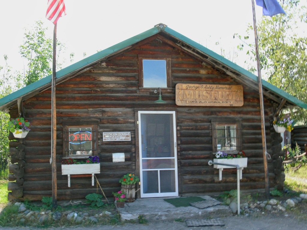
Ashby Museum
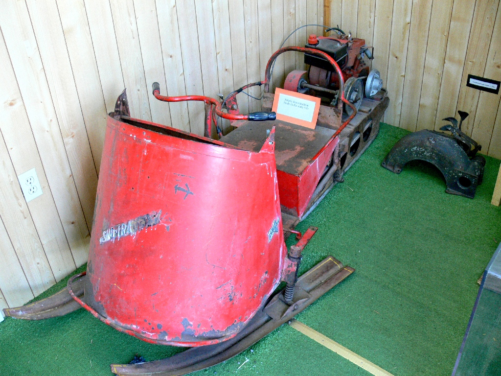
One of the earliest snowmobiles

The Wrangell Range includes Mount Sanford, 16237'
From Glenallen, it's a long slog eastward to the major highway junction at Tok, where Barbara and I stayed just nine days ago. We are looking forward to another nice dinner at Fast Eddy's, our favorite Alaskan restaurant.
§: Well, the road into Denali National Park might actually be a prettier
drive overall, provided that there are clear views of our continent's tallest
mountain. But unless you have a reservation for one of the remote cabins inside
the park, you cannot drive there anyway, excepting on one specific day after winning
a lottery position.
