
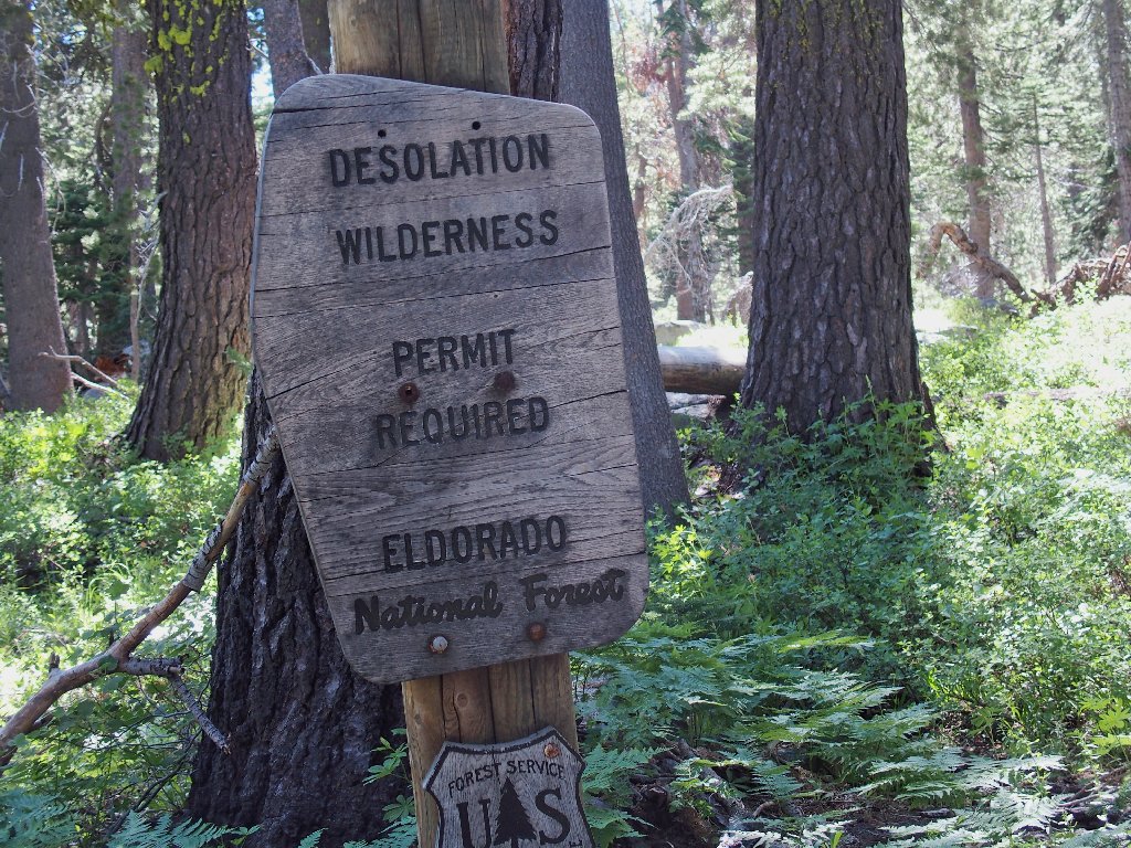
Desolation Wilderness
|
Hidden Tarns of Desolation Wilderness |
June 28, 2018
Despite the fact that the area just east of Wrights Lake is my favorite local
hiking venue, there is much that I have not yet explored. In particular,
I never have ventured around the far end of Island Lake, there being no modern
trail up there. Also, Google Earth has brought to light several enticing
tarns (see Addendum) that should be worth exploring. Today's mission
is to do just that — visit a number of new off-trail features,
because they're there.
The campground remains closed until tomorrow, meaning that the gate is locked; so for the second time this season, I must bicycle the final mile to the trailhead. To that end, the recently lowered gearing on my heavy cruiser has proved a godsend. Also, there is no writing implement at the kiosk with which to fill out a permit; so I will carry a blank one.
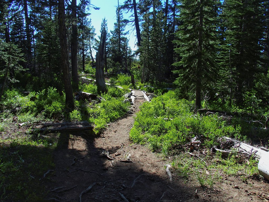
Getting started
It has been several years since I headed directly up this trail. Most of the time, I veer over to Enchanted Pools first; but today, I didn't want to expend the additional energy, because there is much to do. This route leads to a feature I haven't seen in quite a while:
'Backyard Falls', so named because that's where I would like them to be
Farther on, I pass by another local waterfall, planning to take some photos there later. Then I leave the trail, as usual, so as not to have to deal with the crossing at the Twin Lakes Dam, which frequently is impassable without getting wet.
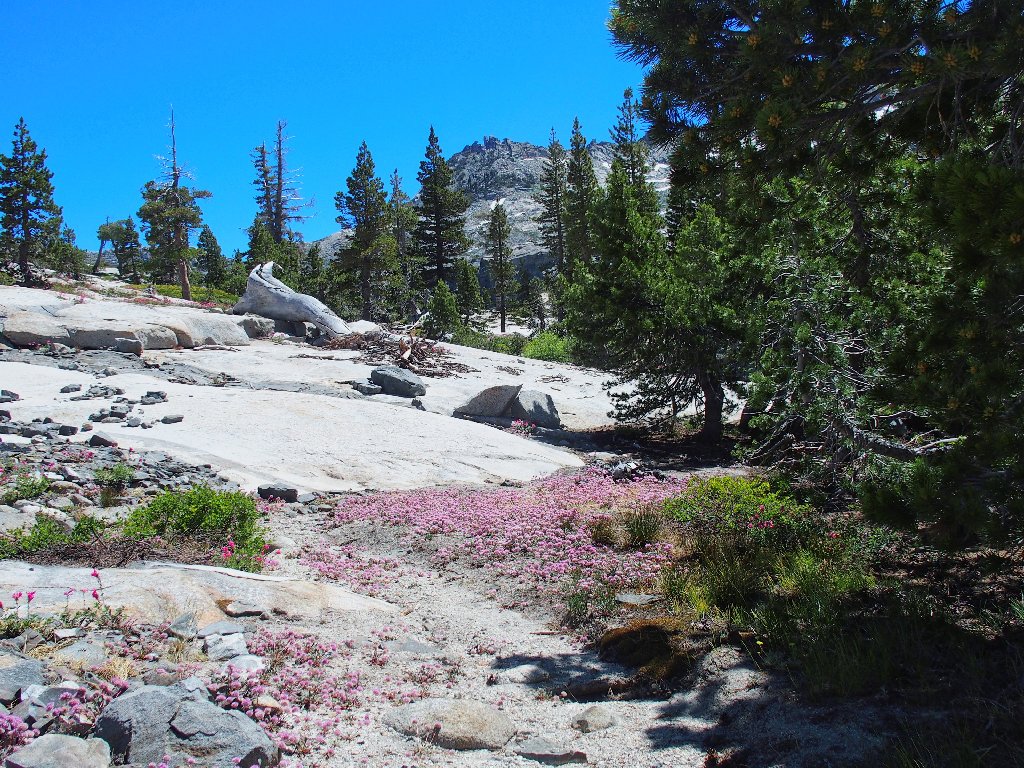
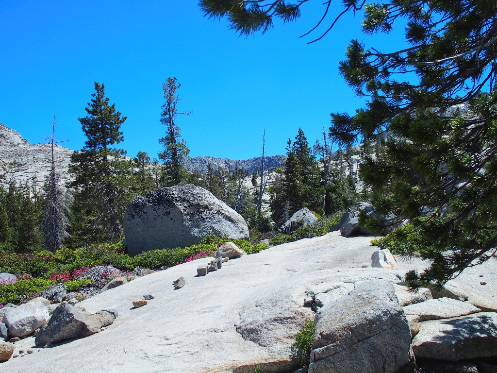
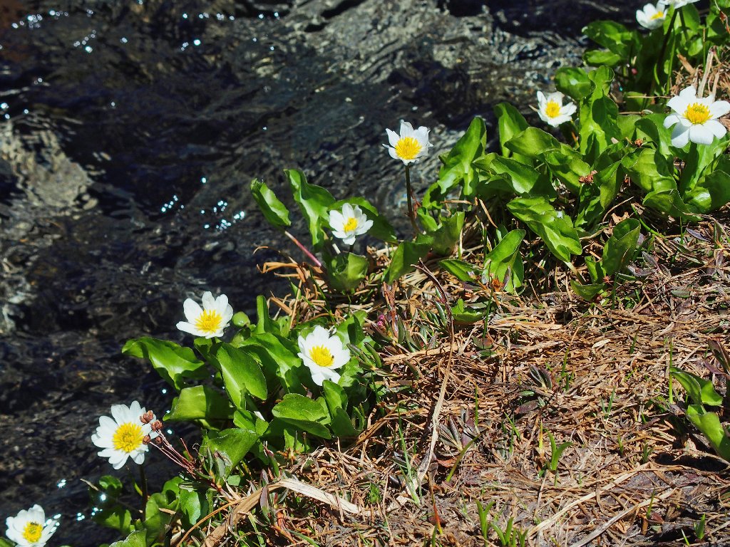
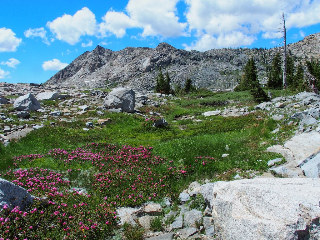
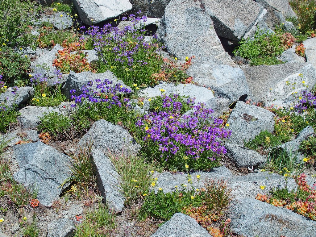
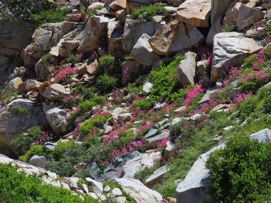
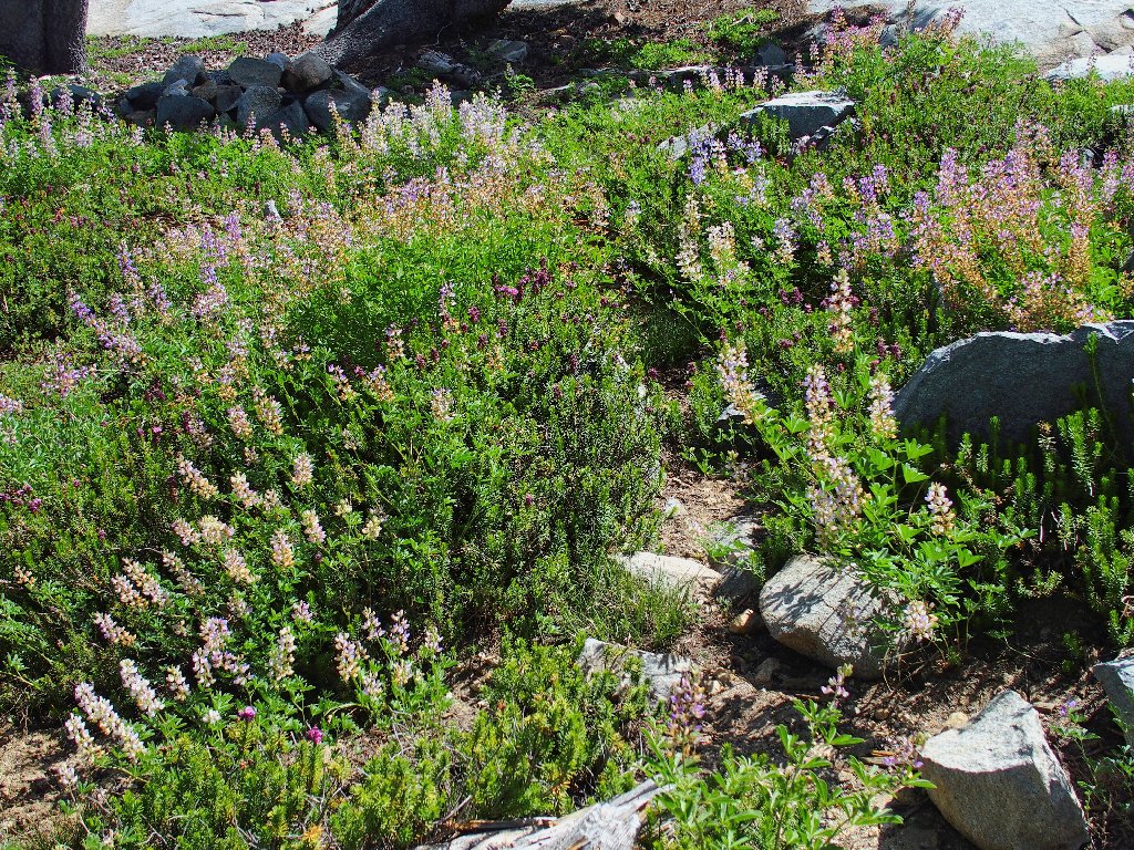
The first real scenic views include a lot of flowers
South Silver Creek seemingly rushes right out of Little Pyramid Peak
After half a mile or so of easy cross-country climbing, I rejoin the trail at Twin Lakes.
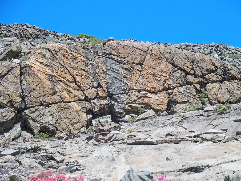
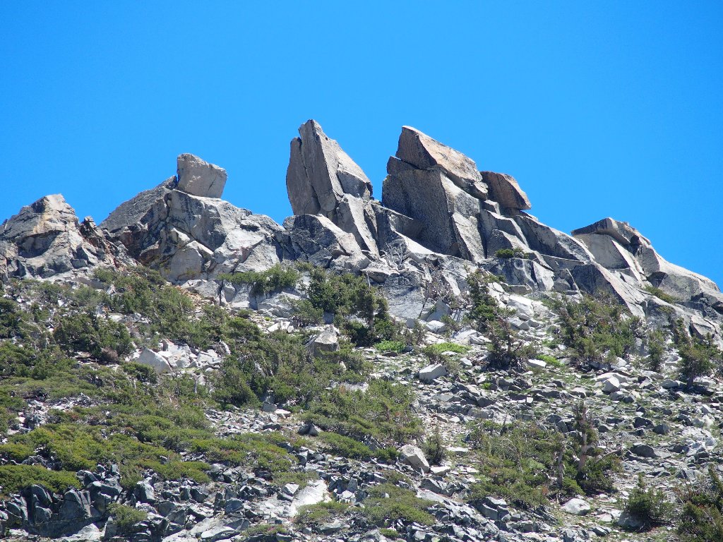
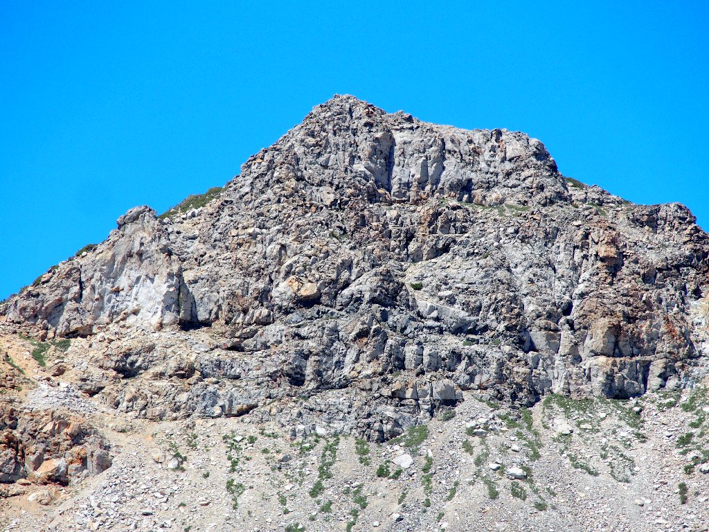
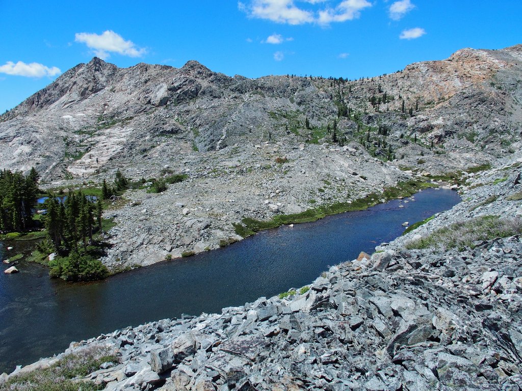
There's the Gray Wall. That's where I'm headed.
I am standing on the 'dam', which is but a two-foot-high retaining wall that already is dry for the season.
An arm of Lower Twin Lake
The actual flow-control is in the creek itself; and surely enough, a dry
crossing looks relatively impassable at this time, at least without waterproof
boots. Inexplicably, I grabbed the wrong ones this morning, and this was
not a good time for such an oversight; there is a lot of rough stuff ahead
for which these old Keens are not well-suited.
They really ought to erect a bridge here
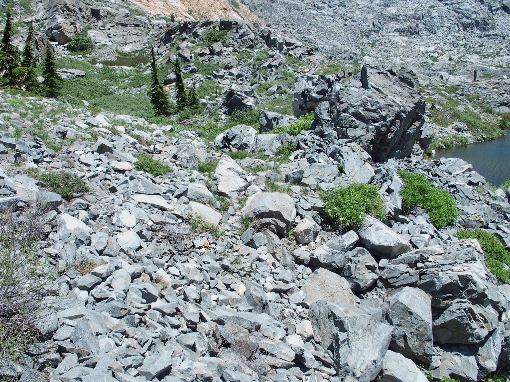
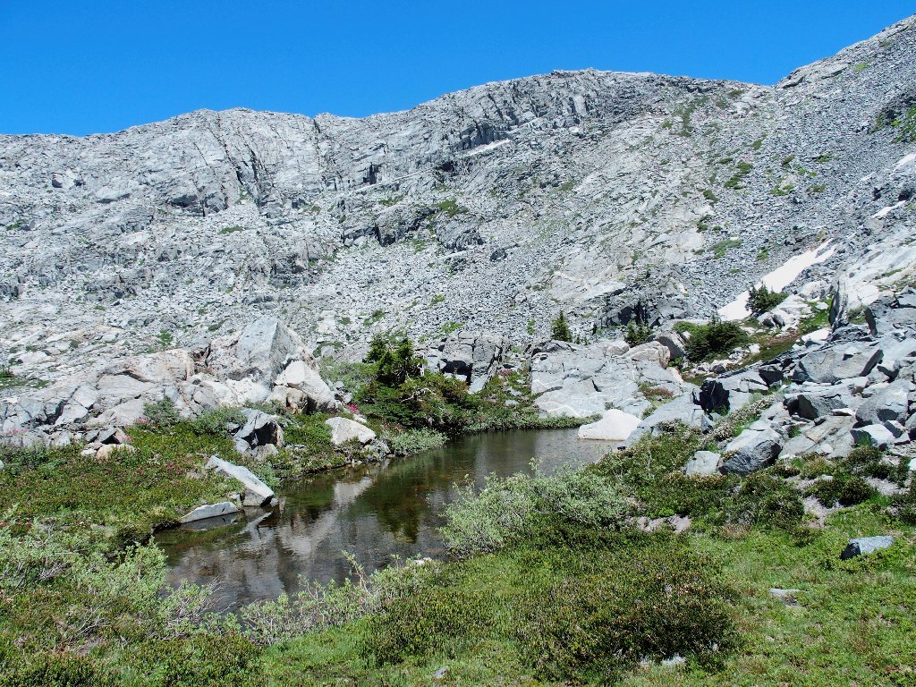
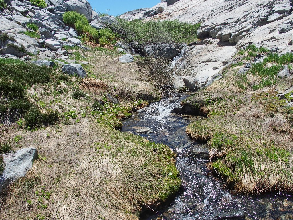
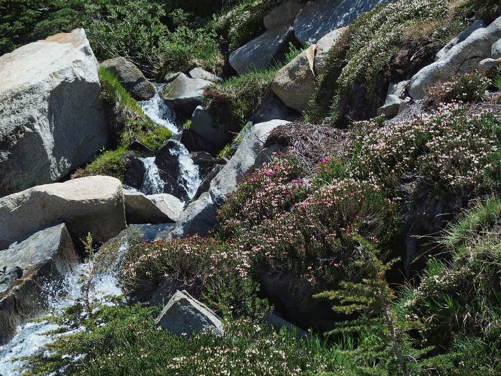
The next order of business is to find a nearby tarn that is close to the trail, yet which I never have seen.
Plunging off the trail here
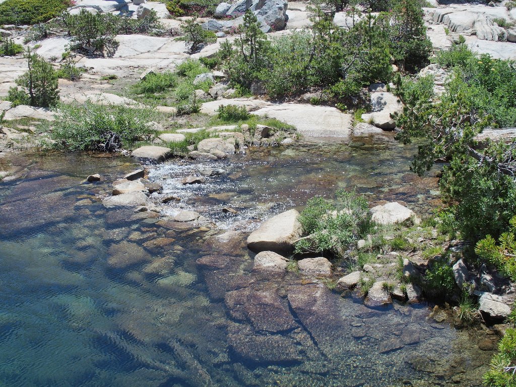
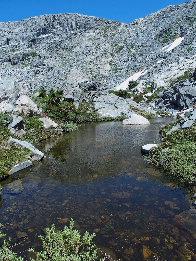
And there it us, replete with its own grasses, trees, and flowers.

Tarn #1
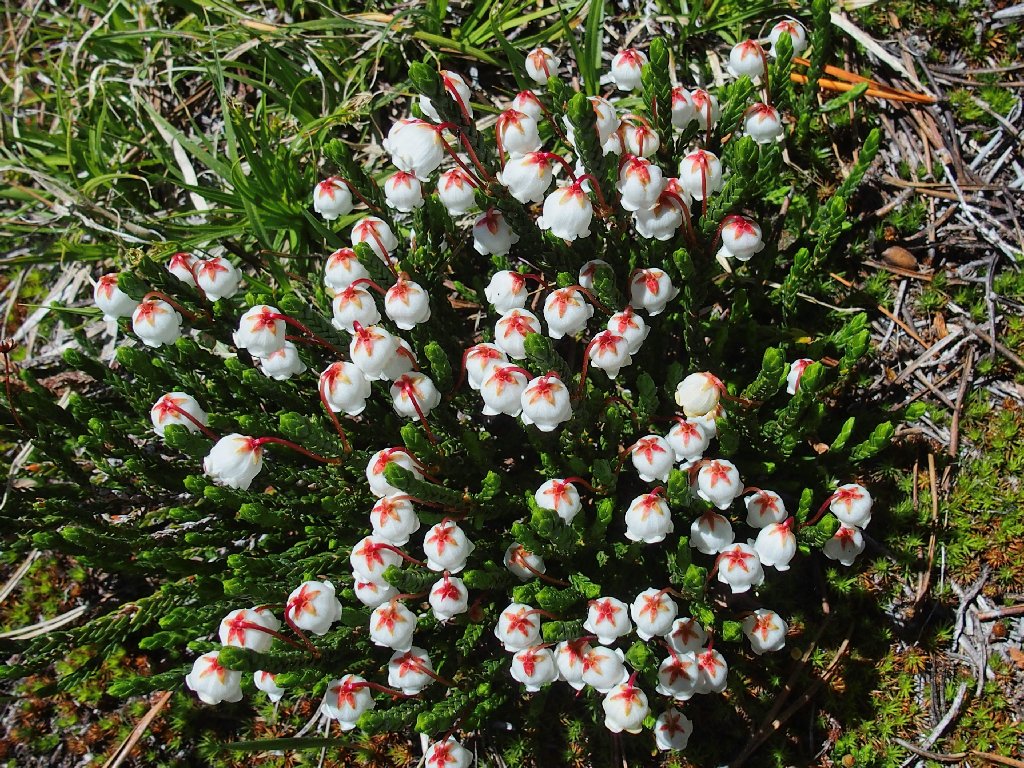
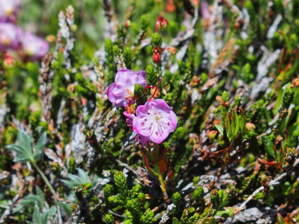
White Mountain Heather
Red Mountain Heather
Rather than rejoin the trail below, I continue eastward over the slabs to the next attraction.
Boomerang Lake
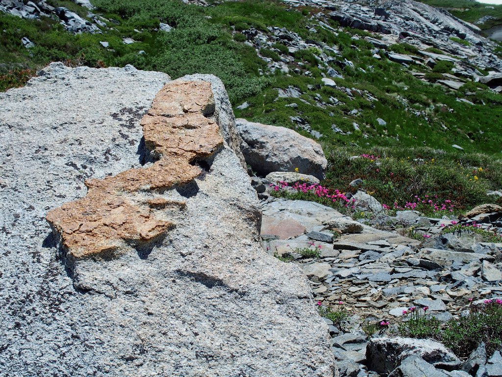
This area features the best collection of insanely configured rock dikes of any place I know. Please bear with me, now and later, as I photograph some of Nature's incredible artwork.
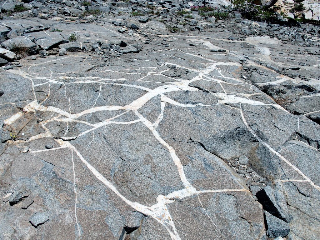
Dikeland
My normal route skirts Boomerang Lake on the right, being almost in the water at one point. This time I'll try going around the other way, because I'm halfway over there already.
The 'back side' of Boomerang Lake
That hiker will try his luck in the wet area
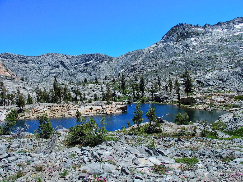
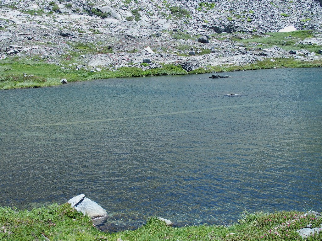
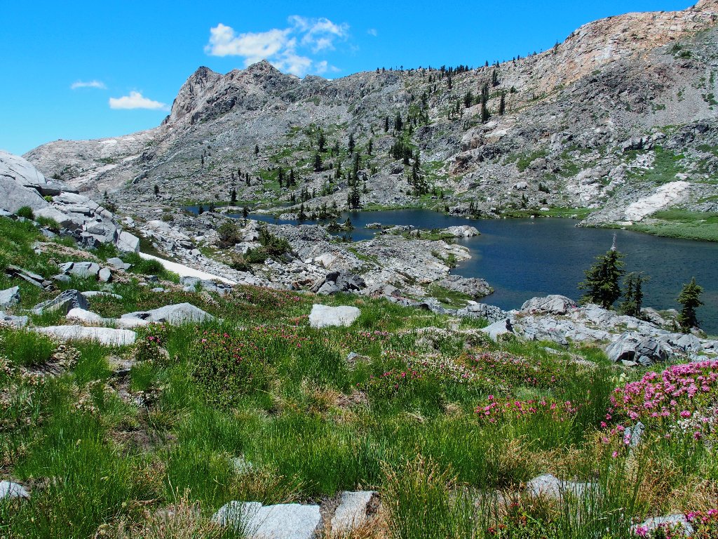
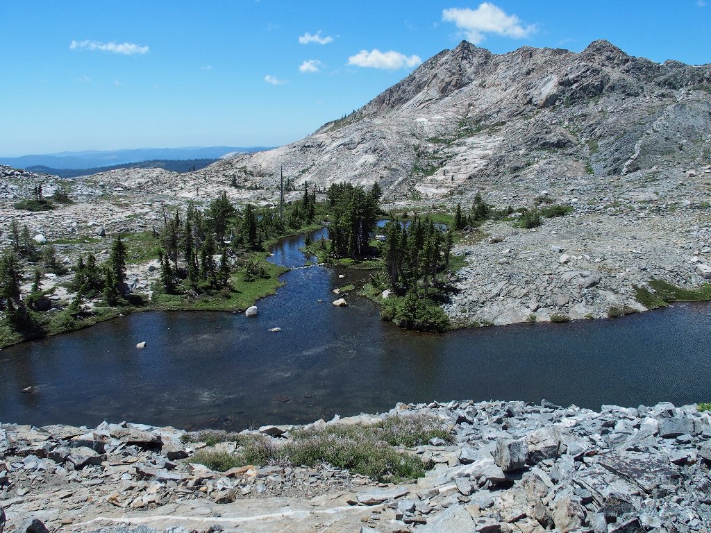
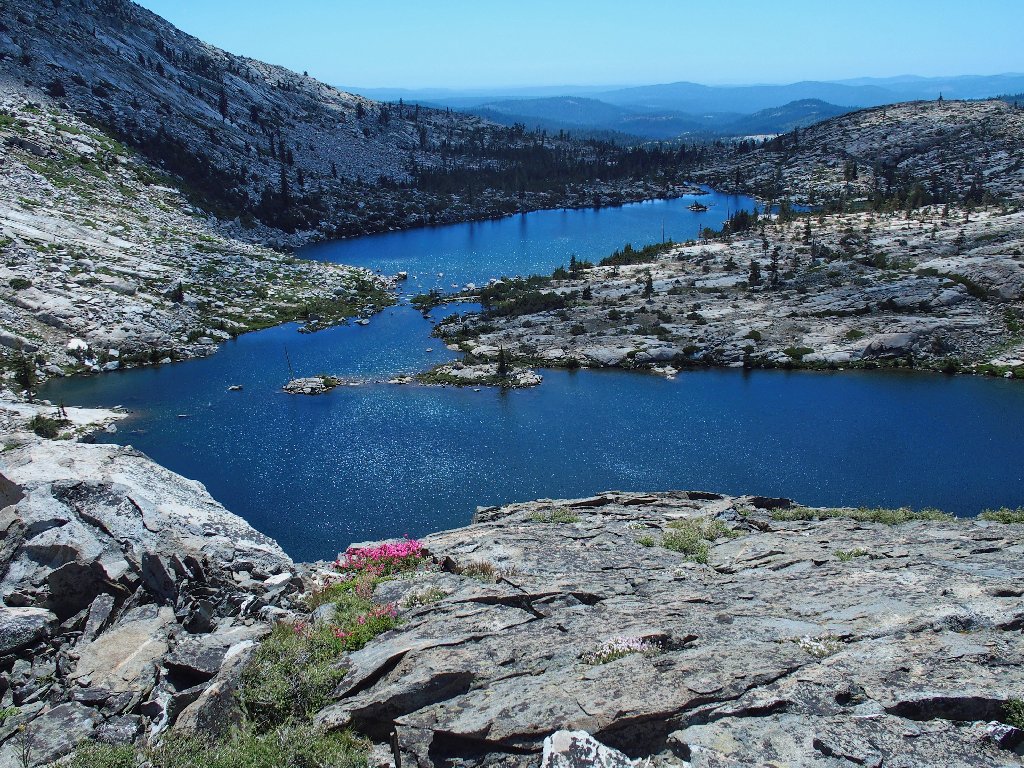
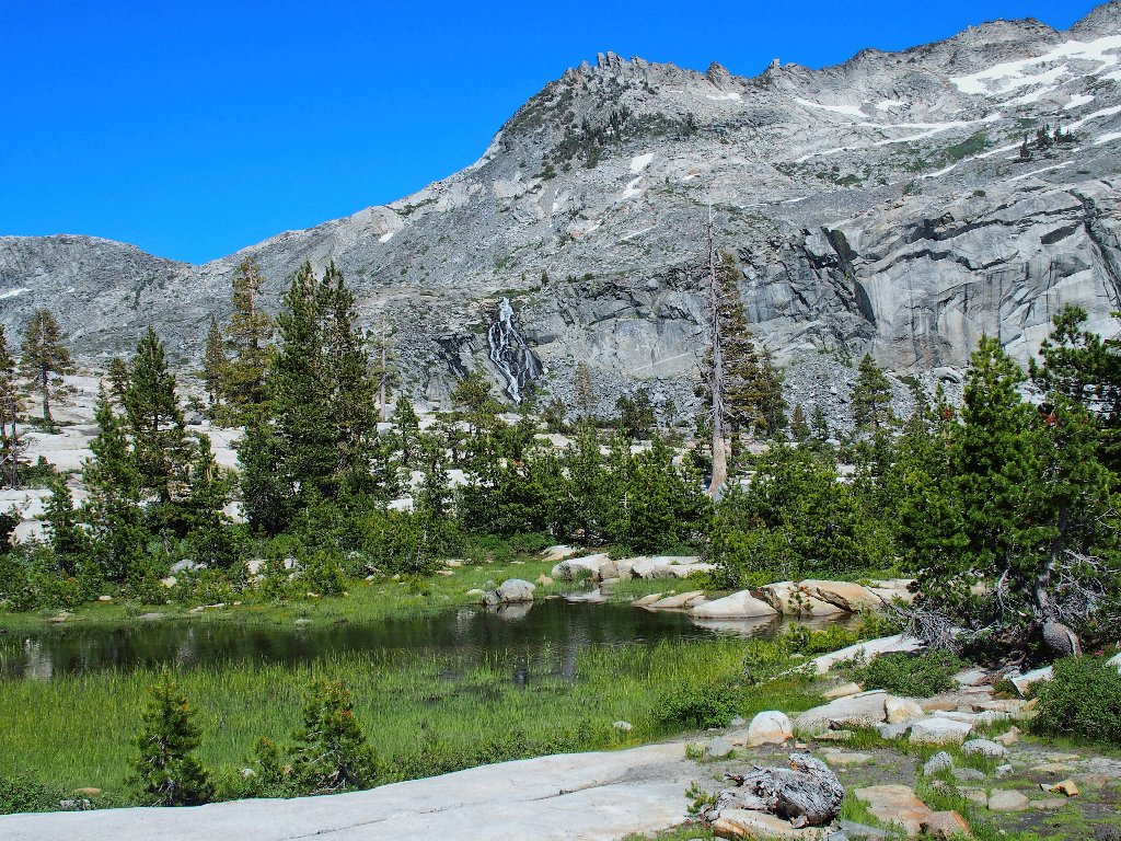
Just over the lip of the next rise is the area's biggest and finest.
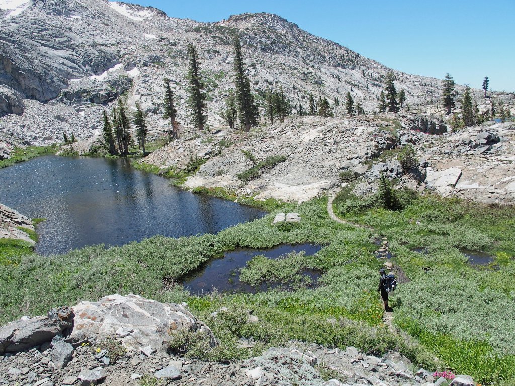
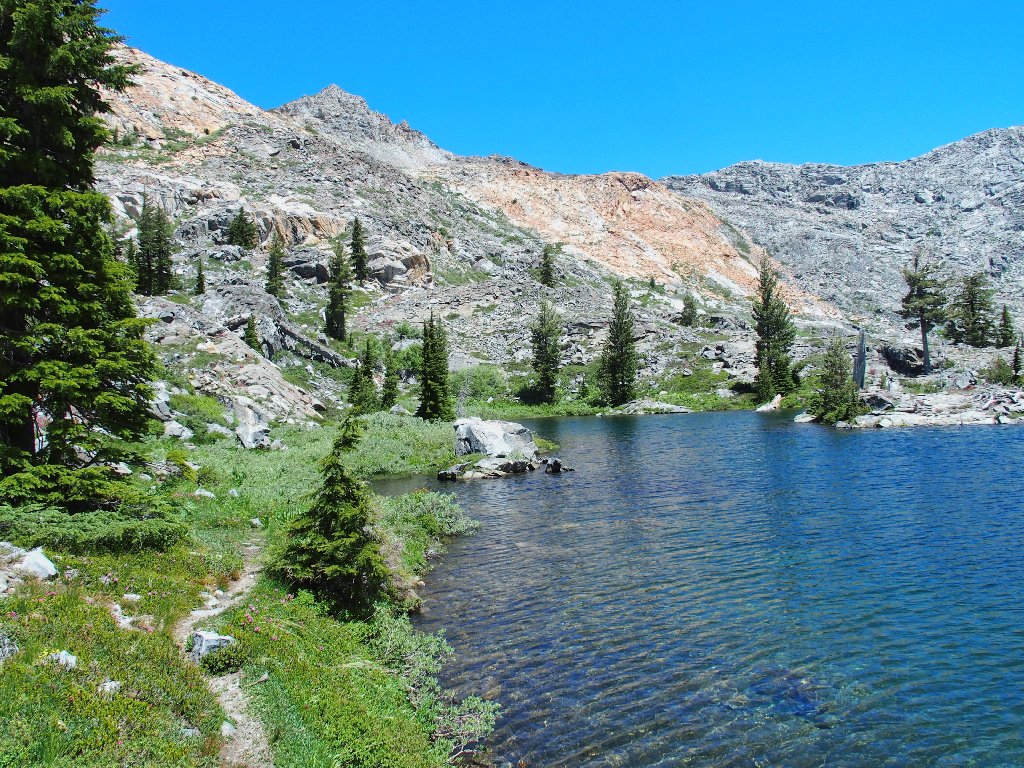
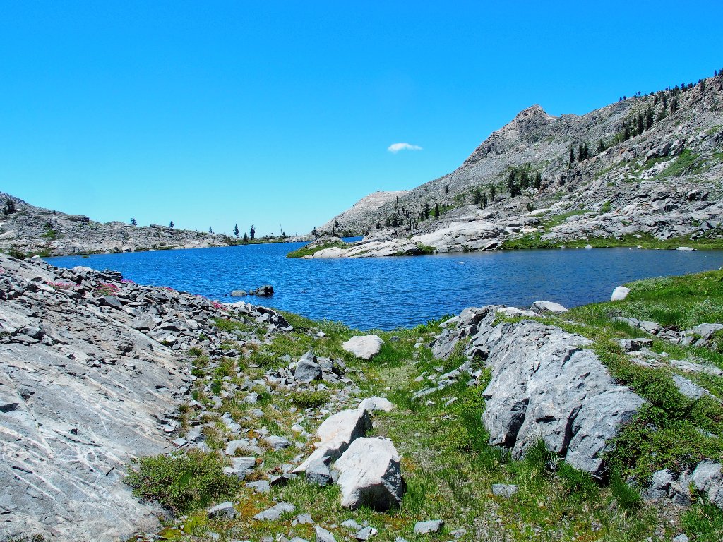
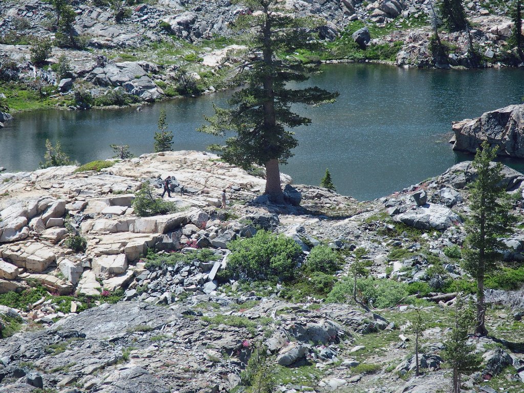
Island Lake, 8120'
It's Adventure Time! Scrambling to the far end of the lake doesn't rate to be a cakewalk because it is half a mile long; and after that, the fun will begin in earnest.
Starting around the north shore
Presently, I scramble down a few feet to grab what looks like a sizable piece of litter; but it's not:
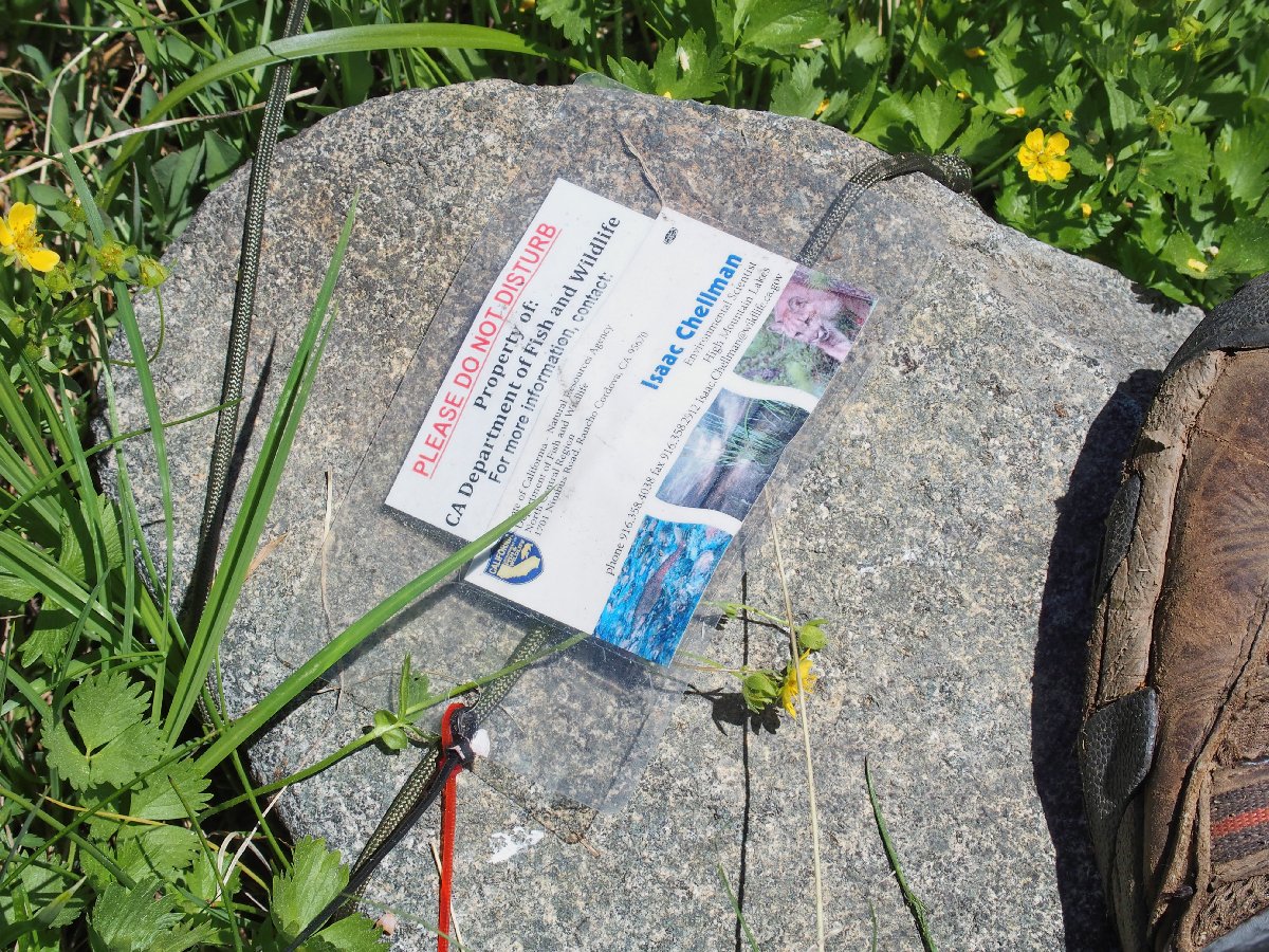
Interesting. Something must be attached to that red string.
As expected, the fisherman's trail peters out at the first obstacle; so I'm on my own now.
Looking back from partway along
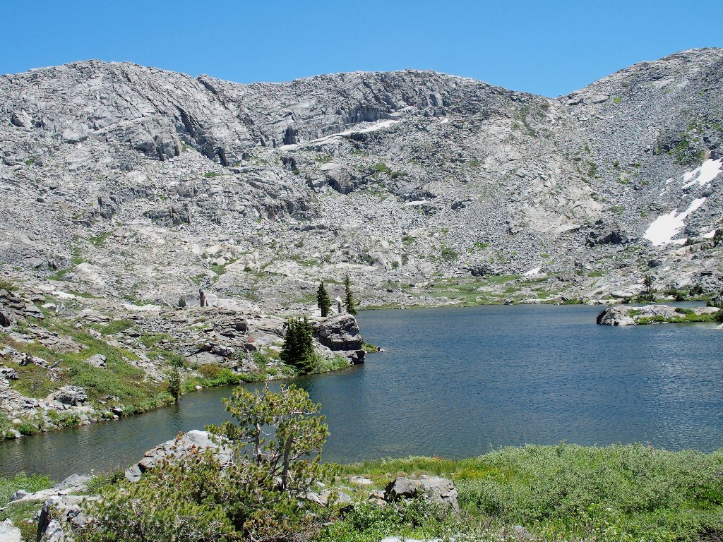
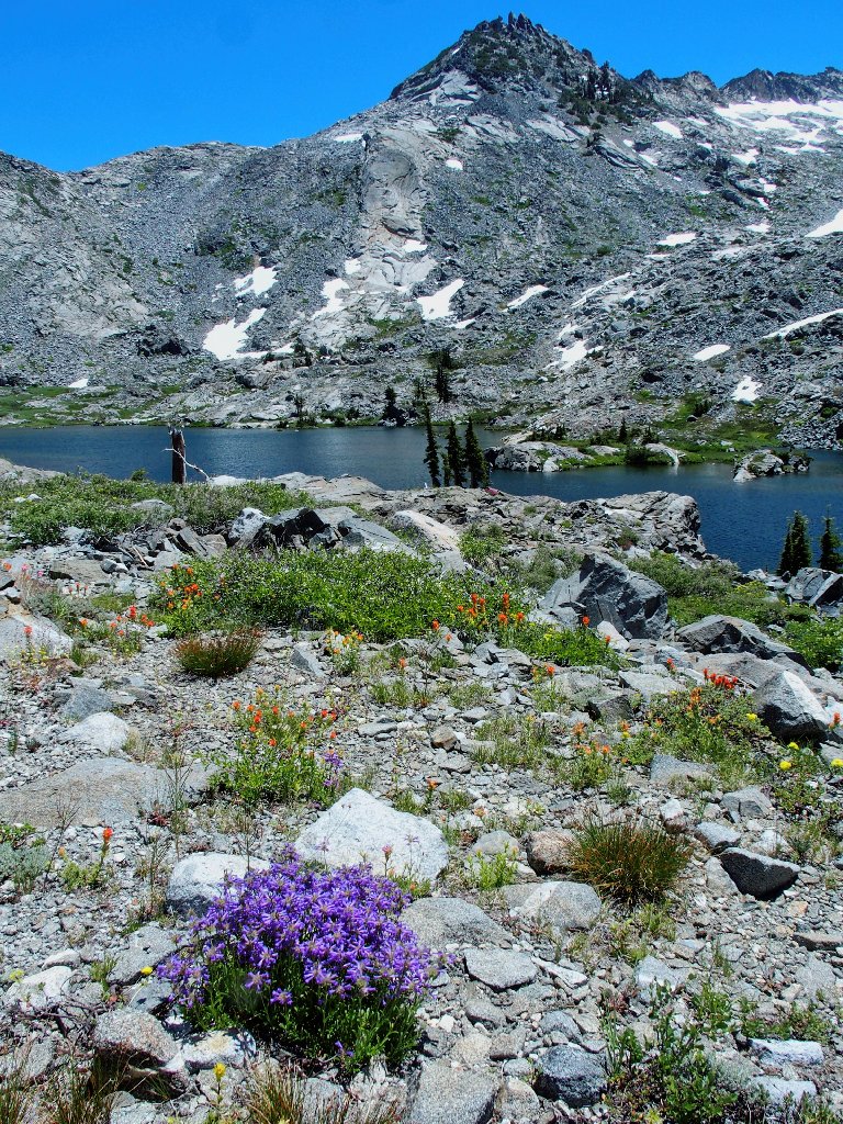
The Crystal Range's Gray Wall is imposing
Desolation Valley is just on the other side. A good friend backpacked from here over to Clyde Lake some fifty years ago, but any semblance of a trail has long been abandoned. Any route up there looks pretty hairy from this angle.
Typical going from here
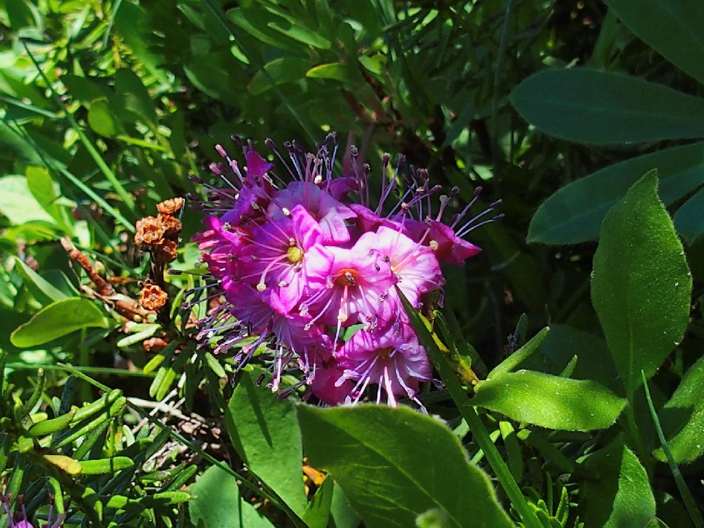
Sierra Penstemon, and Peak 9400 on the shoulder of Mount Price
A giant, white, decomposed dike supports some different flower types.
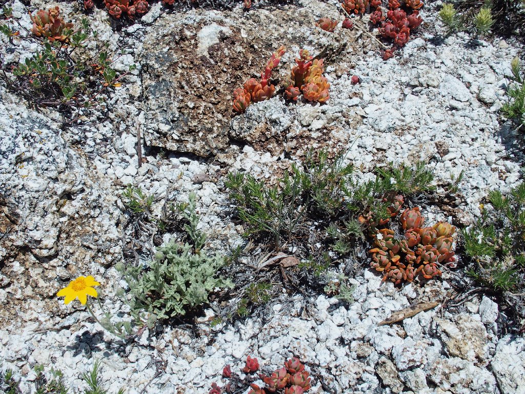
Sierra Stonecrop and Woolly Sunflowers
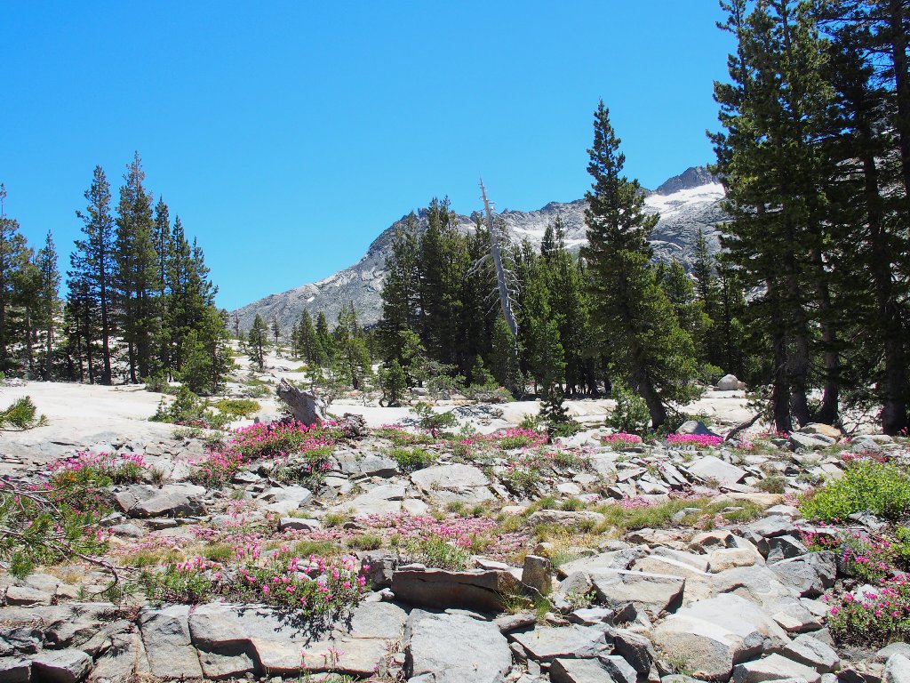
Little Pyramid (Peak 9441) is only another 1,300 feet up, and one way to get up there is to start climbing right about here. It is on my bucket list, but...
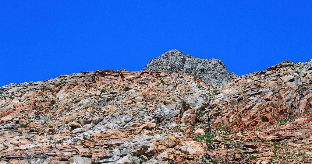
So near, yet so far
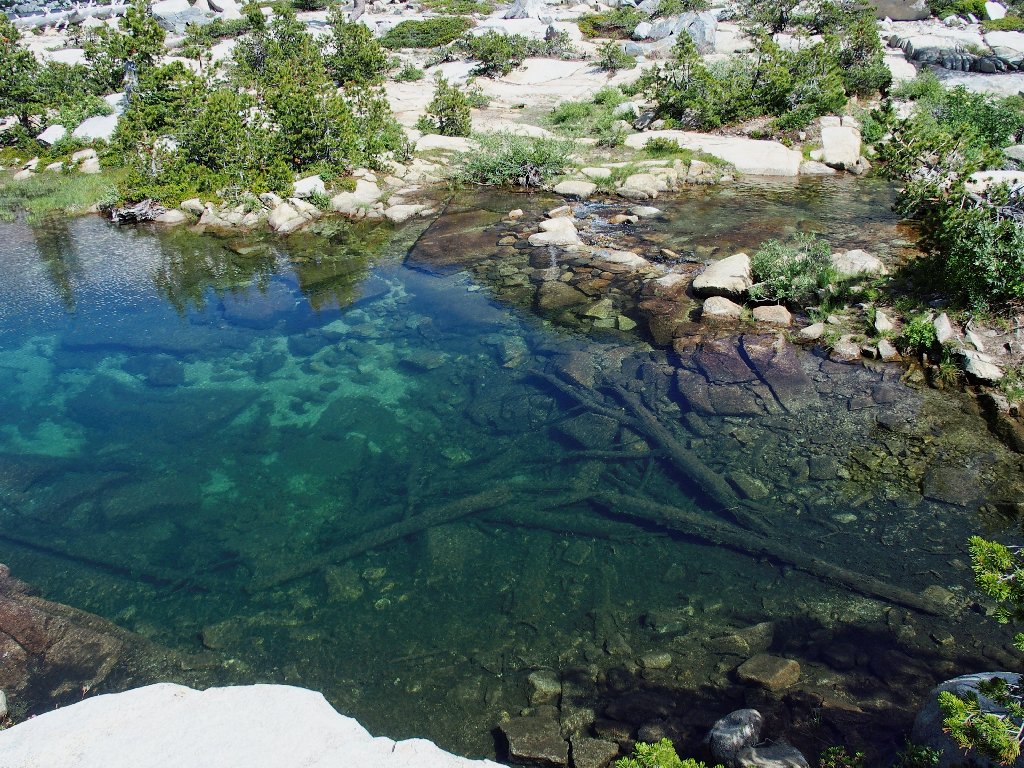
An intriguing underwater formation at the end of the lake
A interesting patch of color at lake's edge
Almost to the end
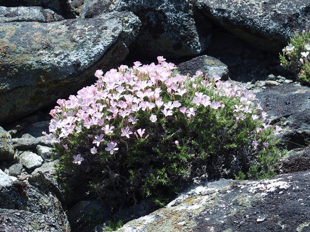
More Heather, with a touch of Spreading Phlox
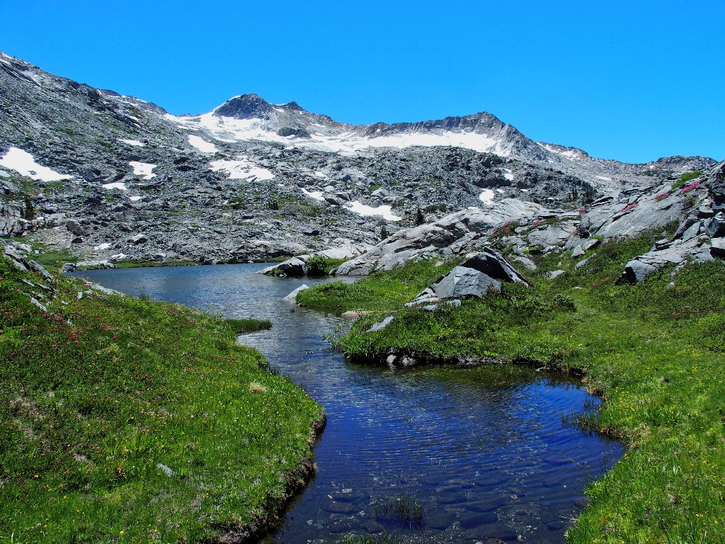
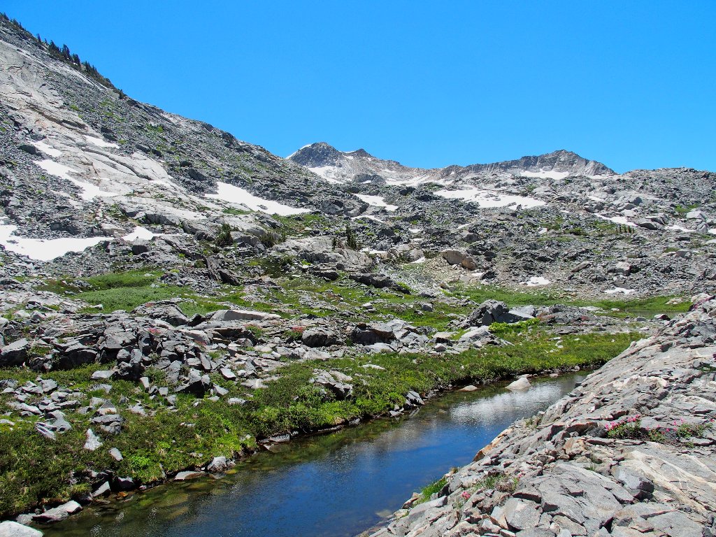
Also anticipated was the probable need to work my way around some wet spots in the meadow areas. One little stream in particular presents a minor challenge; but that is all.
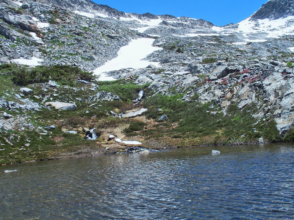
The east end of Island Lake
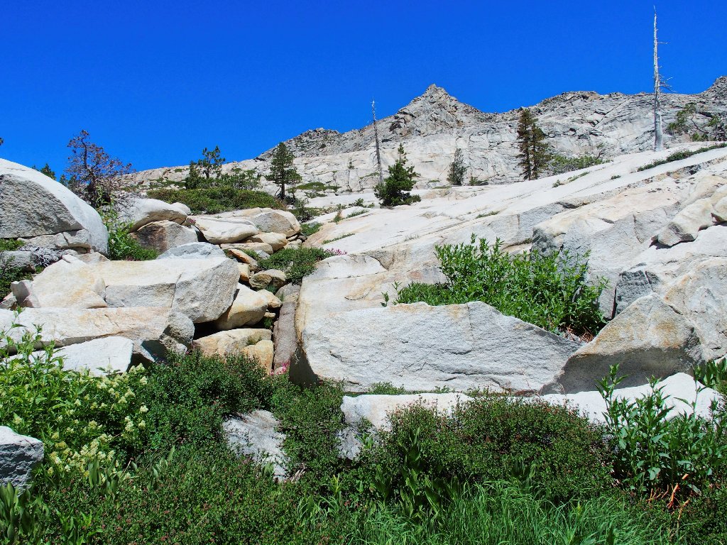
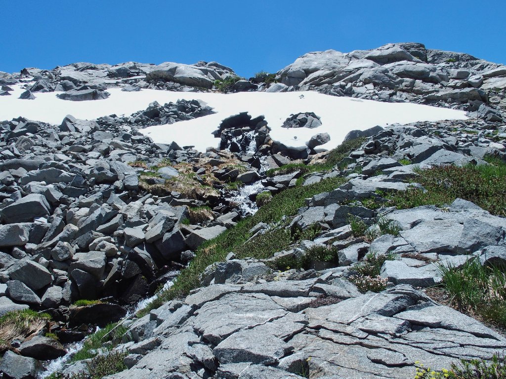
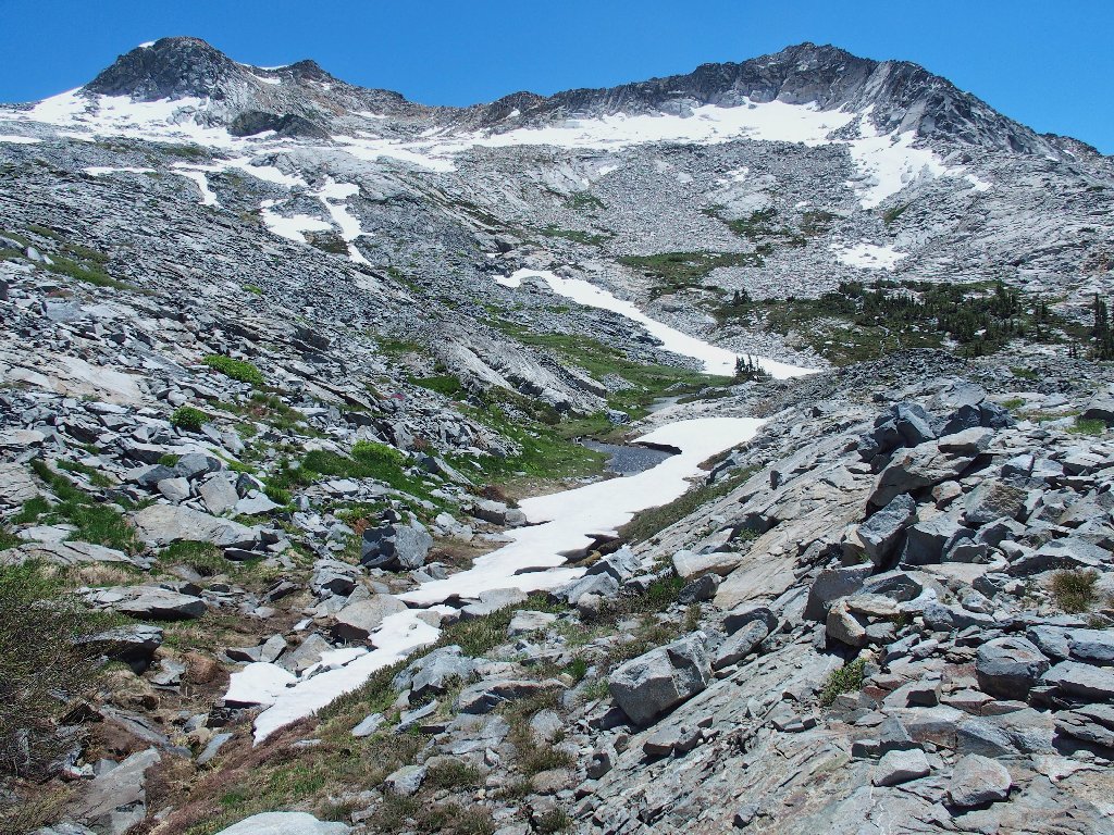
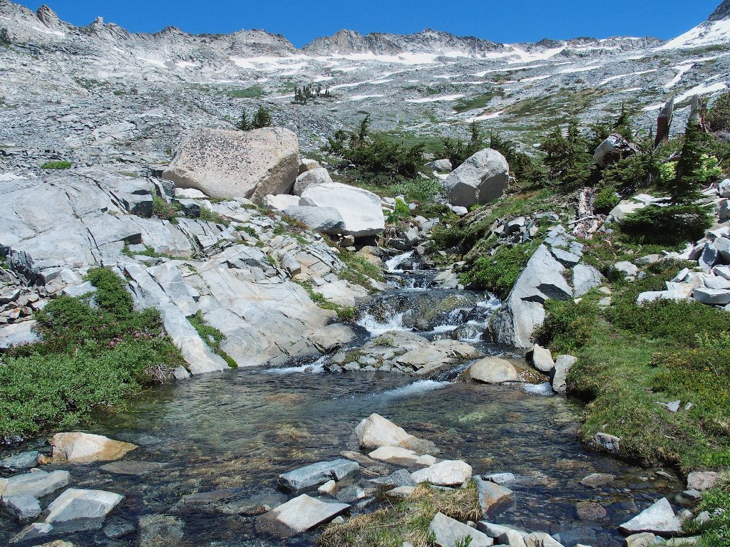
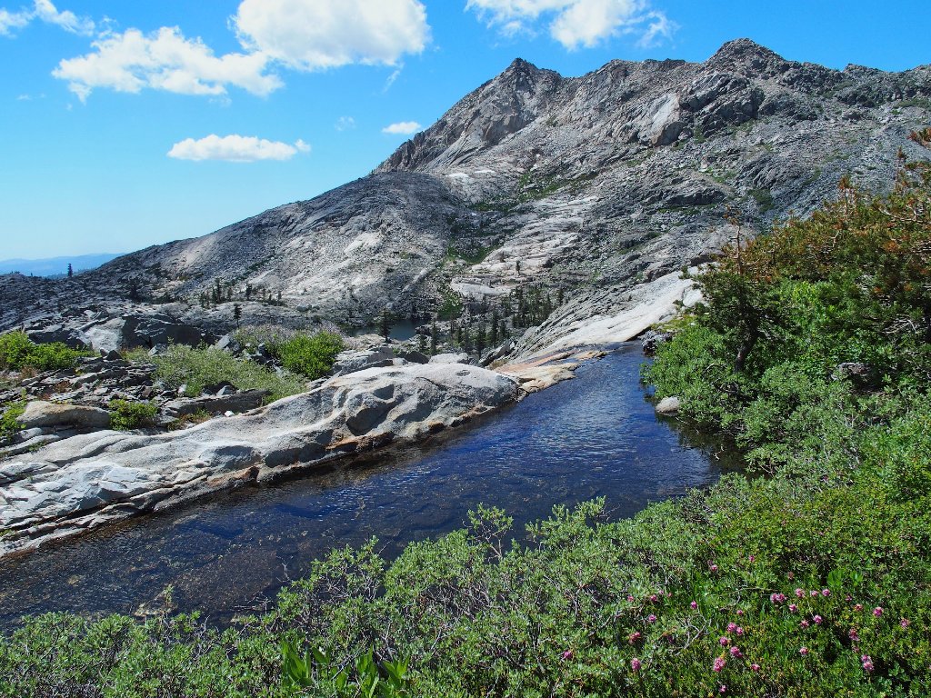
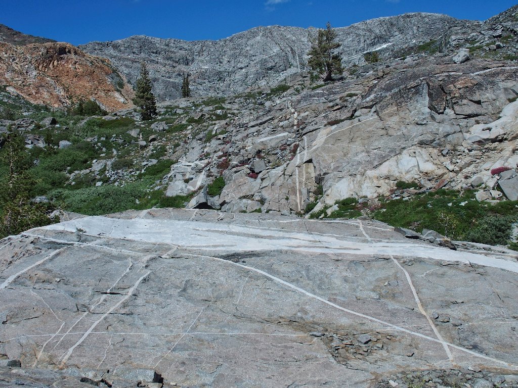
The crux of the mission is at hand. I already have walked more than four rough miles, and the hardest work is yet to come. The presumed good stuff is another 300 feet up from here, and that hillside seems comprised mostly of talus boulders and treacherous snow banks.
The route ahead
I didn't come here to wimp out now, however; and in any case, getting back will be difficult enough as it is. I can postpone further decision by checking out the noisy litte waterfall just ahead.
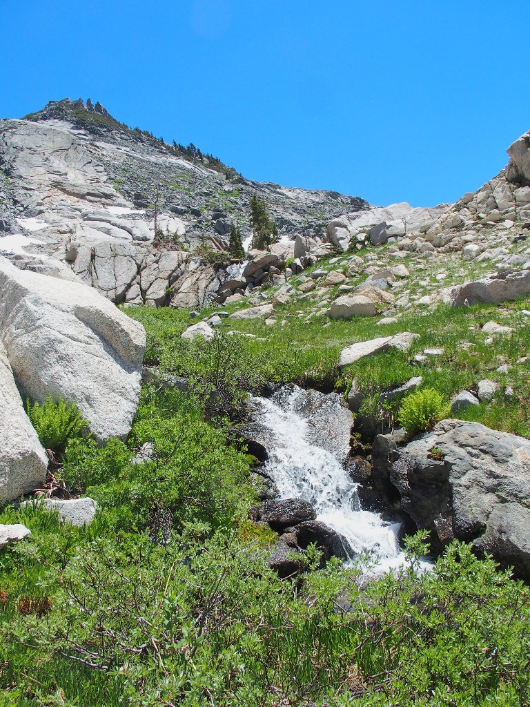
At the base of the falls
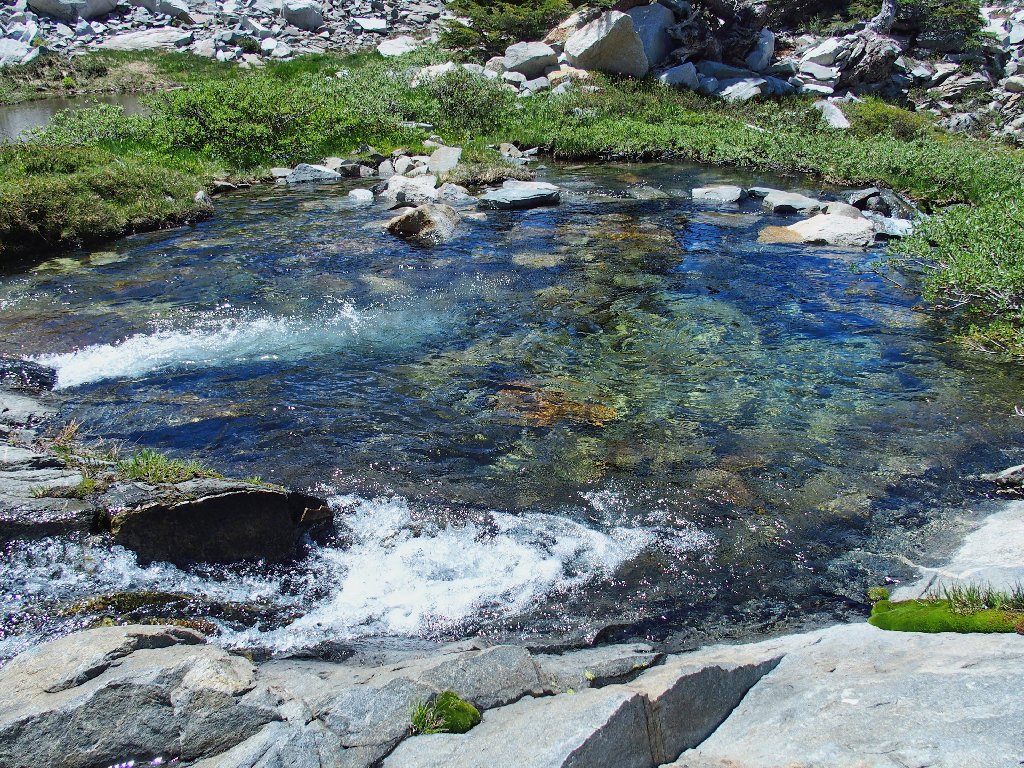
Almost without further consideration, my feet head upstream again. Within a few steps, I encounter the first pool in the series.
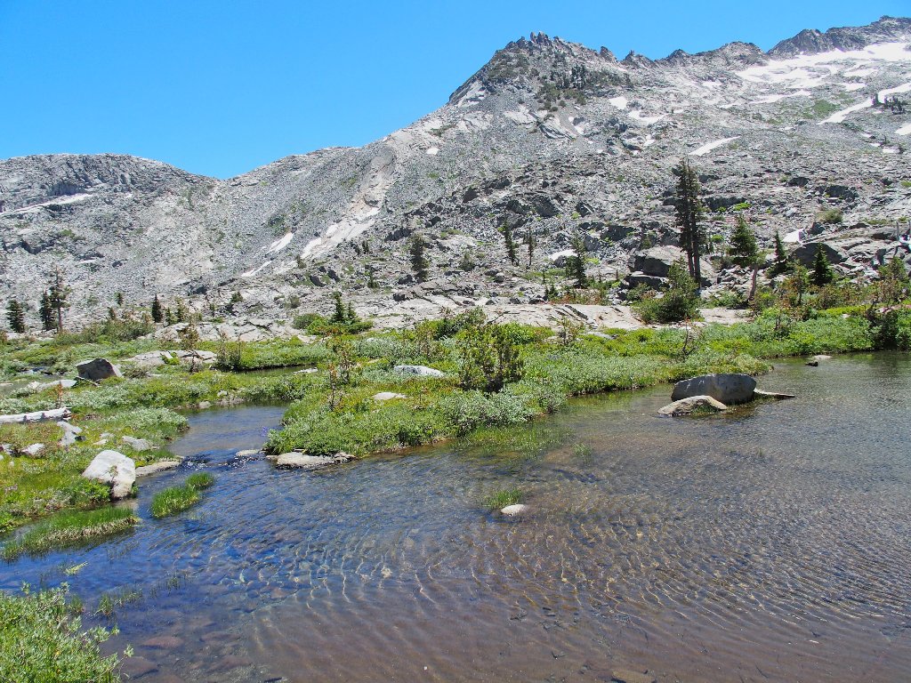
Tarn #2
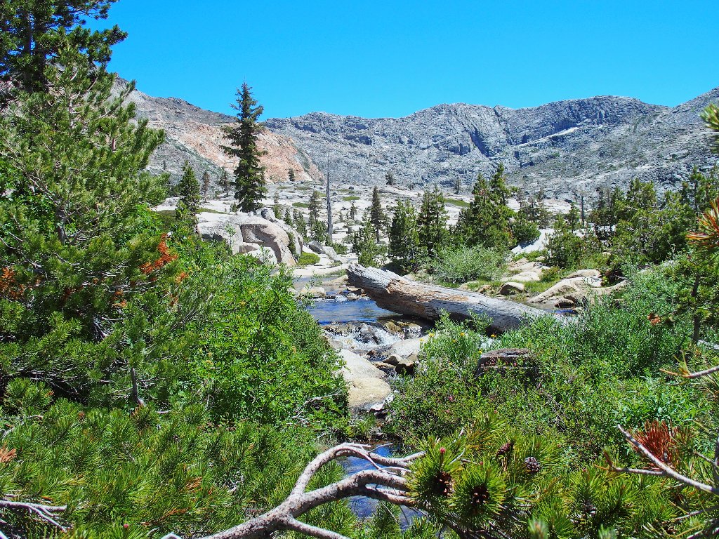
Whichever way I go, it's a Garden of Eden at Island Lake
Scrambling up this hillside isn't nearly as difficult as it might have been, for I actually am able to remain on grassy turf much of the time. One exception is just ahead, where I opt to head straight up the rock rather than tackle a treacherous snow drift.
Heidi, where are you?
To my delight, the going becomes relatively easy from here.
Traversing the creek channel
The amazing summit block on Peak 9400
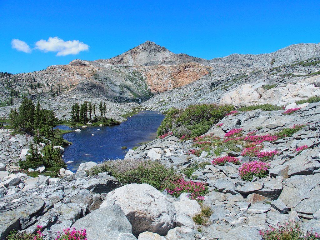
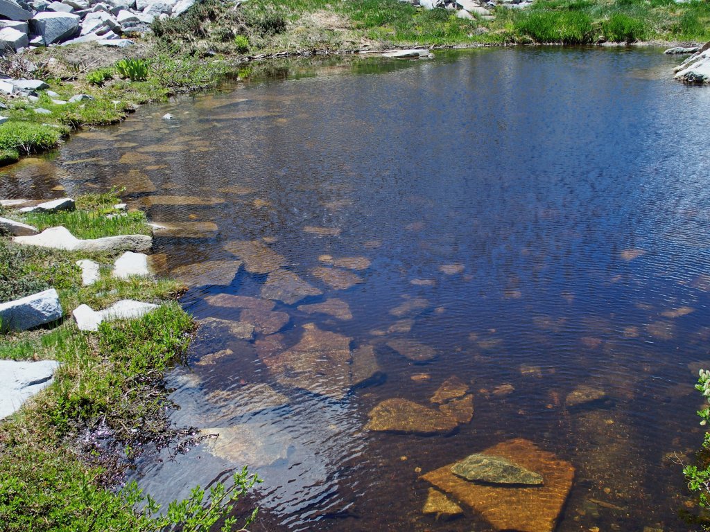
Atop this rise is my next reward.
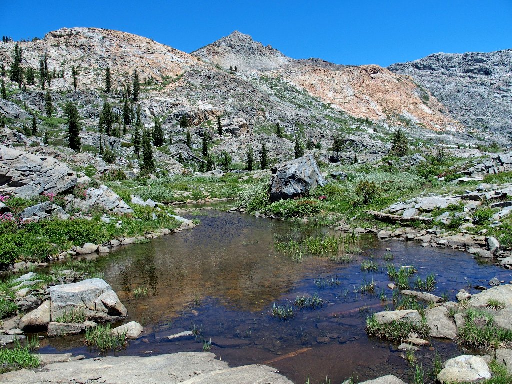
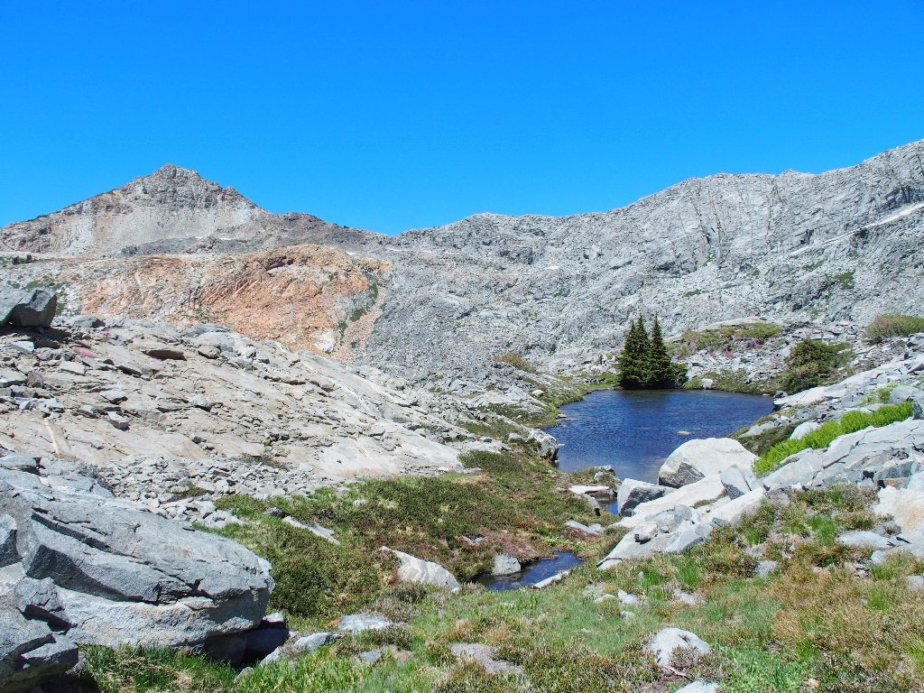
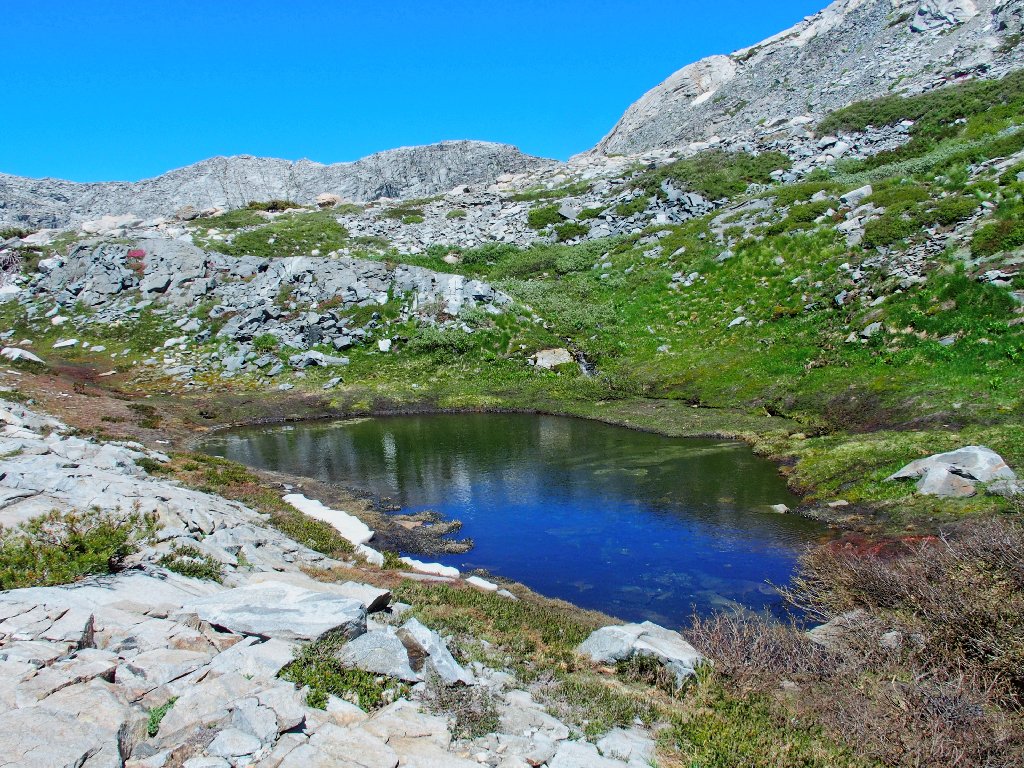
Tarn #3
A delightful resting spot on a bed of flowers
Mountain Laurel
Drummond's Anemone
Farewell to Tarn #3
This is my kind of place. A bucket-list exploration
never has been so long overdue as this one.
Hello to Tarn #4
Maybe I will make it up there someday
That brown dike just won't go away
Tarn #5
Another watery area is just ahead, partially covered by a long snow drift;
but I will settle for a view from here, because I must venture over to the
right to a long-anticipated viewpoint.
Bypassing that tarn, although I really should not
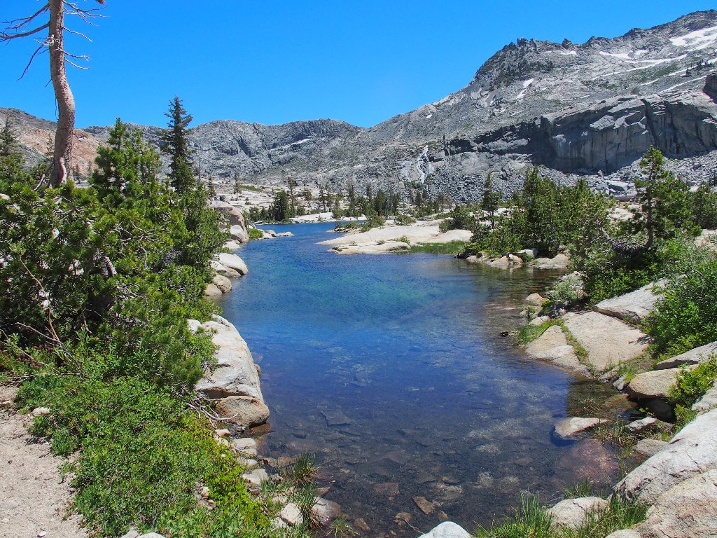
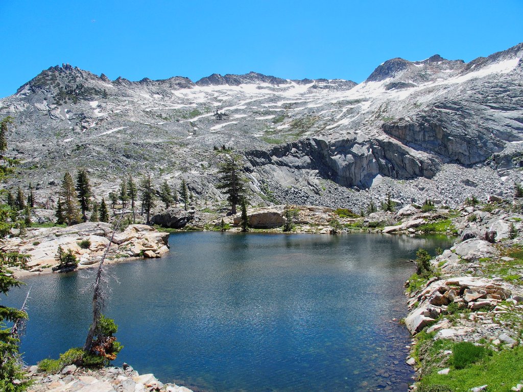
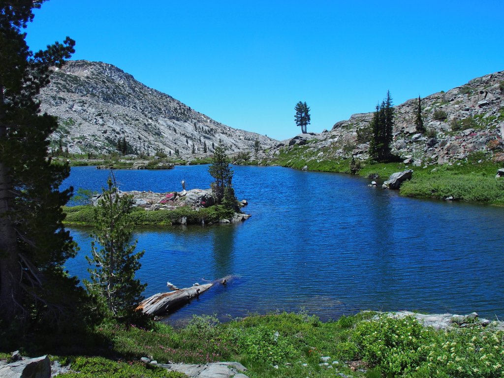
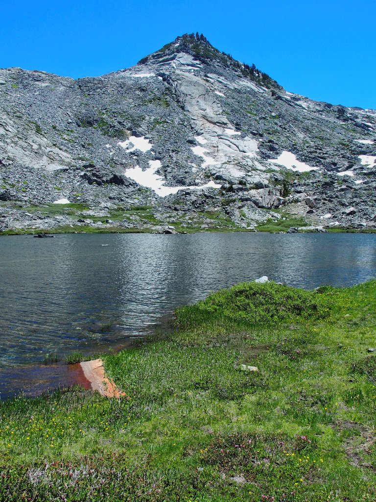
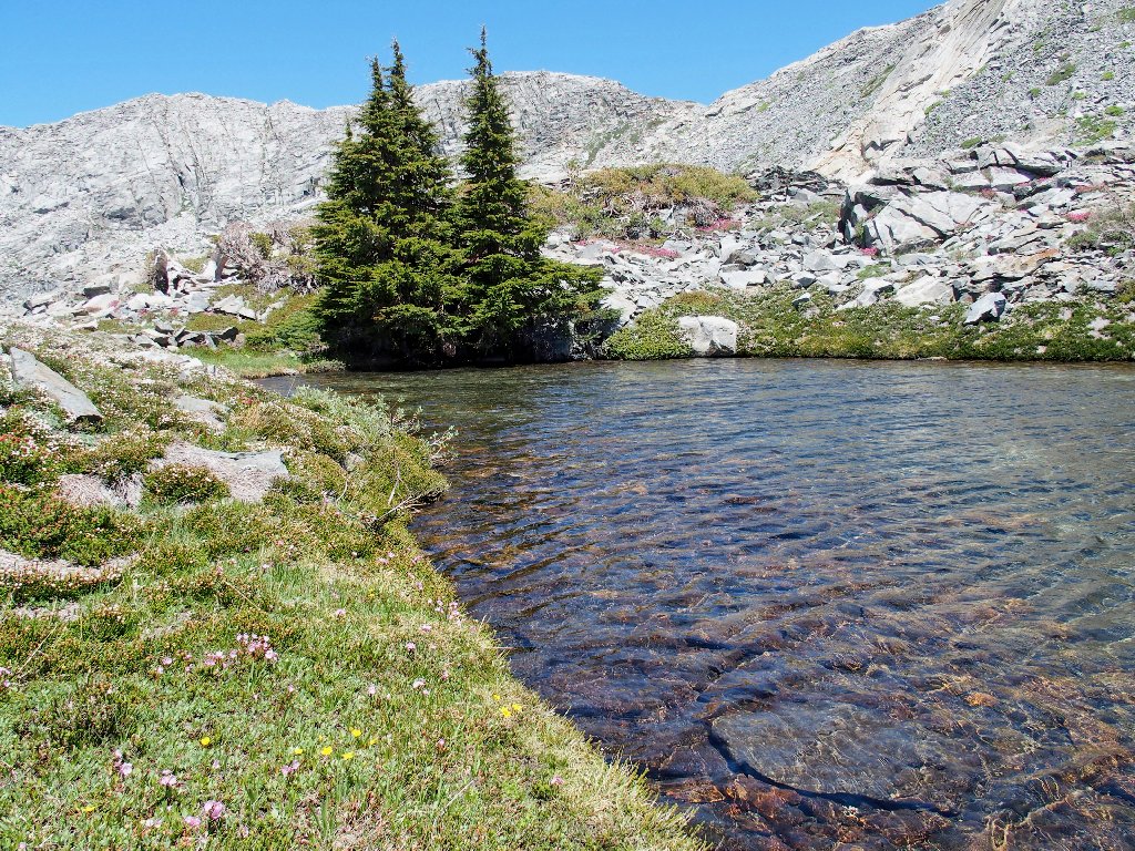
There it is, all right — one of my most favorite places:
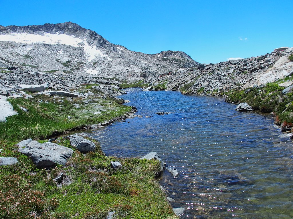
Silver Dagger Lake = Tarn #6
I read that name in a hiking guide published in 1970. Having used it
eleven years ago (Hike #13), I recently
observed two other websites referencing it as well; so it's gotta be true!
Shangri-La awaits me
That more popular name for the place also is unoffficial, but the local rangers certainly know about it.
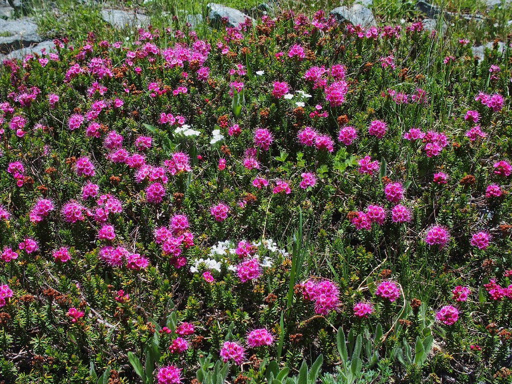
There never are too many red flowers
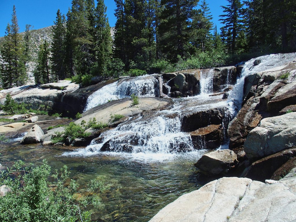
Now I must get down there. Along the way is yet another unanticipated waterfall.
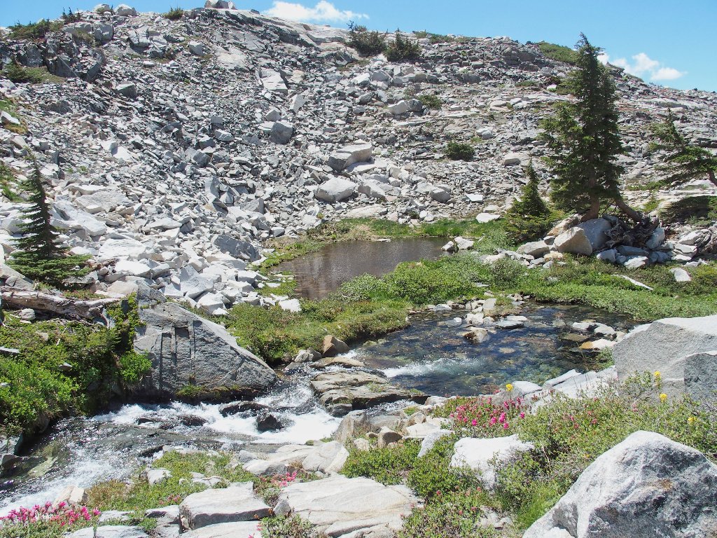
What a neat place!

Outlet from the tarn I didn't visit
A verdant spot
Lovely
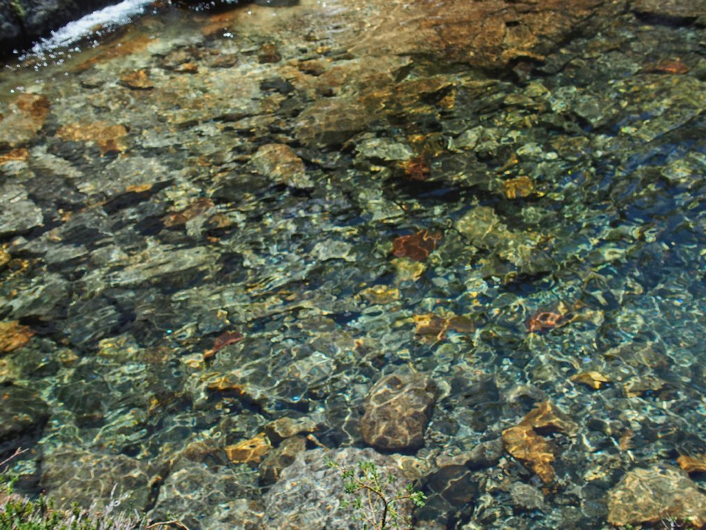
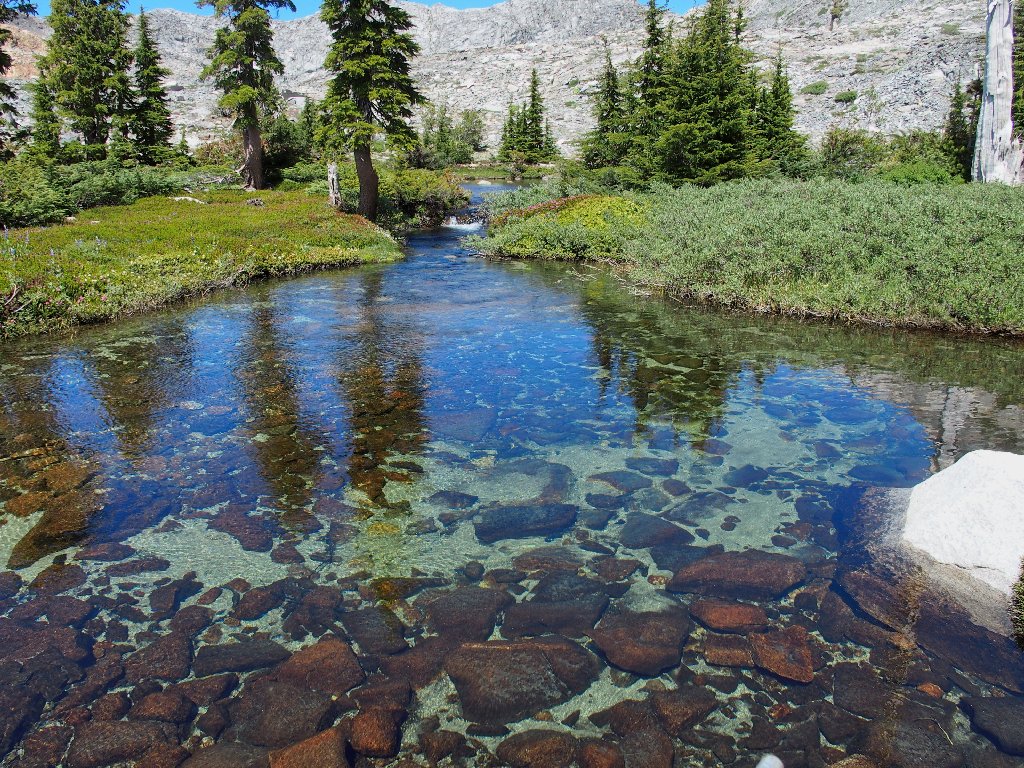
I am mesmerized by the beauty and clarity of this pool at the base of the falls. That is cause to break out my lunch somewhat sooner than was planned. I need to remain right here for a while.

This is why I go hiking
Right beside me is another one:
Tarn #7
Having once again failed to pack my water filter, I once again have run short. Although I might not need it later, I refill my empty bottle directly from the creek. It should be fine.
My special lunch spot
Hot cross dikes
The early-season Heather will shrivel up soon
Shangri-La splendor
Beyond Twin Lakes, the Sacramento Valley smog doesn't look too bad today
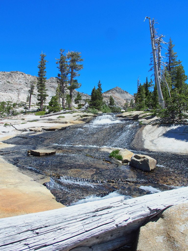
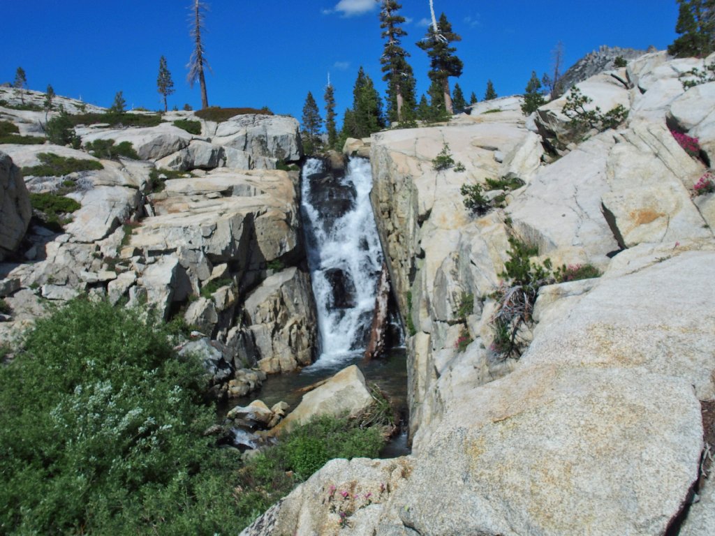
I am right at the top of the big cascade, which I never have seen from this angle.
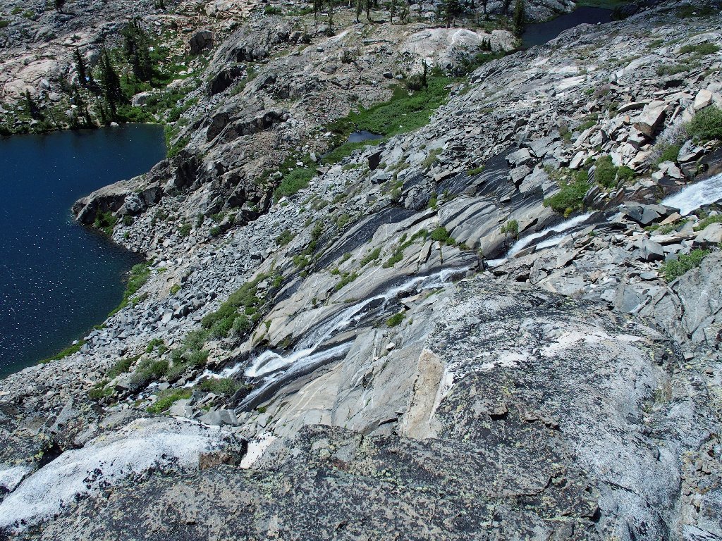
Twin Lakes Falls
Crossing the creek here closes a loop of sorts, by ending the Adventure Route and putting me back in previously charted territory.
This bathtub is right at the top of the falls
The tub doesn't look inviting today. Somebody is washing rocks in it!
Those folk down there are in a world apart
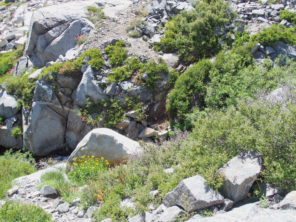
Even on the more arid slopes, the garden is exquisite
Mountain Phlox
This shortcut scramble down to the water is a lot faster than heading back
to the trail at Island Lake. It takes only ten minutes to reach the one
spot where an easy creek-crossing is available.
I already knew about this passage
Atop the little hill on the other side, I am paid a visit by the local panhandler.
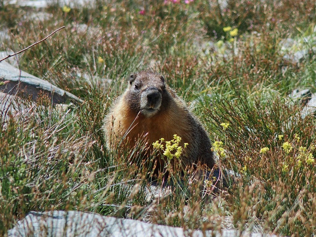
Monte Marmot wants — something
The next of many rest stops provides this marvelous scene:
The real show-stoppers are the Mountain Pride — as usual
More rock art
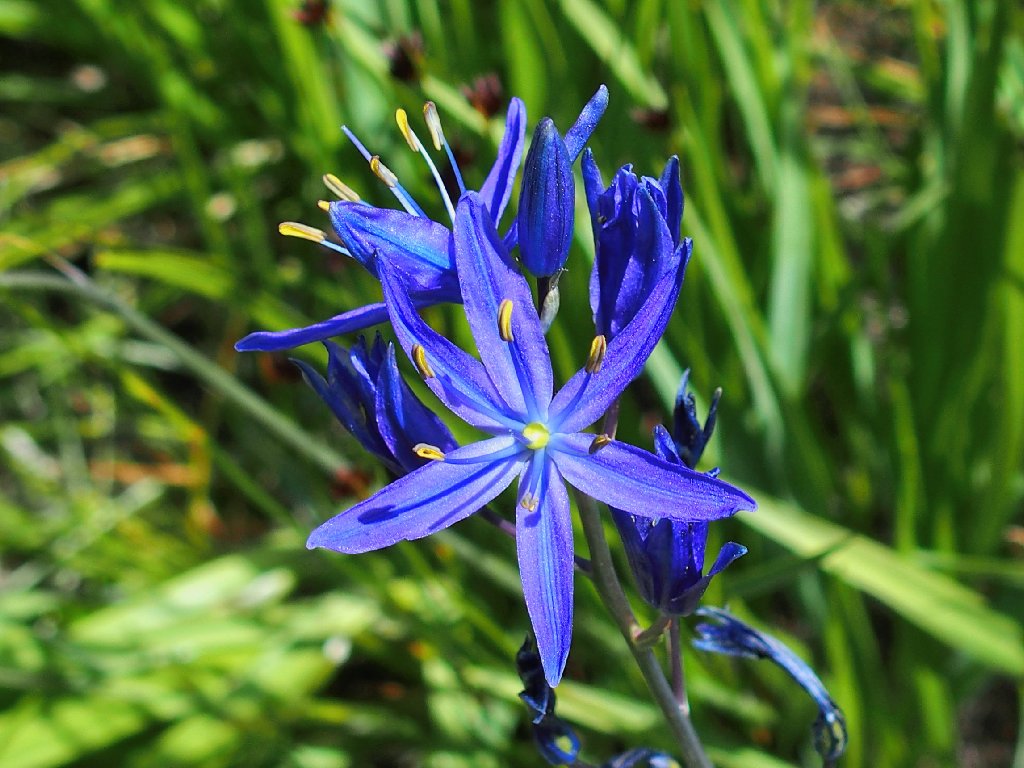
Camas Lily
This shortcut bypasses Boomerang Lake, and soon I am back at the Twin Lakes Spillway.
Last view of the cascade
The tops of some of the rocks have dried off by now, but a dry crossing remains doubtful in my inadequate footwear.
Perhaps next time
So it remains to navigate down to a place where I can cross the big creek. I had marked a waypoint of my prior ford, but I am trying to improve upon it. A detour near a wet area serves only to increase the time and distance, as the ultimate route map doubtless will show.
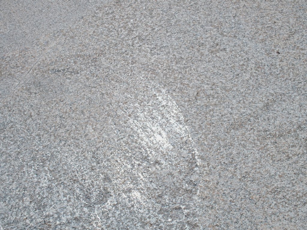
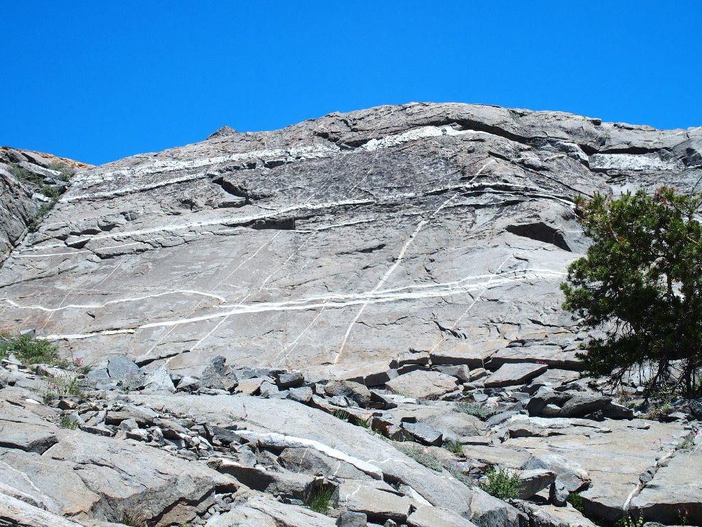
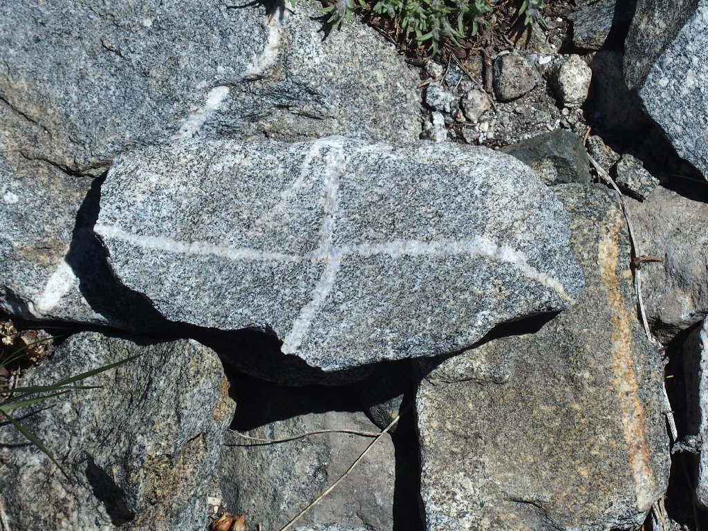
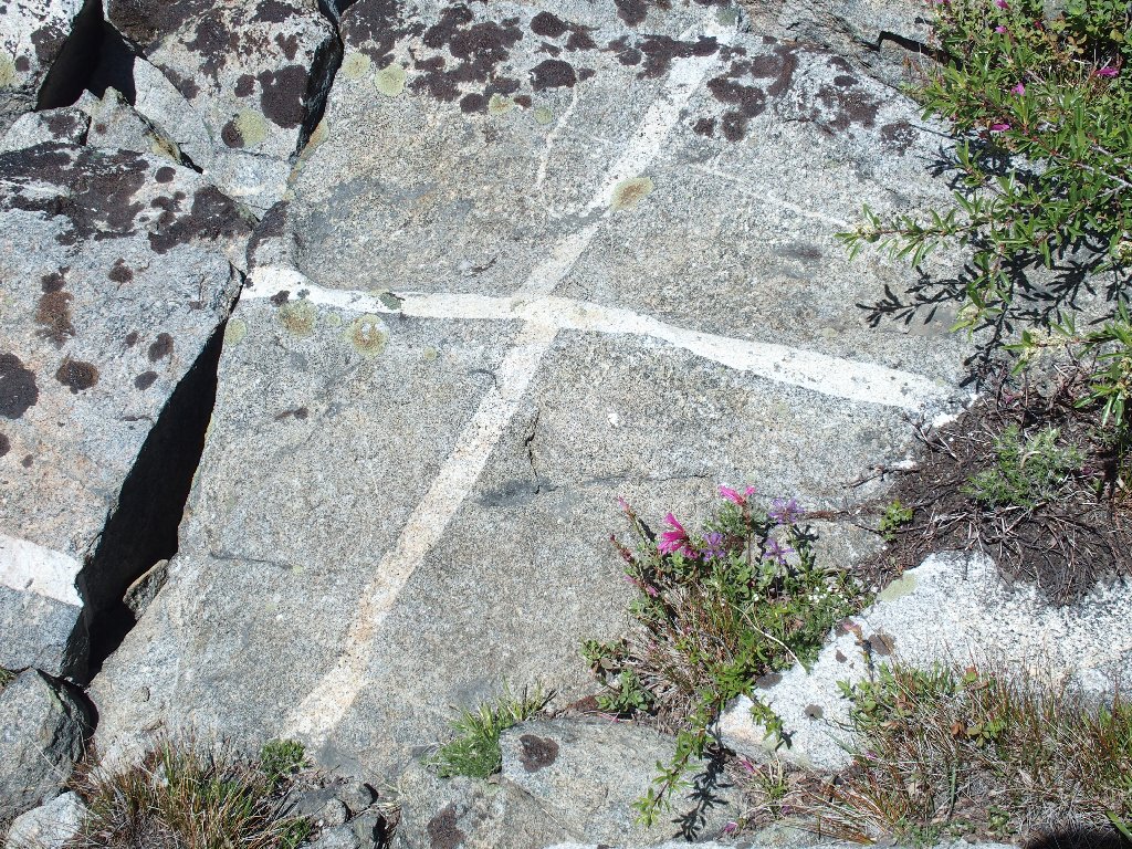
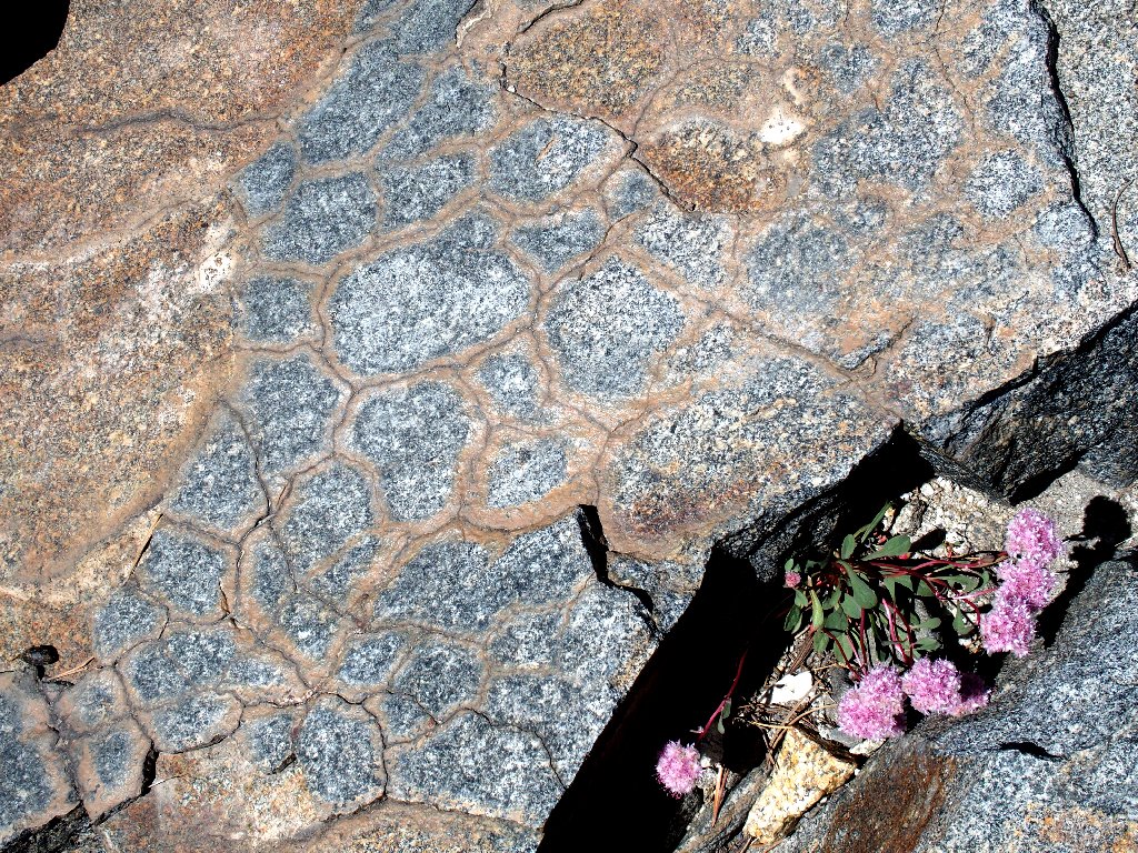
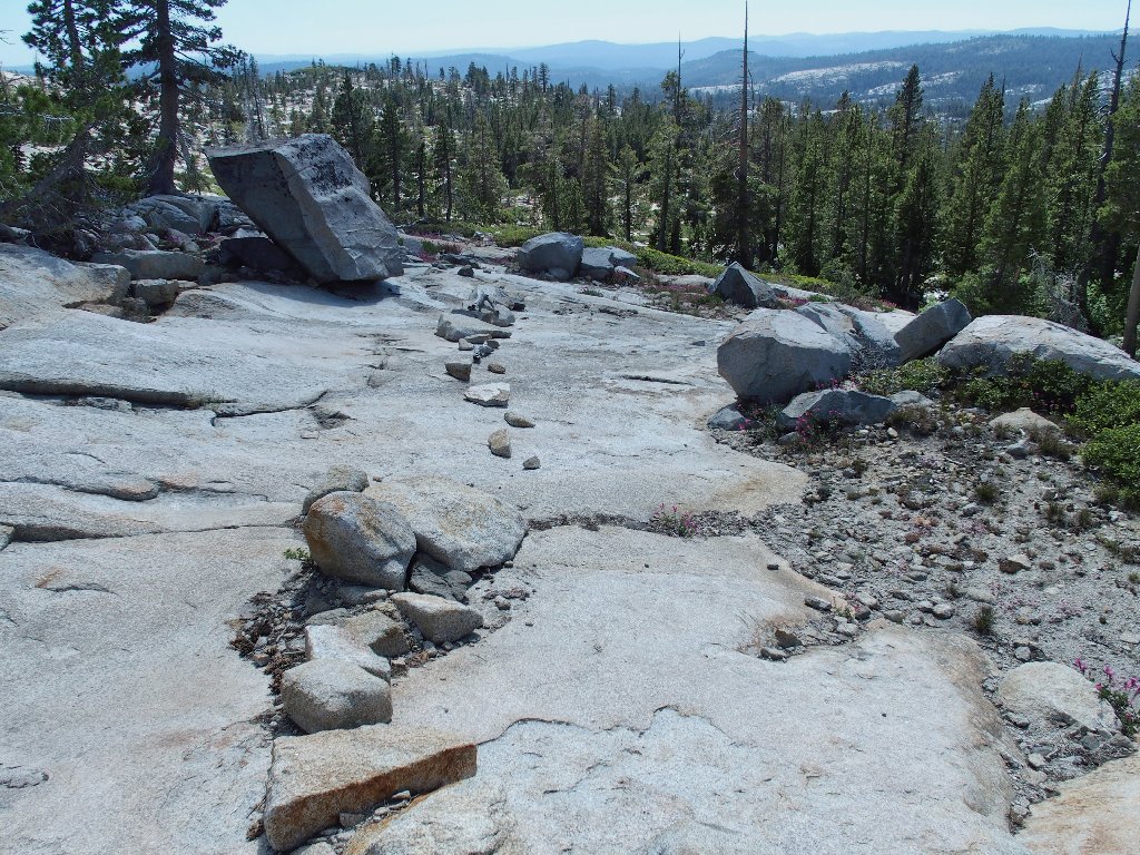
Can you figure out what this is?
In fact, is is something rather unusual — a slab polished so
smooth that it actually is reflecting sunlight like a mirror!
Square Falls
The remaining slog would be more pleasant if it wasn't so relatively rough. In my experience, most of the trails in Desolation Wilderness are similarly hard on the body. The short respites over smooth slabs are but partial compensation for sore feet and knees, and today there is no end to it until the final quarter of a mile.
The trail is well-defined — most of the time
A fairly stiff breeze keeps the air temperature down; but I still am compelled
to drink some unfiltered water — nearly all of it, in fact.
Wrights Lake appears
I like the old-fashioned blazes
Late afternoon always is the prettiest time to be on a trail
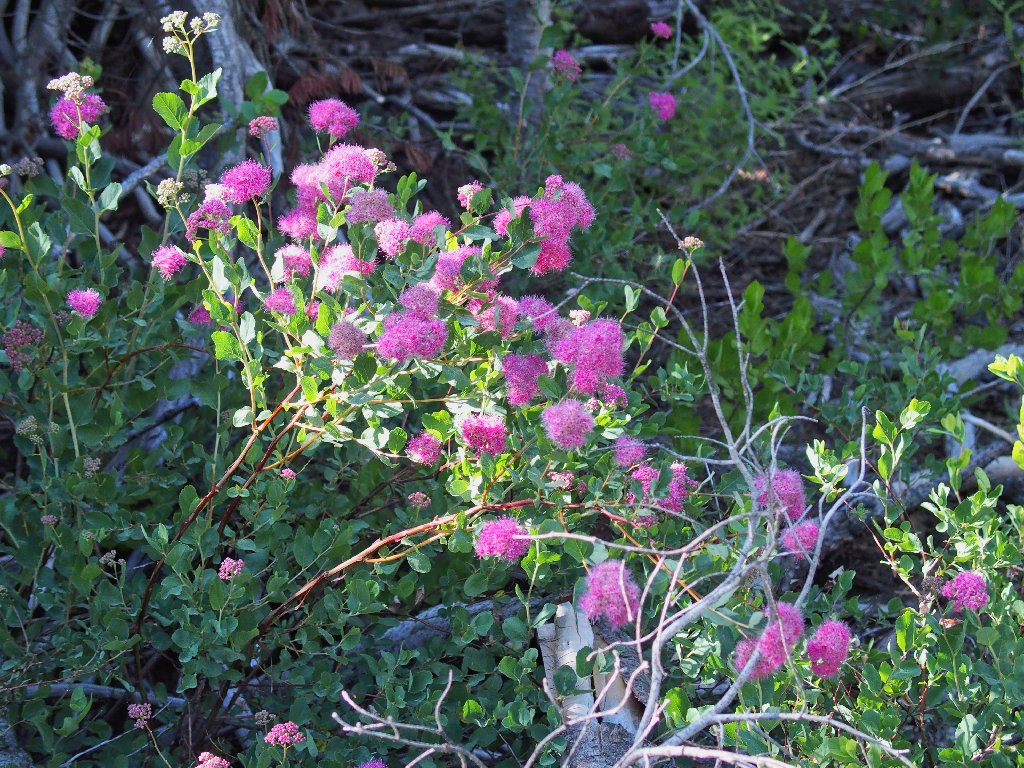
Rose Meadowsweet
Silver Lupine
Finally, the sought-for landmark appears. The usual bevy of kayakers
is absent today; perhaps the cabin-owners are waiting for the bugs
to go away.
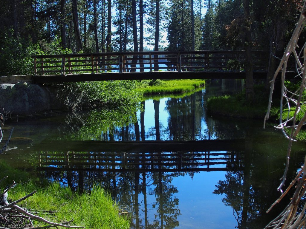
The Wrights Lake inlet
§: Well, that was a 7½-hour outing! Not only did I see more
than was expected, but the whole cross-country venture proved especially
rewarding as well. For some reason, I had not anticipated all the wonderful
running water in the channels between the pools. Should I return to
Shangri-La, I will not hesitate to revisit the pool where I stopped for
lunch today.
I had planned a first for this journal — that is, I actually was going to deduct two whole points from the rating on the basis of difficulty alone; but subsequently I couldn't handle the idea of awarding this exceptional outing a mere '7'.
Besides the mirrored rock, I scored another first today; for there was not a single piece of litter on the entire route! (I did pick up some stuff at the parking lot, though, if only to fufill my Prime Directive of carrying out more than I carried in.)
Upon my return, the gate was open. That's the second time in a row
that I visited Shangri-La, only to have the road opened for the season
during my hike. Finally, I stopped at the Mill Run Ranger Station on
US-50 and deposited a completed permit form.
| Scenery |  |
| Difficulty |  |
| Personality |  |
| Adventure | |
| Flowers | |
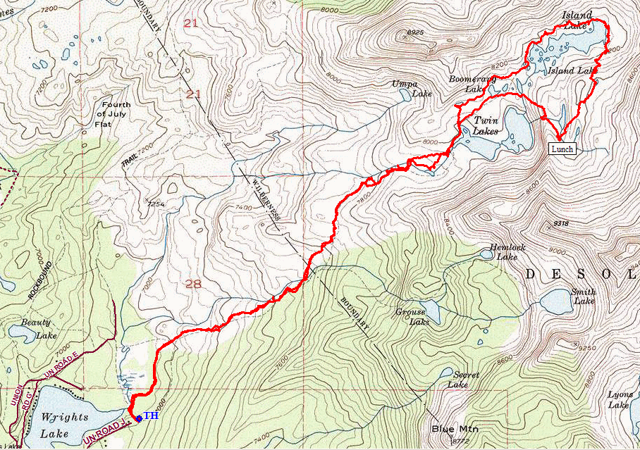
Here also is a map of the route pasted into Google Earth. It shows that I completely missed one of the biggest of the Hidden Tarns. Pshaw. Better management of waypoints would have avoided that oversight. Now I have to go back.
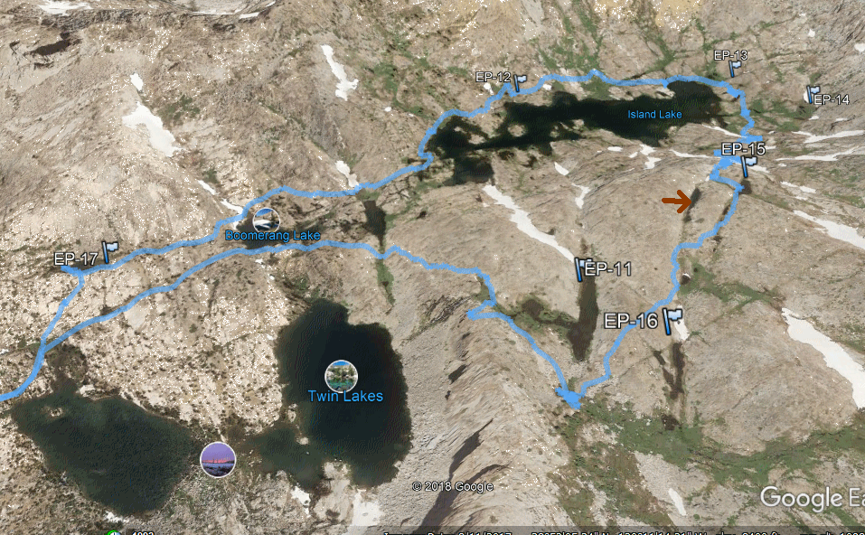
Look by the red arrow

ADDENDUM
There is no scientific difference between a lake and a pond. Depending upon who is doing the writing or speaking, several differentiations have been ascribed, such as size, depth, existence of an outlet, and more. The same applies to a tarn. The National Park Service specifies the hardcore original Northern English designation, which is a glacially formed cirque lake. Many others apply a broader definition to the term.
In the Sierra, there is a class of small bodies of water that lie almost
exclusively in a 'rock crevice', which formation may or may not be of glacial
origin. Although they might not even show up on a topographic map,
I find these little bodies of water to be extraordinarily beautiful and
good-feeling places, and they are deserving of a unique identifier.
Unfortunately, if I were to make up a new word for them, nobody would understand;
so some existing term must be utilized. To that end, here is an excerpt from
the Ted's World Dictionary:
LAKE:
Any body of water with an official name that
includes the word 'Lake', even if it actually is not of natural origin
(apparently, nobody much likes to use the word 'Reservoir'). It usually
has both an inlet and an outlet. If it is stocked with fish, then it's a
lake. If it has waves or a beach, it's a lake.
POND:
Shallow, usually with a muddy bottom and murky
water, is invariably the home of dragonflies, water skippers, and dead trees, and
might well dry up as the season progresses. If it looks as if Swamp Thing might
emerge at any moment, then it's a pond. If you would prefer not to filter water
from it, it's a pond.
TARN:
A special class of lake or pond that exists solely
because of the configuration of the rock in which it lies; or any small body that is
just too pristine to be called a pond. It might or might not have an inlet or be
deep enough to retain water throughout the year. If the shoreline and bottom are
mostly solid rock, then it's a tarn. If you can see the shallow bottom clearly,
then it probably is a tarn.
