
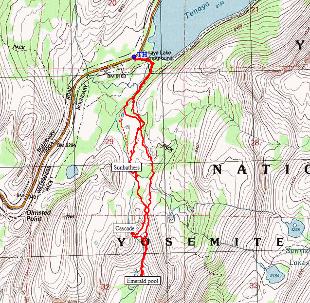
Yosemite National Park
|
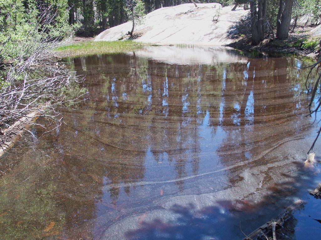
Tenaya Creek Rock Bowl Yosemite National Park |
June 14, 2018
While driving home from Bishop, I get to visit my beloved Yosemite
high-country for the first time this season. The wonderment begins
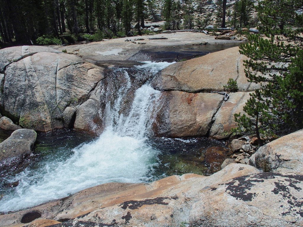
with the principal attraction on the eastern end of the Tioga Road:
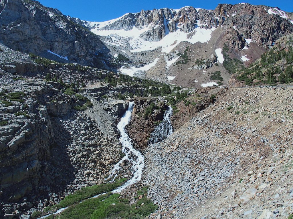
Lee Vining Creek Falls
At the park entrance, a ranger waves me right around the kiosk in the
oncoming-traffic lane, because I seem to be the only one in a dozen
vehicles that has a Parks Pass. Go figure.
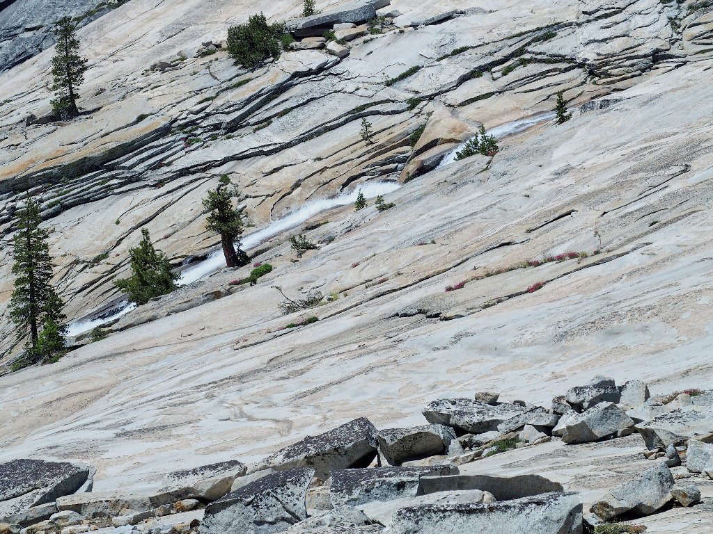
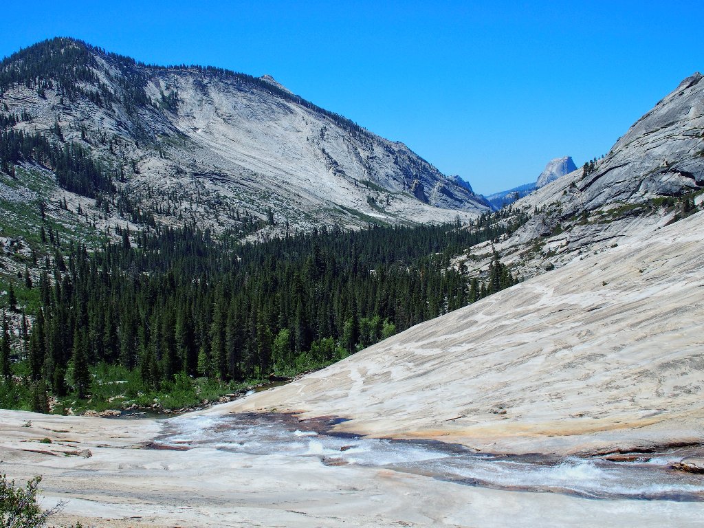
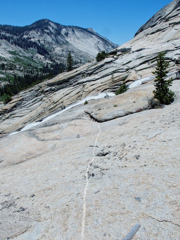
Just before reaching Tenaya Lake is an unusual view of my favorite mountain:
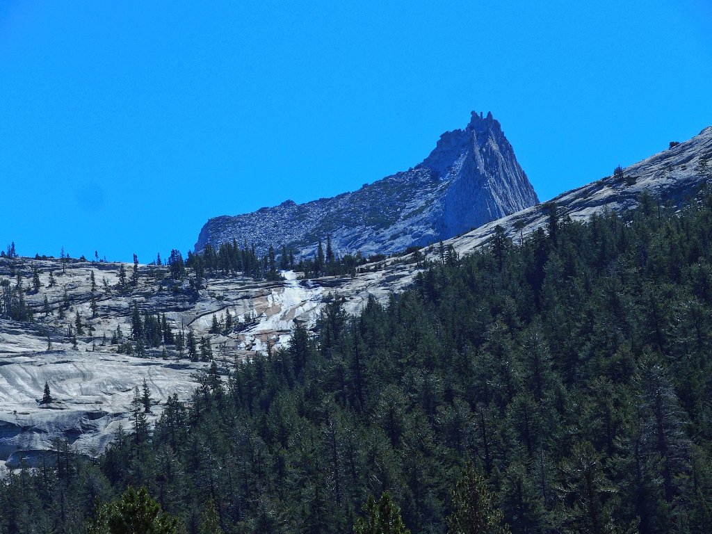
The Cathedral Lakes drainage and Cathedral Peak

Today's destination has been high on my bucket list for some time.
Known informally as the Tenaya Waterslide, I have photographed it from above,
yet inexplicably never have gotten up-close and personal. This is
the day.
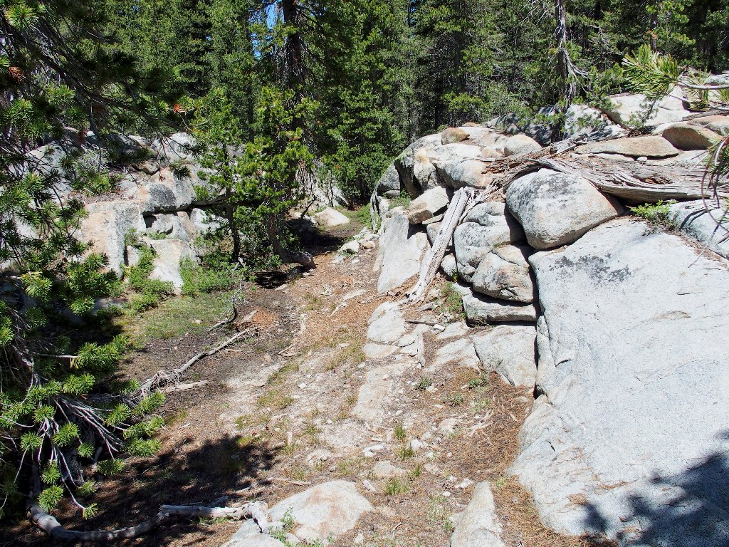
Getting started
Last time, I could not cross on these rocks at all; so I spent the whole
outing on this side of the creek. Today, I am able to make it across
without getting any water in my boots despite a 3-inch depth in places.
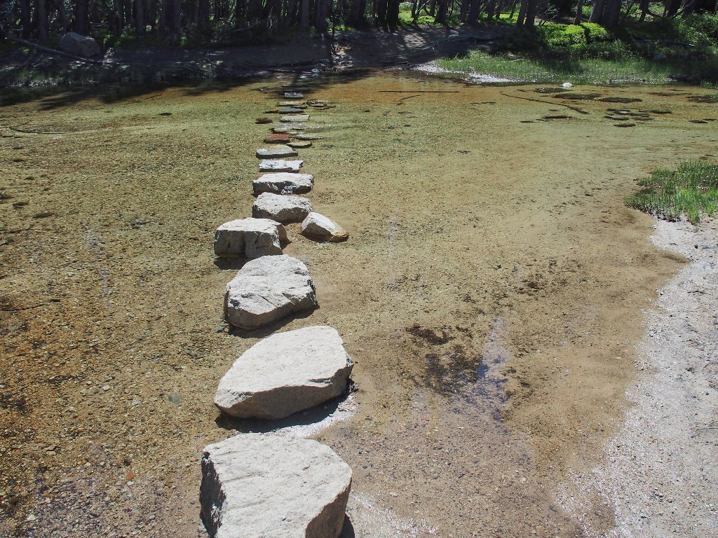
Wading across certainly would have been easy enough
I have stocked up on mosquito repellent, but so far I have not been bothered. This is very good.
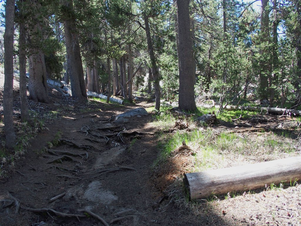
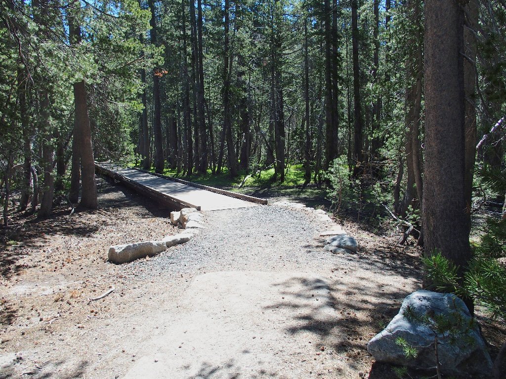
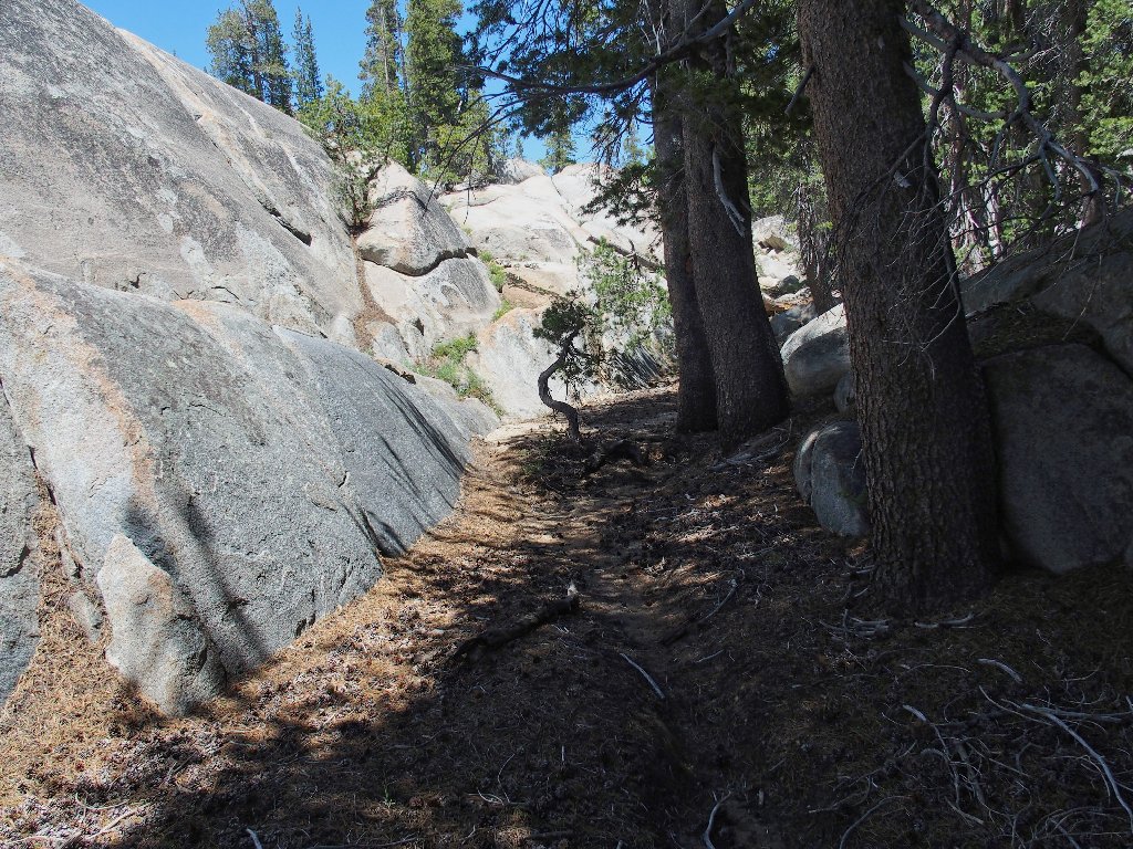
On the Sunrise Trail
Having no established route to guide me farther, I opt to depart the Sunrise Trail just before it turns left and heads upward into some rocks.
The adventure begins
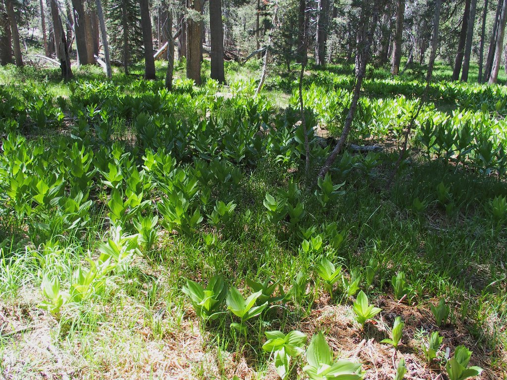
Corn Lilies galore
This must be the Sunrise Lakes drainage
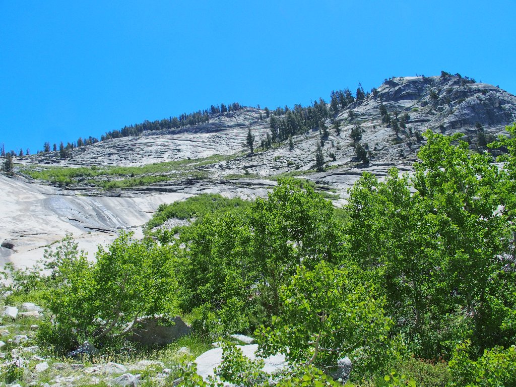
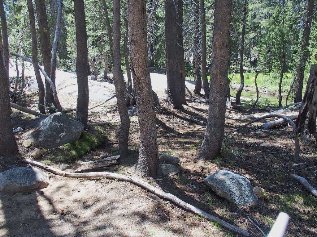
Getting around in the forest here is so easy, because no real bushwhacking is required. After a short but unexpected climb, my excitement mounts; for the destination lies just below.
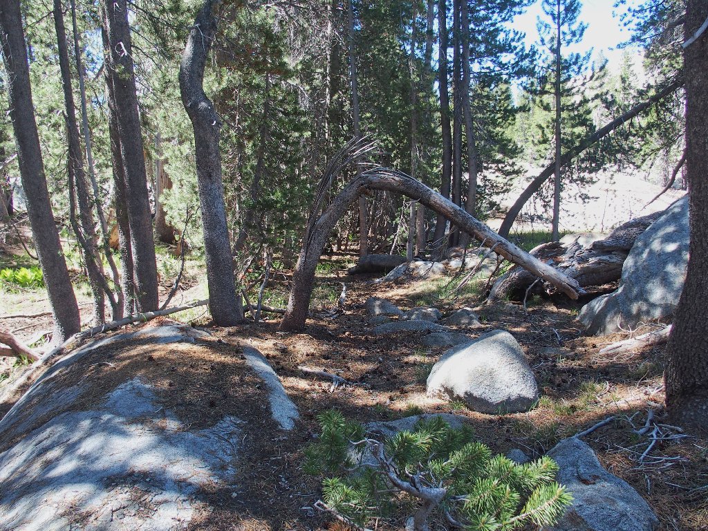
Starting downhill
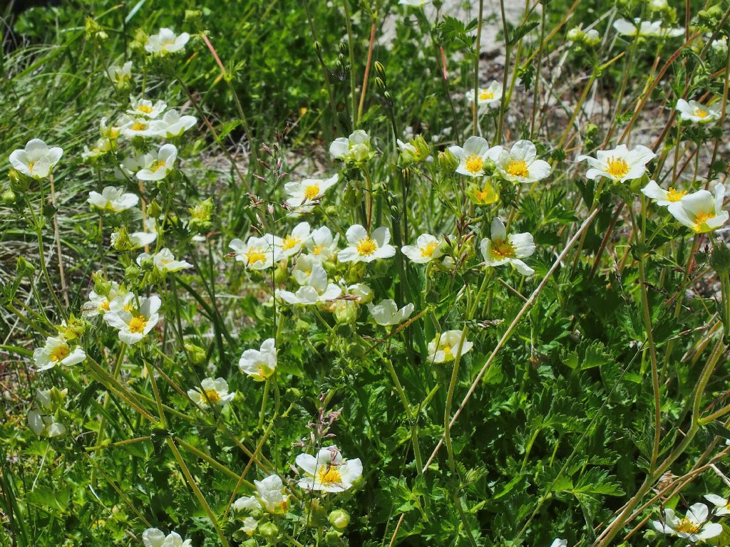
Whoa! A blaze of color stops me in my tracks.
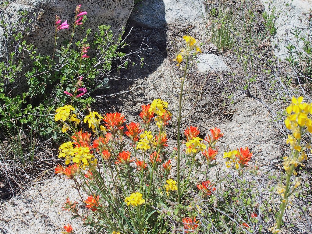
Paintbrush, Western Wallflower, Mountain Pride
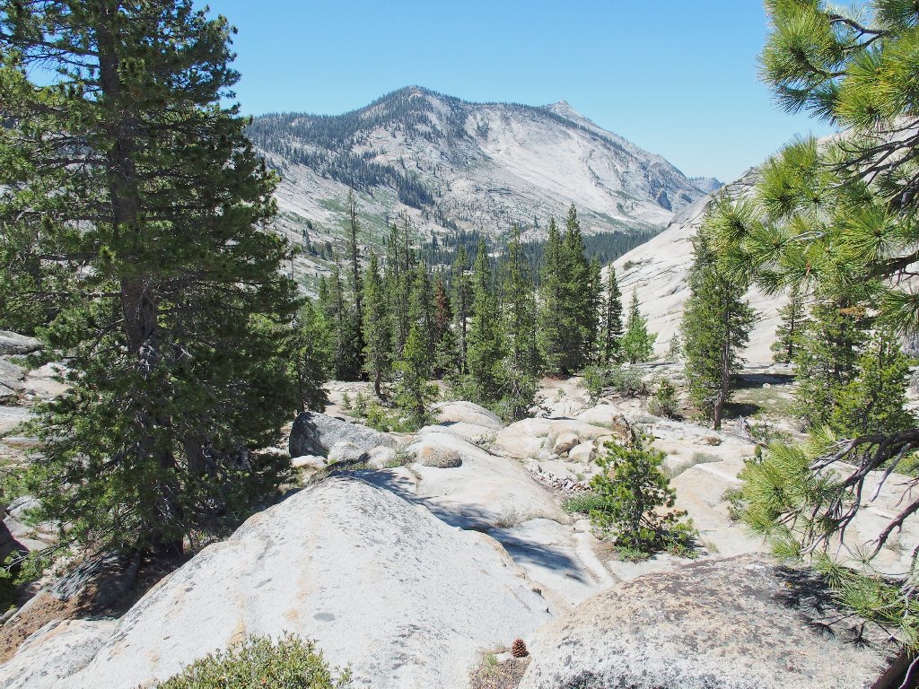
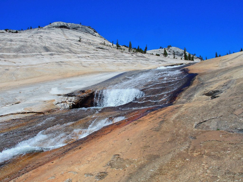
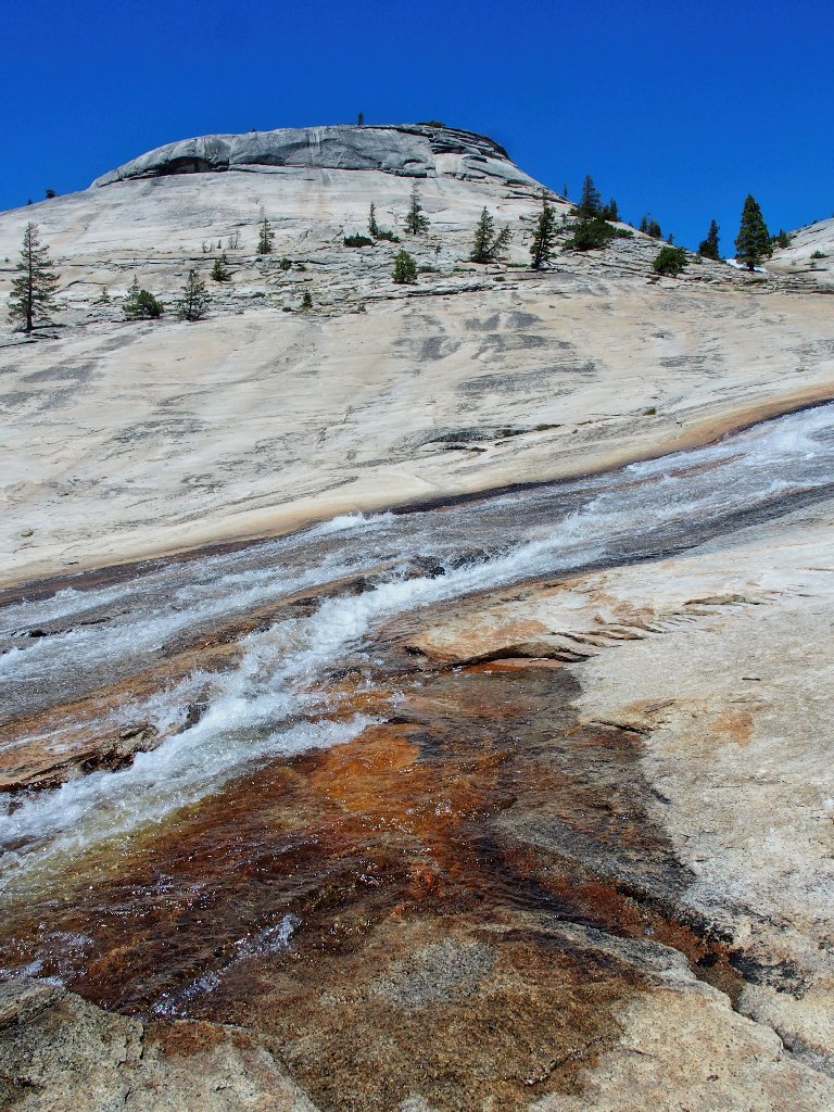
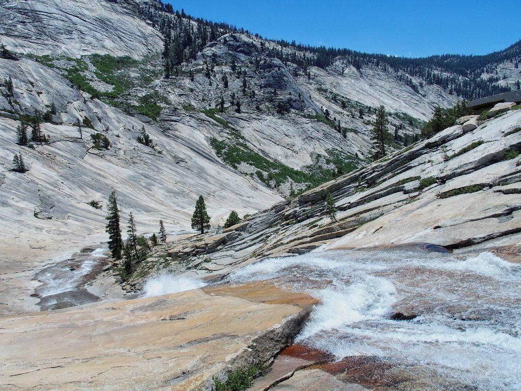
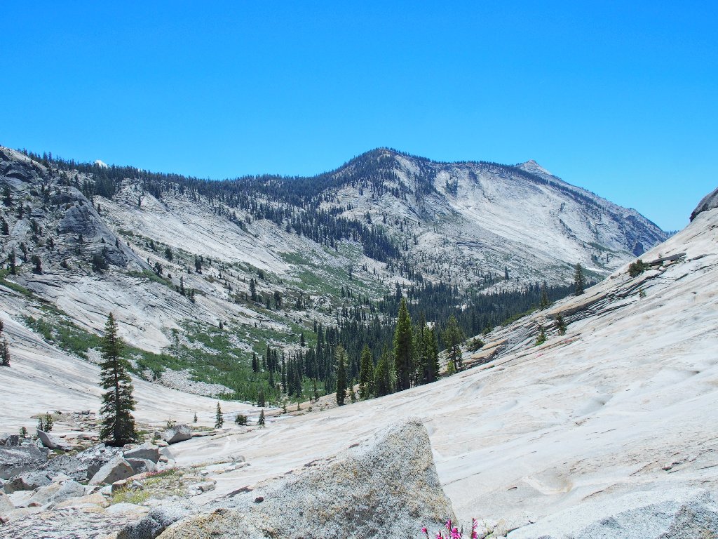
Shortly thereafter, I reach the lip of the rock bowl itself. Clouds Rest dominates the skyline.
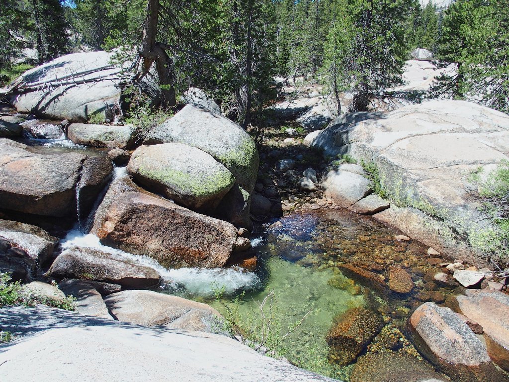
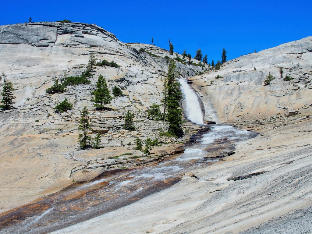
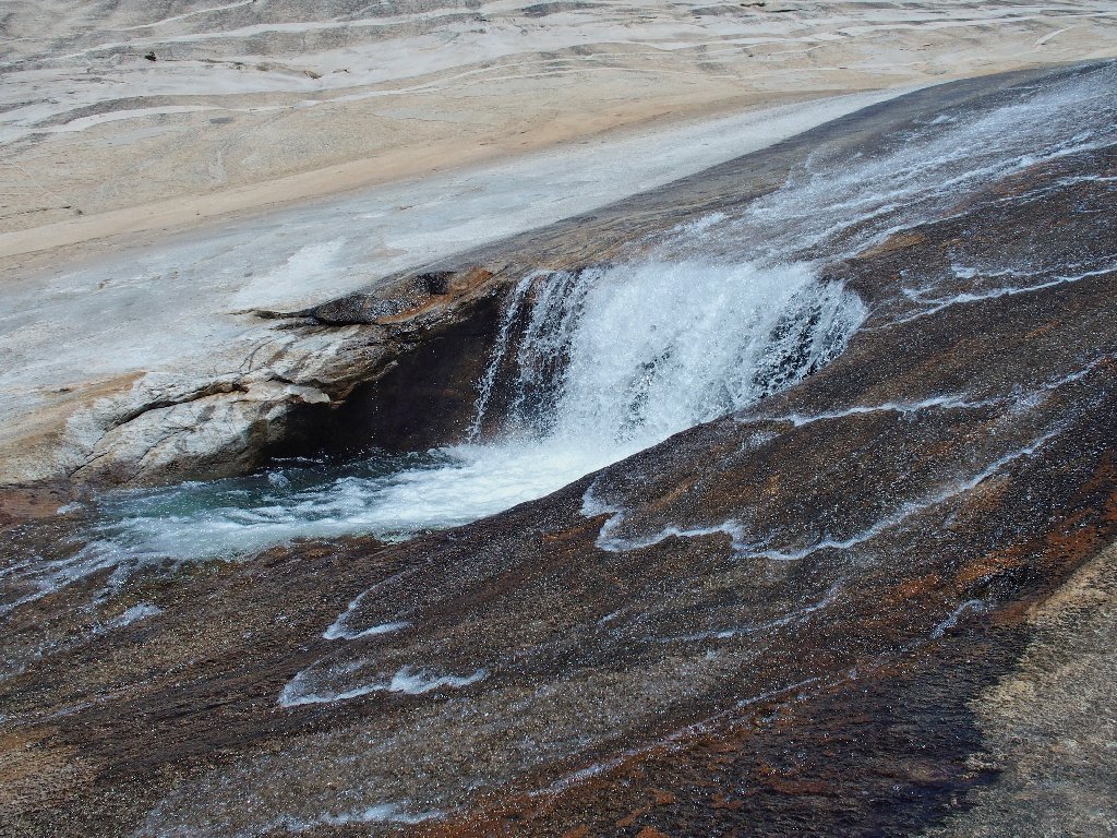
It's gravy-time!
There's the cascade
He doesn't care
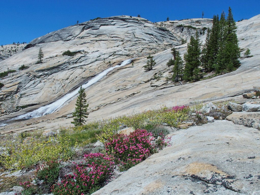
But I surely do. What a fine scene!
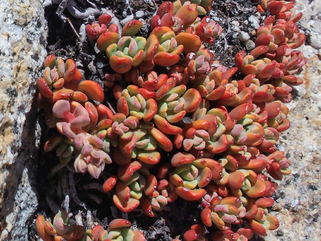
Sierra Stonecrop
Sticky Cinquefoil
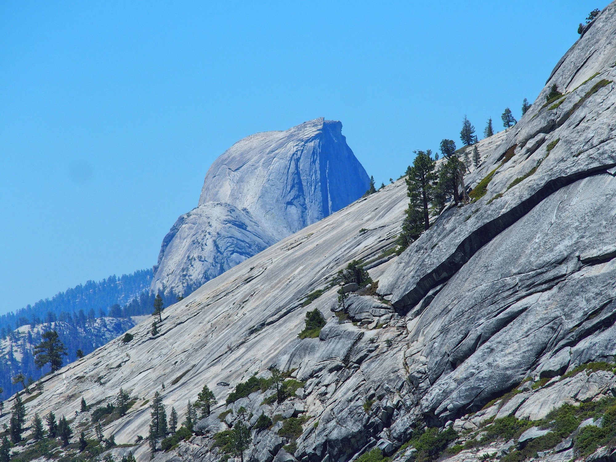
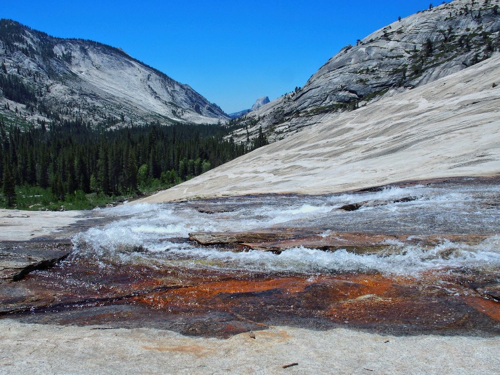
Half Dome appears from around the corner
There are climbers on the dome's cable route, of course; yet because they
are nearly six miles away, I can barely see them without a longer lens.
My backup camera has a 30× zoom, but it is unresponsive.
The poor thing must not have survived the partial dunking it incurred last week
over near the B-17 crash site.
Been there, done that — three times!
Two years ago, I photographed this place from atop the rock directly behind
the big cascade (Hike #304). Those pictures are great,
but there is no substitute for actually being here.
How could I not have done this sooner?
A favorite spot in the Northern Sierra is at Enchanted Pools in Desolation Wilderness, where one can walk alongside a creek in this manner as it tumbles down a granite slab. This section is much longer, however, and the rock is more colorful as well.

For me, it doesn't get any better than this
As I stand here, not trying in the least to suppress some tears, I can only gaze in wonderment.
Sublime
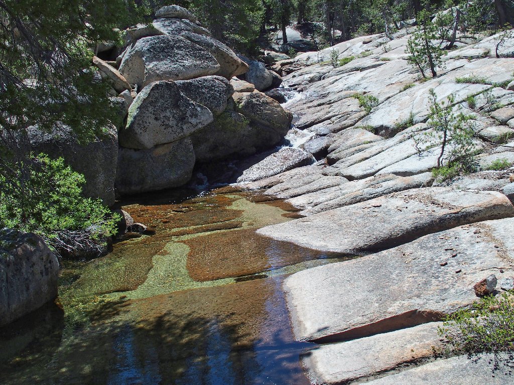
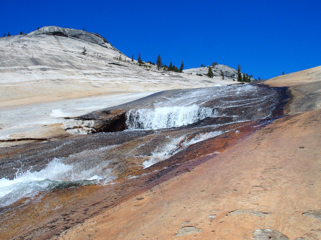
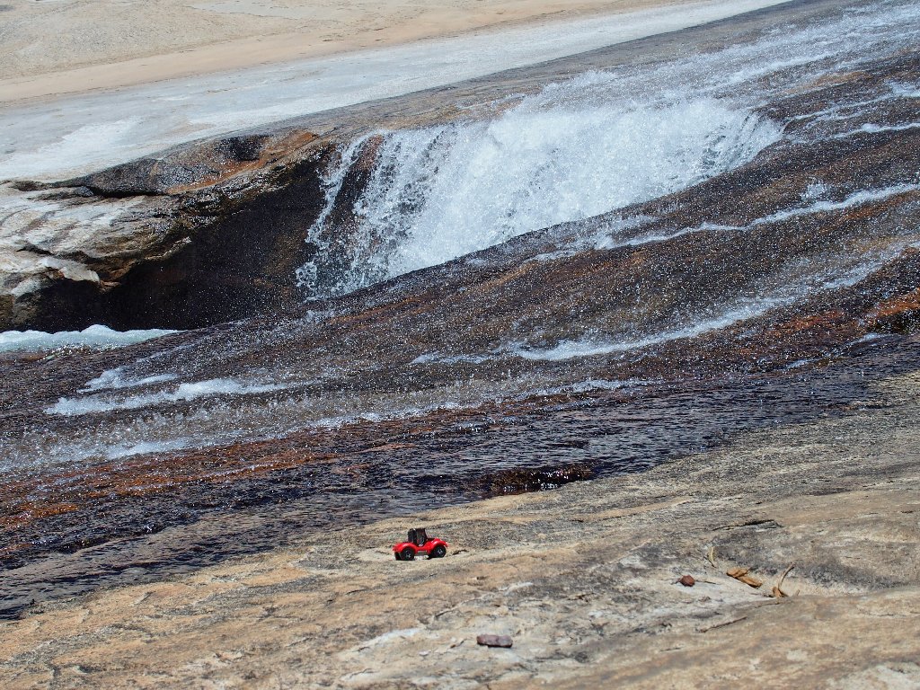
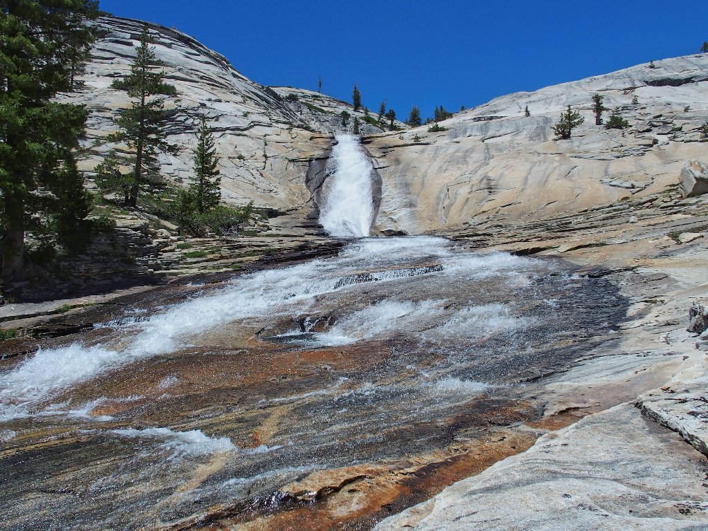
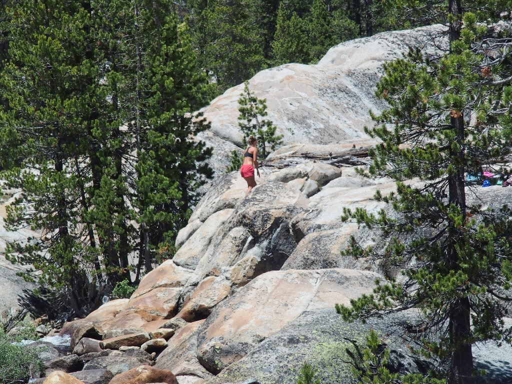
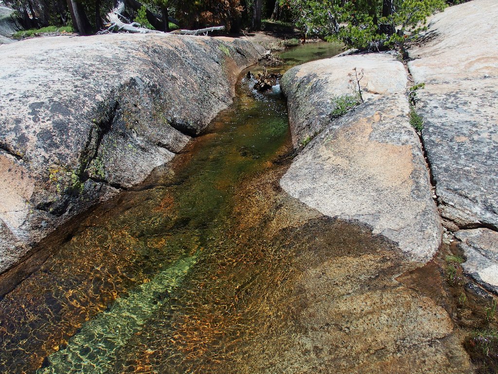
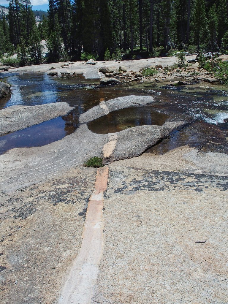
I have reached the top of the bowl's namesake attraction — a section of creek on a slab that is smooth enough for daredevils to slide down into the inviting pool below.
The famous Tenaya Waterslide
In one respect, it would be great to photograph some folks getting their thrills; on the other hand, it feels quite wonderful to have the place to myself at the moment. This is another of those remarkable areas where solitude is readily achievable right in the middle of a tremendously popular park, if one merely bothers to seek it out.
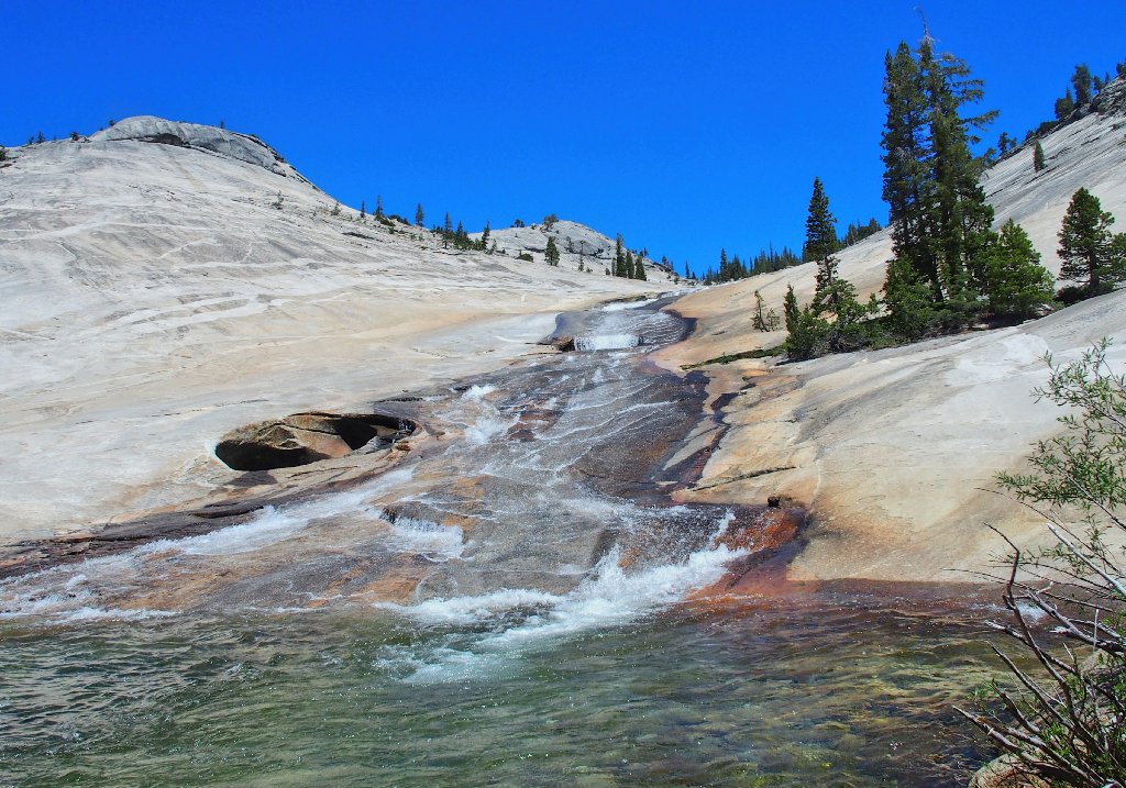
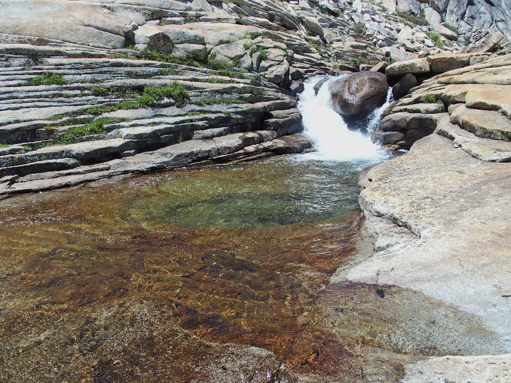
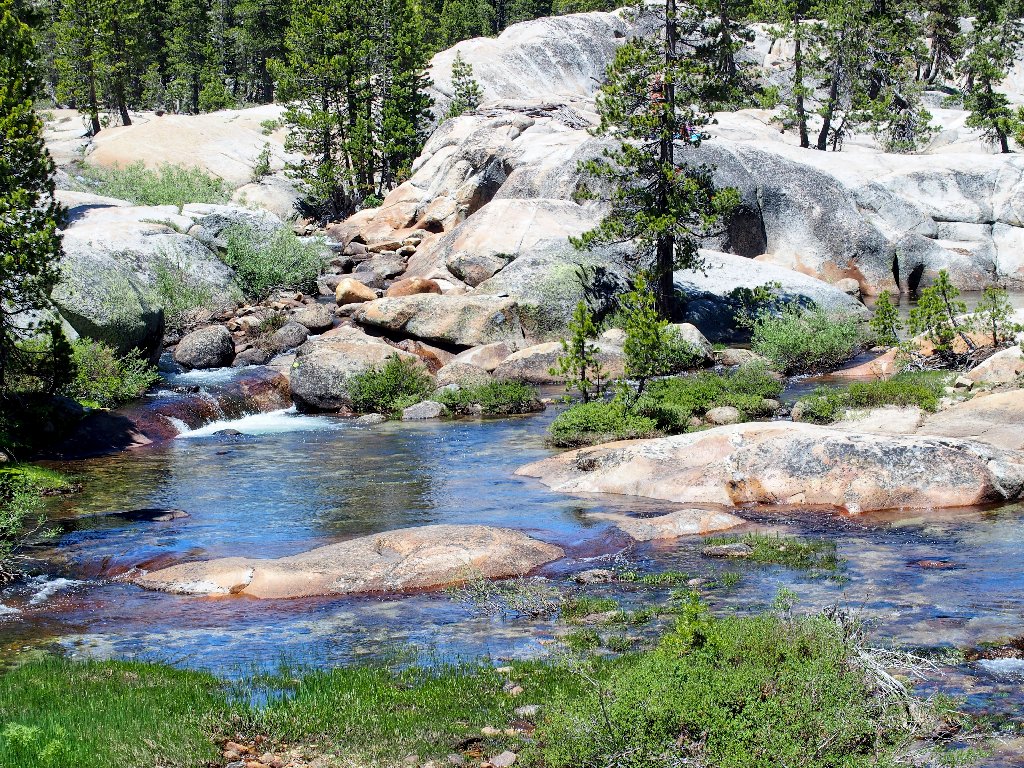
I call this Emerald Pool
One must be careful to slide in the right direction near the bottom; otherwise, a serious bump could ruin one's day.
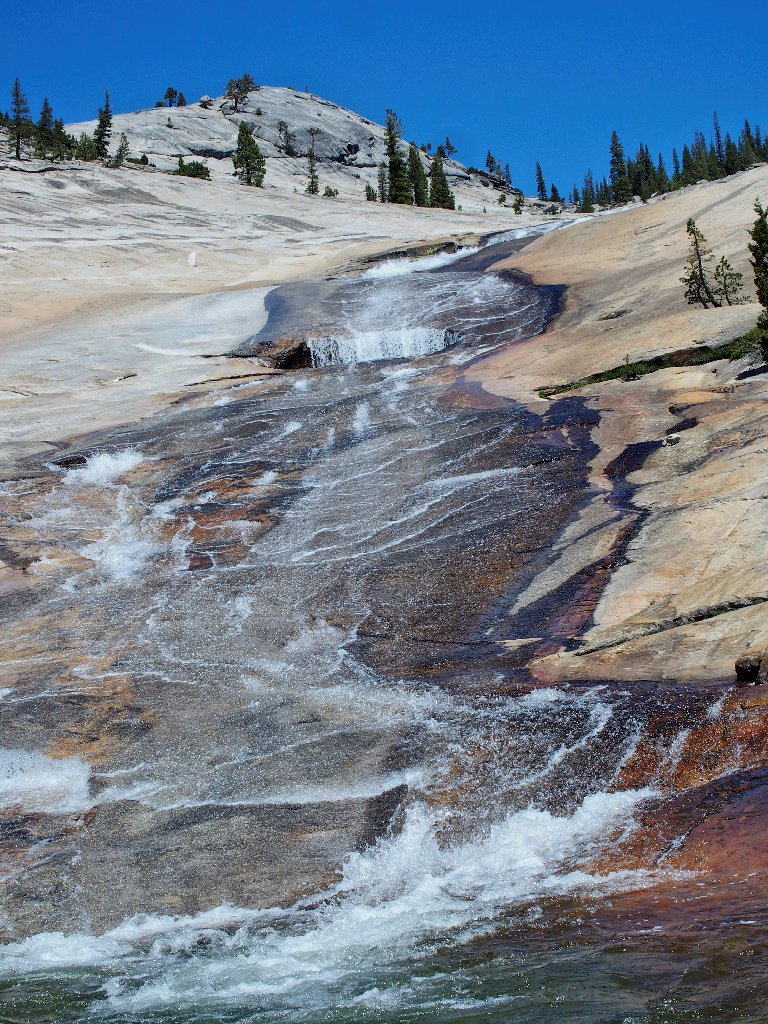
Would you slide down that?
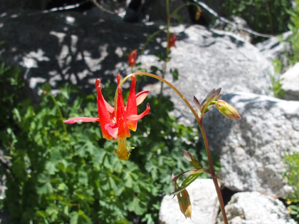
Crimson Columbine
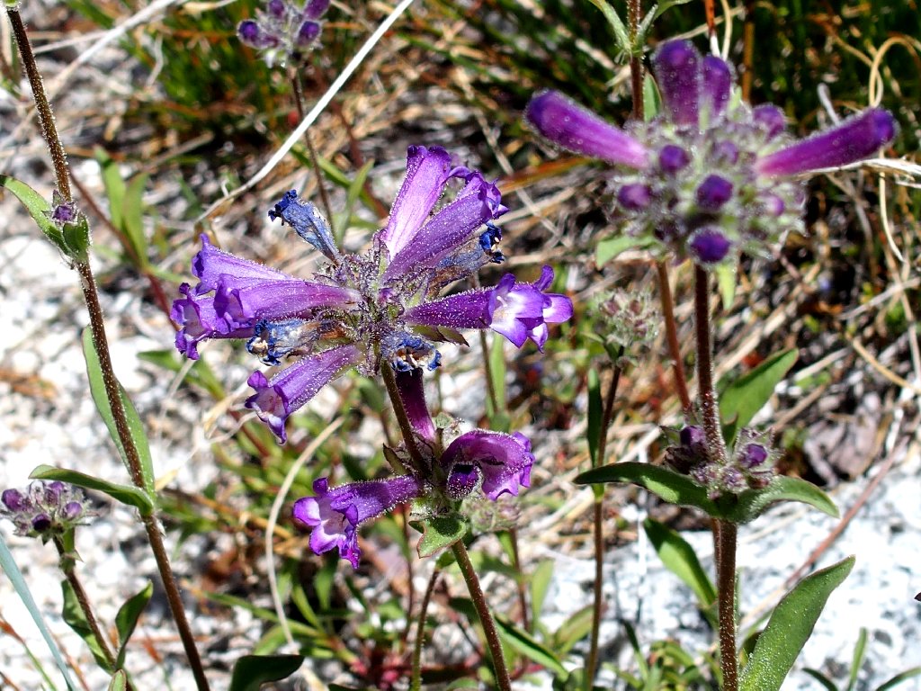
Sierra Penstemon
Looking eastward
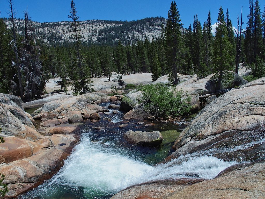
The magnificent Pywiack Cascade is about a mile and a half downstream; but there is no semblance of a trail that I can discern, and it's just as well. That cataract cannot be viewed at all except from across the canyon. A few years back, a hiker fell and died down there, possibly because he was trying to get a better viewing angle. That's not a recommendation for venturing farther downstream.
A good spot for a snack before heading back
I didn't bother packing much of anything to eat. All that I have is a couple of tangerines, but it really doesn't matter.
Staging area for the waterslide
Adding a bit of perspective to the scene!
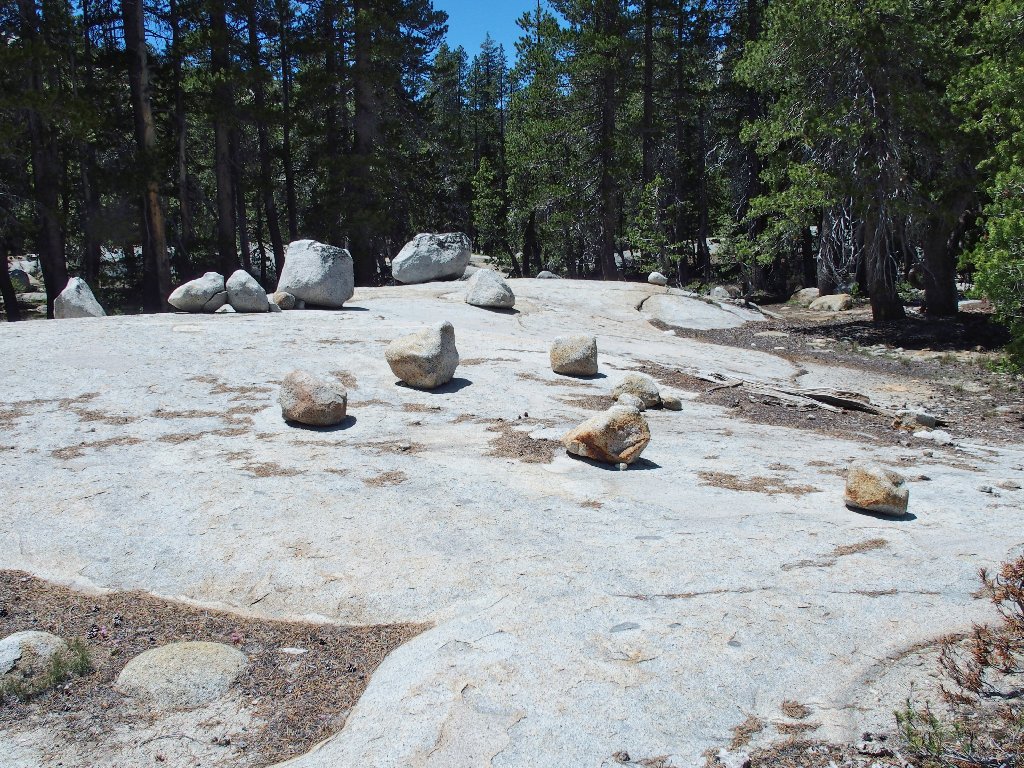
All of the rock is quite smooth around here. In places, I can slide my hand back and forth across it without chafing any skin. Amazingly enough, however, my boots are handling the footing with no problem whatever. I have not slipped a single time.
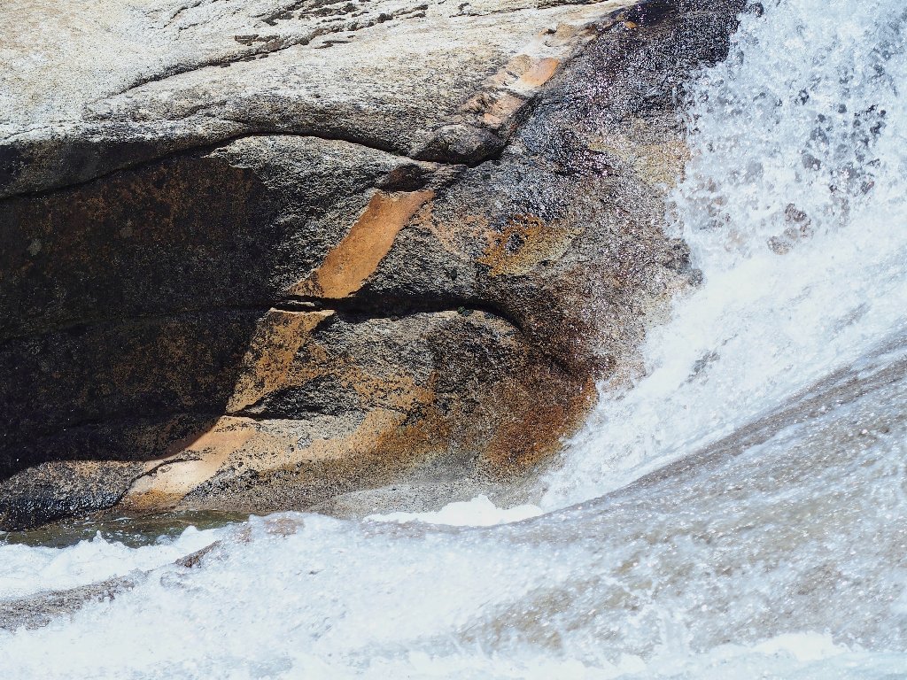
A particularly photogenic dike
So long to Half Dome
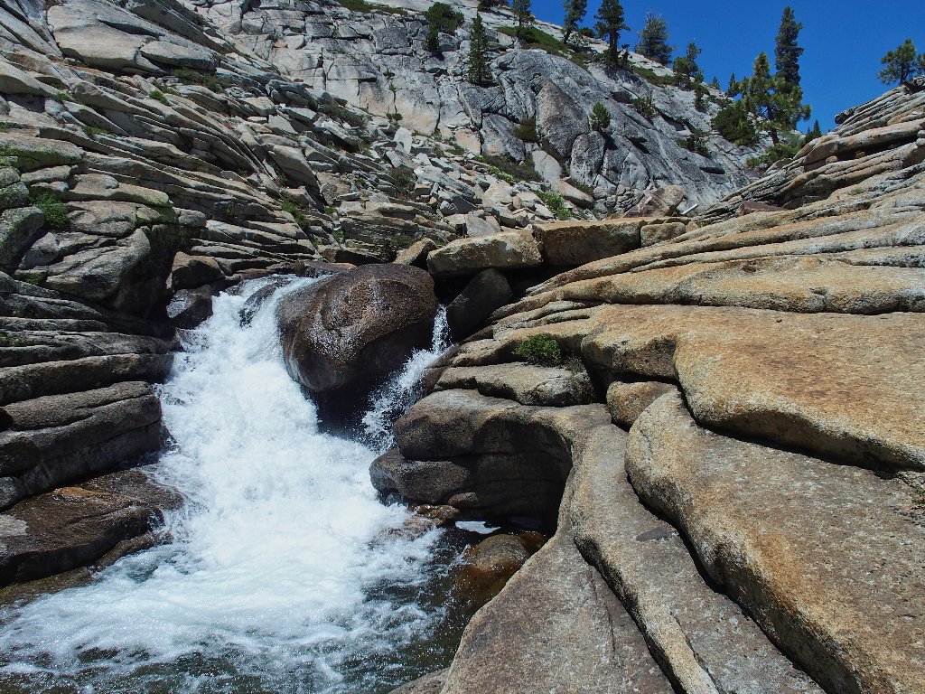
Kayakers try their luck on that cascade, yet rarely make it without capsizing
There appears to be a safe, easy route to the top of the falls by
veering over to the right. That makes it a must-do.
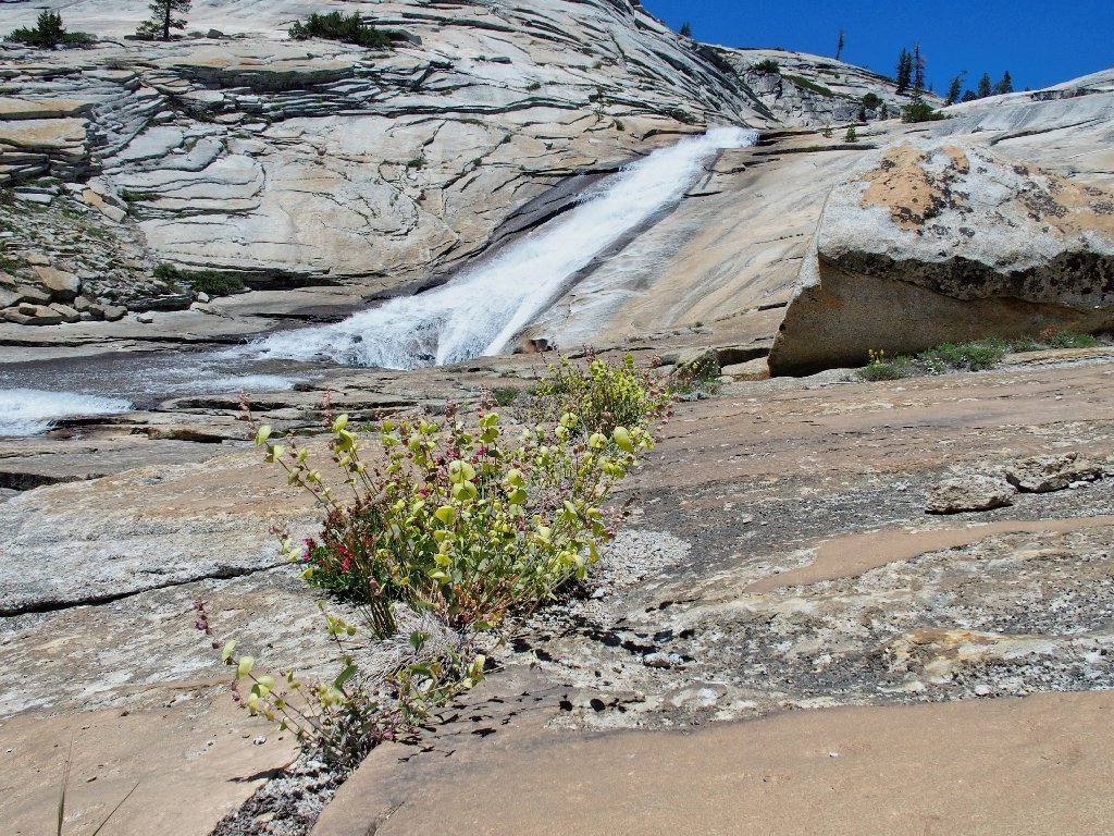
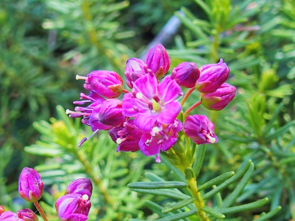
Jewel Flowers
At the brink
Surely enough, there is something new up here.
Beautiful
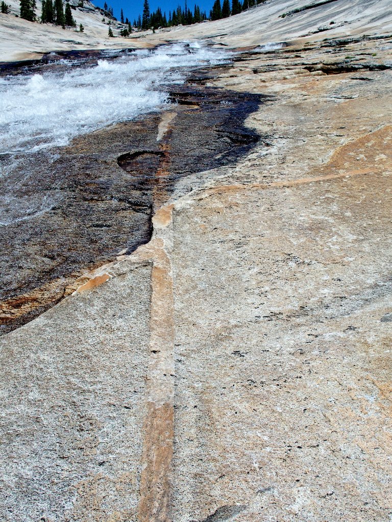
I scramble a bit farther upstream on the orange slabs.
Just around the corner from here is an iron signpost that I encountered two years ago, which admonishes hikers not to proceed farther in this direction. Recalling that there is no way to get through this channel without negotiating a problematical crossing, I'll not tempt fate further.
The line is pointing at Clouds Rest
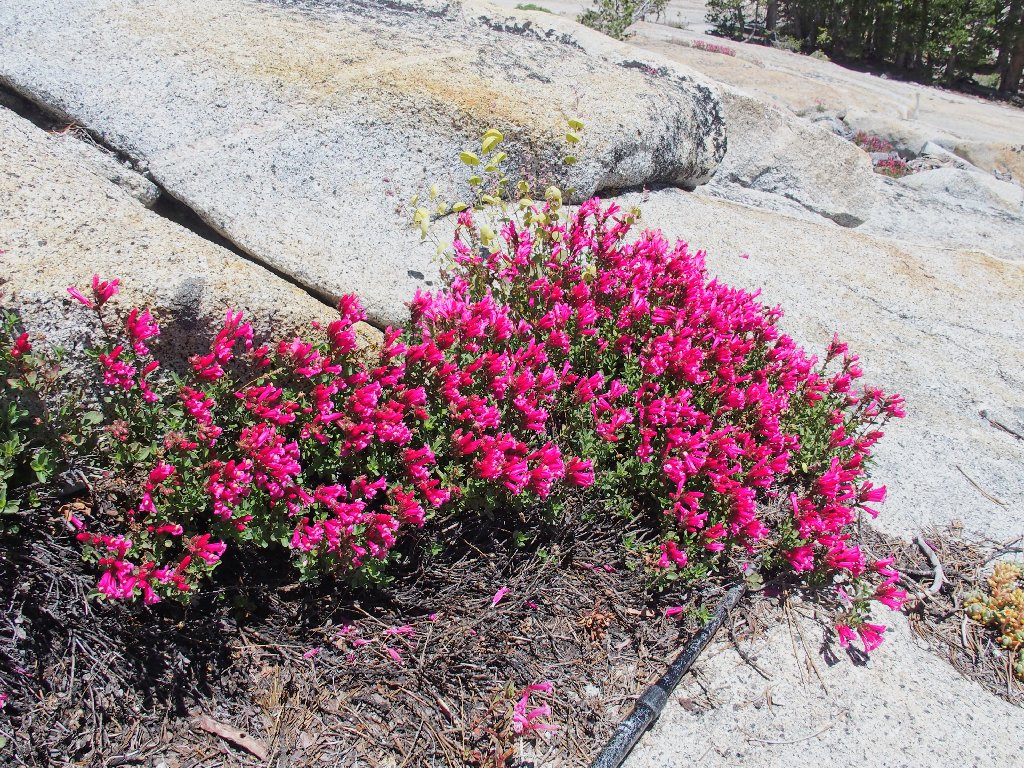
More colorful Penstemon
It appears that now I could scamper straight across the angled slab and out of here, so I do that. Reasonable care is required, however, because the entire surface is quite smooth.
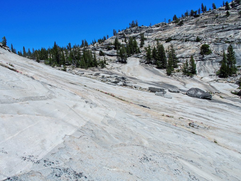
Not the cakewalk that it appears to be
Off the slab
The plan is not to return as I came, but to head over near Tenaya Creek and possibly cross it, which would enable a complete loop route.
Nifty passage
Continuing toward the sound of running water, I encounter a pair of women sunning themselves on a rock next to a waterfall.
The first human I have seen on this walk
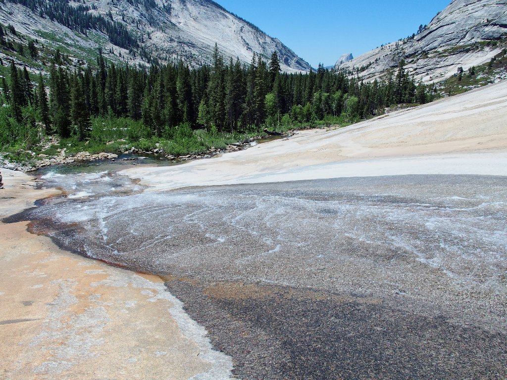
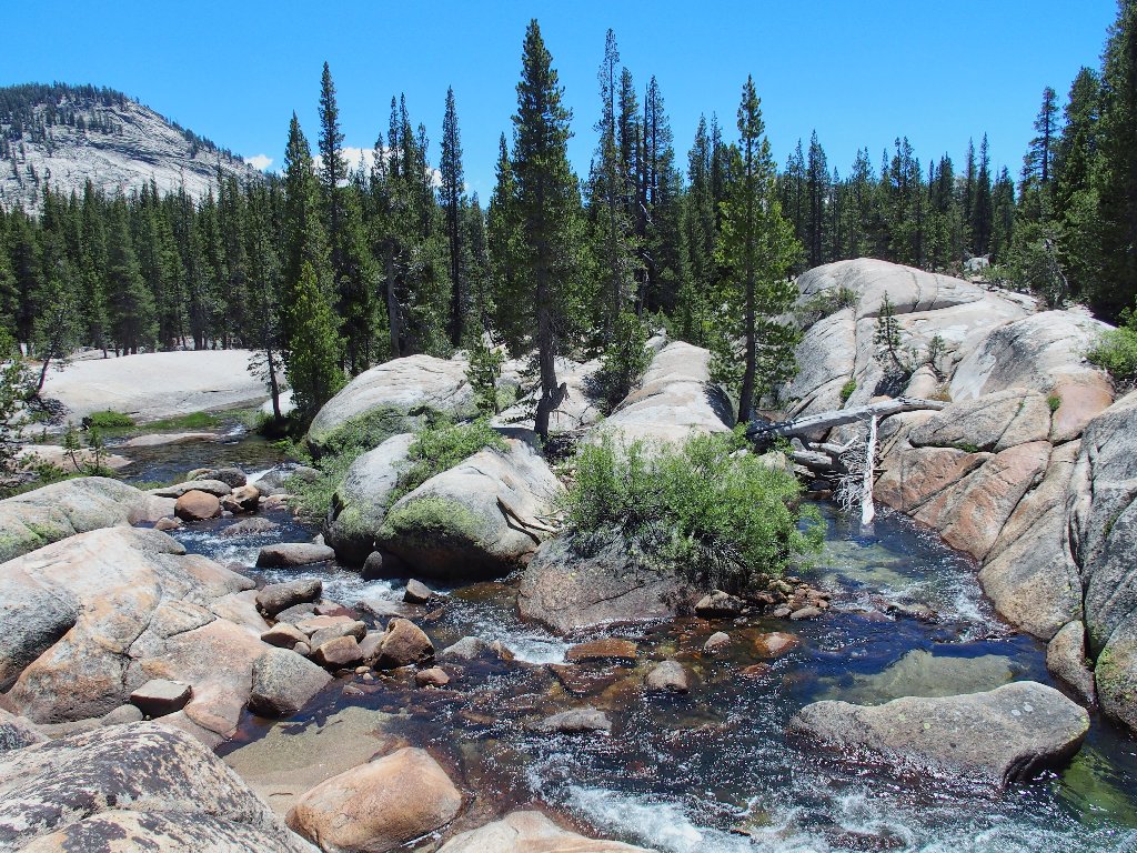
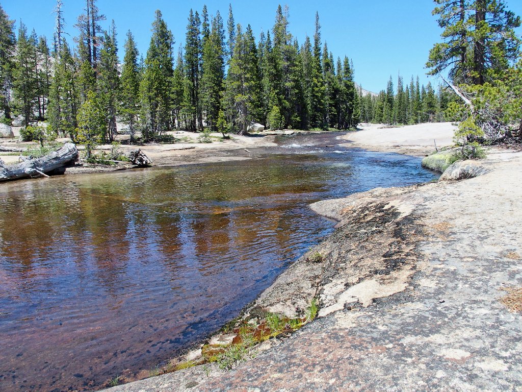
This lovely spot must be the confluence with the Sunrise Lakes drainage
Different
My kind of place
Another hiker peruses his map
I didn't know that all this neat stuff was here, although I certainly might have guessed it.
The local main attraction
I probably could cross here, yet why bother? It's just as
good on this side.
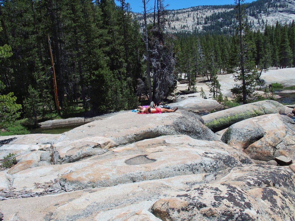
The sunbathers and the lone male hiker
At the brink of the little falls
The line points the way
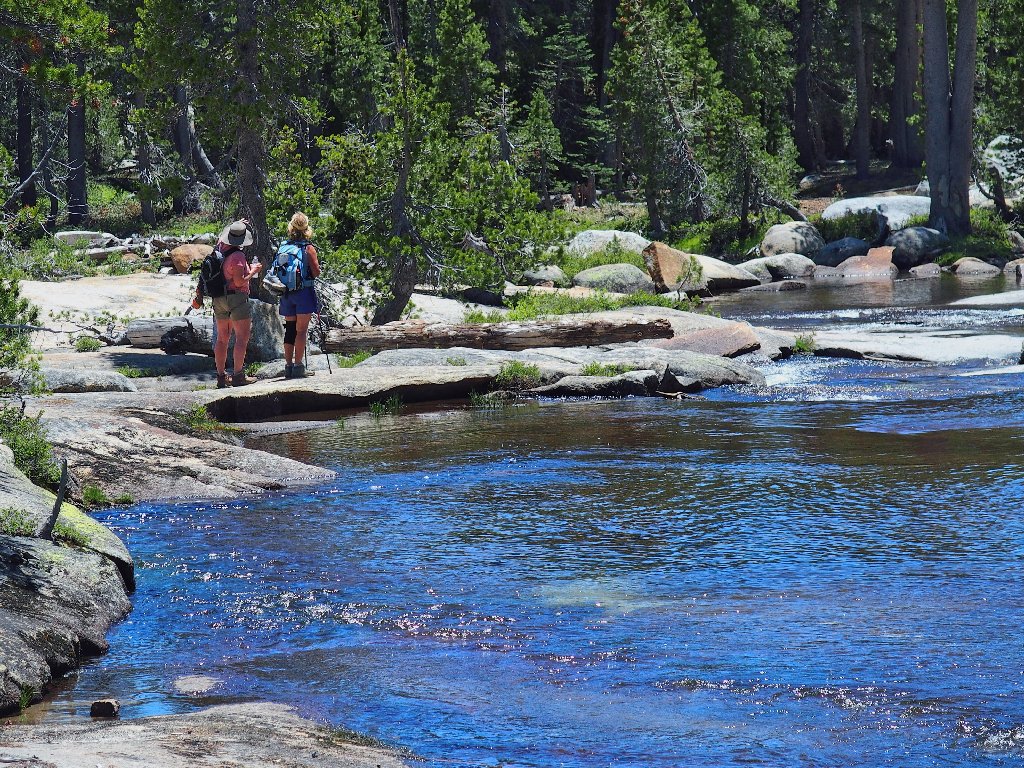
Those two are headed for the waterslide
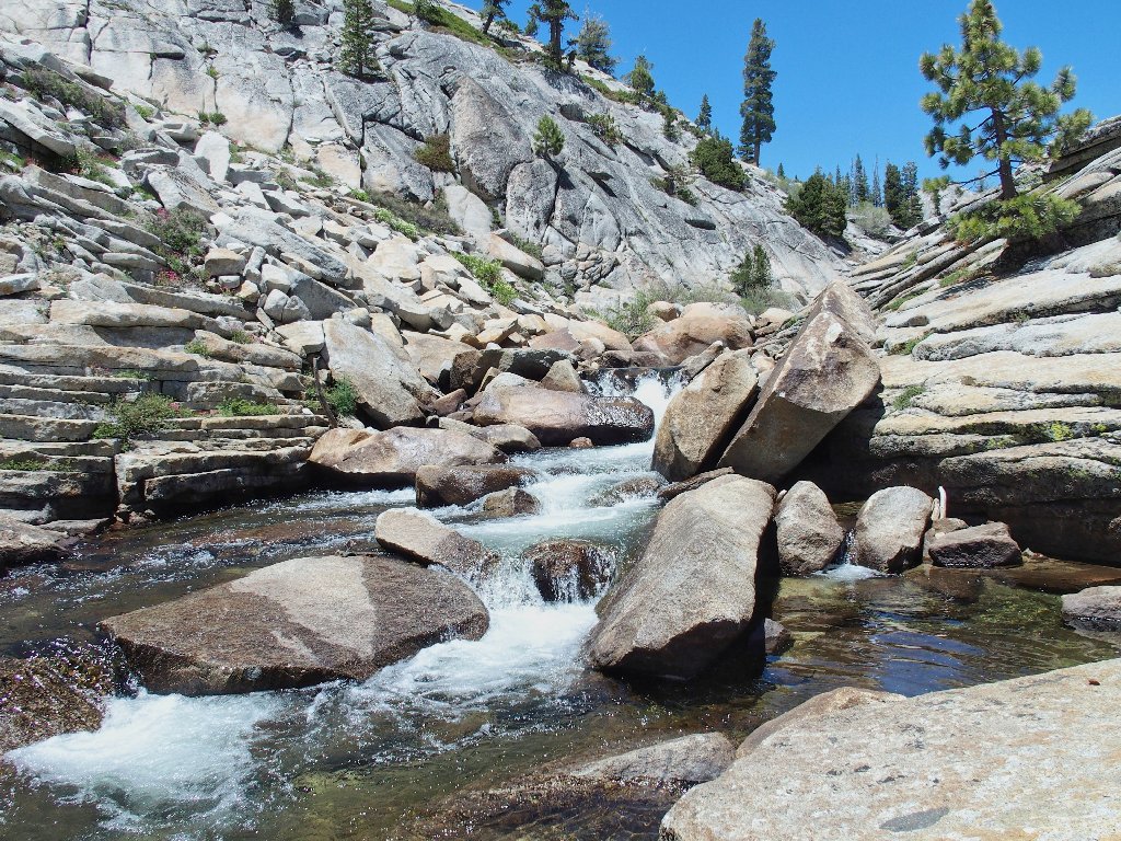
The creek continues to offer up new visual treats:
Neat stuff
Some big rocks are blocking my progress now. I must leave the creek and go around them.
Detour
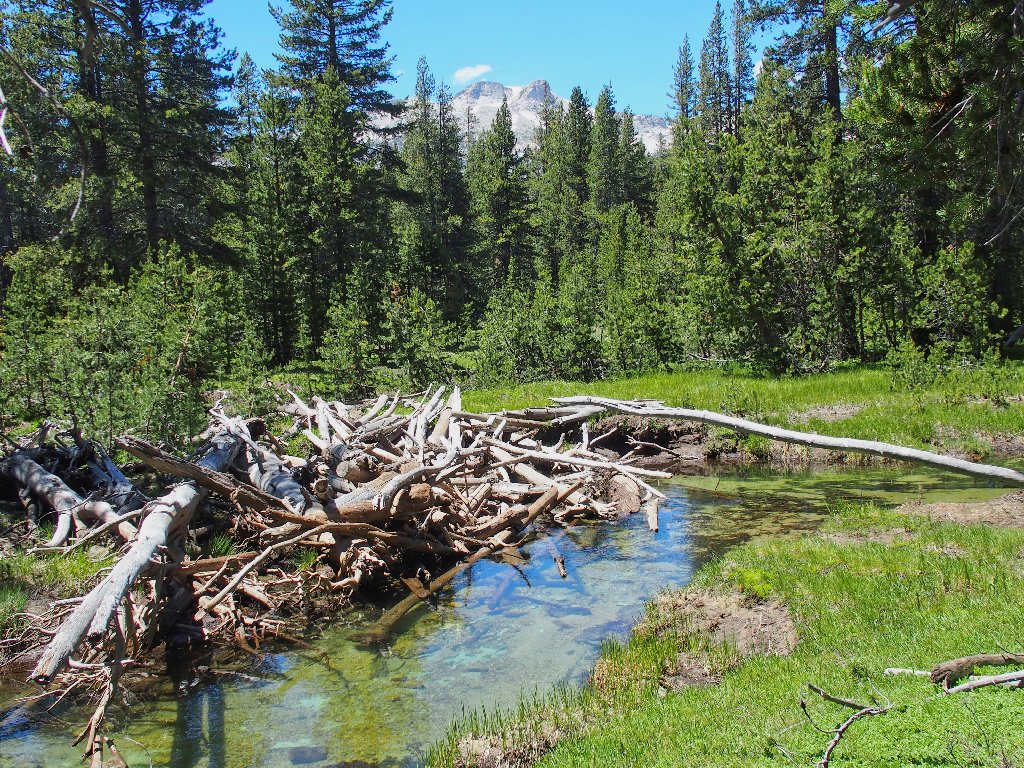
Then I must skirt some standing water as well.
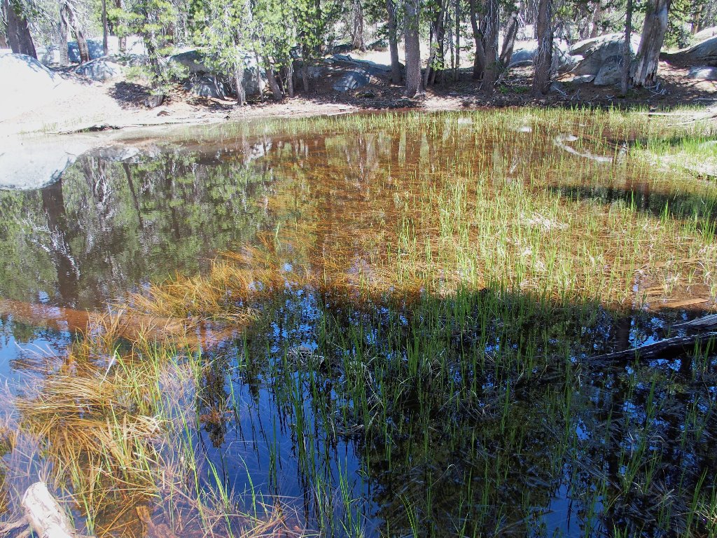
A pretty pond
Red Mountain Heather
A not-so-pretty pond
By now I have ventured almost out of earshot of the creek, which certainly is not what I wanted. At the next opportunity, I make a hard left turn and head back toward the running water.
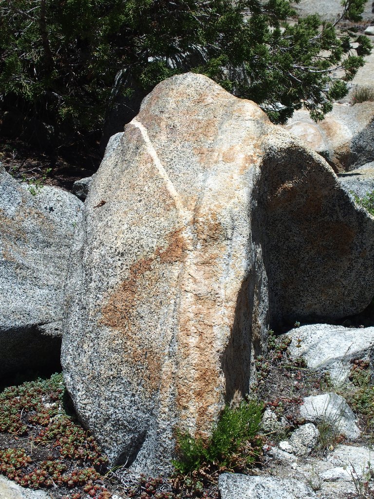
Erratics are all over the place
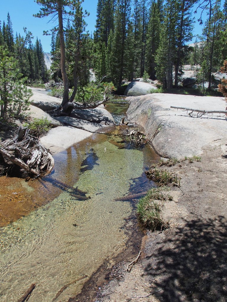
Soon I am back at creekside.
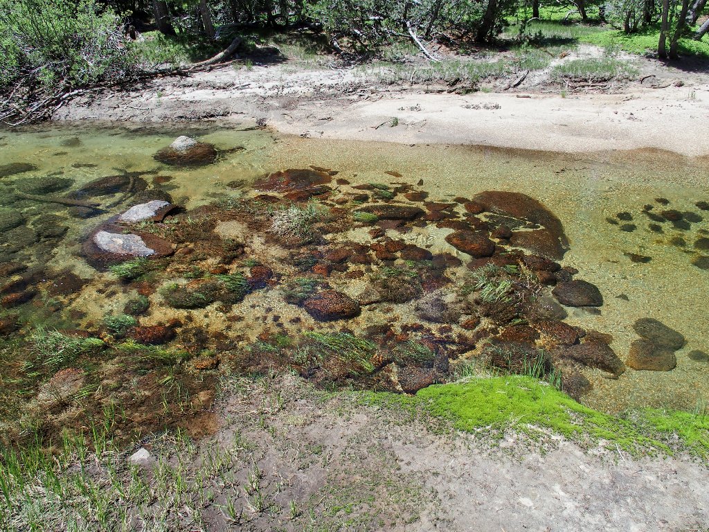
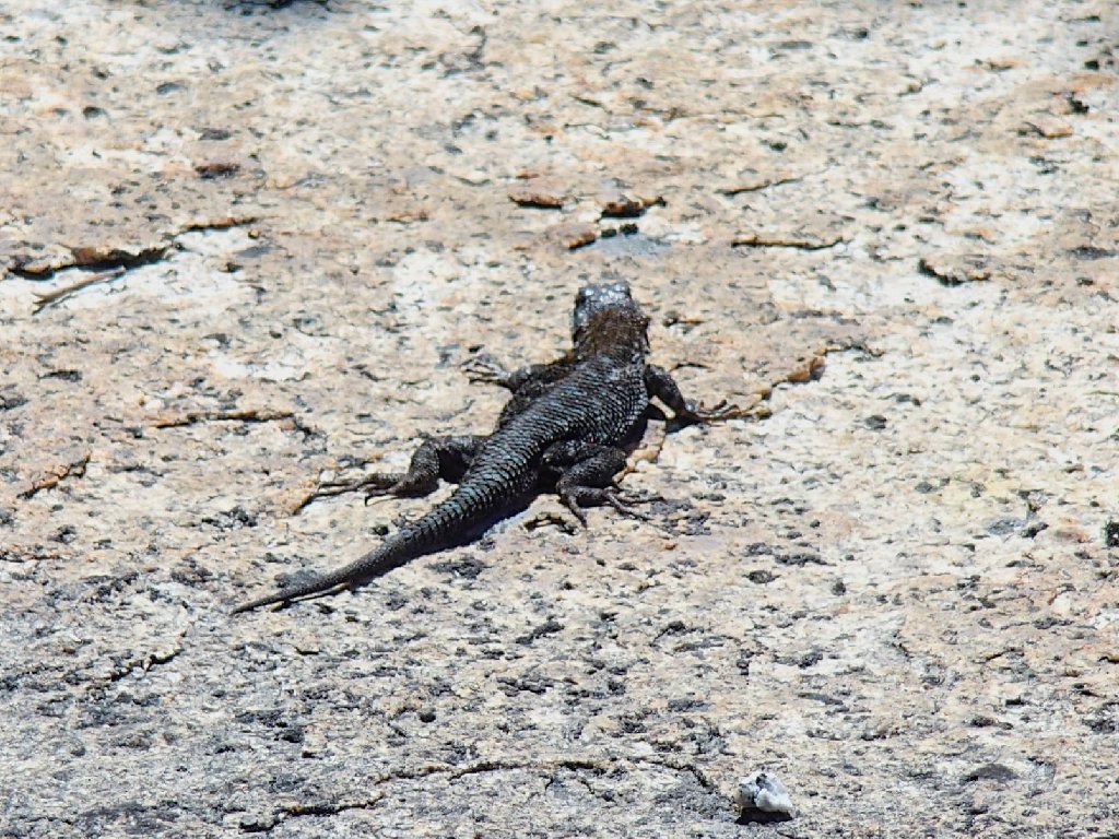
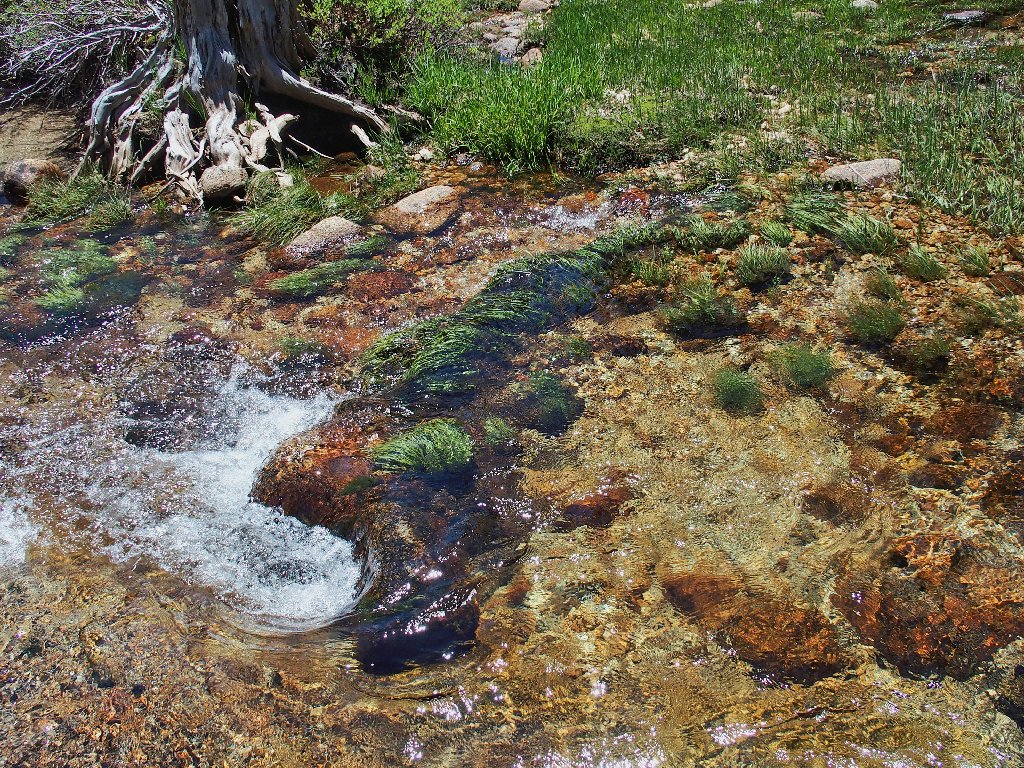
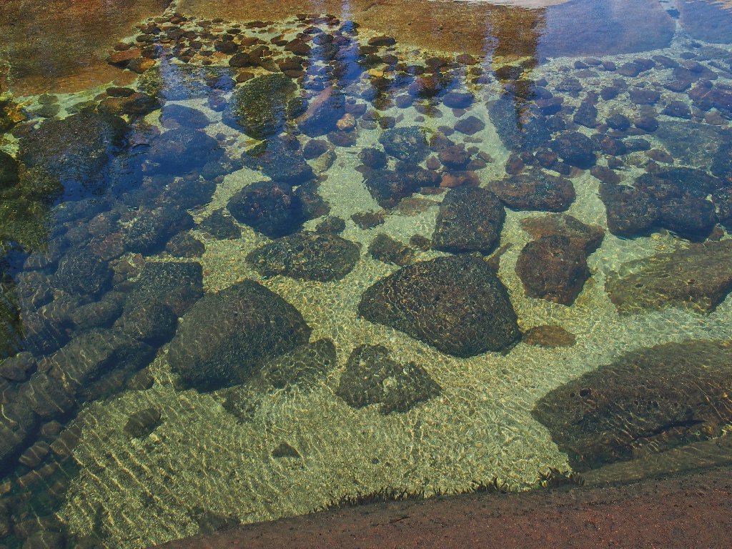
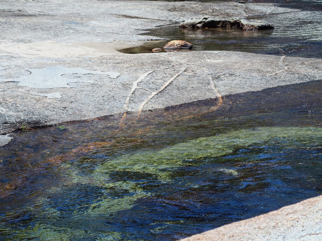
More amazing things in the water
It doesn't appear that a water crossing will be available beyond here, but that is okay.
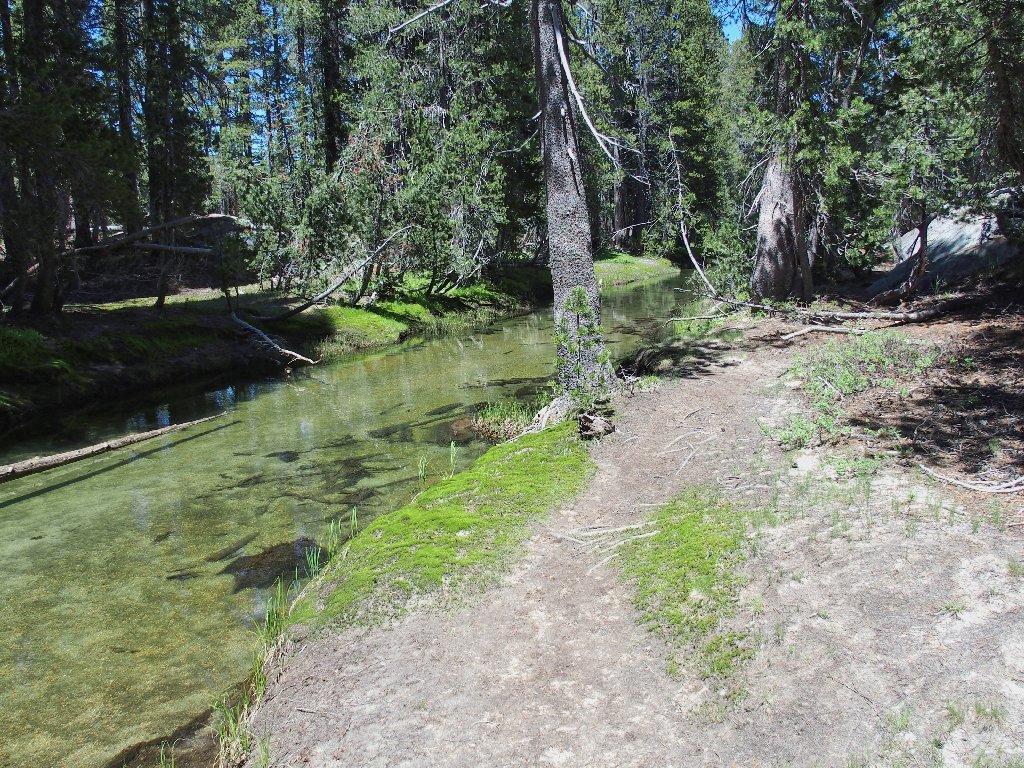
A use trail parallels the creek
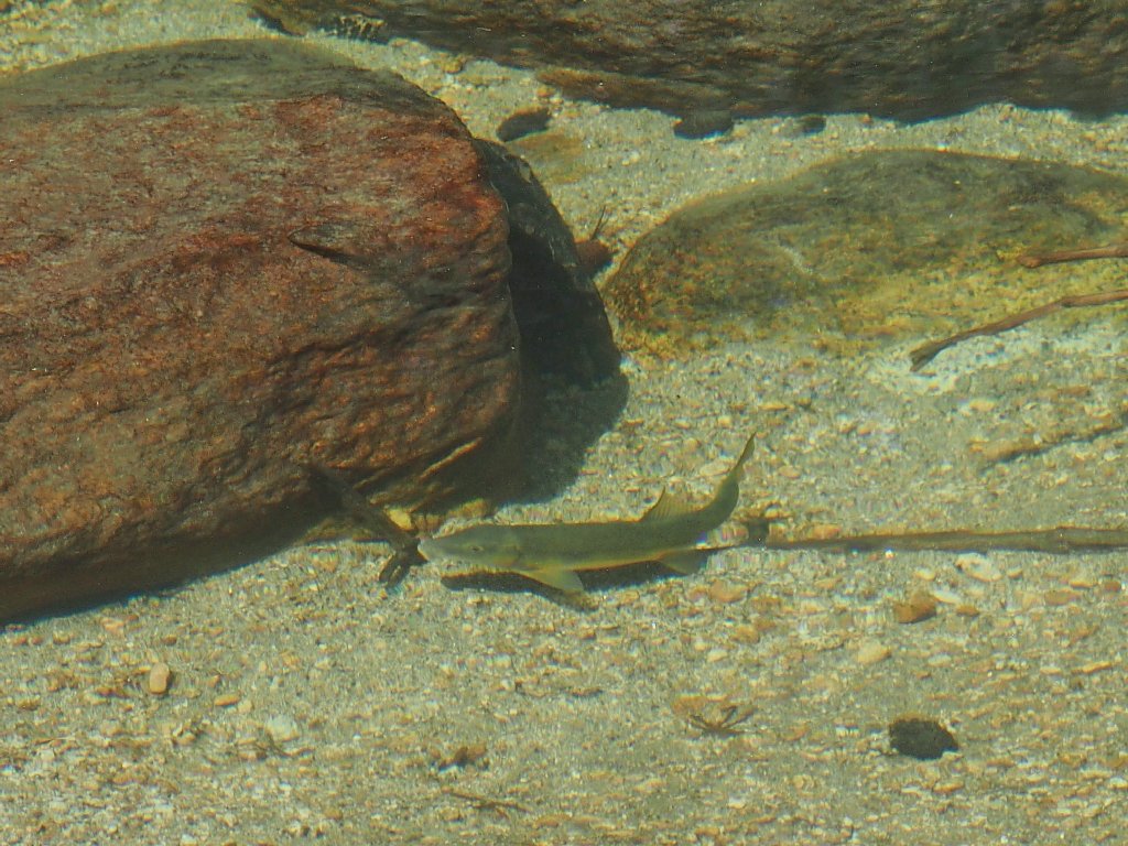
That guy is 10-12 inches long
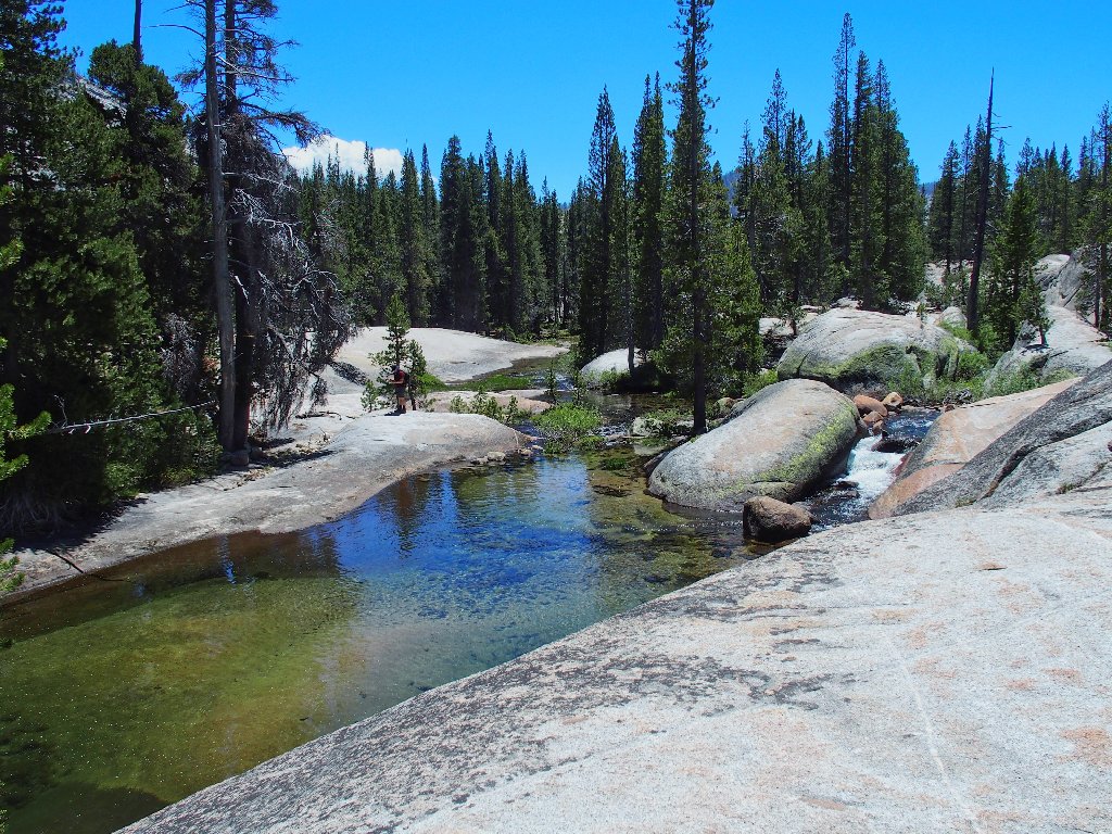
Inevitably, my route insects with the Sunrise Trail. I had passed this point earlier without knowing what I was seeing.
Today's route-finding is finished
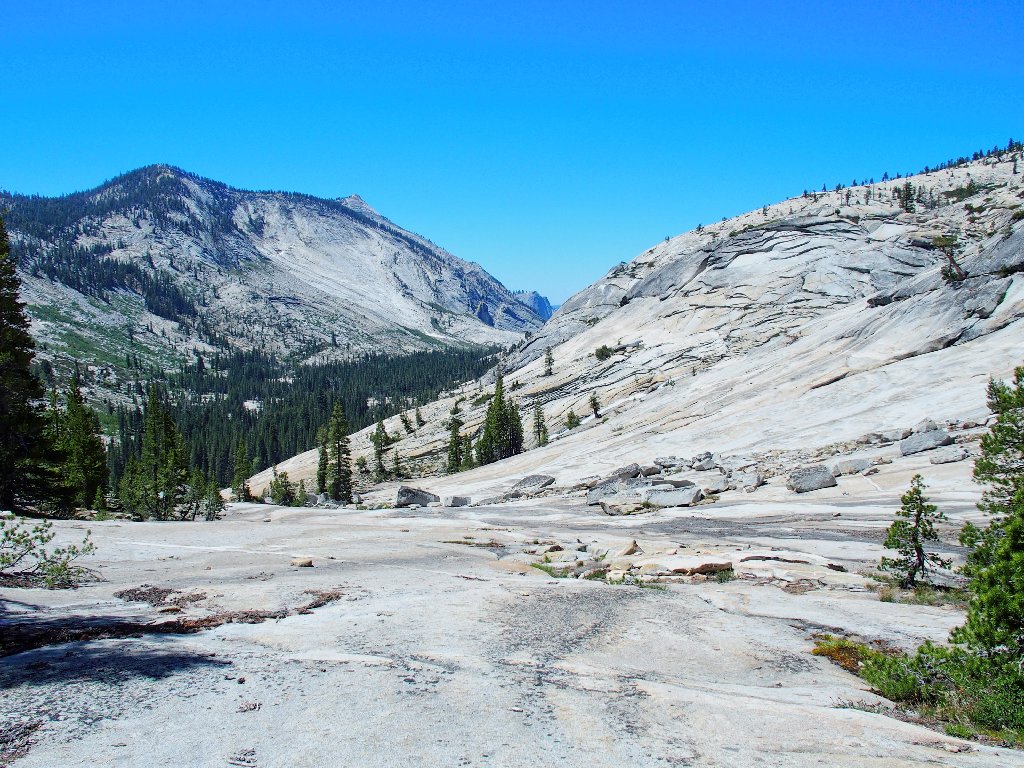
Mount Hoffman in the distance
When I try to cross on the flat slabs this time, I do manage to get some water in both boots. That probably is because two people are watching me do it.
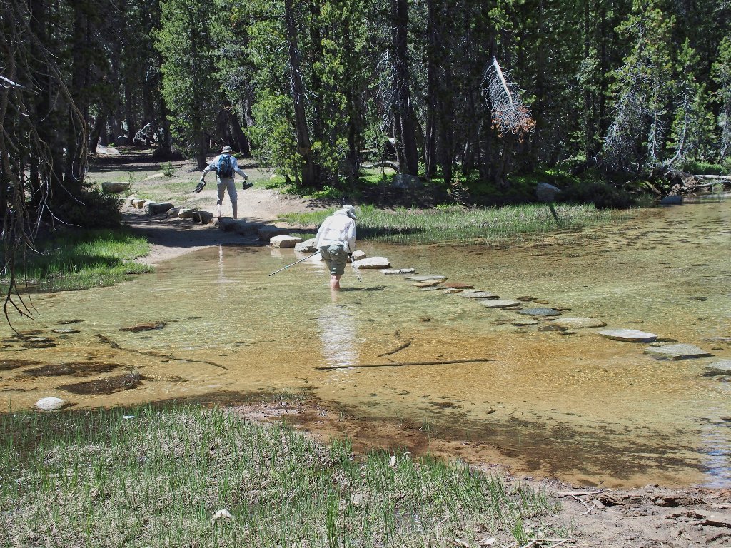
She has the right idea
§: Well, this is why I go hiking! On this perfect and
bug-free day I was totally in my element: cross-country
route-finding, scrambling over granite slabs, exploring new and interesting
places, and reveling in a flower-laden water wonderland. My camera
shutter clicked nearly 300 times today, which could be a personal record for a
day-hike.
At least from a photographer's perspective, this walk represents the best
reward-to-effort ratio in my memory. Finding my own route down
to the rock bowl actually added to the fun, because the loop saved all the
gorgeous creekside discoveries for last.
Judging from the GPS track, I was but a few yards from the Sunrise Trail before turning west back toward the creek. It's a good thing that I didn't actually see the trail, for then I might have used it and missed out on a lot of great stuff.
I was back at the car by 2:15 p.m. Three young men were just starting down the trail armed with floatation devices. In order to observe some folk on the waterslide, perhaps I should arrange my next tour for later in the day. Finishing up several hours hence would be just fine, and might even provide a prettier walk.
| Scenery |  |
| Difficulty |  |
| Personality | |
| Adventure |  |
| Flowers |  |
The dotted route would be preferable, if available
On my way out of the park, I feel compelled to record some of the gorgeous penstemon lining the Tioga Road for many miles.
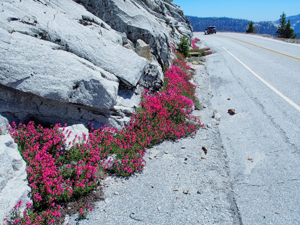
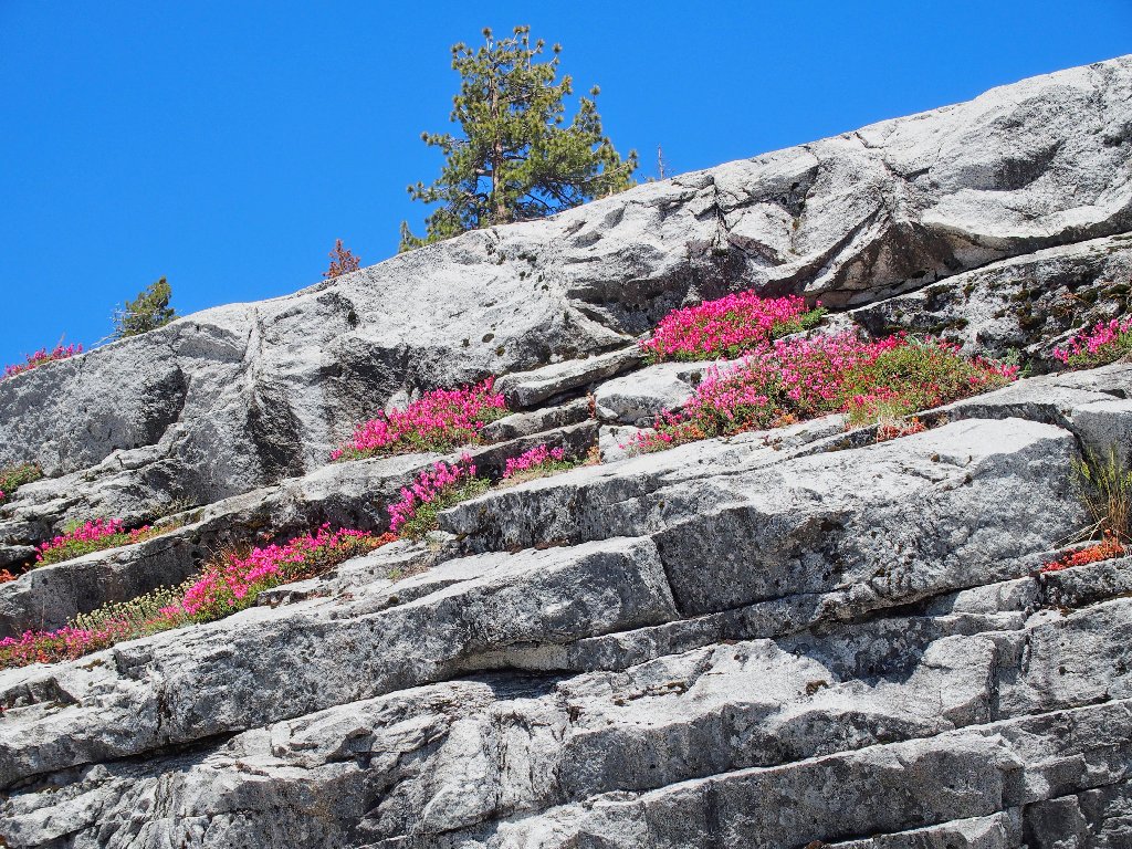
Mountain Pride are everywhere today
