
Smith Valley, Nevada
|
Wilson Canyon Smith Valley, Nevada |
April 17, 2018
Our driveway, which is nearly forty years old, is being replaced. Because I'll not be able to get my car into the garage for a while, this is a good time to take a little hiking tour and pare down my Bucket List a bit.
Leaving My Barbara to deal with the construction workers, I head east to Reno. This is not the shortest route to today's destination, but it is the road that is guaranteed to be open at this time.
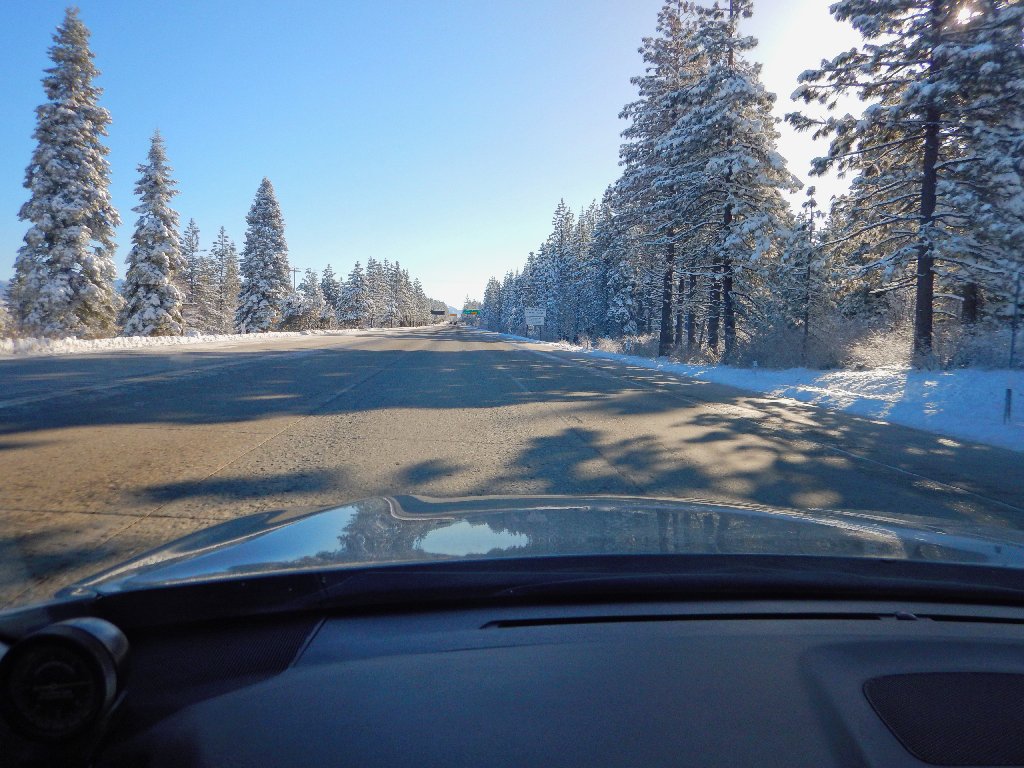
A recent dusting of new snow on Donner Pass
From Reno, it's down US-395 through Carson City and Gardnerville.
It feels a bit strange here right now, knowing that I am scheduled to spend
the night in far-away Cedar City, Utah; but that's life in Ted's
World.
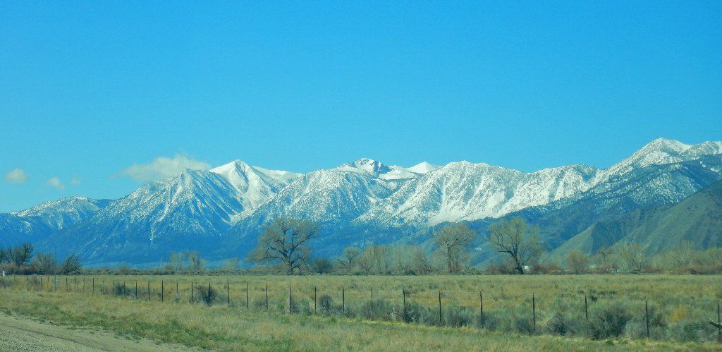
Jobs Sister, Jobs Peak, and Freel Peak in the Carson Range
It still is early morning when I reach the trailhead more than 200 miles from home.
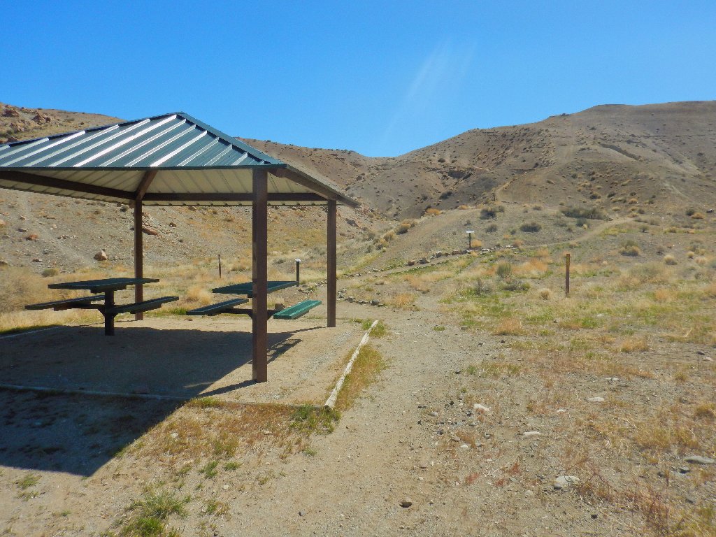
At the trailhead
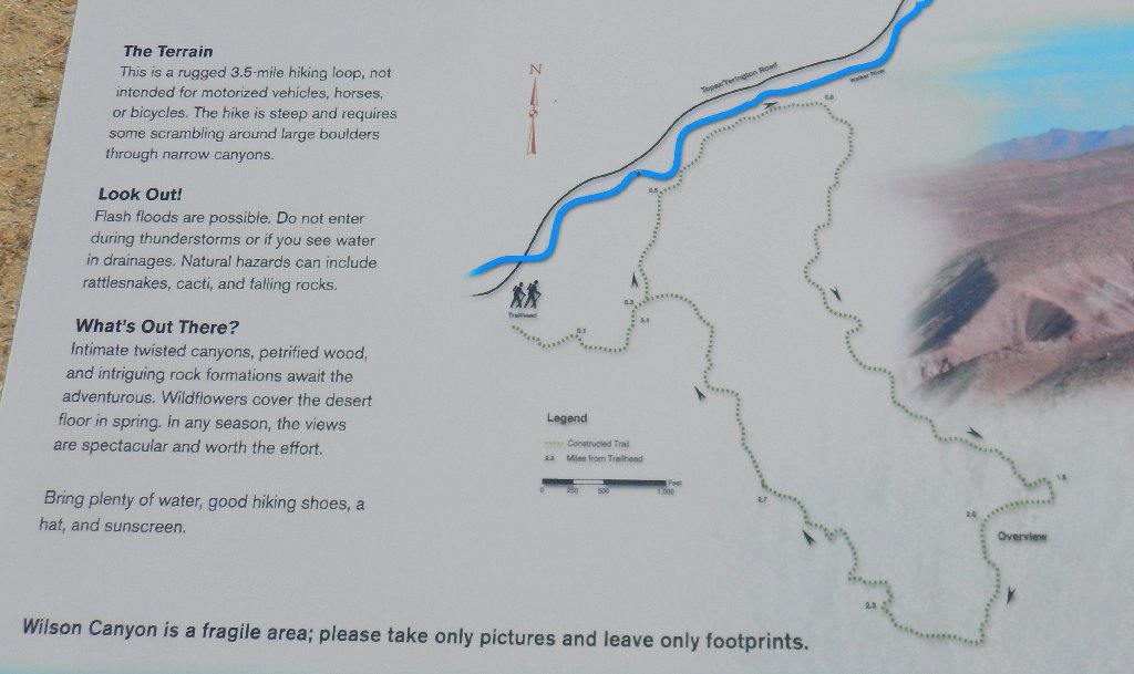
The BLM has created a loop trail here in a somewhat unlikely location, well off the popular driving routes. I don't expect much company this early in the season; but I won't suffer from heat stroke later on, either.
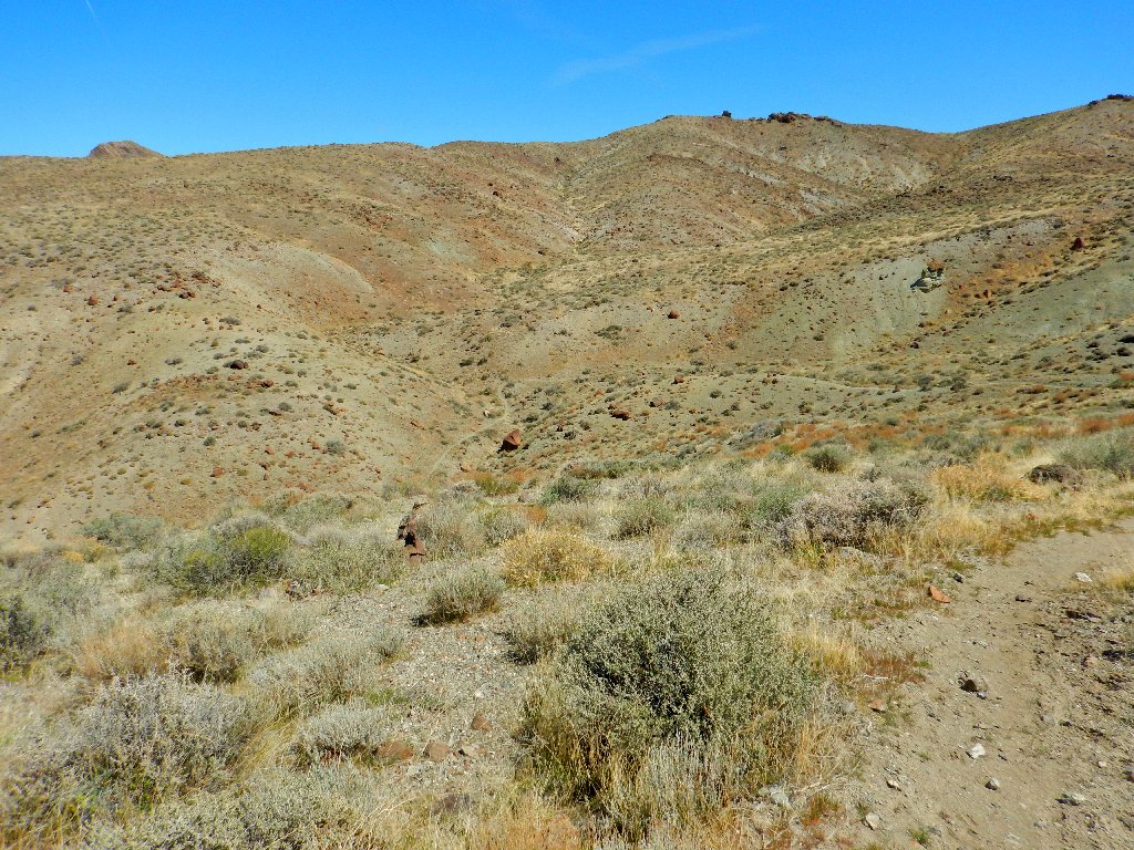
The walk begins with a steep but sort climb to a little saddle.
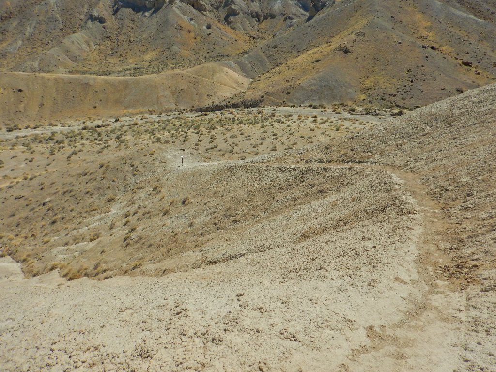
Atop the first hill
That's the return route
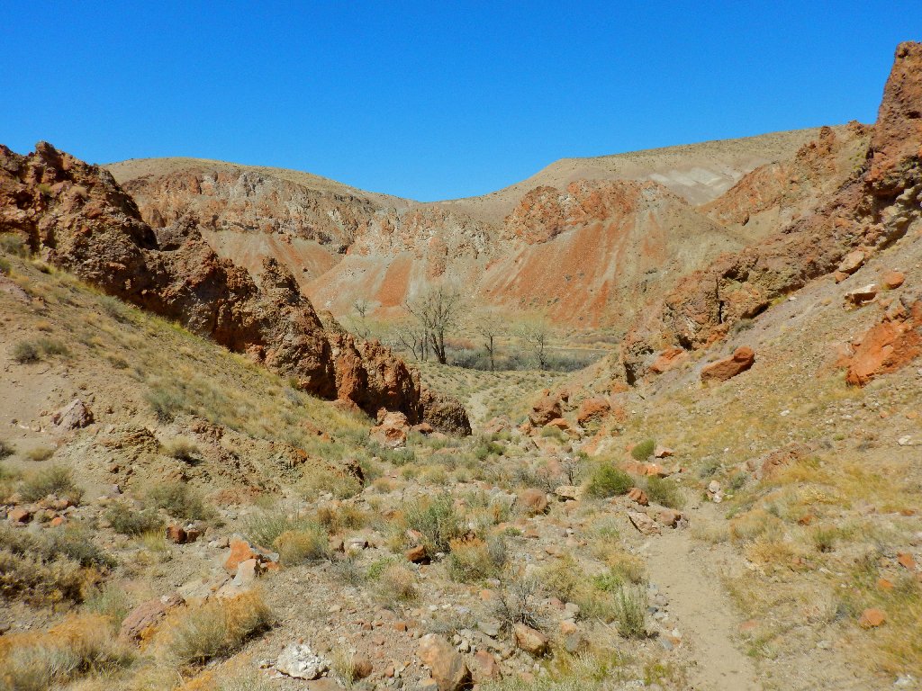
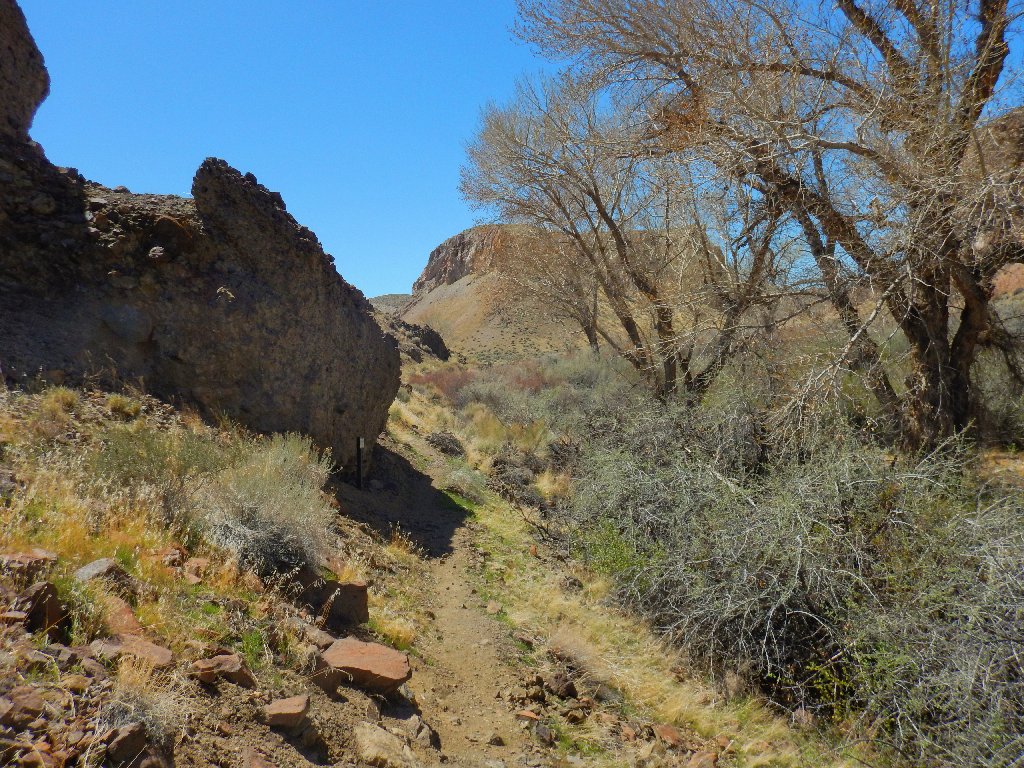
At the bottom of the downhill is a trail junction. Even though the arrows on the trailhead map point the opposite way, it feels right to turn right here, if only because some climbing will begin immediately. Better now than later?
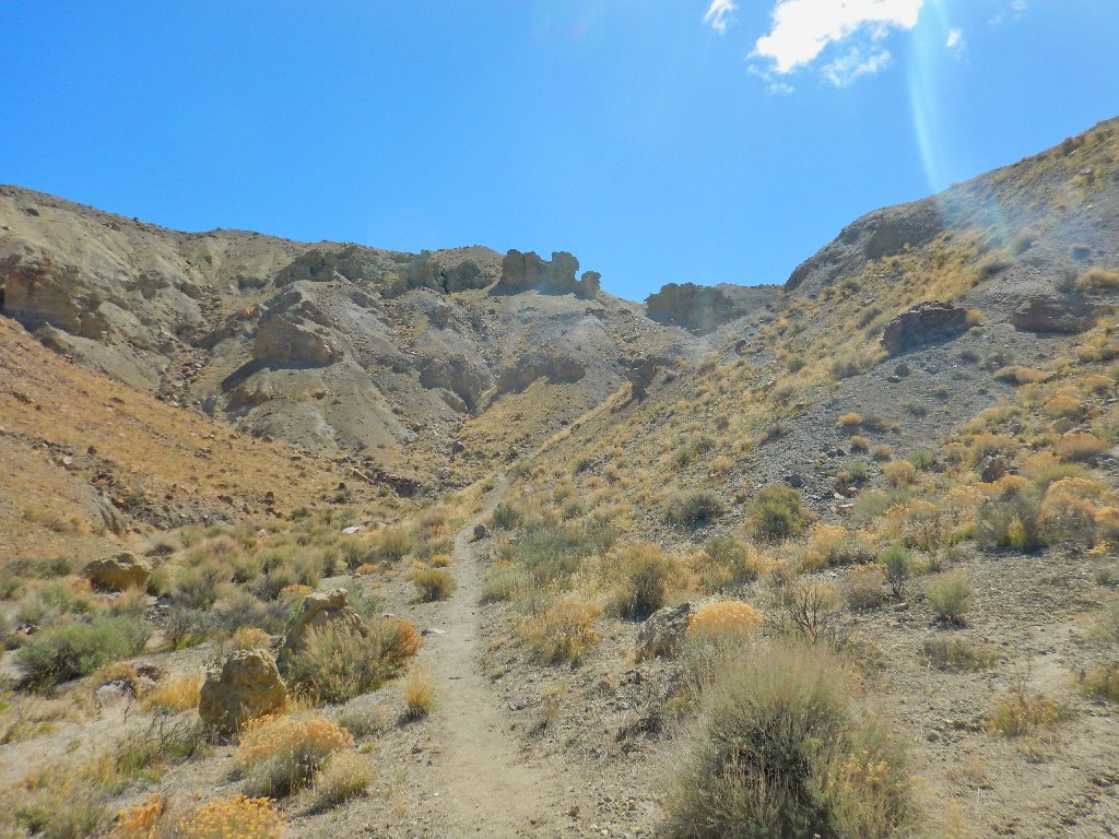
Up, up and away
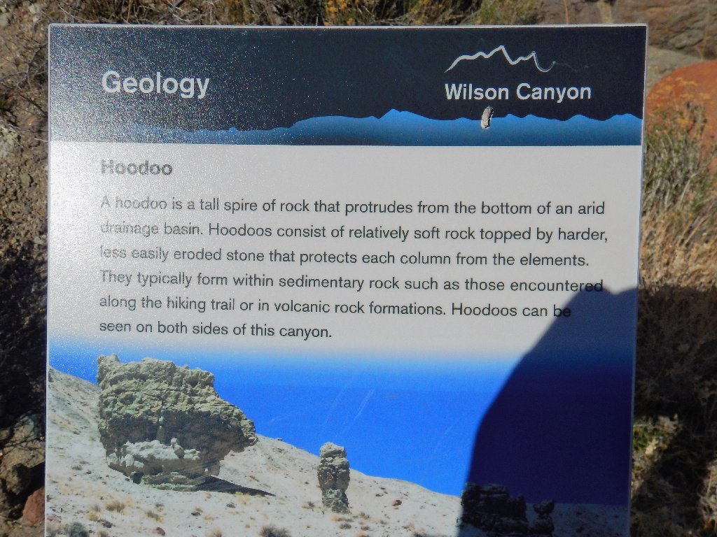
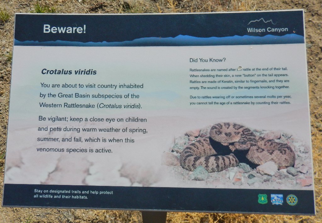
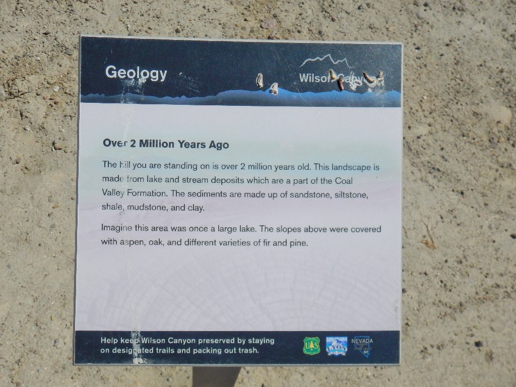
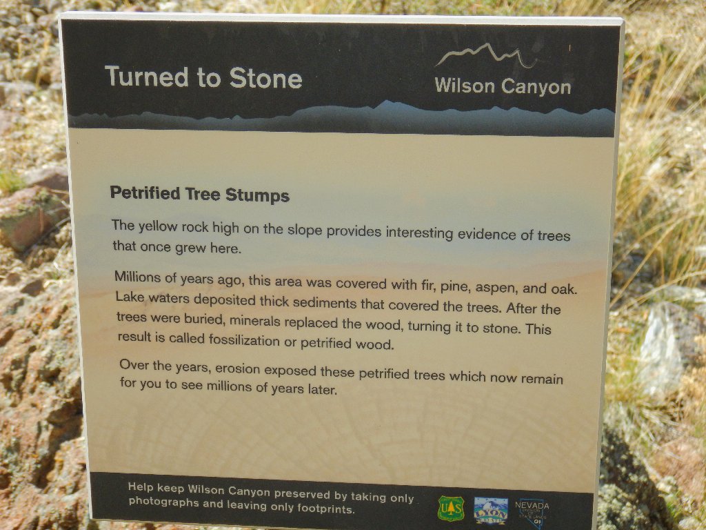
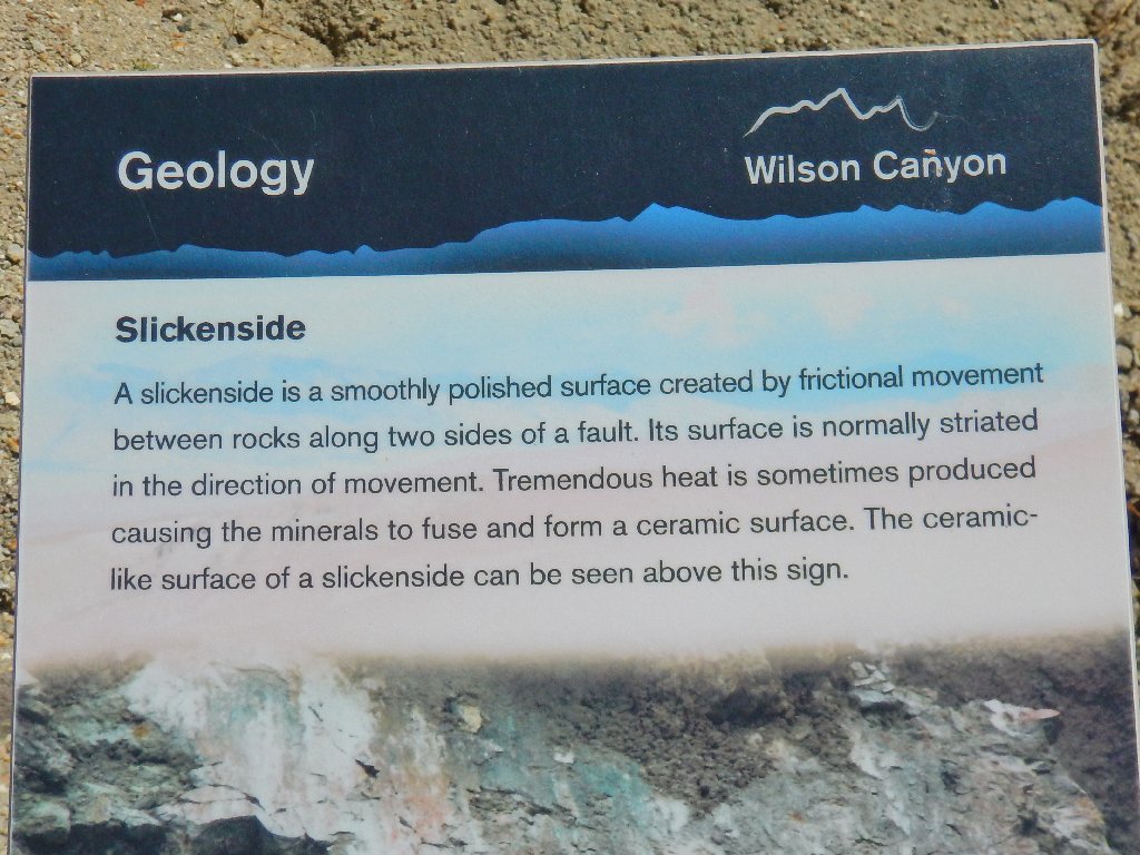
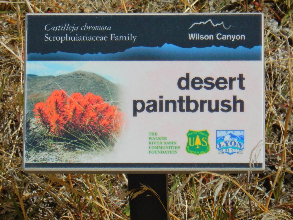
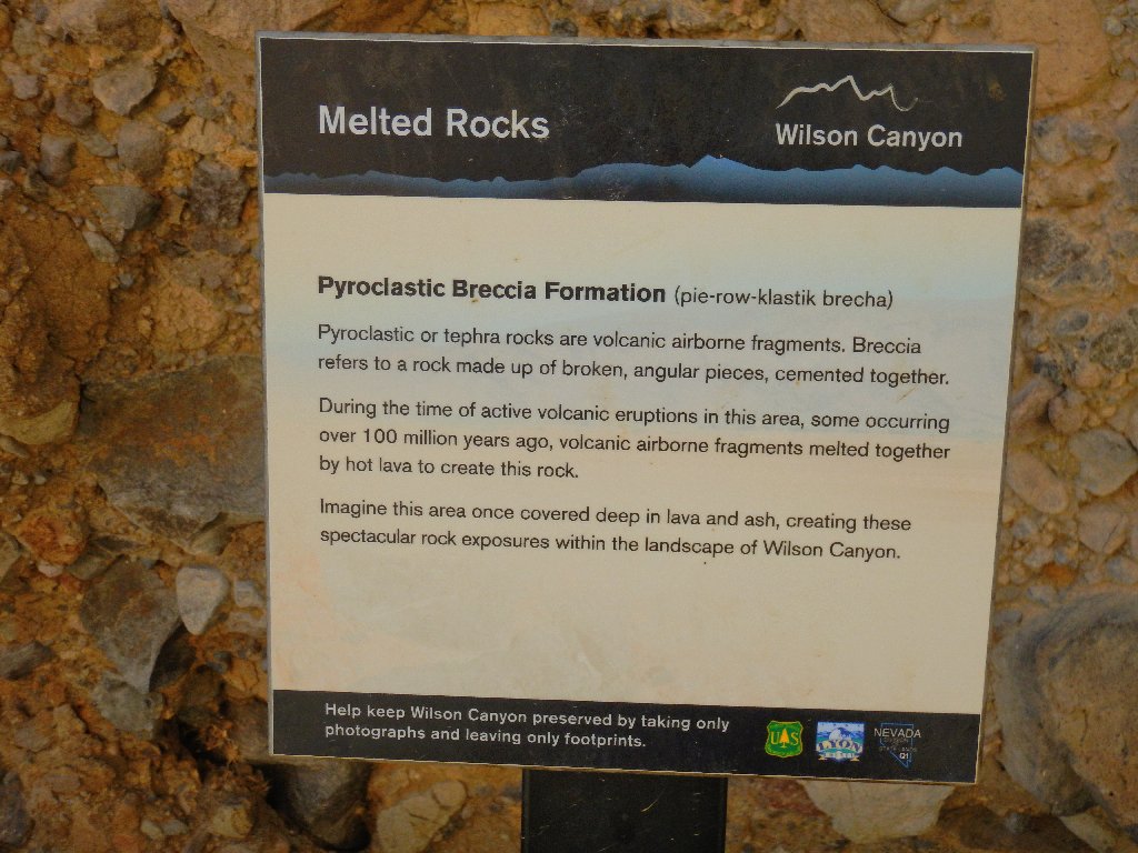
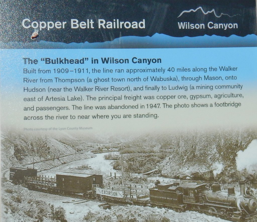
The well-made and informative displays are a real treat
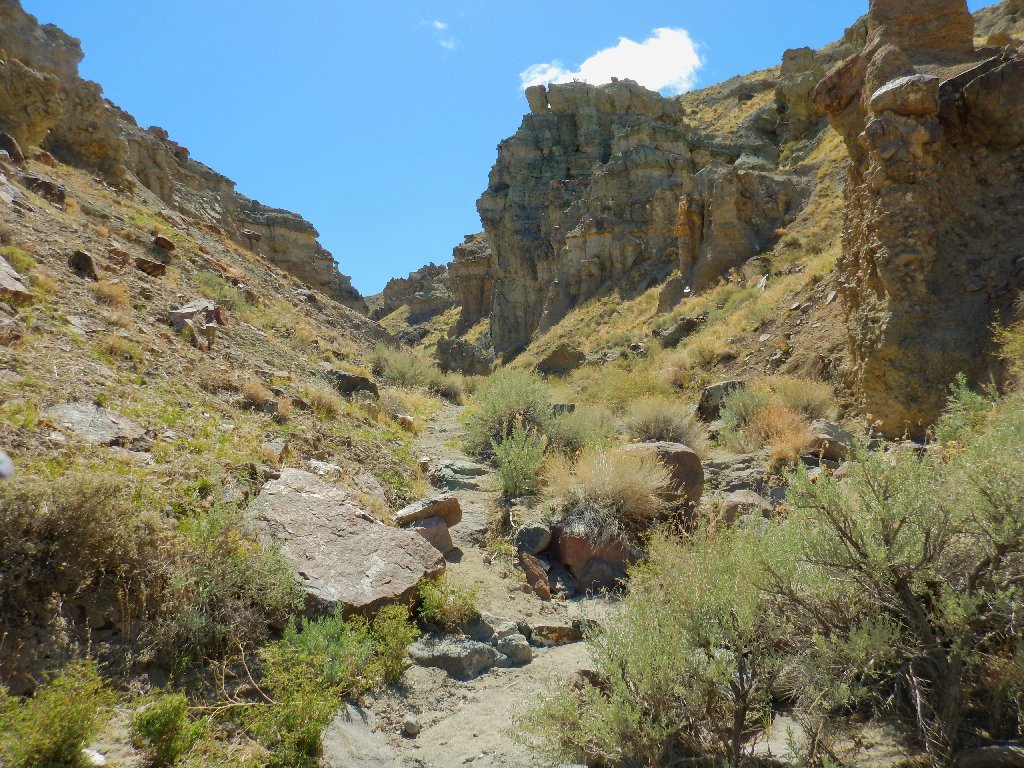
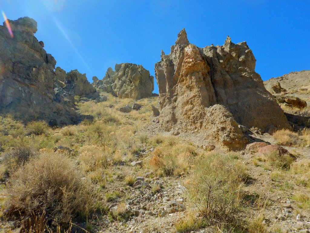
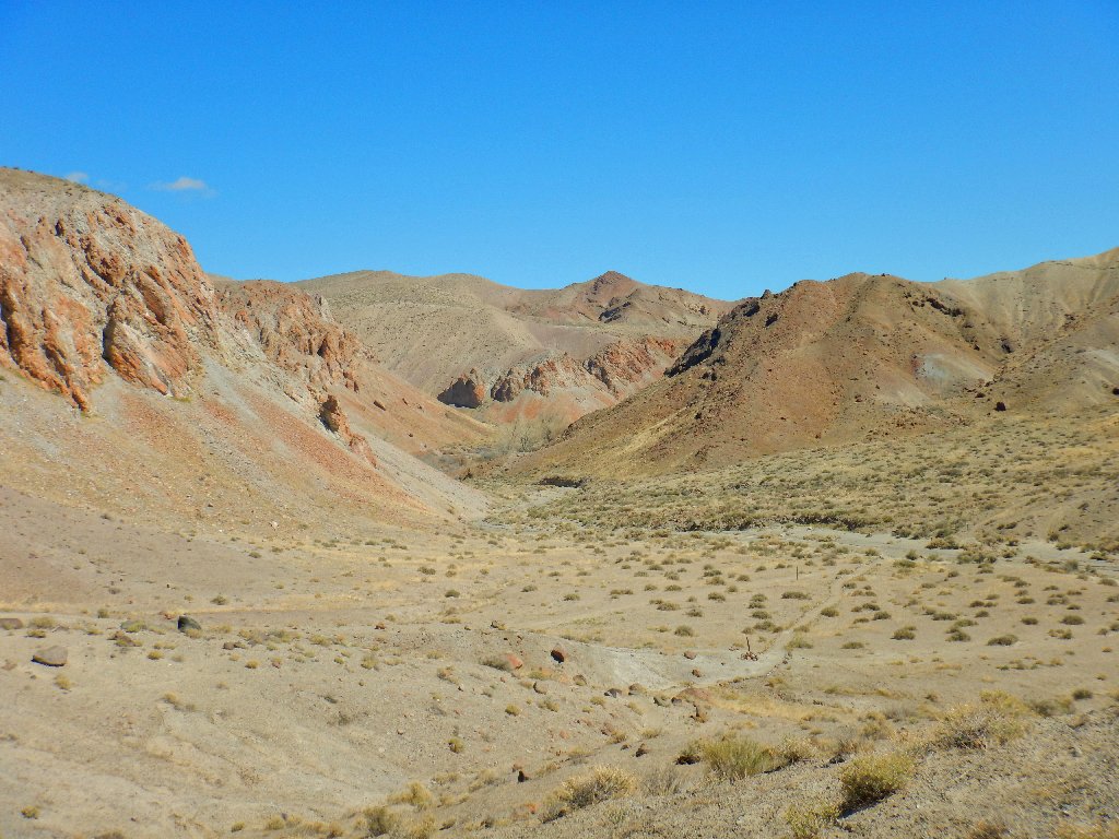
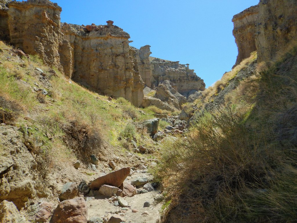
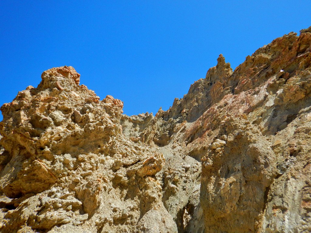
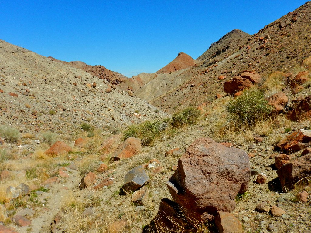
As per the trailhead warning, there is a stretch of boulder-hopping in there, and an occasional handhold proves helpful. The going is not particularly difficult or strenuous, however.
Is that an arch up there?
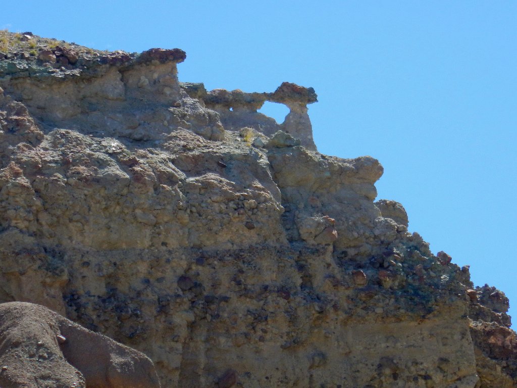
Yes, it is
This unexpected feature is welcome. Arches have a special place in my heart.
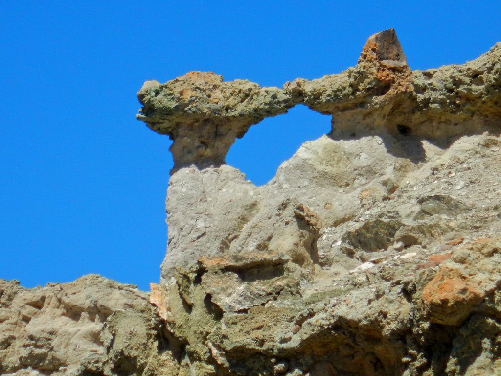
Wilson Canyon Arch
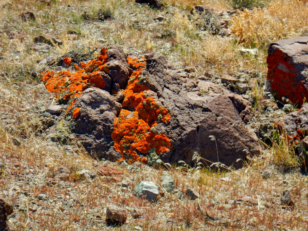
Golden Hair Lichen
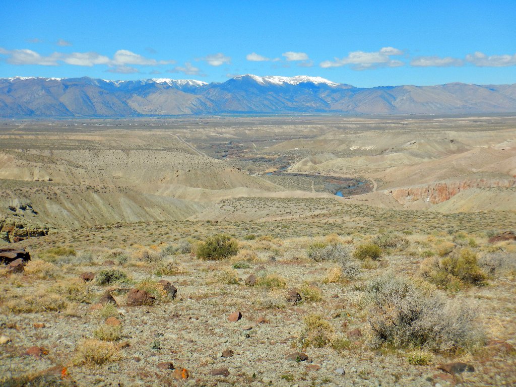
As I gain elevation, several mountain ranges come into view. I had not anticipated that, either.
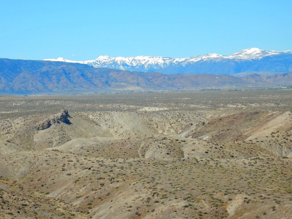
The Sweetwater Range to the south
The trailhead summit sports this historical marker:
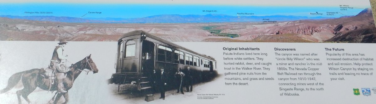
So this actually is "Uncle Billy Wilson Canyon" ⇔
The Pinenut Range to the northwest
I also spent time up there as a kid, harvesting pine nuts every other year by shaking trees until the the fruit fell onto a bedsheet.
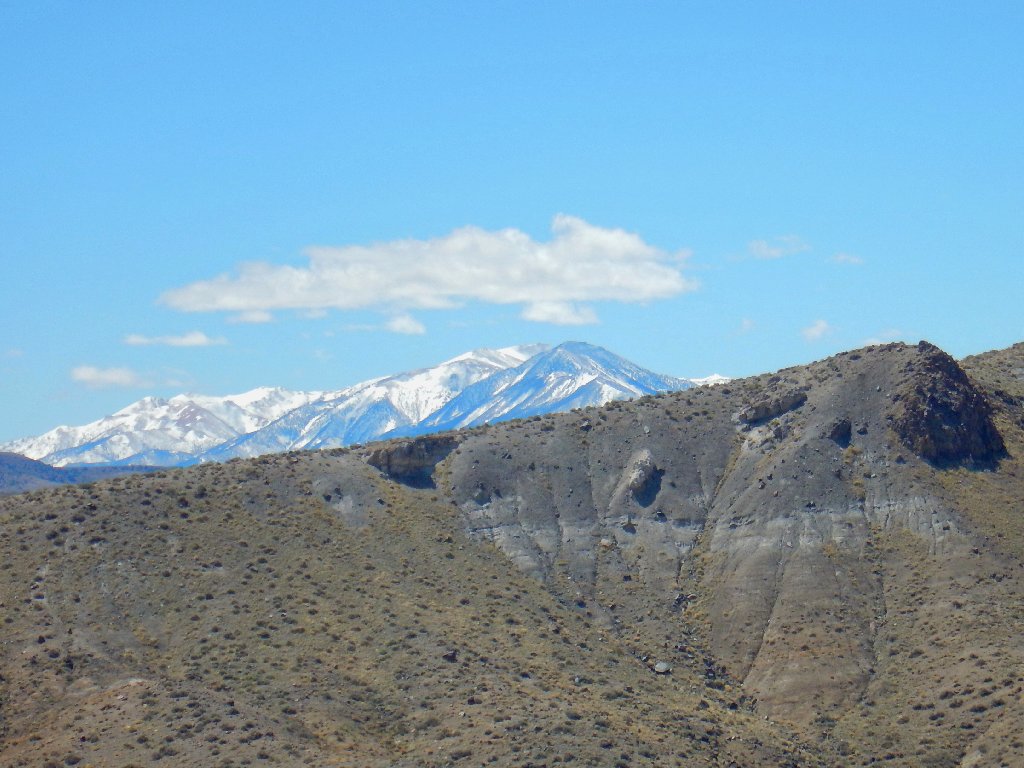
The Sonora Pass area to the west
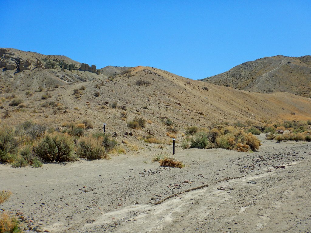
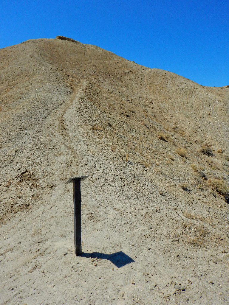
Unfortunately, many of the nice signposts are not pointing to anything at the moment.
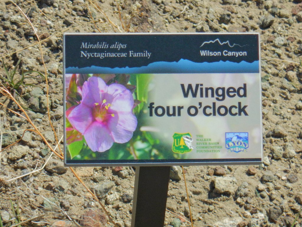
No flowers are out yet

Starting down
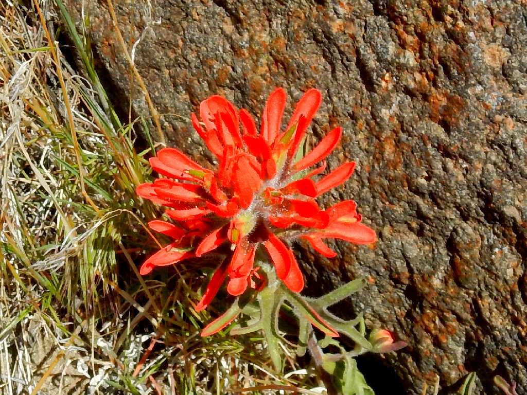
Well, perhaps one flower
There is a lot of color here
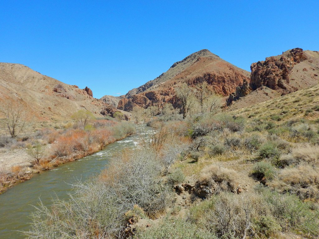
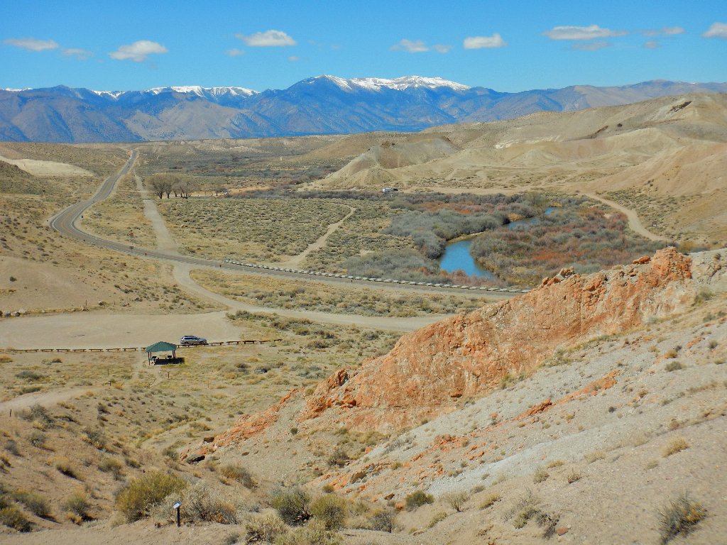
Approaching the water
This is part of the reason that I saved this area for later.
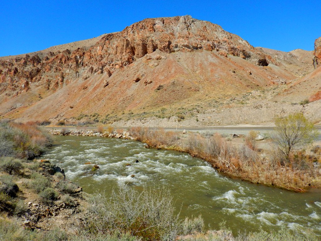
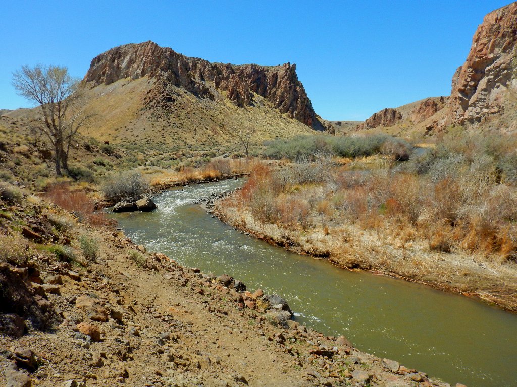
West Walker River
This river and I have a history. At age 19, while working for the
U.S. Geological Survey, I actually measured the streamflow while
sitting in a cable car over the raging waters, at 3 a.m., in December,
in a blizzard. What can I say? A measurement was needed at the
projected time of maximal flow for the season, and I had volunteered to go
it alone. It seems that fifty-six years ago, I already was crazy.
Flowing east, ultimately to nowhere
Although the highway is right on the other side of the river, occasionally I can manage to keep it out of a photograph.
Riverside trail
Back at the junction
What comes down, must go up
My ride awaits me
§: Well, that was a pleasant walk on a perfect day.
I applaud the creators of this trail for making something special of a relatively
unspectacular area. A month from now, some nice flowers would be out,
the brush would be greener, and this could be a beautiful desert outing; but in
order to fully enjoy it, one would have to find a cooler day, which could be a
challenge.
Although the trailhead map suggests a clockwise loop, I highly recommend
traveling counter-clockwise as I did. That way, the
boulder-scrambling section would be tackled in the uphill direction,
which is easier and more fun, and the riverside walk would be saved for last.
| Scenery |  |
| Difficulty | |
| Personality |  |
| Flowers |  |
