
Ecological Reserve
|
North Table Mountain Ecological Reserve |
March 19, 2018
One year ago, my pal Gary and I came up here during a rain and had a most
interesting and photographically rewarding outing. I have been anxious to
return in better weather, though; and this is the day. I also am trying
out a new camera — a Canon G5X. We'll see
how it goes.
I fortuitously discovered just yesterday that a pass now is required for entry
to this reserve, and that one cannot be obtained at the trailhead.
My $4.32 entry document was printed at home last night. I for one am
quite happy to support this and other such places, and the price is right.
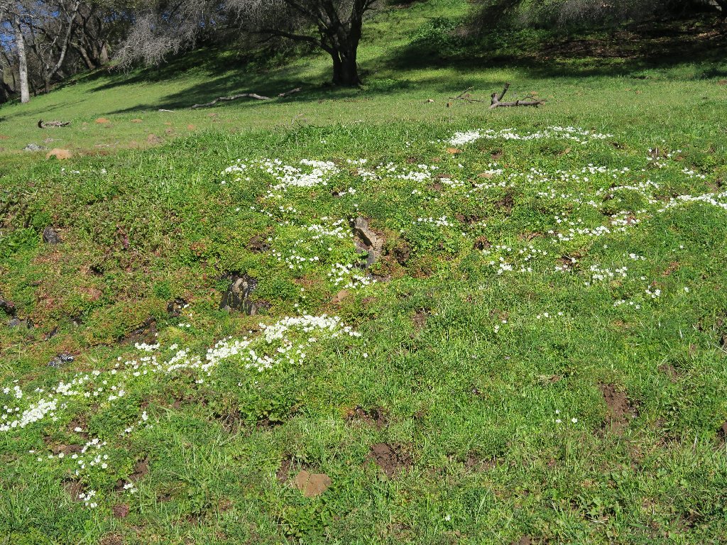
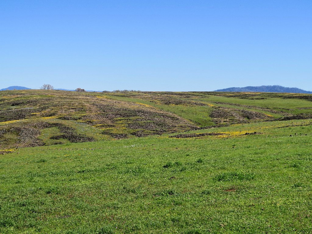
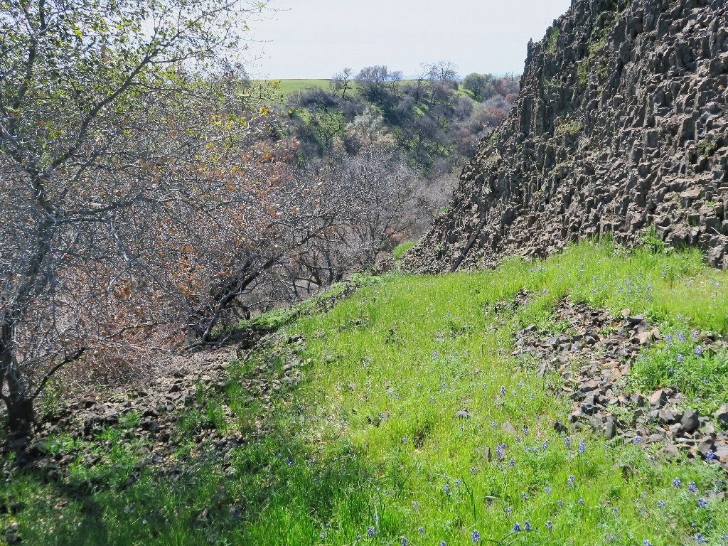
Although I had yet to see any other flowers at all today, millions of Goldfields are lining the route ahead of me, adding great color to the landscape. That ground cover is an important component to the enjoyment of this area.
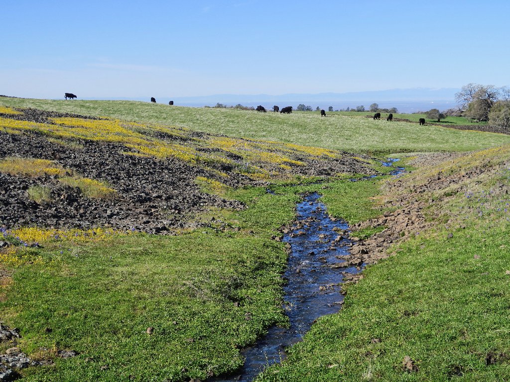
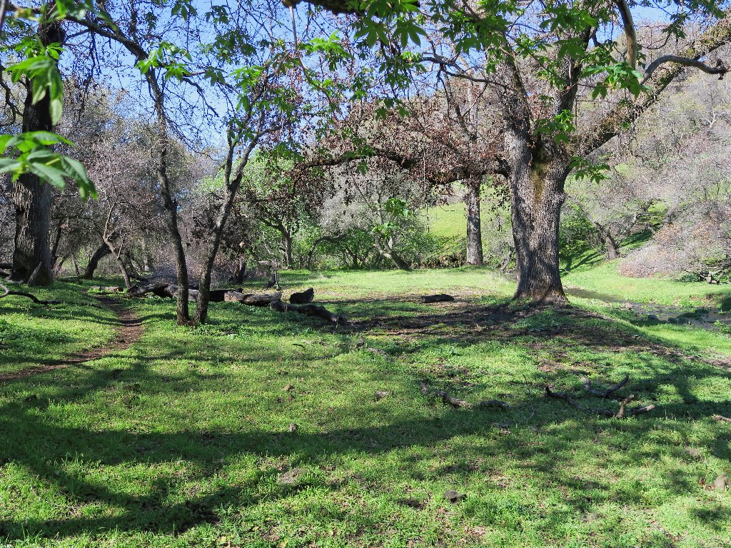
Getting started, in what is a giant cow pasture
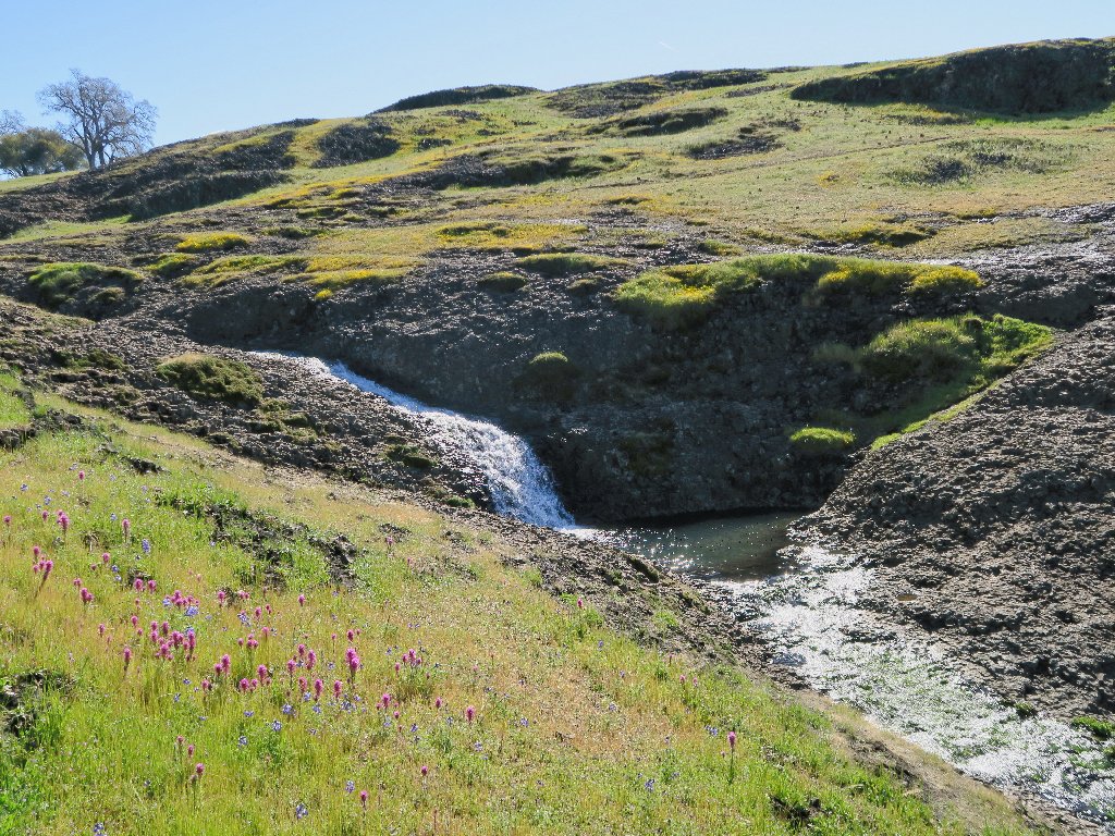
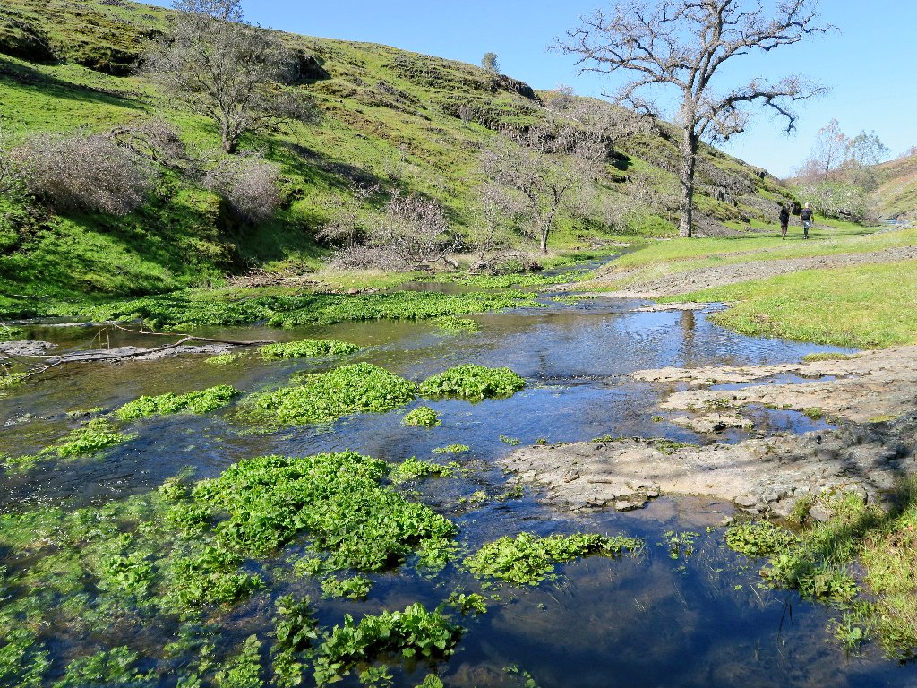
Any first-time visitor would wonder about all the running water that suddenly appears. In fact, it all is emanating from springs on the mesa itself.
Water, water everywhere
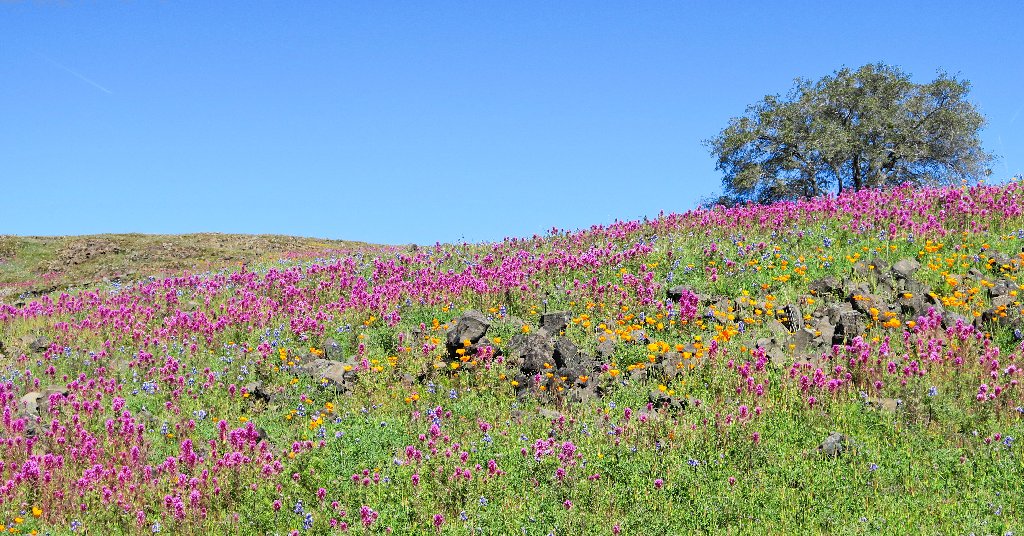
Presently, any concerns about floral displays are dispelled completely.
Oh, my!
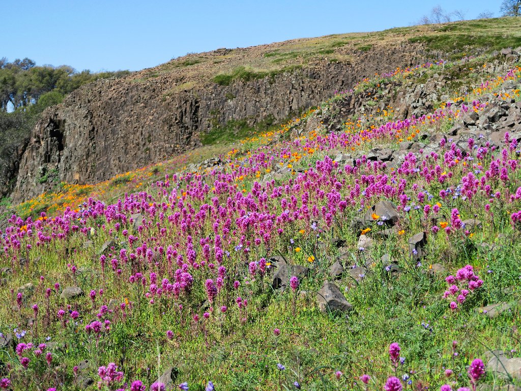
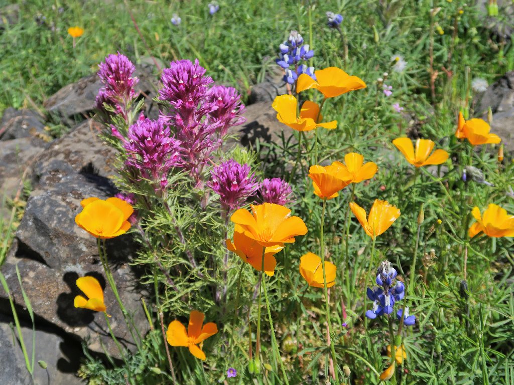
The Purple Owl's Clover are exquisite
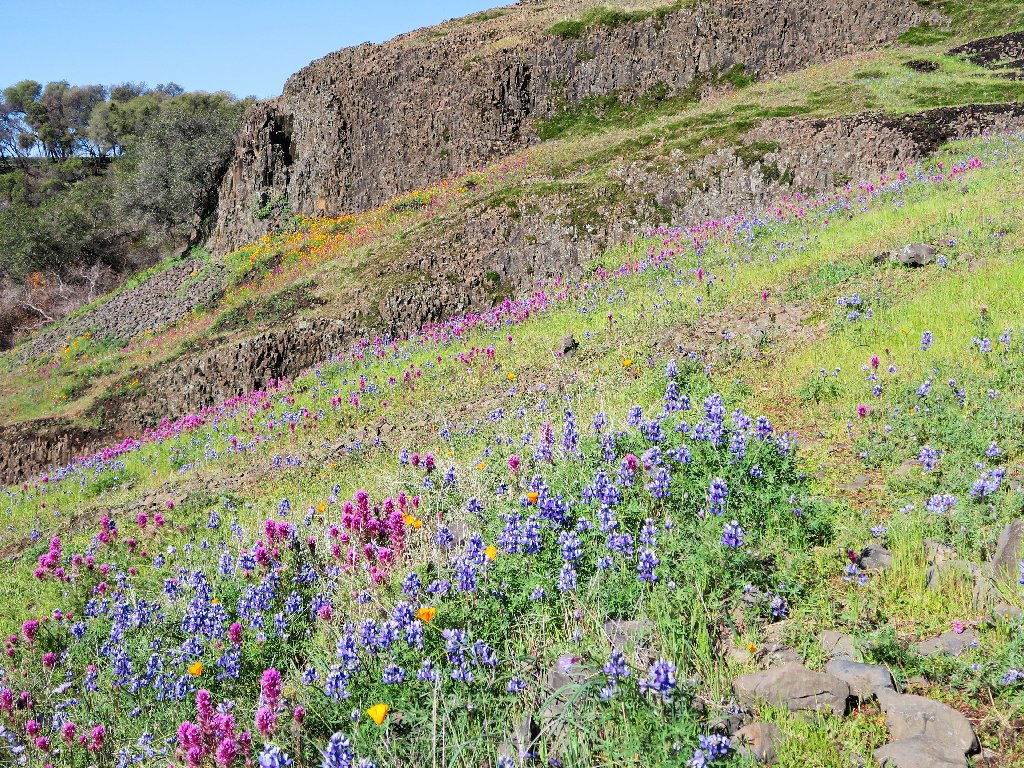
The blue Lupine add a lot to the mix as well
Gee, I already have gotten my money's worth, and I'm just getting started!
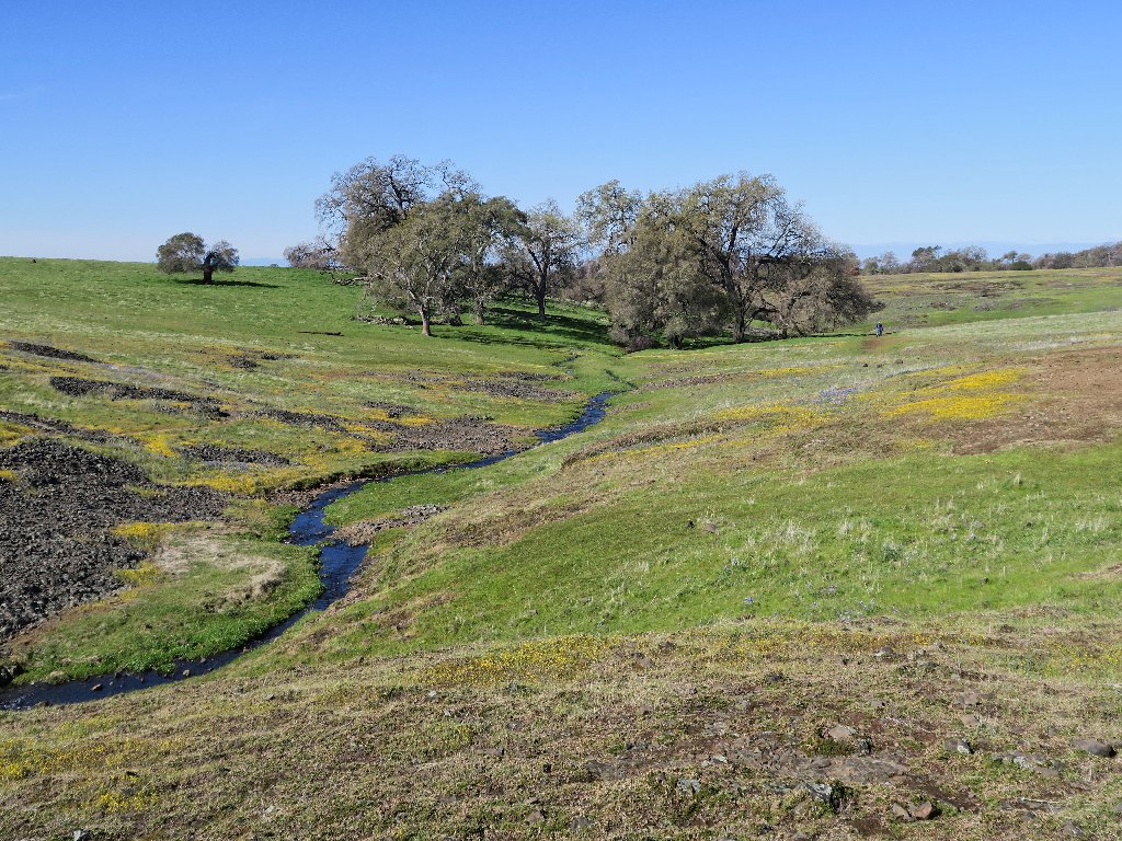
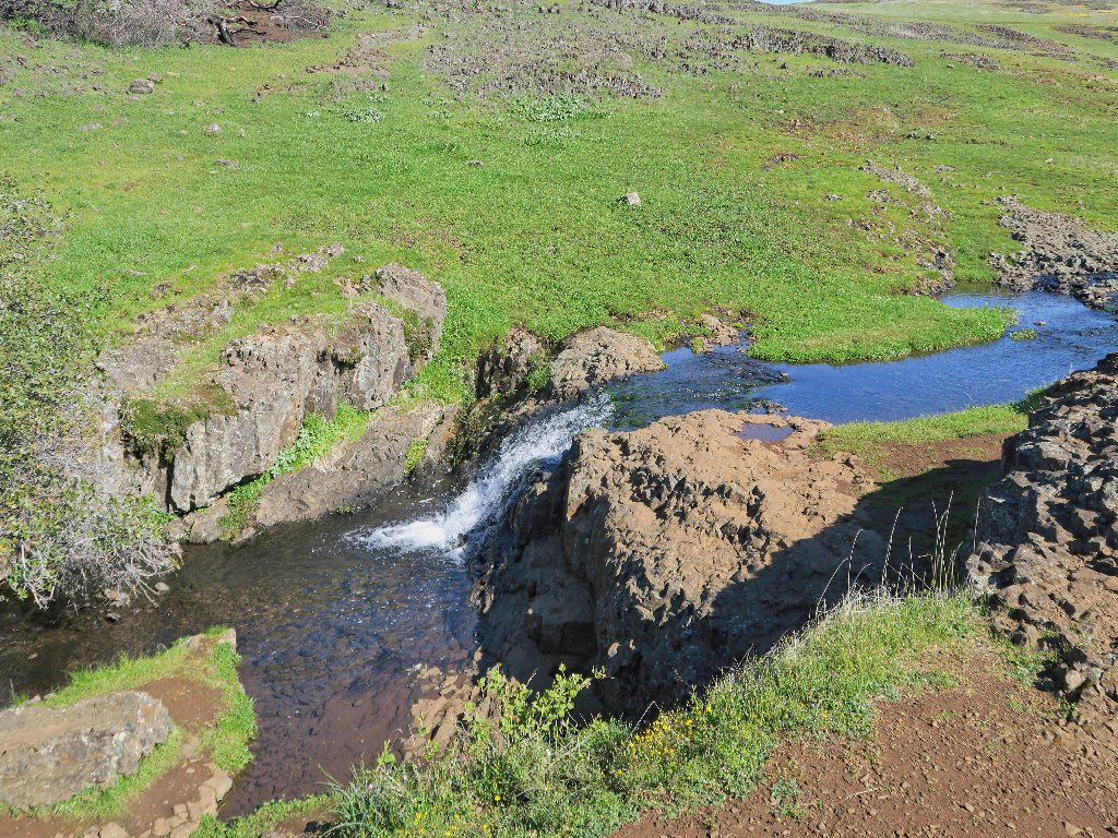
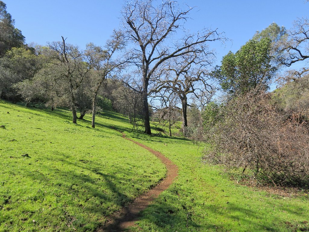
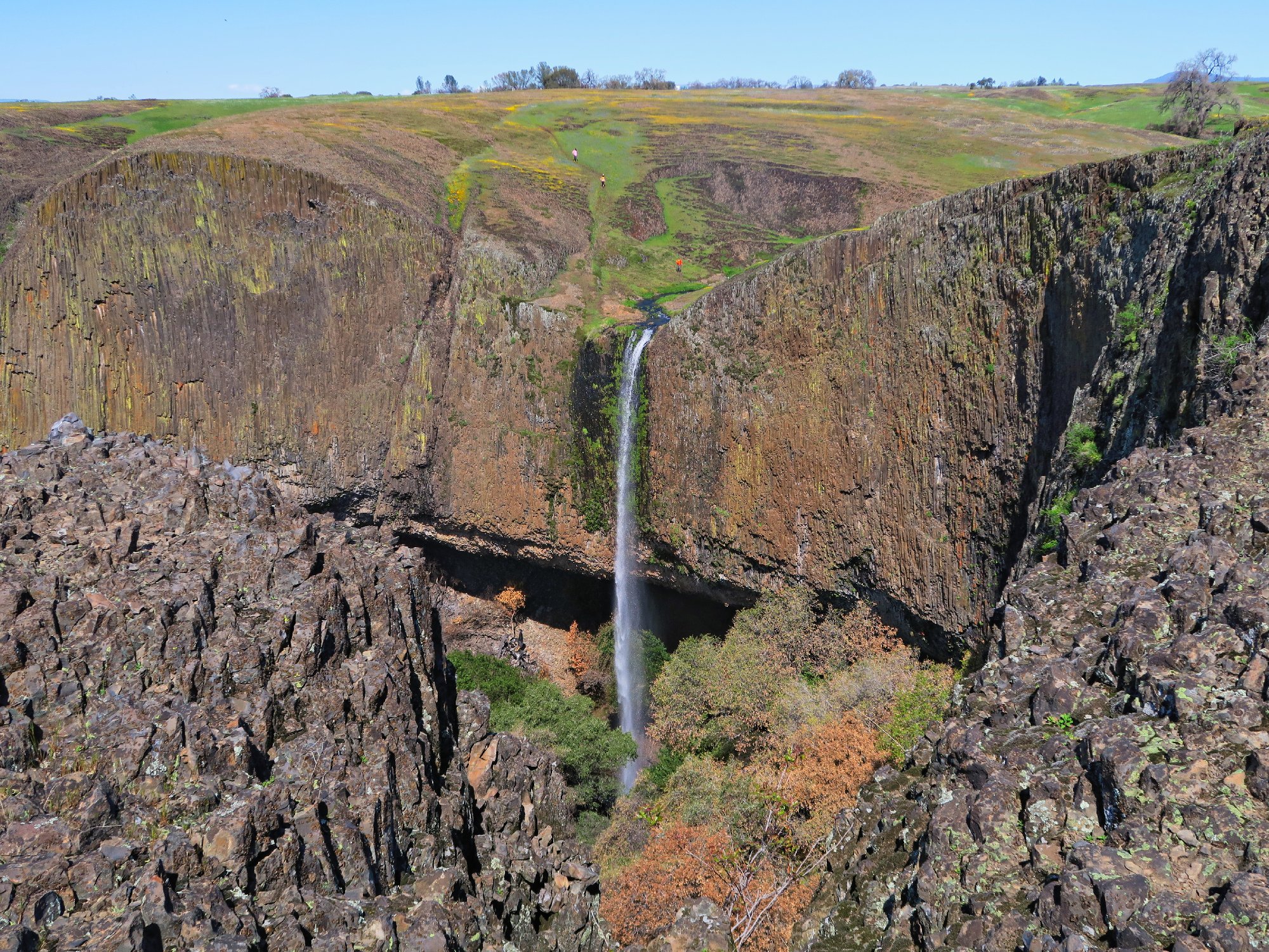
At the trail junction where most folk either turn right or turn back, I continue straight toward the west.
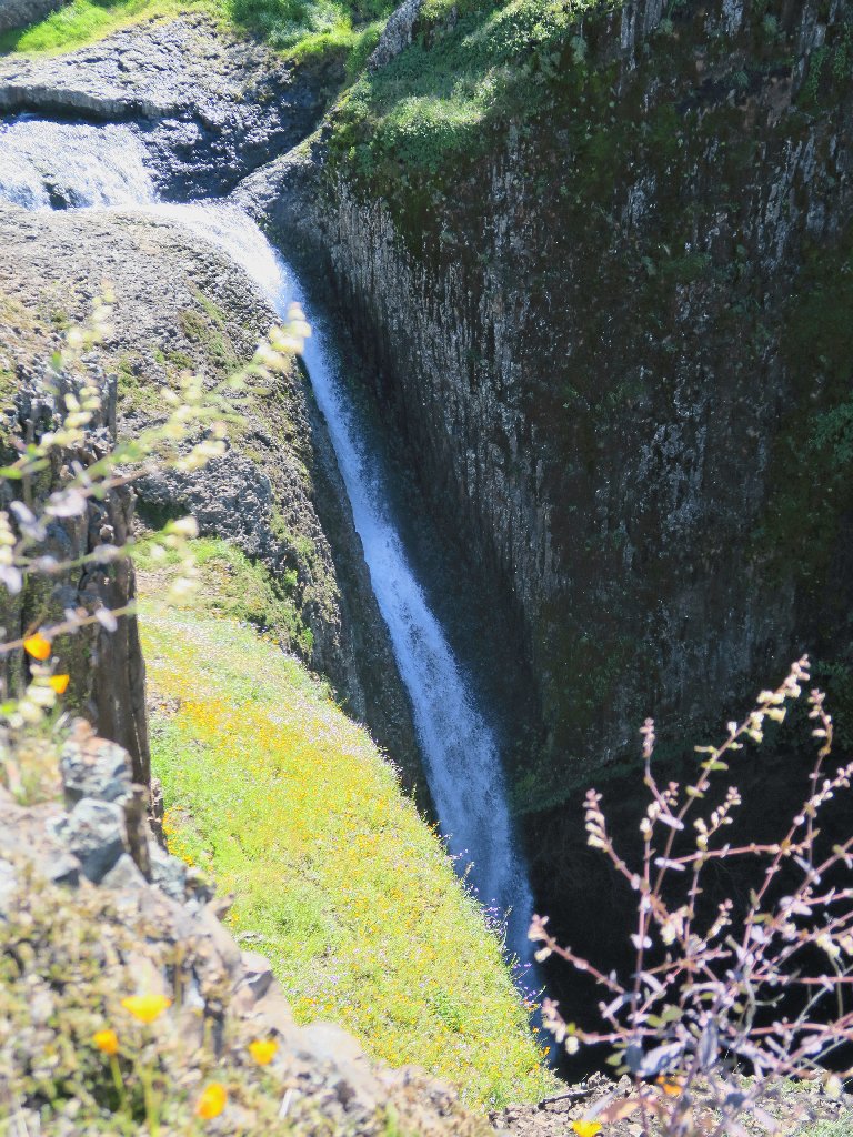
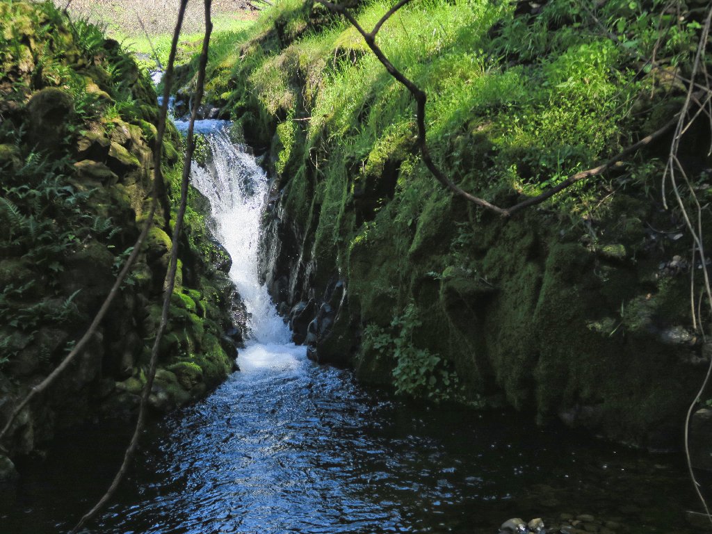
Hollow Falls
A better view of those falls can be had from the other side. I'll do that next time for sure.
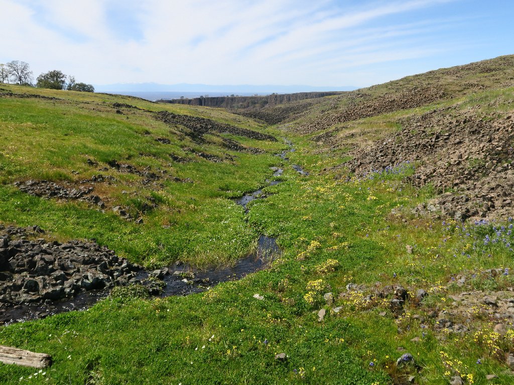
Entering Beatson Hollow
There are several trails in here, but the most popular one seems to be on the other side of the creek.
Perhaps I'd best head over that way
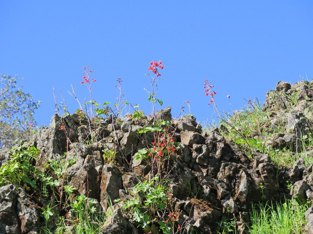
Red Larkspur
White Meadowfoam
Somehow I miss seeing the old corral that was near here previously; I assume that it still is in use.
Campbell Creek
At least one blog proclaims that the best flowers around here are to the north; yet I disagree. Poppy fields are great, but I want to be where these red guys are.
Clover conference
Living proof that no two flowers clash colors
And it just gets better:

This is why I go hiking
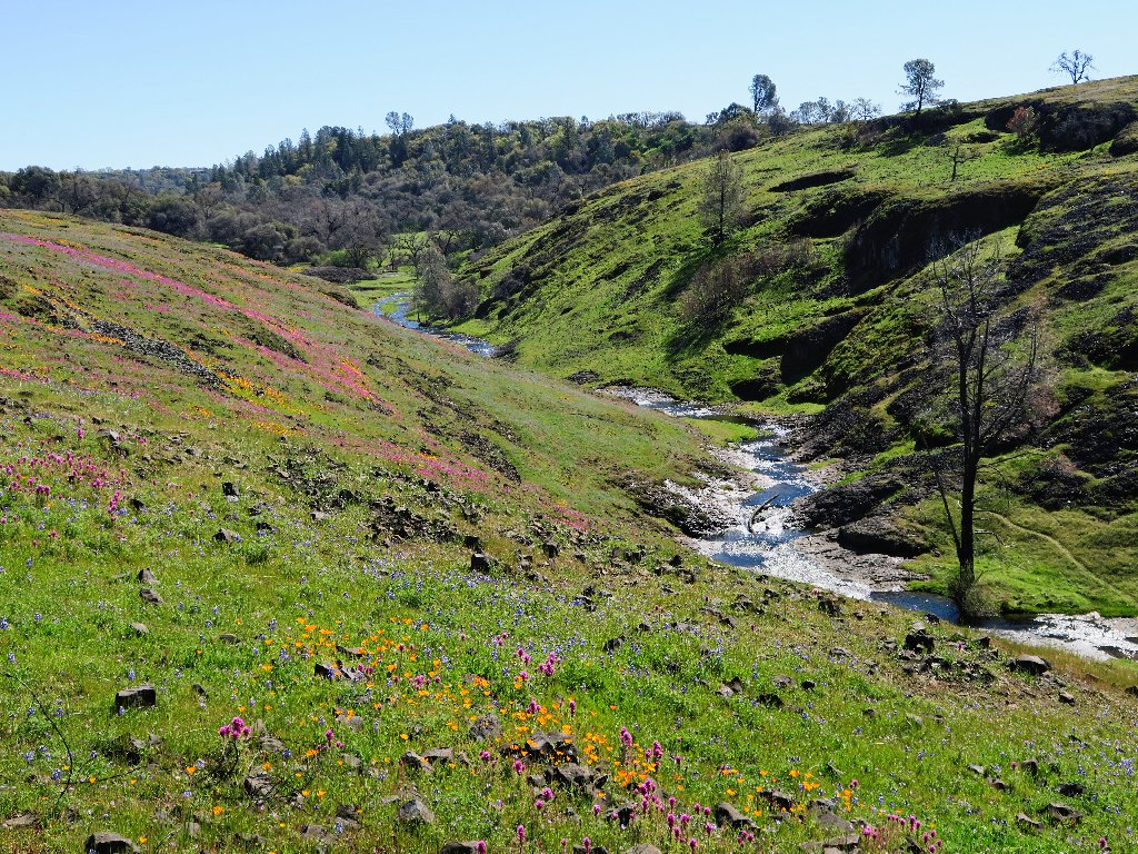
Looking back up Campbell Creek
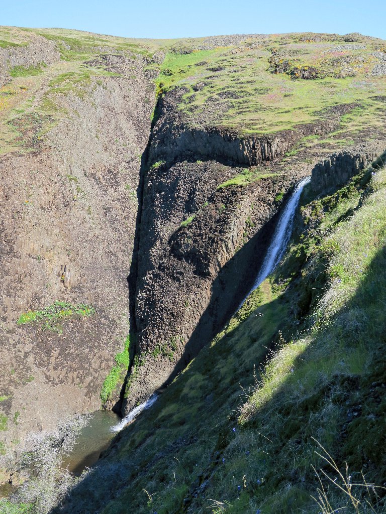
The next attraction is nearby, and I can hear it. A somewhat precarious scramble down a slope lets me get a partial view.
Beatson Falls, 124'
Just downstream of the falls, Beatson Gorge is spectacular.
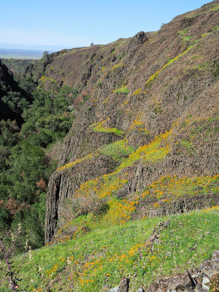
A garden terrace
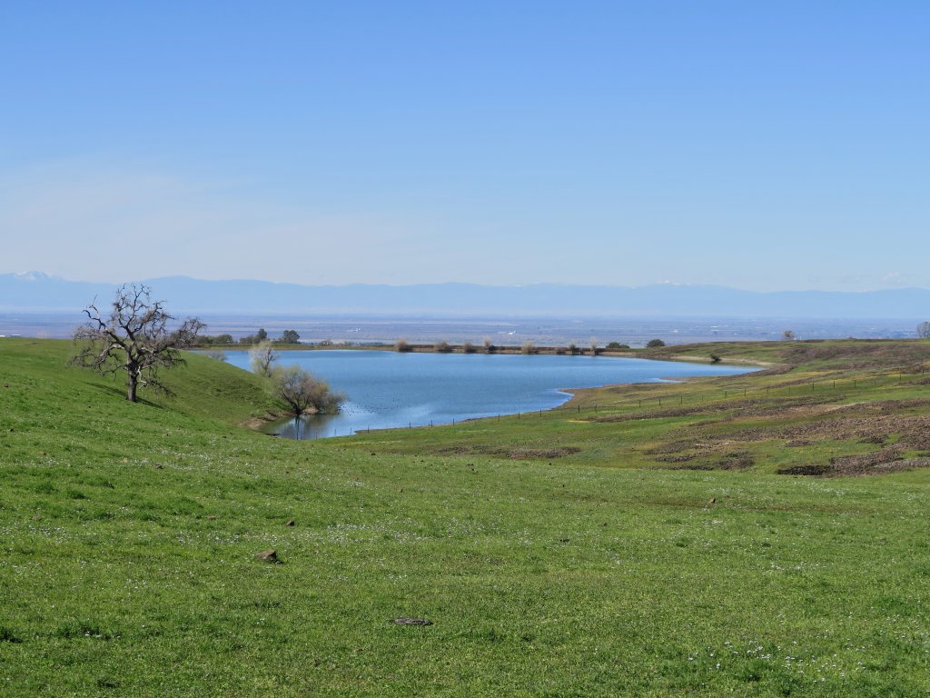
Now, it's cross-country time, in a northward direction. As I approach
a reservoir named Western Pond, I encounter a barbed-wire fence,
as expected. Scrambling underneath it as on my previous visit, I take some
bearings. The only coordinates on my map are for two waterfalls in the
canyon to the north, so I head directly toward the nearest one.
Overlooking the Sacramento Valley
This plan takes me unexpectedly eastward; but within just a few minutes,
the fence takes a 90-degree turn to the left, which means that I need
not have scrambled underneath it after all. Hmmm.
The GPS is pointing that-a-way
Continuing toward the selected waypoint, I reach the edge of canyon; but the trail downward that I had found on the last trip is nowhere in sight. There being a cliff to the left, it doesn't seem right to go that way; so I find a reasonable spot and plunge straight down through the volcanic scree, cursing myself as I go for having neglected to bring my walking stick. In fact, using broken branches for assistance on several occasions enables a descent with but one fall backwards on my rear, which leaves charcoal all over my pants.
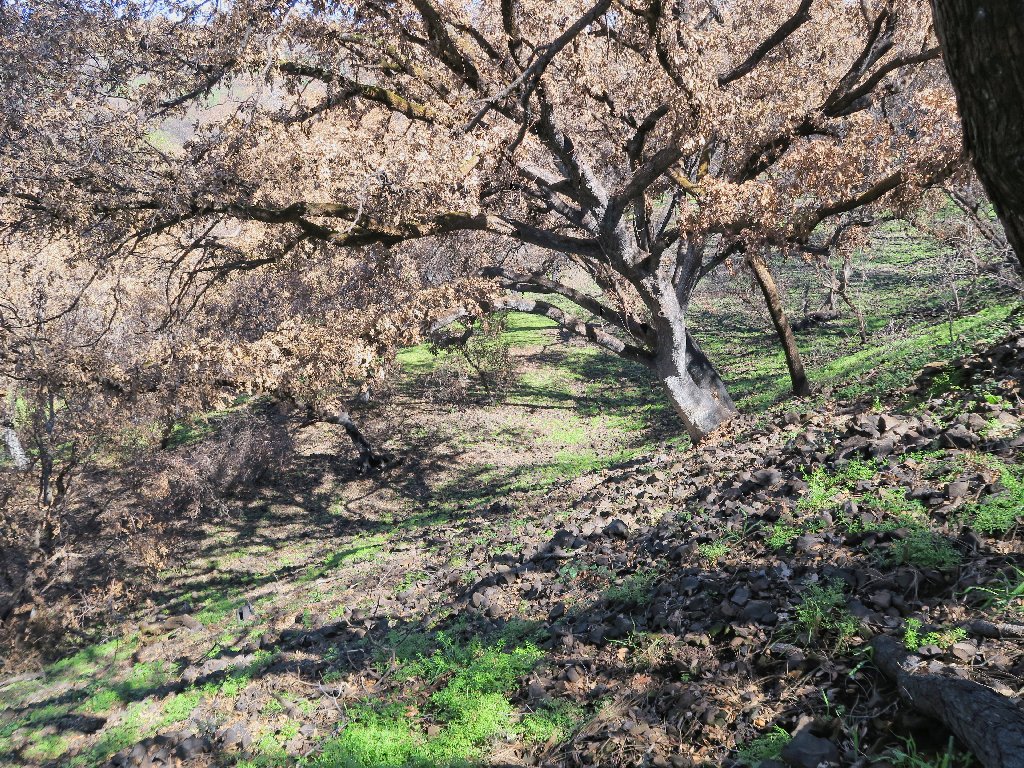
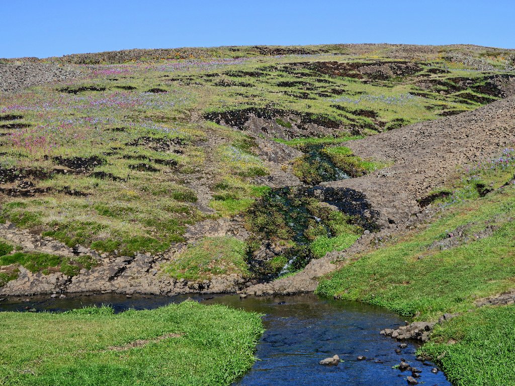
Fire has taken its toll
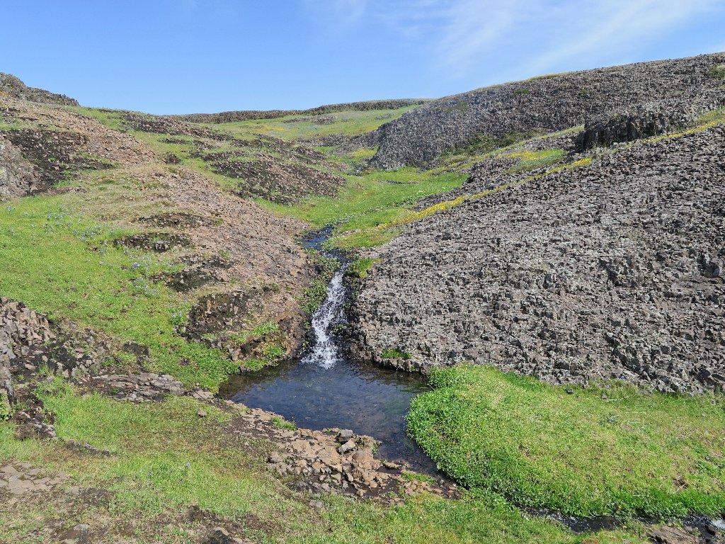
At the creek I turn eastward, and it isn't long before I encounter a little waterfall; yet it is not the one that I remember. Only now do I figure out that I have mixed up the the names of two GPS waypoints, and that I should have been farther west all the time, on the far side of that erstwhile cliff.
Unnamed falls on an unnamed creek
Rather than retrace any steps, however, I must continue northward in order to avoid missing out on the principal attraction of this planned expedition. Being somewhat exasperated, I cross the little creek and plunge straight up the north slope, which proves steep enough to cause problems with footing and balance. Numerous rest stops are in order as well, as I ascend what might well be a 100% gradient. This is not why I go hiking, but it is what I do to myself all too frequently.
Looking back
Looking ahead
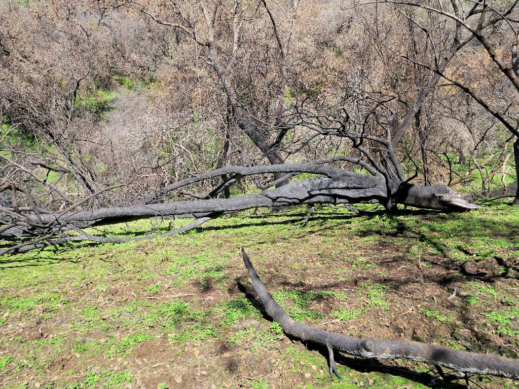
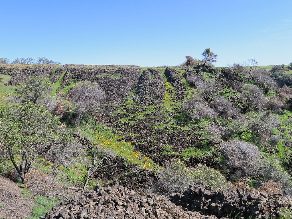
All right! Order has been restored, and the next destination soon appears in the distance. Last year's fire has taken its toll over here as well, however; for much of the former greenery now is an awful brown.
Coal Canyon just isn't the same
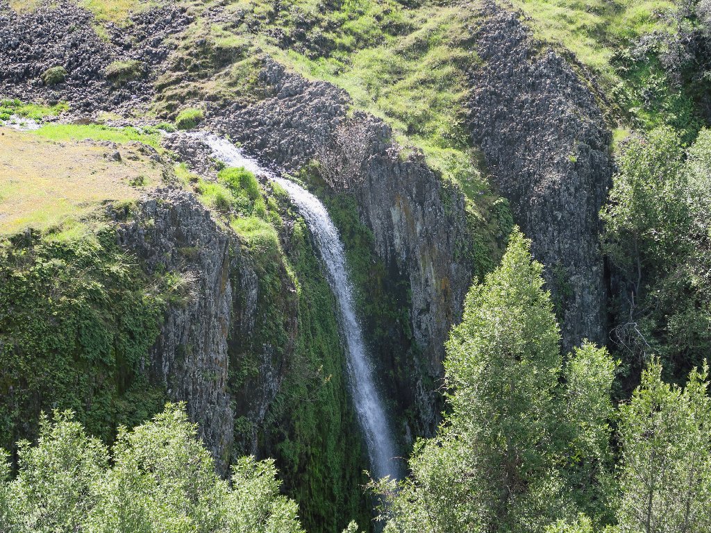
Just to the right of the big watercall is its lesser companion:
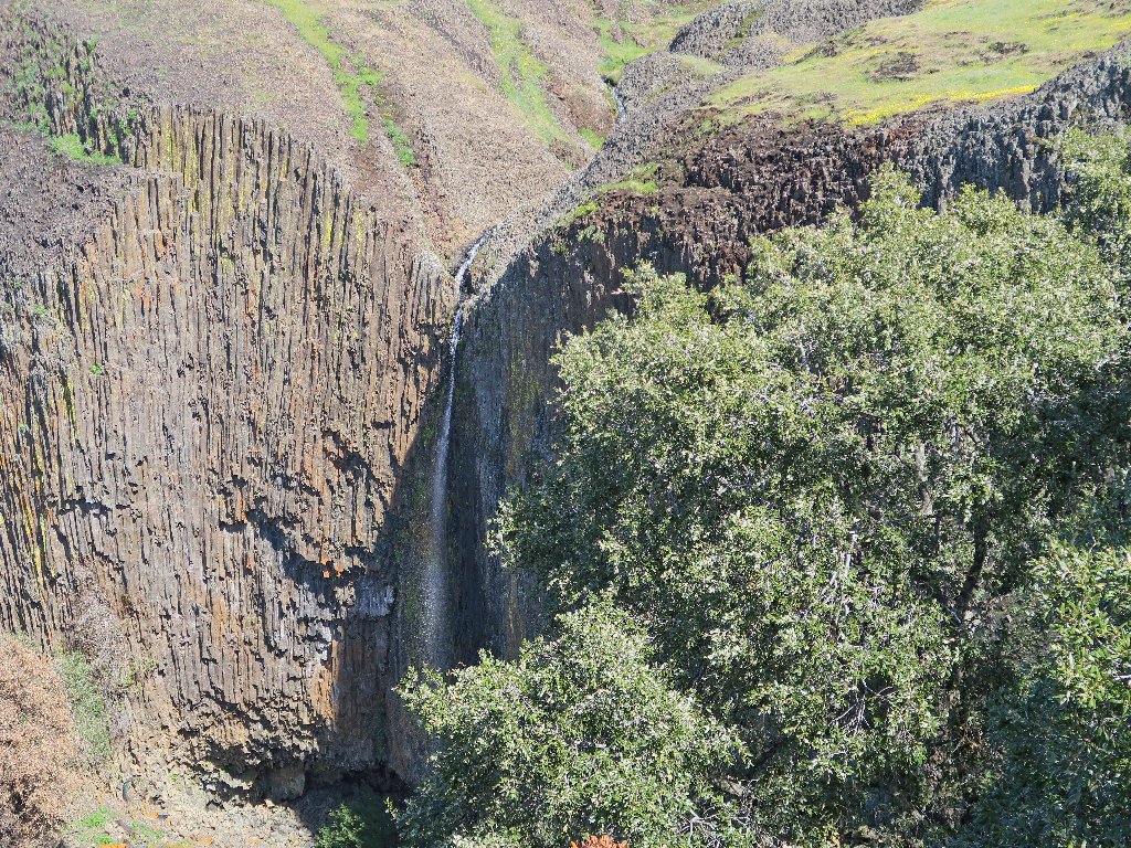
Little Phantom Falls
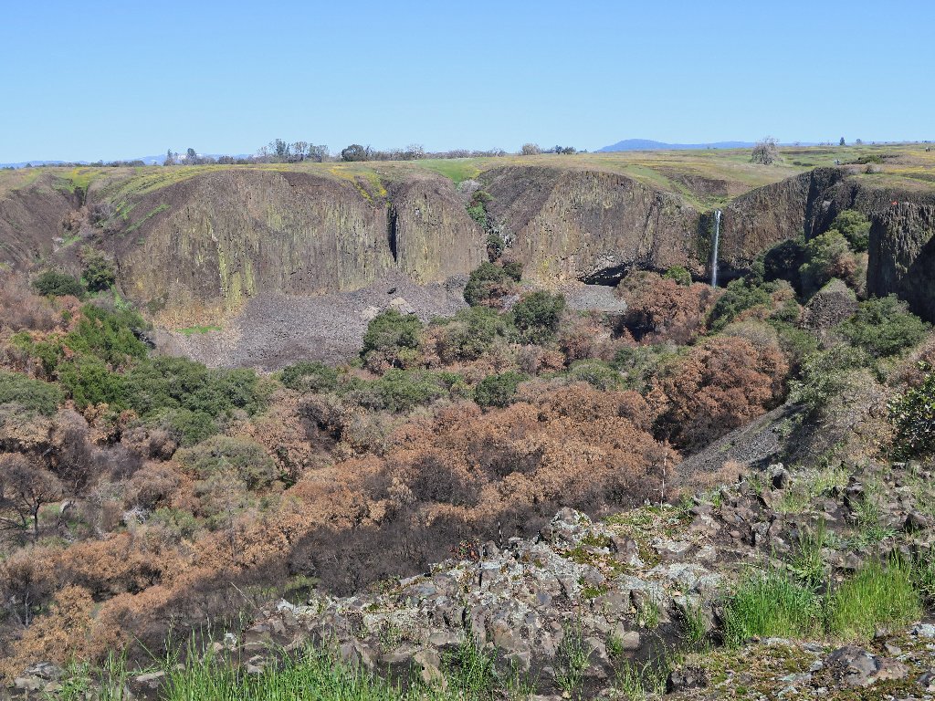
It is time for a lunch break, and there couldn't be a better spot for that.
Phantom Falls -aka- Coal Canyon Falls, 135' ⇔
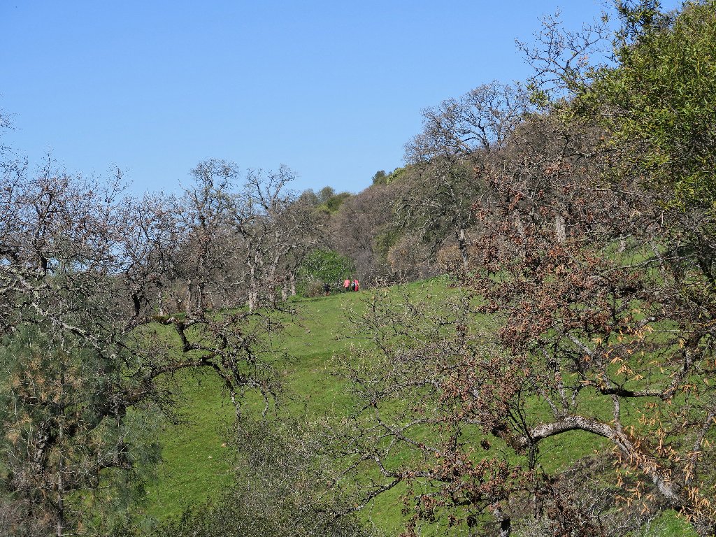
The two women high above the brink have just returned from a visit to the big cave behind the falls. The guy in the orange jacket is headed over there himself. For me, it's "Been there, done that".
The creek that feeds Little Phantom Falls
Shortly on the way back toward Hollow Falls is a scene I have been anticipating:
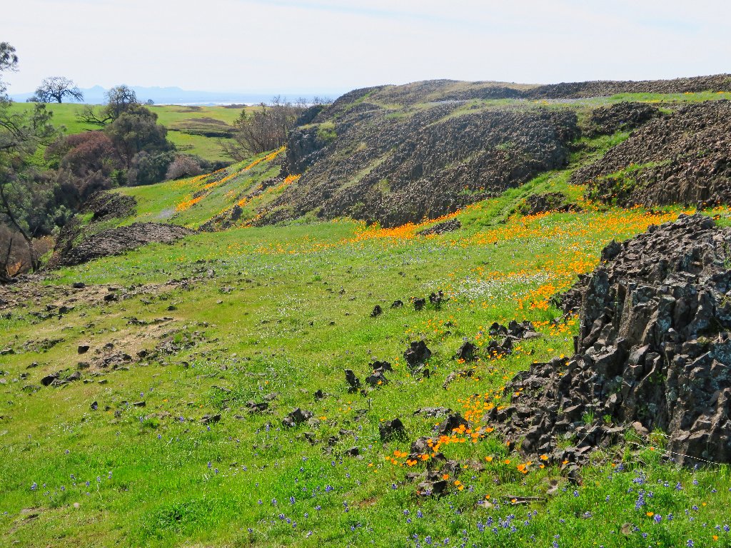
Poppy Paradise
At the next attraction is the tricky spot where hikers must inch their way around the end of a fence, with but a foot of rock to stand on at the edge of a precipice. Ignoring the posted "No Trespassing" sign is just a formality. There are several such dilapidated signposts around, and this point is right at a sharp corner of the private land to the north. Most of the main trail from the parking lot to Hollow Falls also is on private land, but that doesn't seem to matter.
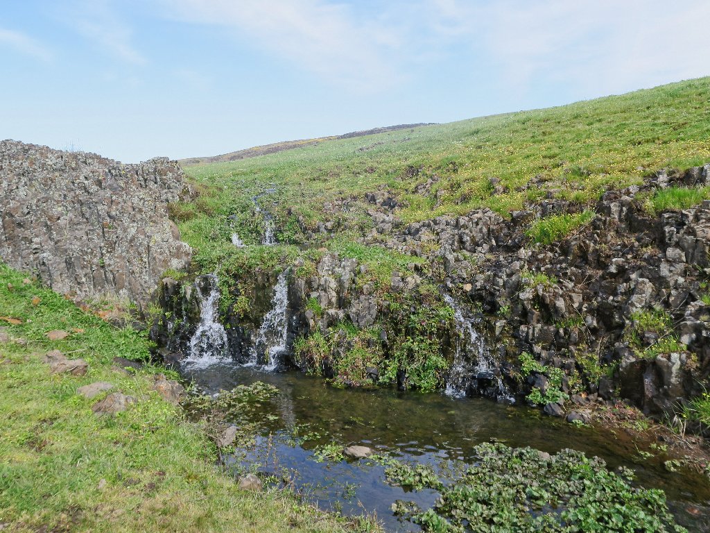
Ravine Falls -aka- Fern Falls
Forgetting that I will miss another nearby waterfall, I cut off the path here and head directly toward the trailhead.
The shortest way is straight over that hill to the left
My shortcut proves not to be much of a timer-saver, though;
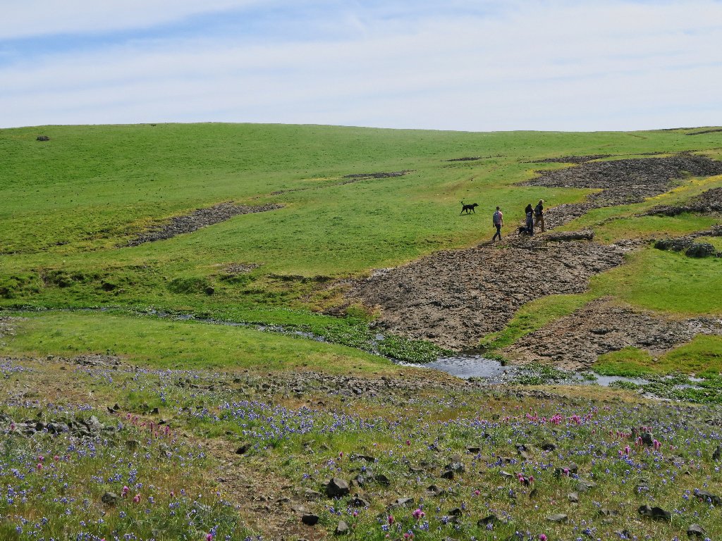
within fifteen minutes those two doggies overtake me and try to smother me
with kindness as I regain the main trail.
It's all but over now
§: Well, I certainly got more than I had bargained for today.
The flower display provided a spectacular start to this hiking season, and I
actually did benefit from the unexpected aerobics. With better planning
and the good sense to carry my walking stick, I would have been even better off.
In any case, I believe that now I finally have this route figured out. Next time, I'll bring some company and take in all eight waterfalls available on this loop; three of them were missed today. There also is unexplored territory at the south end of the mountain.
A noteworthy part of the mystique of this place is a lack of trail directions
or mileage markers. Social trails exist, of course; but one is free to wander
anywhere the mood strikes. Between mid-March and early April
(in most years), Table Mountain is a scenic wonderland. When the water
has dried up and the flowers are gone, however, most would find this area quite
dull and boring. Be forewarned.
Camera-wise, I had some issues with firmware settings. This G5X behaves rather differently than any other camera I have owned. Numerous potentially fine shots were ruined today, but I'll work out the kinks.
| Scenery |  |
| Difficulty |  |
| Flowers |  |
| Solitude |  |
| Route-finding |  |
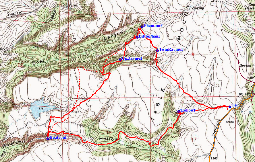
The dotted red line is the proper route
