
Yosemite NP
|
Gaylor Lakes & Granite Lakes Loop Yosemite NP |
July 14, 2015
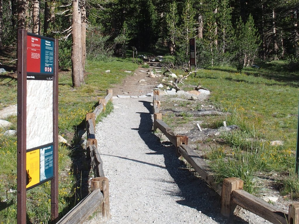
The Gaylor Lakes Trailhead is right next to the Tioga Pass park
entrance. At eight o'clock it is a calm, clear 50 degrees,
which is just about perfect. Two hundred feet up the trail, I realize
that I have not applied any sunscreen; so I return to the car to load up.
Six hikers are just starting out for Mount Dana across the way. As not one of them is half my age, they should do just fine.
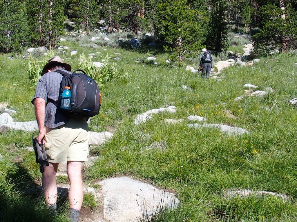
On my second attempt, there are two men just ahead of me, both carrying big cameras and tripods. After a greeting and a few pleasantries, the man in the lead asks whether I am Ted, then introduces himself as Chuck. This is an incredible coincidence, because it was he who had emailed me very recently regarding a suggested shortcut up to Cathedral Lakes.
Chuck is a renowned astro-photographer who knows his way around a camera. Today, he and his partner Bob are headed for a high point to create some panoramic images of the Gaylor Lakes area.
Had I not returned to the car, I never would have met these guys!
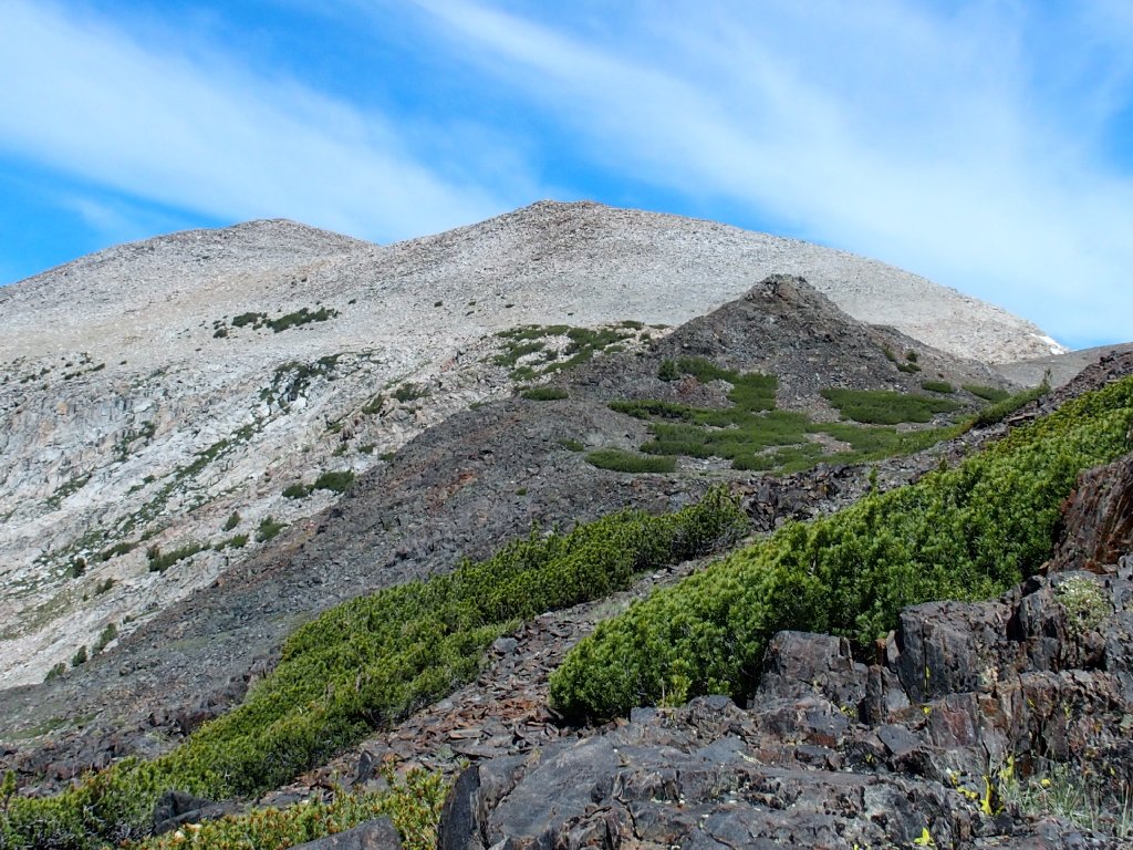
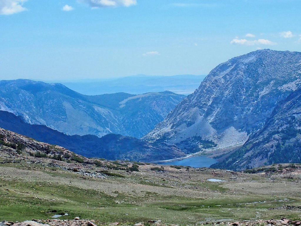
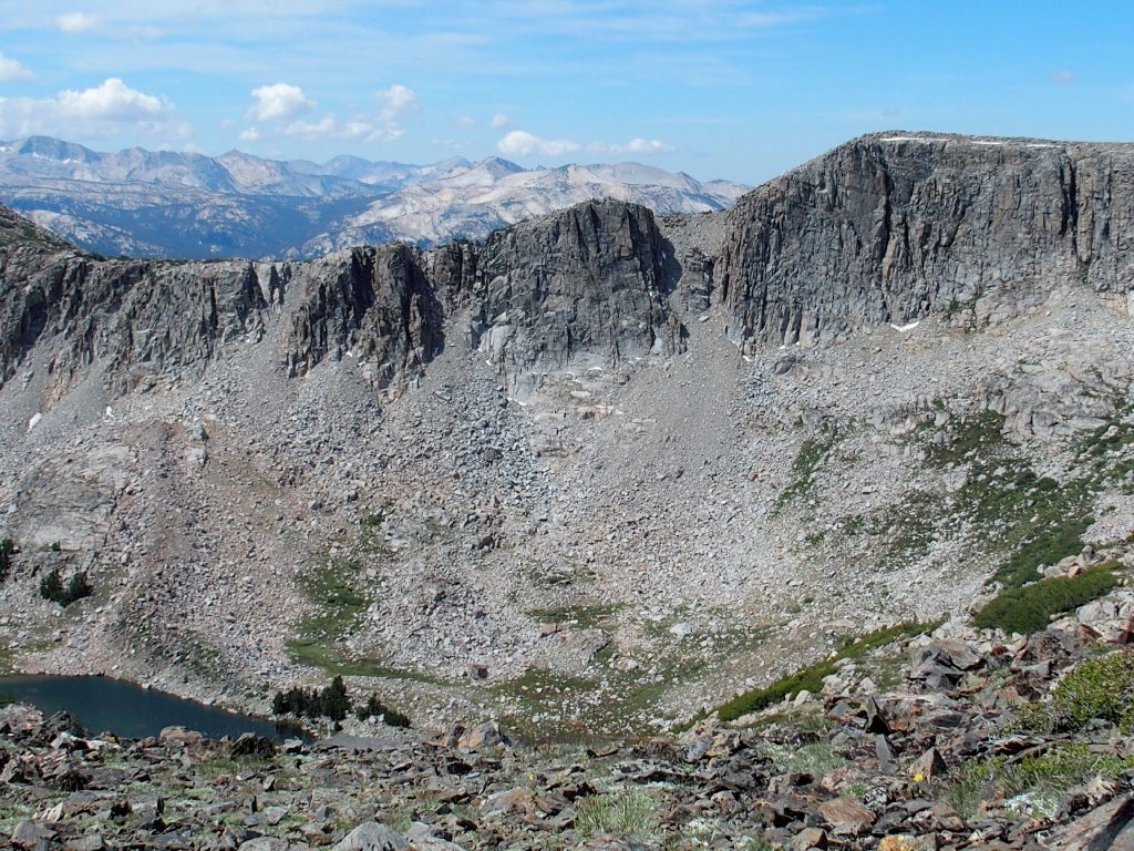
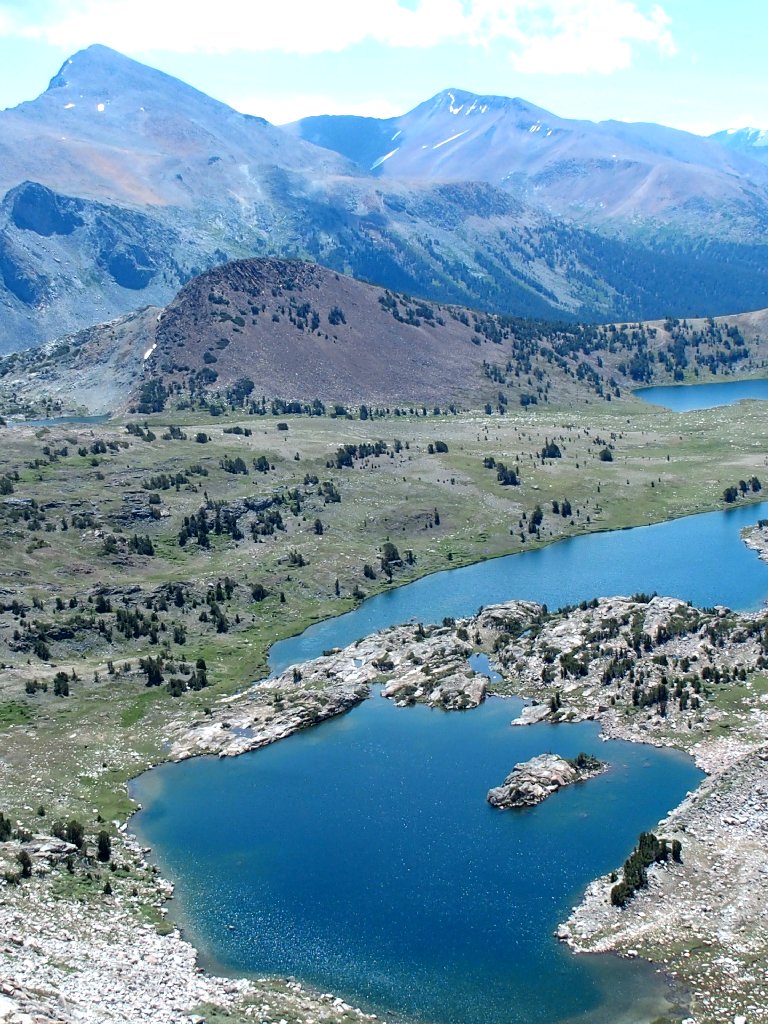
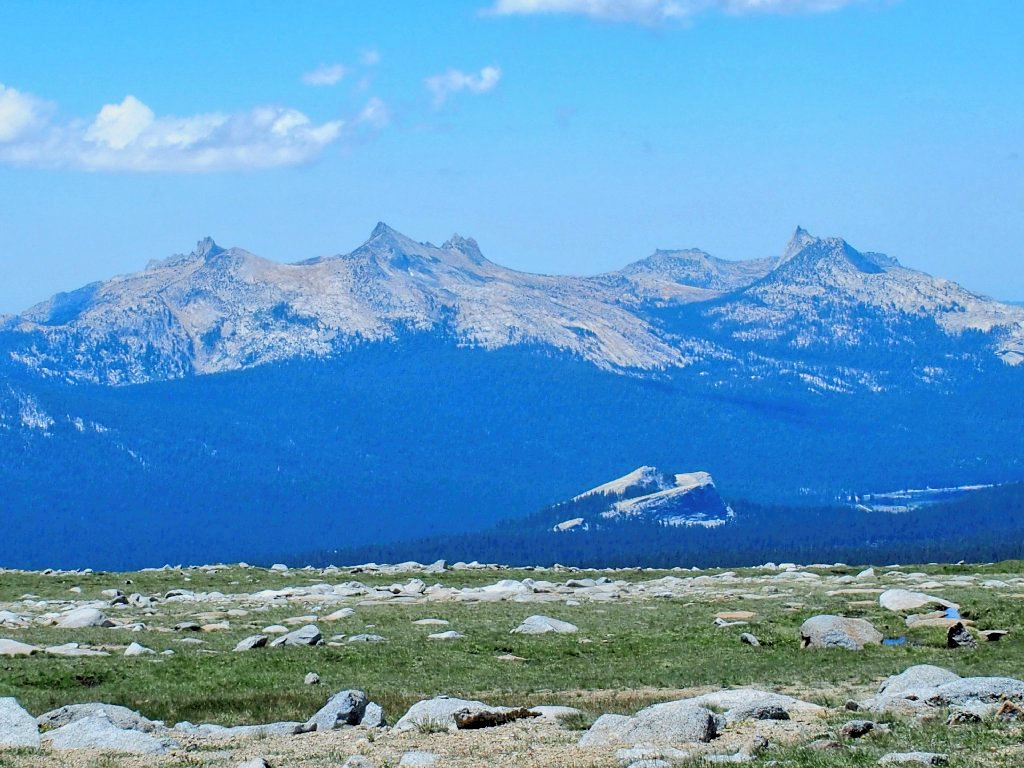
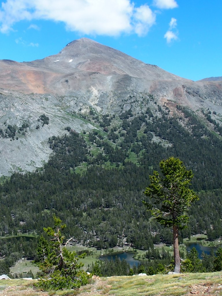
A 600-foot steep climb to a saddle begets a view of today's venue.
My planned route is way up there, above the cirque wall
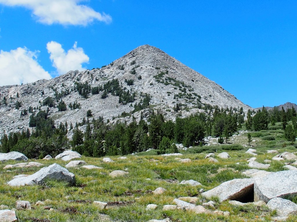
Chuck and Bob are headed for pyramid-shaped Peak 11091
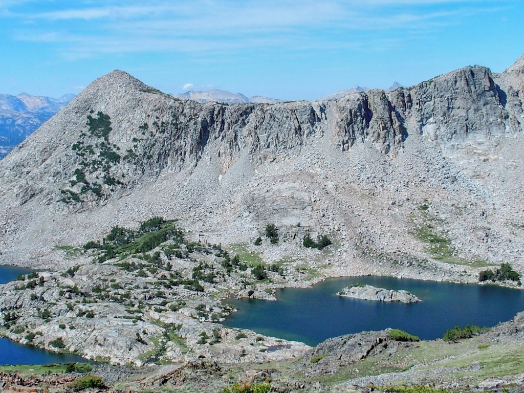
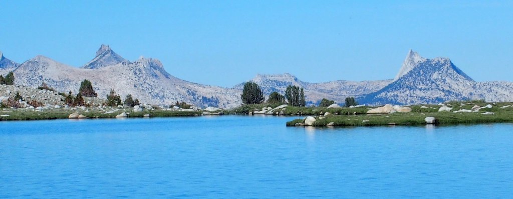
Back in 2008 I shot one of my all-time favorite photographs from this location. Here is a reprise:
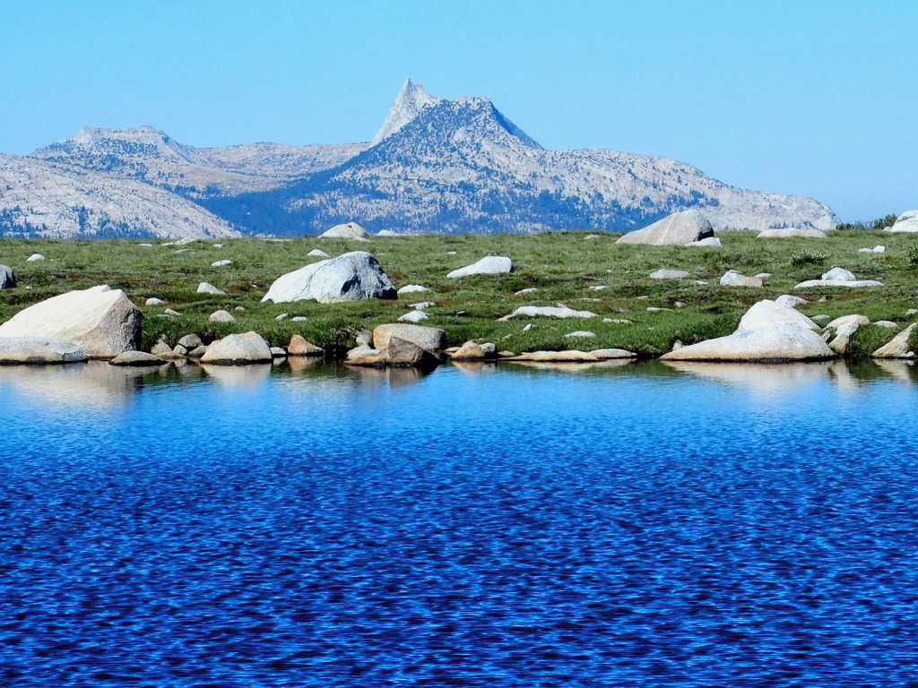
Cathedral Peak is nine miles away
An interesting feature of this scene is that hundreds of park visitors are scurrying about in Tuolumne Meadows between the lake and the mountains, albeit conveniently out of sight below.
Saying farewell to my new acquaintances, I turn right onto the Great Sierra Mine Trail.
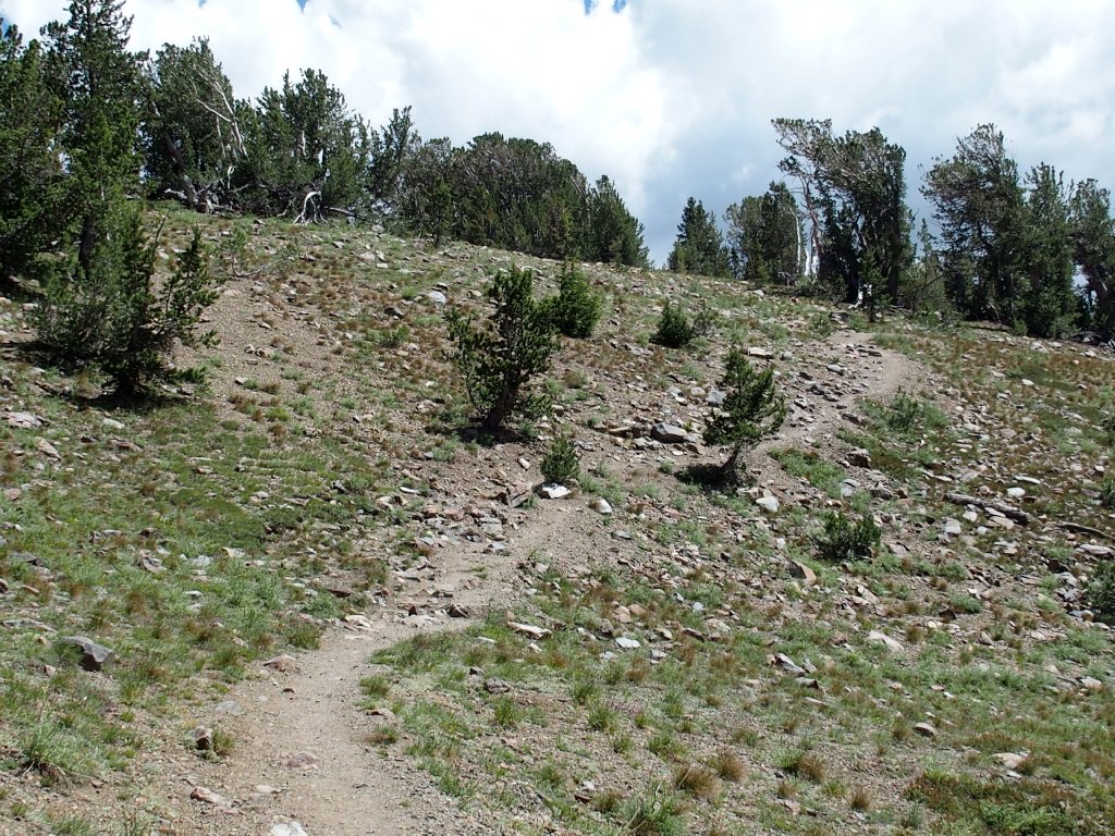
Starting up the hill
There they go. Good luck, guys.
There are little signs posted at regular intervals, admonishing hikers to remain on the trail so that the fragile meadow can recover from overuse.
This sentinel is making sure that I don't deviate from the trodden path
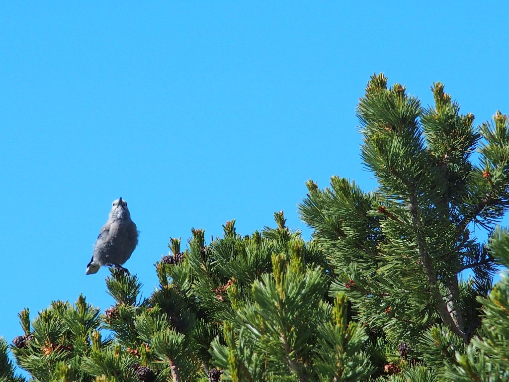
The Clark's Nutcracker also intends to keep me in my place
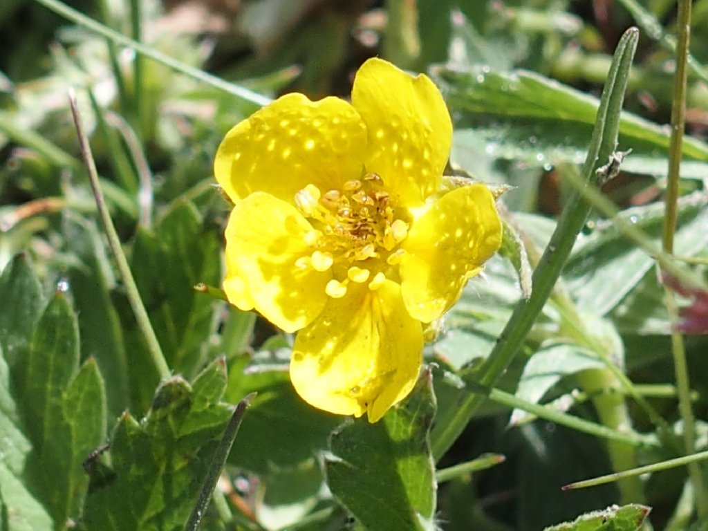
This Slender Cinquefoil doesn't care what I do
Nearing the next lake, I refill my water bottle from the creek. Just after doing that, I notice an unlikely dead squirrel on the trail, then check to make certain that my refill was made upstream of this spot.
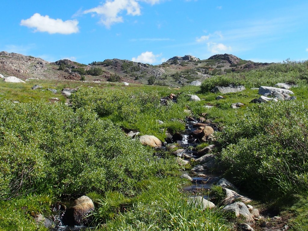
Last chance to fill up from a creek
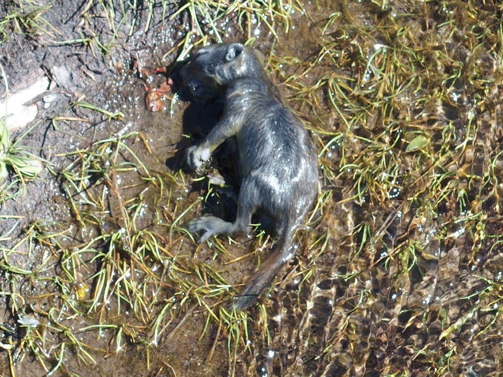
Old age? Or the plague?
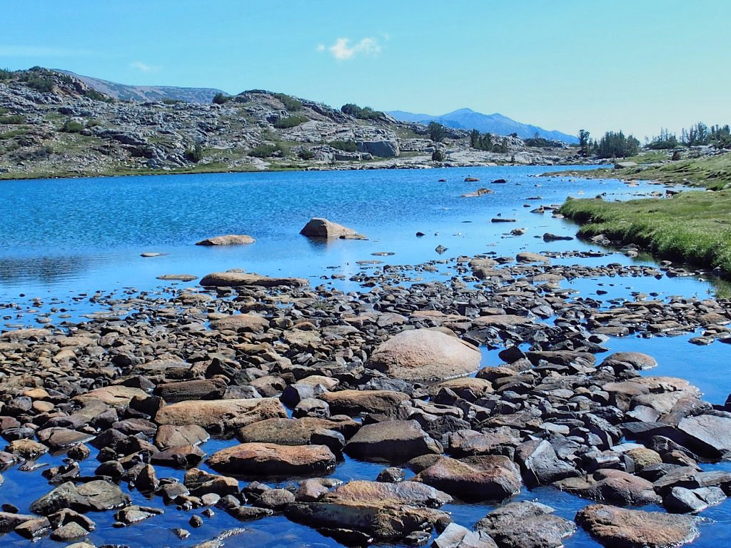
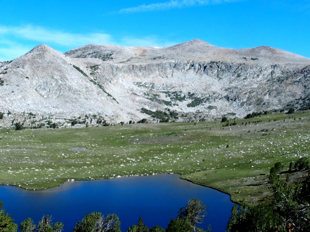
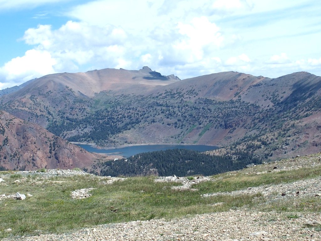
Upper Gaylor Lake
Suddenly, I realize that I have forgotten my carefully prepared map, just as I did seven years ago. Although it is impossible to become truly lost around here, the visual assistance and marked waypoints can come in handy. Oh well, I'll just have to make the best of it.
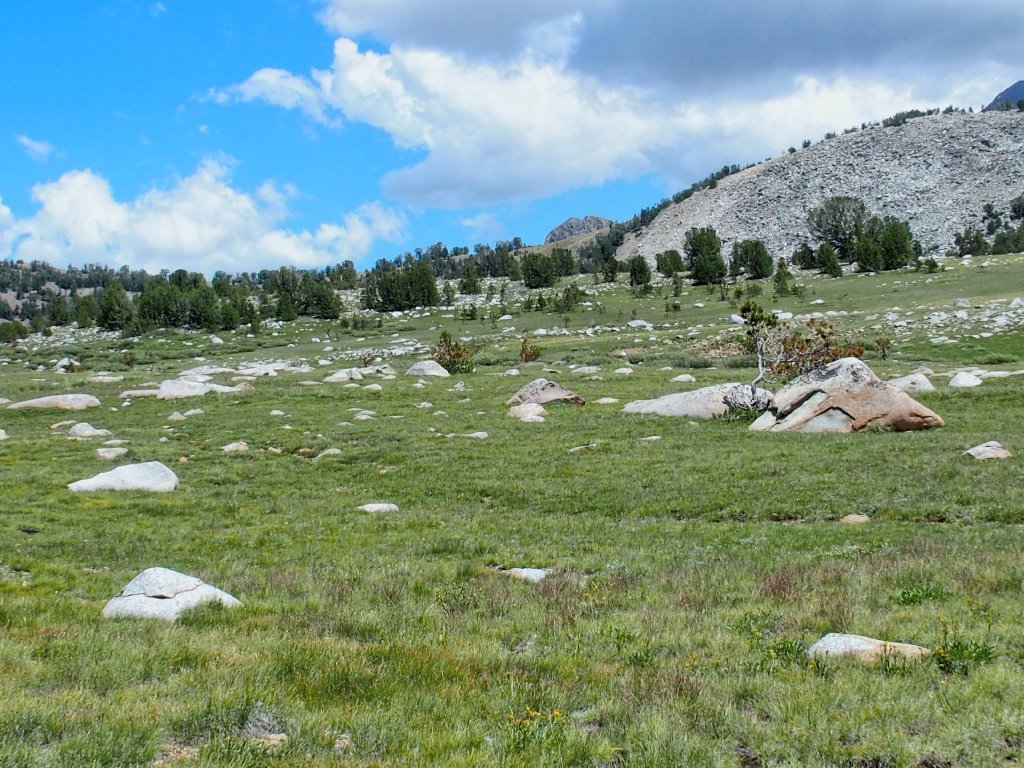
I cannot spot a trail continuation, although one is known to exist. The Great Sierra Mine site is nearby. Perhaps climbing the little rise to my left will provide a clue.
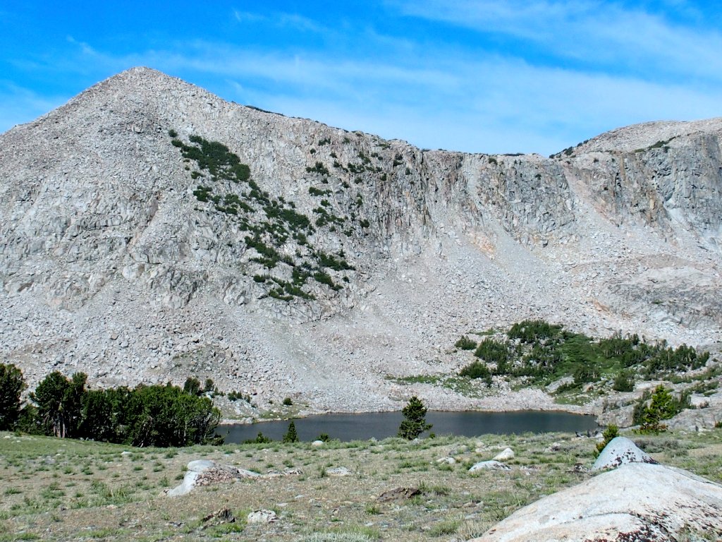
Upper and Lower Granite Lakes appear
Well, there are no clues; but there are some nice flowers.
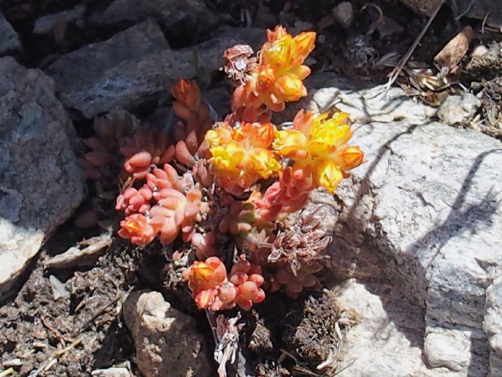
Sierra Stonecrop
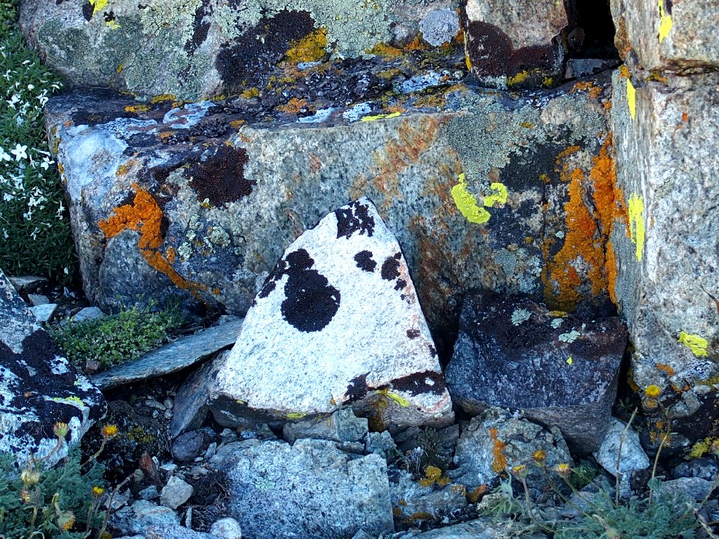
Bumpy Map Lichen
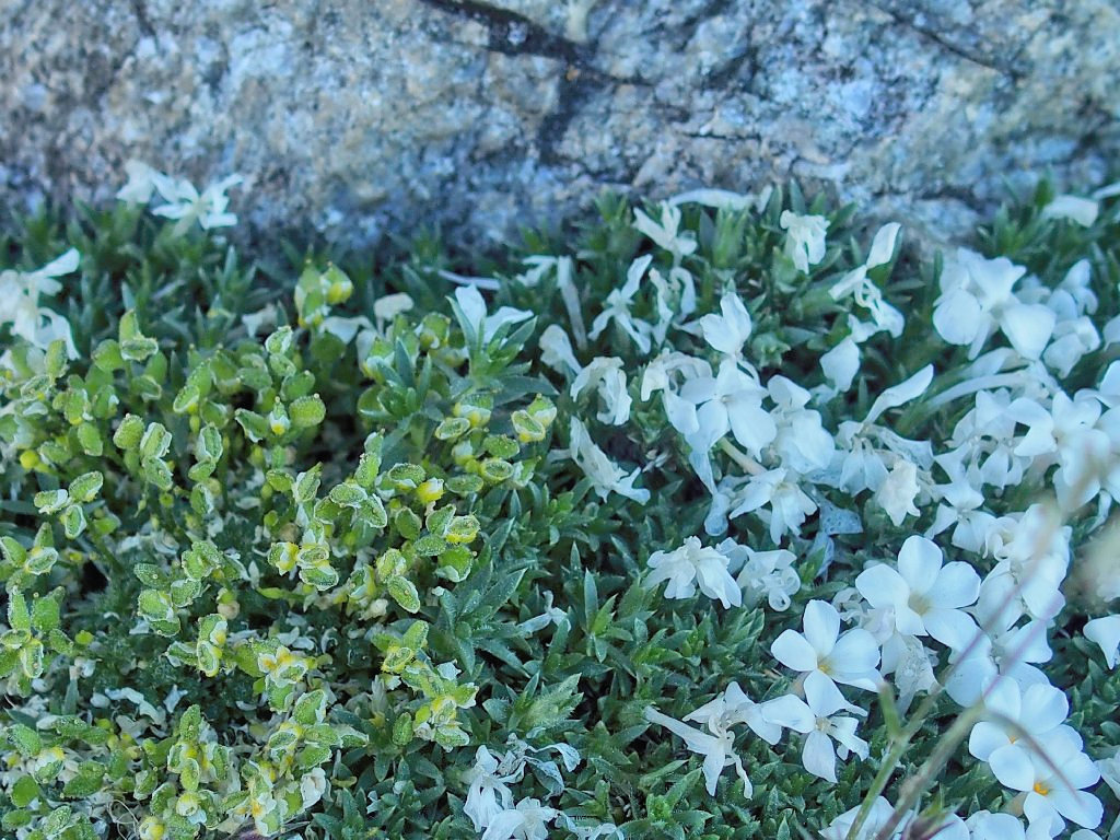
Spreading Phlox
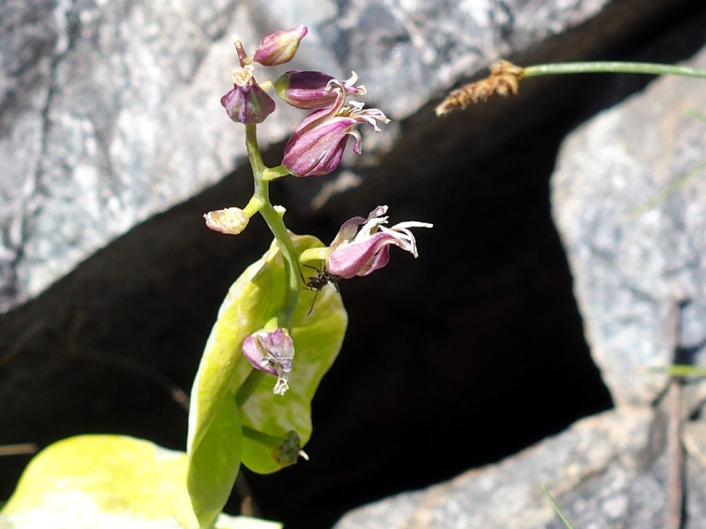
Mountain Jewel Flower
What now?
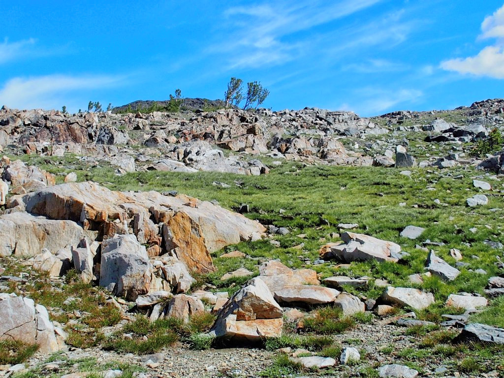
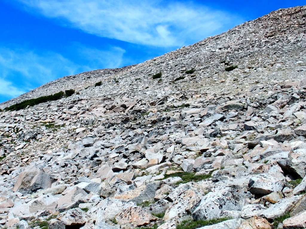
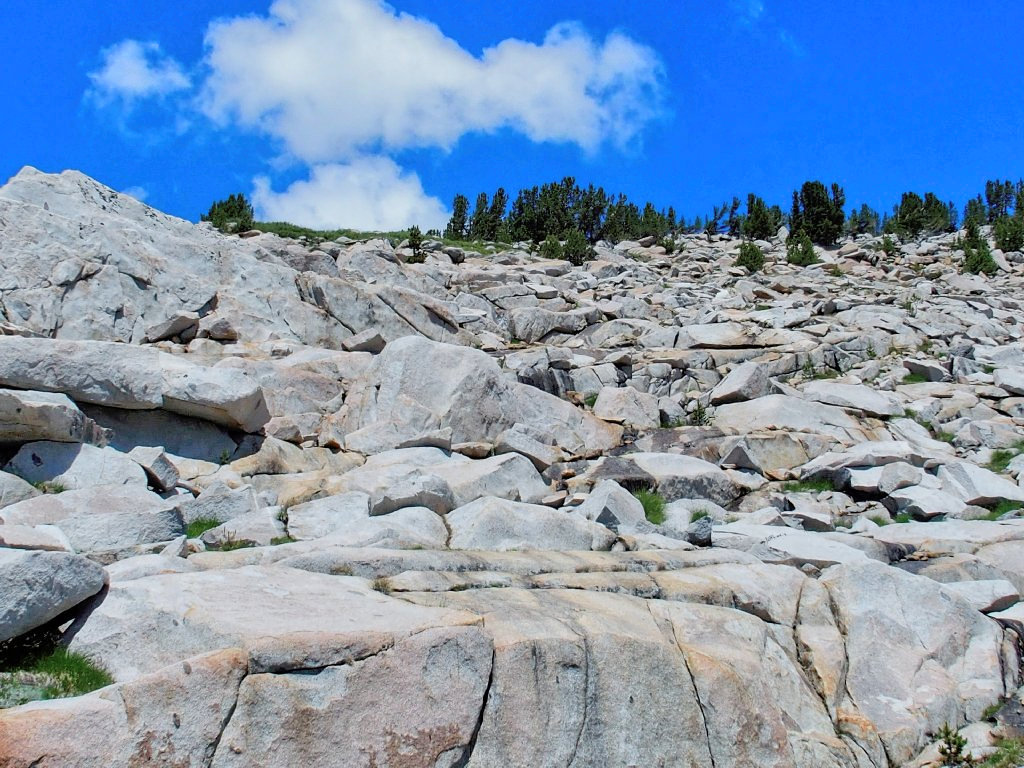
All I can see nearby is a lot of scree; but it doesn't look too bad, so I take the plunge.
Forging ahead across the loose rock
The scenery continues to improve
This is better. I'll go around to the right
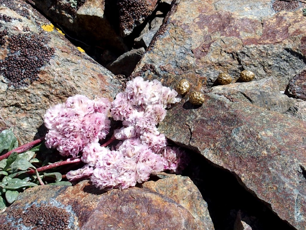
Pussy Paws and some gold nuggets
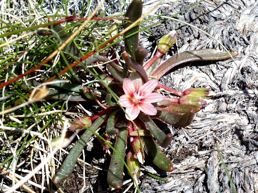
My first Alpine Lewisia
Three deer ahead are monitoring my activity, mostly because I am heading directly toward them.
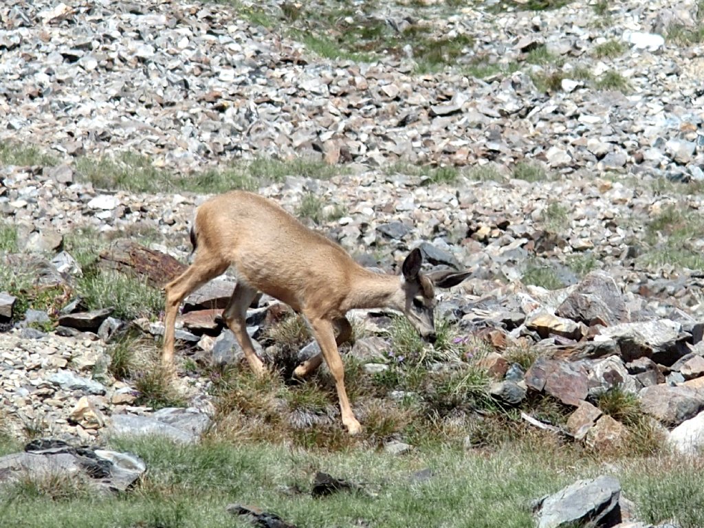
"I'll go somewhere else"
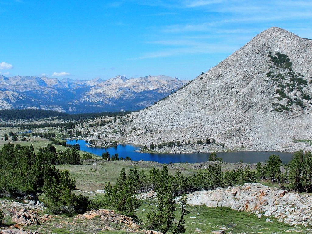
Atop the next rise is unexpectedly and unequivocally one of the finest vistas I ever saw. Oh, my!
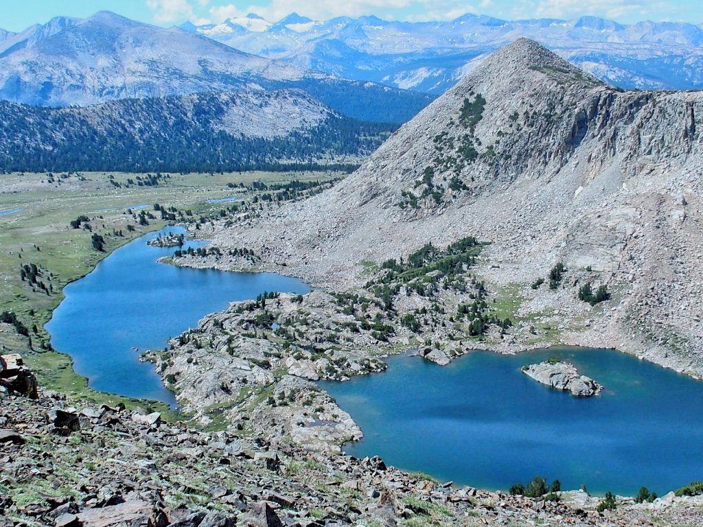
This is why I go hiking
Pshaw. My camera lens isn't wide enough for the best shot. I really should back up on the scree slope so as to capture the entirety of Upper Granite Lake, and more of the sky as well. Oh well, other opportunities will present themselves; meanwhile, there are more views to focus on, to the east:
Ellery Lake
Saddlebag Lake
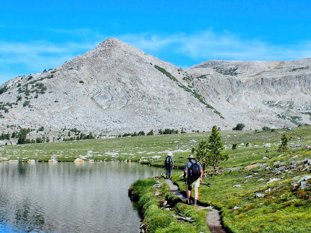
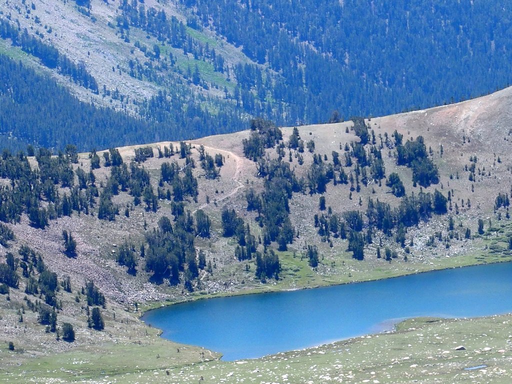
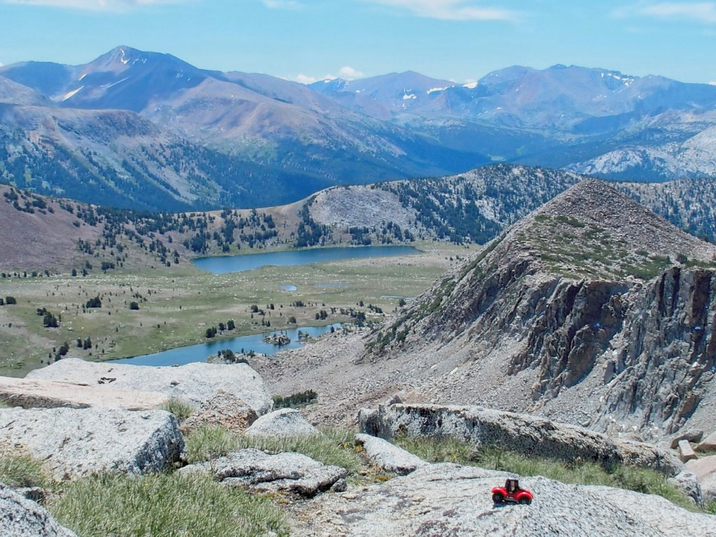
Continuing westward along the top of the cliff provides an increasingly attractive angle of view. Middle Gaylor is in the scene now.
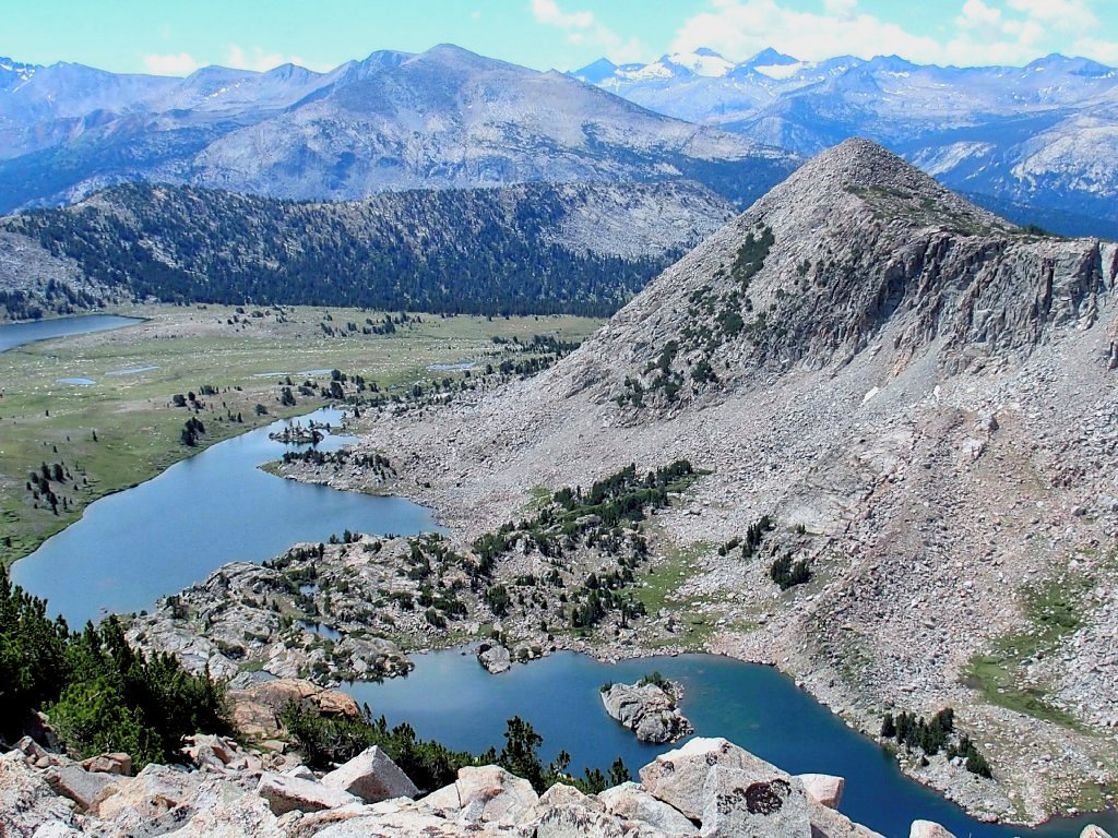
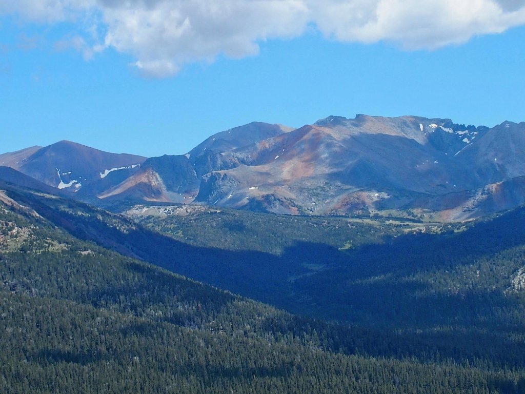
Mount Lyell and its big glacier overlook the entire park
The far end of Lower Granite Lake
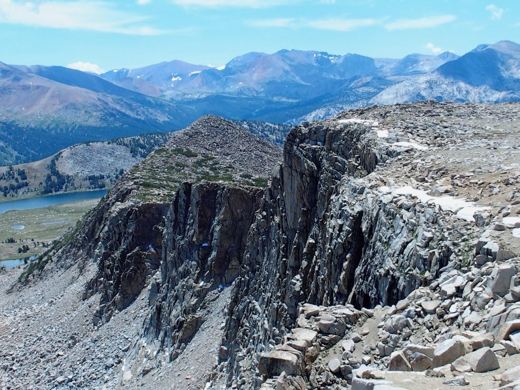
Tioga Pass is just over that hump
I hope it will be easy walking behind that wall
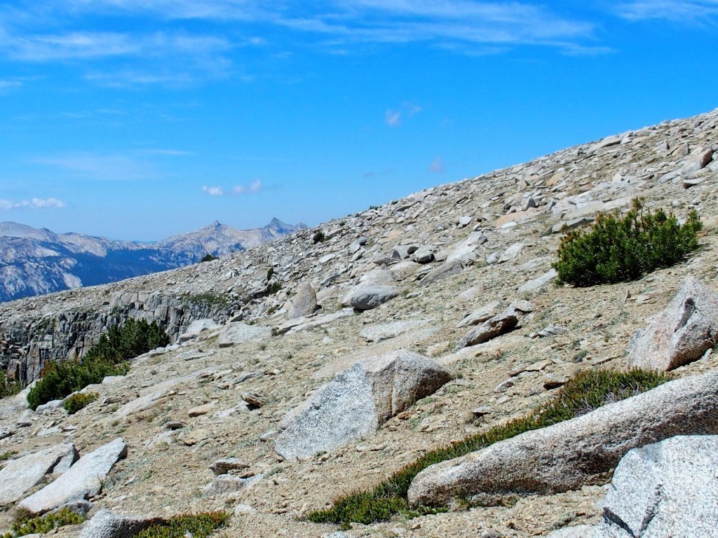
Proceeding from here looks problematical, for I can see little ahead except boulders. It looks awful, but wait! For much of the way, there is just enough grass between the big rocks to enable a relatively effortless passage. This is great! Once I reach that clump of trees, the going becomes even easier yet.
Easier than it looks
It's a cakewalk from here
Having made it over to the far cliff, I pause to reflect upon my good fortune. This is a good time to take a break and try a phone call to my sweetie at home, and it works! My AT&T service inexplicably doesn't work at all in Lee Vining, so I must come up here instead. Go figure.
Tears well up as I attempt to describe the beauty of this place to my bride. Being able to talk to her like this from such a remote location always is most enjoyable. Anytime that My Barbara is expected to be at home during a hike, I pack a phone.
The route behind
The route ahead
I can just make out a few hikers standing on the summit of Mount Dana, which is four miles distant:
It's still on my bucket list ⇔
On the side of the mountain I can barely make out a portion of the use trail:
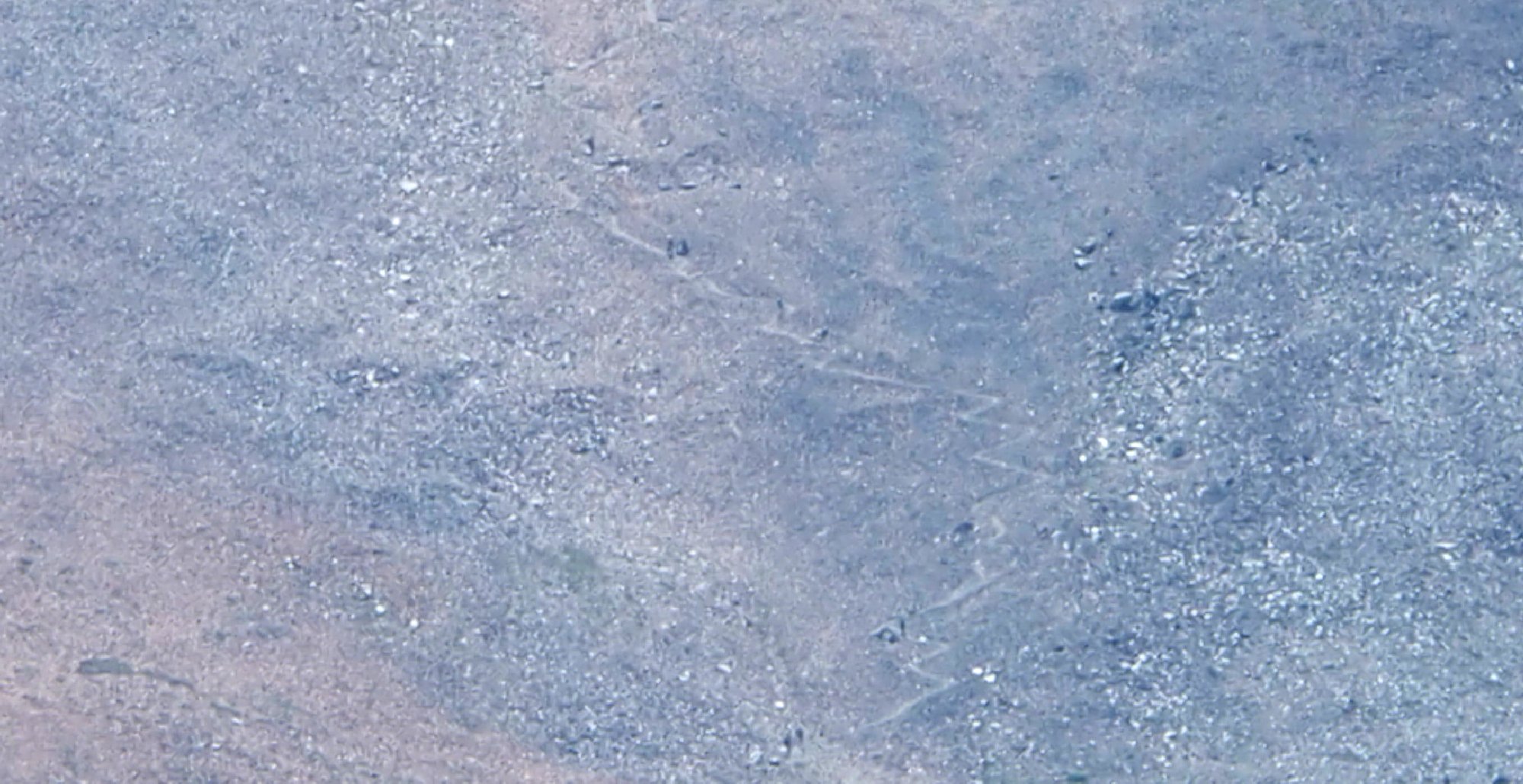
There are half a dozen hikers on that stretch ⇔
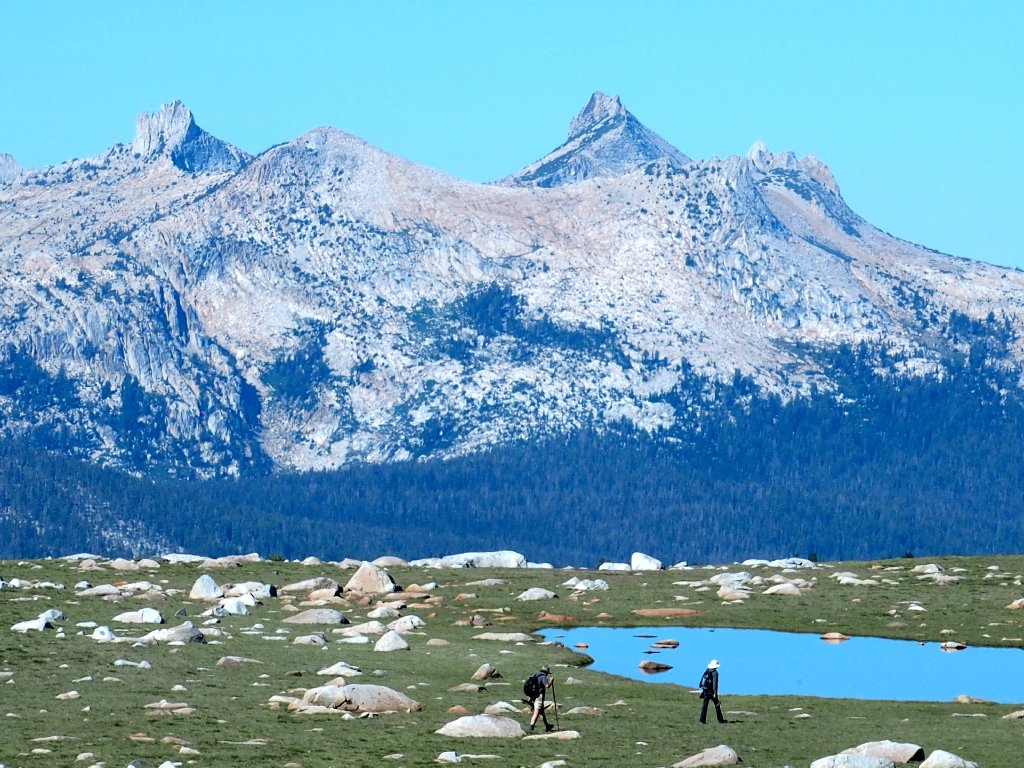
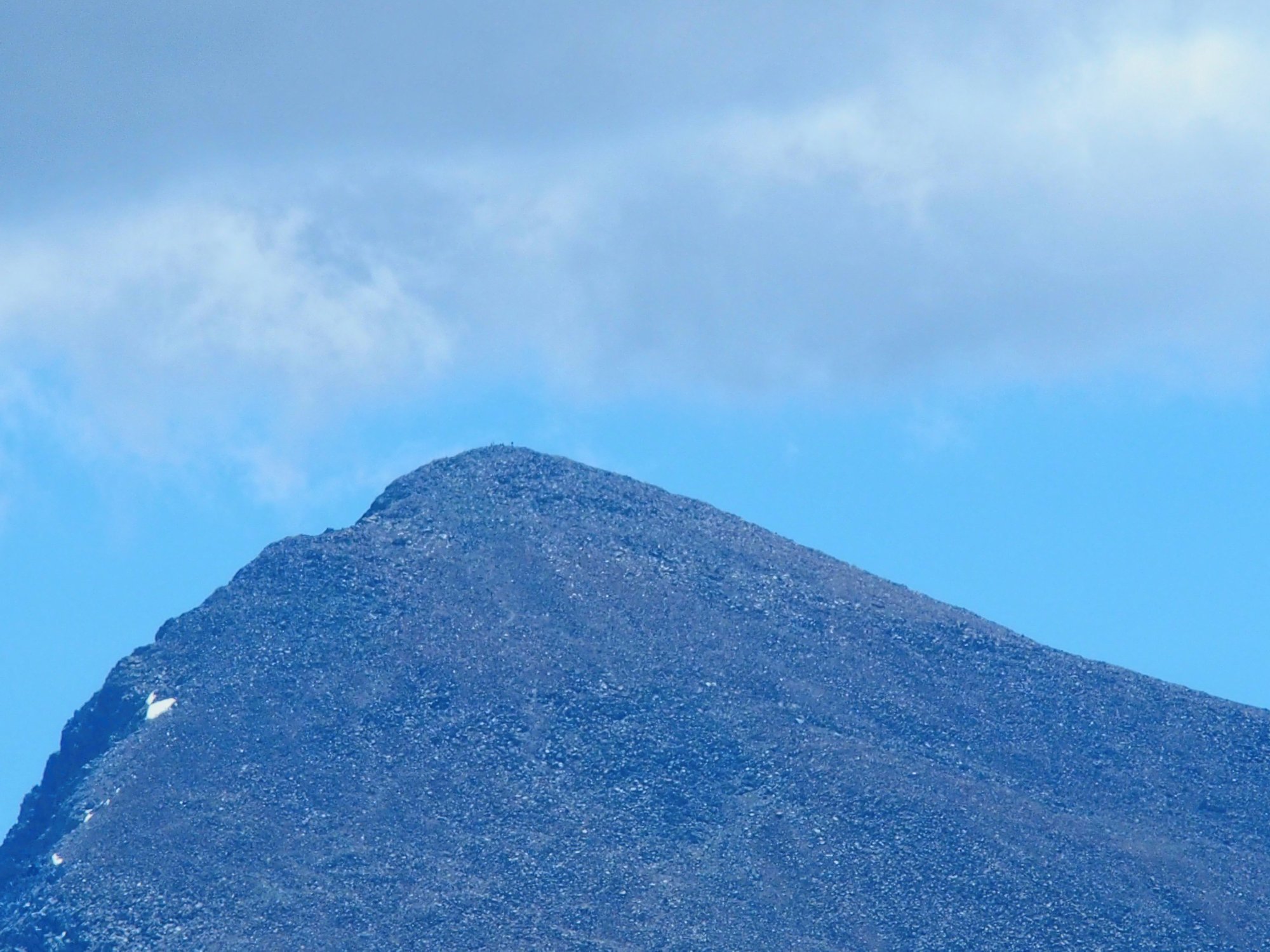
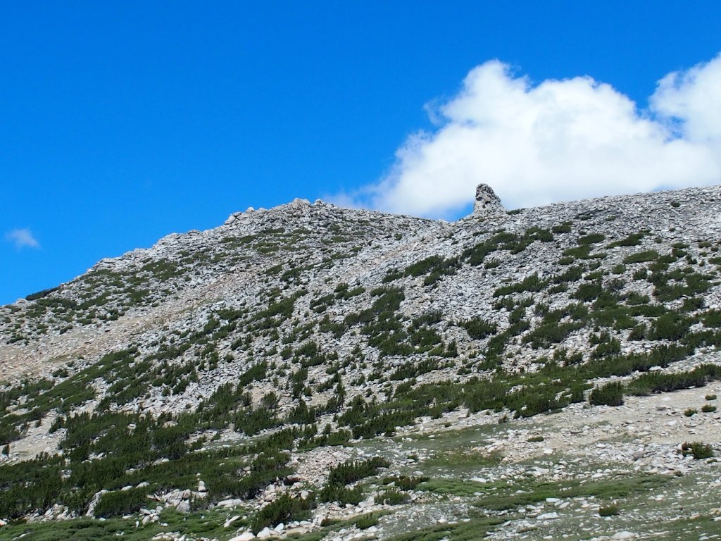
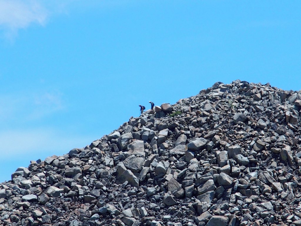
Hello! What's this? The camera crew has arrived!
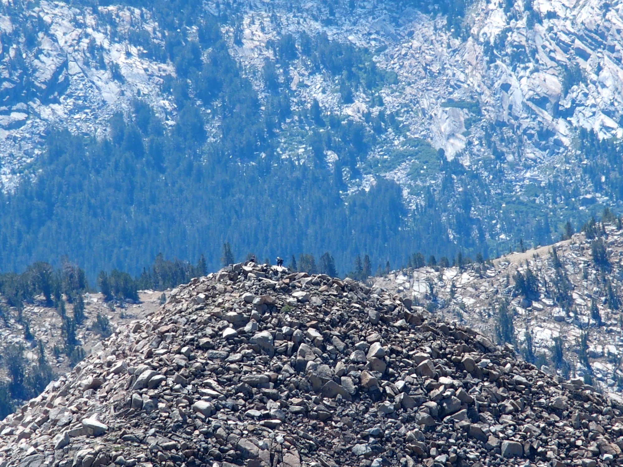
On the summit of Peak 11091 ⇔
I cannot see the two of them very well, because they are a mile
away. Also, this new camera has only a 10× zoom, which is
somewhat limiting. My other hiking unit stretches to 24×.
That prominence is deserving of a name. To commemorate the current activity over there, I'll call it Panorama Peak.
There is a bit of snow over here
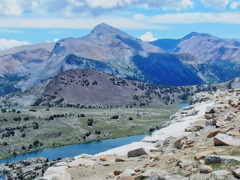
A study in color, with brownish-purple Gaylor Peak in the middle
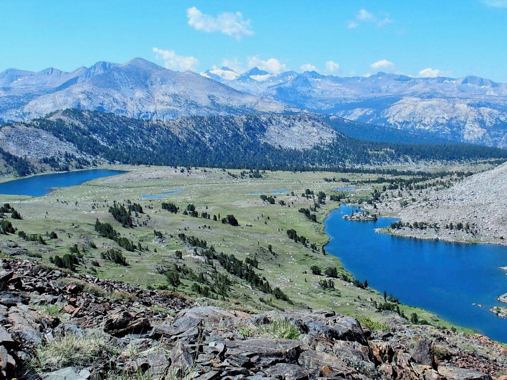
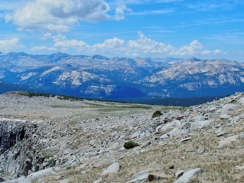
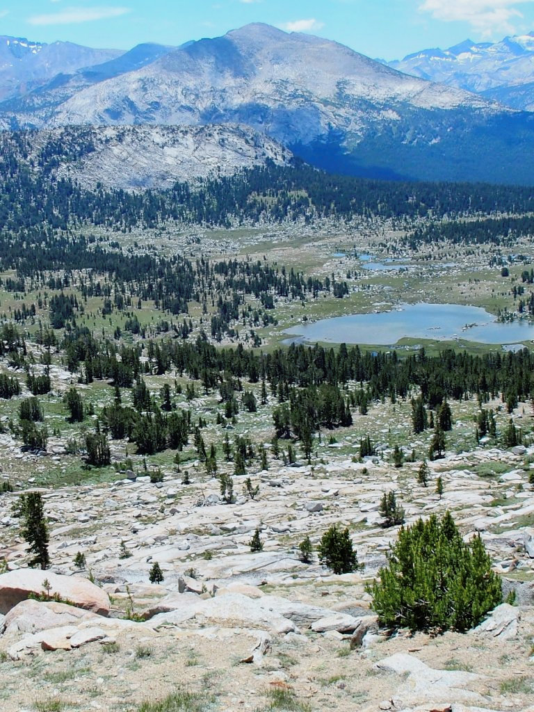
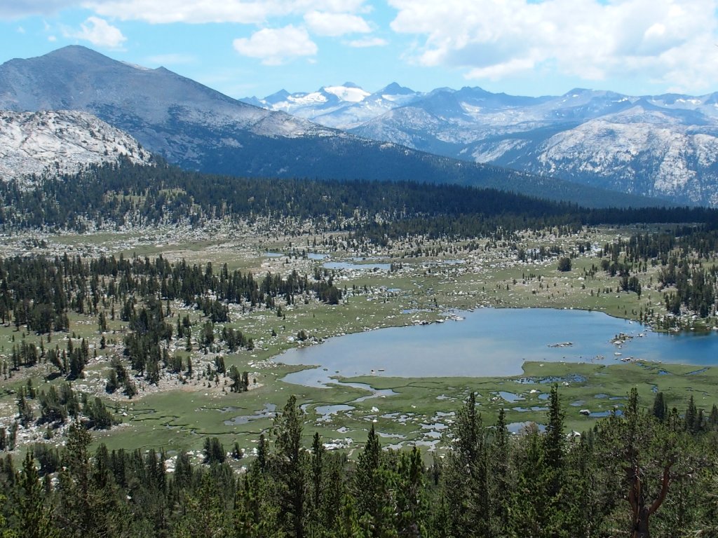
After a couple more cliff-side photos, I head southwest down the path of least resistance. Now for the first time I can see down into Tuolumne Meadows. Wow! You won't find this scene in the park literature, nor probably anywhere else for that matter:
Lembert Dome almost shimmers underneath the Cathedral Range
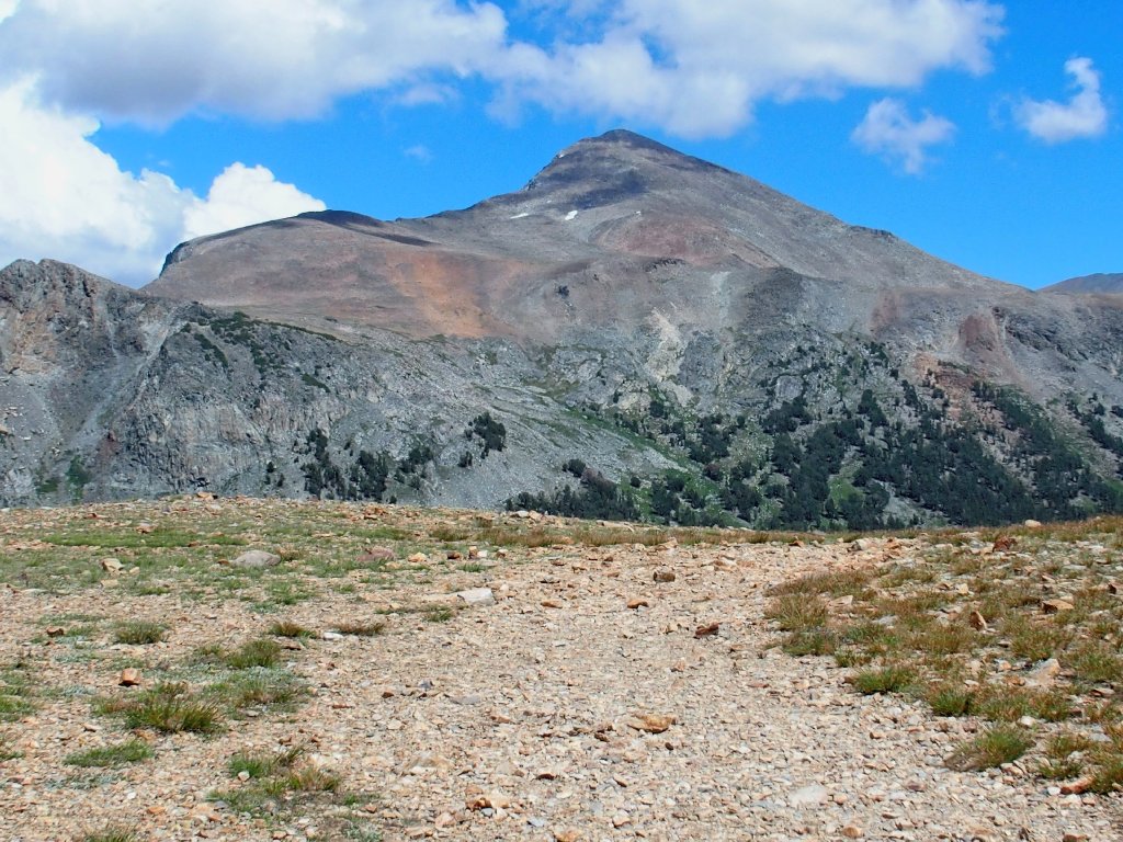
I climbed that dome just yesterday. I believe that I will not pursue
a quest for the summit of False White Mountain (Peak 12002) today,
however. It's only another mile and another 600 feet up, but I have
gone essentially the wrong way and the hard way since leaving Upper Gaylor
Lake. In any case, I have gotten more than my money's worth already,
and there is plenty of work yet to do.
False White Mountain is behind that hill somewhere
Keeping to the west of a rocky prominence, I am able to descend about
400 feet on gentle slopes to a point where my near future becomes more clear.
The valley is a thousand feet farther down
From here, Panorama Peak is in view again, and it's much closer than before. The guys are still up there, doing their thing:
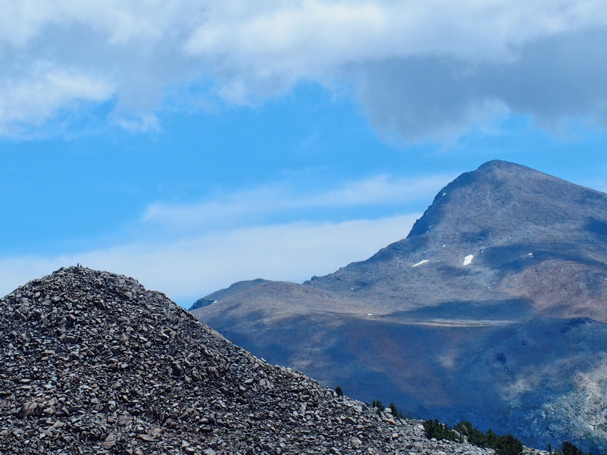
They're gazing at the ubiquitous Mount Dana, no doubt ⇔
As I stand here watching, Chuck and Bob coincidentally finish their business and start down through the horrid boulder patch. I don't know just what route they will take, but perhaps we will meet up later after all.
Zooming in from four-tenths of a mile away
Descending this array of slabs and grasses is delightful as I pick and choose the best routes, rarely needing to negotiate a dropoff or even a big step.
Some running water would make this a more special place
Four hundred vertical feet later:
That was fun!
In order to maintain elevation, it would be necessary to traverse eastward from here across a steep slope; but the going looks so difficult that I quickly abandon the notion. Besides, I am rather tired. I'll just head for the bottom of the hill and get the rough stuff behind me.
Lower Gaylor Lake still is 600 feet down
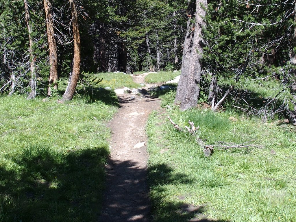
The remainder of the downhill is forested and, because I am so weary, tedious. When I reach the meadow after this arduous descent, I sink to my knees in gratitude and mild exhaustion.
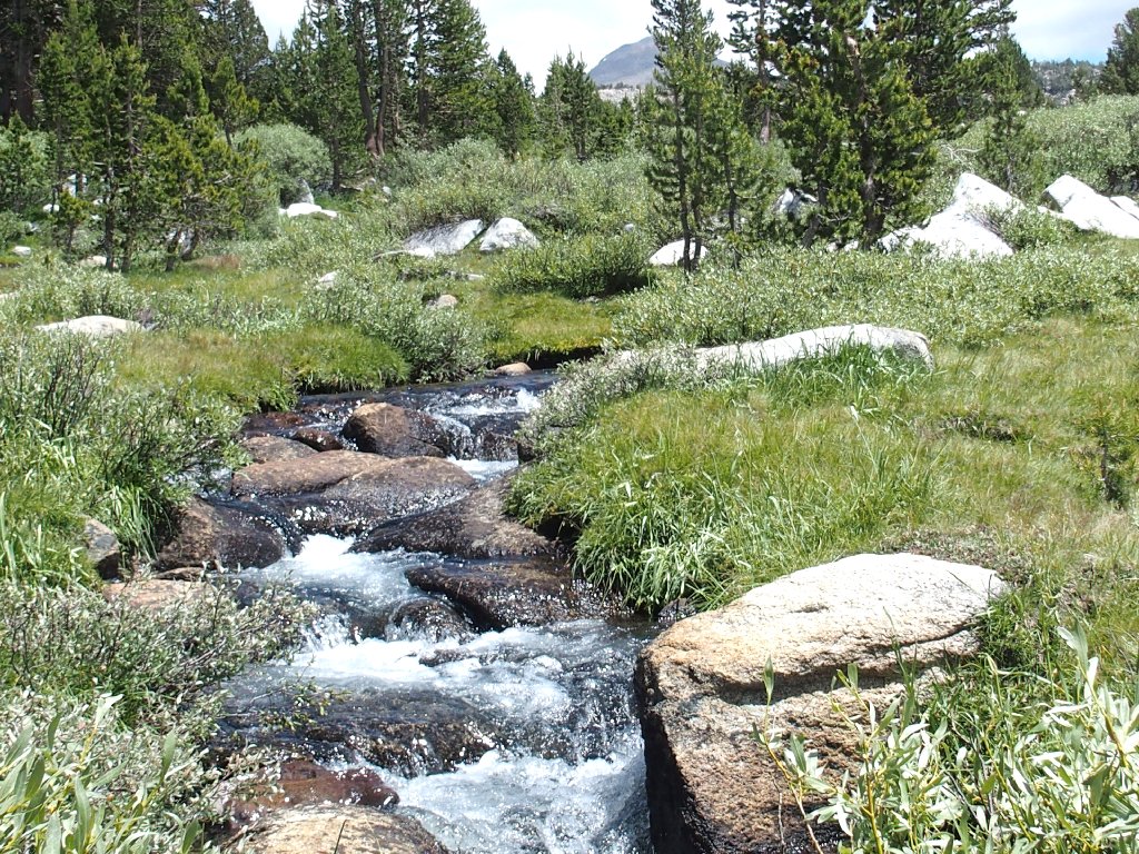
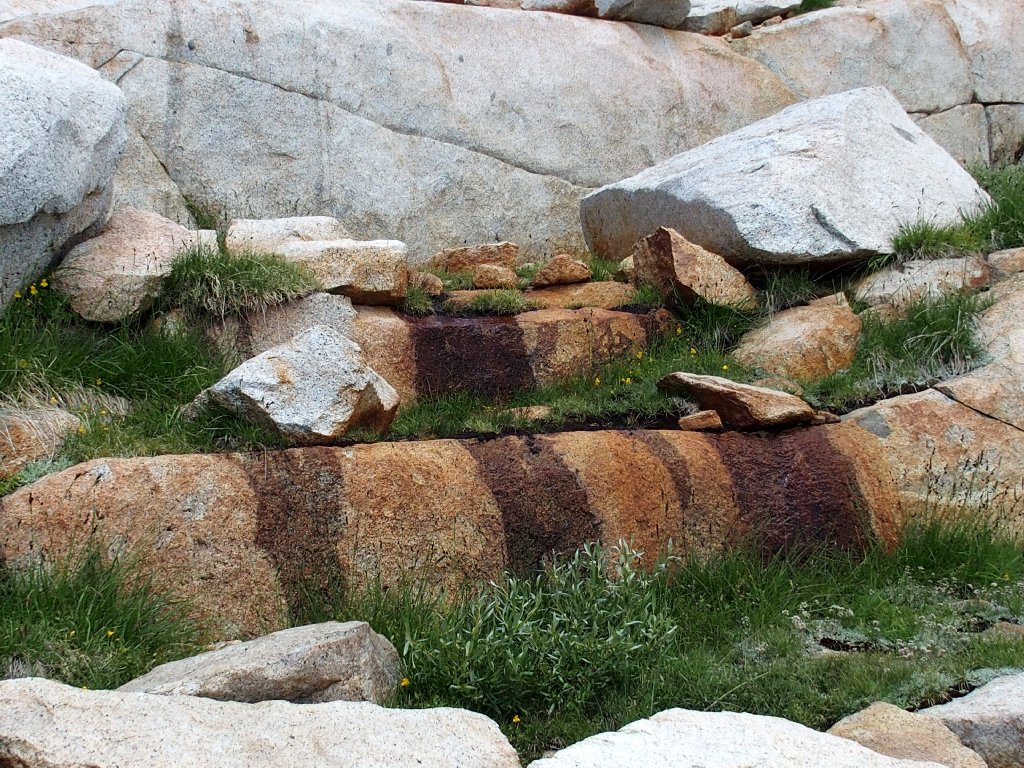
Granite Creek, I presume
Perhaps if I simply wait here, someone will come and get me. No? Well, at least I know what to expect now, because I have been here before. It's time to don my Walkman and listen to some music to relieve the tedium of the upcoming meadow crossing that will gain back three hundred feet.
It is three-quarters of a mile to the next lake
It does indeed look pretty rough over there on the side of that mountain. I have no idea as to whether Bob and Chuck are behind me or in front of me.
Scaling that peak is not for everyone
As I approach Middle Gaylor, a woman is trying to prop up her camera on a rock. I offer to take a picture of the pair. The couple is staying somewhere in Yosemite Valley. Tomorrow they plan to do the Mist Trail to Vernal Fall and Nevada Fall, which of course I heartily recommend, because it is my favorite hike.
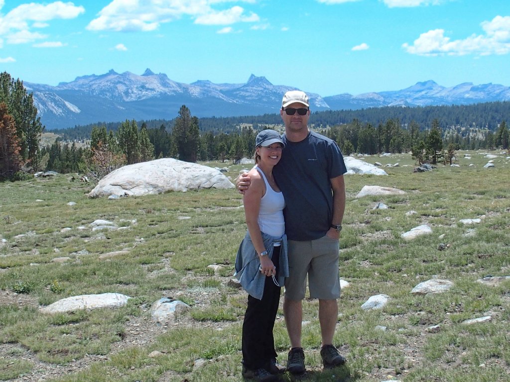
Darlene and Jeff from Toronto
Before I head up the dreaded final hill, I must capture a little panorama of my own at Middle Gaylor:
Johnson Peak, Cockscomb, Unicorn Peak, Tresidder Peak, and Cathedral Peak
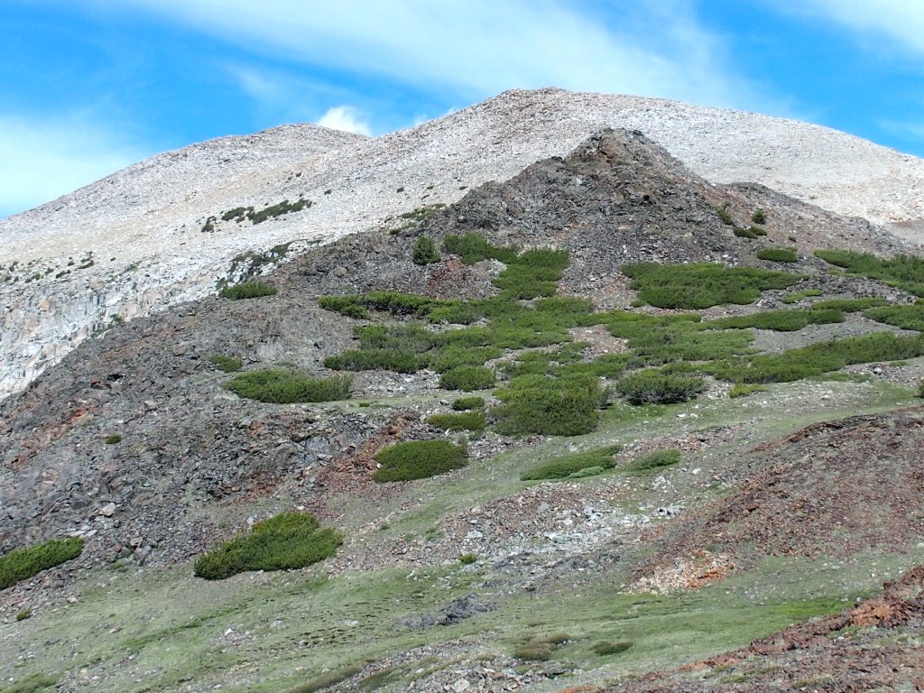
Like it or not, there is one more hill to climb.
Only 200 feet to go
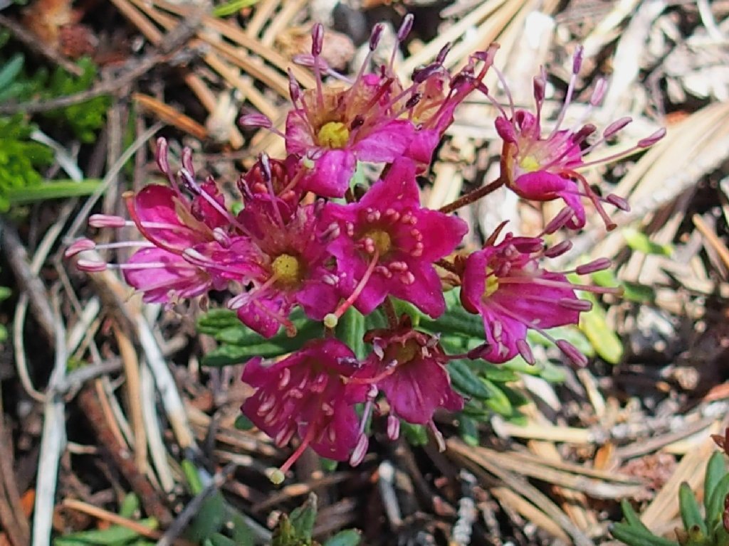
Red Heather is a good reason to stop
The mountain looks almost friendly now
At the top of the saddle, as I sit on the ground with my tongue hanging out, a woman hiker asks whether I have enough water. I smile and assure her that I do.
Tioga Lake still is 600 feet down.
Déjà vu.
With music in my ears, I endure the steep final downhill; but it's okay, because I am nearing the endpoint.
The Kuna Crest to the south
At the parking lot, the group of six youngsters is just returning from Mount Dana. I walked farther today, but they climbed a lot higher. Chuck and Bob have not yet returned; their vehicle is still here. Either they found something else to do, or their return trek was difficult. This outing took me seven hours.
Nearing the trailhead
§: Although I did not accomplish everything in the original plan,
it really doesn't matter. I could not recommend this adventure more
highly. In particular, the cliff-side view of the Granite Lakes
and Panorama Peak is exceptional.
With a map in hand, I would have visited the Great Sierra Mine, and I might even have gone up to False White Mountain after all; but then I would have missed out on the aforementioned grand viewpoint, which was the best part of the trek. Serendipity?
| Scenery |  |
| Difficulty |  |
| Flowers |  |
| Adventure |  |
| Solitude | |
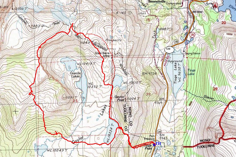
The dotted route past the mine would have been easier

ADDENDUM
Is so happens that Chuck and Bob were behind me all the while; they got back to the trailhead about half an hour after I departed. Getting off that boulder pile was a real bitch for them, especially while toting a heavy tripod in one hand. Their mission was a success, however; I already have seen a pair of beautiful productions from the summit of Panorama Peak.
