
Lake Tahoe Nevada State Park
|
Marlette Lake Lake Tahoe Nevada State Park |
October 16, 2013
Today's trailhead is at Spooner Lake State Park, located on SR-28
which runs up and down the eastern side of Lake Tahoe. Having not
planned well, I lack sufficient cash for the ten-dollar entrance
fee at the self-pay kiosk; so I park a quarter of a mile away and
climb over a fence onto the grounds in order to save some walking distance.

I'm not cheap – just cash-poor
This is a very nice little park, with helpful signs and informative walks
all around. The public restroom is even heated, and it's only
42 degrees out at the moment.


I spot a big van dumping off a gang of mountain bikers and their equipment. This is the standard starting point for traversing the immensely popular Flume Trail that runs between the Marlette Lake Dam and Incline Village to the north.

The road is the trail
Off to my left is an old cabin. As indicated on the signpost, it still is used by hikers and skiers alike.

⇔

At the three-quarter-mile mark is a junction. A hikers-only
option veers to the left; I'll take that one.

The well-maintained duff trail is easy on the feet, and the gradient is mild.


Criss-cross Contrails

Wheel tracks from maintenance equipment?
The Tahoe Rim Trail runs along the top of the distant ridge. I must explore up there sometime as well.


After more than four miles of slogging through the forest, the destination
finally comes into view. This is good because, having not seen a soul
since departing the trailhead, I am hoping for a little closure.
From here, it's a 300-foot drop to the lake shore.

Marlette Lake appears
Having resided within forty miles of this lake for more than forty years, this nevertheless is my first visit here. Go figure.


A recent dusting of snow has left its mark
An interesting promontory juts out from the right-hand shore; I must check it out.

Rocky Point and Marlette Peak
I had saved this walk for late in the season in order to take advantage of the fall color, which has not disappointed me.
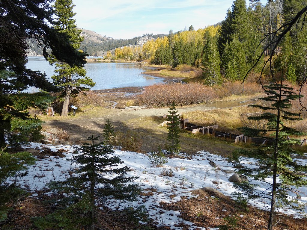
What a nice scene
Originally named Lake Goodwin, this body was named after Seneca Hunt
Marlette, the first Surveyor General of Nevada. Marlette also
collaborated in the development of a huge lumber company and a system for
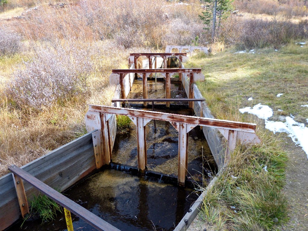
supplying water to the Comstock mining region. At present, the
Marlette-Hobart Water Supply system continues to feed Carson City,
and it is the sole source of water for Virginia City. The first dam
was constructed in 1863; since then, it has been enlarged three times.

⇔
Because the watershed for this lake is only about three square miles in size, it is no wonder that the water level is so low at the moment.

There is big grove of aspens over by that promontory; it seems right to head over there for some photos. A portion of the roadway is covered with some sort of webbing, presumably to make it passable when wet. Ice has formed on the artificial material.


This roadway is most interesting
Approaching the outcropping, I learn that it is the actual center of local attraction.

A road runs right out to the area named Rocky Point. Besides being quite scenic, there is some historical stuff out here in the middle of the lake.


⇔
The aspens are doing their thing for me, so I accommodate them with a number of photos.

Two bikers join me on Rocky Point


A great lunch spot
After lounging for half an hour, it is time to depart. Rather than return on the hikers' trail, I opt to follow the road back. Maybe I'll meet more people that way.


There is plenty of time for listening to music on this route
It is nearly a five-mile return trek. I do encounter a handful of bikers, plus as many walkers. At trail's end I veer left for a first look at this little park's centerpiece:

Spooner Lake
Continuing along the lake shore, eventually it is necessary to scramble up a steep, slippery, and tiring highway embankment. When I finally clamber over the guard rail, I find that the car is directly across the street.

Shortcutting back to the car
§: Within the first mile, I no longer needed a sweatshirt
except for a brief time at the trail high-point. Although
the fall color provided some nice scenery, I probably would have enjoyed
this hike more when everything was green and the wildflowers were
blooming. Despite the park signposts' admonishments of "moderate
difficulty", this was the easiest 10-miler that I have done.
The next time I visit here, I'll double the entry-fee; this park deserves it.
| Scenery |  |
| Difficulty |  |
| Personality | |
| Solitude |  |

