
Parque Nacional los Glaciares
|
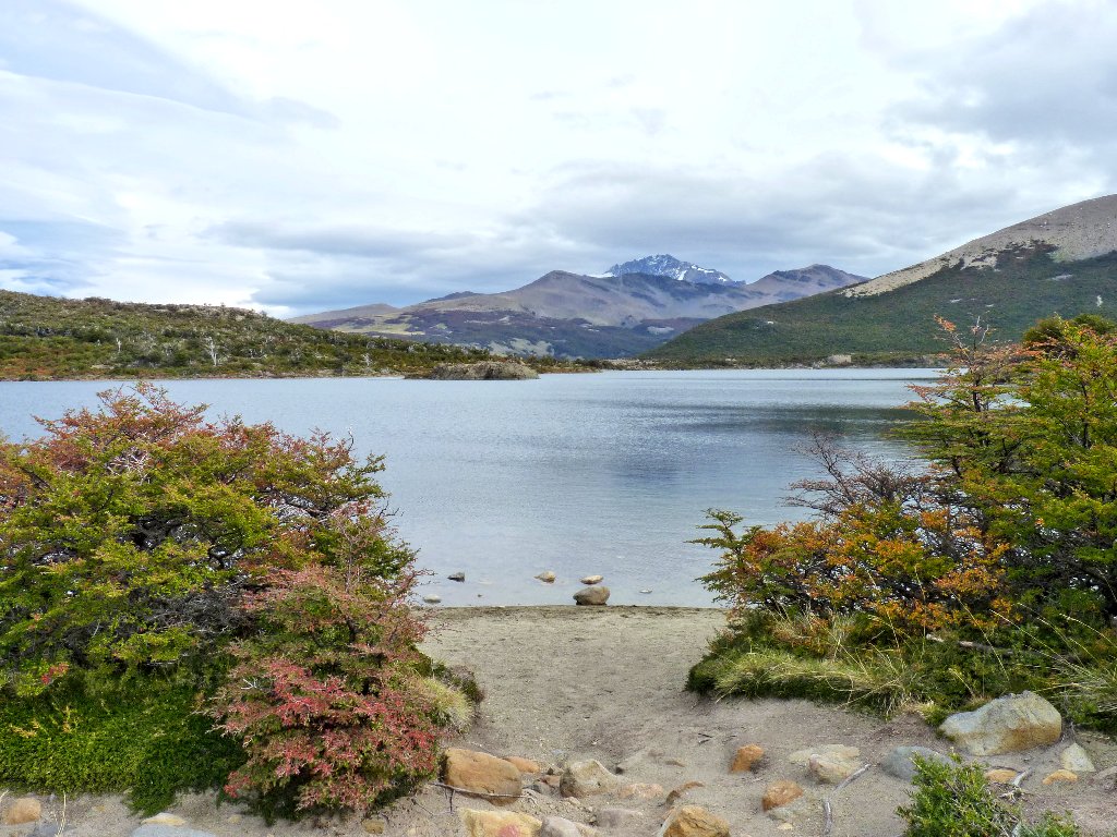
Lago de los Tres Parque Nacional los Glaciares |
March 26, 2012
Well, this is the big day — the one I have greatly anticipated, and the one of which I am somewhat apprehensive. Although it might not seem like so much to (younger) veteran hikers, today's 16+ miles will be more than I have covered previously in a day, and the requisite 2,500 feet of ascent aren't going to make the trek any easier. My great new boots have been treating me quite well, however; so I am optimistic.
As usual, the alarm clock rings at 7 a.m. As usual, David heads for the shower to do his thing; whereas I just throw on my boots and I'm ready to go. It is cloudy out; but there is no wind, so we are off to a reasonable start. As usual, the bus comes by our hostel at eight o'clock, just after the usual superlative sunrise.
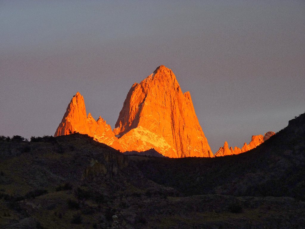
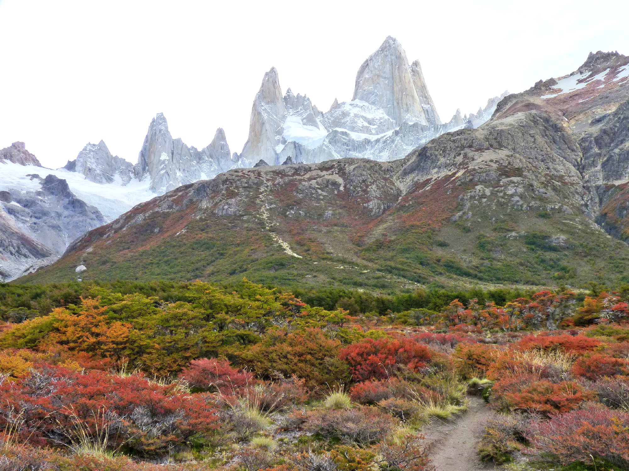
Monte Fitz Roy is glorious in the morning
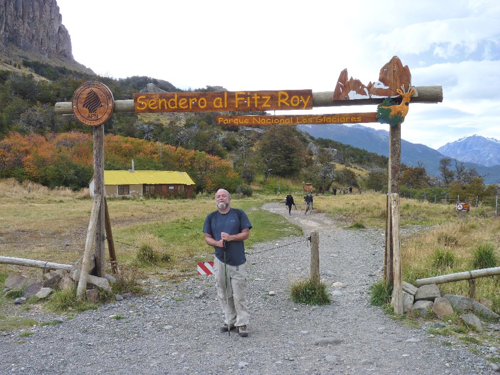
Rather than do an up-and-back, there is a way to reduce the overall distance of the walk and increase the total scenery at the same time. Our trailhead is at a fancy hostel north of town. Because everyone on the bus seems to have the same destination, we are driven all the way in to the facility. This is good.
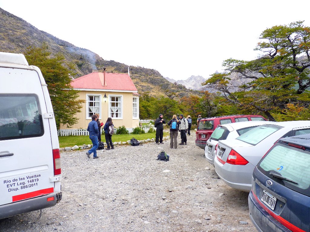
Hosteria el Pilar
Starting beside the Rio Blanco
There is no wind, which is wonderful; also, it is overcast, which is not so wonderful. Perhaps the sun will put in an appearance later.
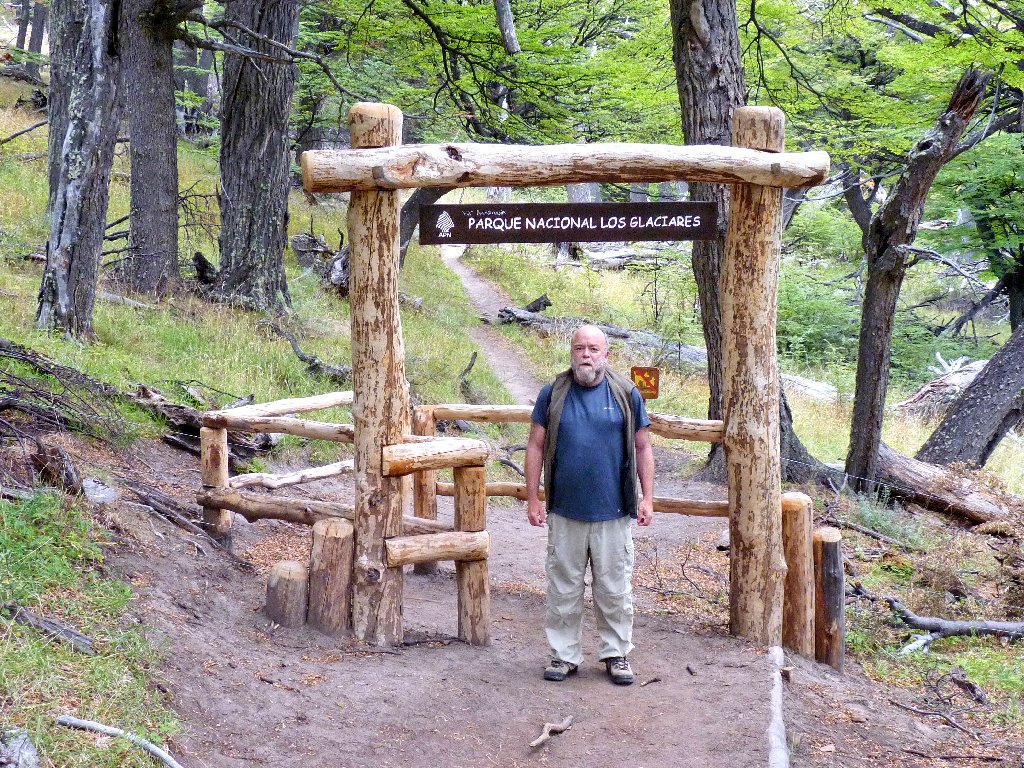
Entering the Park of the Glaciers
A group of half a dozen serious photographers is stopped at an overlook. I envy their dedication, but not their heavy equipment. At day's end my photos night not match theirs for sheer image quality, but I will have been able to cover a lot more miles without torturing my back and feet.
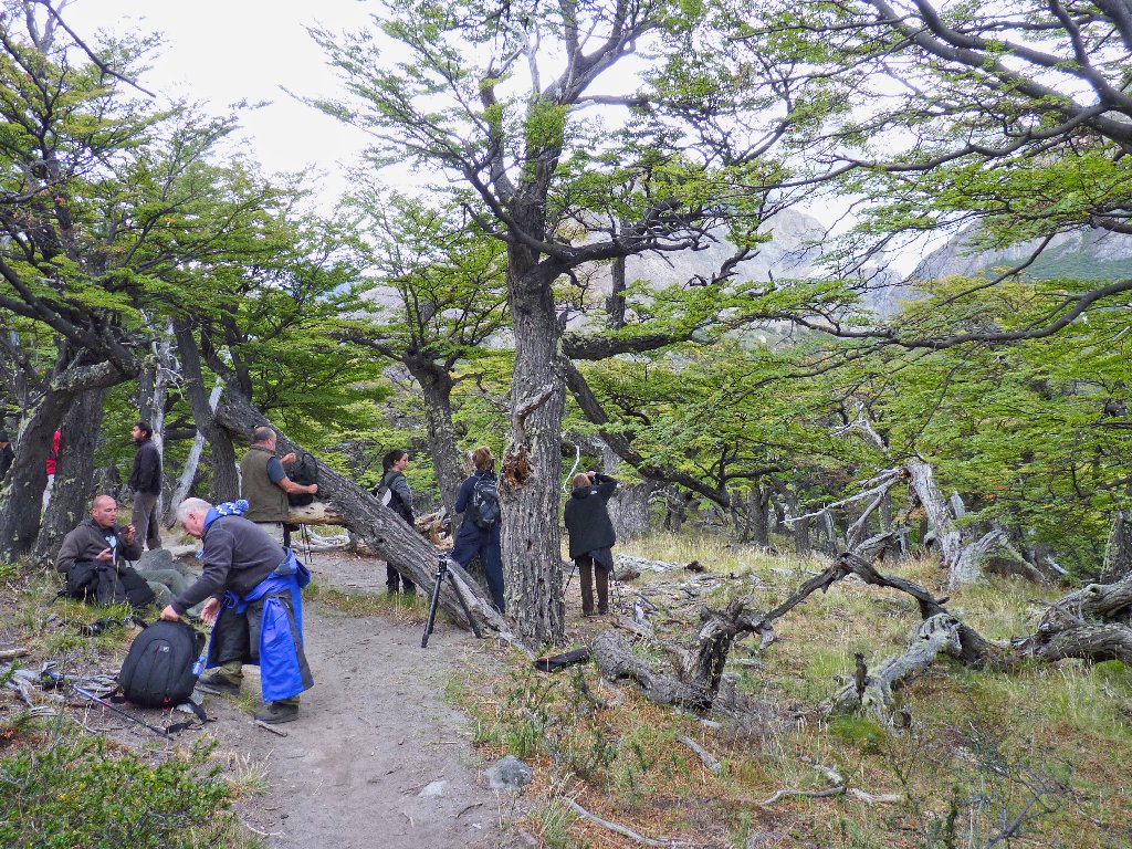
These guys are involved in a guided photography class
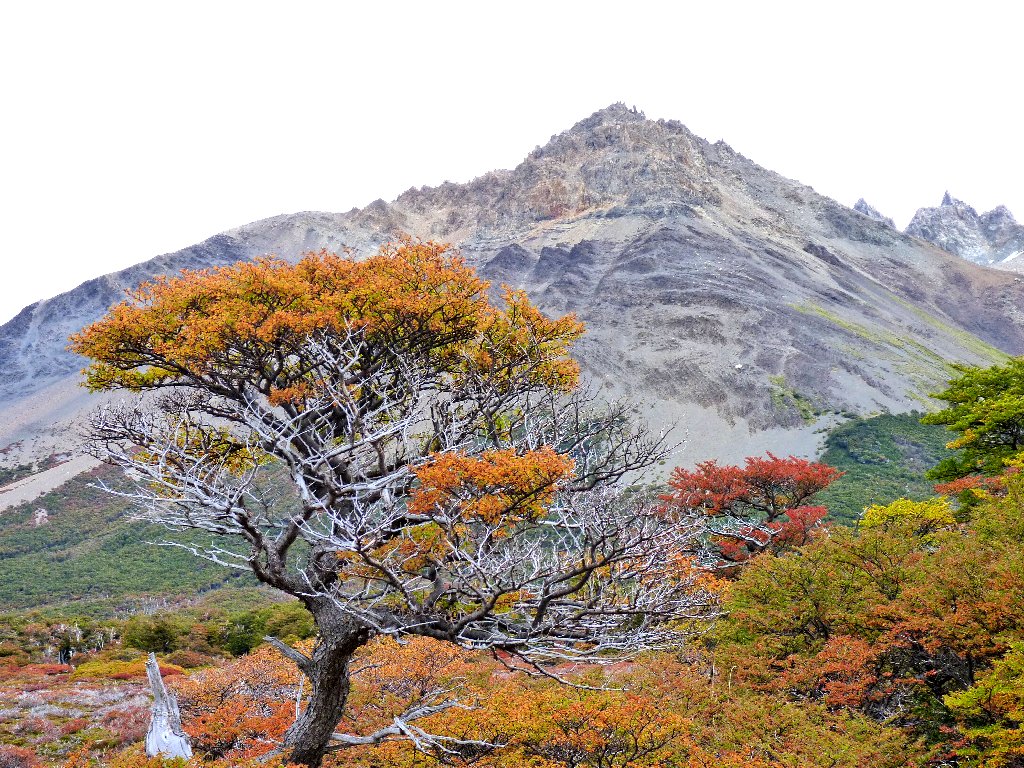
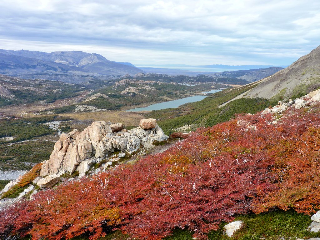
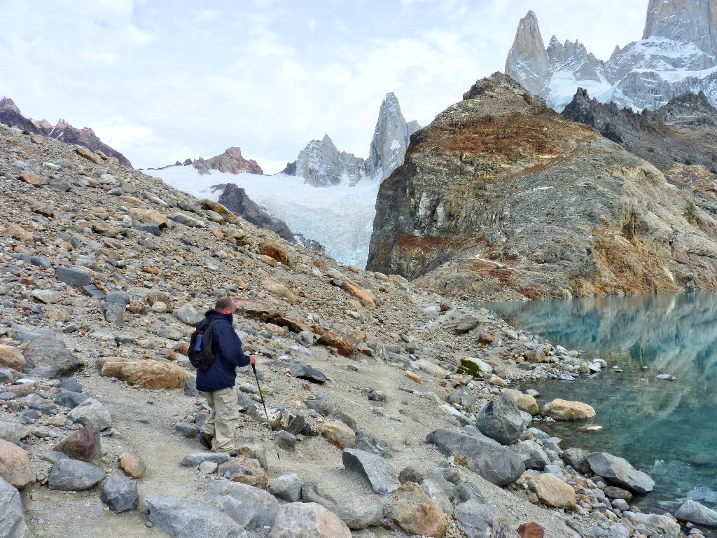
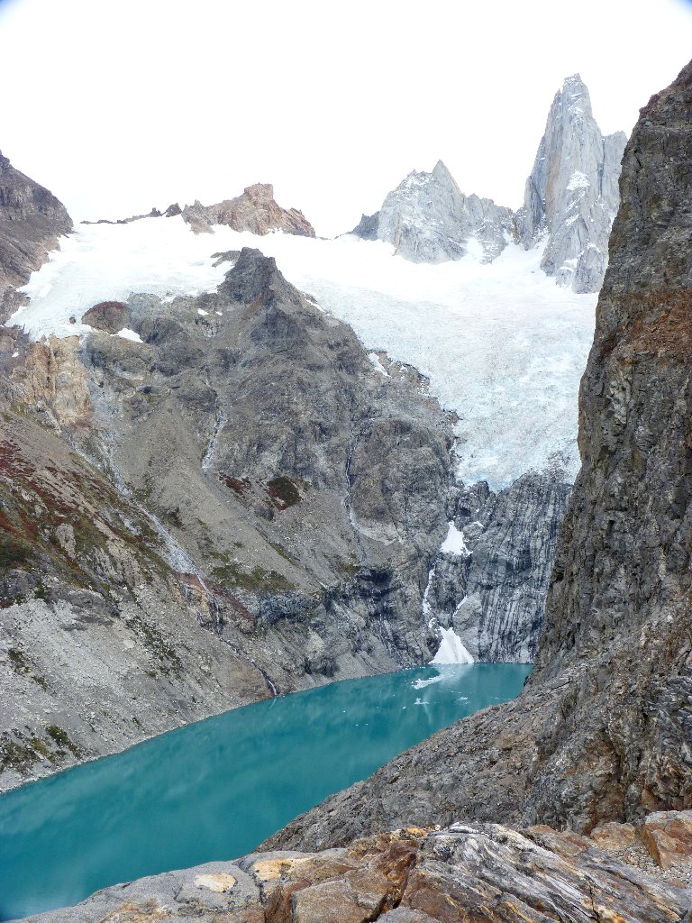
Across the canyon, a big glacier is hanging over a little lake. What an awesome sight!
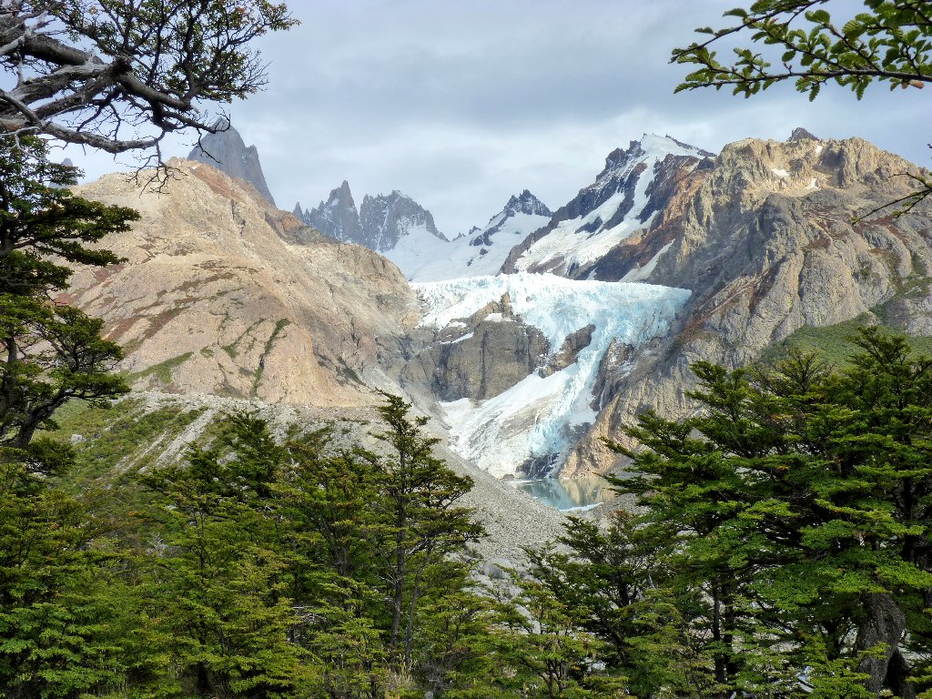
Piedras Blancas Glacier
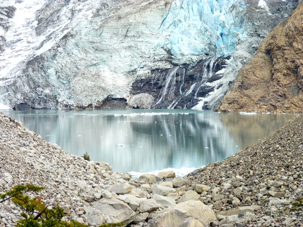
Piedras Blancas (White Rocks) Lake
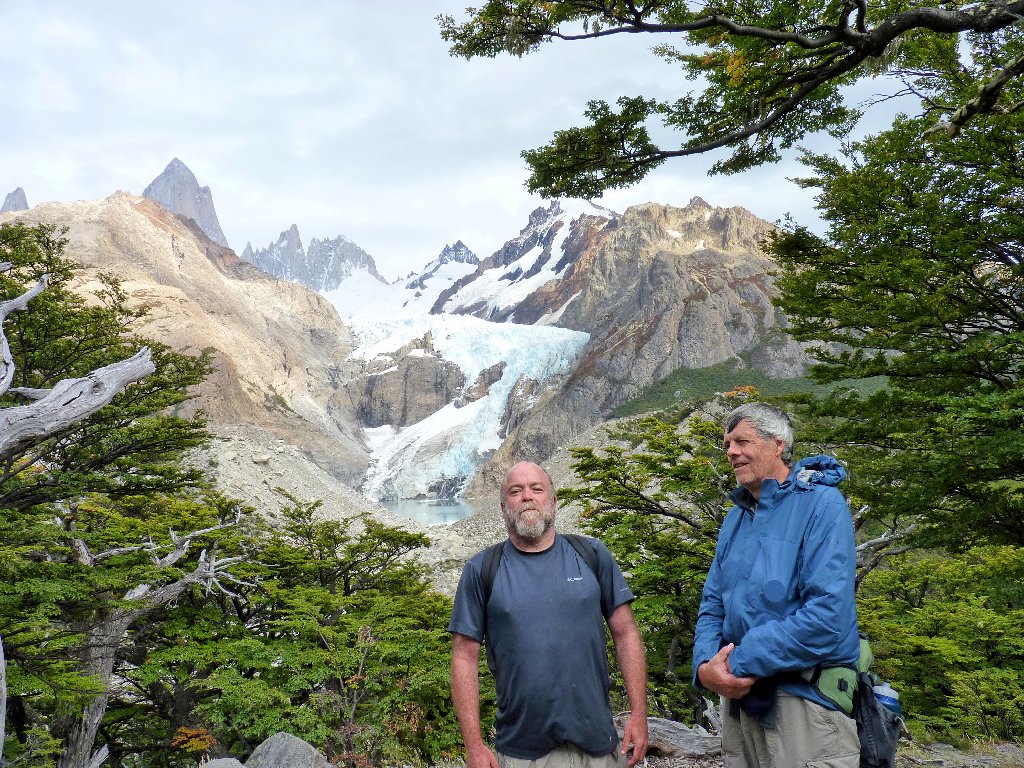
We get into the act as well
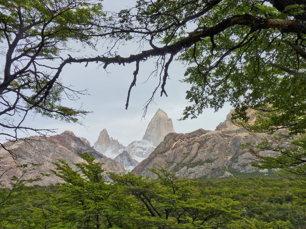
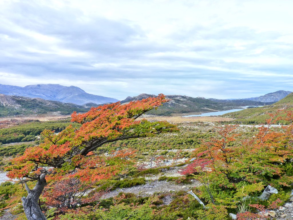
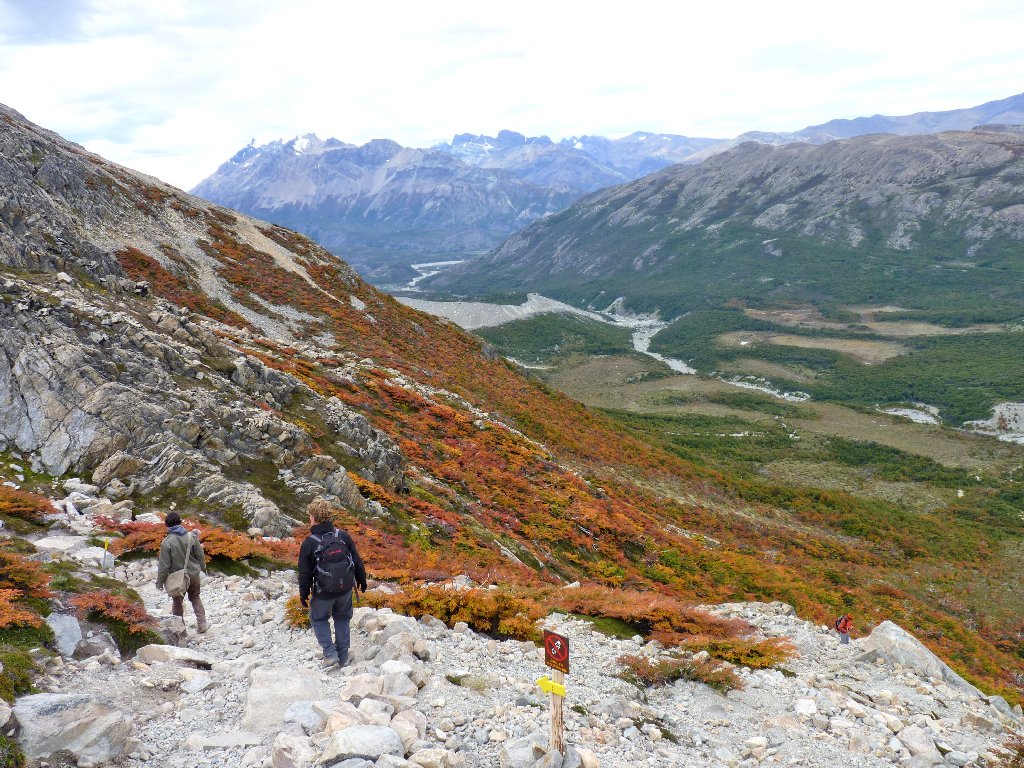
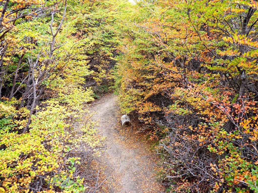
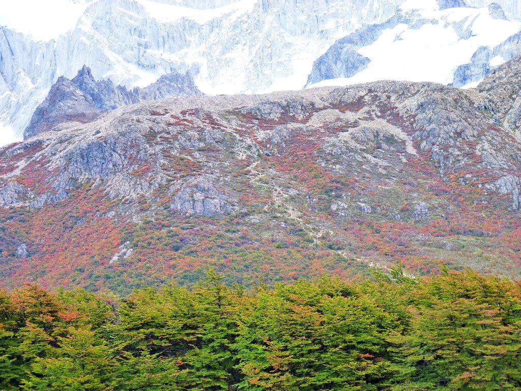
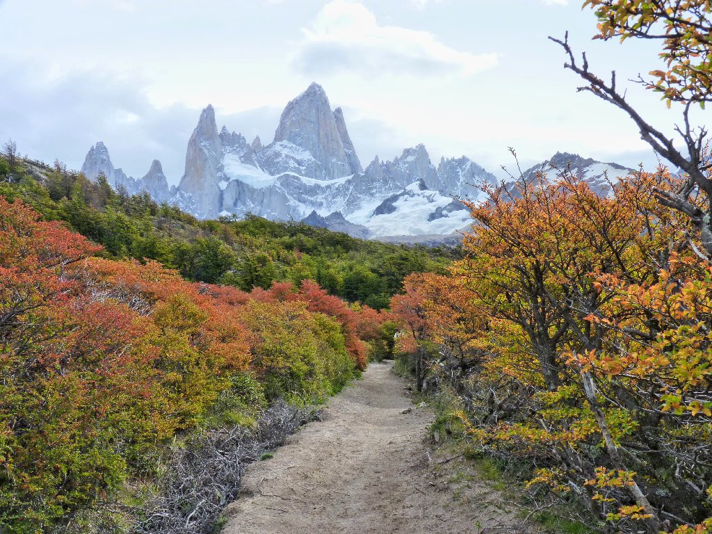
The fall foliage is outdoing itself today, making every foot of trail a delightful walking experience.
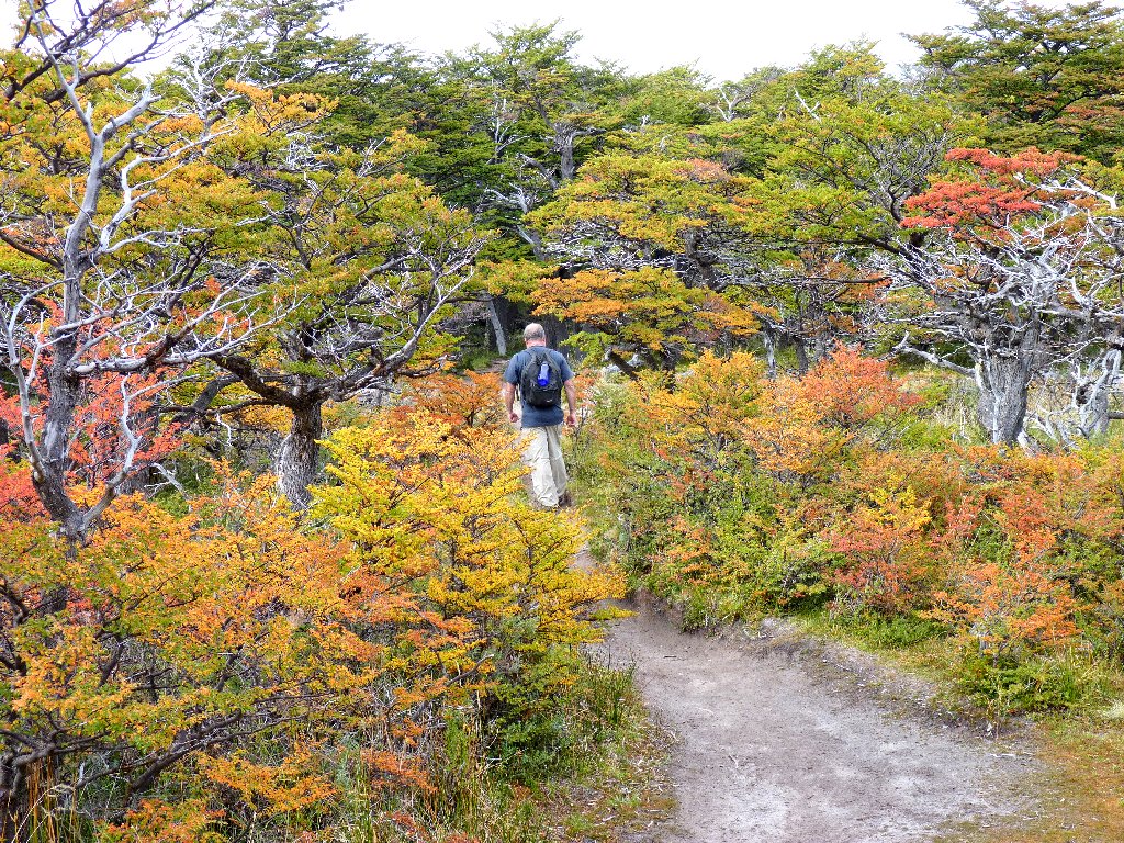
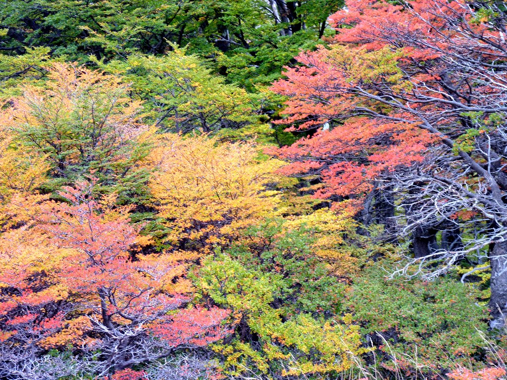
New England has nothing on this place
At a major trail junction lies a big backpackers' campground. Although David and I already have climbed about 1,200 feet, the going has been pretty easy. That is about to change. Turning westward, we head across the river toward the mountains.
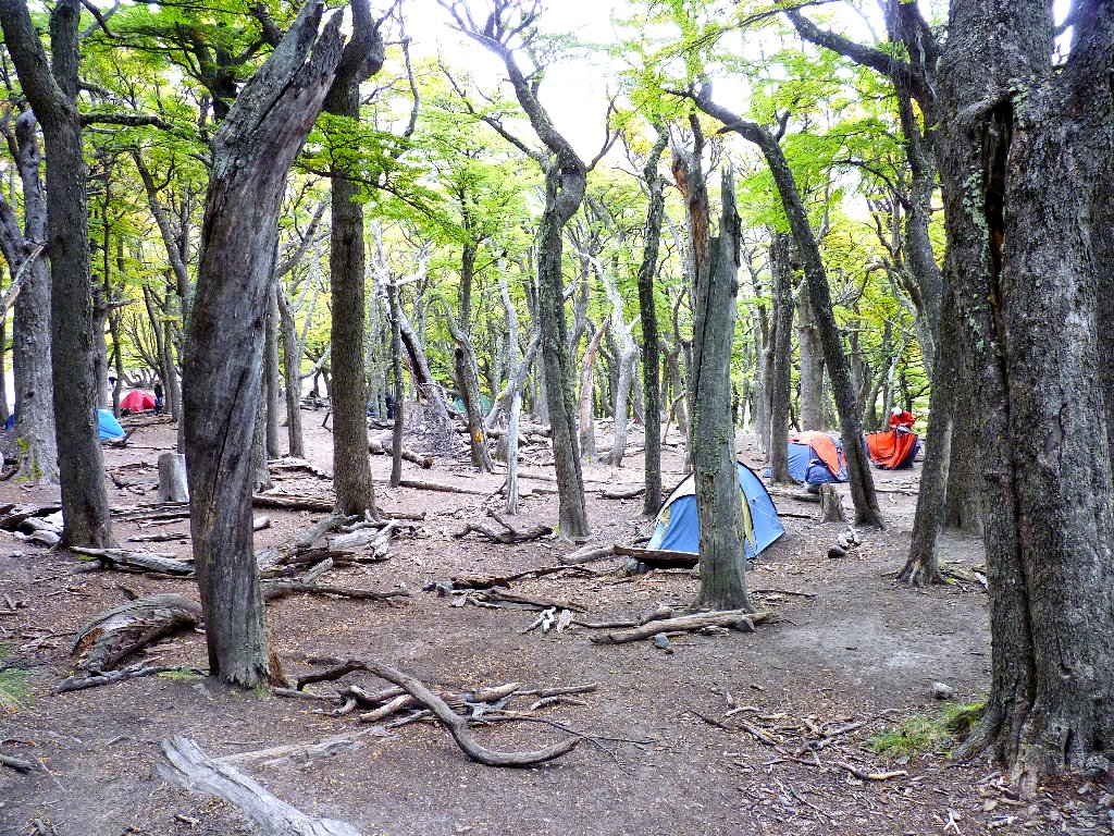
Camp Poincenot was named after an alpine climber who died nearby
At the next clearing, our near future is laid out before us:
There it is, all right ⇔
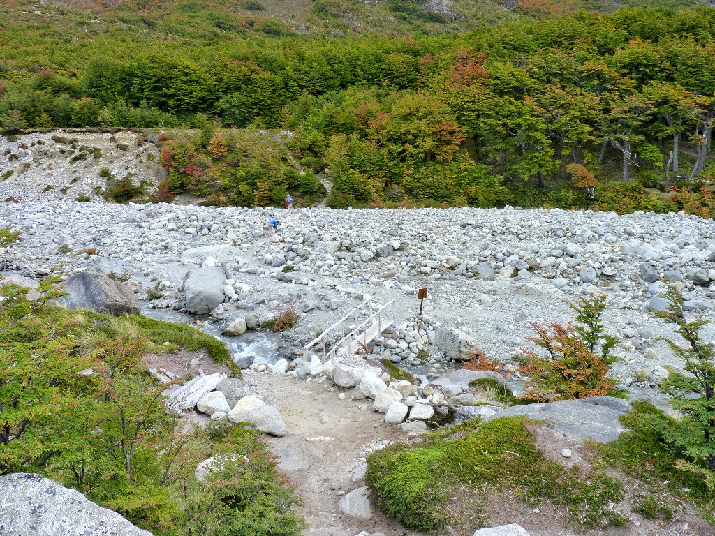
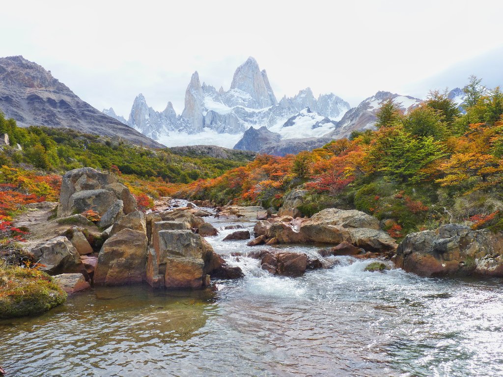
Crossing the Rio Blanco
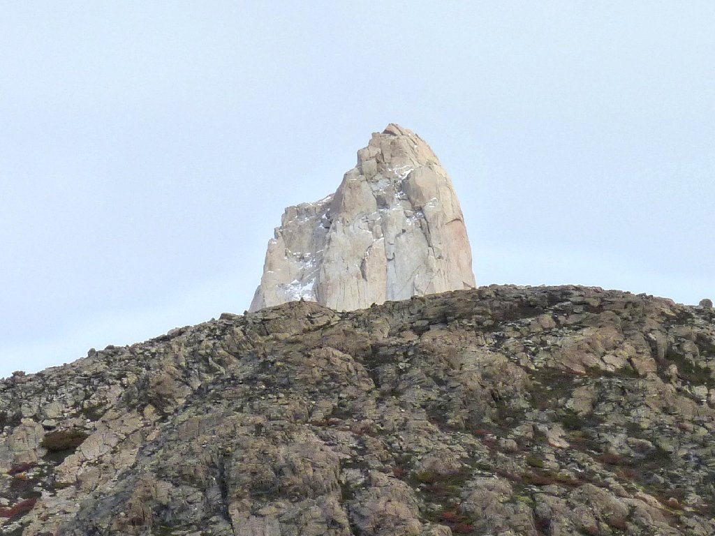
One peak is not in the clouds, anyway
On the far side of the river is a camp for climbers only. Hopefuls
sometimes hang around here as long as a month or more, awaiting the right weather
conditions. No peak-baggers are in evidence today, though.
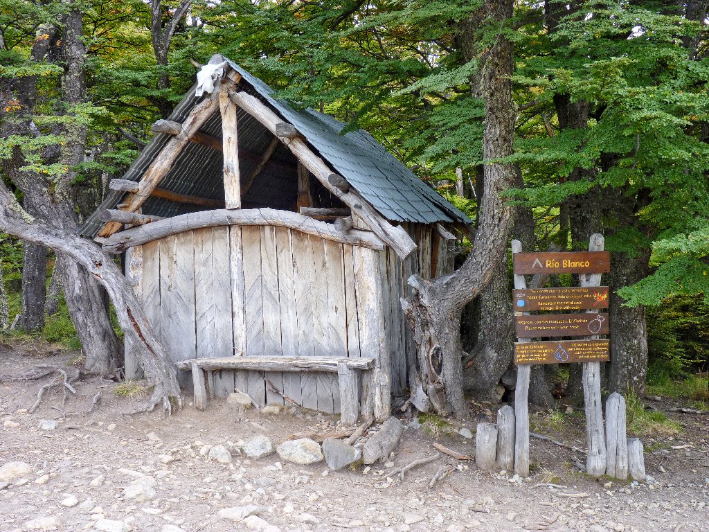
Campamento Rio Blanco
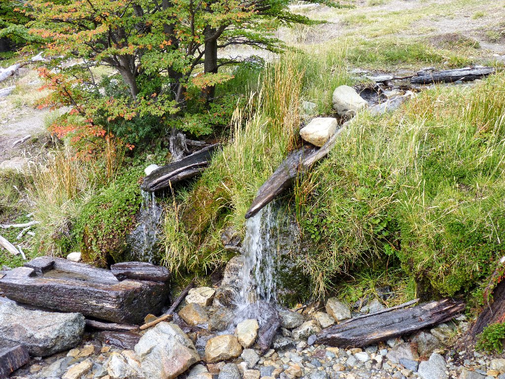
The water bottle refilling station
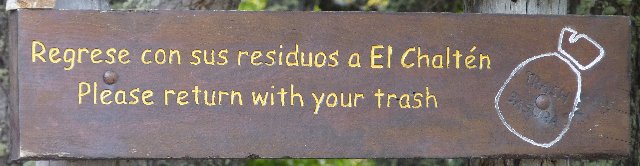
Right here is a sign unlike any other that I have seen:
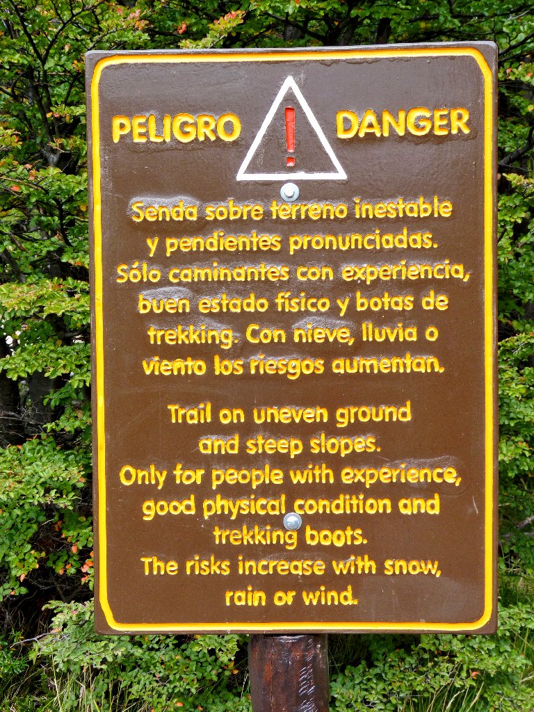
Wow! Are they trying to tell us something?
We're up 400 feet already
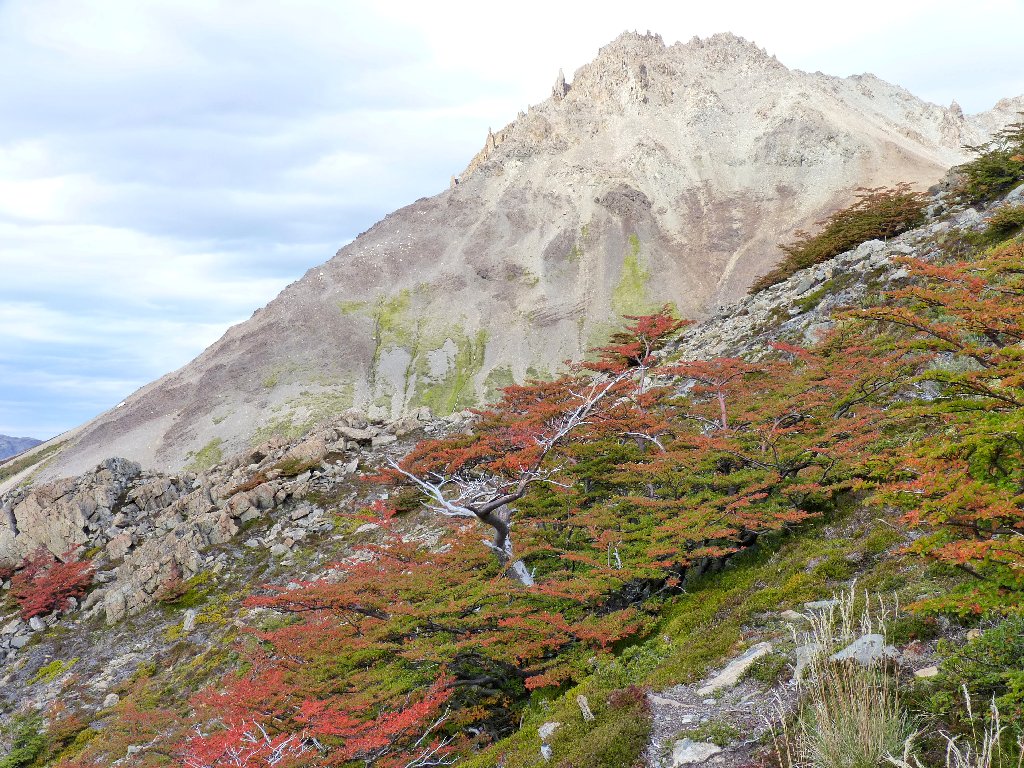
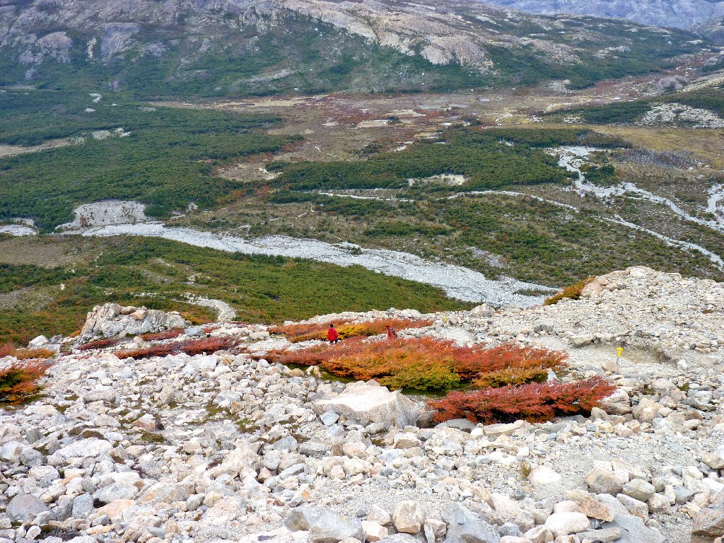
For some distance beyond the scary warning sign, the trail is steep but easy. Suddenly the party is over, as the route becomes quite rough. During a rain or a high wind, the going would indeed be dangerous in here.
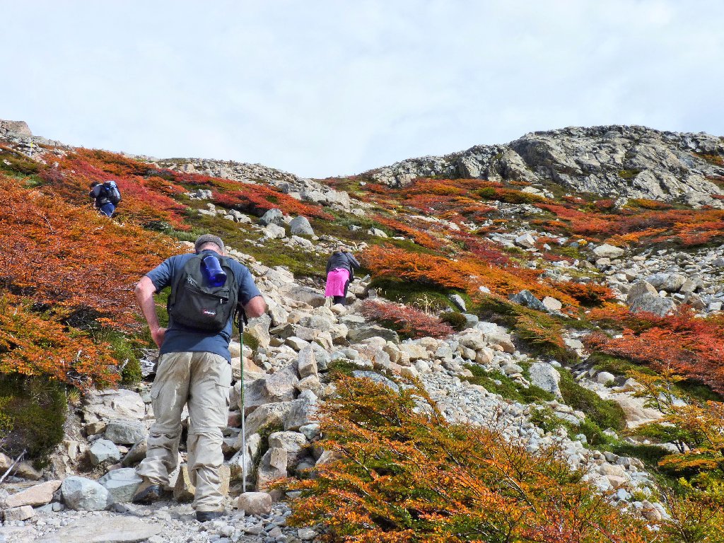
Careful footing is in order
Lago Madre
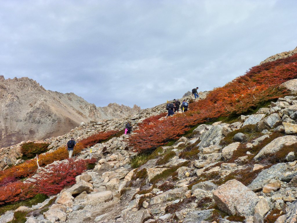
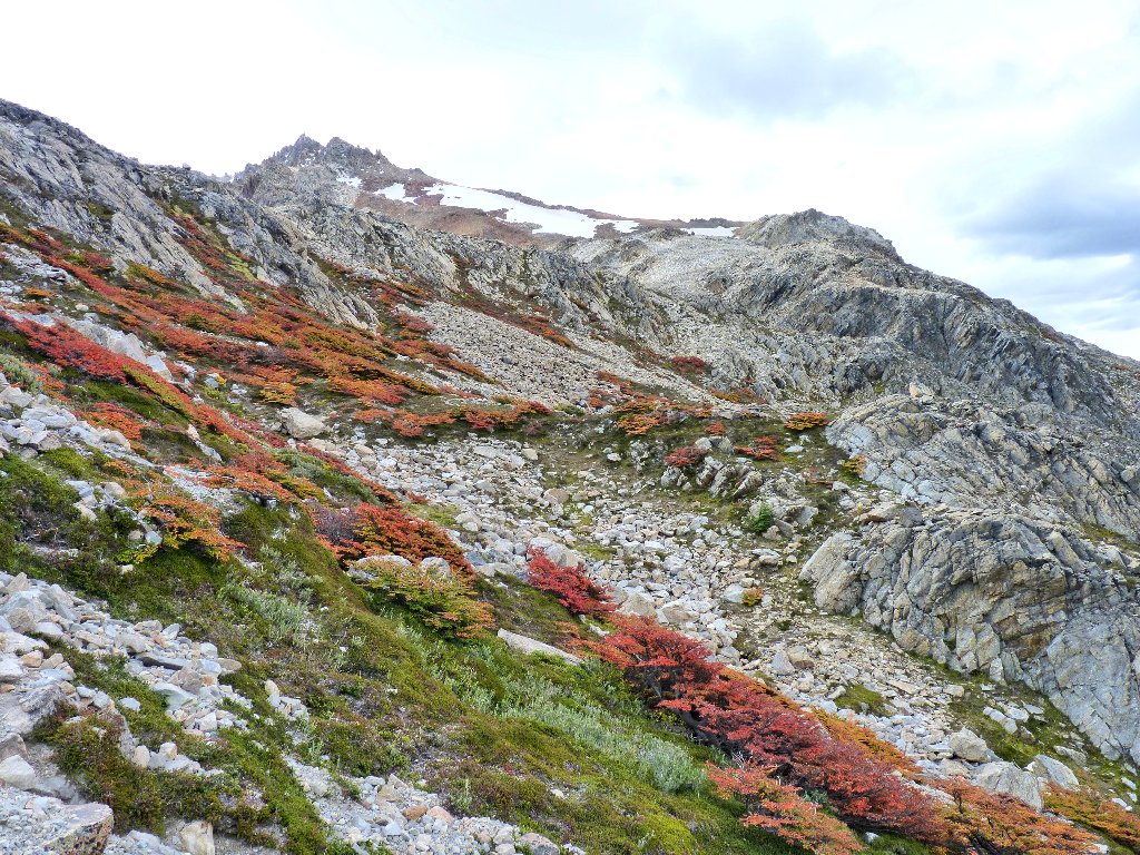
It looks as if we are nearing the top, but I suspect not. David is hopeful, but my GPS is reading about 200 feet short of the anticipated summit. Surely enough, as we top the ridge the rest of the moraine comes into view.
It's a wee bit farther yet
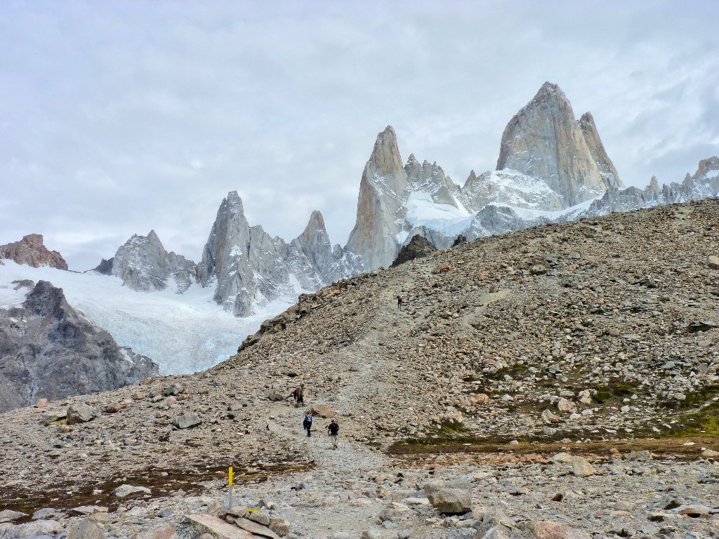
The remaining scree is dispatched in short order. Finally...
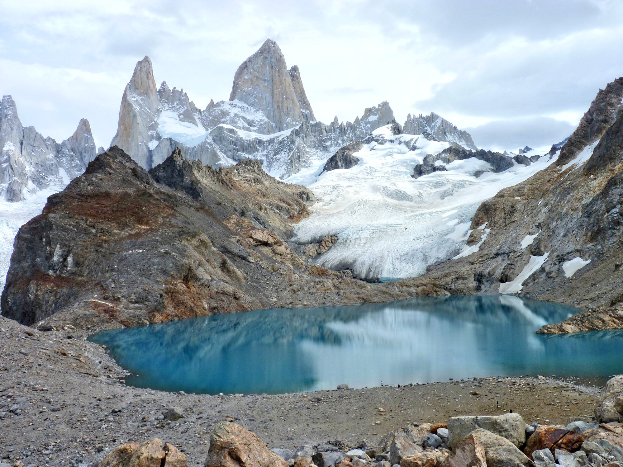
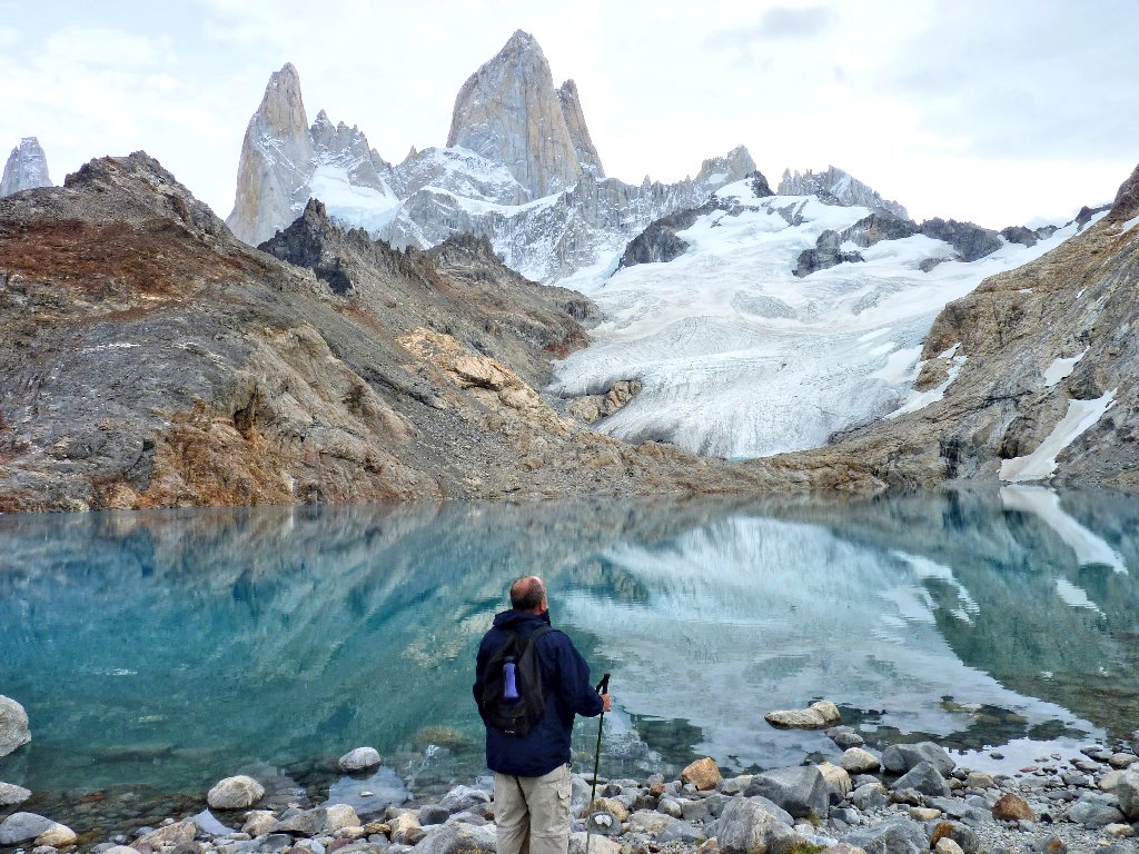
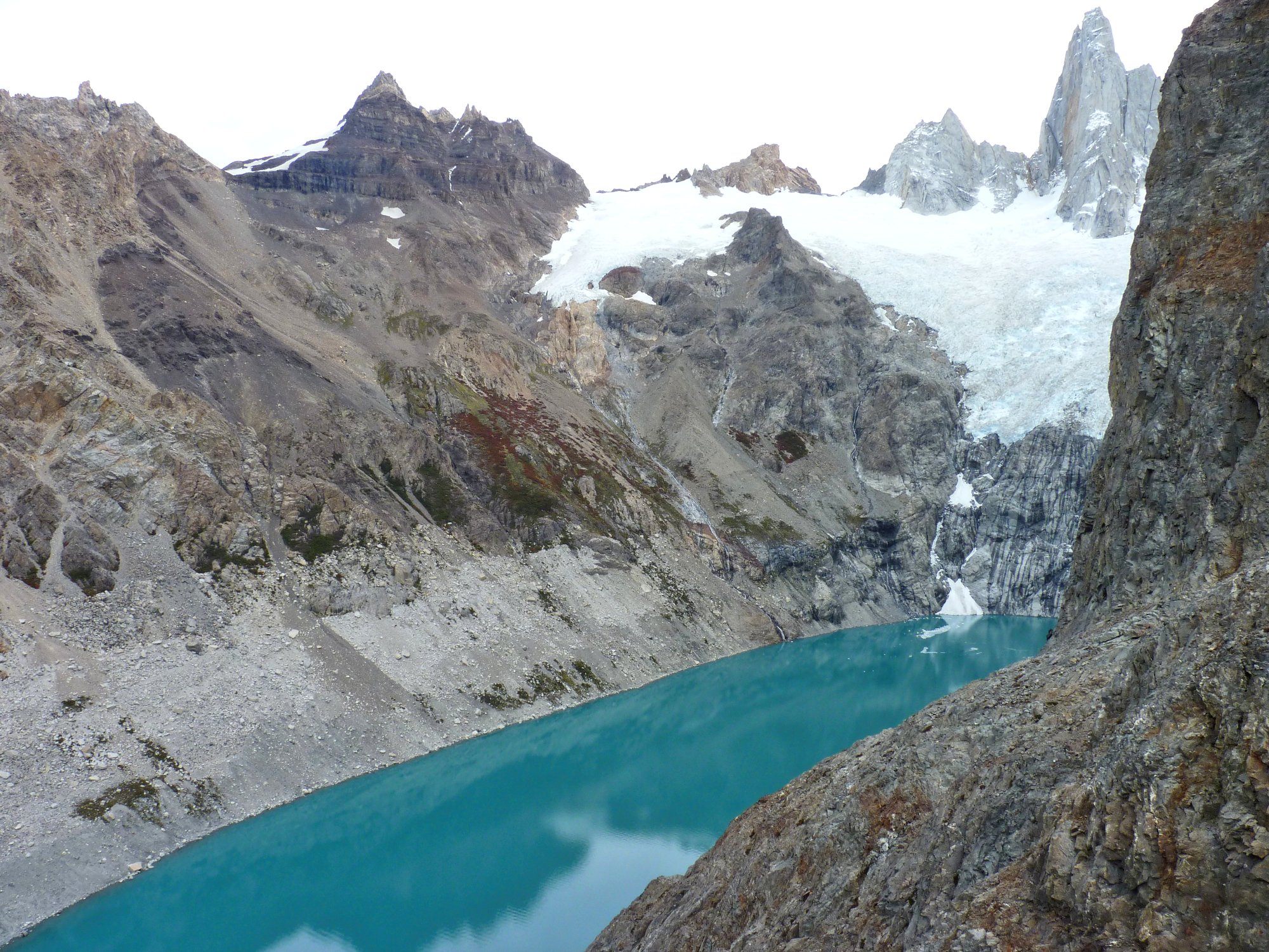
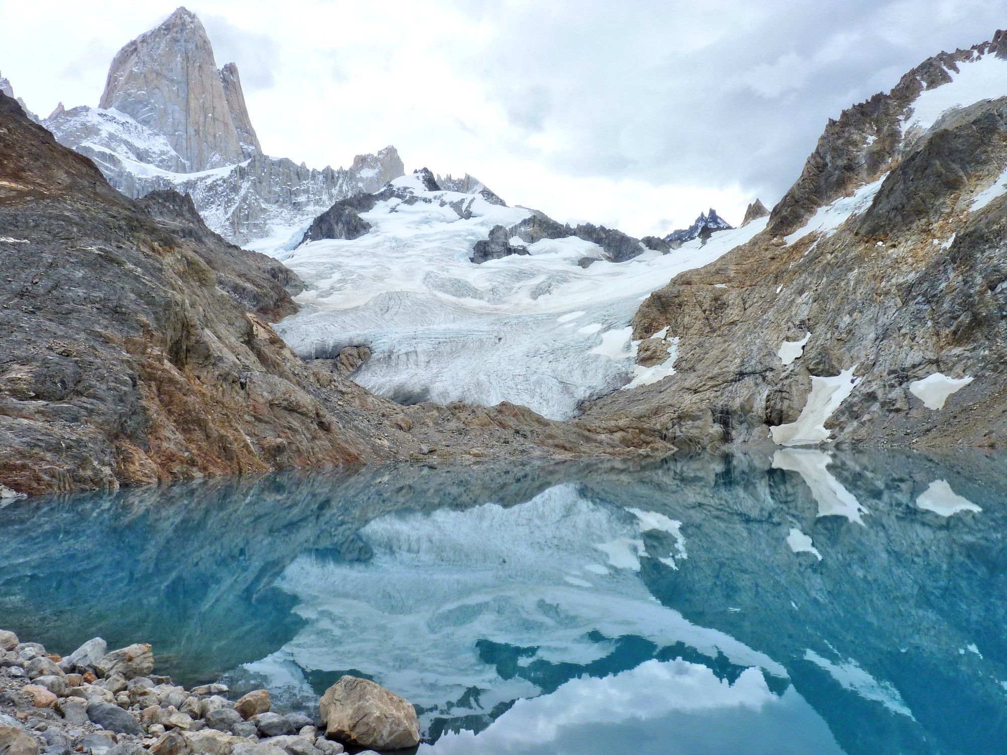
Lago de los Tres and Glaciar de los Tres. Omygod! ⇔
This stunningly beautiful setting is almost surreal. The scene is reminiscent of a movie set for an old western, yet who could actually think up a landscape like that? David and I are agreed that the grandeur of this place has no equal of which we are aware. Words fail us completely, but our tear ducts do not.
This "Lake of the 3" is named after the three most prominent spires above it. From left to right, they are Aguja Raphael (8392'), Cerro Poincenot (9849'), and Monte Fitz Roy (11020'). Those names translate to "needle", "hill", and "mountain". I guess that the word "cerro" has a rather broad definition.
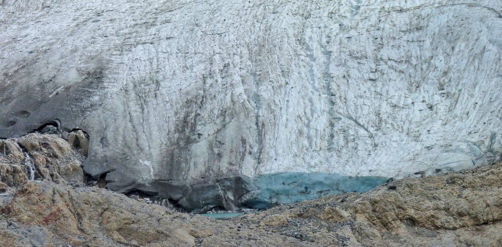
The glacier actually drops into another little lake that is barely visible
Damn! I wish it were sunny out. The photographs would be so
much better. David and I break for lunch here, of course.
He munches on salami and bread, while I down another box lunch with more
of those bland ham and cheese sandwiches. This time, however, some
store-bought mustard saves the day.
This is why I came to South America
Me, too
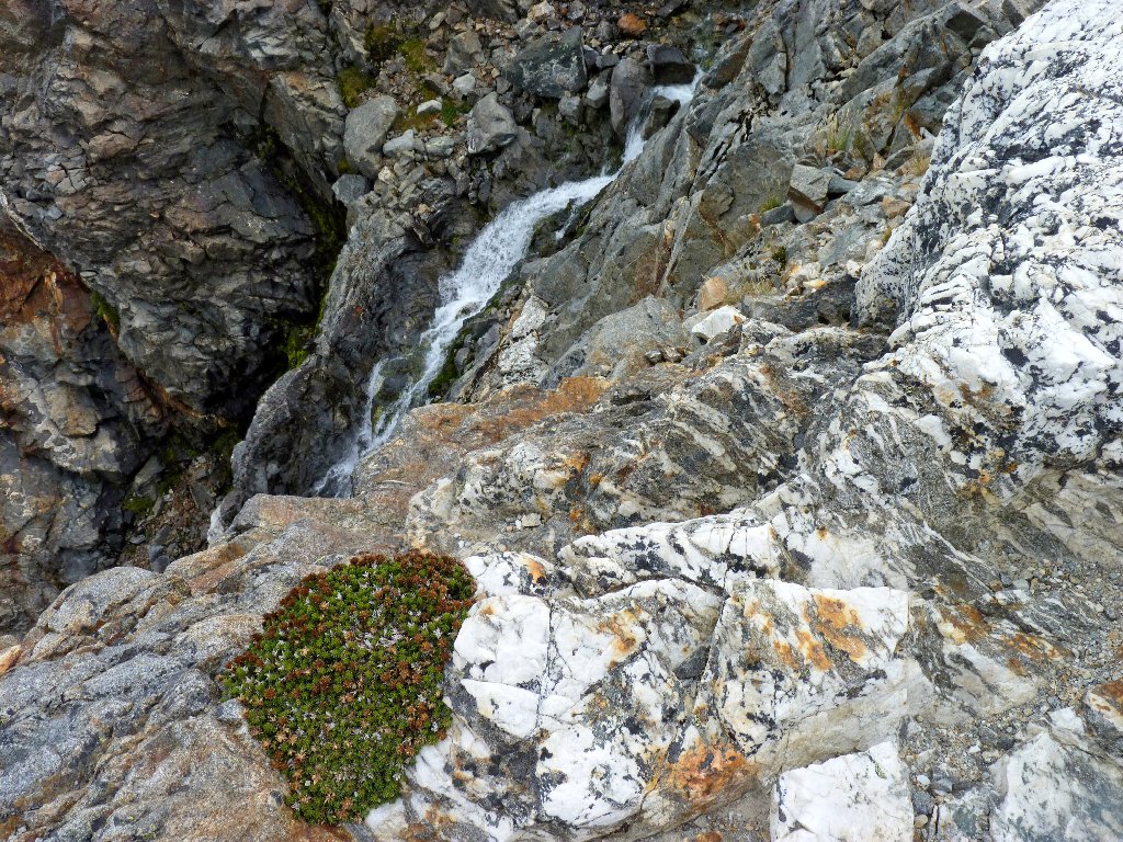
After eating, a special mission is in order. Scrambling down the talus slope, we traverse a couple hundred yards beside the lake shore to a viewpoint of which both of us have prior knowledge while many visitors apparently do not; for there is a hidden attraction that cannot be seen without venturing over to the lake's outlet.
Heading to the overlook
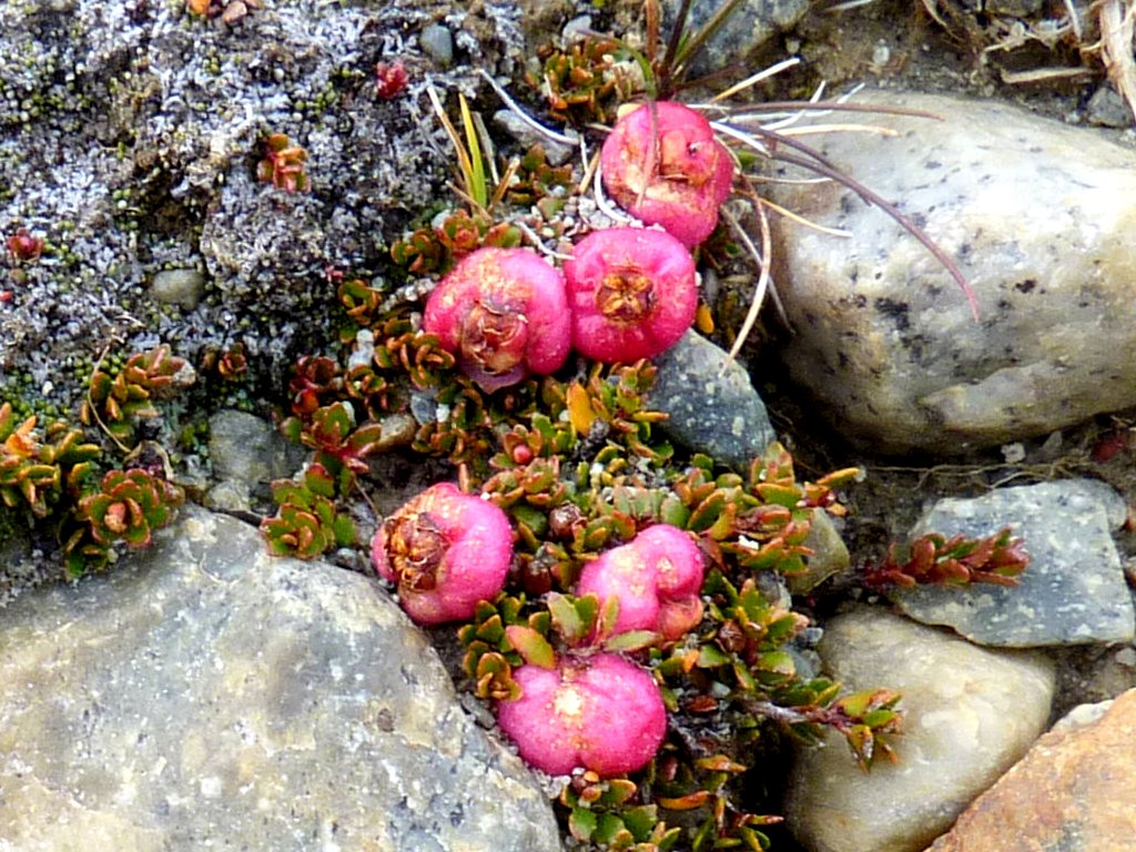
The closest thing to flowers that I have seen
Our reward is my favorite scene from our entire journey to Patagonia.
Laguna Sucia lies more than a thousand feet below ⇔
The name translates to "Dirty Lake", which could be the most incongruous designation ever.

A long, beautiful cascade flows between the two lakes. From this angle, however, it is impossible to get a photo of the entire scene.
That's 7,000 feet from spire to lake!
Most of those folk do not know about Laguna Sucia
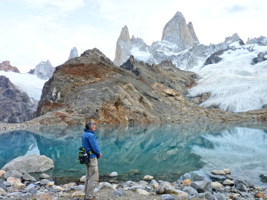
Back at the big lake, the breeze has died down enough for the water to reflect the scene.
Are there any climbers up there? See Addendum ⇔
Okay, it is time to go. With heavy sighs, we turn our backs and head for the exit.
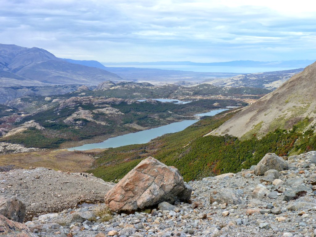
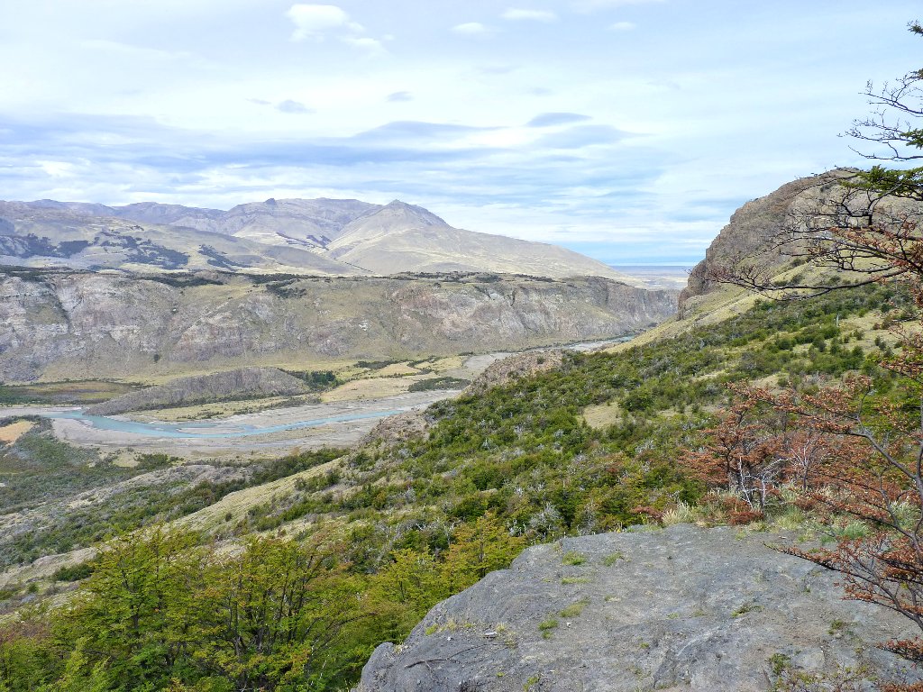
Viedma Lake lies in the distance
I did not bring my walking stick today, but David has two. Even though his legs are needy, he graciously lends me a pole for the upcoming grueling descent; and it is most welcome.
Where we started, at left-center
Where we are headed, in the upper-right
The camera just won't stop shooting
Back at Rio Blanco Base Camp, it is high time to give our feet a rest. Off come the boots for a while. One of my liner socks has a big hole, so I will not wear those any farther.
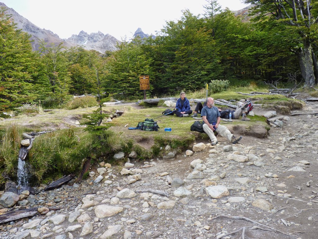
I sure hope it doesn't return without me!
I feel really good right now. What a day this has been already! It also is about now that the realization sets in that, despite our accomplishment, our walking is only half done. Yes, our hostel still is nine miles away, and no bus will be coming to fetch us this time. Somehow, though, I feel okay about that as well. There is plenty of time, my feet aren't at all sore, and the remaining route should be flat to downhill throughout. How bad could it be?
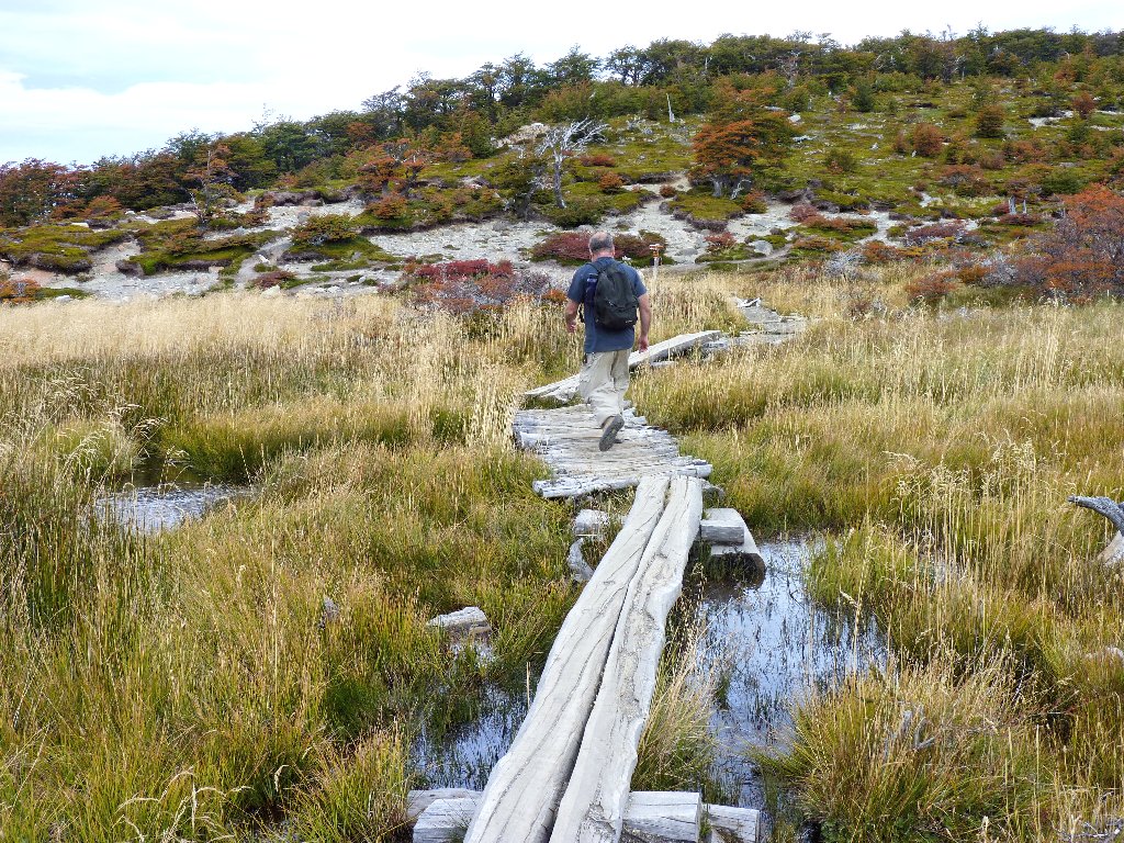
The next few miles entail a combination of sandy boulevards, marsh crossings, and squeezes through dense undergrowth. The only thing that never changes is the overwhelming beauty of our surroundings.
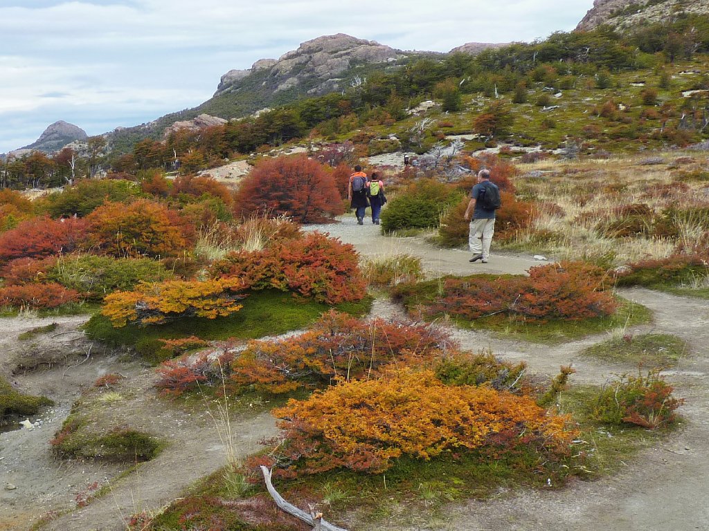
It's a walk in the park!
Something compels us to turn around for an incredible recap of our recent route:
Our erstwhile trail snakes up the hillside. Oh, my!
David and I find ourselves glancing over our shoulders again,
And again.
Today's last, but not least, view of the incomparable setting
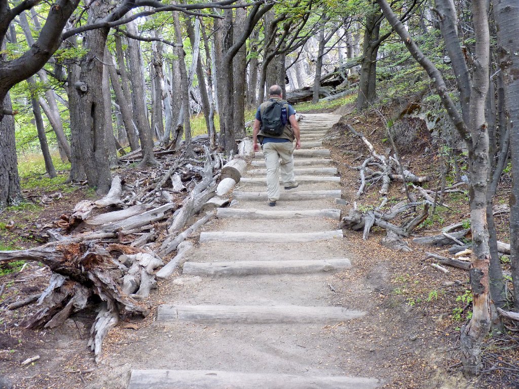
Into the forest
At a signed junction we opt to jog right, past a lake that would not otherwise be seen. It is nice, yet unremarkable as lakes go around here.
Lago Capri
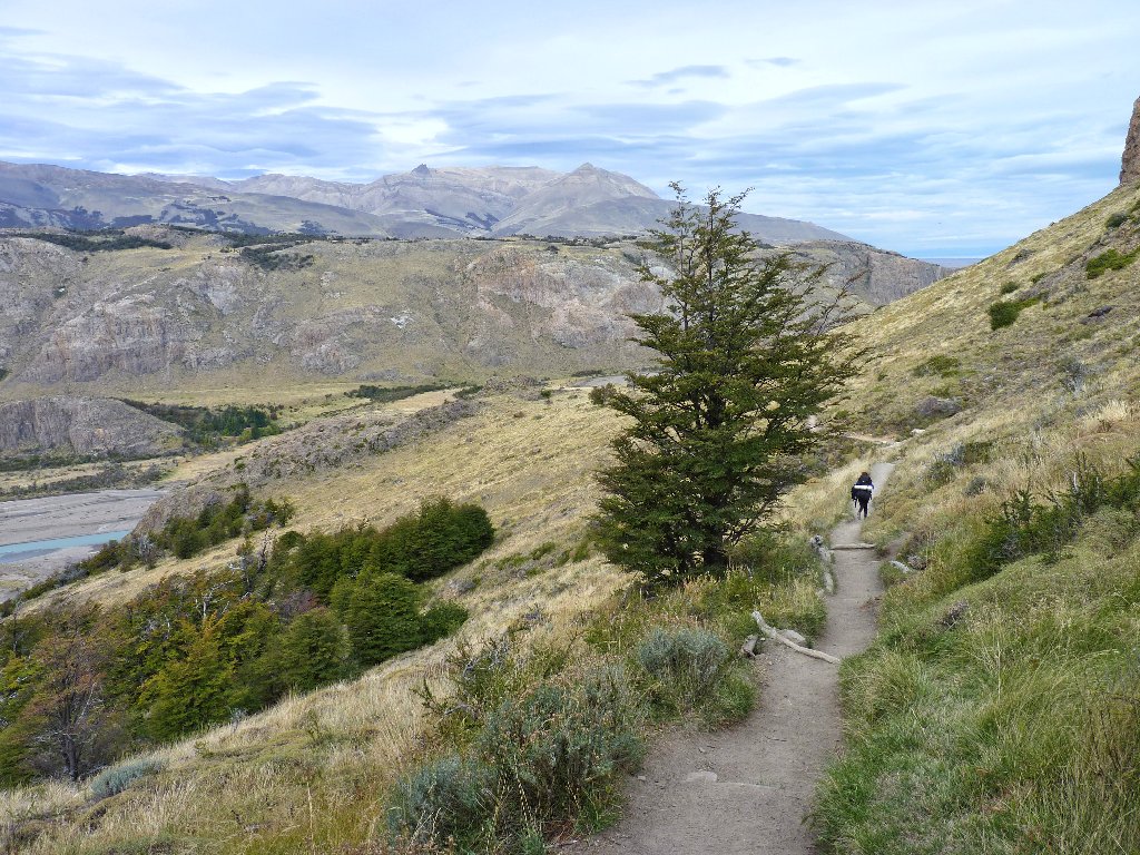
Abruptly, we are back on the eastern side of the hill, overlooking the familiar Valle Rio de las Vueltas.
Still a lot of downhill to do
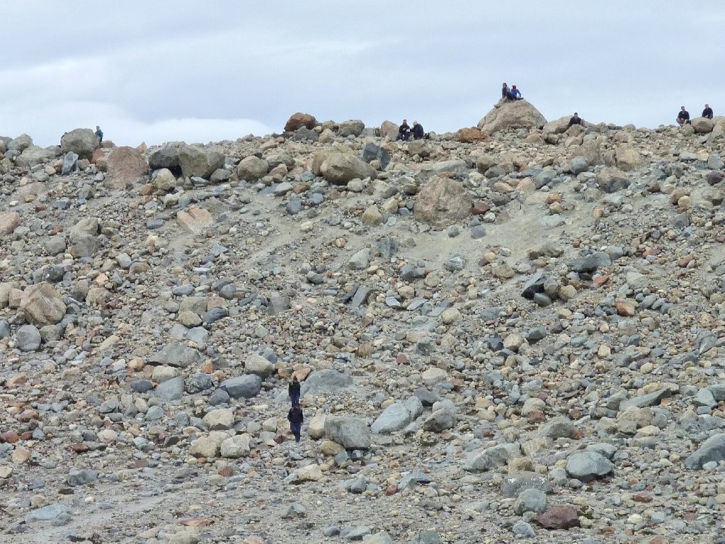
A short, thin, very young woman runs by us with a pack that's as big as she is, proclaiming that she "doesn't like to walk these last miles". We can only marvel in envy as she disappears within moments.
Now you see her; now you don't
At long last, El Chaltén comes into view, and a welcome sight it is.
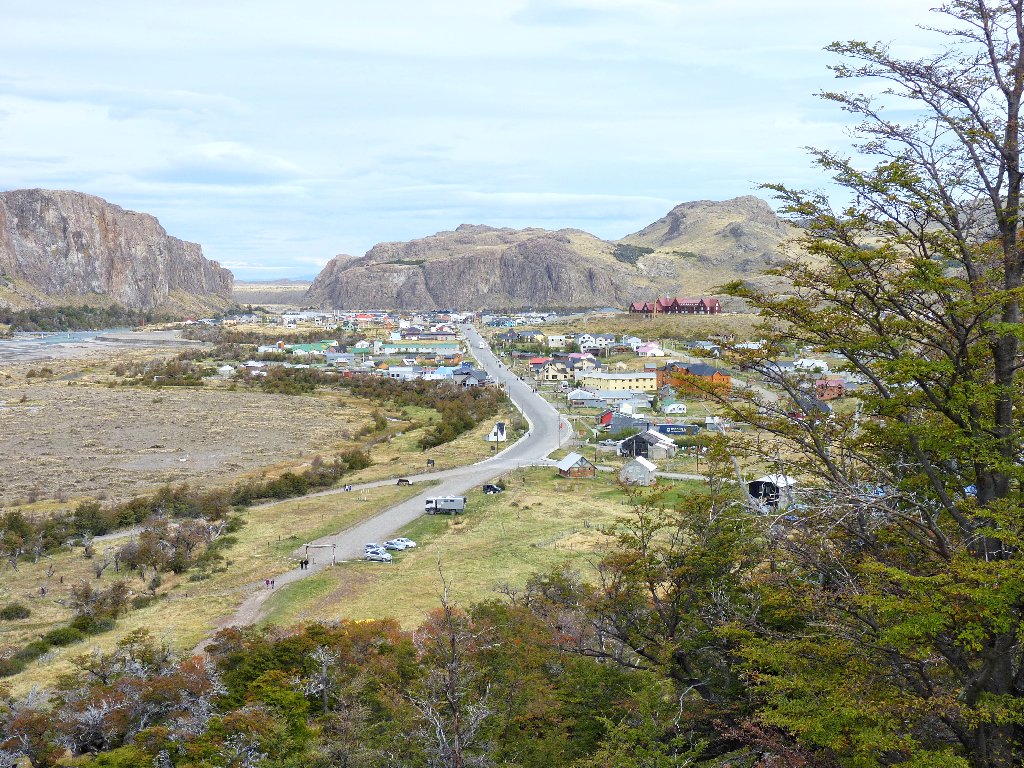
The town that is only 27 years old
I did it, and I'm glad
There remains a mile-long slog back to the hostel, but that doesn't seem to matter. Perhaps the most amazing part of this day for me is that, after the longest walk of my life, my feet aren't even sore, and I would have taken wagers against that possibility. Nothing else is ailing, either. It seems that visiting the world's most beautiful places has multiple therapeutic benefits. It is something of a pity that we must return home tomorrow.
A residence on the El Chaltén main drag
§: If you have time to hike only one area in Patagonia, this one
gets my vote. The Torres del Paine might be the most famous attraction,
but they rank only second-best in Patagonia. In fact, I found all
the trails around Monte Fitz Roy to be more attractive in general. Be sure
to go only in reasonable weather — that is, with minimal breeze and
no rain or low clouds. Perhaps the region is most spectacular in
mid-summer, when greenery is more abundant and wildflowers are out;
but the fall colors are quite compelling as well, and the weather is more
predictable at that time.
Friends sometimes chide me for a willingness to drive for eight hours in
order to take a four-hour walk. This time, I have traveled 9,000
miles for a nine-hour outing; but I get the last laugh, because this
was and is likely to remain the most outstanding hike of my life.
In fact, this one could well be:
— The Best Day-Hike in the World —
| Scenery |  |
| Difficulty |  |
| Personality | |
| Weather |  |
| Solitude |  |

ADDENDUM
In 2014, Sacramento native Alex Honnold (the man who later did the Free Solo of El
Capitan) and Tommy Caldwell accomplished the first-ever Fitz Roy
Traverse — a 5-day, 7-peak climb of Mount Fitz Roy and its
lofty neighbors. This earned them the Golden Ice Axe award,
mountaineering's highest honor.
In 2021, Belgian climber Sean Villanueva O'Driscoll, himself a previous winner of the Golden Ice Axe, did the traverse solo, at age 40 and with borrowed equipment to boot. This is considered by many to be the premier climbing achievement in Patagonia.
So yes, at least three climbers know the place very well.
