
Yosemite National Park
|
Yosemite Creek Traverse Yosemite National Park |
June 25, 2012
Hiking up the Yosemite Falls trail to the top involves a steep climb of
2,700 feet on switchbacks comprised of hot sand, stone steps, and dusty
cobblestones. Being resolved to visit the brink of the falls for the first
time without the aforementioned effort, I have taken the hikers' shuttle bus up
the Tioga Road to Yosemite Creek. The trek will be a lot longer this way,
but it will be almost entirely downhill.
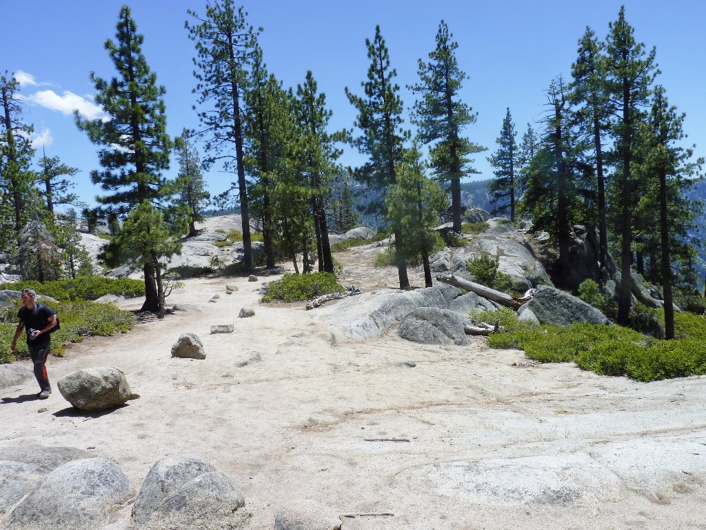
The bus driver is a knowledgeable woman who is planning to retire after this,
her fortieth year on the job. She deposits me at the trailhead just before
10 a.m.
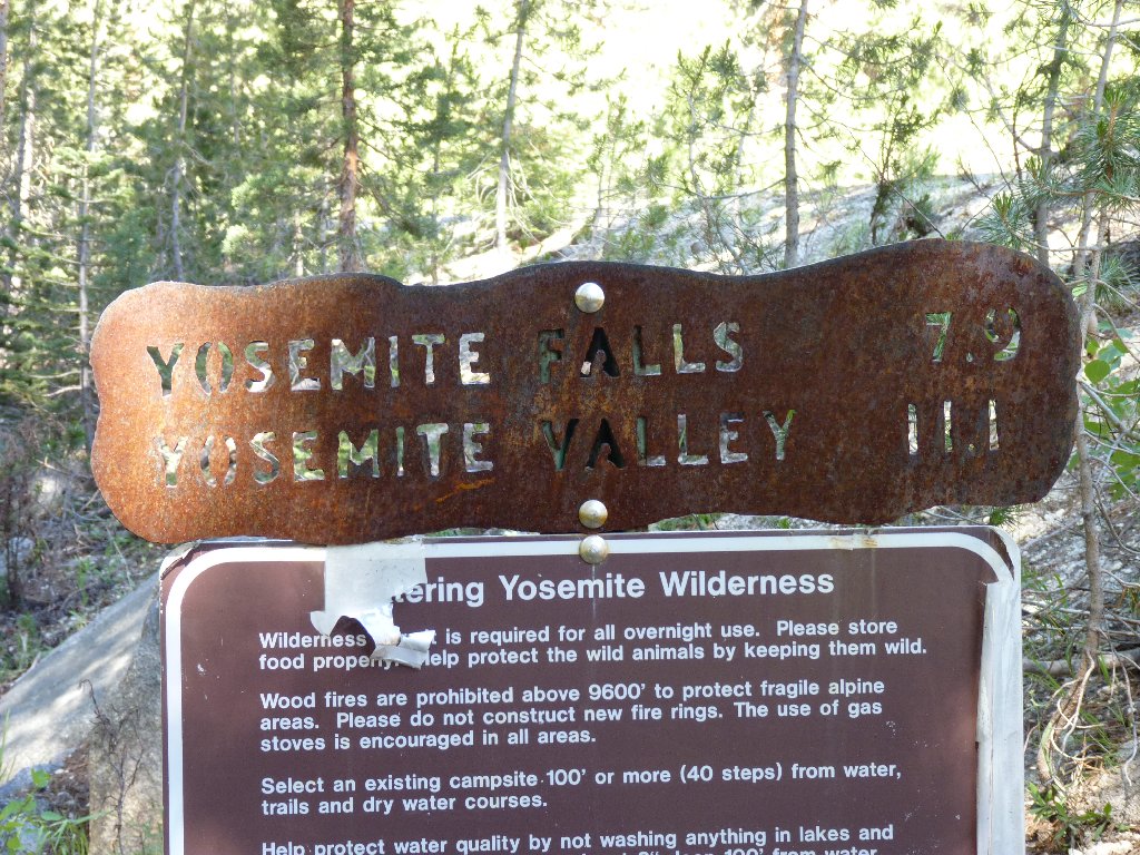
The sign tells me what to expect in terms of mileage, reaffirming what I already knew. The creek sure doesn't look like much so far, but I am confident that its volume will increase.
Yosemite Creek, eight miles from the falls
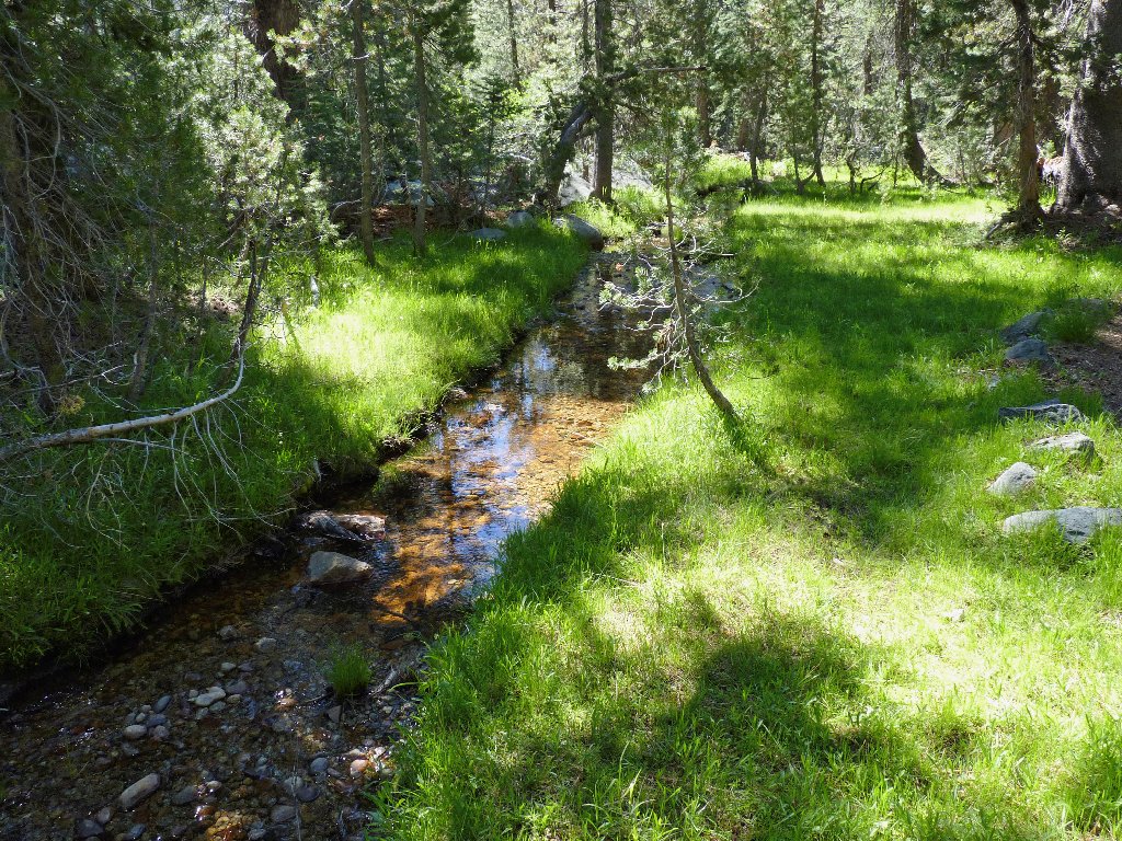
Two miles into the walk I reach Yosemite Creek Campground. Although no helpful signs are in evidence, my map shows the trail continuing on the other side of the creek; so I follow the pavement through the camp and across a bridge, where the path reappears.
The first of several crossings
I quickly overtake a group of seven backpackers, including two adults and
five youngsters. The short, stocky boy in the lead seems determined to
stay ahead of me, but eventually the weight of his huge pack compels him to
yield to my long-legged pace.
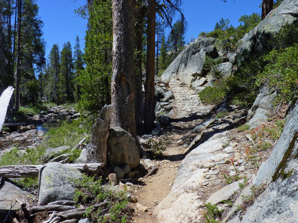
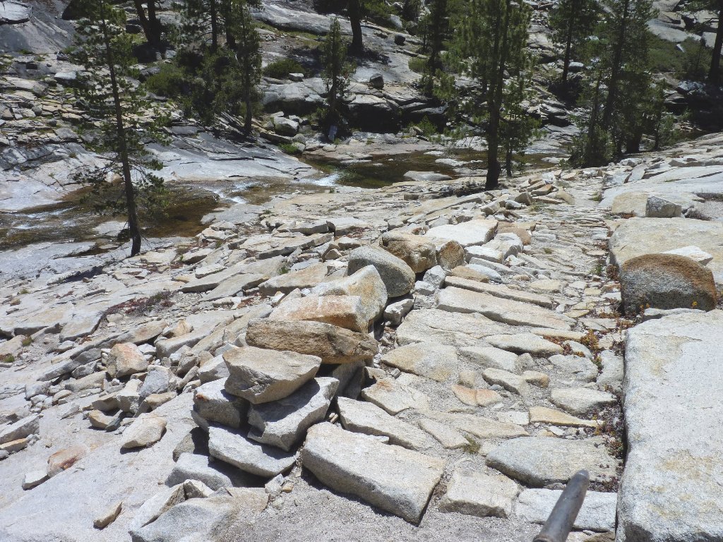
Numerous sections are preserved in stone
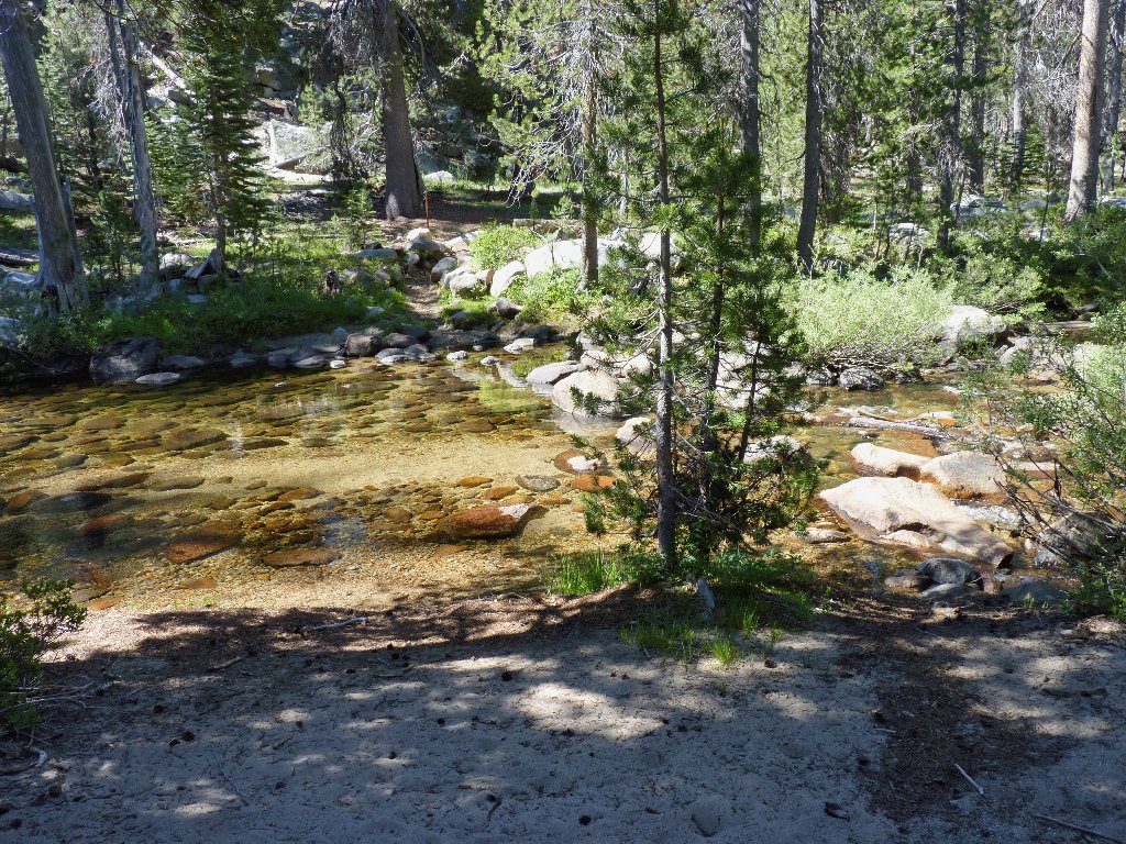
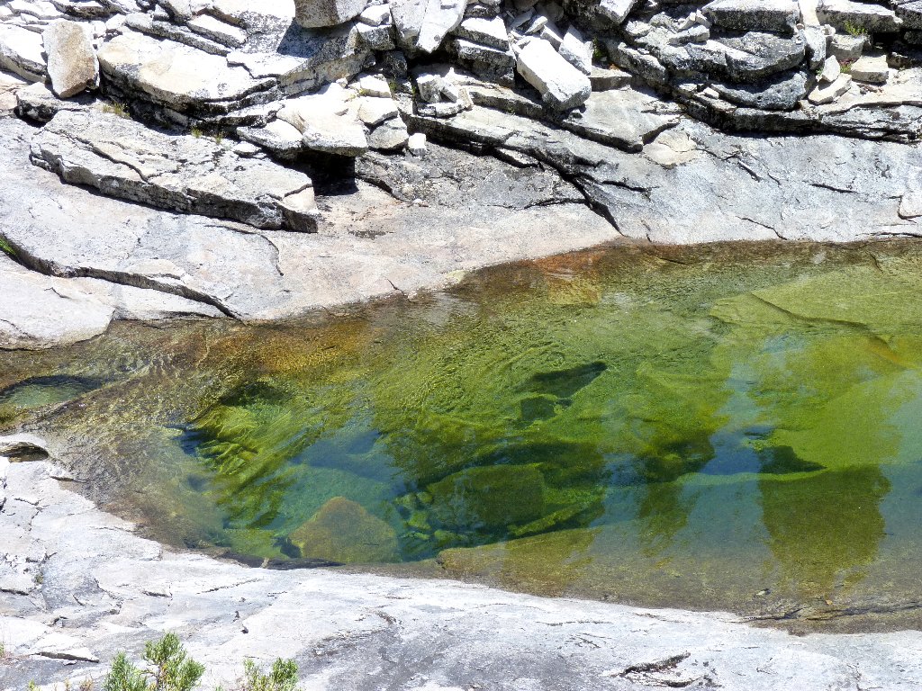
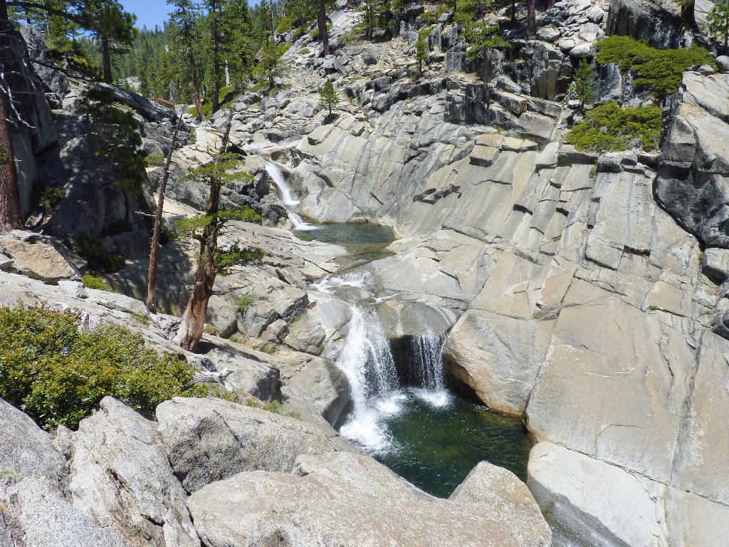
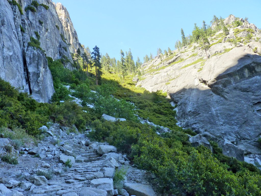
After several miles, the trail leaves the forest to parallel the creek in a pretty little canyon.
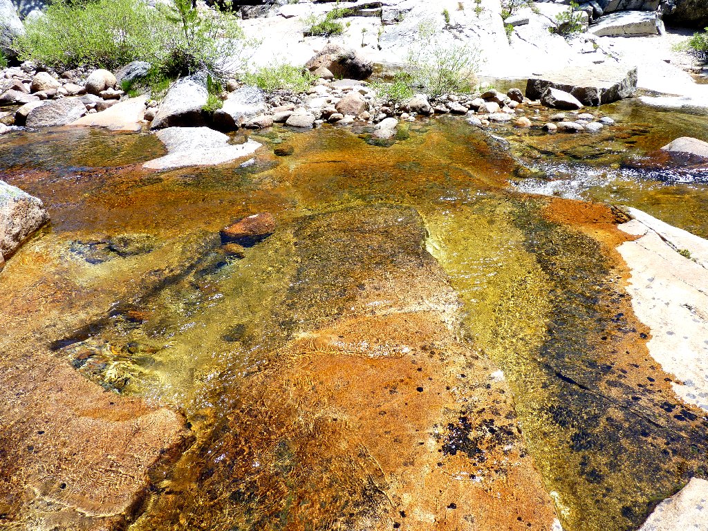
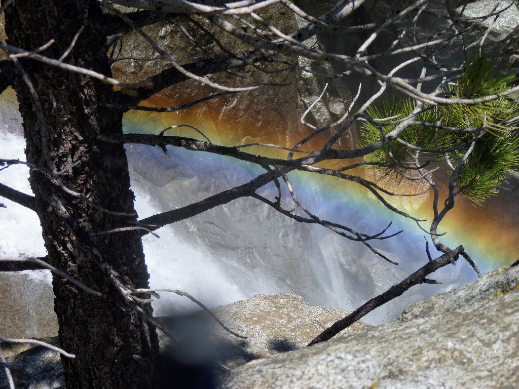
Water does wonderful things to the color of the rock
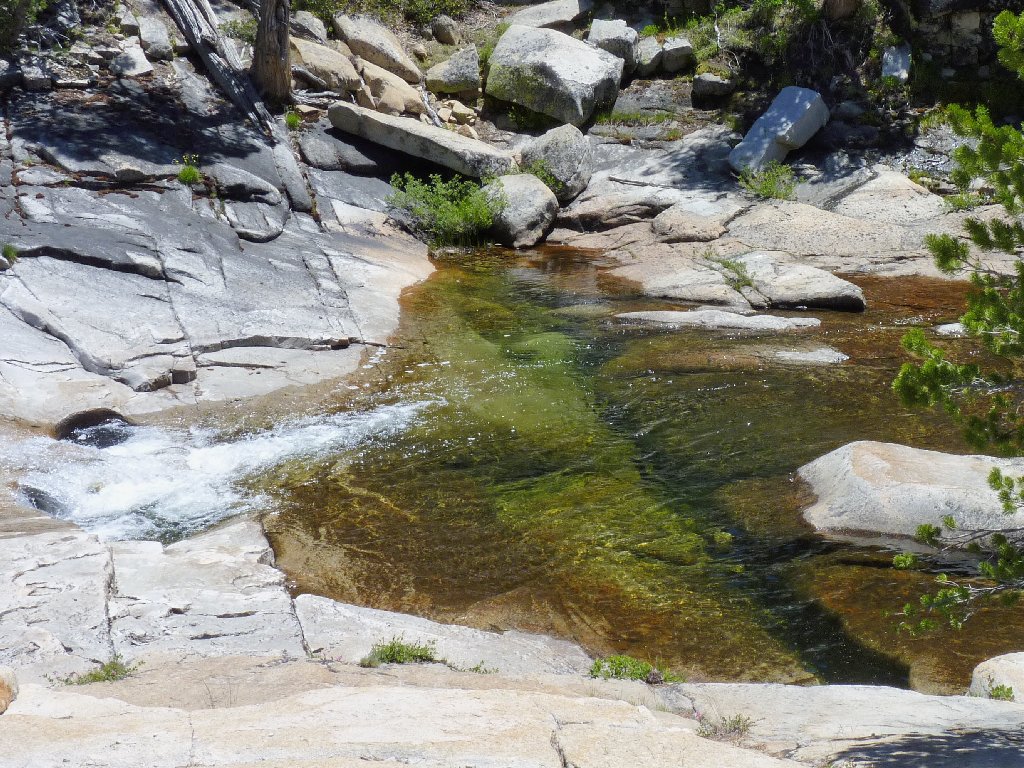
A nice swimming hole
When water flows on granite slabs, I'm a happy guy
There are few flowers around as yet, and a breeze is preventing me from doing much with my camera anyhow.
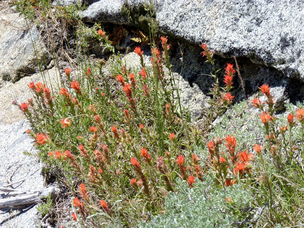
Wavyleaf Indian Paintbrush
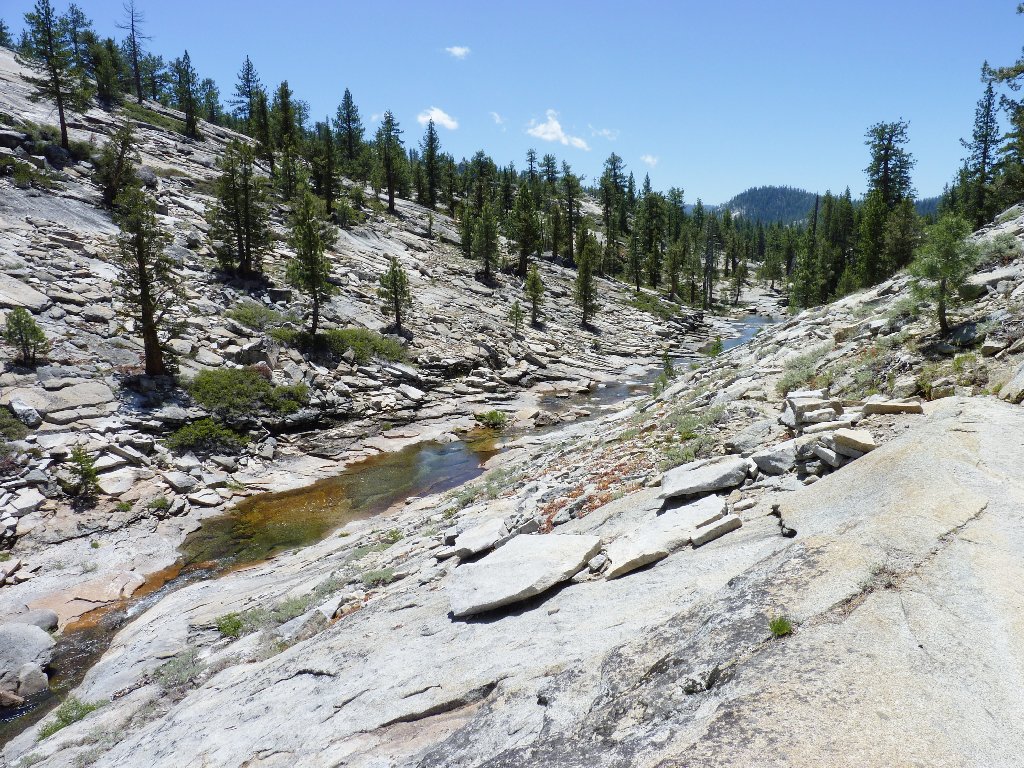
Another inviting pool
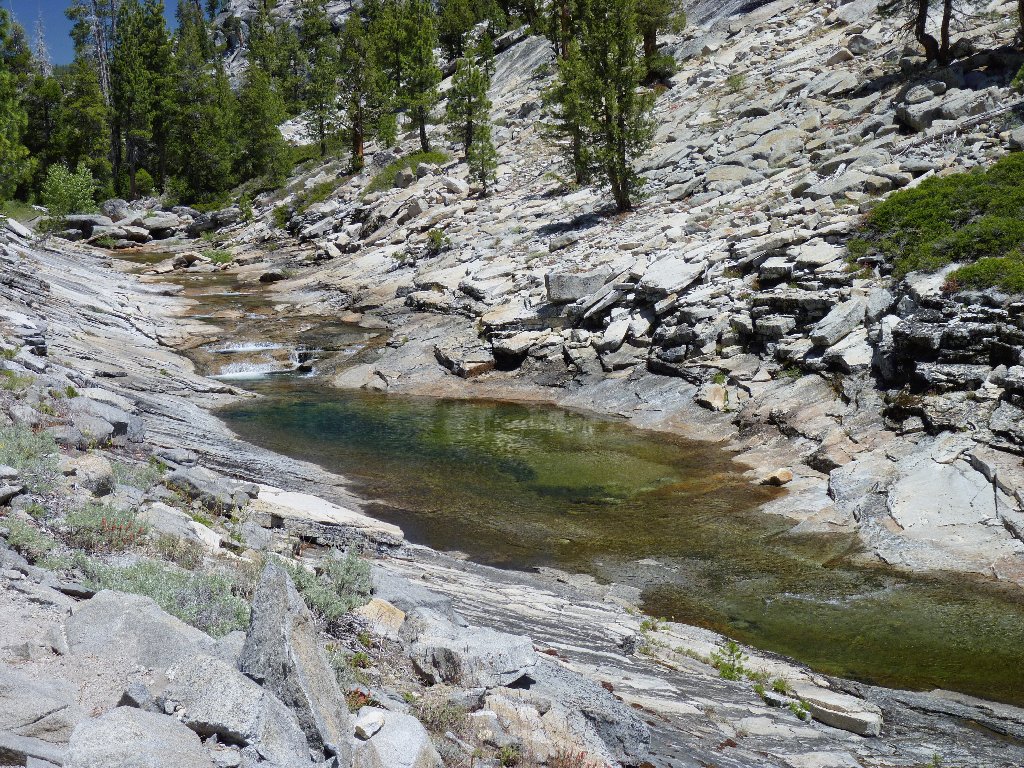
A bit more water would have enhanced this scene
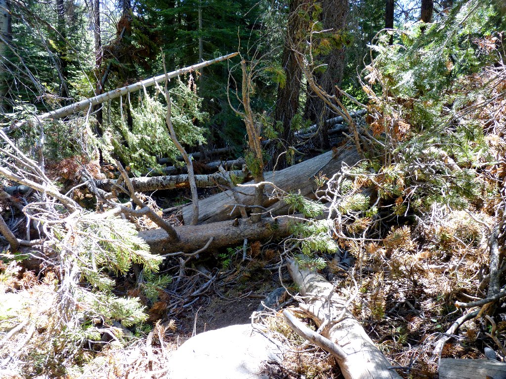
Just past the canyon, the trail takes a hard right turn into what is the biggest pile of deadfall I ever have seen. There is so much chaos that I have trouble believing that it would not have been cleared by now. Backtracking a hundred yards hunting for a possible alternative route proves fruitless, because all the footprints lead directly into this jumble. Getting through it isn't particularly difficult; it is just that its presence seems so unlikely.
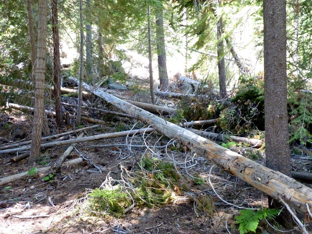
Before
After
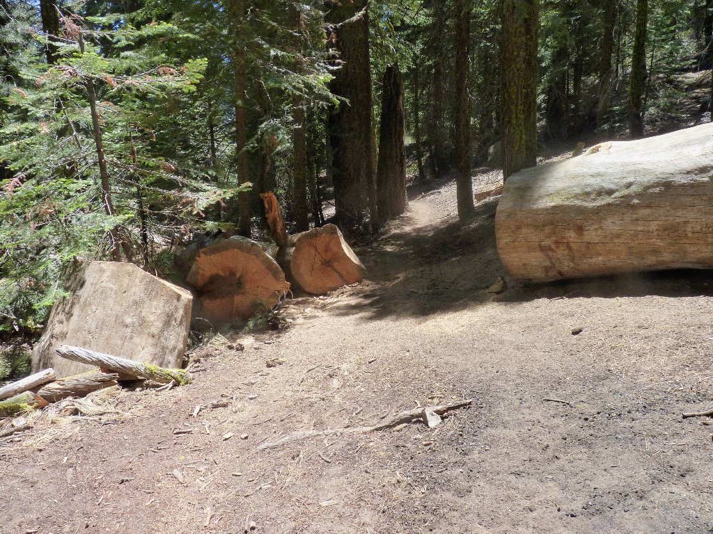
At least they didn't force me to climb over this one
As the trail turns southward again, I encounter the only wildlife I
would see today — a trio of mule deer.
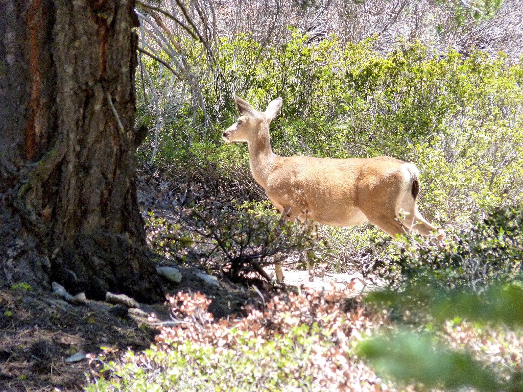
They are unafraid here
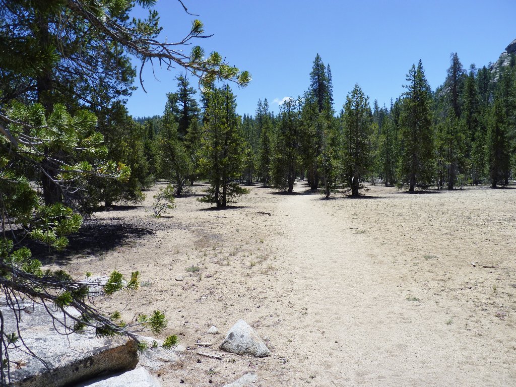
Mundane walking
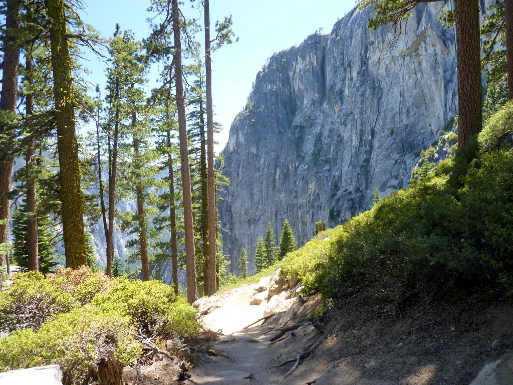
A couple more relatively boring miles are put away in short order; finally, signs of humanity suggest that the destination is nearby.
Approaching the overlook
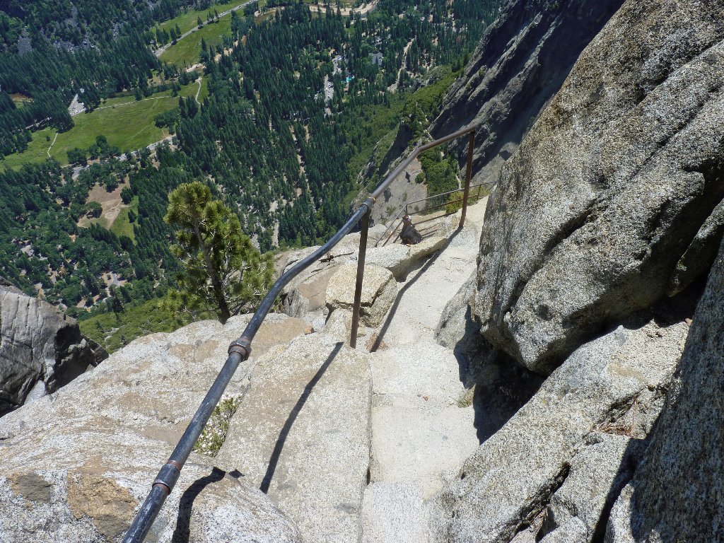
The process of getting to the brink of the falls proves more exciting and complicated than I had anticipated. It is necessary to climb down several stairways near the edge of the cliff, while making good use of the provided handrails.
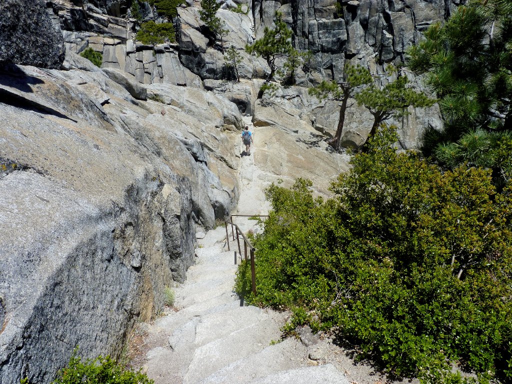
Getting to the brink
Just upstream from the falls
Via Ferrata!
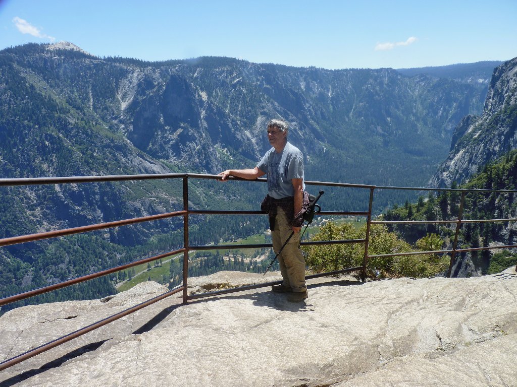
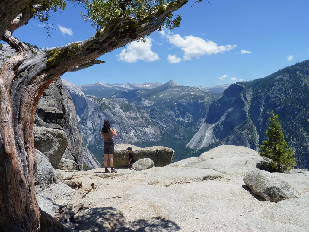
At the overlook
At the terminal point I find a guy sprawled prone outside the railing at the very edge of the cliff, attempting to take a good picture of the falls, while his female companion observes somewhat anxiously. I would be willing to do that as well, but I feel that the photographic reward would not be worth the effort.
By sheer coincidence, I happen to be wearing my best Yosemite
T-shirt today. Perhaps judging from my dress that I am
an expert on park statistics, the man inquires as to the possibility
of scaling Half Dome today. Well, first-time visitors
or not, these two certainly have not done any homework. I inform
the pair that not only can they not get to Half Dome from here (not
without tramping all the way up to Tenaya Lake first, anyway),
that it's a 14-mile, 4,800-foot round-trip hike from
the trailhead at Happy Isles, and that it already is mid-afternoon,
and that they would need permits in any case.
Actually, I guess that the man's assessment of my park knowledge was accurate, because I did have the answers. In any case, I told them that if they do nothing else during their visit, to be sure to hike the Mist Trail and drive up to Glacier Point. If one wants to gaze down the total expanse of a high cascade, the brink of Nevada Fall is the only place I know where that can be done.

Yosemite Village is 2,500 feet below
At the brink
Accessing the falls overlook has proved an exhilarating experience.
In terms of scare-factor, this place compares somewhat with Angels
Landing in Zion Park. At one point, the stone steps are only about
a foot wide; if you slip there and you are not clutching the handrail,
then that could be very bad. The major difference between the two
routes is that at Angels Landing the dropoff is 1,200 feet, whereas
this one is only about 50 feet. So if you fall here you might
still qualify for an open casket.
Despite a strong breeze that adds to the excitement, negotiating this route really isn't that great a task; but the other visitors aren't all clamoring to get down here, either.
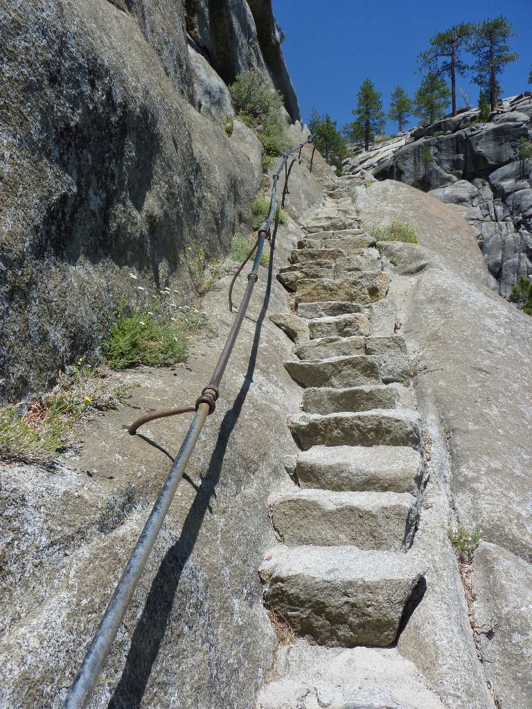
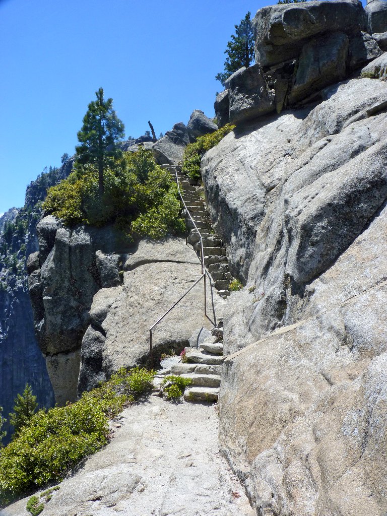
A couple of the less challenging sections
Retreating from the overlook area, I spot a nifty new footbridge enabling
hikers to walk east along the valley rim toward North Dome. Yosemite
Point is less than a mile away, but in my present condition I cannot generate
any enthusiasm for lengthening today's trek. The next leg is expected
to be a most difficult 3.3 miles, and my feet already are sore.
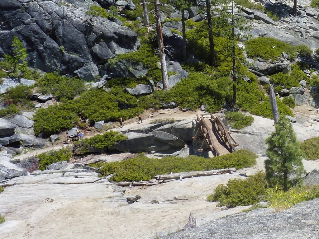
They are headed for Yosemite Point
While I am stopped to rest and munch some gorp, the seven backpackers show up. Before departing, I pull on a pair of knee braces, which is a first for me. If such devices actually do provide some benefit, then this is the time.
The dreaded downhill is just ahead
The view from 500 feet down
Peek-a-Boo
Concentrating on the task at hand relieves some of the tedium of the descent. There is no choice anyway but to plug away at it. Care must be taken with each step on the cobblestones, because they are dusty and therefore slippery. Despite due caution, I lose my footing on two occasions.
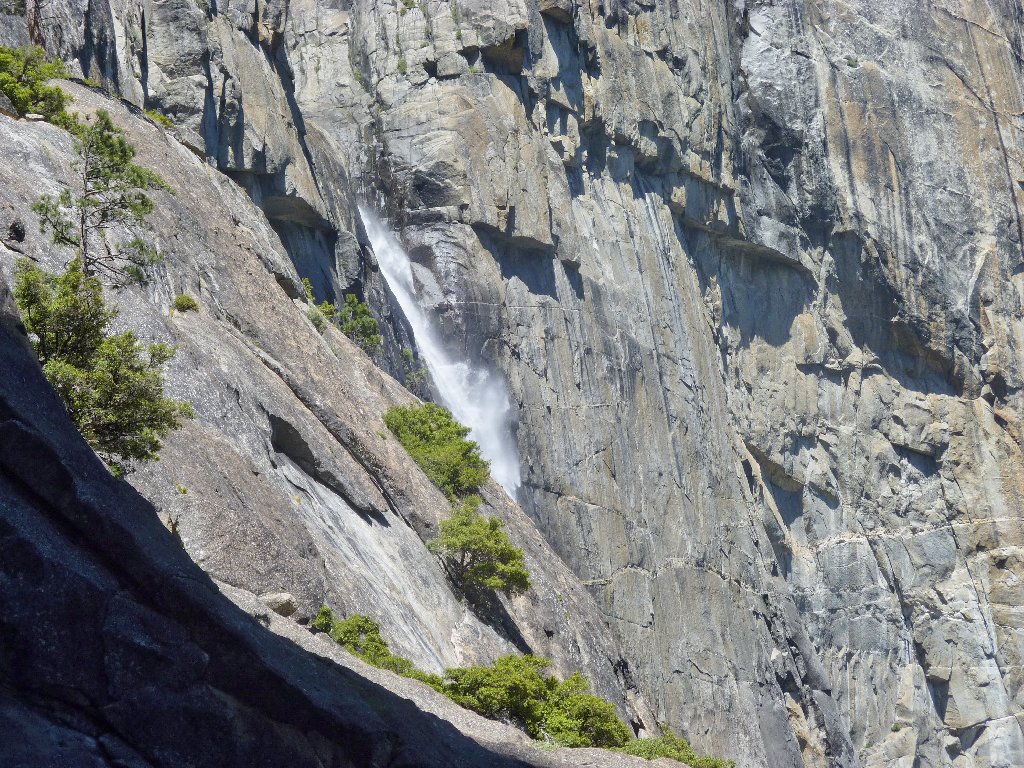
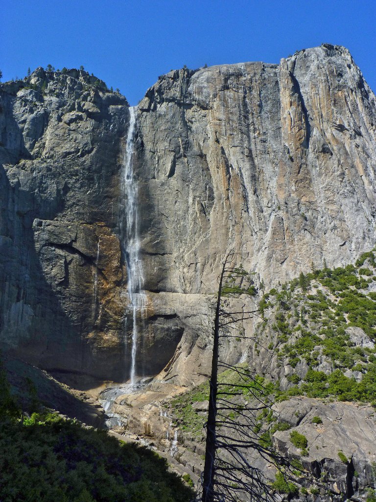
Finally, the entirety of the Upper Falls comes into view, and what a treat it is.
The 1,430-foot sheer drop
Yosemite Falls is the fourth-highest in North America at
2,425 feet, and it ranks #20 in the world according
to recent accounting. Below the visible sheer drop are
675 feet of cascades, then a final plunge of 320 feet
which is easily visited via a short stroll from Yosemite Lodge.
This is why I go hiking ⇔ CLICK ME
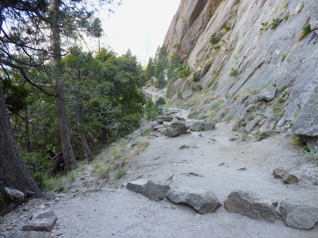

Heading out of the amphitheater
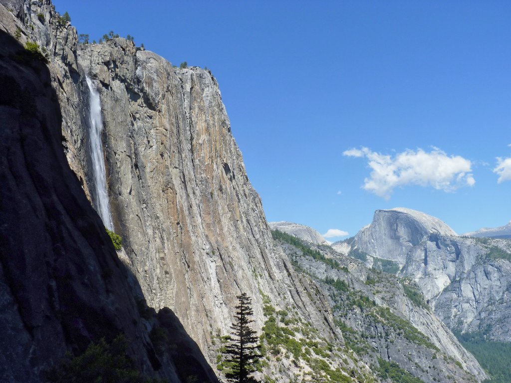
From a bit farther away, the falls do look pretty emaciated. At its best, Yosemite Falls ranks among the most photogenic objects on the planet; however, no one will be taking any postcard pictures today. This being a year of highly sub-average snow pack, Yosemite Creek surely will dry up within a couple of weeks. Last year these falls never did disappear, but that was a rare occurrence.
One effect of the lesser water flow is that there is no spray from the
falls to make the cobblestones wet and even more difficult to negotiate.
On the other hand, I know from prior experience that when there is moisture
in the air, the base of the upper falls is one of the best-feeling
places around.
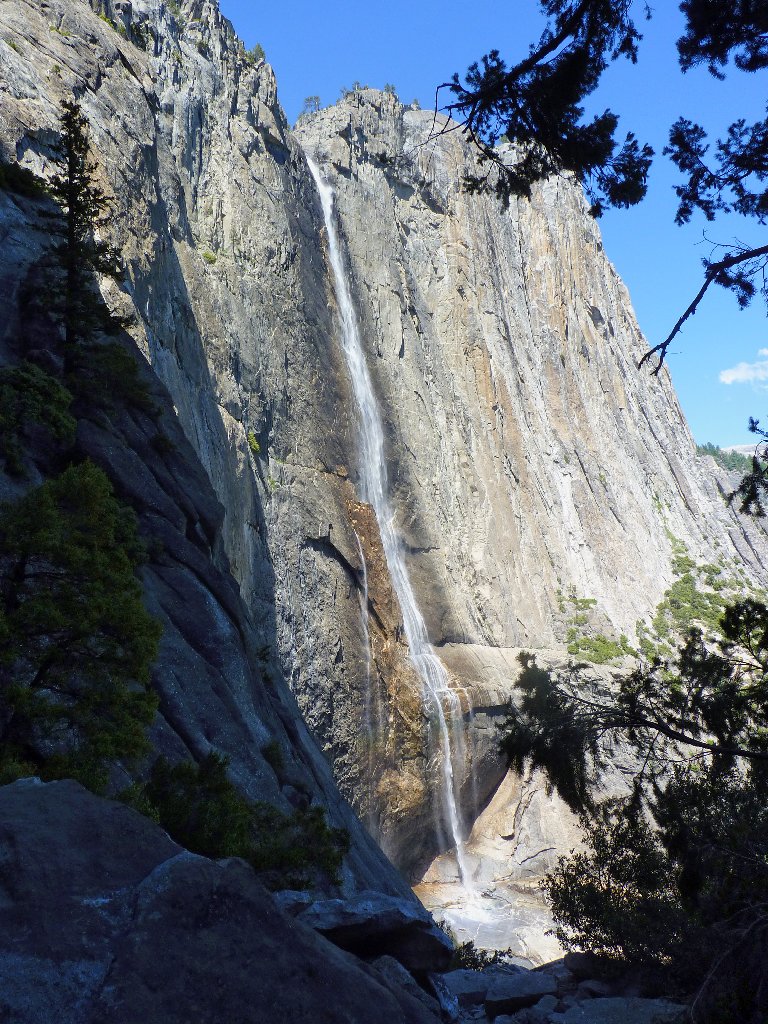
Last look at the falls
A thousand feet of descent remain. The last time I was in this very spot, more than one person asked whether I was okay. Although the effect is purely unintentional, apparently I can take on the appearance of someone in great distress when I am weary; for it is happening again.
A pretty young woman and her male companion scamper by as I shuffle along. Then Kimberly, a wedding photographer from San Luis Obispo, offers to walk with me while her friend Adam continues his youthful pace down the hill. Discussing various items on our respective bucket lists helps to pass the time. Thanks, Kimberly, for caring.
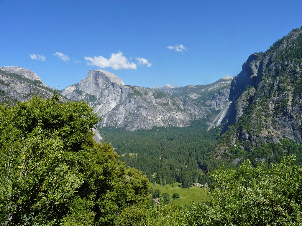
A good day to be in the park
§: In retrospect, it took me just two hours and twenty minutes to
make the descent, so what was all the apprehension about? Never mind that
my legs were on the verge of giving out completely on several occasions.
I didn't need to use my headlamp after all! In fact, including a dinner
stop, I was home in Sacramento before nine o'clock. Did my knee braces
help? Well, I guess it's like taking vitamins: who can tell for sure?
Anyone interested in replicating my journey might consider starting the
hike at the Lukens Lake Trailhead. Nothing special would be missed,
and that option would save nearly two miles of walking — as well
as two dollars in bus fare!
I have mixed emotions about the rating for today's trek. Excepting
the short canyon section where the creek flowed down the granite slabs, the
first eight miles were but a relatively uninteresting slog. Also, the
grand descent was just as I had anticipated — namely, the most
grueling several miles in my experience. In contrast, getting
up-close-and-personal with this incomparable gift of nature was quite
something — especially for one who prizes waterfalls above all else.
Earlier in the season I would have rated this trek more highly.
| Scenery |  |
| Difficulty | |
| Personality |  |
| Solitude |  |

One can fully enjoy the magic of Yosemite Falls without
incurring the difficulties of a round-trip trek to the top.
The views up there simply aren't that exciting anyway. Just climb
the first mile to the base of the upper falls on a nice day in April
or May. When you round the big corner and feel the spray as you
encounter the roaring spectacle up close for the first time, and if
there is an ounce of sensitivity in your soul, then you will
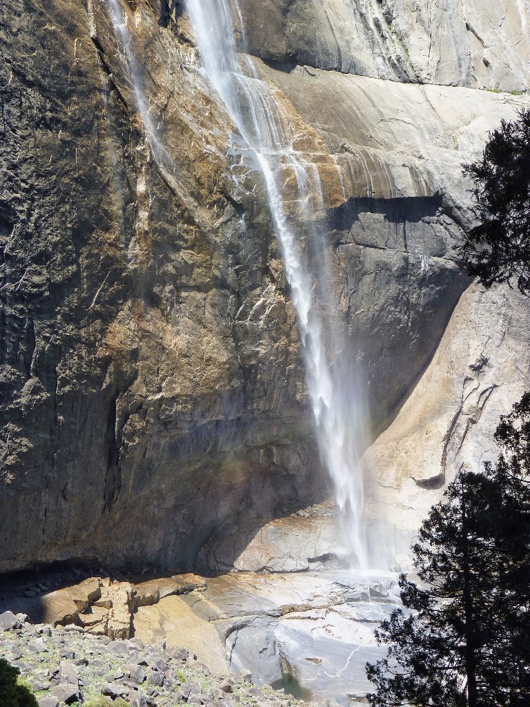
be affected in an unforgettable way. I offer this exhibit from
my Best of Hiking pages as a teaser:
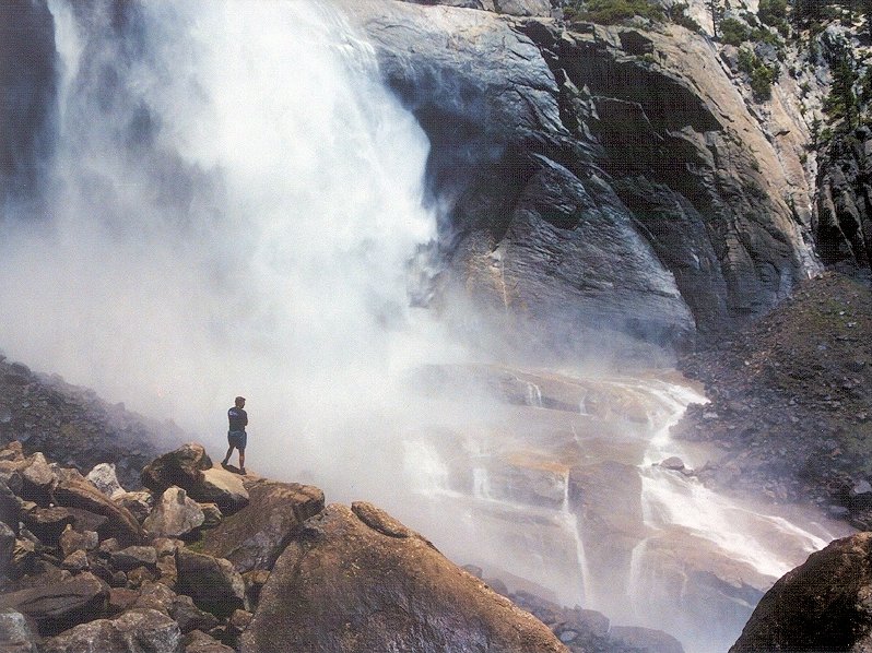
The base of Upper Yosemite Falls in May
