
Desolation Wilderness
|
Velma Lake ~ Dicks Lake Loop Desolation Wilderness |
June 11, 2012
It is going to heat up to nearly 100 degrees today in the valley, so it rates
to be pretty warm up here in the Tahoe Basin as well. It is about 70°
as I reach the trailhead at the relatively late starting time of 11:30 a.m.
There is a short loop trail here that does not require a wilderness permit. Most visitors seem either to be using that, or heading across the highway to view Eagle Falls as they plunge directly into Emerald Bay.

My work is cut out for me
Five minutes up the trail, I realize that I have forgotten my camera.
The round-trip back to retrieve it costs me an extra quarter-mile
of walking. Stupid.
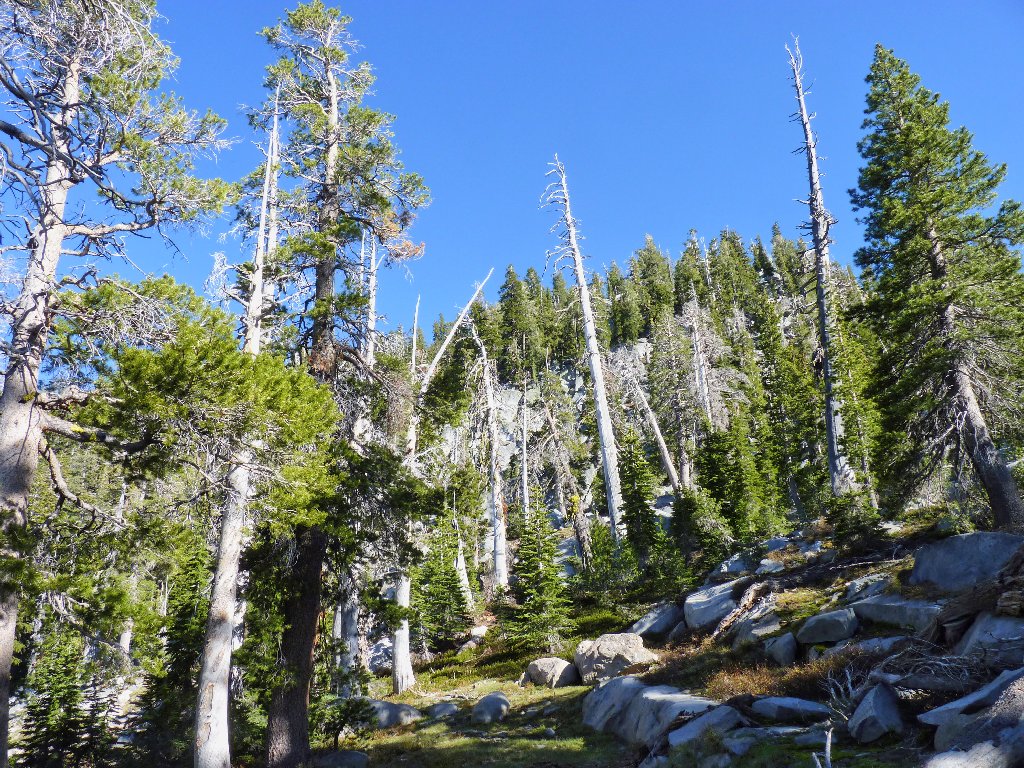
I also elect to leave my walking stick in the car, hoping I won't regret that move. In any case, the steep route up this canyon is comprised largely of stone steps. There is a short respite at the top just before reaching a spur trail over to Eagle Lake.
Most walkers go little farther than this
Jeffrey Pines rank among my favorites
Eagle Lake is a popular destination
After another half hour of mundane trekking up a hot, sunny slope, I encounter a family of four with two friendly dogs. I pass them, then they pass me back, etc. Finally, I forge ahead of the group for a last time and plunge over to the right, failing to notice that the trail goes to the left.
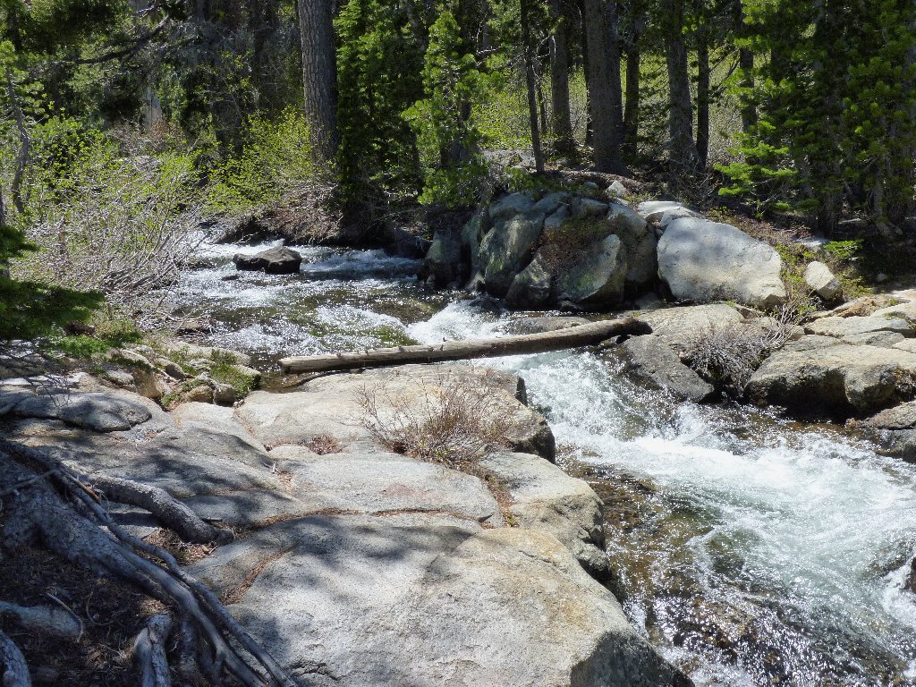
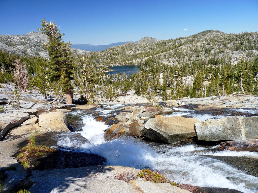
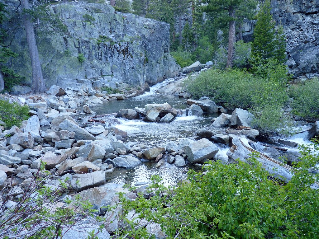
Soon, I am overlooking a marvelous cascade which would not have been seen had I stayed on the trail. Serendipity.
Heading off the trail
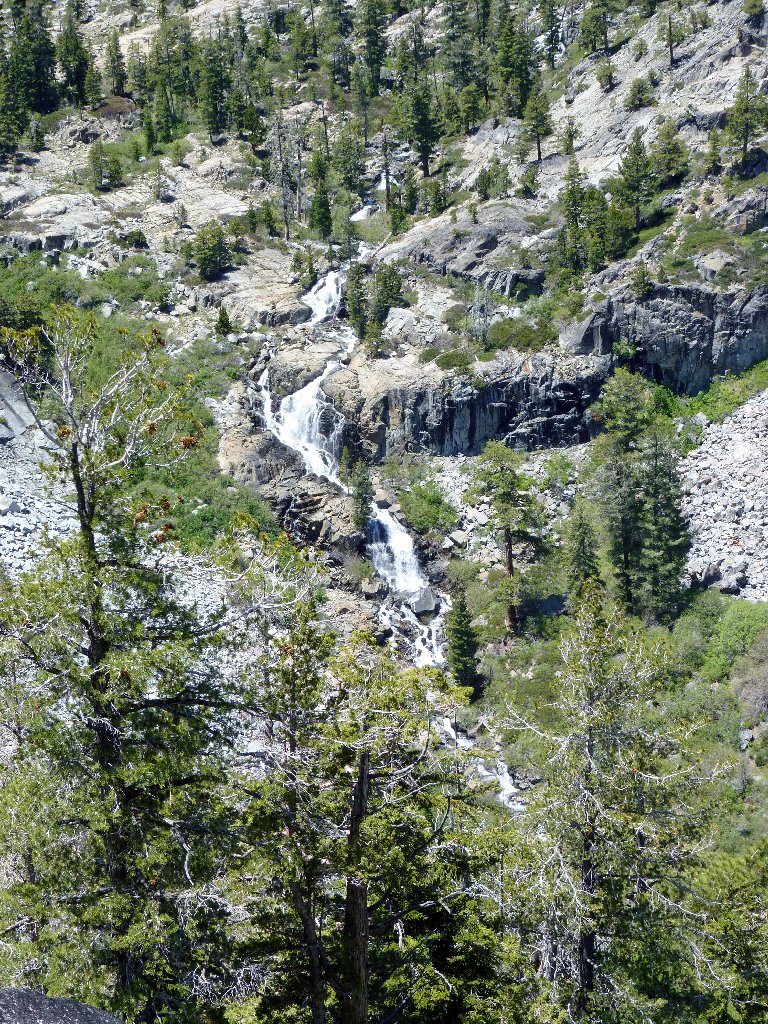
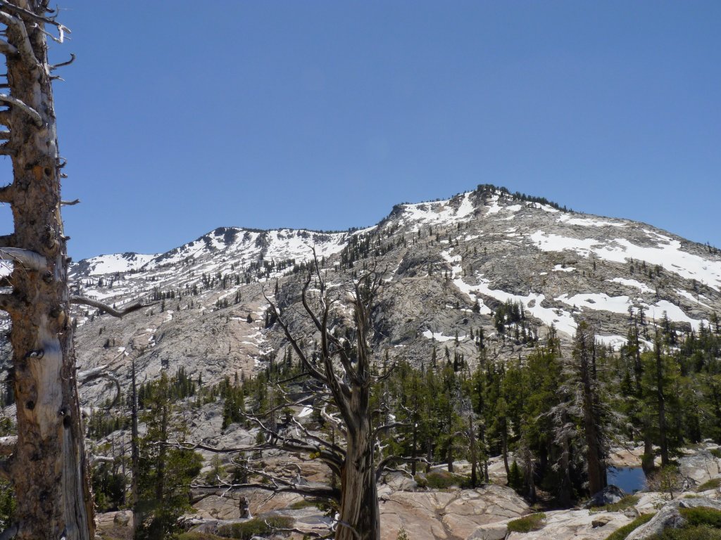
Runoff from Phipps Peak
The question now is whether to continue in hopes of rejoining the trail shortly, or prudently backtrack a couple hundred yards. There is a use trail of sorts over here; perhaps it goes all the way around this side of the hill. Hating to retrace steps unnecessarily, I forge ahead.
Where I have been
Where I am headed
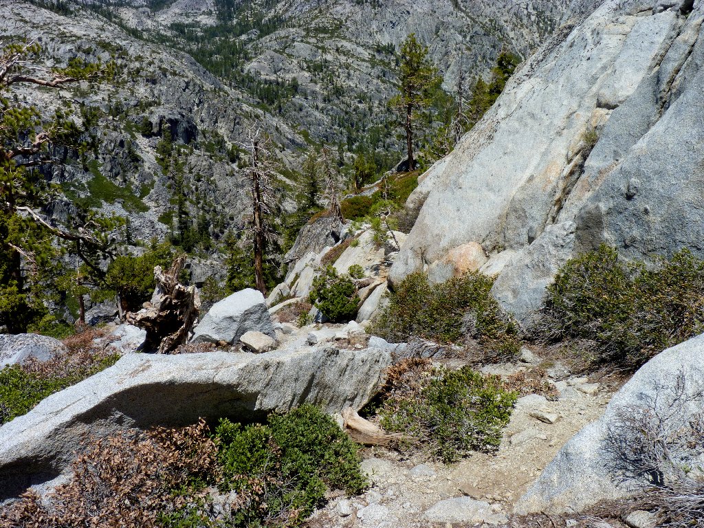
Not surprisingly, the obscure path ends shortly, and I am compelled to do some boulder hopping and extra climbing. Within ten minutes or so, however, I regain the trail somewhat the worse for wear.
Back on track
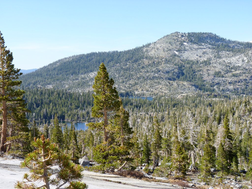
At a junction with the Bayview Trail, which leads back over between Maggies Peaks to the highway, I meet a trio of male backpackers studying a bird book. Cool. Shortly after that, I spot one of the Velma Lakes in the distance — my interim destination.
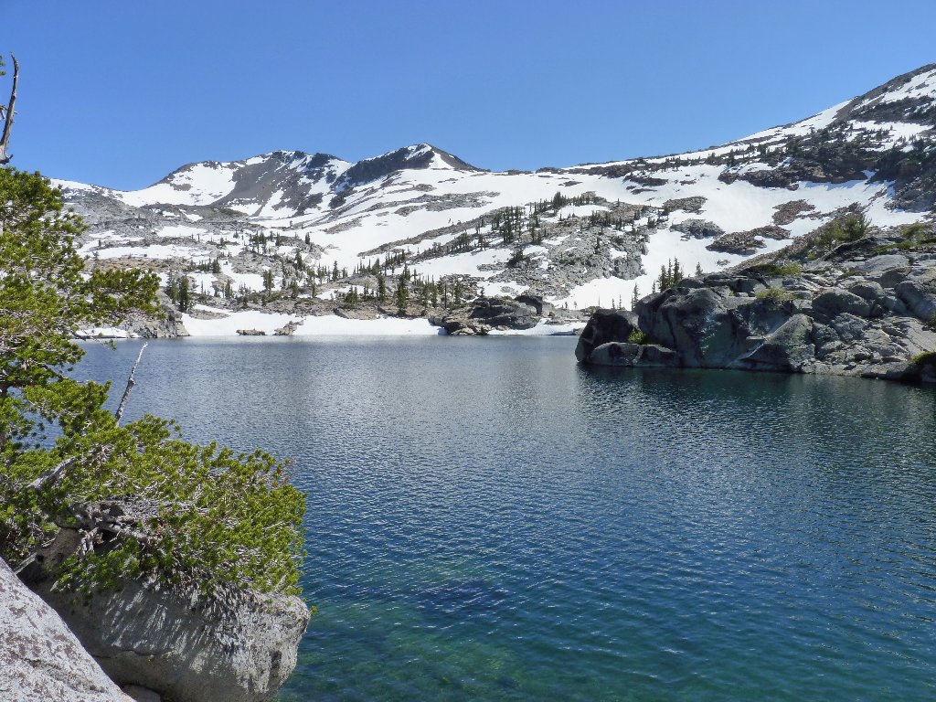
Looking south
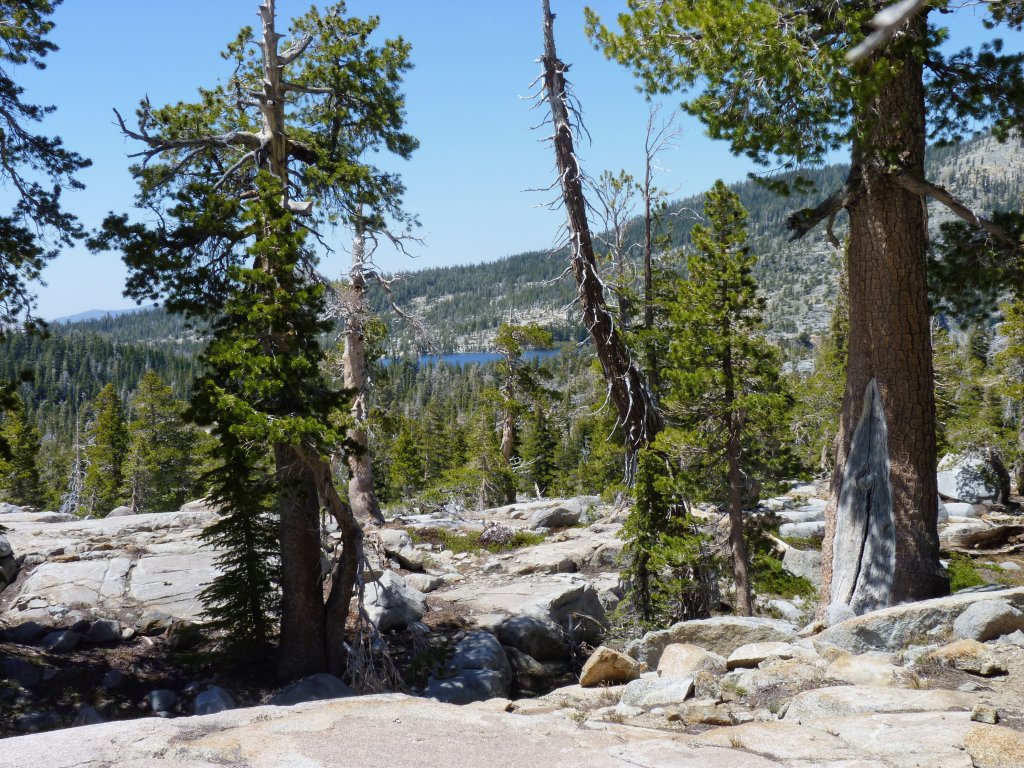
Middle Velma Lake, I presume
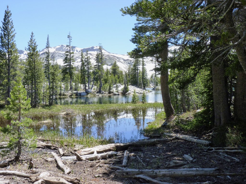
Unnamed pond
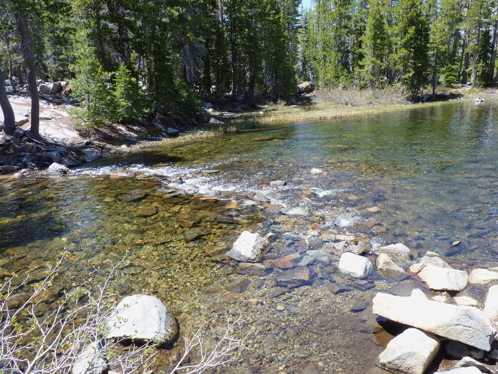
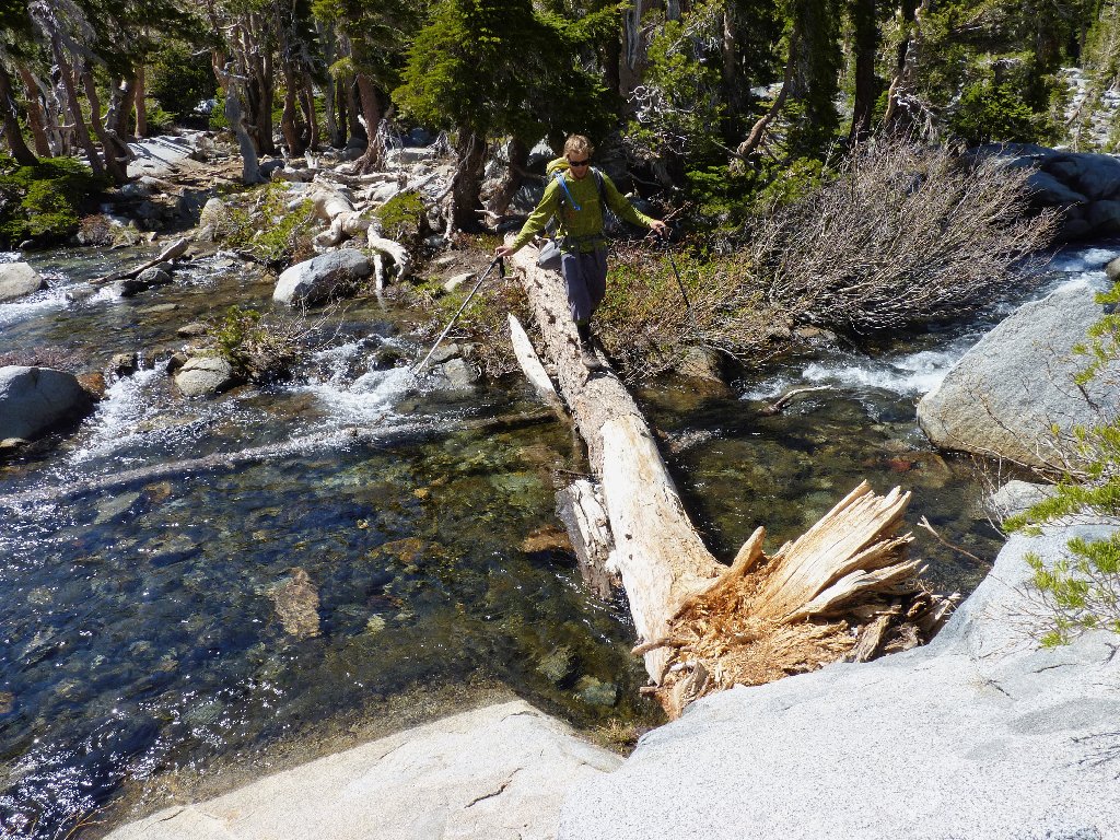
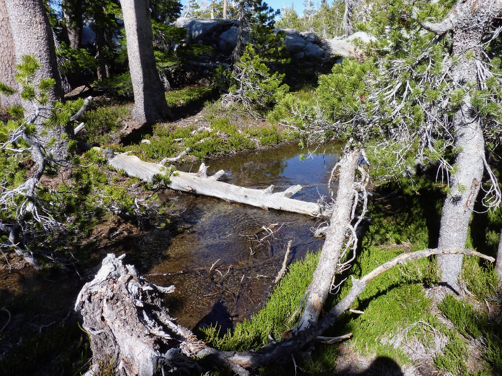
Oops. The Eagle Creek crossing still is unpassable. Will I have to go wading? No. A few hundred feet upstream is a carefully placed little log that enables a passage by taking just one step on the log itself.
Not this way...
...but this way
I started out this day unsure as to how many miles I would try to put away. The Velma Lakes Trail continues westward past Middle Velma, and Lower Velma lies about half a mile to the north with no official trail available. This little basin is relatively flat and unexciting, although I suppose that there are some nice campsites around.
Shortly ahead, I could pick up the Pacific Crest Trail which heads down to Fontanillis Lake; but I believe there is a better plan. Having walked nearly five miles already, I opt to ignore the other two Velmas and head directly south to the shore of the next lake.
Upper Velma Lake
Just beyond here is a special attraction that has been audibly evident for quite some time.

At last — something special on this walk!
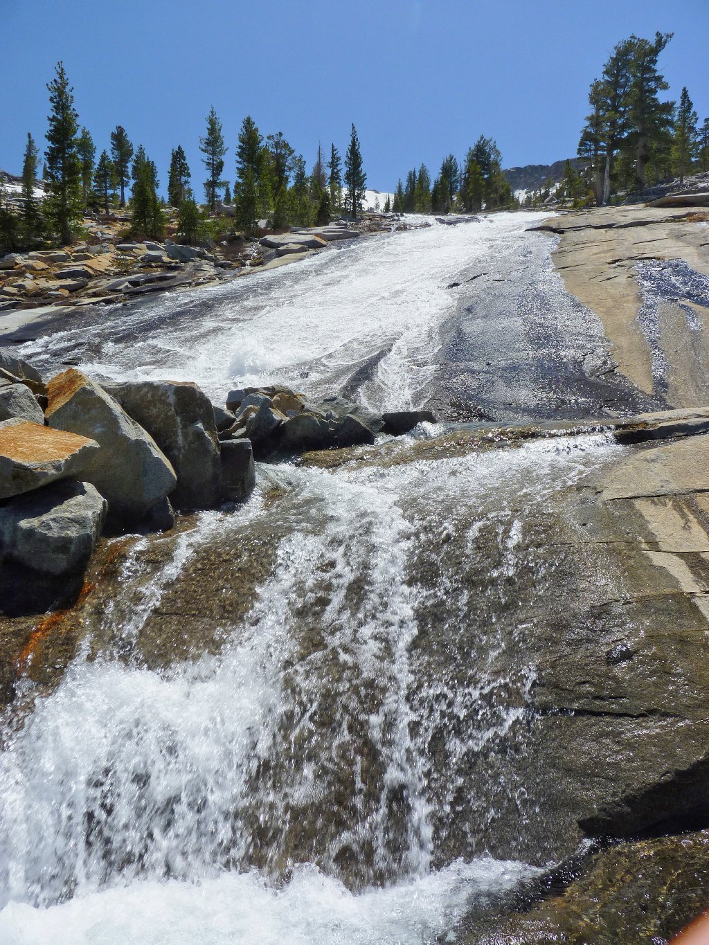
I dub thee Fontanillis Falls
It is but a 300-foot climb to the top of the cascade; so of course I must do that, while taking pictures and enjoying the surroundings all the way. This is my kind of place.
Flowing directly out of Fontanillis Lake
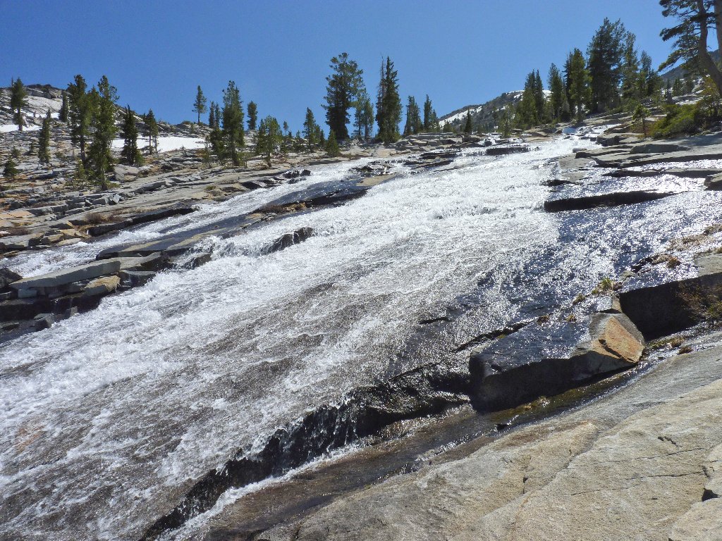
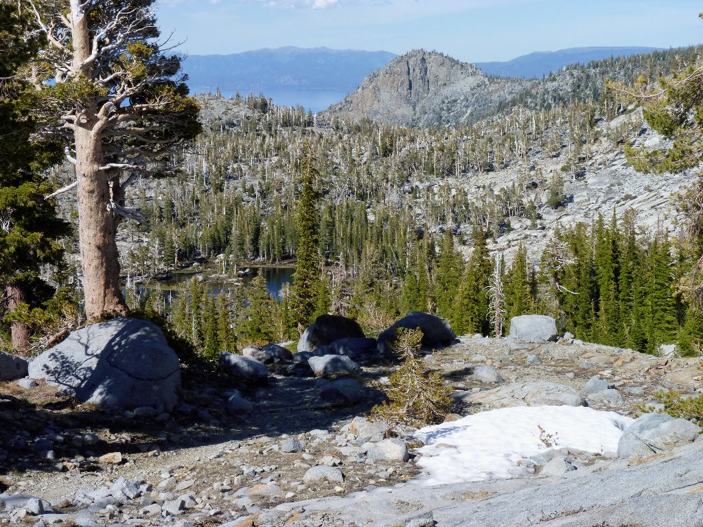
The cascade, Upper Velma Lake, and a bit of Lake Tahoe in the distance
At the top of the falls, I do encounter the Pacific Crest Trail. Accessing it sooner would not have been as scenic as my venture up the slabs next to the tumbling waters.
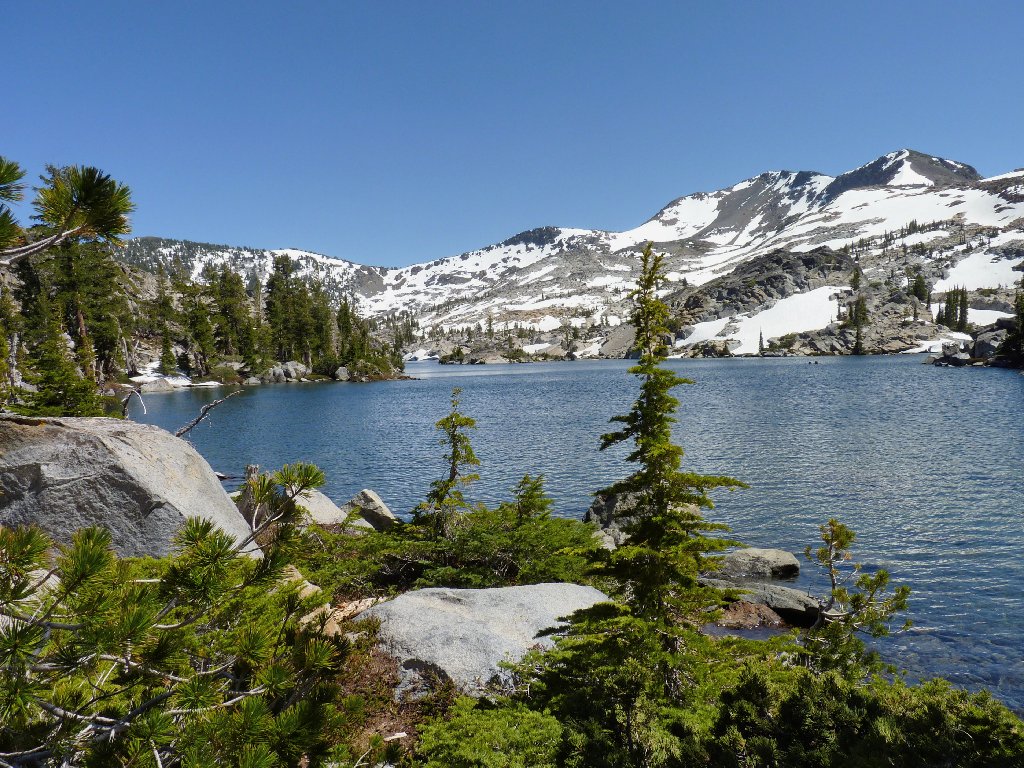
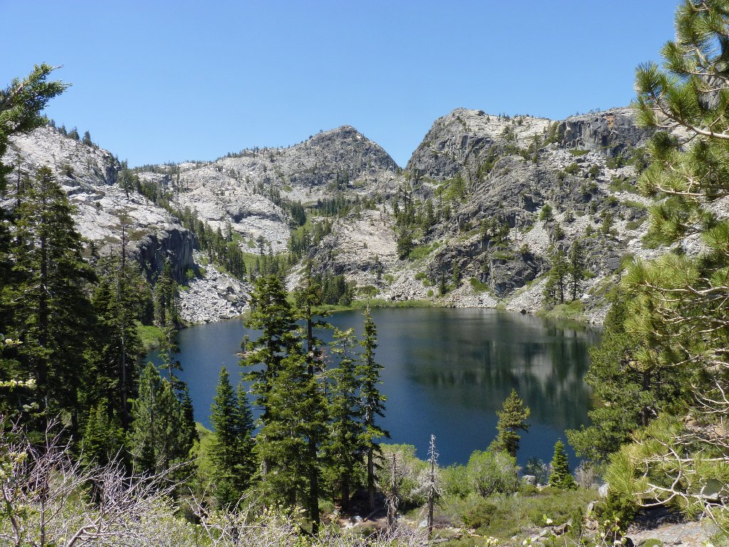
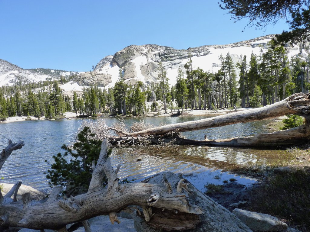
Fontanillis Lake
Now I am at a crossroads. Judging from my map, it would be no farther to continue south to Dicks Lake on the PCT and loop back than to retrace my erstwhile path. I guess that that is what I had in mind all along, even at the cost of some extra mileage. Either way, my trek is only half complete at this juncture; so I might as well go for it. I surely hope that my feet hold up; they already are feeling the effects of what has been a pretty rough trail most of the way.
The water looks inviting, but it is not
I solo backpacker approaches me. Having started in Tahoe City,
he is doing a portion of the Tahoe Rim Trail, which shares about
45 miles of this section of the Pacific Crest Trail. While
awaiting his companion who began his own trek much farther away at Mount
Rose, we doff our boots and dangle our feet in the frigid water —
for a few seconds at least.
A Tahoe-Rim-Trail enthusiast crosses at the outlet
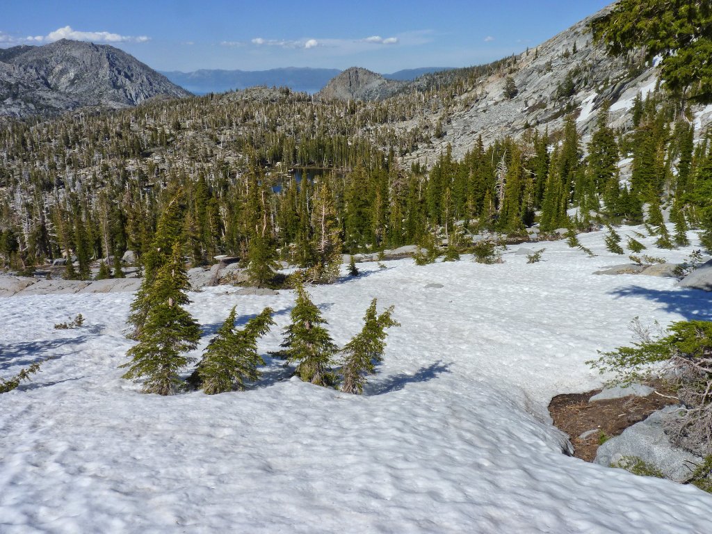
Fontanillis Lake is so long and thin that one cannot see it all from a single vantage point on the trail. After departing the two packers, I continue down the PCT to the end of the lake and beyond. Before long, I am traversing one snowdrift after another. It is fortunate that others knew the way, for their footprints across the drifts invariably lead in the right direction.
The southern end of Fontanillis
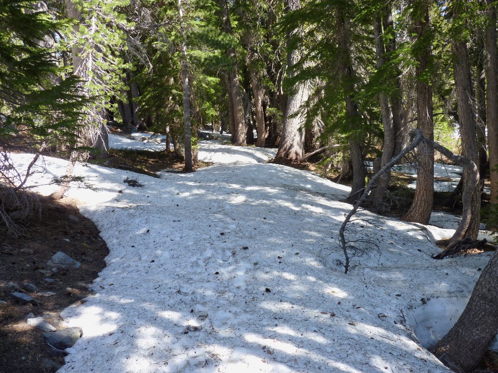
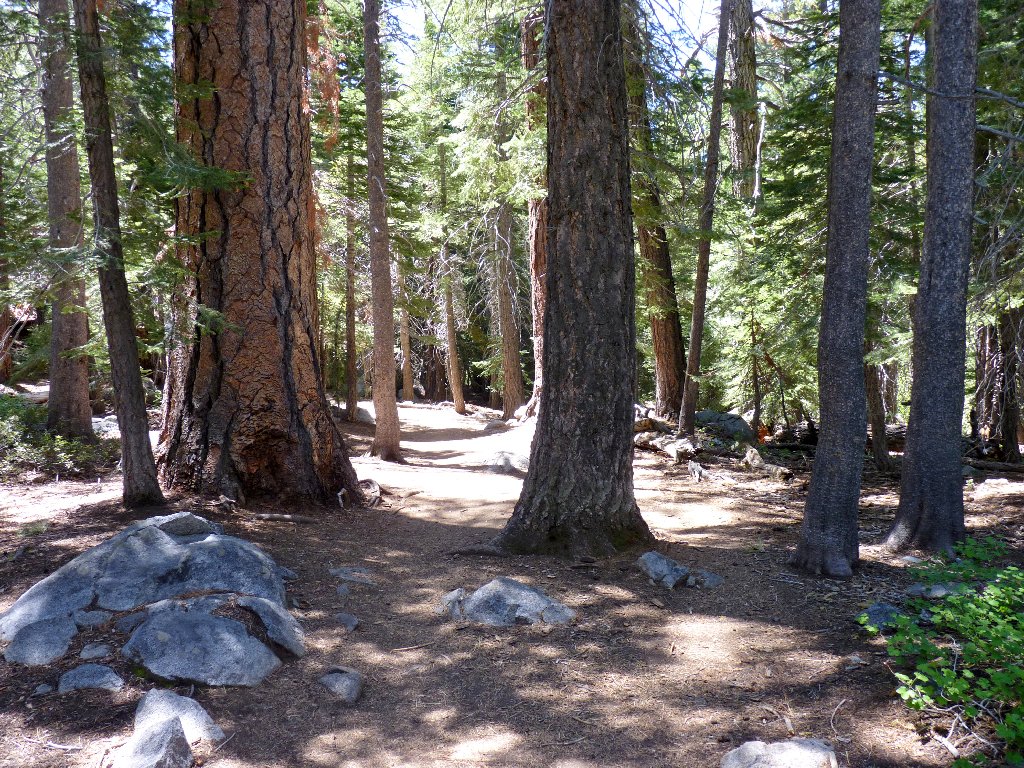
Entering the lonesome forest
A short mile from my wading spot is a minor junction with a spur
trail. The next objective being in view among the trees, I head
straight down to the shore of an ice-bound lake.
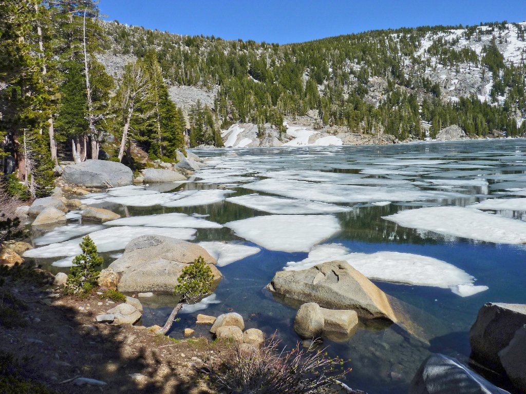
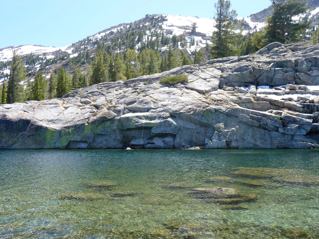
Dicks Lake, 8430'
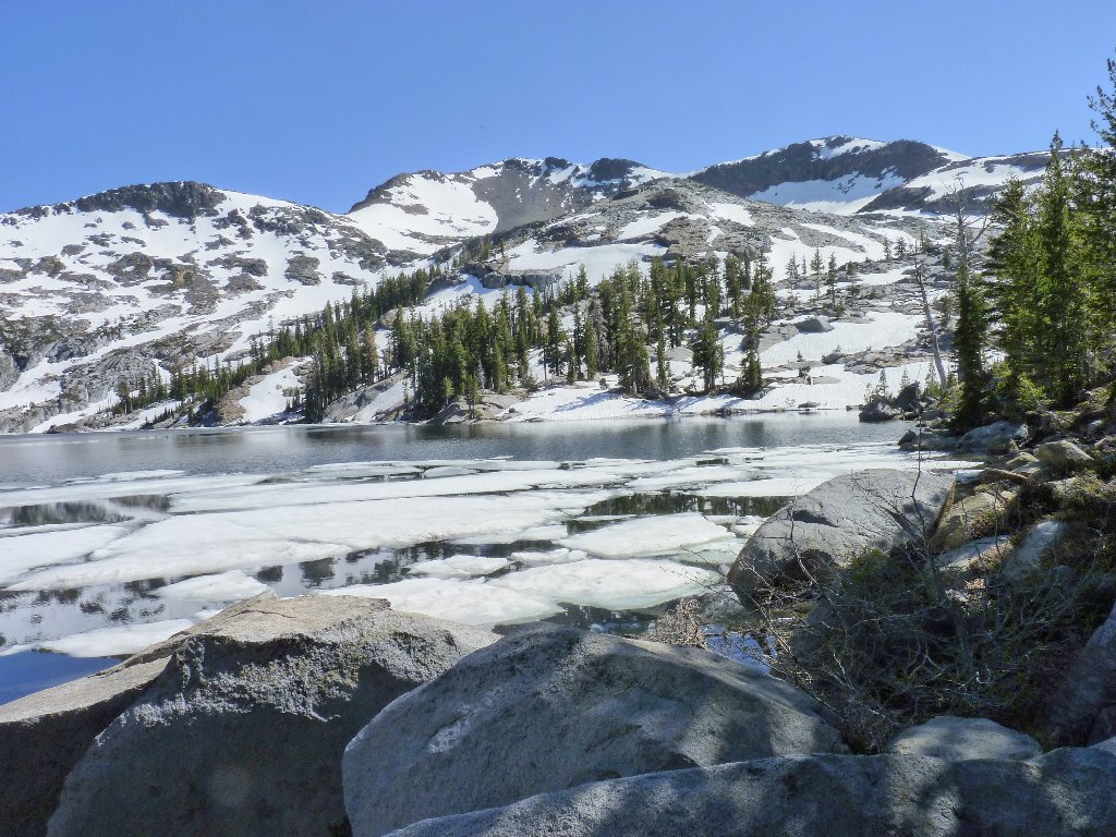
Dicks Peak, 9974'
Due to the length and relative difficulty of this hike, I have been
feeling a wee bit out of my comfort zone for a while; so this is a good
milestone to have reached. Already a mile into the home stretch,
shortly I will be headed down below 8,000 feet and out of the snow.
Within a quarter of a mile a major signpost shows the way.
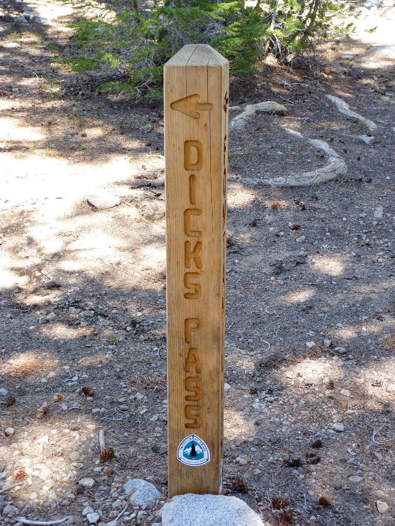
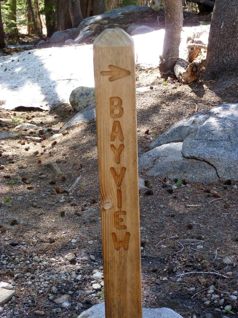
These arrows actually point in the same direction
I won't be doing Dicks Pass, but heading toward Bayview definitely is the way to go; so it's goodbye to the Tahoe Rim and Pacific Crest Trails as I turn northward.
As I near the top of the hill, I suddenly am missing my hat. Shades
of Euchre Bar! Heading back down toward the last rest stop, I finally
realize that my hat has been in a pocket all along — just not the
one that I normally use. Chalk up another quarter-mile to stupidity.
Another unnamed pond below
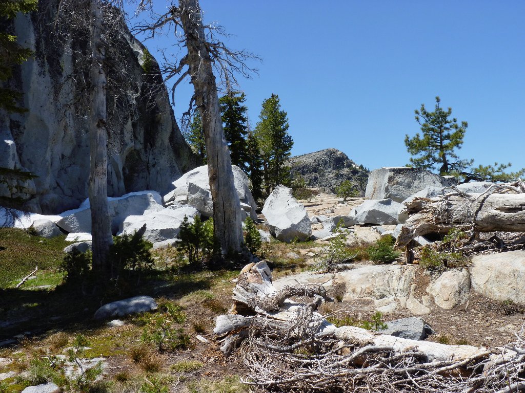
On the northern side of this ridge is a big snow bank, into which the trail disappears without a trace. There are no helpful footprints, either. The map shows the trail going just to the left of that new pond, however; so that is where I head. Slipping and sliding down the steep snow bank, I don't regain the trail until reaching the pond.
The trail is under there somewhere
Upper and Middle Velma below Phipps Peak, 9234'
Another well-placed log
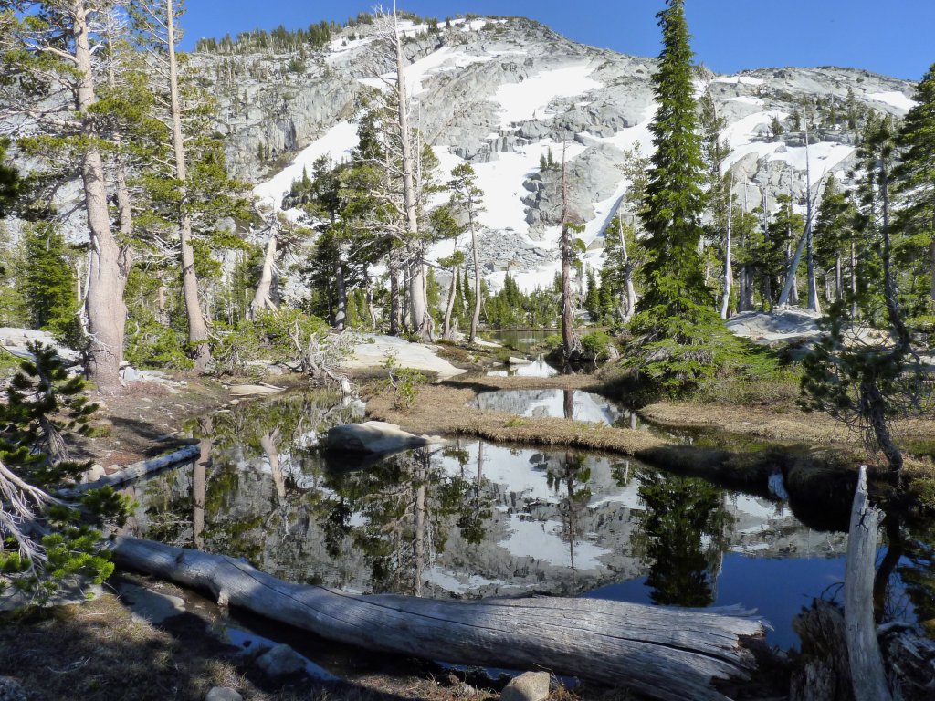
Nice reflections in the pond
Ten minutes from here I close the loop and regain the Velma Lakes Trail. It is time to give my feet another good rest before tackling the final three miles.
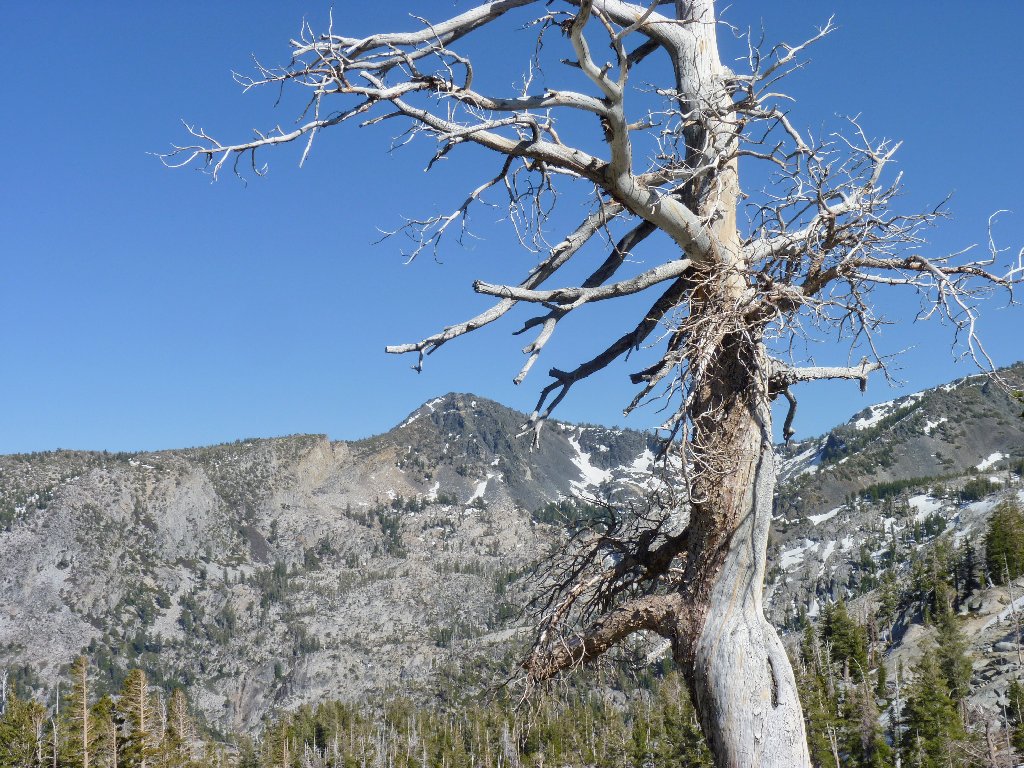
The back side of Mount Tallac
It is after 6 p.m. as I enter Eagle Creek Canyon. I find myself traveling as quickly as possible for some reason. It's not going to get dark on me, but I would like to be done with this walk of well over seven hours' duration.
Late afternoon in the canyon
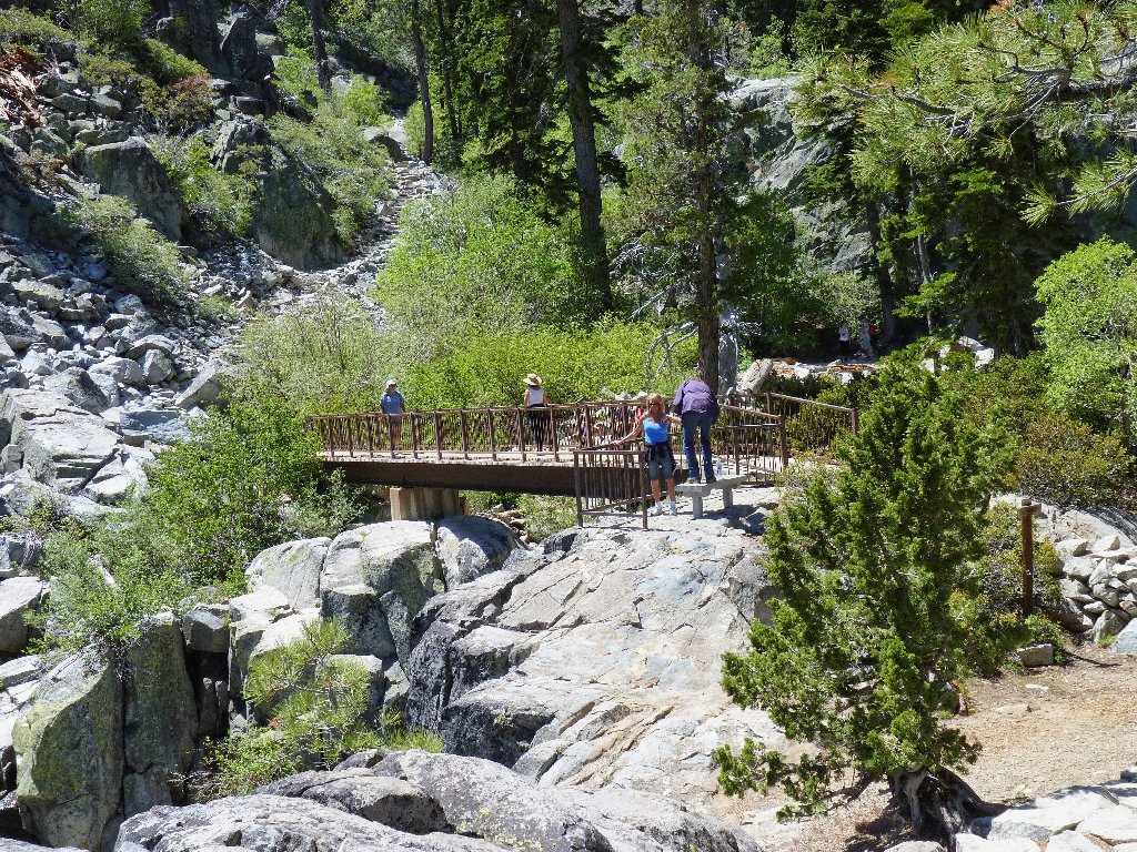
A light breeze has come up, and the sun is gone down. For the first time today, I am comfortably cool. As I approach the footbridge on Eagle Creek, I encounter the first humans I have seen in several hours.
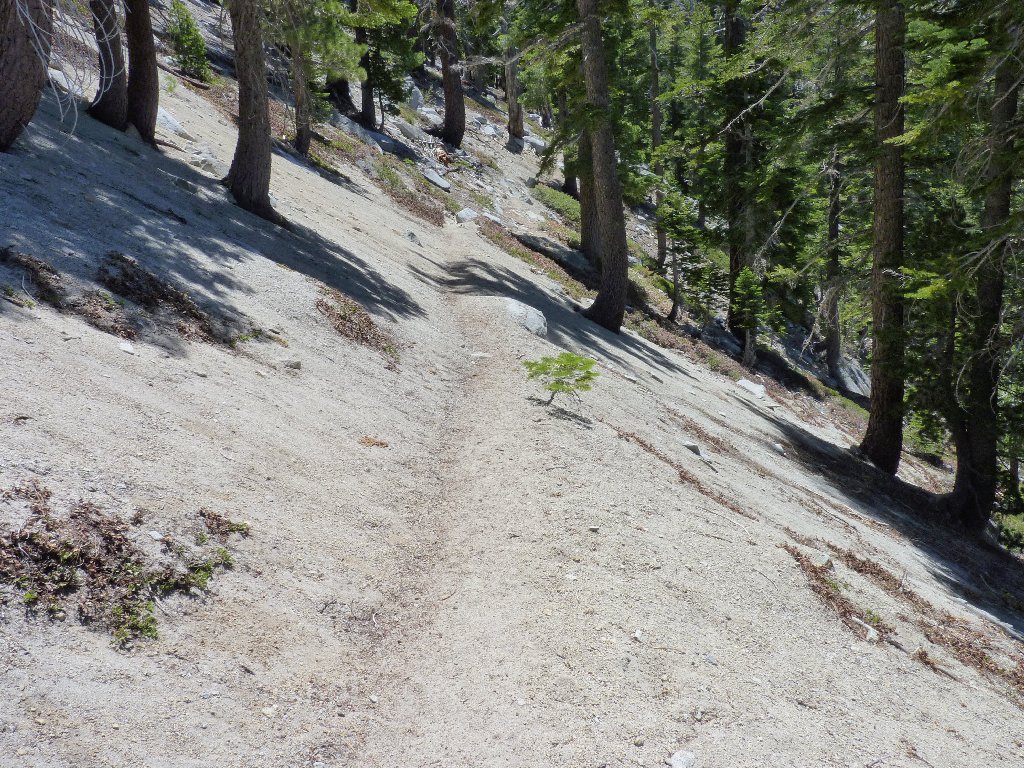
The last half-mile is in the shade
§: I put away more miles today than were anticipated.
Without my handy-dandy new carbon-filter water bottle that I
refilled three times, I could not have done this walk on such a warm day
without drinking from the creeks (which probably would have been okay).
The Fontanillis Cascade was great, and the two high lakes were nice.
The rest of the hike was relatively dull, and the trail was quite rough
the entire time. Also, there were no flowers.
Prudence dictates that I not make a habit of embarking upon such a
time-consuming trek unless I start out earlier — or at least
with proper equipment. Had it proved necessary to take a significant
break, I would have been compelled to finish the walk in darkness, and I
was ill-prepared for that.
| Scenery |  |
| Difficulty |  |
| Personality |  |
| Solitude |  |
