
Yosemite NP
|
Pywiack Cascade Overlook Yosemite NP |
July 12, 2011
Last week, while at the Glacier Point overlook, I spotted a roaring cascade at the upper end of Tenaya Canyon. I am headed there today for a closer look. Because hiking is actively discouraged in this canyon for safety reasons, there will be no trail to assist me for much of the way.
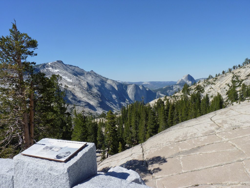
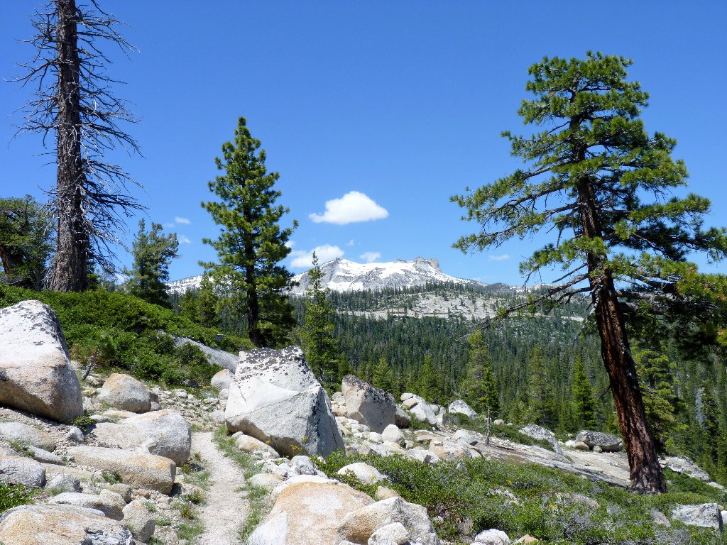
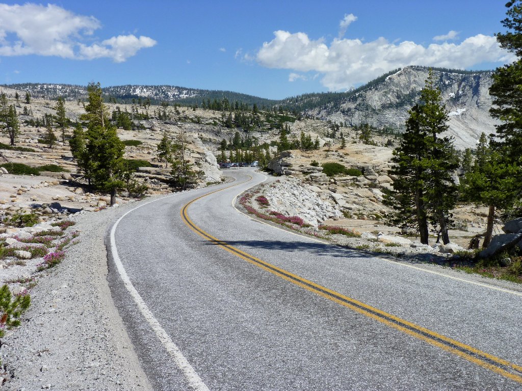
The adventure starts at Olmsted Point on the Tioga Road
The objective is about two miles due south of the tourist overlook.
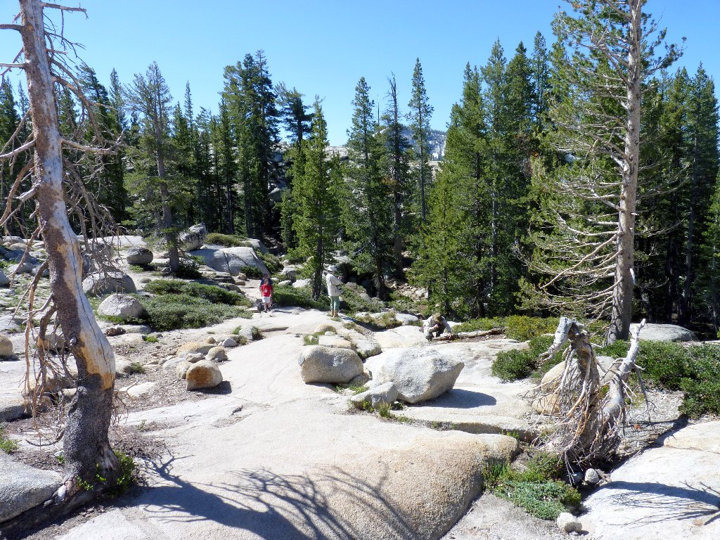
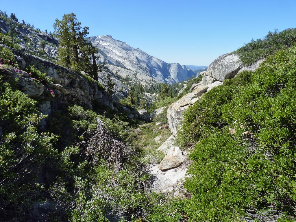
Starting on the Mount Watkins Trail, I abandon it within five minutes when it
cuts back in the wrong direction. Having no first-hand knowledge
of this route, guessing the easiest way down is problematical; but it really doesn't
matter. Already I see that I have descended to the bottom of the gully
sooner than necessary; I could have made use of that long granite slab on what
is now the other side of the wash.
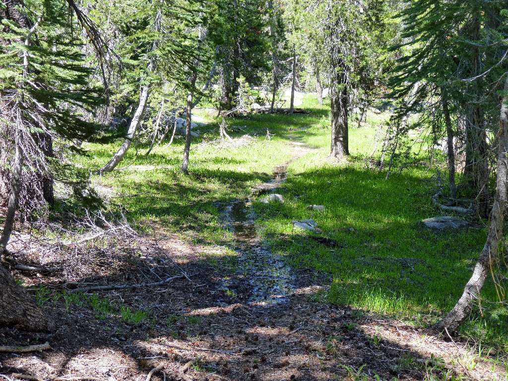
The Mount Watkins-Yosemite Valley Trail
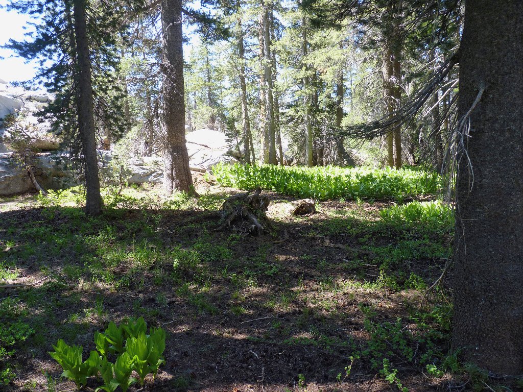
Into the forest
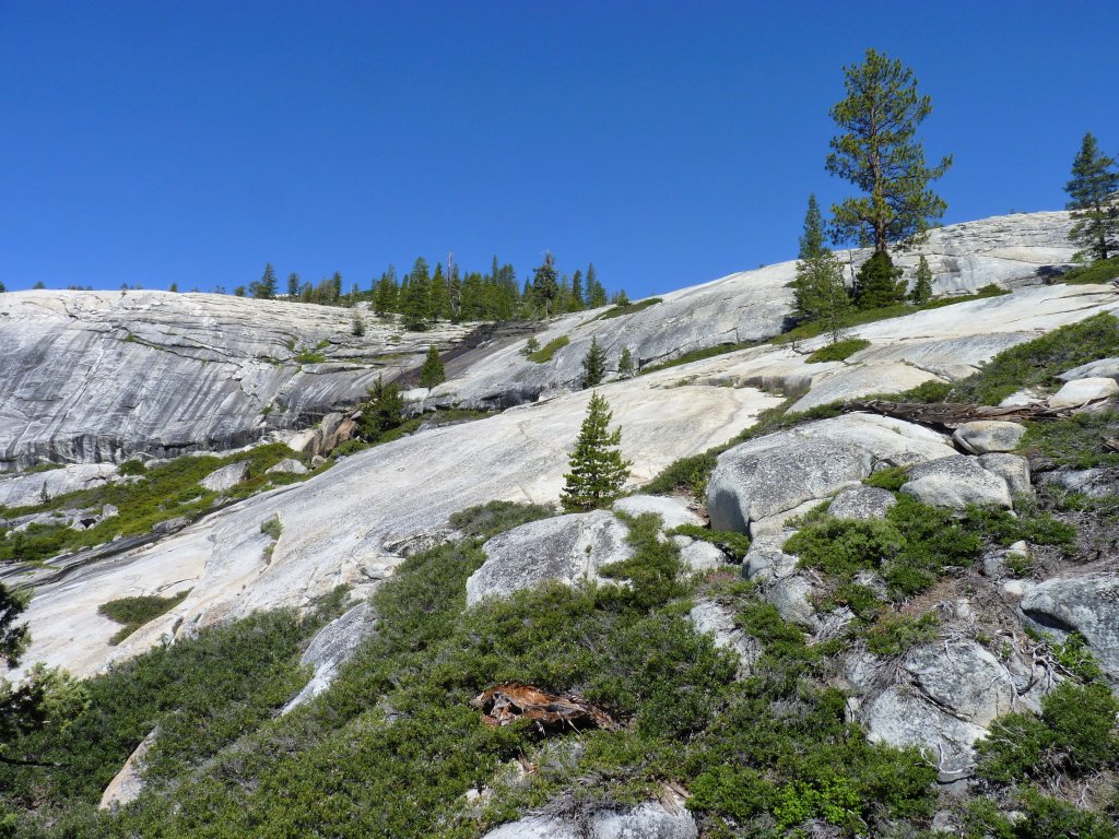
I should have gone that way...
...instead of this way
A grouse startles me as I approach its nest, creating quite a commotion in an attempt to lure me away from the area.
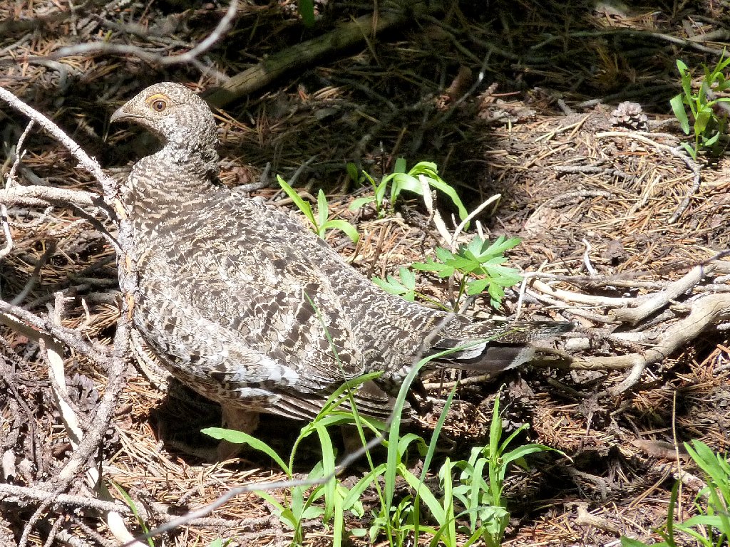
Sooty Grouse
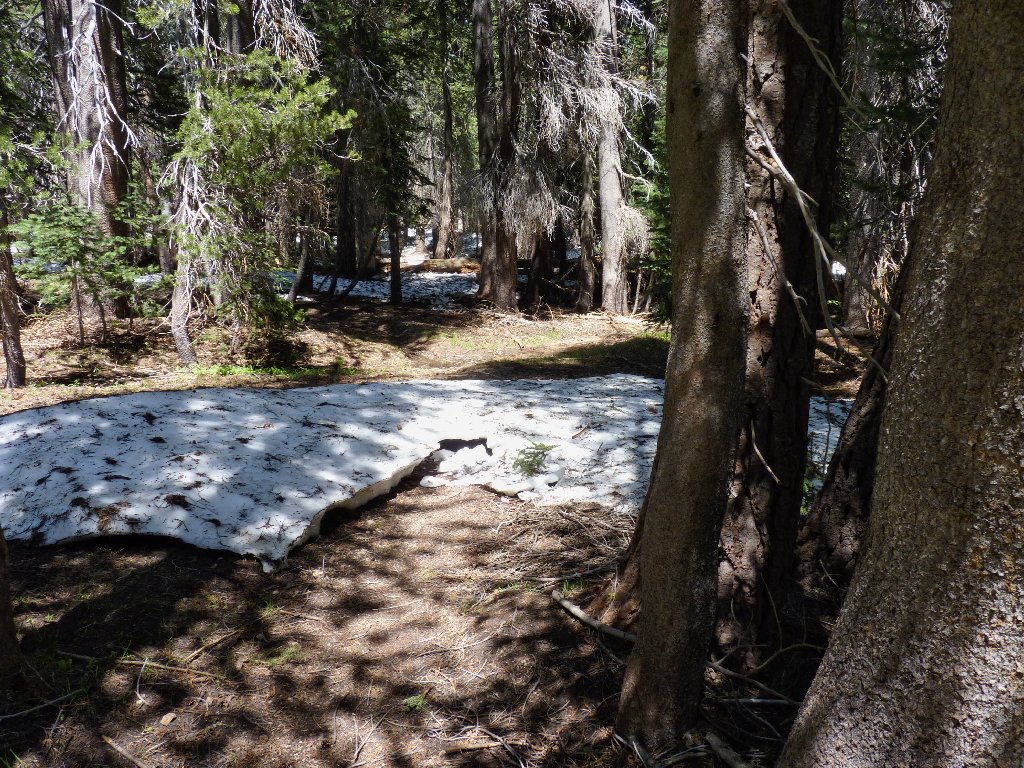
At the edge of a cliff I pause to get my bearings. It appears that I actually could bushwhack down this canyon all the way to the base of the falls, but that is not in today's plan. Both a visual sighting and my GPS tell me to climb over to the west.
A temporary dead-end
Presently a first view of the cascade appears. There is another way around the big boulder, but I'll give this one a go. Treading carefully along the slanted slab, I really wouldn't want to lose my footing here.
This is not quite a "Don't tell my wife" passage,
but I wouldn't try it in a high wind or if the rock were wet
There are lots of wonderful flowers about; I mustn't ignore them.
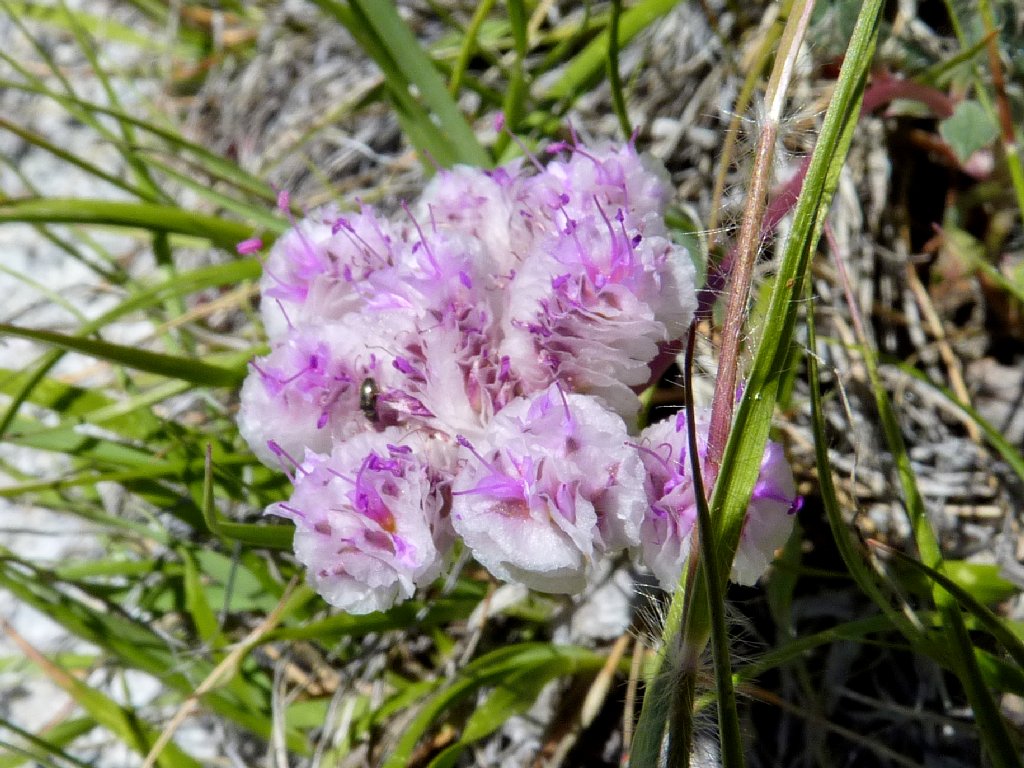
One-Seeded Pussy Paws
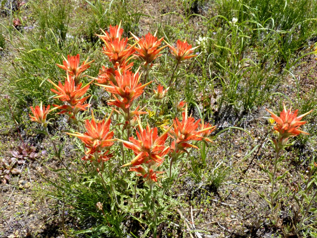
Paintbrush
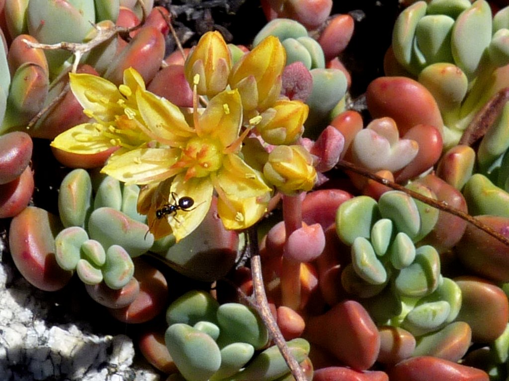
Sierra Stonecrop
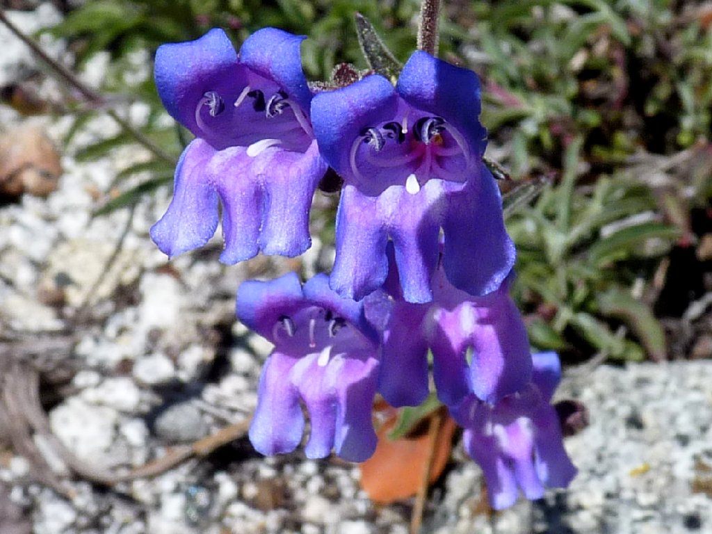
Royal Penstemon
Finally reaching the first planned overlook, I am close enough to view most of the cascade; and what a sight it is! A search for good vantage points involves trying always to keep a big rock or a tree between myself and the edge of the chasm.
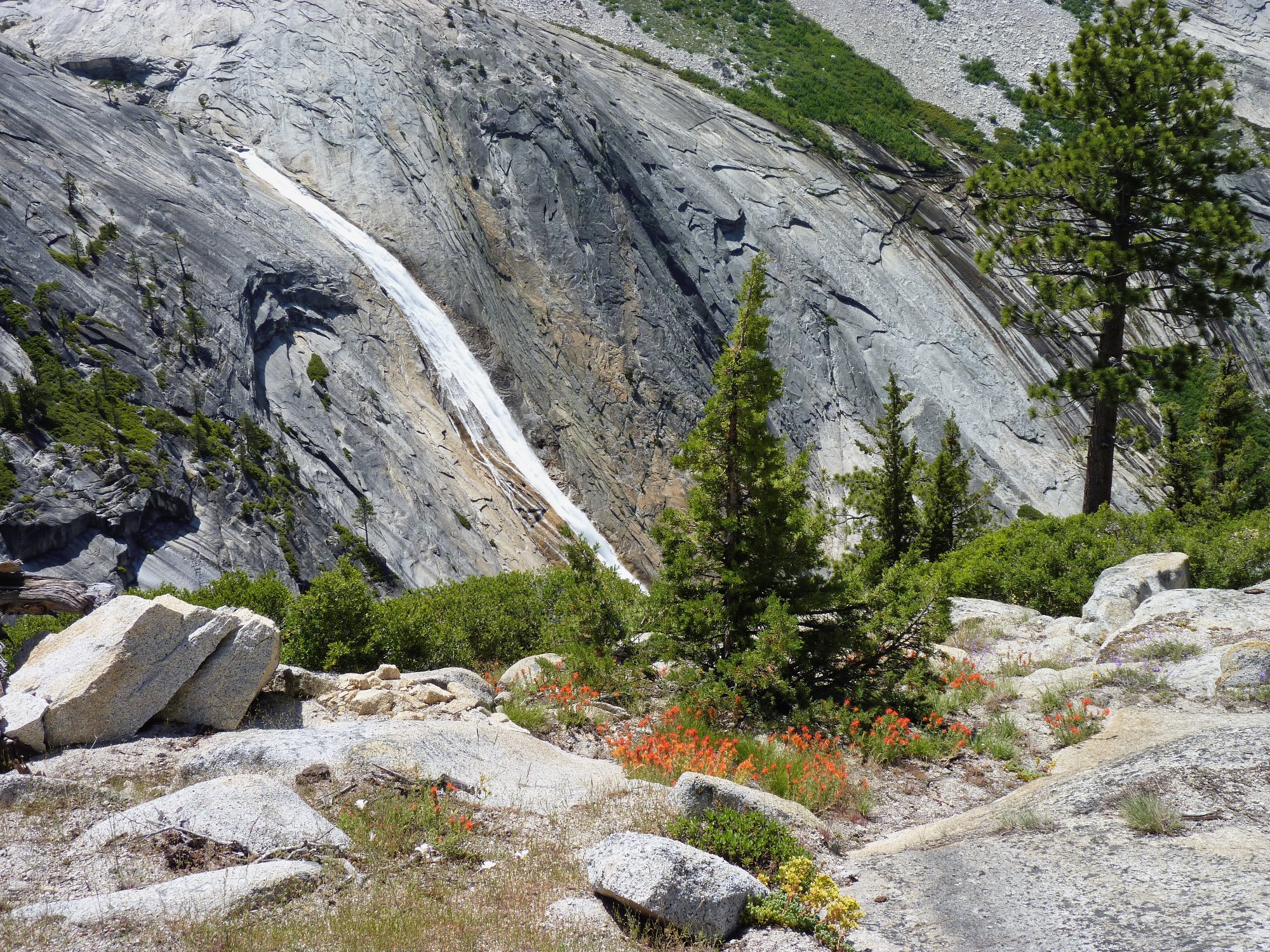
Pywiack Cascade ⇔
"Py-we-ack" in the native language means
"glistening rocks", named after the abundance of glacial polish
in the basin. The 600-foot cascade drains Tenaya Lake,
sending its waters tumbling down toward the Merced River in Yosemite Valley.
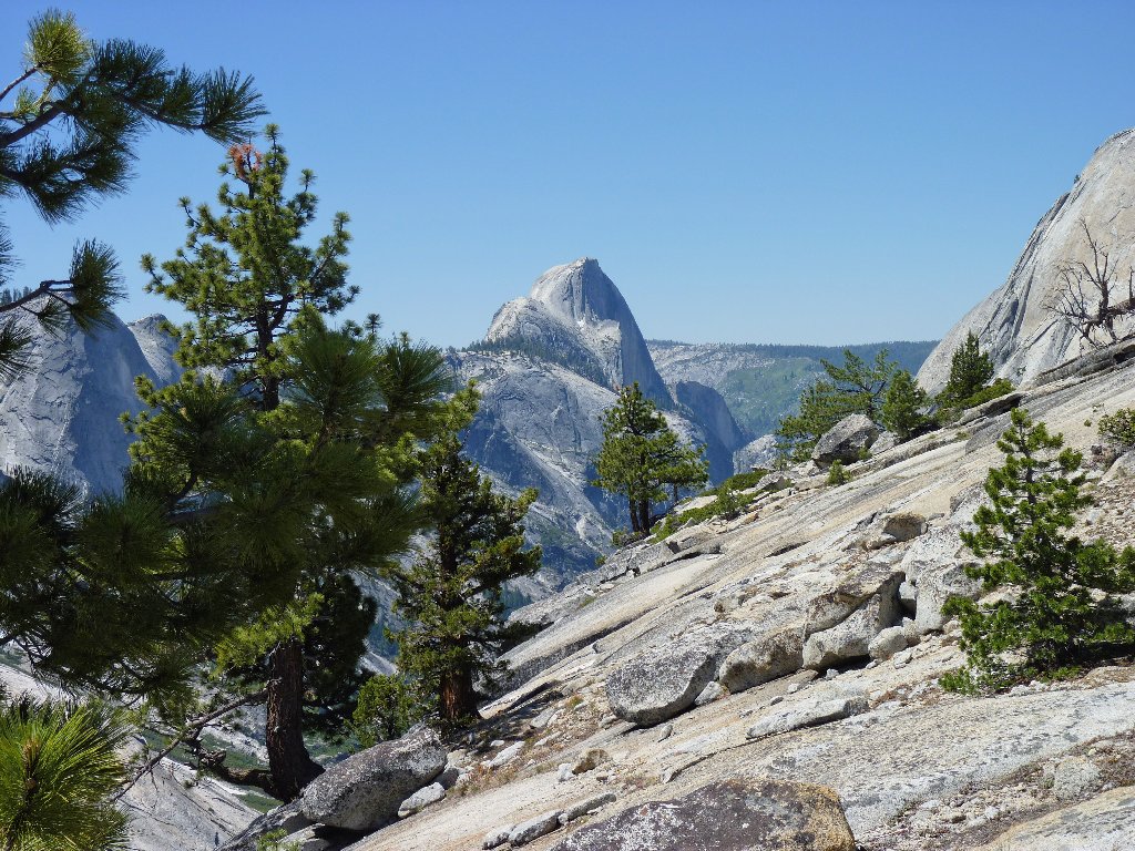
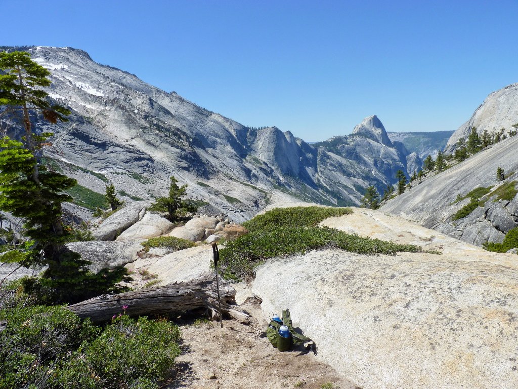
Half Dome looms in the distance
This is a good-feeling place, but I cannot see the lower portion of the
falls. A quarter-mile to the west is a potentially better
viewpoint, which elevation is marked on the topo map as 7646.
Scrambling over there, I maneuver as close to the edge as is prudent,
for some photos.
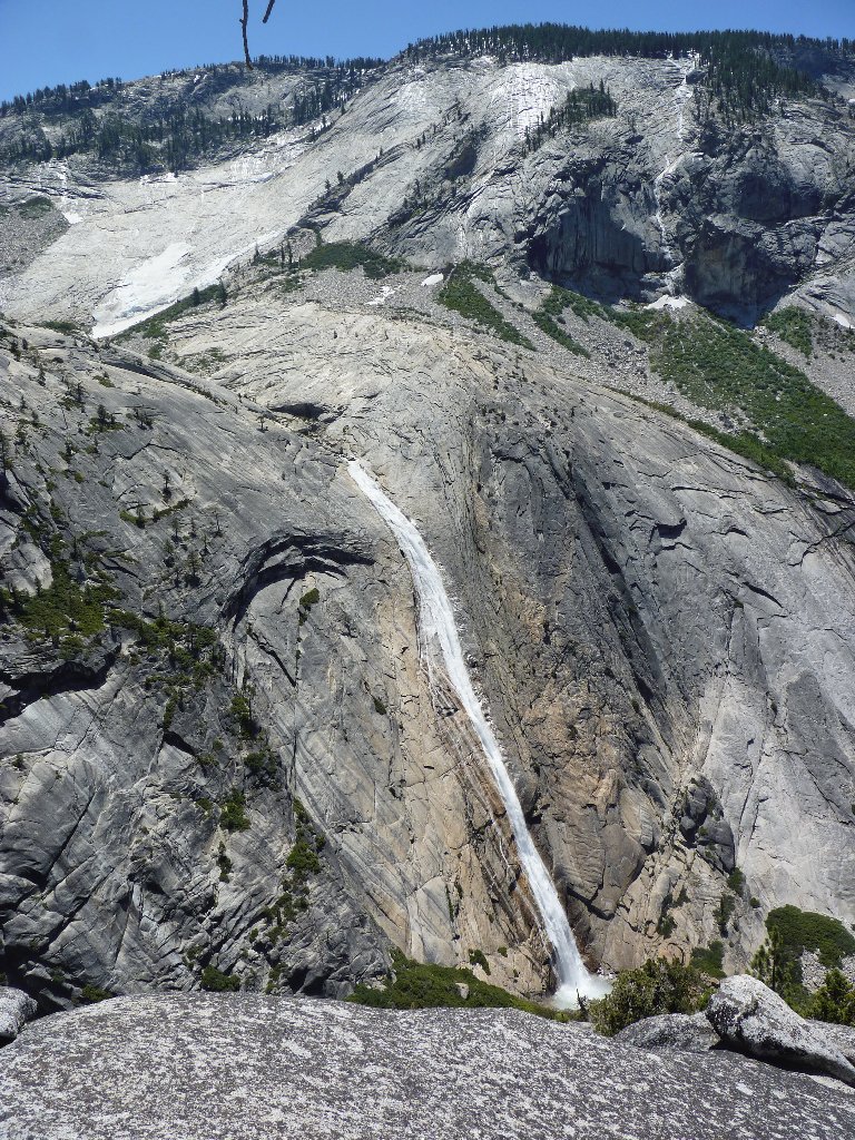
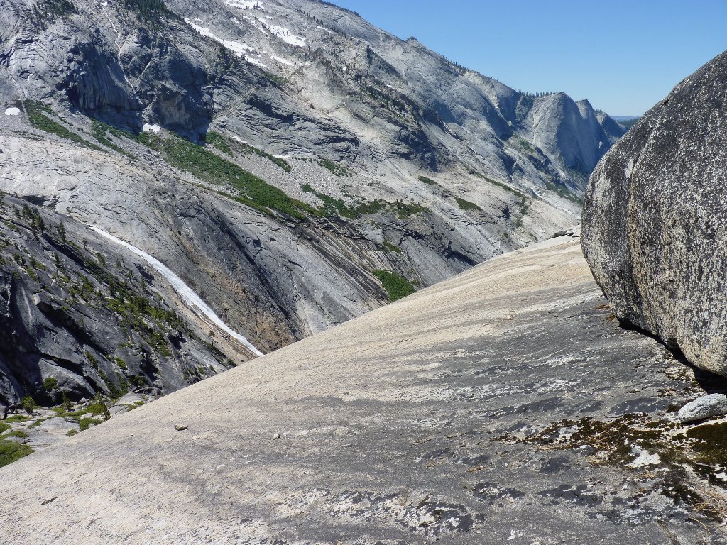
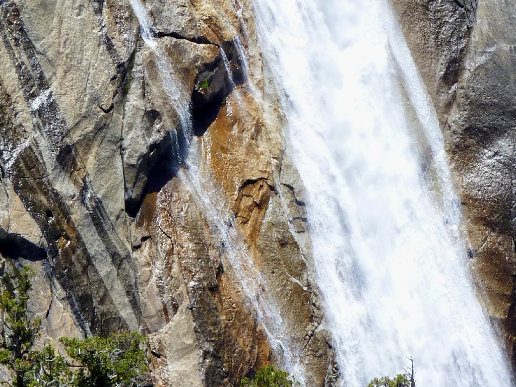
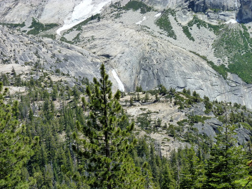
Another cascade above Pywiack
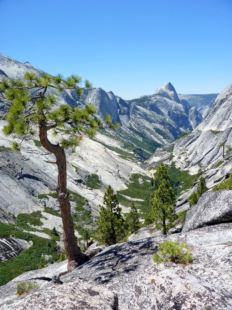
Tenaya Canyon
These efforts are rewarded, because now I have a good view of the base of the cataract. Oh, my!
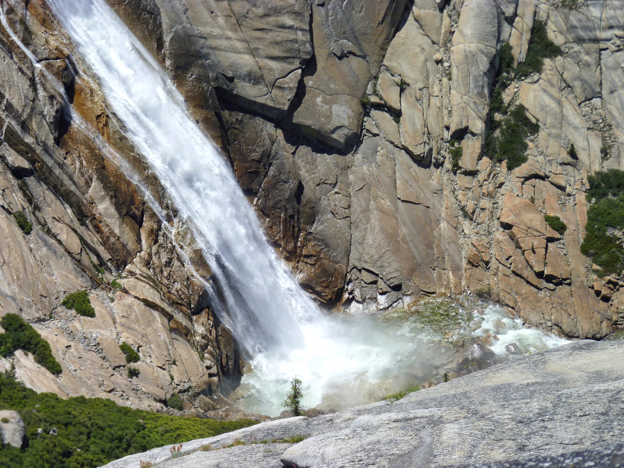
This is why I go hiking ⇔
What a magnificent spectacle! This perspective of the cascade and Pywiack Pool is unavailable from any trail or other viewpoint. It was worth any effort to be here right now.
It's thi-i-is big!
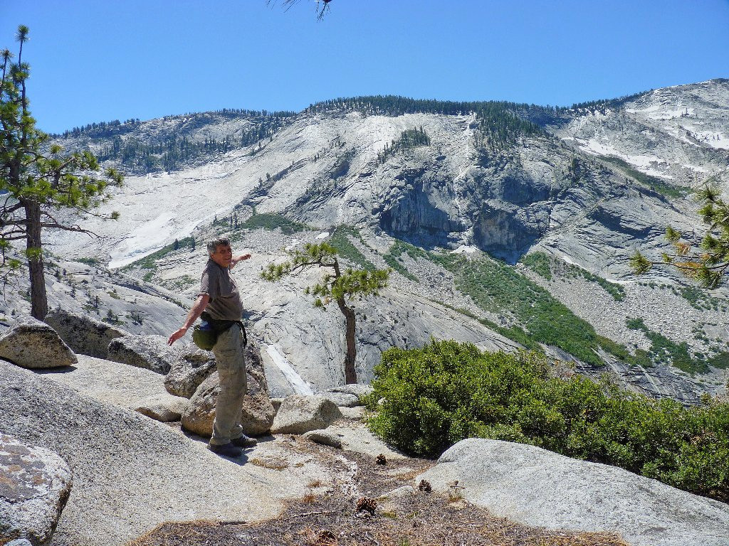
I see that another hiker has made his way to Overlook #1. I wave to him several times, but I don't believe that he ever notices me.
That guy has the same idea as I
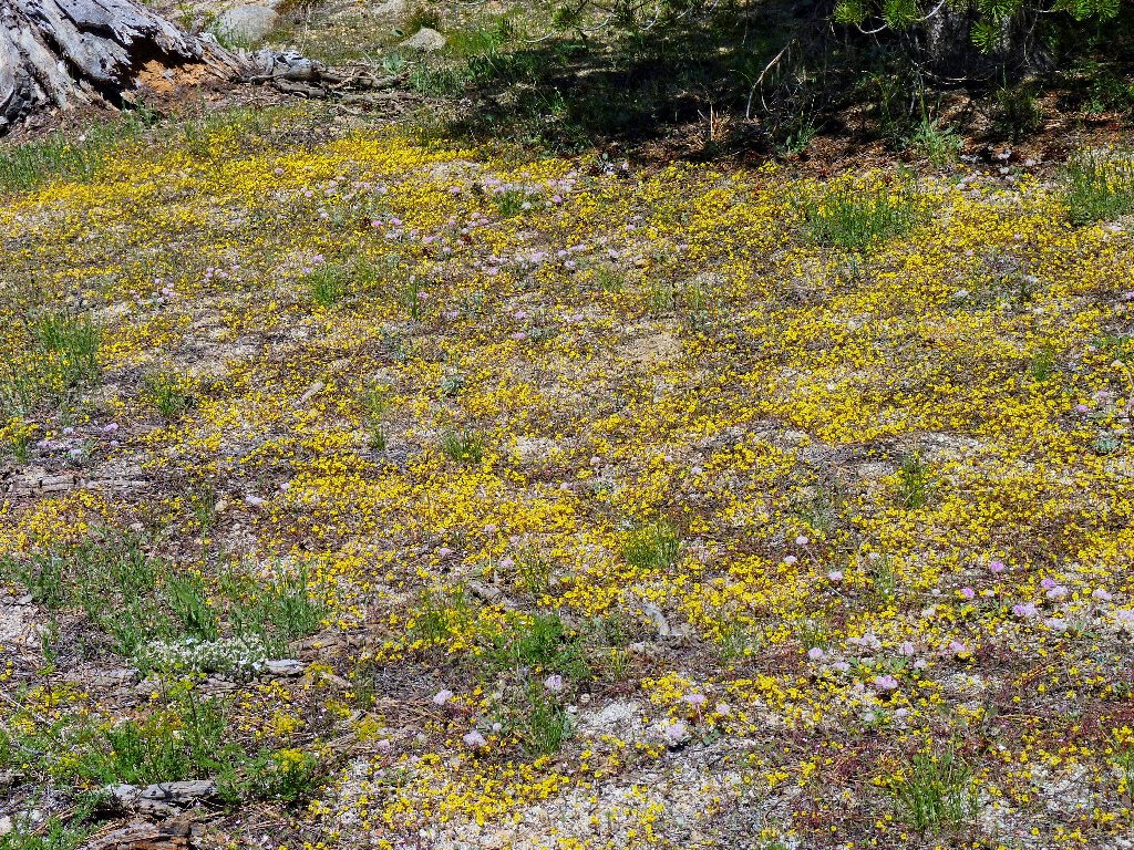
Monkeyflowers
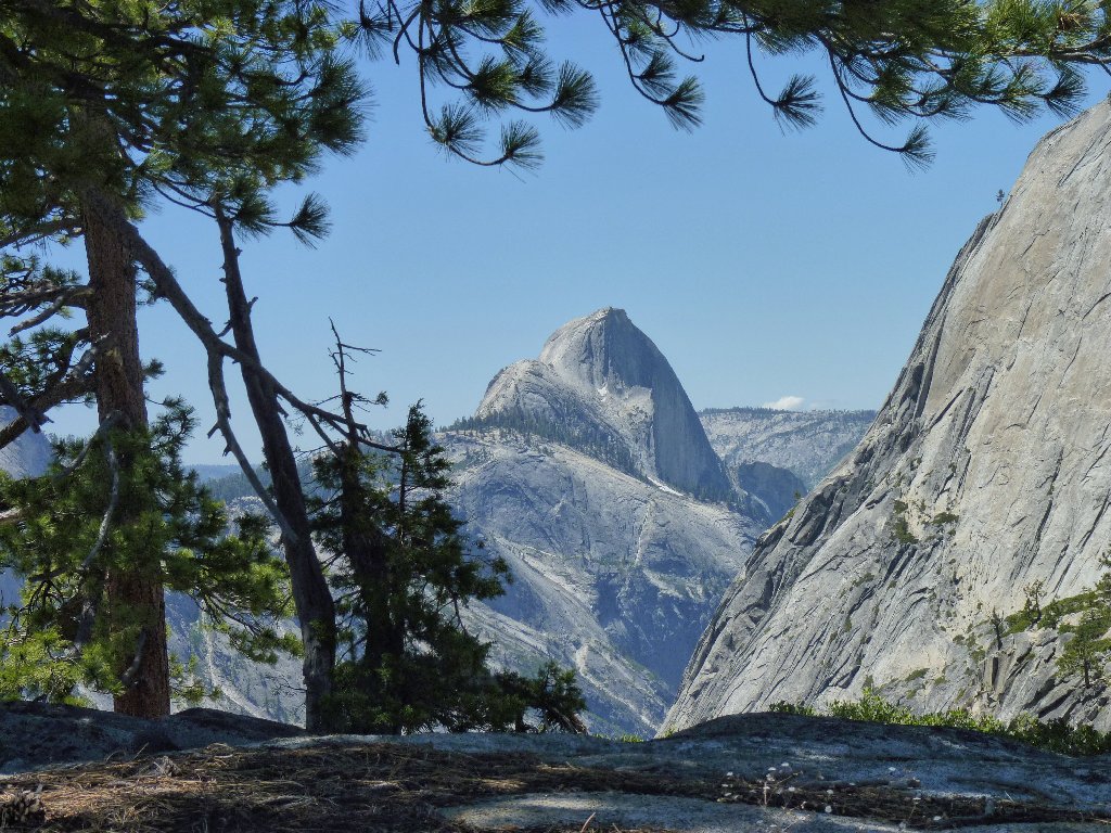
Half Dome still is nearly four miles away
A telephoto view of the distant monolith reveals 40-50 hikers
in the process of achieving what for most of them is the pinnacle of their
hiking careers. (So far, it is mine as well.) Some feel that
scaling Sub Dome on the left is a more difficult climb than the cable route,
due to its 600 vertical feet of stone steps.
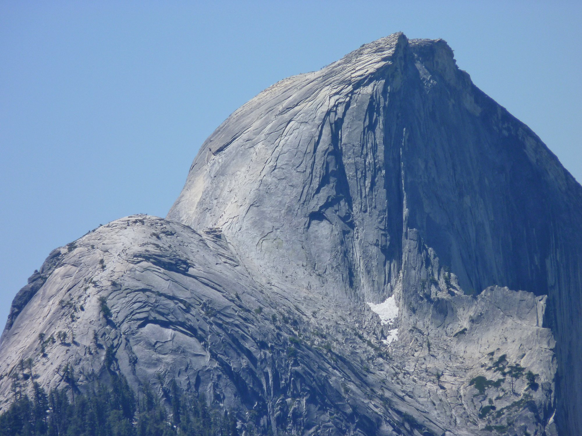
Zoom in for a close-up of the hikers on the cable
route ⇔
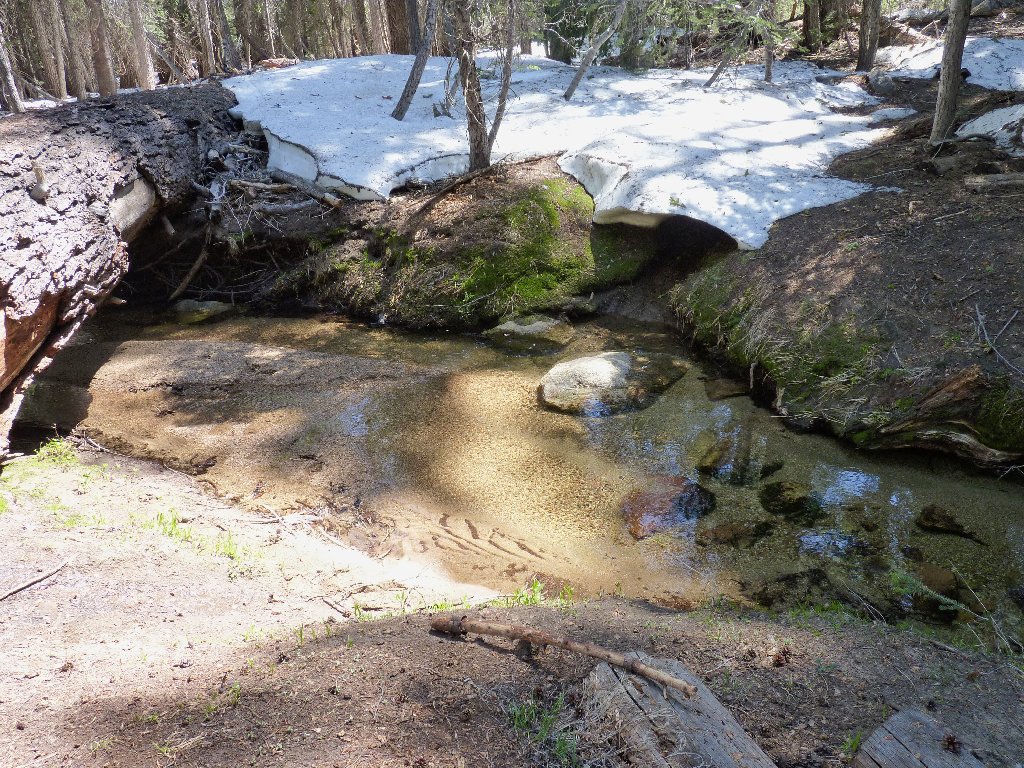
Abandoning my original itinerary, I venture westward toward the Mount Watkins Trail. This ploy turns out to involve more effort than expected. Instead of sensibly following the creek upstream, I veer too far left, necessitating extra climbing and a detour around another cliff just in order to access the trail.
The trail is right over there — so near, yet so far
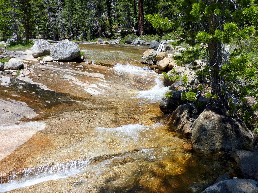
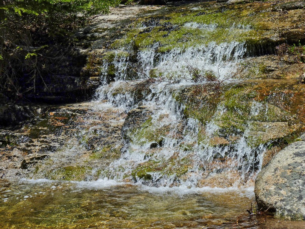
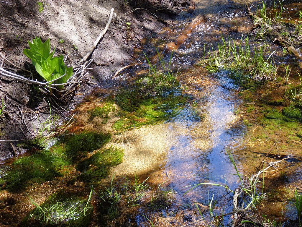
The water obstacles are pretty, but some crossings are problematical
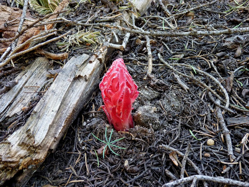
Snowplant
After an enervating manzanita bushwhack of many hundreds of feet upward, I finally do encounter a real trail. Stopping to remove my boots, I discover a big blister on the bottom of a big toe, and another on the back of a heel. This is distressing, because I simply don't get blisters.
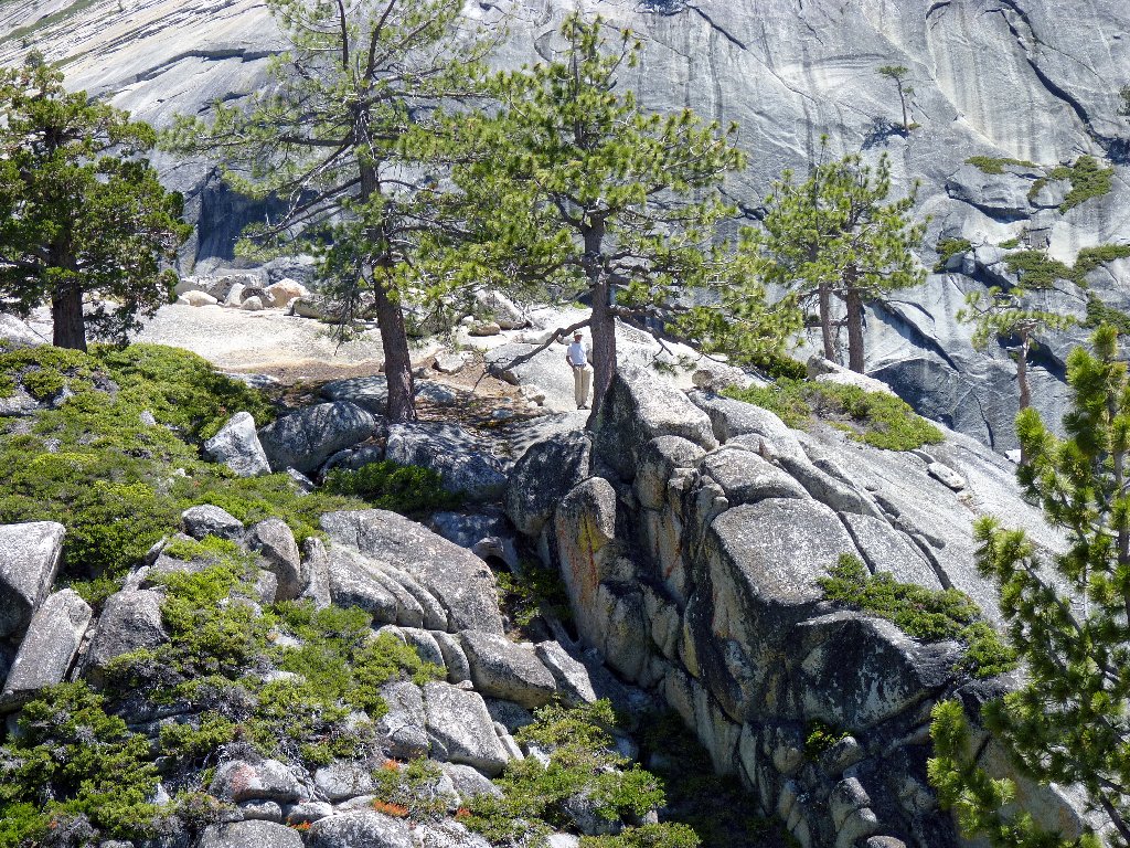
Overlook #2 is more than an hour away, by foot
Déjà vu. This scramble was located not far from the one I incurred
last year attempting to shortcut from nearby Hidden Lake over to this same
trail, on my way to Mount Watkins (Hike #99). A passing
backpacker remarks that my effort was quite an accomplishment, yet somehow
I do not feel particularly accomplished at the moment — just older.
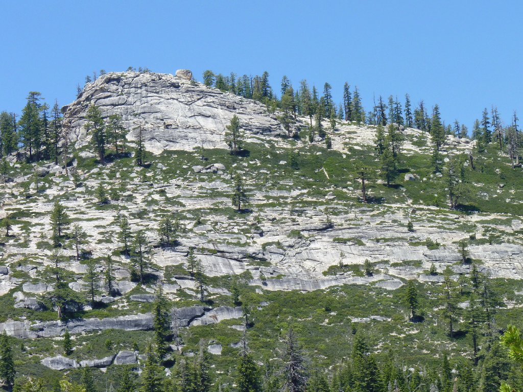
Mount Hoffman, 10856'
Being back on a real trail should make the remainder of the hike easier, but lots of snowdrifts and wet areas slow my progress. It would be more fun if I wasn't so weary.
About half a mile from the finish line I abandon the trail once again, preferring to complete my journey on the level shoulder of the highway.
The end is in sight
§: In retrospect, this adventure was a total success. I got
my hoped-for unique views of the elusive Pywiack Cascade, plus the best
photograph of the falls that I have seen anywhere, and I didn't fall off a
cliff. It would take little prompting to get me to revisit this place.
Next time, however, I will return to the trailhead by a more friendly route.
Note: one can access a clear view of the two cascades from near the Mount
Watkins summit, which is an easy hike; but from there the falls are three times
as far away as from today's vantage points. Making the effort to visit
Overlook #2 would enable better photographs than can be shot elsewhere.
| Scenery |  |
| Difficulty |  |
| Personality | |
| Flowers |  |
| Solitude | |

ADDENDUM
The place name Olmsted Point is idiotically misspelled by the vast majority of internet writers referencing it, who in so doing are insulting two of our nation's greatest conservationists. I even have felt obliged to make corrections to several Wikipedia pages.
Frederick Law Olmsted (1822-1903) is considered the "Father of American landscape architecture". His professional accomplishments include the designs of New York's Central Park and the expanded U.S. Capitol grounds.
Olmsted’s visionary 1865 charter for a brand-new Yosemite has had a
profoundly beneficial effect upon the world's parklands, having offered
one of the first Western-world expositions of the importance of
contact with wilderness for human well-being, the effect of
beautiful scenery on human perception, and the moral responsibility
of governments to preserve regions of extraordinary natural beauty for
the benefit of the whole people.
This incomparable legacy was carried on by Olmsted's son, Frederick
Jr. (1870-1957). Among a lifetime of other nationwide
accomplishments, in 1916 Junior helped draft the present-day mission
statement for the federal parks; in 1928 he guided the acquisition of many
California state parks; and in 1944 he devised a plan to save the coastal
redwoods. Finally, he won the 1953 Pugsley Award Gold Medal
for outstanding contribution to conservation; and in the same year he
attended the dedication of Olmsted Grove in what is now Redwood National Park.
It seems to me that the least we might do now for these national heroes is to spell their names correctly.
