
Desolation Wilderness
|
Cascade Basin Loop Desolation Wilderness |
June 30, 2010
I have awaited this hike for many moons, and it seems that most of the
Tahoe Basin trails are snow-free up to 8,000 feet or so. Much of
today's route will be on unmaintained trails, or perhaps no trail at all.
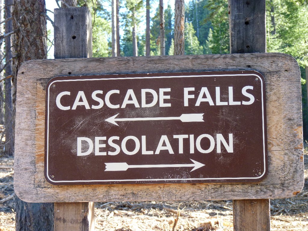
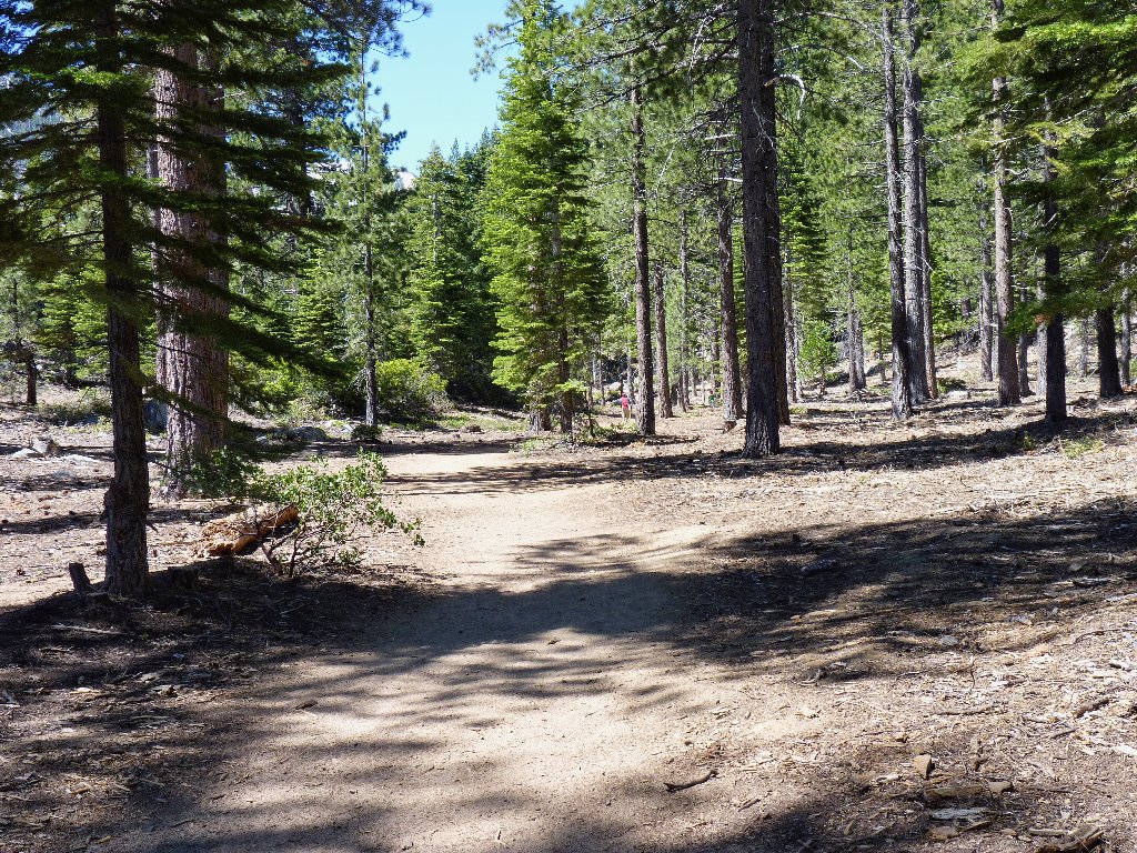
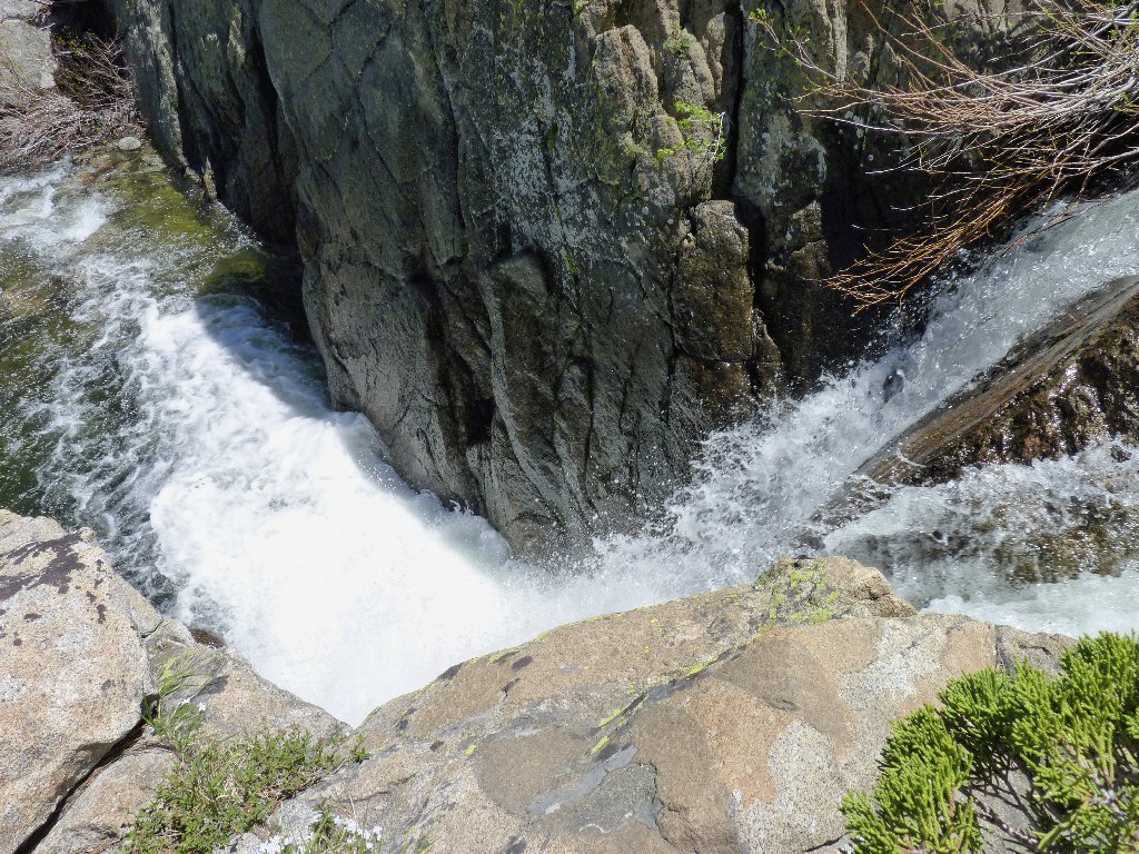
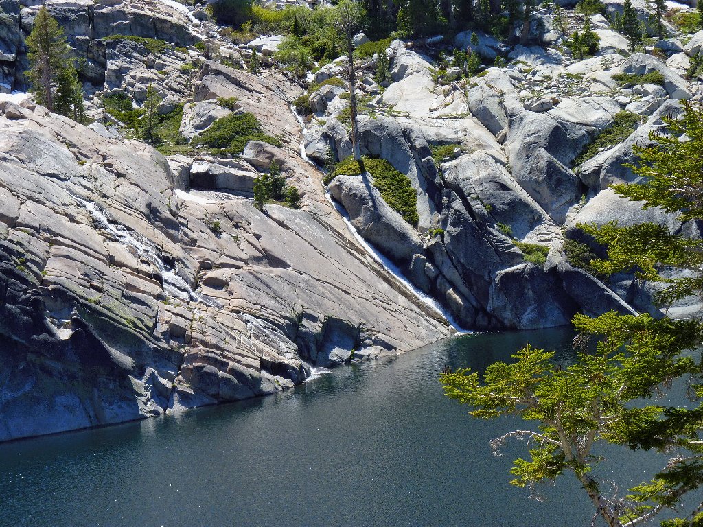
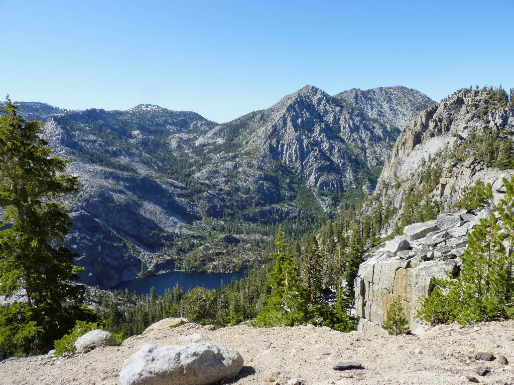
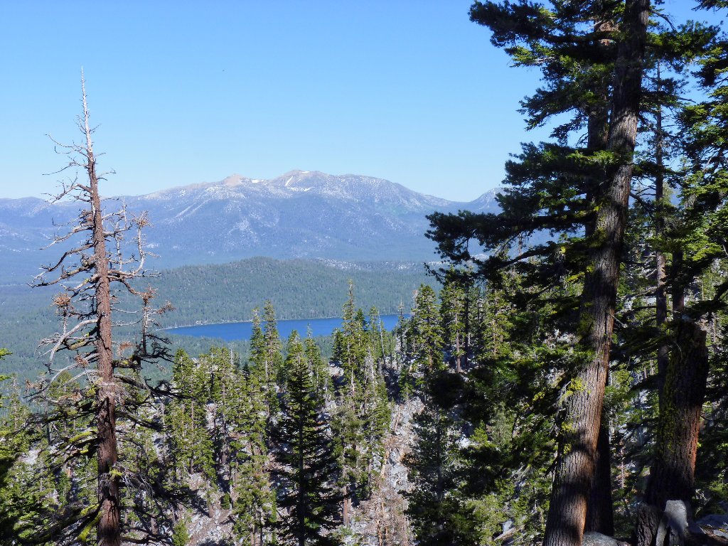
The first three-quarters of a mile is on the popular trail to Cascade Falls which, oddly enough, enables Cascade Creek to plunge into Cascade Lake. Unfortunately, there is no good way to view the falls directly without access to the lake itself, which is unavailable to the public.
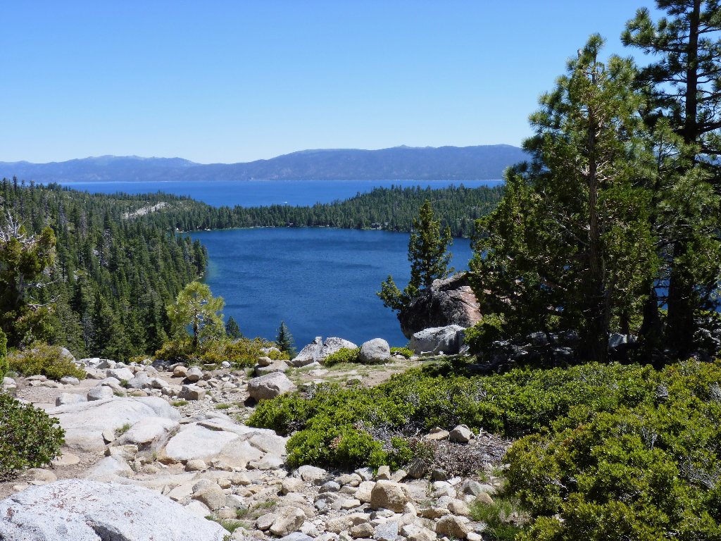
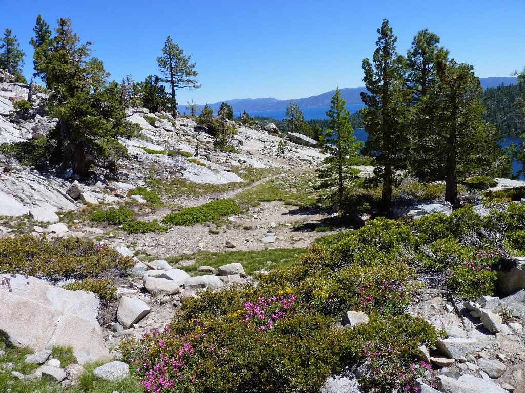
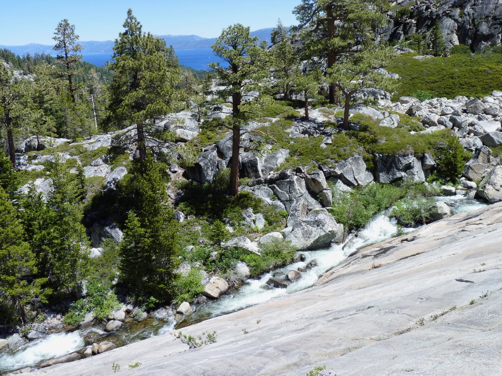
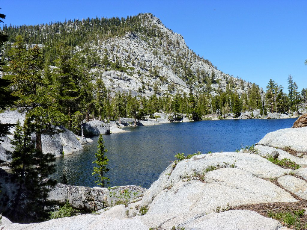
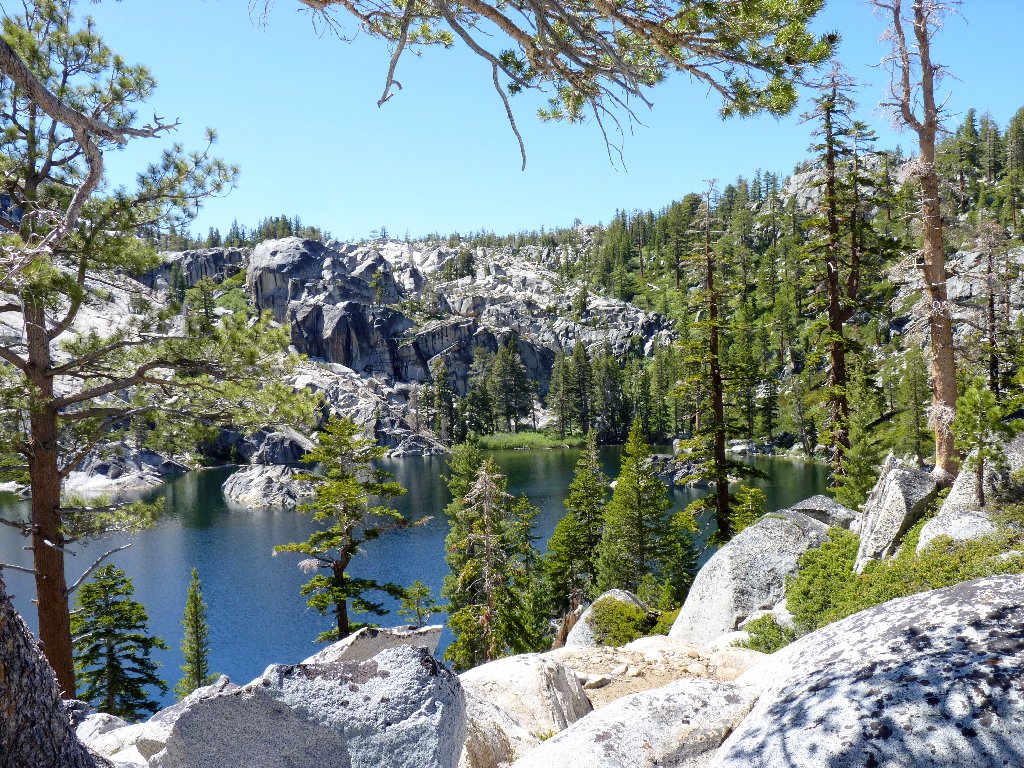
Cascade Lake and Lake Tahoe
The trail winds around and down to the brink of the falls, where I grab the best photo that I can manage.
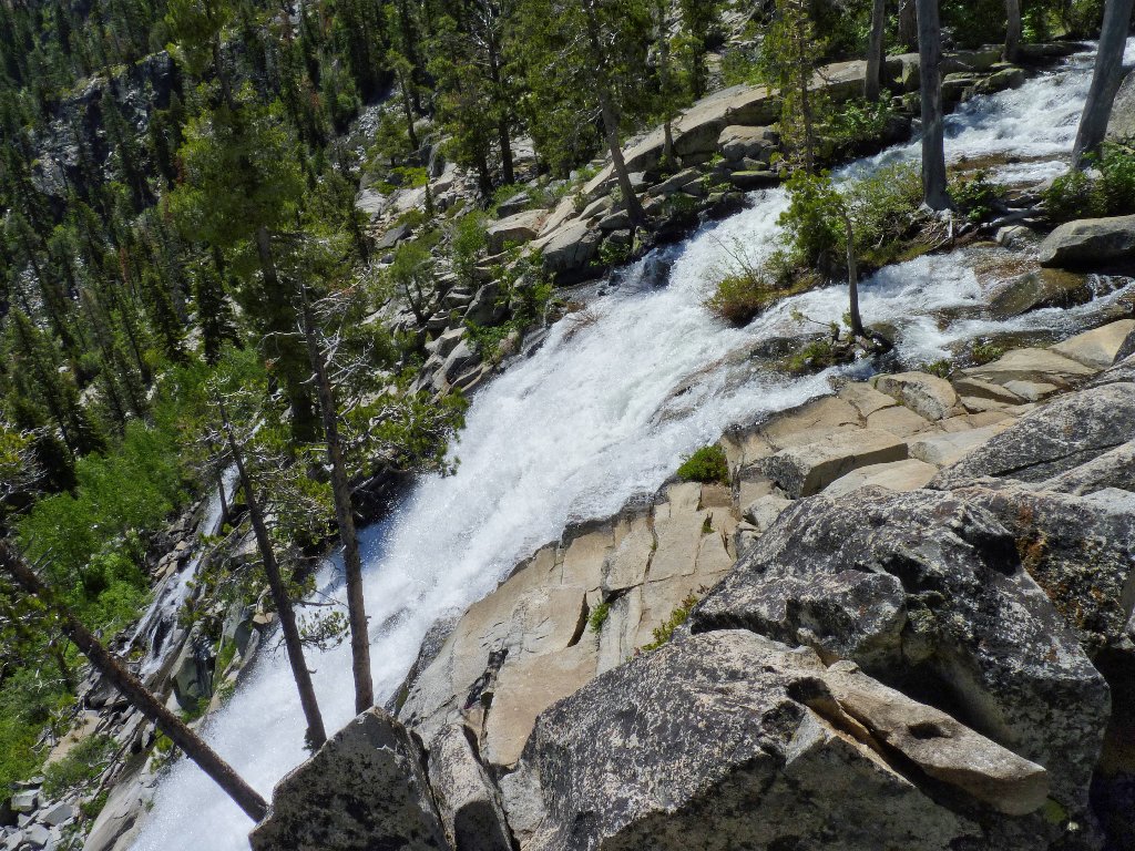
Cascade Falls
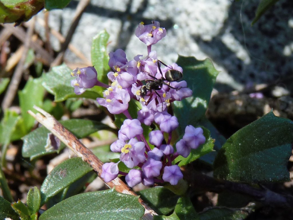
A number of flower varieties are out today; especially pleasing are the mountain pride and phlox. I fear, however, that getting good photos of the flora will prove difficult; a bright sun is washing out the colors and detail, and nary a cloud is in sight.
Fresno Ceanothus
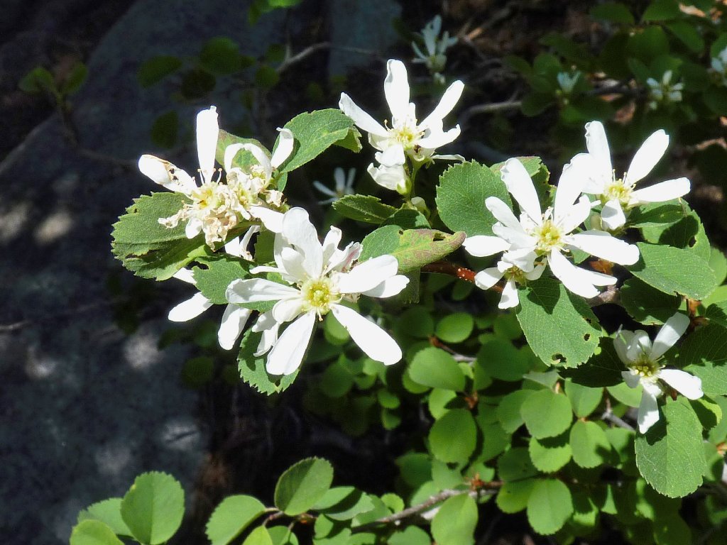
Service Berry
A use trail continues west above the falls to the right of the creek.
Although there is no sign at the wilderness boundary, occasional tree blazes
indicate that this was an officially maintained route at one time.
Negotiating the overgrowth in the aspen thickets quickly becomes tiresome,
and suddenly I find myself in a bog with several inches of water preventing a
continuation. I manage to slip and step shin-deep into the mud,
yet nothing actually gets inside my boot. Hooray! Perhaps these
Merrells are worth 170 dollars after all.
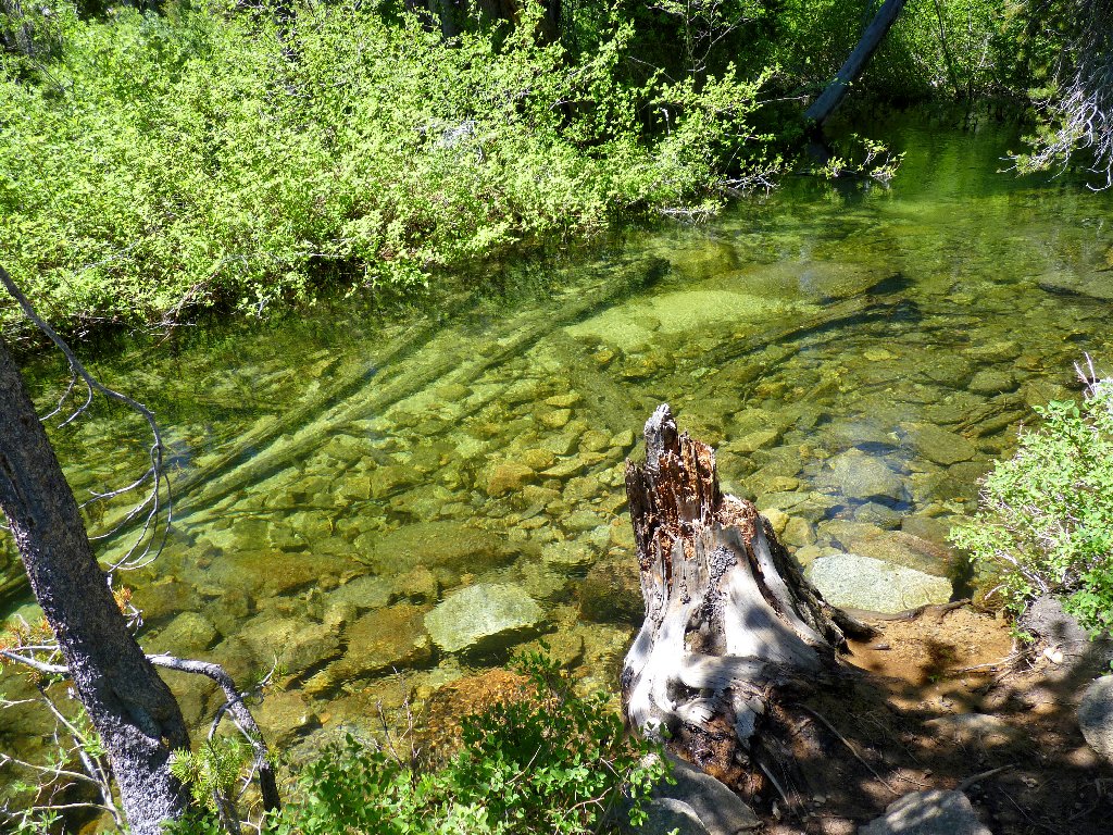
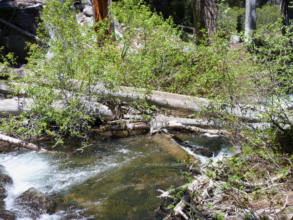
Nice colors in the creek
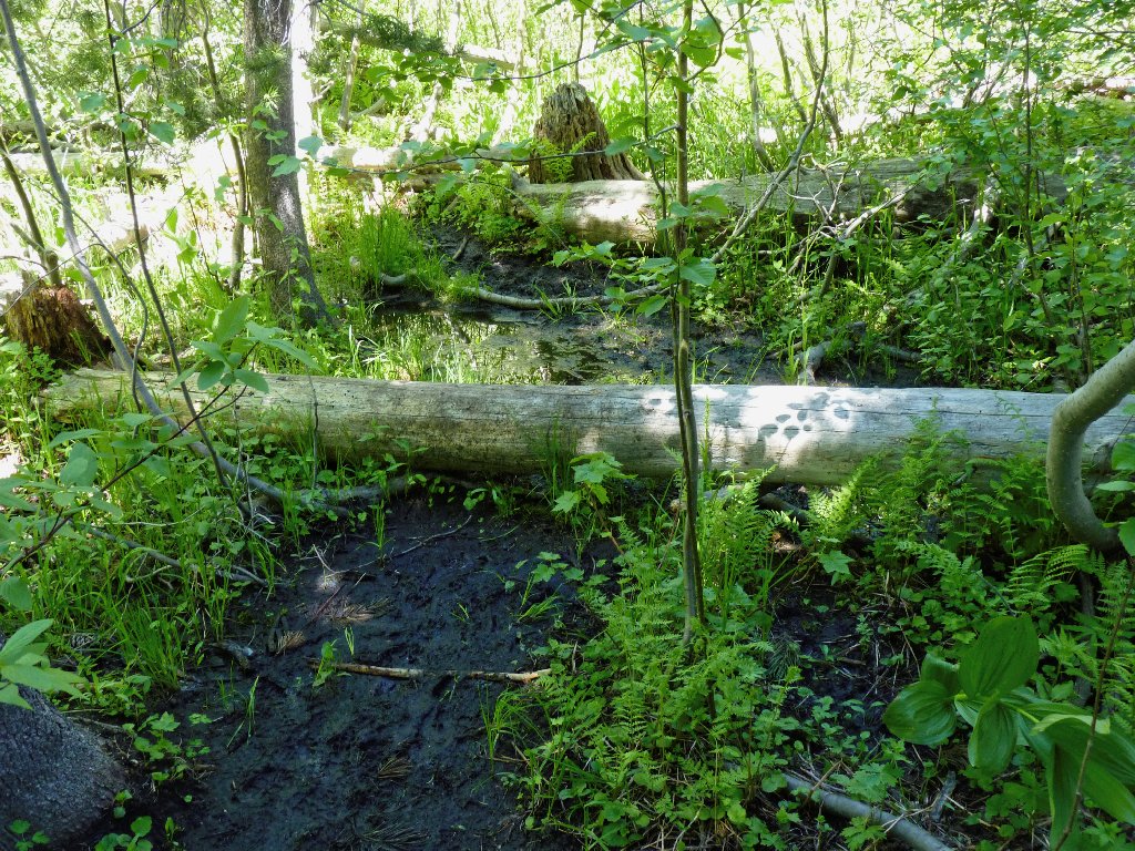
The hike bogs down here
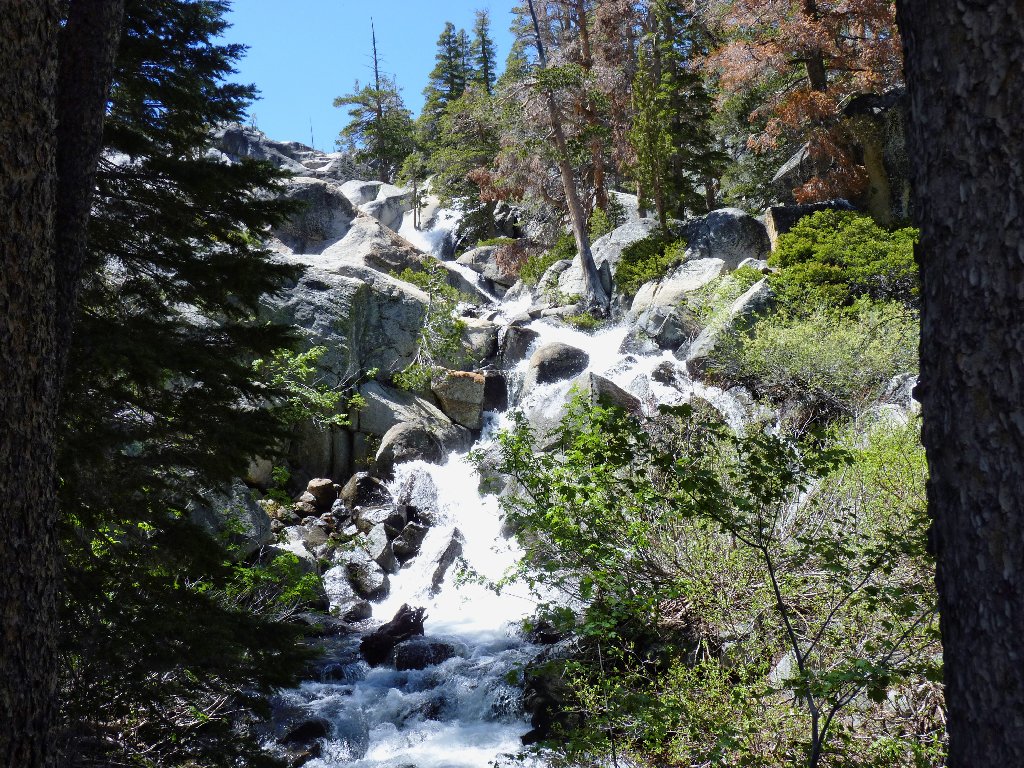
There is nothing for it but to backtrack and try to find another route on drier ground. There is one, and shortly I find myself ascending a welcome series of granite slabs. Because the creek is being especially noisy around the far corner, I venture over there for a look, finding a beautiful cascade that makes my effort worthwhile.
Cascade Creek doing its thing
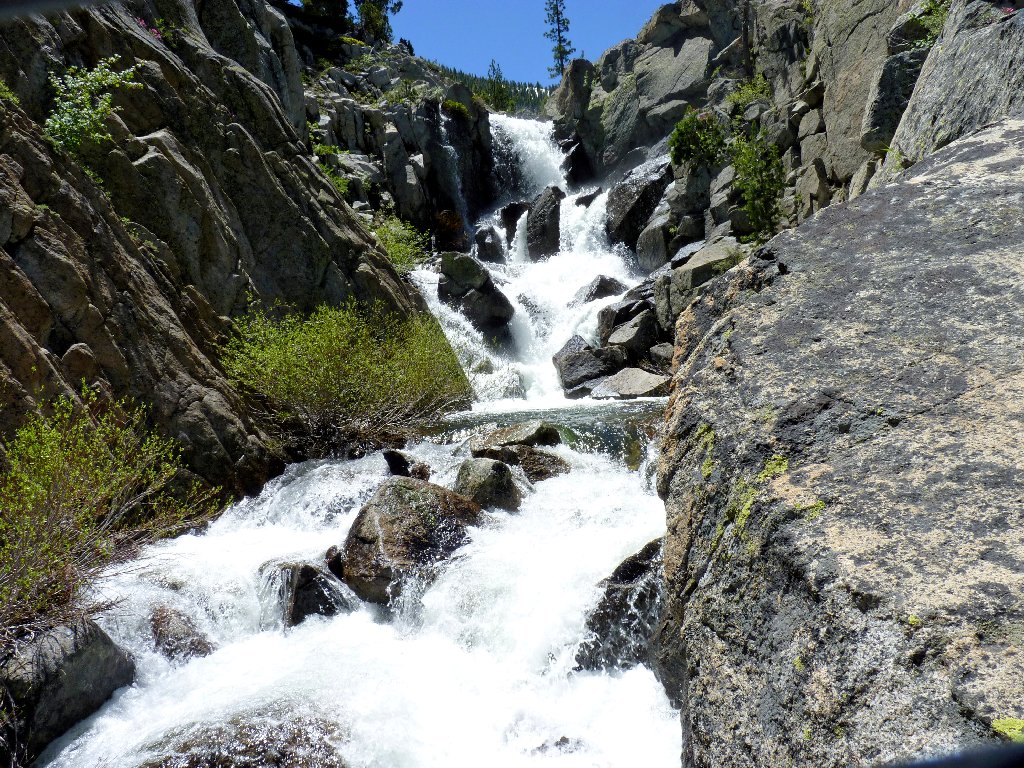
I wonder how many hikers bother to walk over here to see this
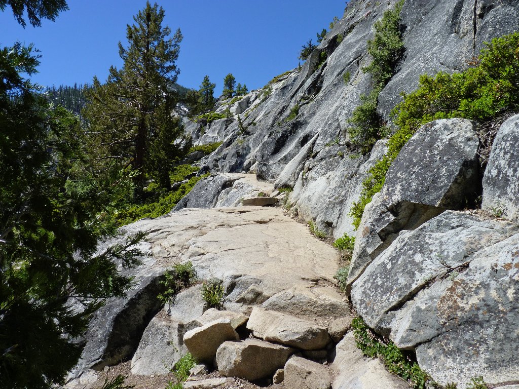
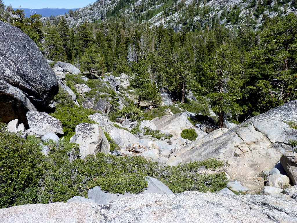
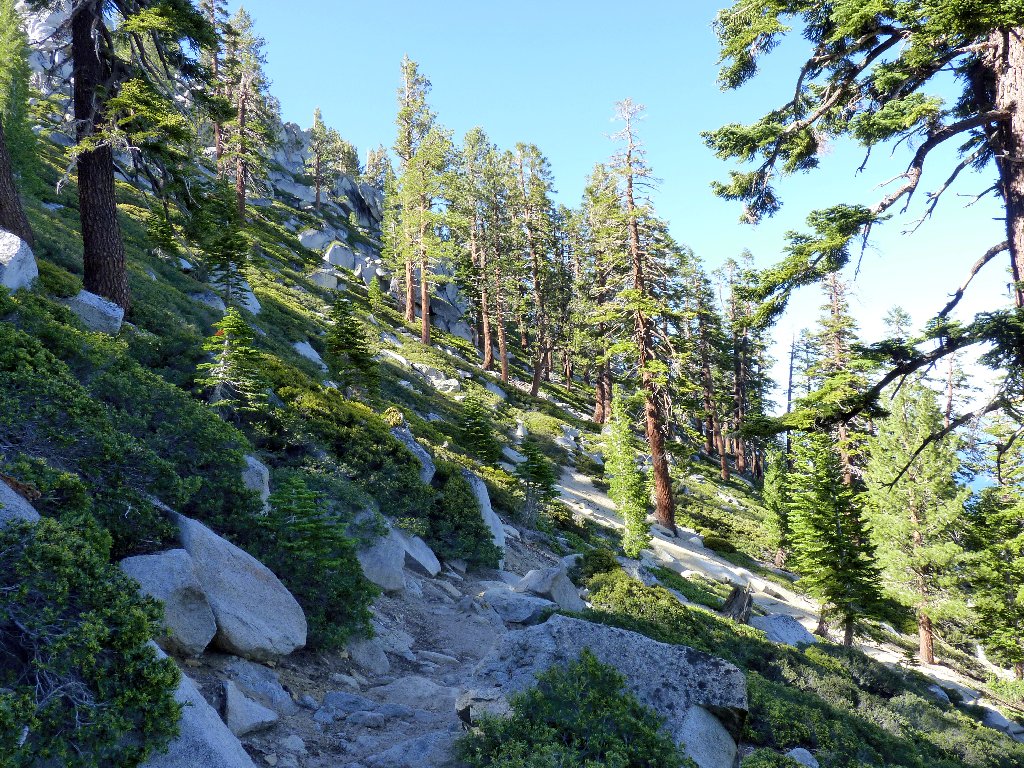
More nice slabs lie ahead. Presently a couple of black poodles appear, escorting a couple of white humans. The man says that they had traveled up the other side of Cascade Creek, encountering a pair of scary crossings along the way. My choice of routes seems to have been better than theirs. Even at that, the slabs soon disappear; so it's back to scrambling and even some actual climbing.
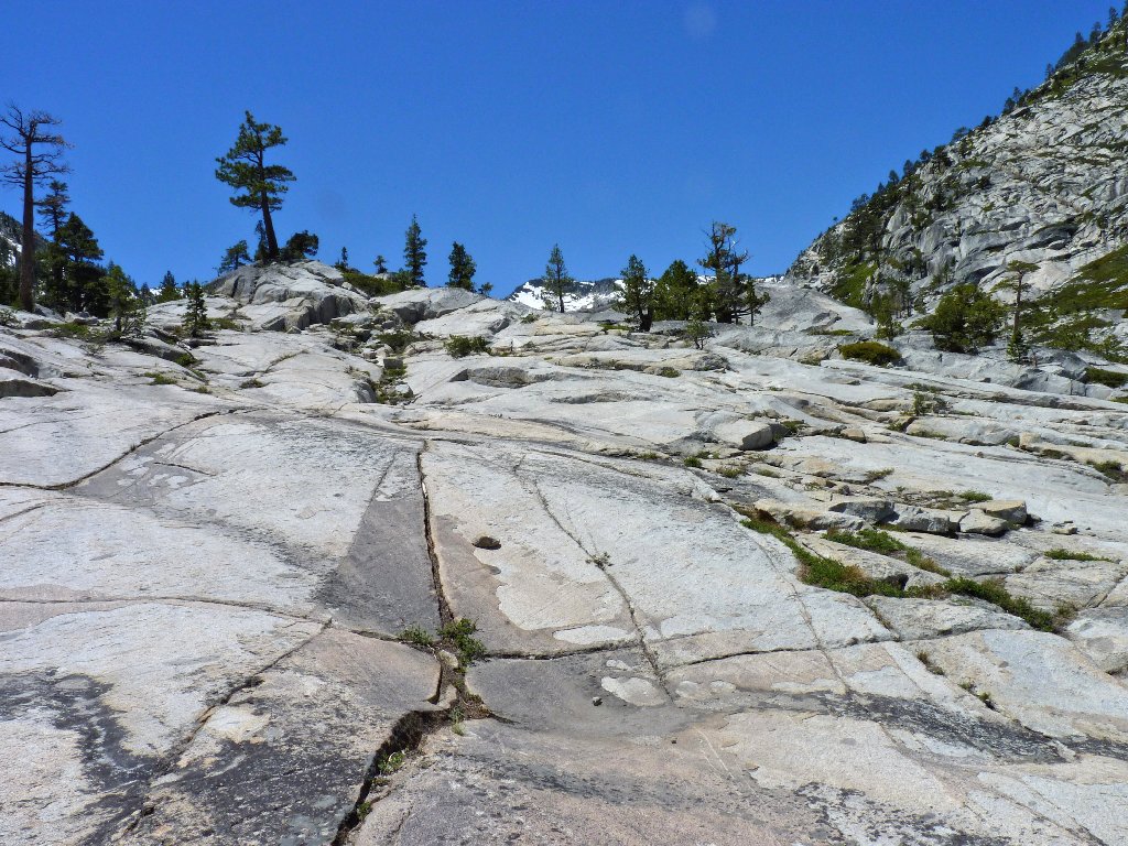
The going is easy on the slabs
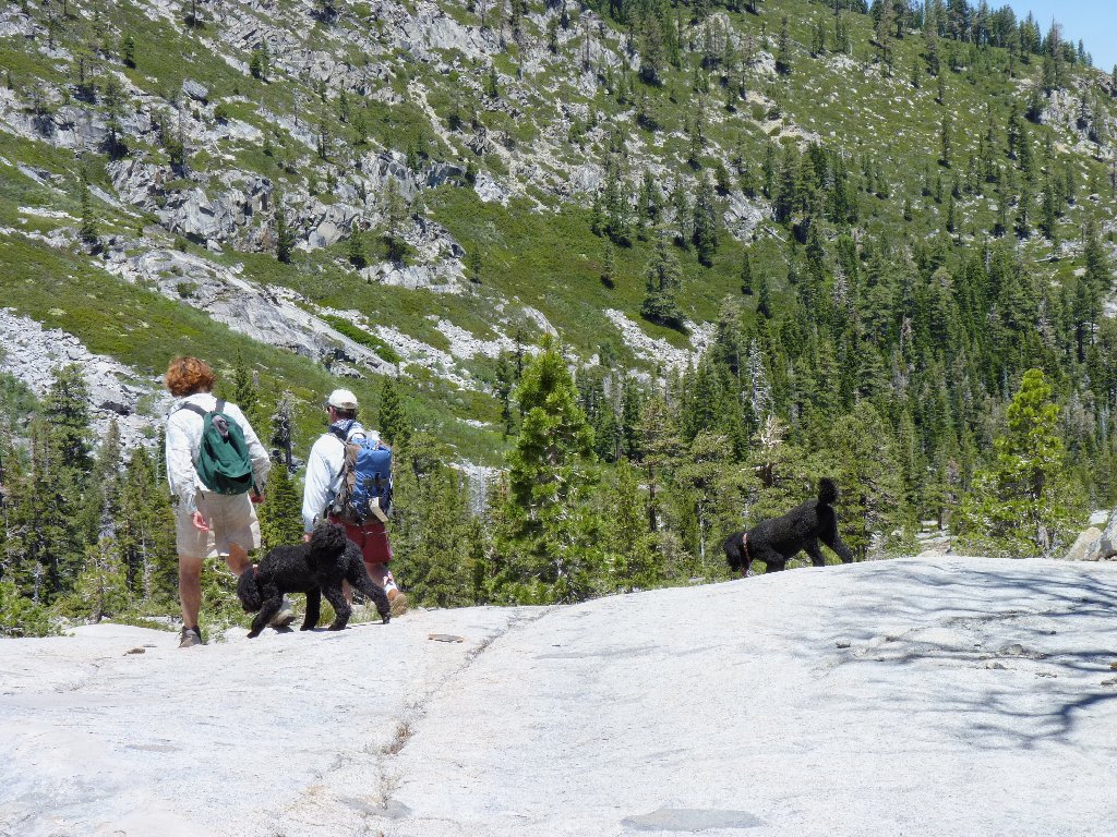
The last humans I would see for many hours
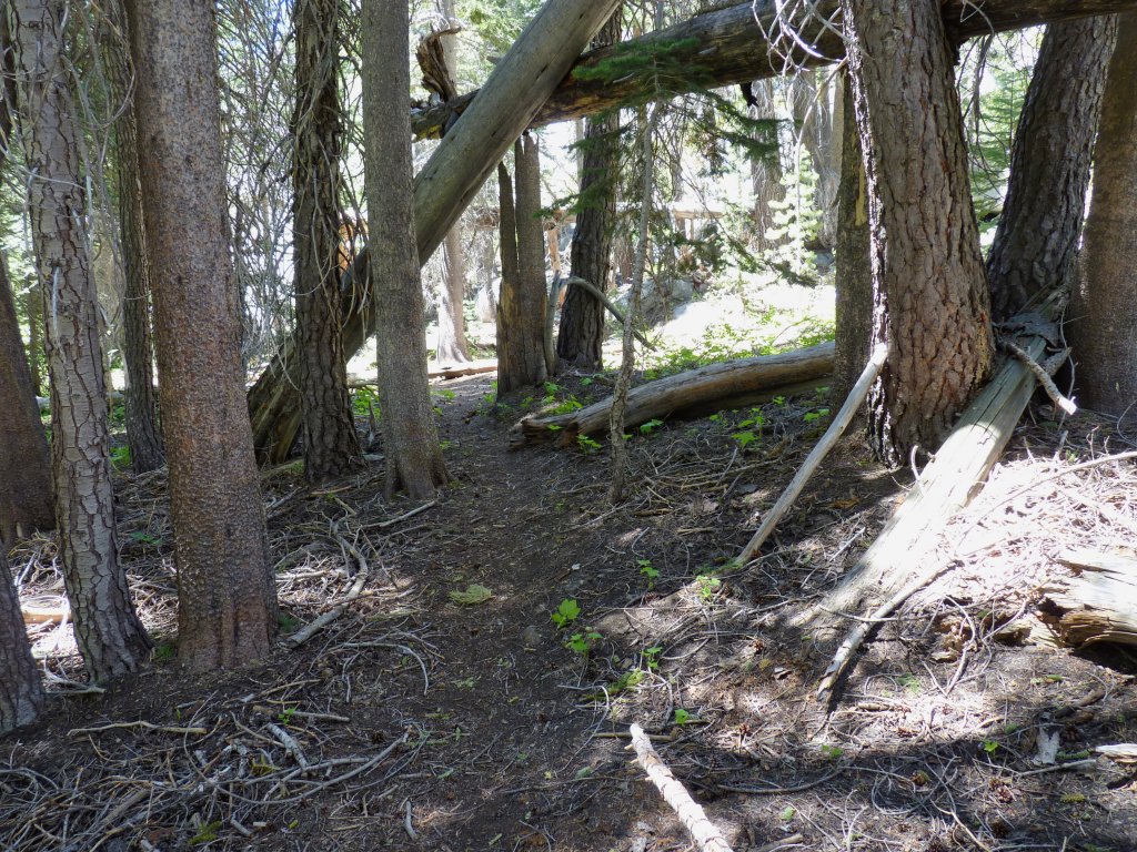
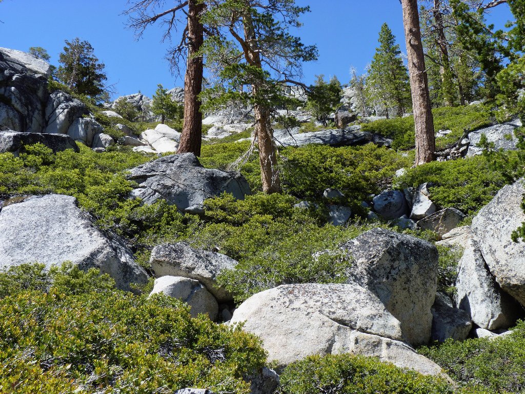
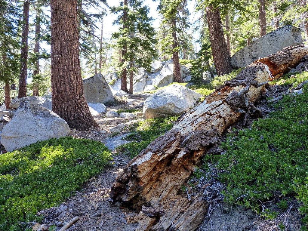
There are countless dozens of downed trees to clamber over today, and they probably will remain there indefinitely. Another significant cascade appears, hemmed in by a cliff on the right. It doesn't look as if there is any passage that way, so I cross the stream on a convenient log. Doing this heads me southward toward Snow Lake. I had not planned to go over there; but it's not far, so what the hell.
Sometimes the walking is easy
My crossing
After following my nose for about ten minutes, with an interim stop to
apply some mosquito repellent, I suddenly emerge from the forest to a
spectacular setting that nearly brings tears to my eyes. On both sides
of me are thousand-foot cascades!
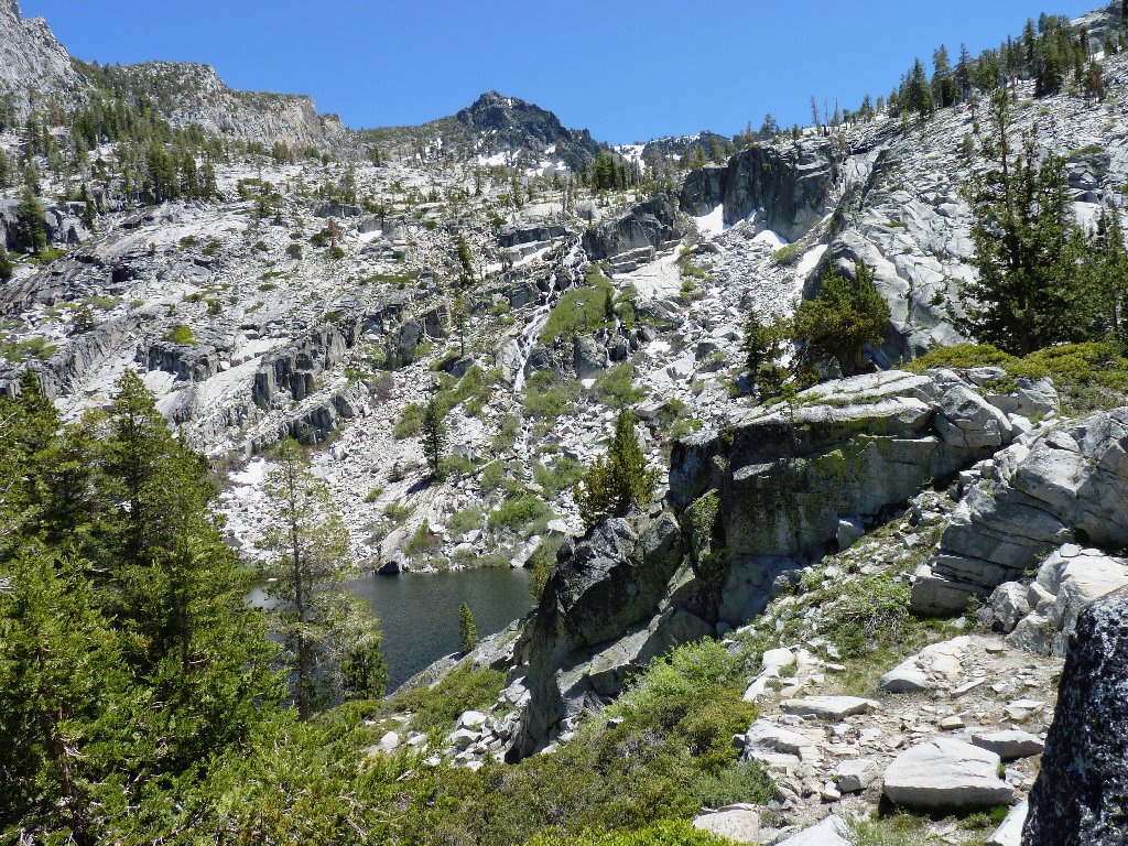
This water flows from the slopes of Mount Tallac, 9738'.
The actual summit is just out of sight
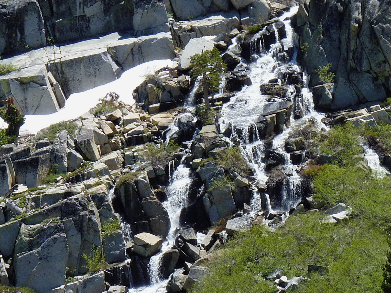
Of course, no waterfall can be adequately represented by a photograph;
one has to be there to experience the audio-visual treats that make
any falls so special.
From Tallac Lake ⇔
This one drains the Dicks Pass area
Unknowingly, I had bypassed most of the lake on the way into this cirque. Looking back, I see one of the Maggies Peaks looming above. Unless I become discouraged and head back the way I came in, my route ultimately will take me behind that prominence.
Snow Lake and South Maggies Peak, 8699'
Snow Lake was formerly named Lake Katrine by a surgeon named Charles Brigman, who had purchased this entire basin in 1882. Early western pioneers commonly named lakes after their daughters, and this one was no exception. Brigman's family still holds the title to Cascade Lake itself.
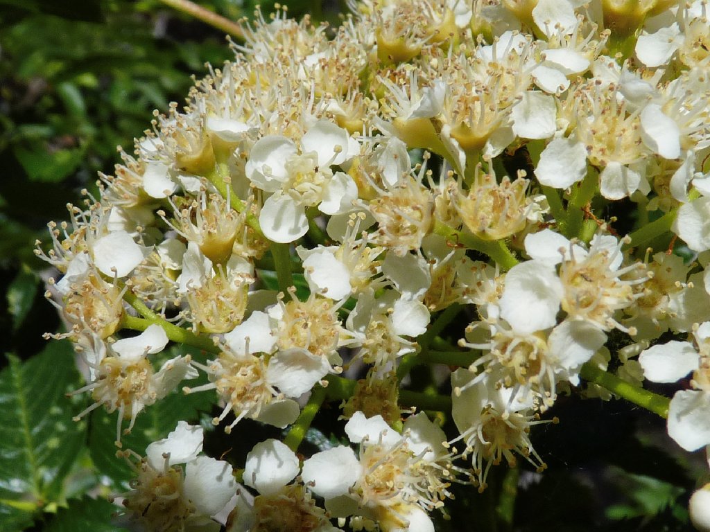
California Mountain Ash
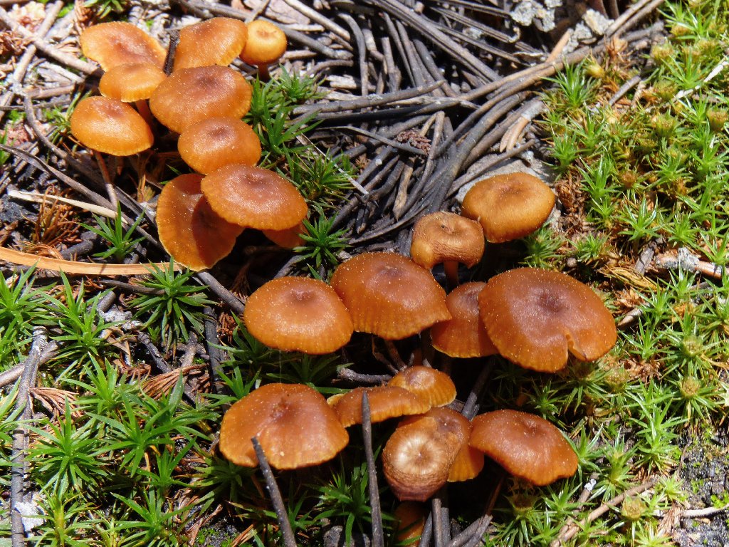
Bonnet Mushrooms
Back at the log crossing, I can see no way to proceed upstream except to squeeze between the cascade and the big rock pile to the right. Not wanting to admit defeat in my quest, I sigh a bit and cross the Rubicon, scrambling over boulders and aspens, and needing to step virtually into the rushing water in the process.
The not-quite impassable cascade
At one of many rest stops, I take stock of the situation. I am
feeling a a bit lonely right now — not because I am alone per se,
but because this particular odyssey would be more enjoyable if it were being
shared. In any event, the only thing less attractive than the prospect
of bushwhacking uphill is the prospect of bushwhacking downhill.
Besides, by now my next destination must be nearby; so I press on.
Been there
Doing that?
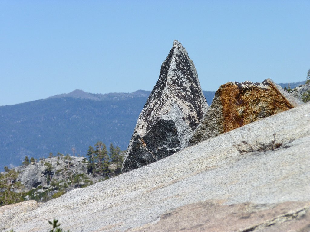
Genoa Peak, 9150' (that's the distant one}
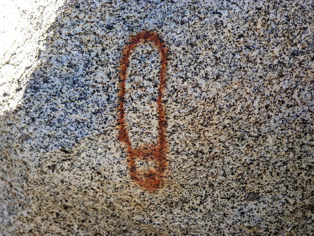
This marking is a total mystery
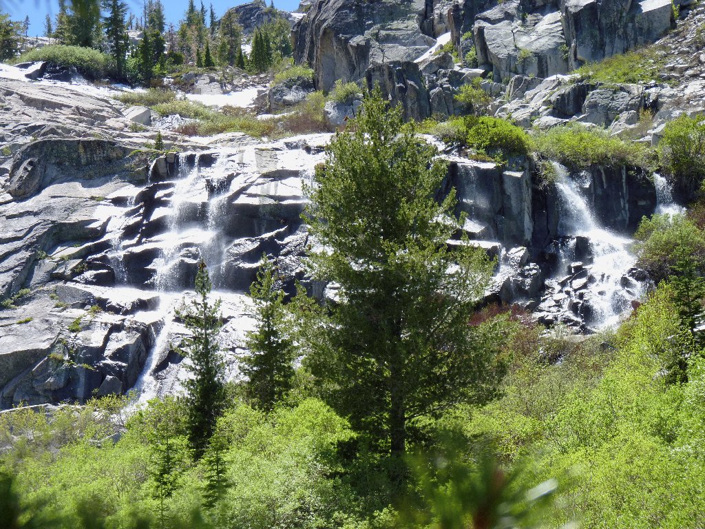
After more than 300 vertical feet in a manzanita-boulder mix, my reward appears, and it is lovely indeed.
Azure Lake lives up to its name
Yet another thousand-foot cascade drains Kalmia Lake
At the northeastern corner of this lake, I discover a use trail leading northward up the hill. Although I had assumed that one existed, my recent time in the bush had shaken my faith somewhat. And although I am weary from dragging myself up boulders using manzanita roots as handholds, there is another 800 feet of climbing to do. As expected, the path up to the Bayview Trail is steep, with numerous rest stops involved.
Eventually, without even knowing that I had reached it, I find myself on a
well-maintained trail with lots of bootprints; and it seems to be leading
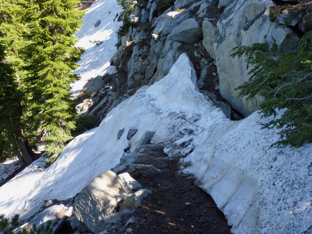
in the proper direction. There are numerous snowdrifts to traverse on the
high saddle between the two Maggies Peaks, adding interest to the walk.
Dappled sunlight is a recipe for nice photographs
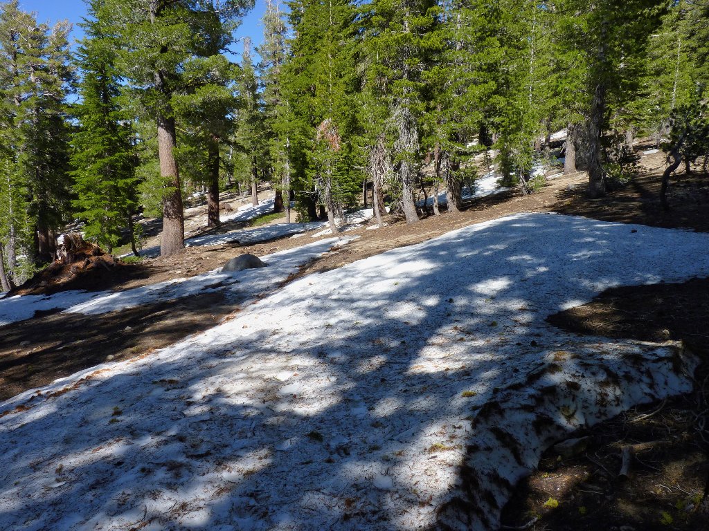
Snow lingers at 8,500 feet
As legend has it, Maggies Peaks were named after a well-endowed
barmaid who worked at the Tahoe Tavern in the 1880s. Unfortunately,
it is later afternoon already, and I am sufficiently tired to forgo a
relatively easy scamper to the nearest summit. I'll check out
Maggie's namesake peaks some other time.
Eagle Lake 1,400 feet below, Jakes Peak 600 feet above
As I start down the shaded northeastern side of the hill, an unexpected obstacle is blocking the path. Crossing that steeply angled snowdrift will require a scary and somewhat dangerous traverse. A slip here could cause a lengthy slide down the rocky snow bank, and a broken bone or two might well be the outcome. So I had better not lose my footing!
A little slip-up here will result in a big slip down
With the hairy stuff out of the way, great views of the area's various lakes begin to present themselves.
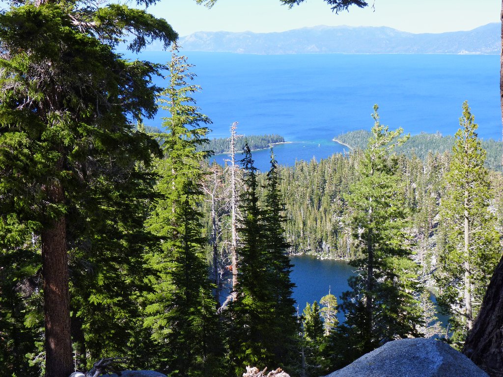
That's Granite Lake in front
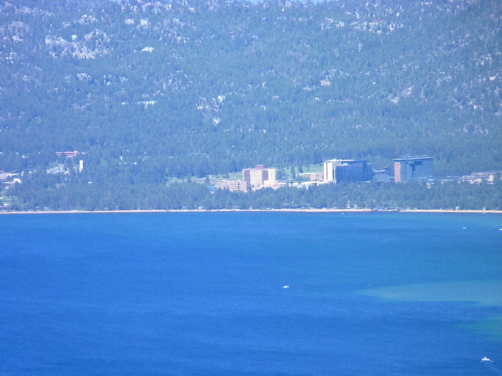
The Stateline casinos are ten miles away
Fallen Leaf Lake, and Freel Peak, 10886'
The sun is trying to set on me now at just 5 p.m.; but it will
be a cakewalk from here, down the switchbacks and past Granite Lake, which
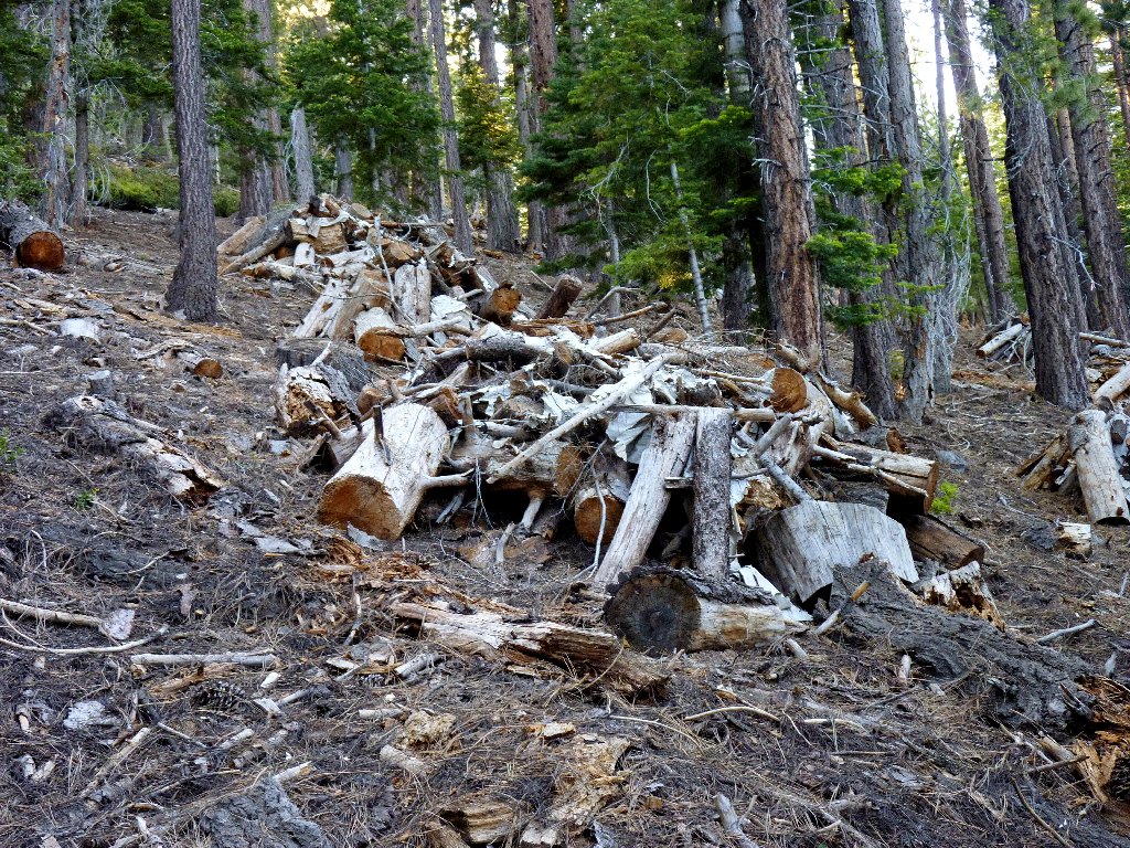
is pleasant but relatively uninteresting. Lots of pruned deadwood is
stacked in piles in the lower areas, due to increased concerns resulting
from the dreadful nearby Angora Fire of 2008.
About a mile from the trailhead, a world-class vista stops me in my tracks.
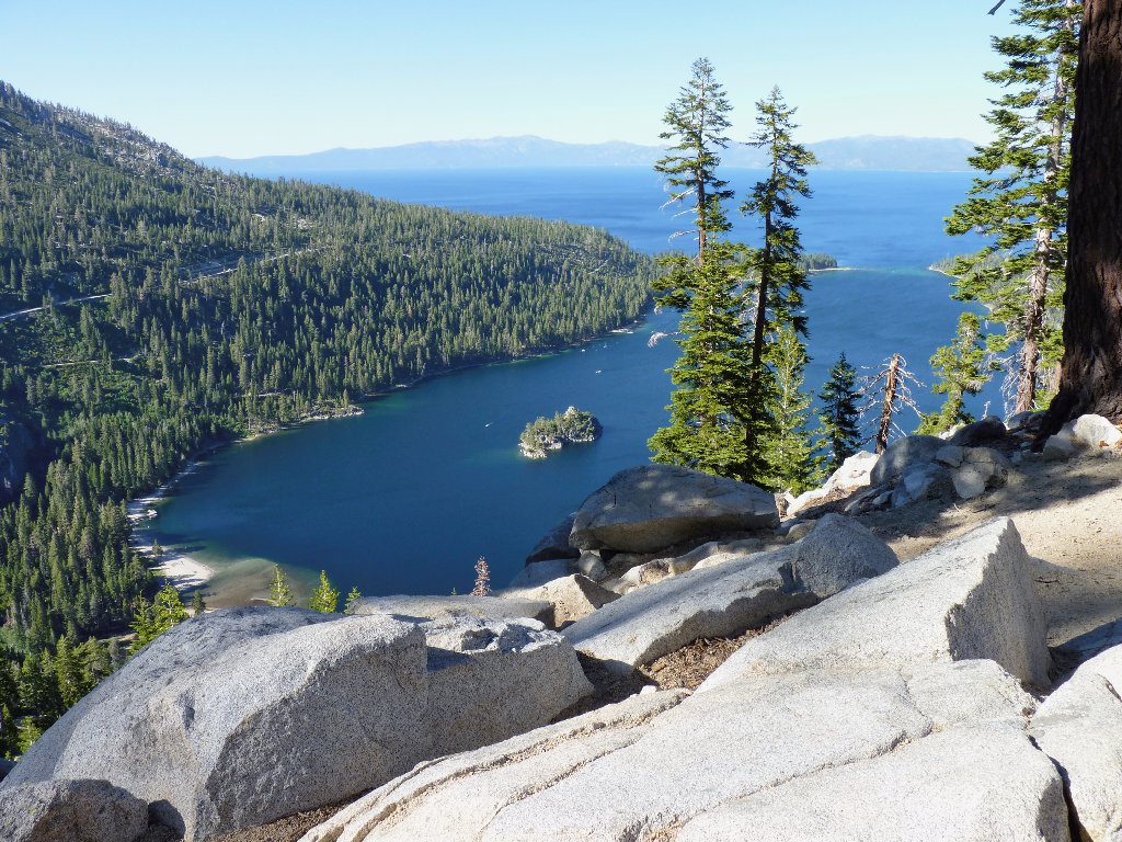
Emerald Bay — jewel of the Tahoe Basin
The little stone structure on the picturesque island was constructed by Lora Josephine Knight, owner of Vikingsholm Castle on the beach. She regularly served high tea to guests out there. For ten years the island served as the residence of an Englishman named "Captain" Dick Barter, who built his own tomb there. Ironically, he never used it; for his sailboat crashed in a storm off Rubicon Point, and his body was never recovered.
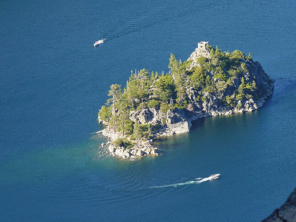
You can swim or boat to Lake Tahoe's only island — now named Fannette
§: Despite this being my toughest day-hike in quite a while,
in retrospect it was a grand adventure that I would happily repeat, but only
with some company. How highly you might rate it would depend
largely upon your relative route-finding skills and tolerance for
some rougher going. In any case, the trek was highly varied and
interesting, and the combination of Tahoe-Desolation scenery was outstanding.
Actually, dealing with the manzanita today wasn't nearly as bad as it
could have been; it was more time-consuming than difficult.
Also, it is entirely possible that an easier and more direct use trail exists
between Cascade Falls and Azure Lake, and that I simply didn't find it.
Veering farther north of Cascade Creek might have been the answer, but then I would
have missed the Snow Lake cirque and the best-feeling spot of the day.
| Scenery |  |
| Difficulty |  |
| Personality | |
| Adventure |  |
| Solitude | |

Read a colorful historical account of Captain "Them's my toes" Barter here:
