
Yosemite National Park
|
Sierra Point Yosemite National Park |
May 24, 2010
Needing to be out of the house this evening to accommodate a women-only
dinner party, this seems like a good opportunity to do some exploration
in Yosemite Valley. My faithful Outback finds its way up the
180-mile route to Curry Village in just 3½ hours.
Due to greater-than-normal amounts of rain and snow in the park lately, the falls are booming. The usual suspects are there, plus a number of others that I have not seen before. It is a shame, however, that the sky is completely overcast today. Needing to decide upon a course of action, I opt to try for Sierra Point, which trail has been officially unmaintained since it was partially obliterated by a rock fall in the 1970s. Even though the old overlook is directly above the main trail and is plainly visible from it and from the brink of Vernal Fall, few visitors ever notice it, and fewer still know that it remains accessible.
Although the valley shuttle would take me the final mile to Happy Isles, I know of a place about half a mile up the way where there is space for a few cars to park, at the point where the road is closed off to visitors' motor vehicles. Instead, I am surprised to discover that a big hikers' parking facility has been constructed there, doubtless to relieve traffic congestion at Curry Village.
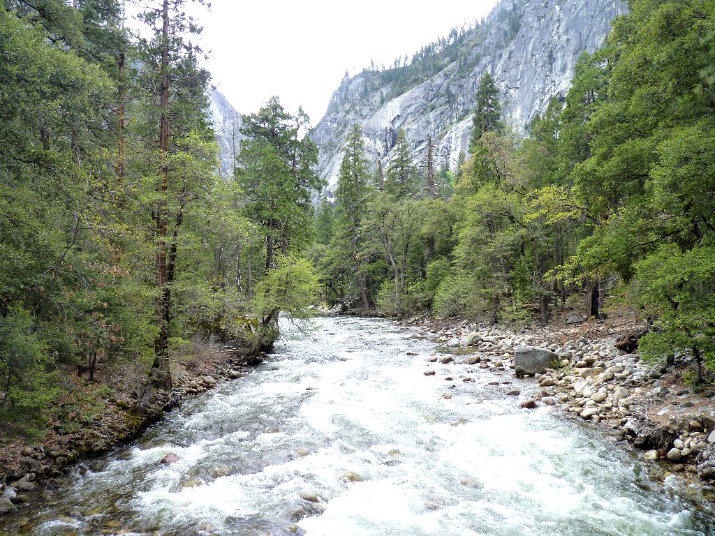
The Merced River at Happy Isles
It is about a half-mile stroll to the beginning of the John Muir Trail
— a 211-mile high-country adventure that culminates
at the summit of Mount Whitney, and which just happens to be America's
most beautiful trail. I decide to walk the first three-quarters
of a mile up the paved path to the big bridge which represents the end of the
line for many strollers, most of whom are ill-equipped to venture
farther in any case. There are restrooms here, drinking fountains,
and a sneak-preview of coming attractions on the Mist Trail.
Vernal Fall — so near, yet so far
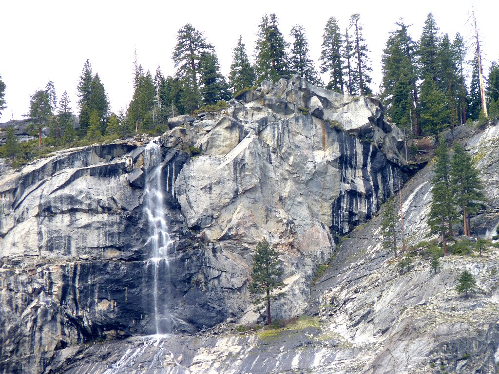
Along the way up, a beautiful seasonal cascade plunges down from the vicinity of Washburn Point. I also pass a sign which has information about the aforementioned rockfall lying just behind it. Online sources state that my destination can be accessed from here.
Unnamed falls near the trailhead

The Sierra Point Trail formerly started right here
Telephoto view of Sierra Point, 500 feet above
I was originally scheduled to be here today anyway, as part of a
5-person, 3-day expedition to the summit of Half Dome.
It is just as well that the hikers' cables are not in place yet,
because it is clear now that the trek would have been cold and
inclement throughout. I briefly toy with the idea of
continuing up the Mist Trail, because it is my most favorite
place; yet somehow the idea of being drenched by spray just
doesn't seem like that much fun at this time. Besides,
the lure of uncharted territory beckons.
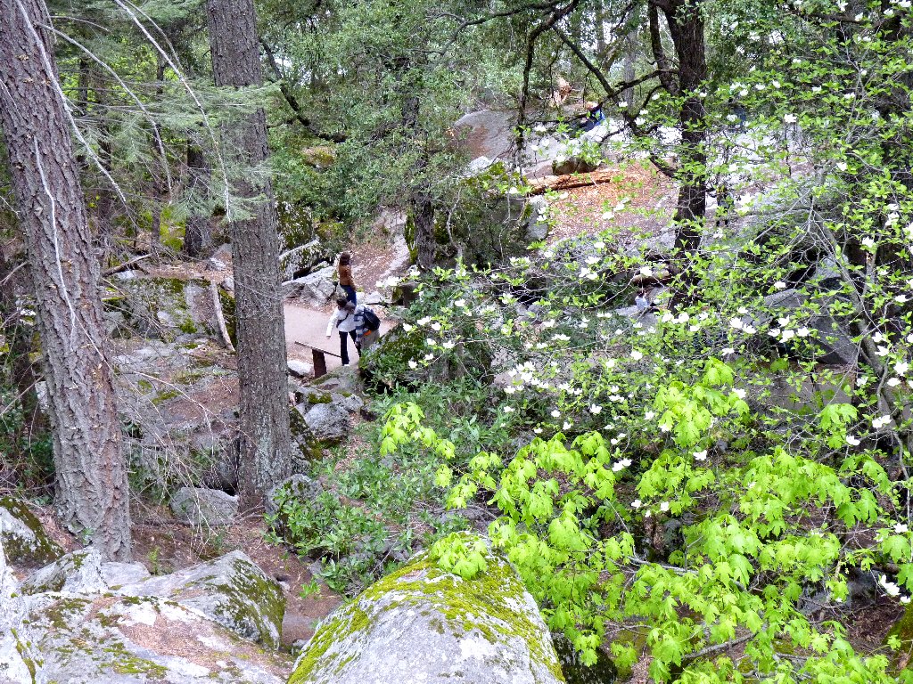
On the way back to the signpost, an inviting path with numerous
boot-prints leads up in the right direction beside the cliff.
Since going that way presumably would avoid the rock pile, I say what the hell.
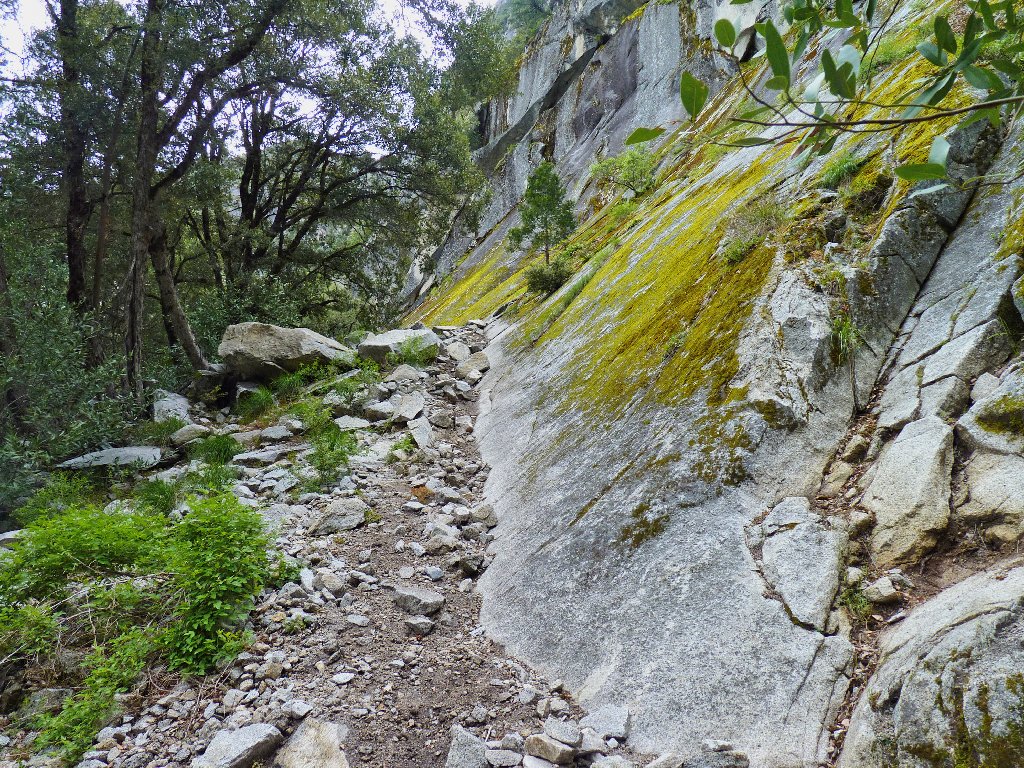
The start of my adventure
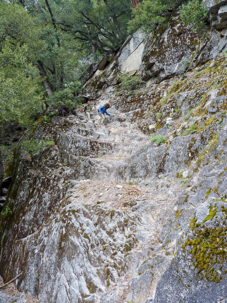
For a few minutes, the going is pleasant. The party abruptly ends,
however, as I am compelled to ascend the next 200-300 feet virtually
straight up, needing to grab bushes and tree branches along the way for
support, and with numerous rest stops along the way. I would not
recommend this 'shortcut' to anyone.
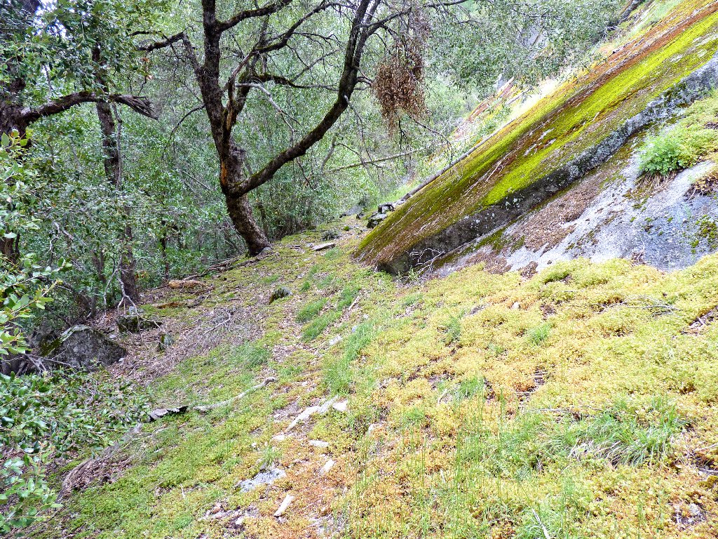
Easy going at first
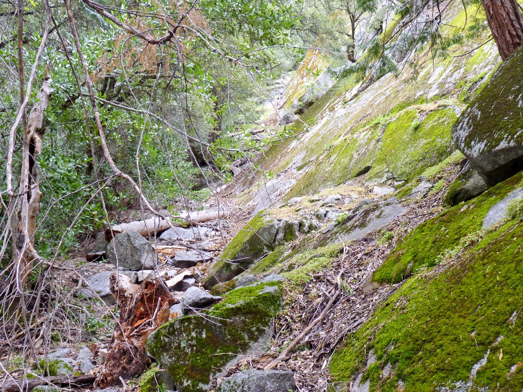
It is wicked from here on
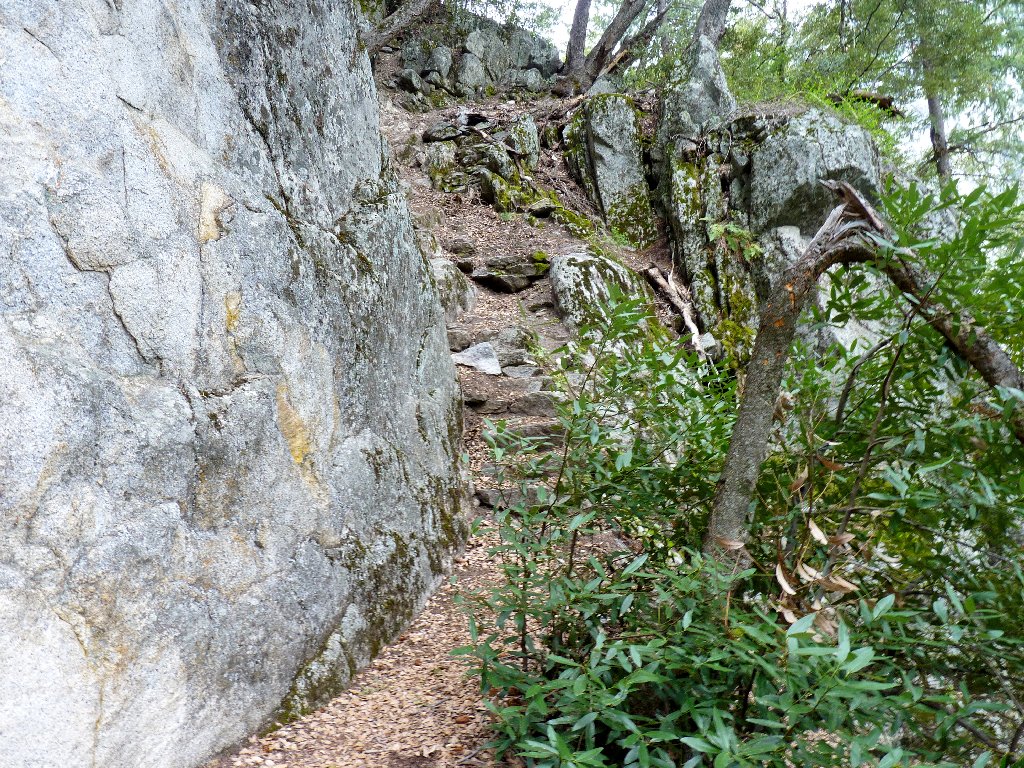
Eventually I encounter the old trail leading upward to the right. It also is quite steep, but the going is much easier now. Around the corner I am treated to my first scenic vista:
Yosemite Falls, Arch Rock, and North Dome across the valley
A pair of young hikers fortuitously appears at just the right time to enhance a photo of the hairiest section of the entire route. Both they and I had expected not to have company on this outing!
This route clearly is not suitable for everyone
All things considered, this trail is amazingly well-preserved for its age. Many segments feature stone steps which remain properly functional after several decades, which possibility seems unlikely. Even though the Park Service will not recommend this trail to anyone or even acknowledge its existence, perhaps it does some periodic upkeep anyway for safety reasons, and if so, Kudos to them for that.
Stairway to heaven
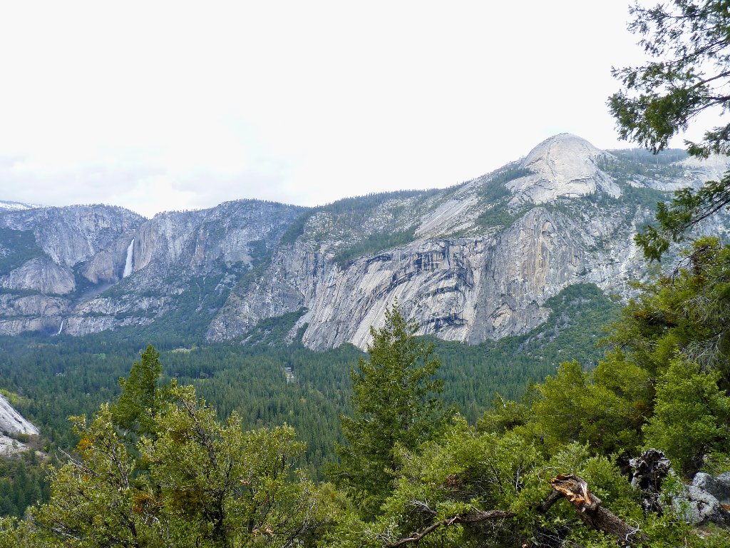
After several rounds of "Almost there, almost there", the hillside finally drops away at a boulder outcropping, revealing marvelous vistas in every direction.

First view of Illilouette Fall
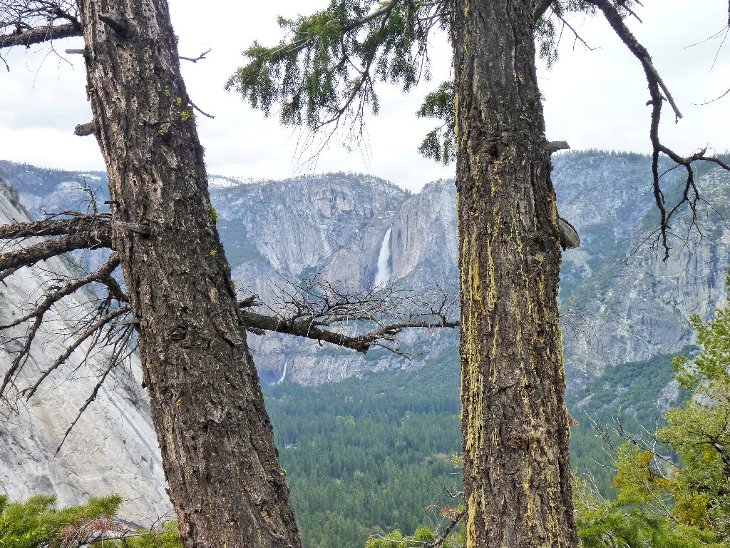
Upper and Lower Yosemite Falls
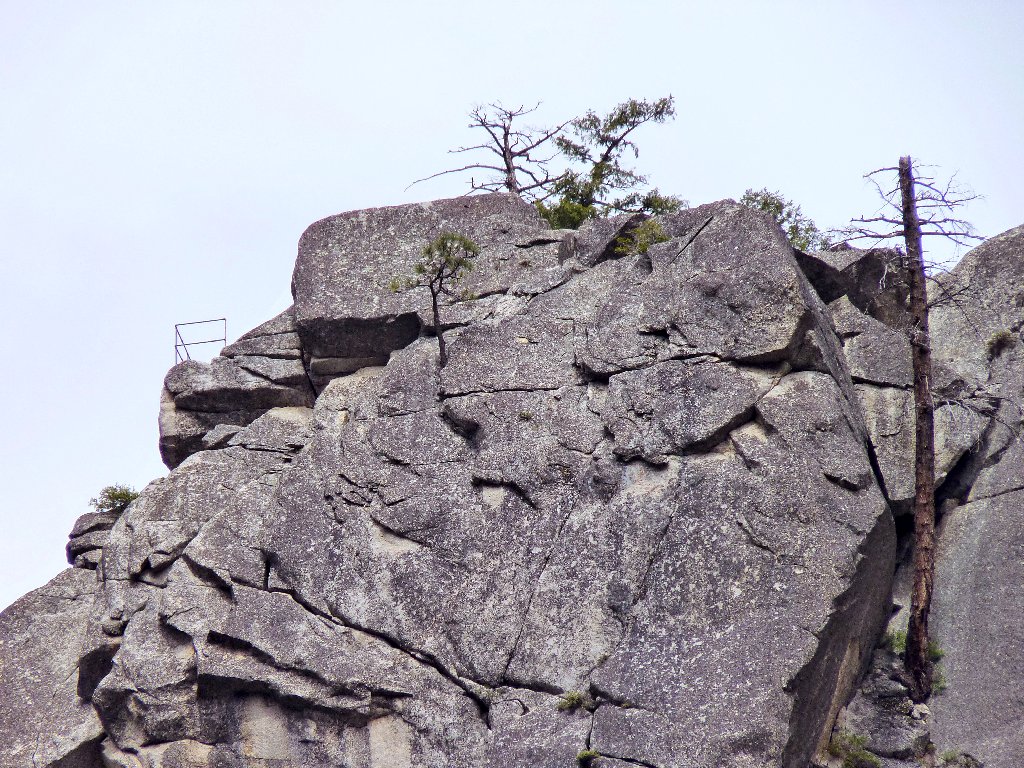
Just below the big boulder, at the terminus of the trail, is the fenced
overlook that I spied previously. From this vantage point one can see
Nevada, Vernal, Illilouette, and Yosemite Falls all the same time!
That is not possible from any other point in the park except Grizzly Peak,
a Class-4 climb directly above me. For that matter, I wonder
whether four major waterfalls can be simultaneously viewed anywhere
else.
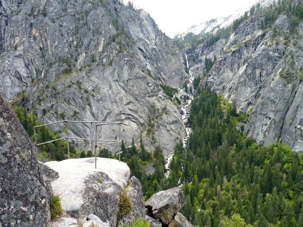
Sierra Point and Illilouette Falls, 370'
It is truly glorious here, at this is a waterfall-lover's paradise! My senses are stunned by the sheer grandeur of these environs. Bonus views include Liberty Cap, North Dome, and Glacier Point. A minor flaw is that one cannot see the lowermost portions of either Vernal or Nevada Fall.

The Mist Trail is living up to its name today
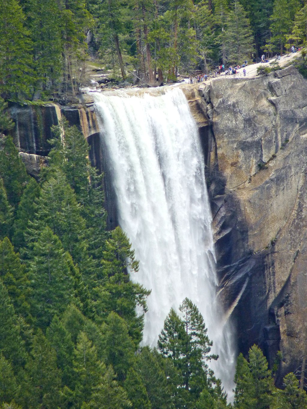
Incomparable Vernal Fall, 317'
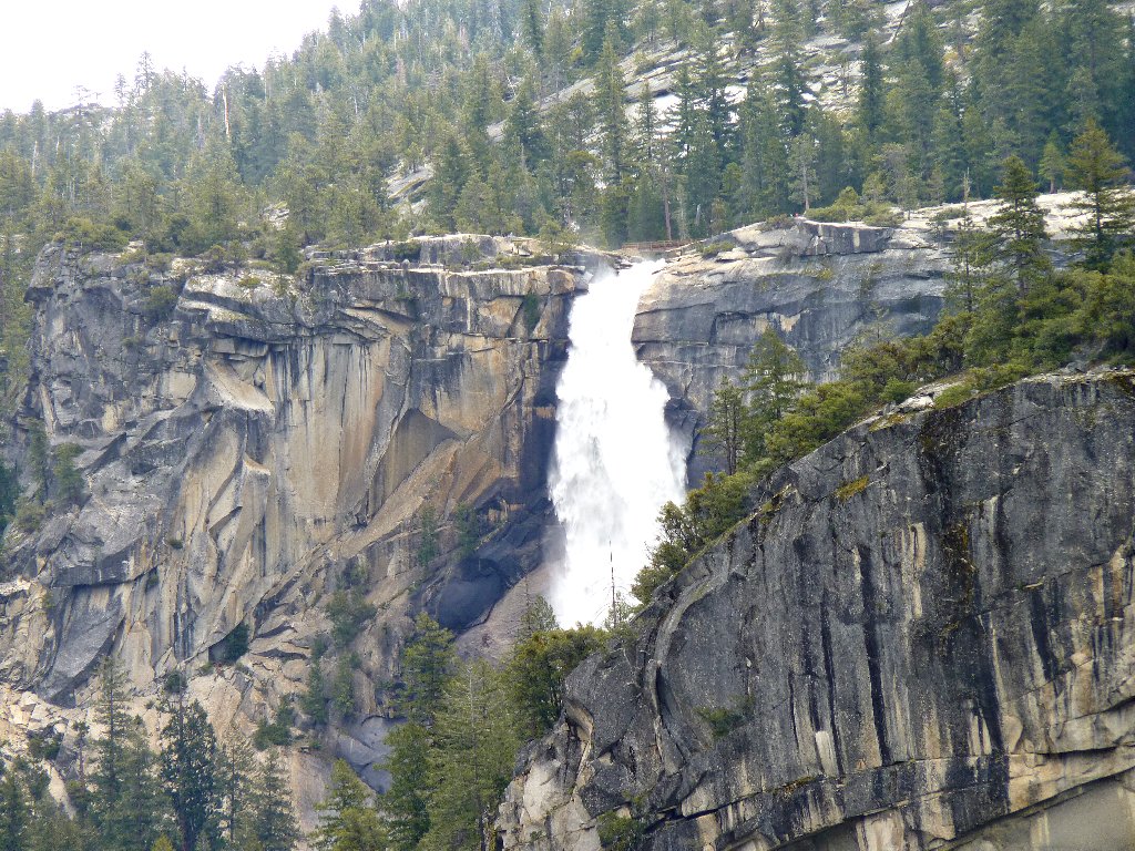
Nevada Fall, 594', is nearly two miles away. Can you
spot the hikers to the left of the brink?
Doubtless this metal railing becomes a great lightning rod on occasion. All the way up the trail I was somewhat concerned about the possibility of being turned back by the onset of a storm; one would not want to be around here under those conditions. I believe that I will head back now, before the weather does change for the worse.
Going down seems even steeper than coming up!
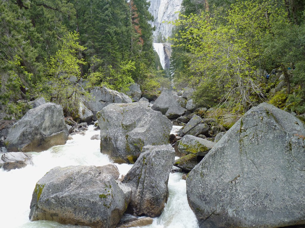
With care, the downhill trek is negotiated without incident. Increasingly loud noises of rushing water tell me that I haven't much farther to go. Presently I encounter the dreaded talus jumble, which proves to be but a minor nuisance.

This obstacle is fairly easily negotiated
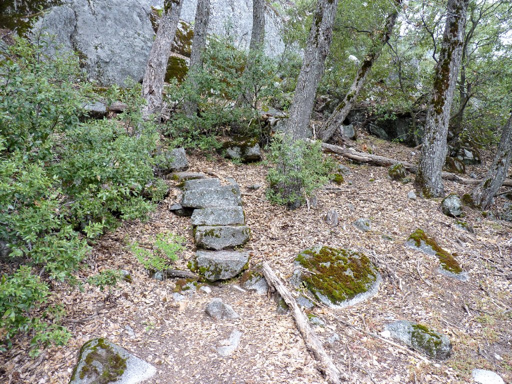
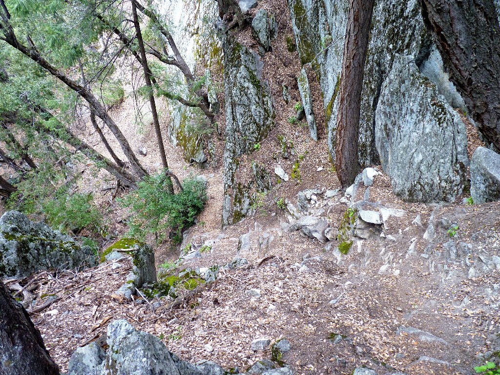
The JMT reappears
There are virtually no flowers out today; the only plant I have photographed is a tree!
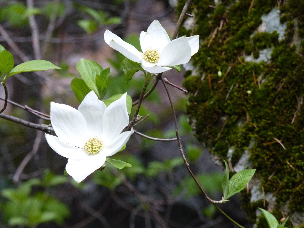
The Dogwood blossoms are out in force in the valley
I cannot pass up a reprise of the little cascade from Washburn Point, for I might never see it again:
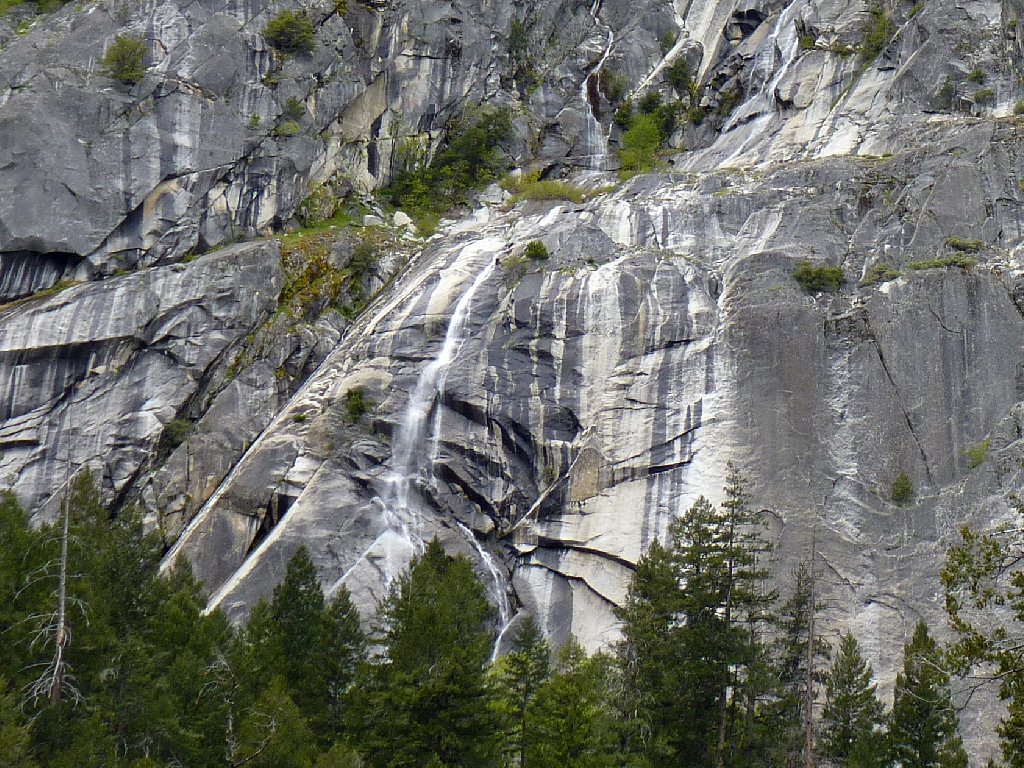
Washburn Falls will be gone soon
§: This unpublicized gem is not for everyone. Do not attempt it unless you are reasonably energetic and sure of foot. Albeit less than a mile each way off the beaten path, this is one of the steepest and roughest trails in my experience.
What a difference a little elevation gain can make! Seeing the lookout from the lower trail is not the same as being there. Assuming that you meet the fitness criteria, Sierra Point will reward you with the most unique waterfall vista in Yosemite Park. Blue skies and greater success with my shortcutting effort would have earned this trek a top rating.
A number of bloggers have reported that they either had trouble locating this old trail, or they could not find it at all. I don't understand the difficulty, however. Unless you should opt for my alternate route (which is guaranteed to locate the trail!), just scramble up over the boulders behind the Rock Pile sign, veering leftward as you go (see the "JMT reappears" photo). It's not that difficult, and you should discover the old trail within a couple hundred feet, with little or no searching. If you do have trouble, then you probably have veered too far to the left (west). The trail itself runs in a northeasterly direction up the slope. Remember that the destination actually is close to the John Muir Trail.
| Scenery |  |
| Difficulty |  |
| Personality | |
| Adventure | |
| Solitude |  |

ADDENDUM
According to the Guide to Yosemite (Ansel F. Hall, 1920), there had been an ongoing quest to find a point in Yosemite from which the four major waterfalls could be seen. Finally, in 1897, Charles A. Bailey (a notable rock climber of the era) and a friend felt that they had determined such a location by triangulation.
The first ascent on June 14, 1897, proved the calculation correct. The crag, which surprisingly turned out not to be one of the dominating summits, was named in honor of the Sierra Club. Bailey subsequently publicized his find in The Vantage Point of Yosemite, Sunset Magazine, April, 1899. The name appeared on the second map of Yosemite Valley in 1918.
This place figured prominently in another historical way. In 1916,
at the age of 14, Ansel Adams took his first trip to Yosemite, and
wrote in a letter to his Aunt Mary in San Francisco that, "Yesterday
I went up to Sierra Point and enjoyed lying on my chest and looking over
the edge — about fifteen hundred feet down, perpendicular".
Ansel also reported that he already had made thirty photographs with a
new Kodak Brownie — his first camera. The pictures were
nothing special (and the actual dropoff was only about 500 feet); but this
trip inspired Adams to keep returning to Yosemite for the rest of his life.
It seems that the career of America's most famous photographer might have
begun right here — at Sierra Point!
