
Eldorado NF
|
Jay Bird Canyon Falls Eldorado NF |
May 12, 2009
This outing began merely as a drive to see a new waterfall, snap a couple of pictures, and move on. But that's not what happened.
Heading up Ice House Road from Highway 50 toward the Crystal Basin, my route branches westward. After eleven nicely paved but lonesome miles, an impressive waterfall comes into view on the far side of Silver Creek Canyon. Although the combination of falls and cascade probably exceeds 600 feet, no particularly good photo opportunity presents itself.
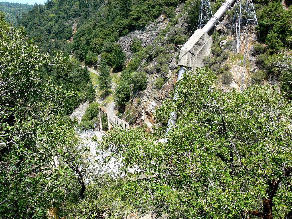
Just ahead is the Jay Bird Powerhouse, which overlooks Camino Reservoir, which is inaccessible to the public. A sign on the open gate admonishes vehicles to proceed no further. I soon learn why; for as I am parking, a power company employee drives up through the gate, locks it closed, greets me, then disappears.
Sugar Pine Creek Falls
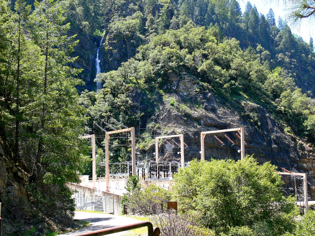
View from the powerhouse gate
A hundred yards down the road toward the facility, a long metal ladder stretches
up the hill to provide access to a giant penstock. Thinking that there might
be some good views of the falls from the top, I head up the stairs. They prove
a bit scary, being as high as 6-8 feet above ground in places; but a nice
handrail is provided.
The resultant viewpoint isn't as good as I had hoped, because trees are concealing the bottom of the falls.
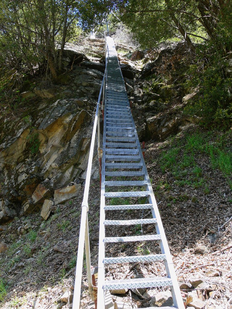
There are 218 steps
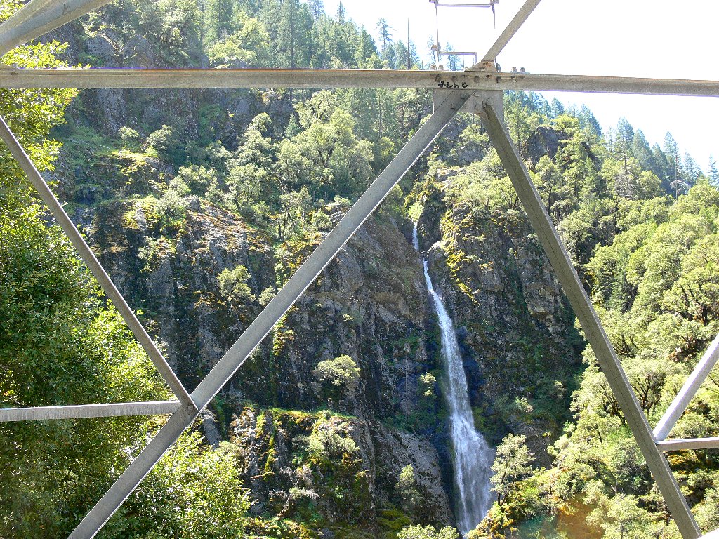
Falls view
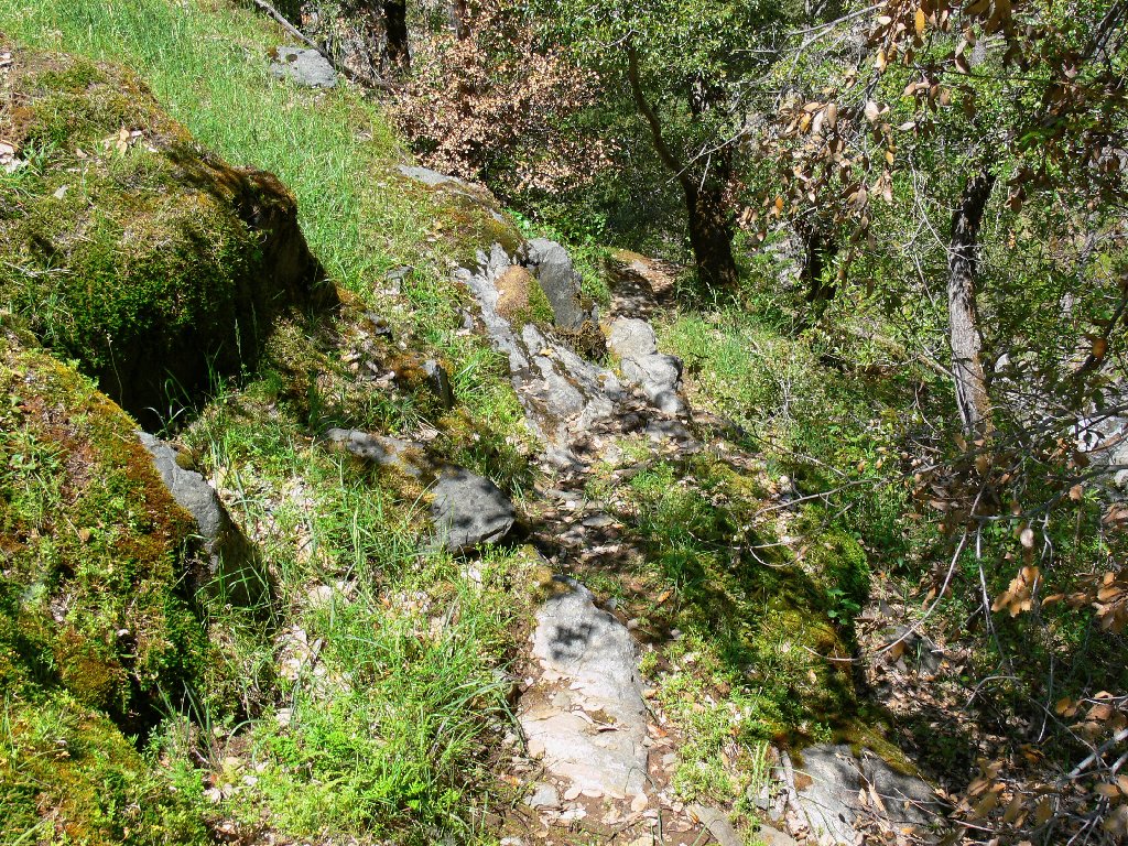
Back on the road, I cross the creek, discovering an unmaintained use trail that leads straight up the hillside. That seems worth exploring, so I return to the car, don my pack and boots, and set out anew.
The first piece of trail is a steep scramble up through the dirt, with but an occasional tree trunk to grab for assistance. I understand that there once was a handy rope installed here, but it is long gone. In any case, the difficult section is quickly dispatched, and a gentler incline begins to provide some views.
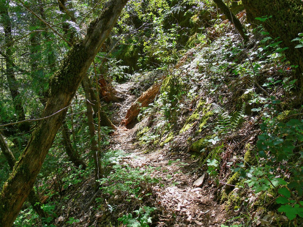
Use trail
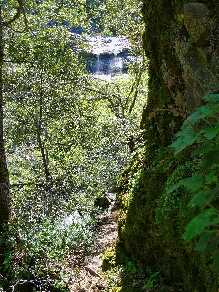
A cascade is in sight
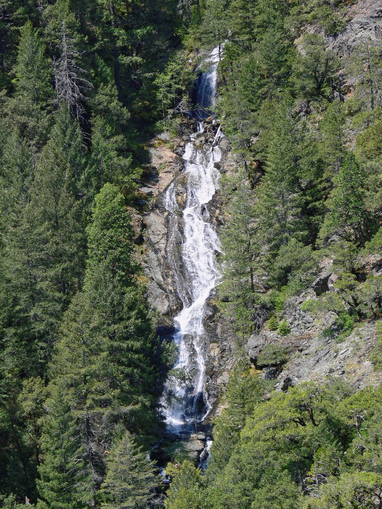
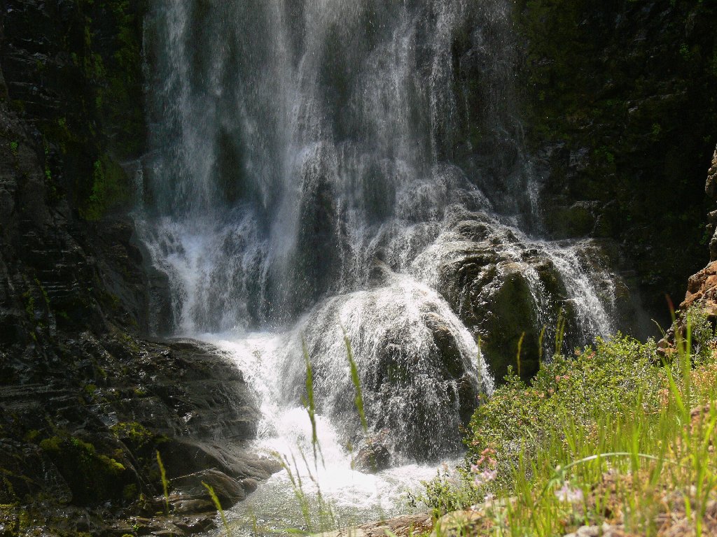
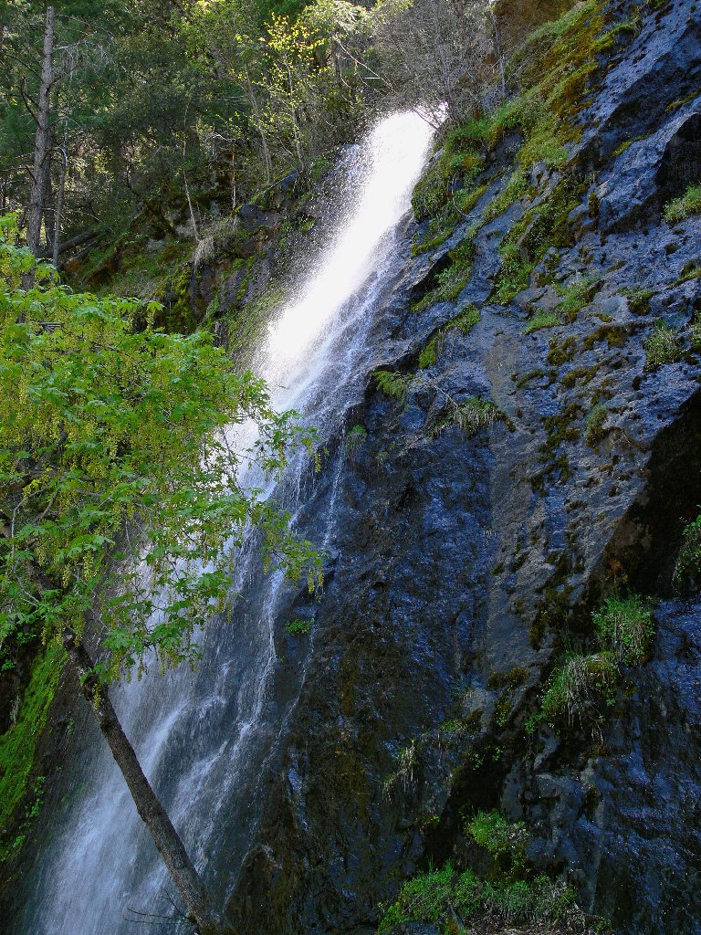
Within just a couple of minutes a stair-step cascade comes into full view, and it is awesome! On the right are the big falls, noisy and beautiful.
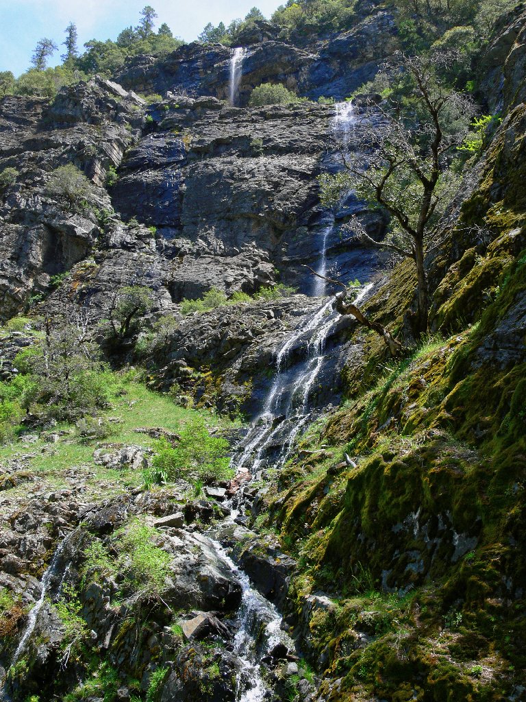
Reminiscent of Glacier Park
The main falls
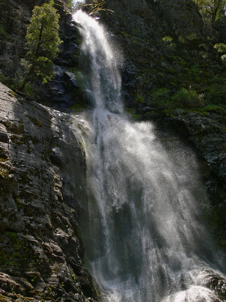
Another few yards of scrambling brings me close to the falls. A light spray is covering everything, including myself. Being here is wonderful! This ranks among the most special places I have visited in the northern Sierra.

This is why I go hiking
Determined to get a better overall view, I scramble up the opposing hill, stopping to visit with some nice flowers along the way.
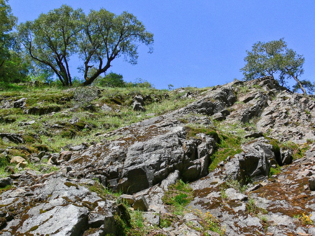
Hilltop scramble
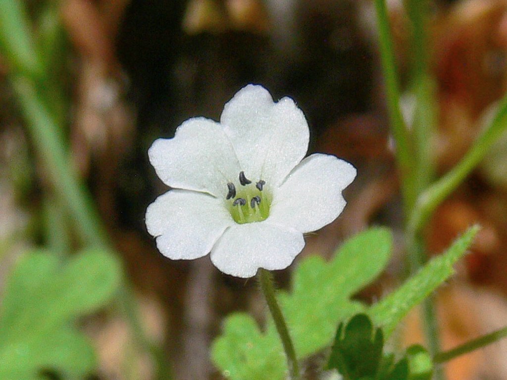
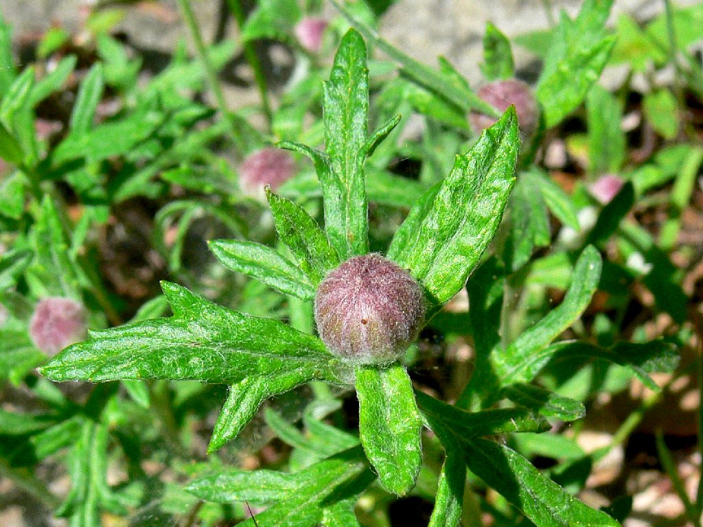
Little Baby Blue Eyes
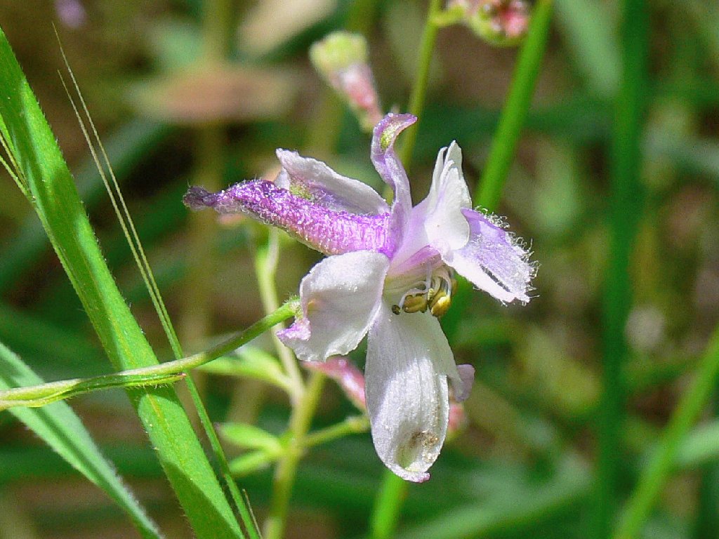
Slender Larkspur
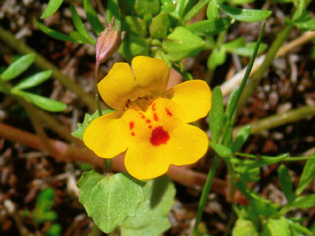
Monkeyflower
As I achieve the hilltop, the falls remain pretty much in the shade, and the sun is badly positioned for photographs. So I sit patiently for over an hour, content to munch some gorp and revel in my serendipitous find. A glance to the left provides a reminder of my proximity to civilization. Looking in the direction of the falls, one could never tell.
Falls and flowers
The powerhouse below
Eventually, the sun does cooperate and I capture some reasonable
full-length photos of the falls, all the while berating myself
for having left some essential camera equipment in the car.
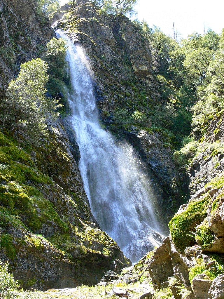
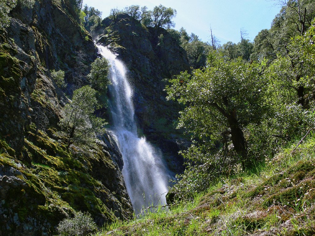
Leon Turnbull — waterfall explorer extraordinaire —
estimates the height of the falls at 175 feet, so I'll go with that.
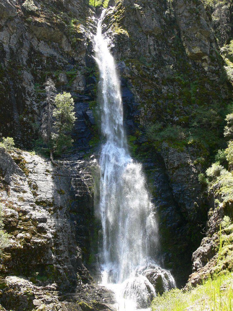
Jay Bird Falls, 175'
On the way down the hill, there are more flowers to shoot as well as new perspectives on the scene.
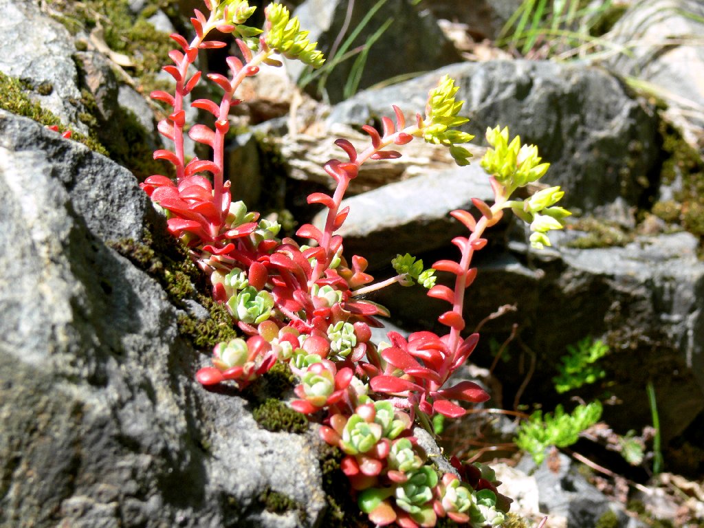
Pacific Stonecrop
Woolly Sunflower, almost
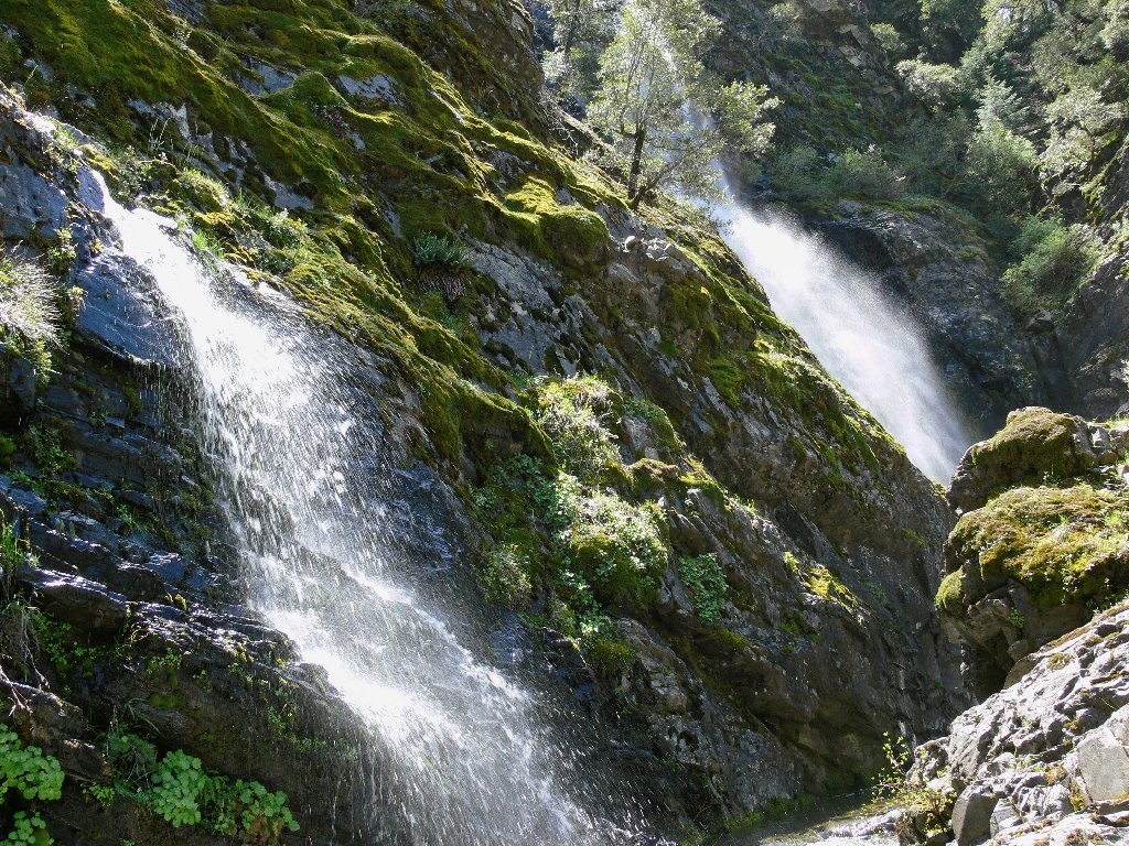
The two sets of falls
Side view of the big falls
Reluctantly, I head for the exit, resolving to be better prepared
camera-wise on the next visit.
A parting shot
Starting back down
On the return I stop to examine an unusual roadway configuration:
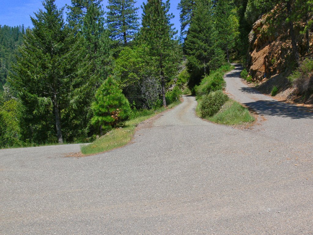
What is this all about?
Having originally come down the middle lane and continued to the left,
I opt for the right-hand option going back. My guess is correct,
for it proves to be a substantially steeper but half-mile-shorter
alternative — probably the original route.
Back on the main highway I get my first-ever photo of Bridalveil Falls, which are right beside the road. Normally this fall is just a trickle.
Bridalveil Falls on US-50
Finally, near Camino I am treated to some sub-literate sign-posting in action:
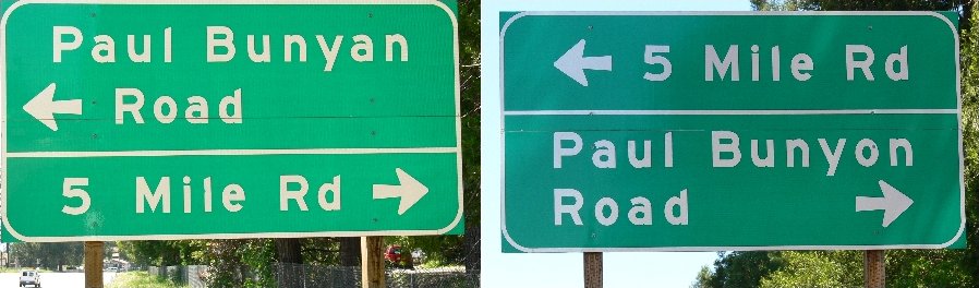
NOTE: As of 2020, the left-hand sign has been replaced; now both are
non-historically spelled
§: An "uncommon experience" is a prerequisite for my top
rating. I had one of those today. Standing at the base of a high
waterfall, basking in the misty spray together with the ferns and flowers,
being overwhelmed by the roar of the water, and having the place completely to
myself — well, it simply doesn't get any better than that.
What an incredible high this was!
And nowhere else will you beat the ratio of scenery to hiking distance!
Ted's Tip: I recommend a visit in later afternoon, when the sun shines more fully on the falls. Be aware that the creek will dry up with the snow pack.
| Scenery |  |
| Difficulty |  |
| Personality |  |
| Novelty |  |
| Solitude |  |
 |
In June of 2012, the powerhouse was vandalized; so PG&E began locking
the access gates more frequently. Although some subsequent road damage has been fully repaired as of March 2022 (despite the ongoing lie on the Eldorado NF website), the gates remain closed to unauthorized vehicles. As of 2024, however, the falls still can be visited by a trek on asphalt, plus a 15-minute scramble. |
