
Desolation Wilderness
|
Umpa Lake Loop Desolation Wilderness |
July 2, 2008
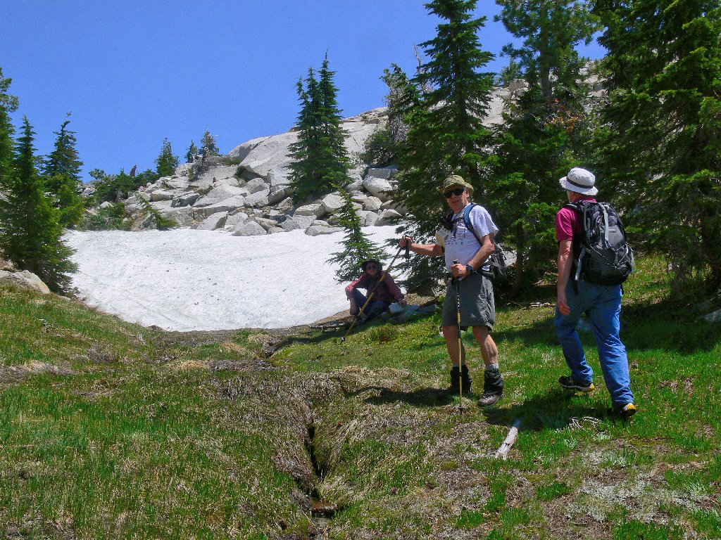
Being anxious to visit this trail relatively early in the season —
before the creeks go dry — I have recruited friends Ali, John, and Phil
to join me despite the threat of smoke in the air from the dozens of California
wildfires that remain active at this time. It is most fortunate that none of
the current conflagrations have threatened my high-mountain playground.
At the last moment we are joined by Dave, a Sierra Club principal, who offers to
guide us cross-country to Umpa Lake via the Enchanted Pools —
new territory for the rest of us.
As we start out I immediately spot some shooting stars beside the trail register,
followed by countless Sierra Mariposa lilies — which I previously have
seen only at this very location. Also noteworthy are the meadows full of camas
lilies, plus a few million prettyface which I inexplicably neglected to photograph
today.
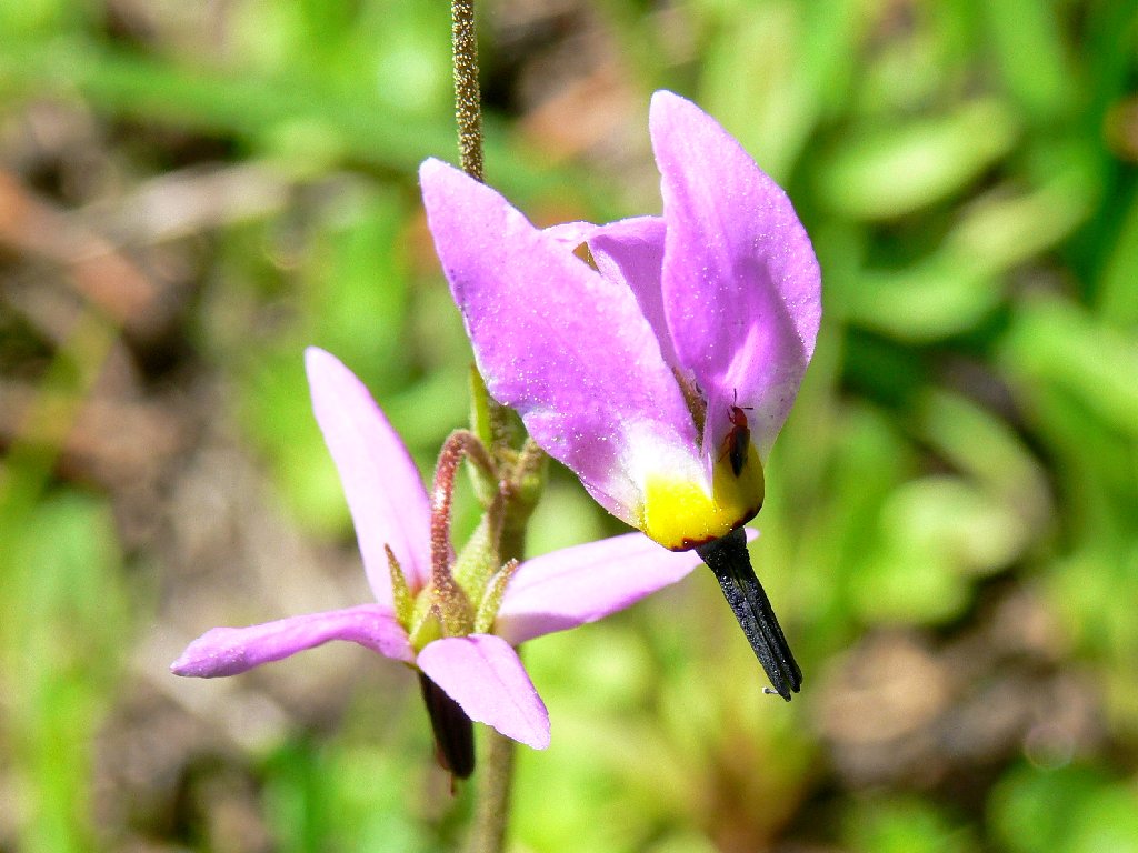
Darkthroated Shooting Stars
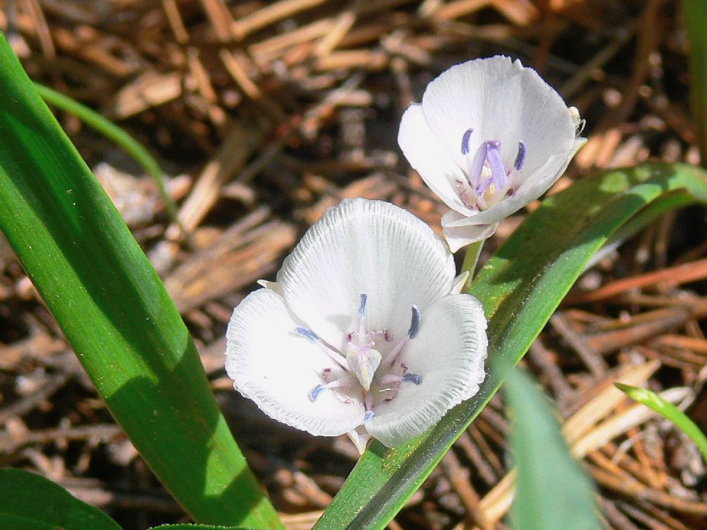
Sierra Mariposa Lilies
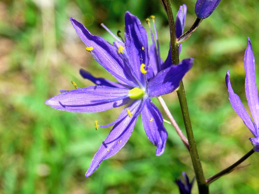
Camas Lily

Rose Meadowsweet
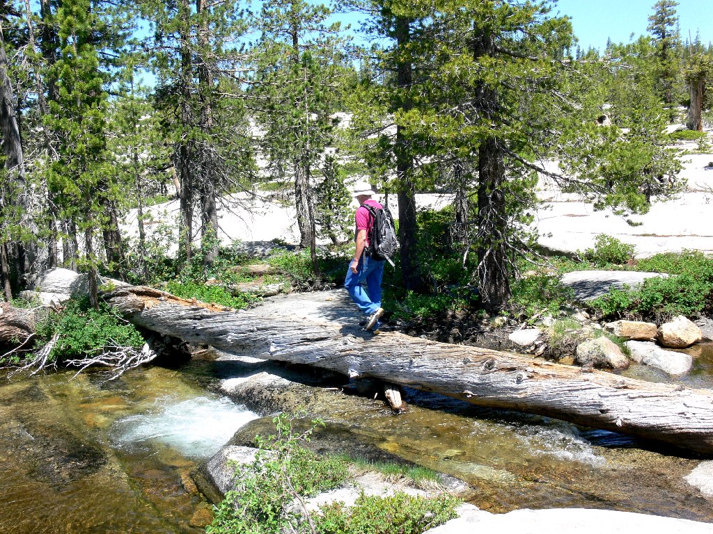
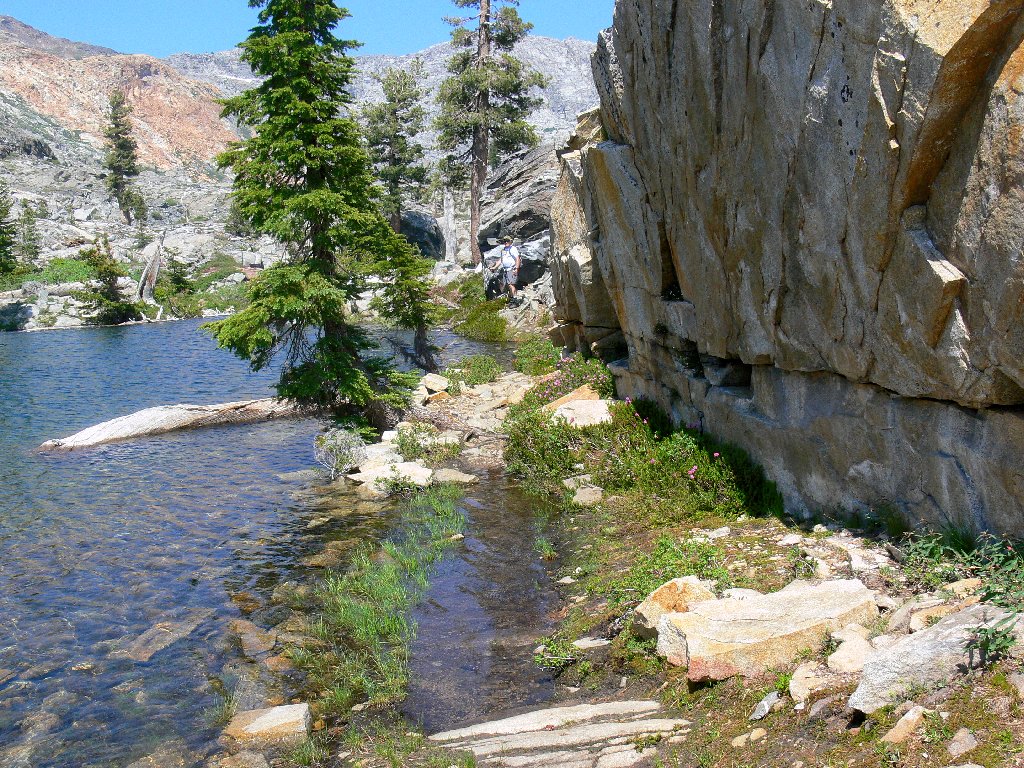
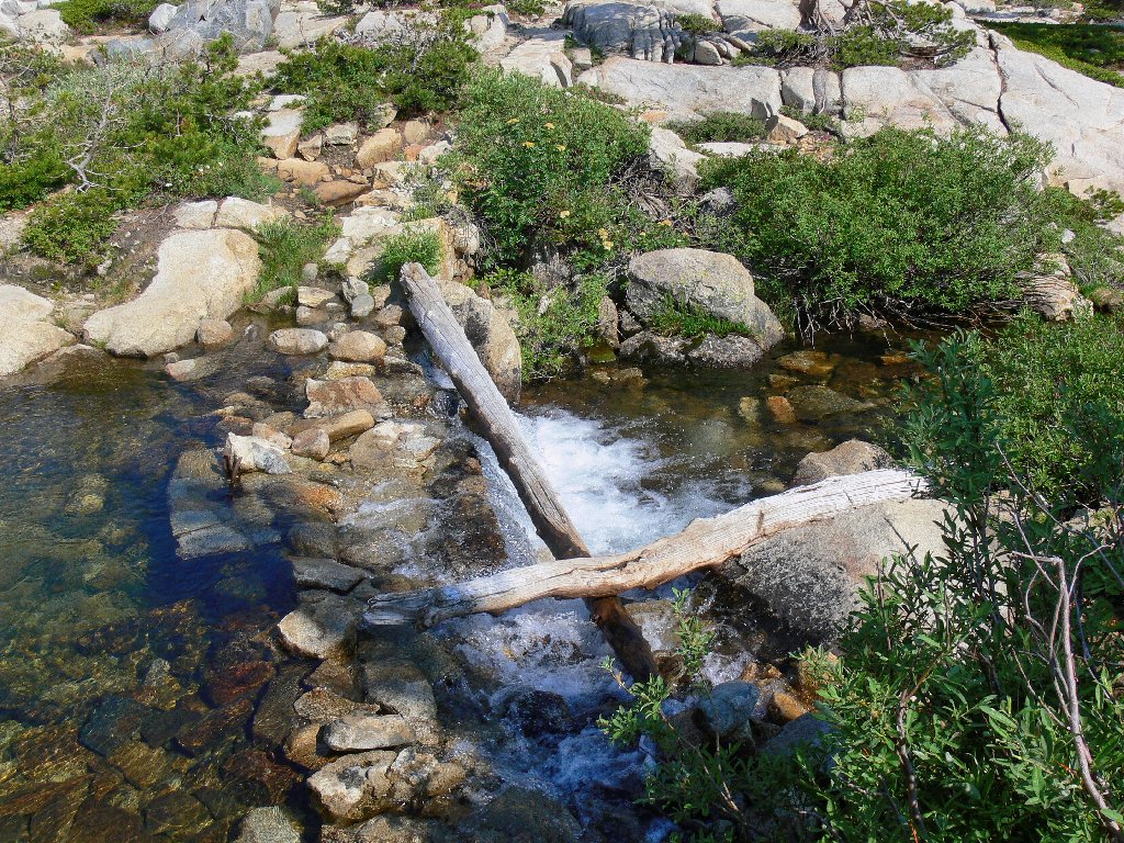
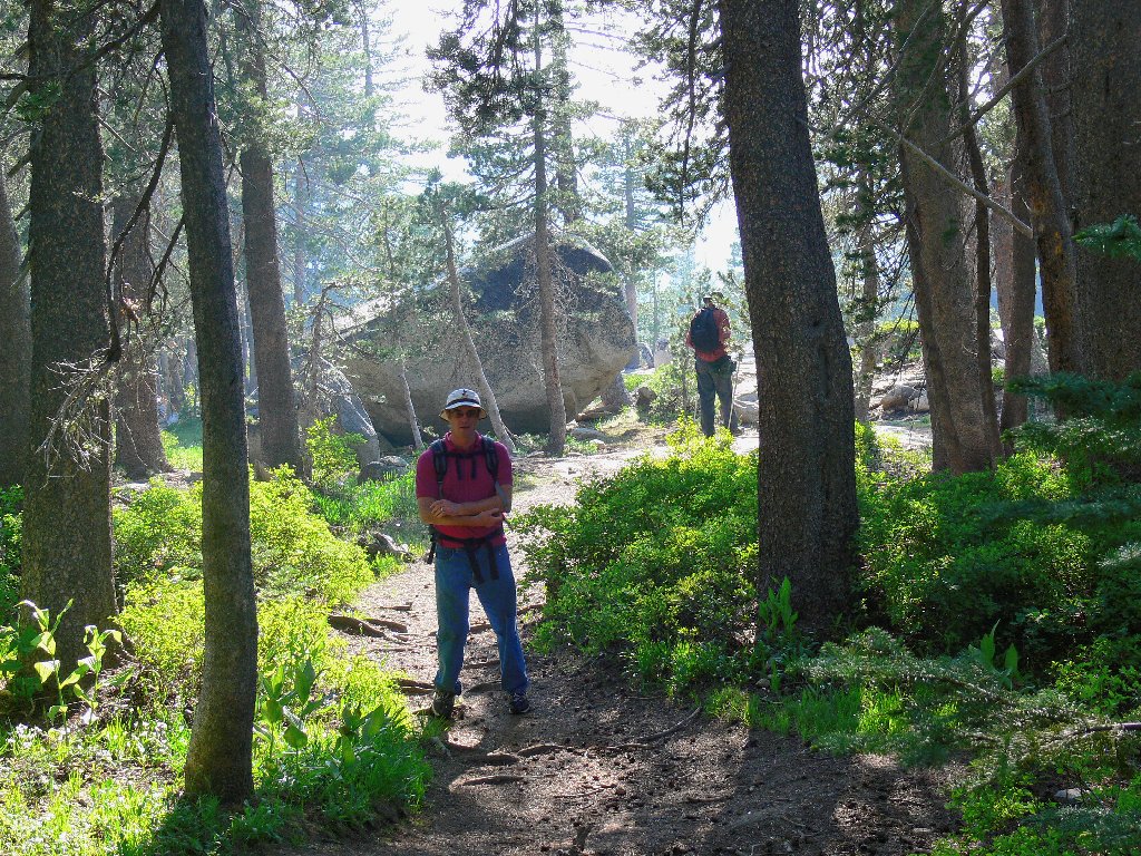
Shortly up the Twin Lakes Trail, we detour left on a usage path that might go unnoticed by someone not familiar with the route. A conveniently located fallen log provides a nifty bridge across the Grouse Lake drainage.
Not all stream crossings are this easy
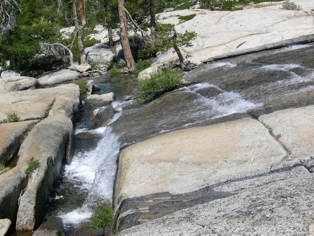
The creek takes a 90-degree turn
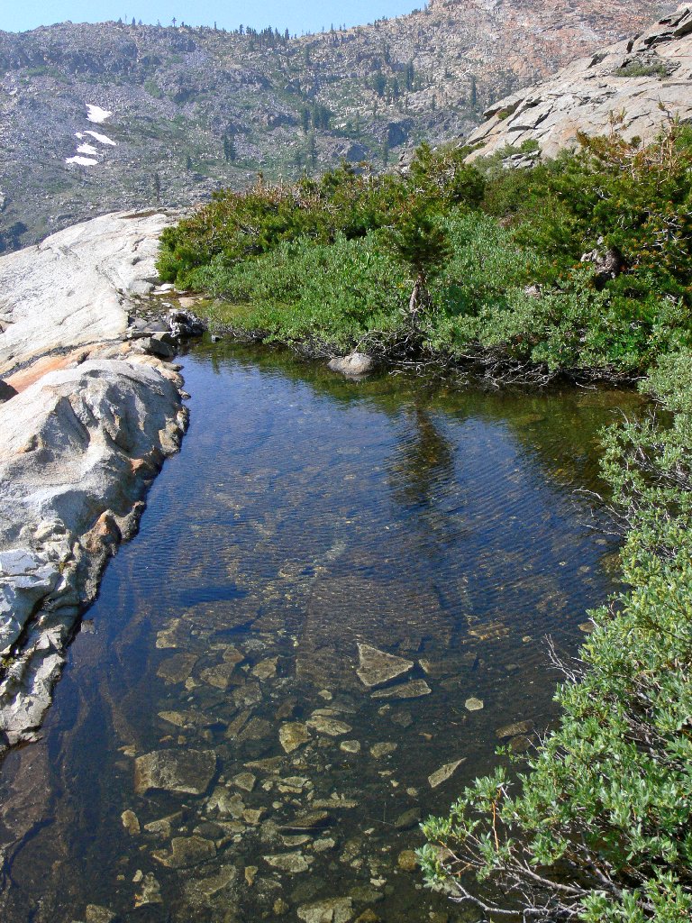
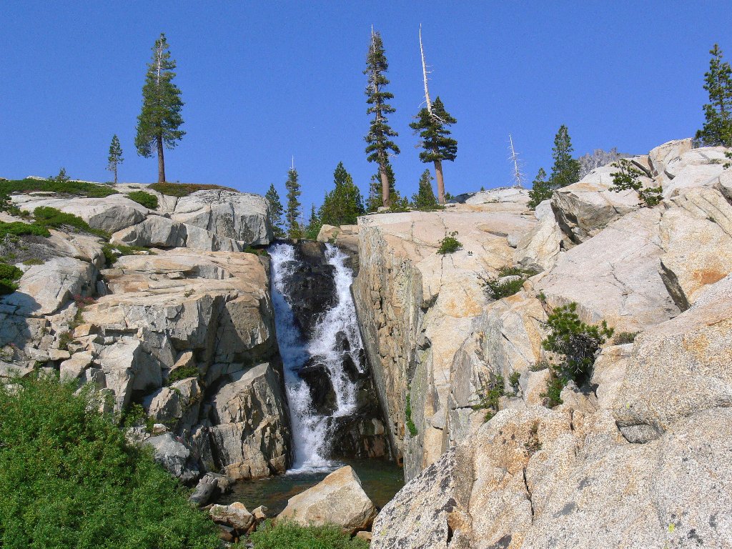
Before long we reach the chain of so-called Enchanted Pools, which name will not be found on maps. After reaching two small and relatively uninteresting sections, we continue upstream along the beautiful South Silver Creek to the last and biggest pool, which sports a pair of waterfalls plunging off the huge granite slab above. I remember spotting these falls last summer from the nearby Gertrude Lake Trail, which fact suggests an alternative future loop trip.
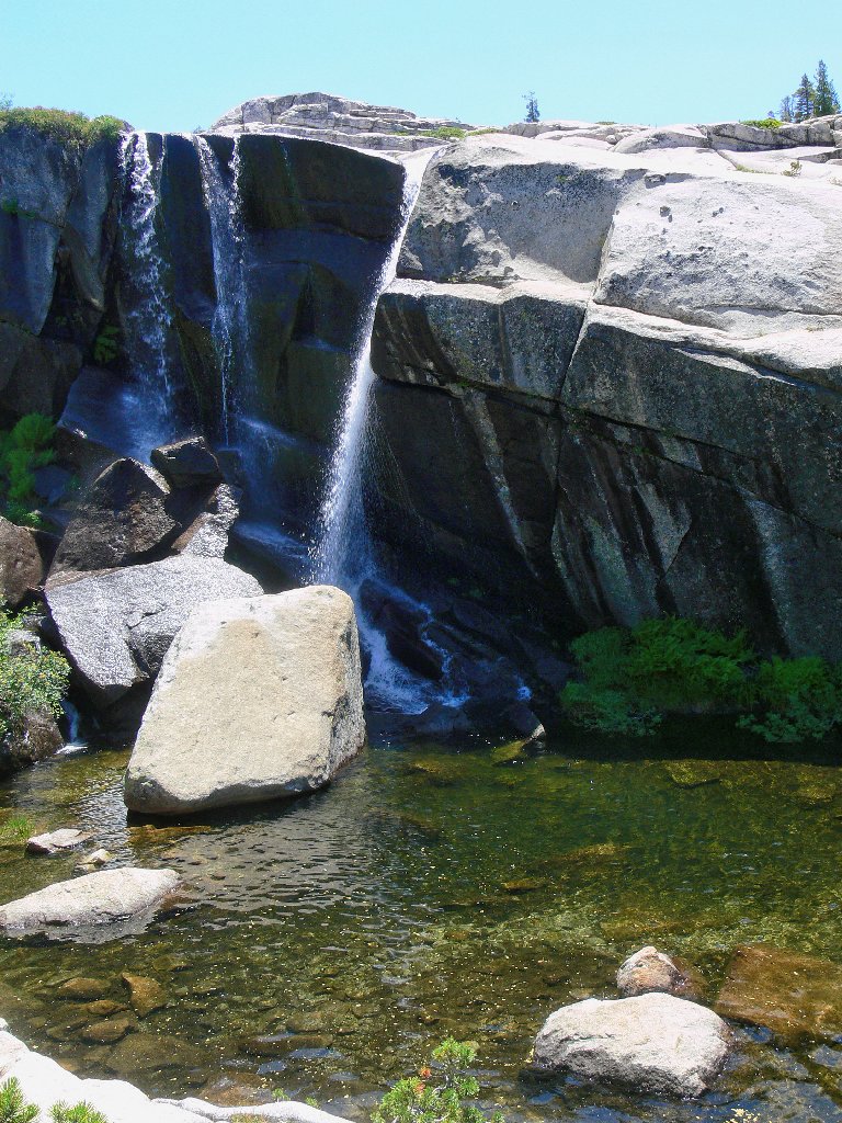
A fine swimming hole
The biggest and nicest Enchanted Pool
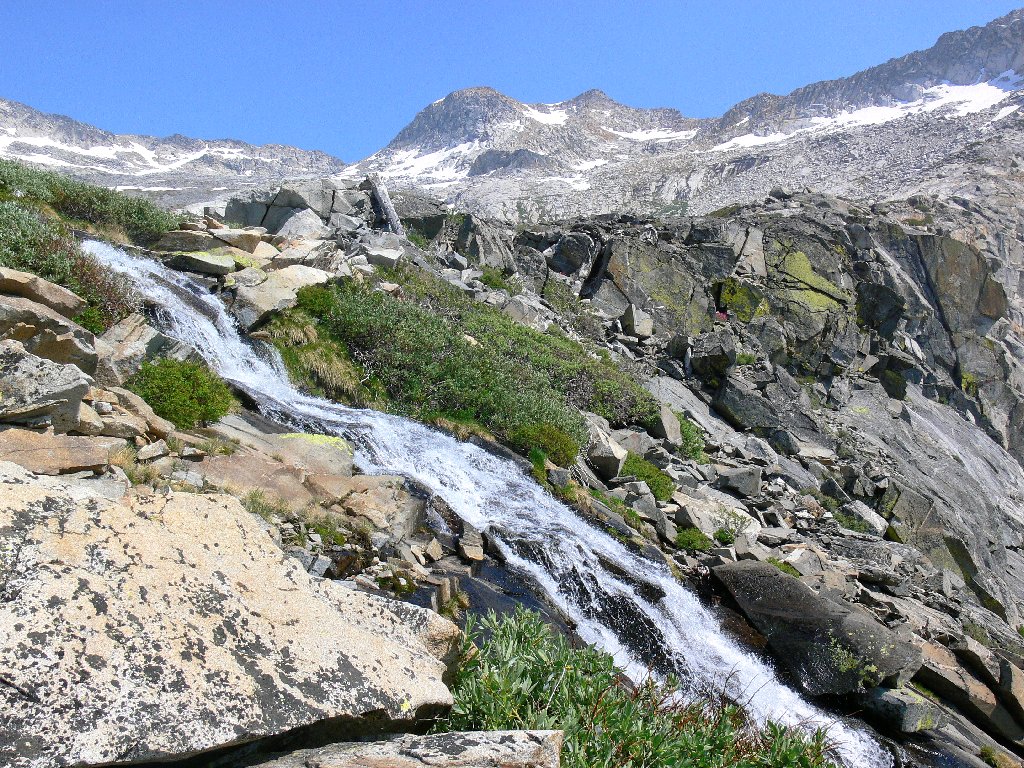
Normally I would jump into the water straightaway, but today we
have much to accomplish. So after a short respite we hit the trail
again — or rather, the non-trail. After scrambling
above the falls, Dave shows us the "private bath"; then we head up
the granite slab beside the creek. Late in the season this would be a
relatively hot and uninteresting climb; but today, it is exhilarating.
This is my kind of place!
A final shot of the falls
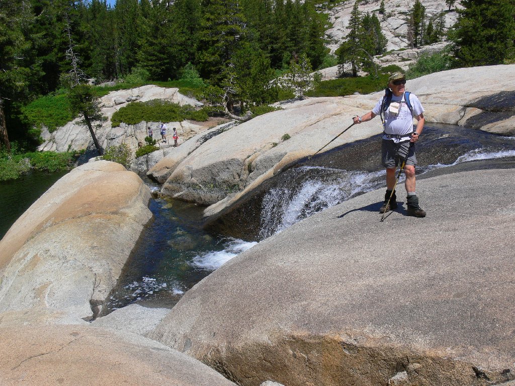
Dave's not-so-private bathtub
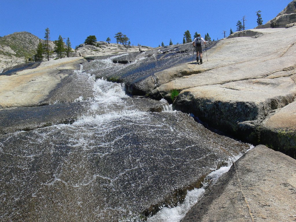
Traversing the Sierra Highway
It just gets better
The group takes a breather and checks its bearings above an interestingly curved section of creek. I try in vain to capture a photo of a checkerspot butterfly which seems disinclined to land anywhere. Last year at this time those guys were out in droves; today they are disappointingly scarce.
The geeks consult their gadgets

A nifty curve in the stream
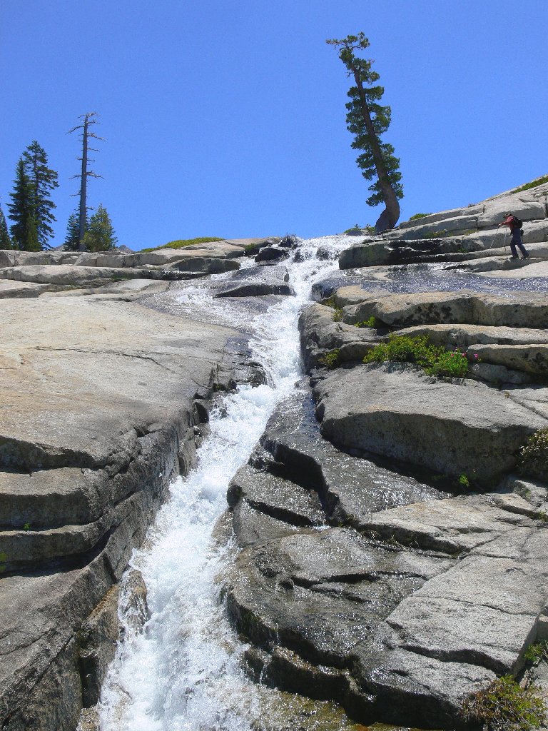
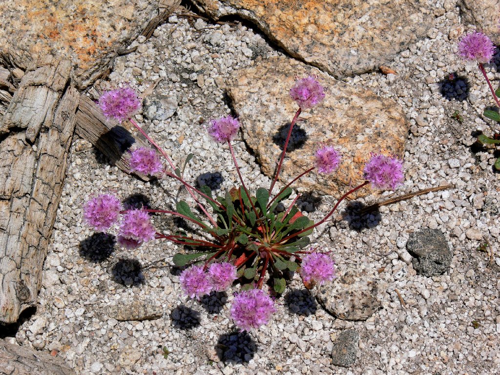
Our boulder-hopping odyssey resumes in earnest, toward a clump of trees at the base of the far cliff. Ali and Dave take the high road; the rest of us opt for a lower route, which serendipitously features some more new flower types. They are everywhere today in great numbers; I am so pleased.

Elusive Umpa Lake remains out of sight above us
Ali and Dave on the high road
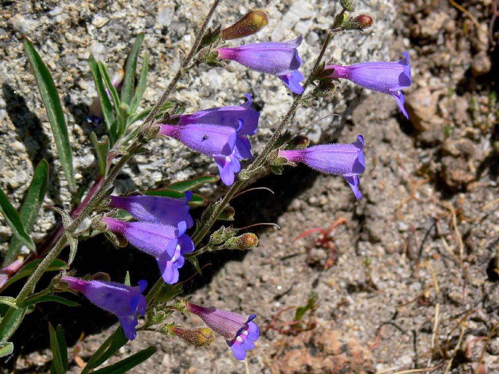
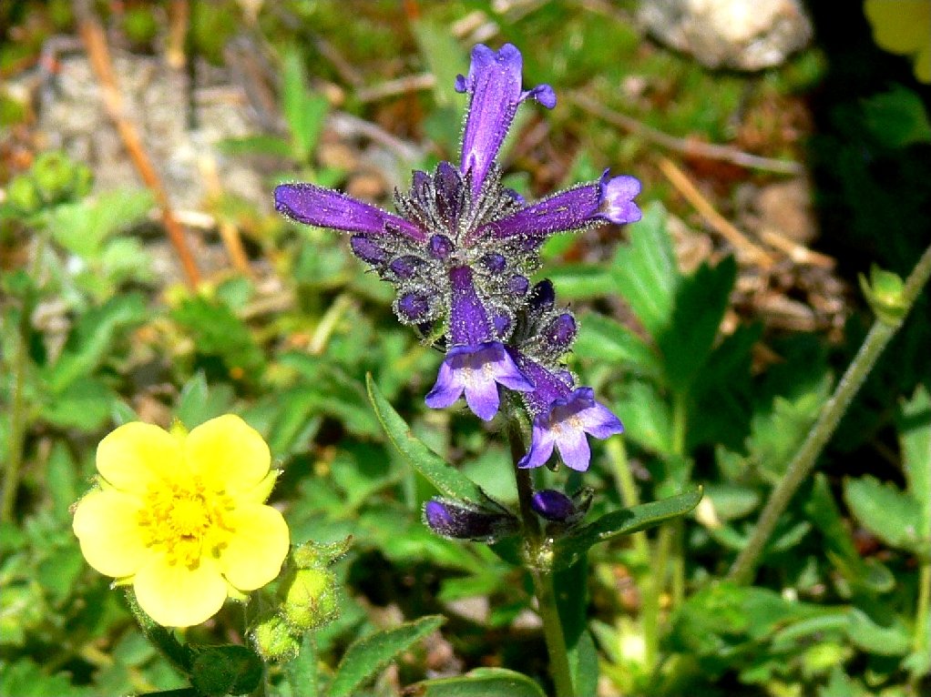
Penstemon

Leichtlin's Mariposa Lily
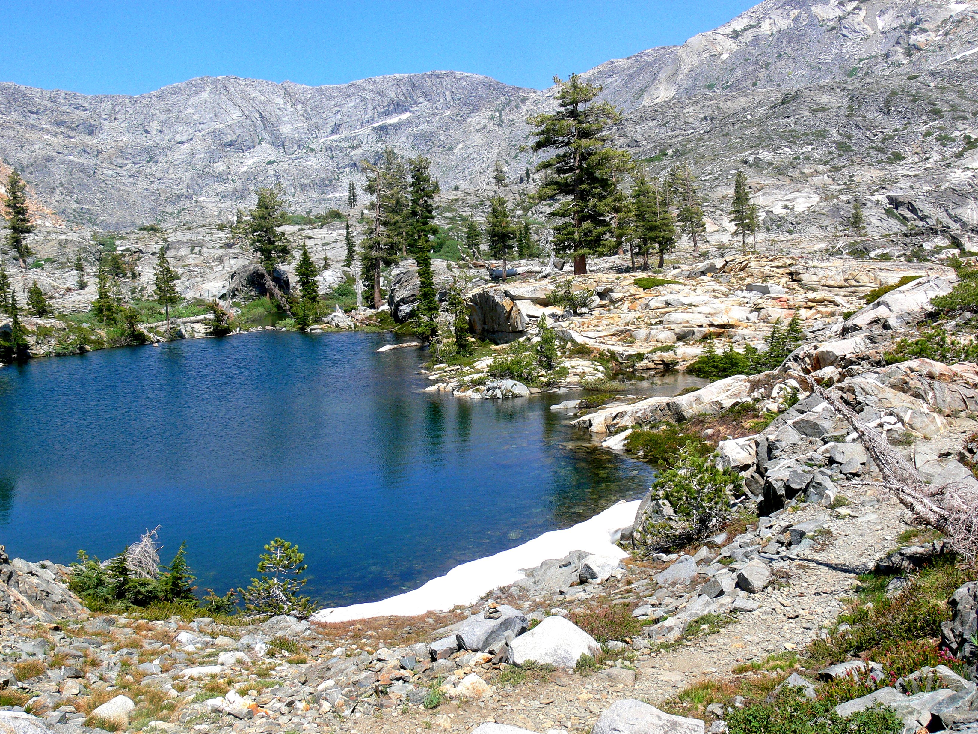
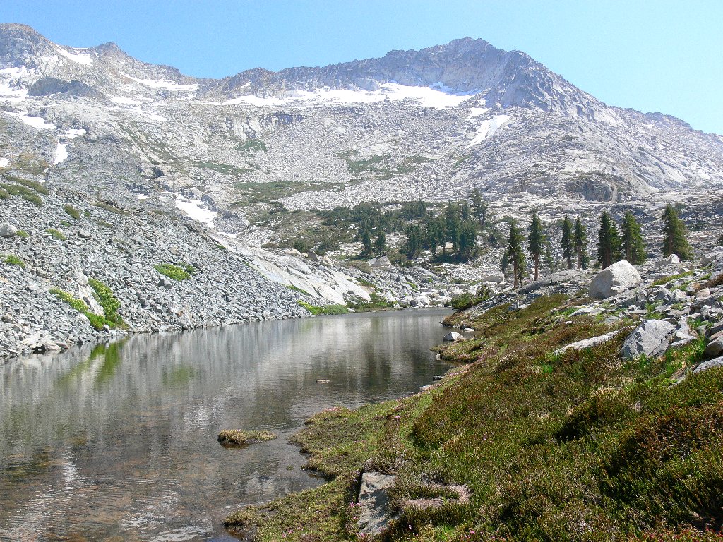
Umpa Lake and its environs surprise me, as I had not anticipated such a verdant
setting. The area appears to be spring-fed; the constant water supply
is able to support all the grasses and ferns that line the shore. This is a
perfect place to break out some trail mix and dry out some damp socks.
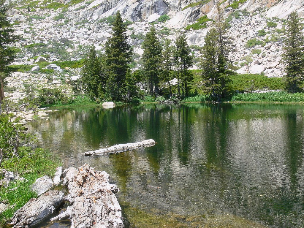
Umpa Lake
Many of the four-letter lake names in Desolation Wilderness are abbreviations for presumably important personages: Toem for Tom Emory, Waca for Walter Campbell, etc. Not so this one. It seems that in the 1920s a Forest Service employee had a grandson who wanted to name it "Grandpa Lake"; but when the child tried to pronounce the word "grandpa", it came out as "umpa". And dat's da truth.
Our journey continues up a moist, grassy canyon above the lake, with the valley smoke at our backs. Presently we encounter the first snowdrift on our route. It is here that John decides to try using his cell phone, and it works! Many miles to the west we can barely make out a hilltop tower in the haze, which Dave says was bought by AT&T, which just happens to be John's service provider. I grab this opportunity to make a surprise call to my bride at her workplace.
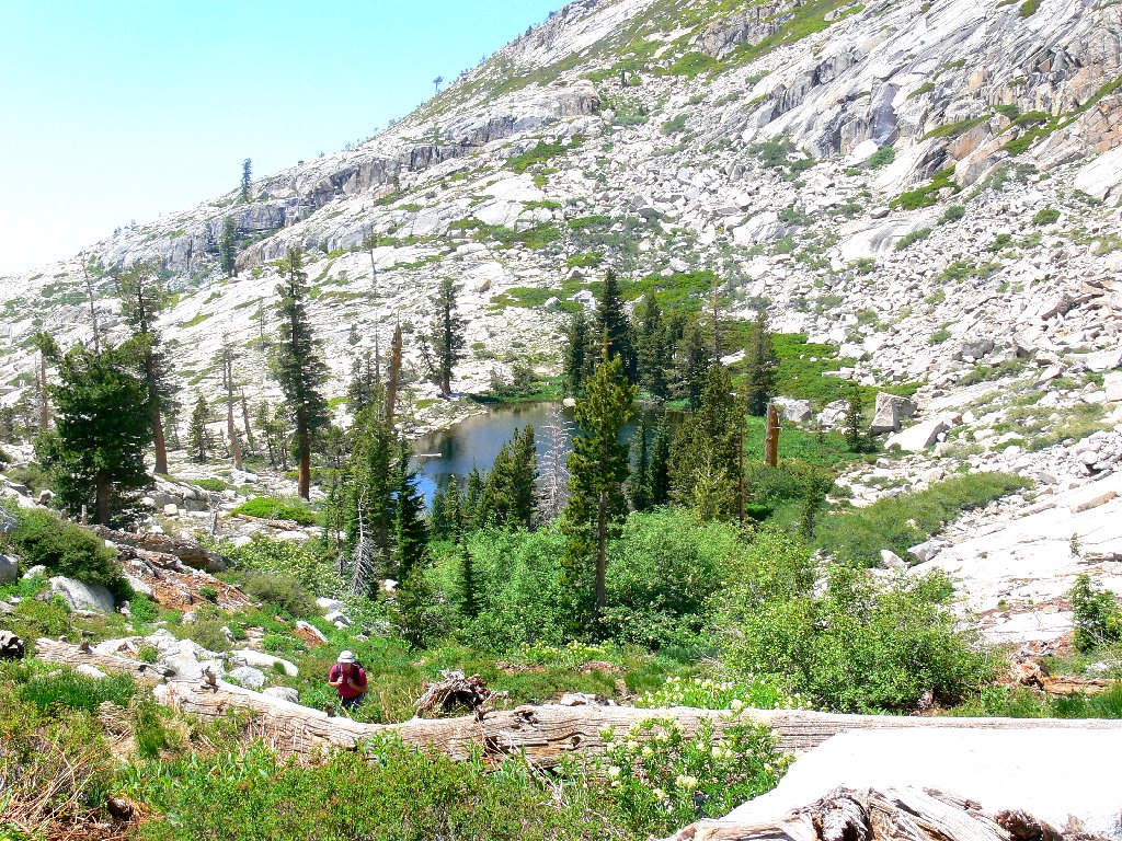
Departing lonesome Umpa Lake
Time for a phone call, of all things
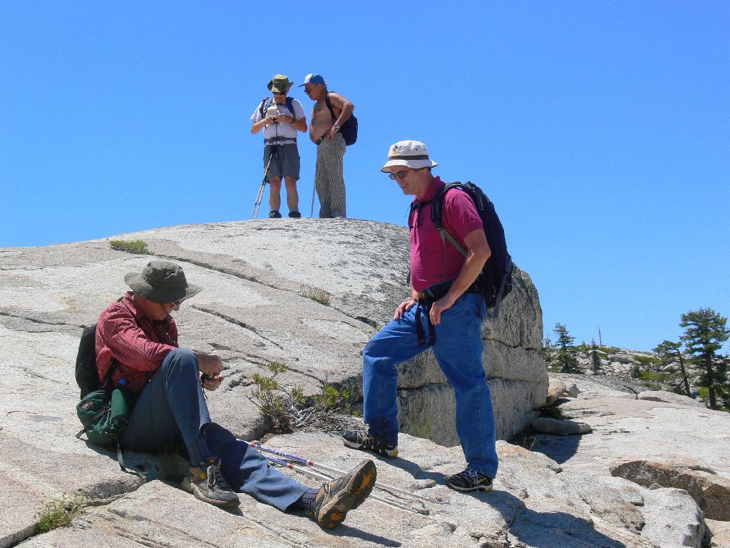
Despite our group's relatively advanced ages (four of us are 66+ years old), a rather brisk pace is being maintained. I have been running uncharacteristically short of breath today, to the point of actually holding up the party at times. This is highly distressing, for I have spent my entire hiking career closer to the head of the pack than the rear. An ongoing bout with allergies serves as a convenient excuse.
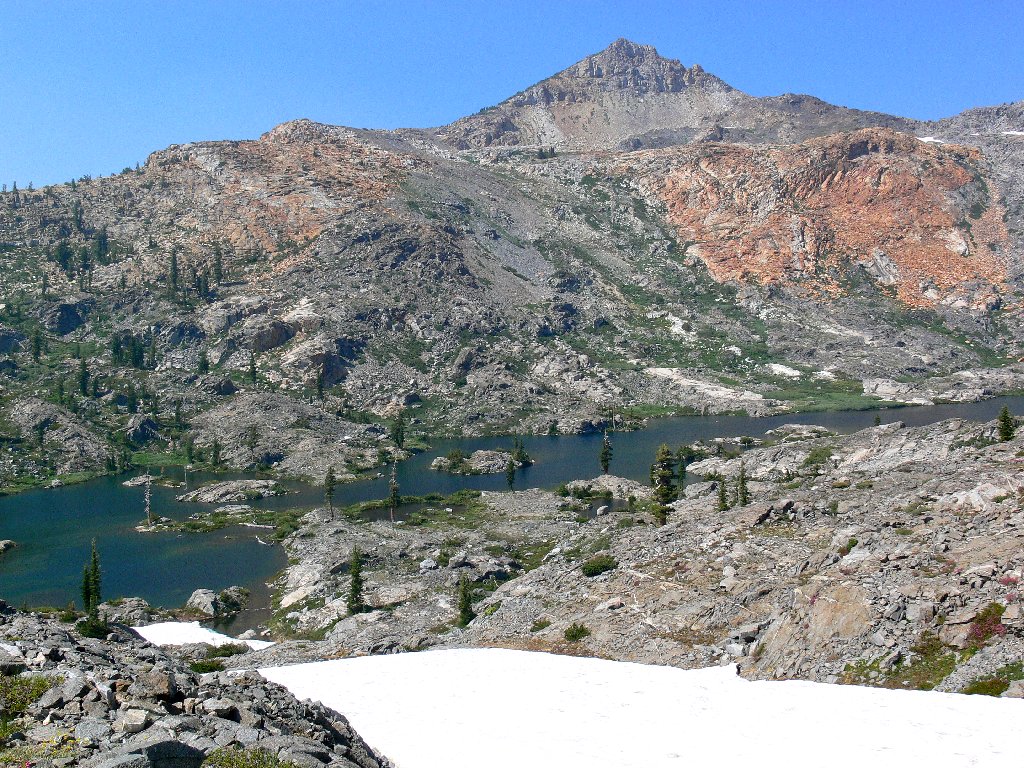
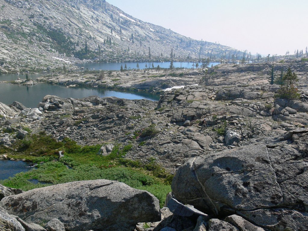
A fairly stiff breeze is blowing in a lot more smoke than was here a while ago. A modest climb achieves a saddle from which we are treated to a first view of Twin Lakes.
Twin Lakes and the Crystal Range
It is suggested that we might head back from here, as virtually the entire
day has been spent off the established trails, and that is hard on the body.
Yet I know that Island Lake is "just over there", and three of my
companions have not been here before; so I vote to continue to the end of the
line, which we do. Well, it so happens that "just over there" is
another half-mile or so of relatively rough going, but it is worth any
effort. More new flowers line the pathway together with some old friends,
as we approach what I long have considered a virtual garden of Eden.
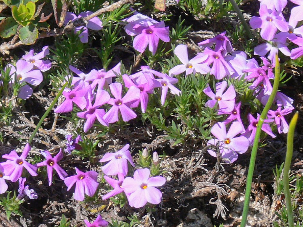
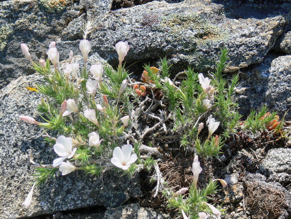
Spreading Phlox
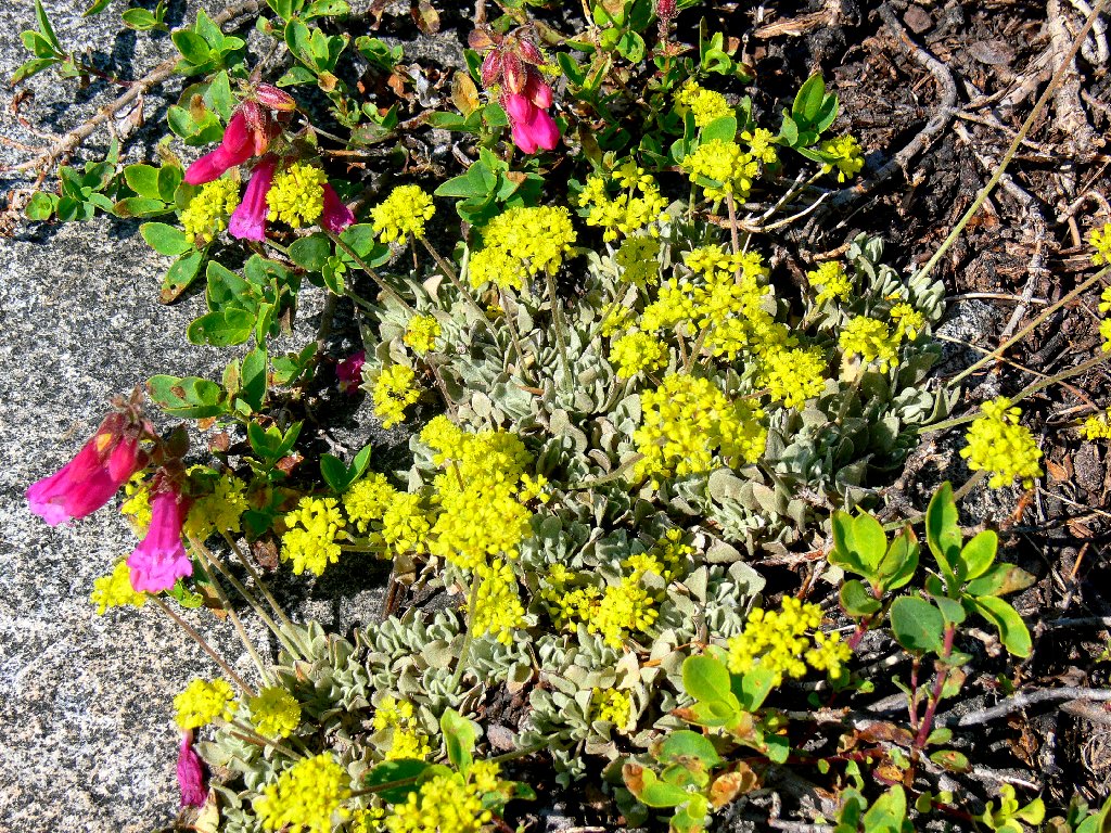
Sulfur-flower Buckwheat and Mountain Pride

Sierra Stonecrop
Pussy Paws
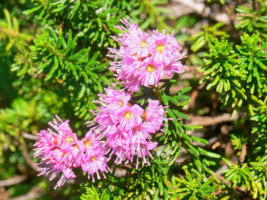
Red Mountain Heather
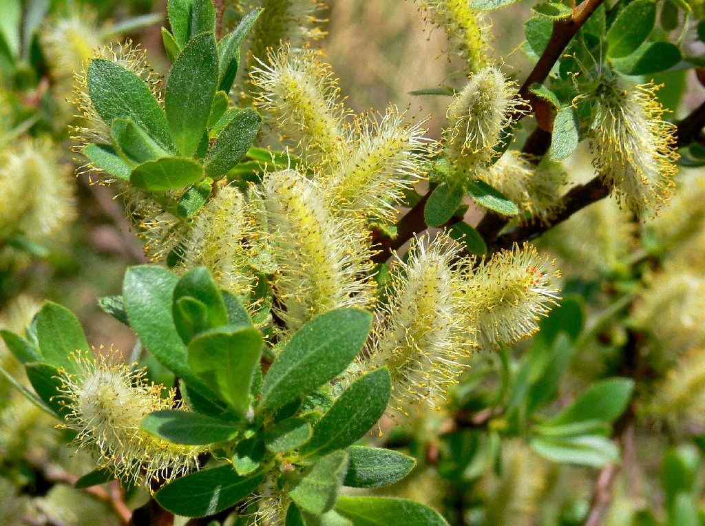
Sitka Willow
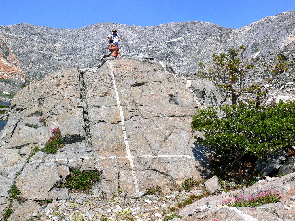
The trail literally merges with Boomerang Lake, instead of detouring around a cliff.
Boomerang Lake
The trail goes right through the water
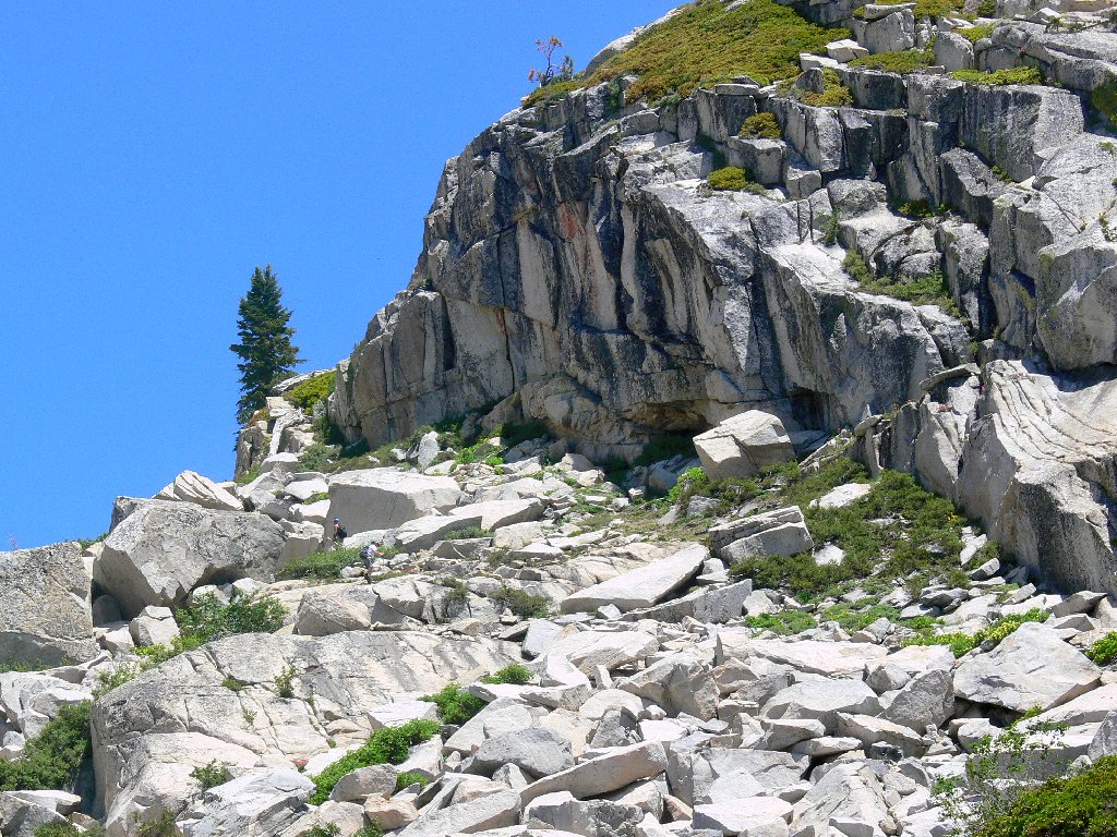
This region's amazing geology is particularly evident in the immediate area. At every turn there is something new and unusual to observe.
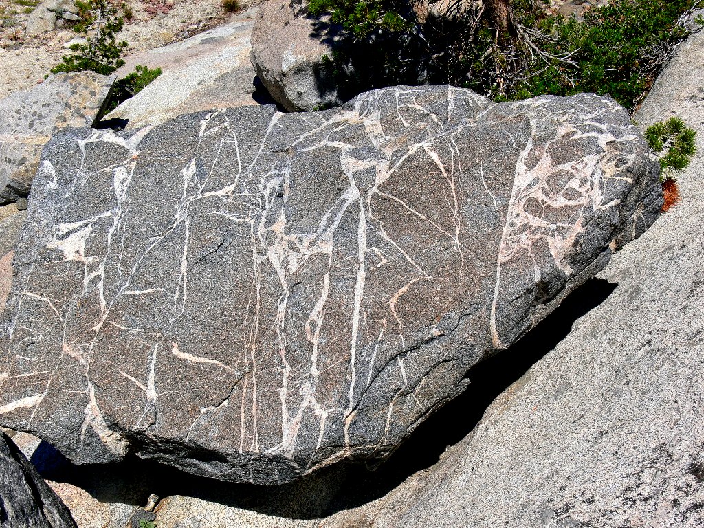
Rocky Road Rock
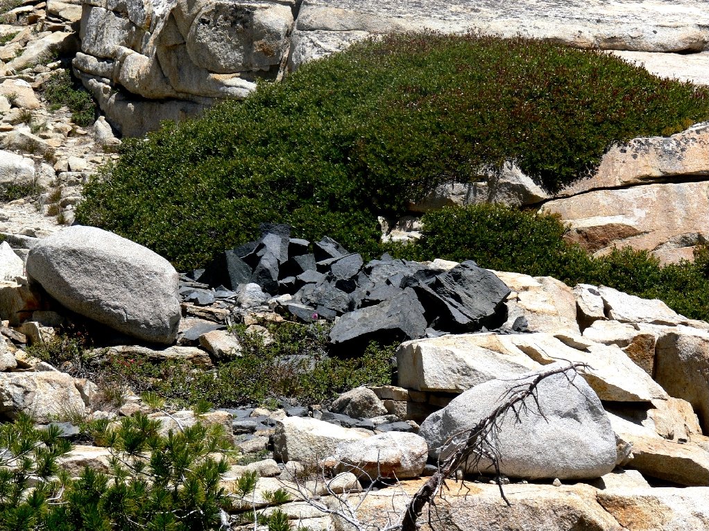
How did those black erratics get here?
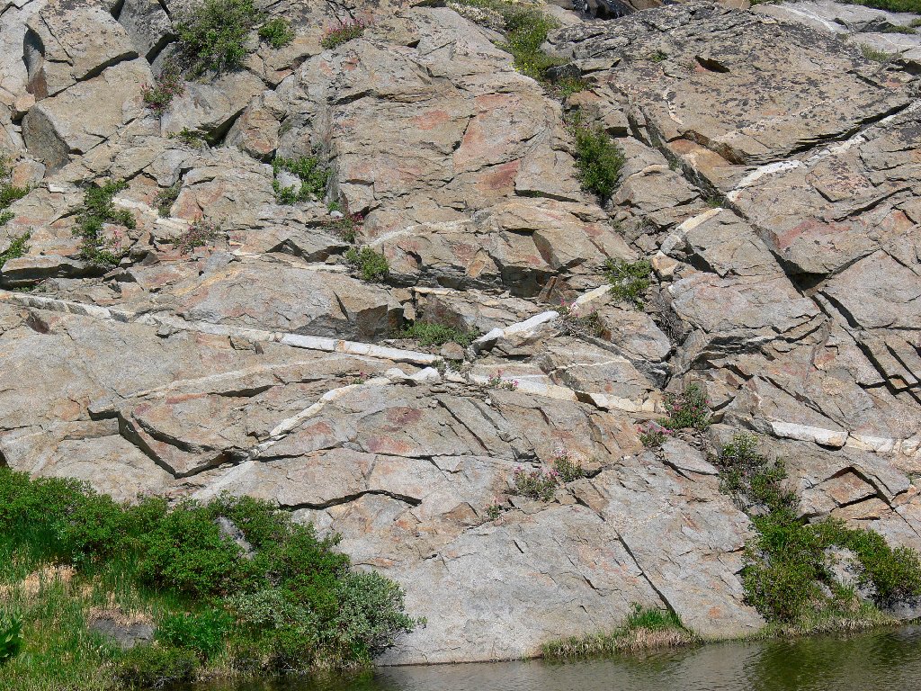
'X' marks the spot
Arriving at Island Lake, Dave and Ali scale an amazing formation to look around. I point to the big snow bank nearby, promising a very pretty pair of lakes just above it. Being apparent gluttons for additional exercise, we make this final ascent to the elevation high-point of the hike. A backward glance provides a stunning vista.
The Hot Cross Bun
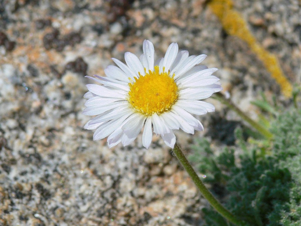
Wandering Daisy atop the boulder
Around the Mulberry bush
Island Lake and Little Pyramid peak, 9941'
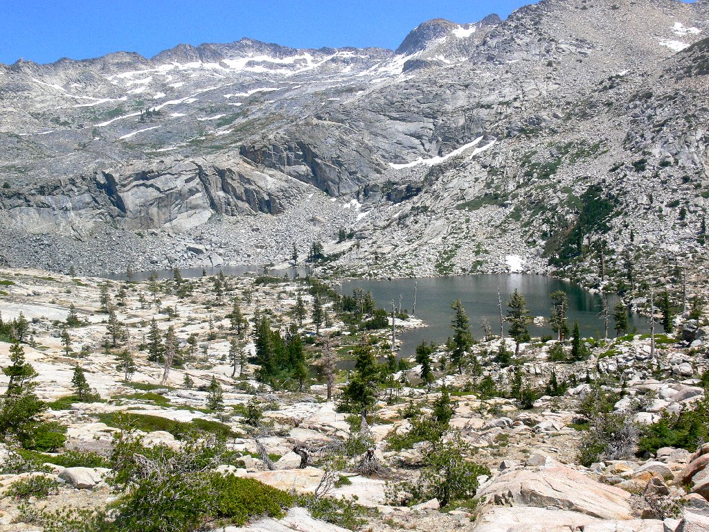
What a waste it would have been to forgo a visit to this upper end of the
cirque — the most scenic portion of our entire trek. Just
ahead is one of my most favorite places in the Sierra. As always is the
case here, one must tread gingerly in order to avoid crushing the lakeside flora.
Silver Dagger Lake and Peak 9318
This knife-blade-shaped body flows directly into a small round lake that
is right at the top of a 200-foot cascade. The heather here are
as brightly colored as we ever have seen them. On Google Earth this area
is referenced by some as Shangri-La, and it certainly is that.

This is why I go hiking
After assuring my companions that a shortcut is available back to Twin Lakes, we tackle a treacherous talus slope that prompts the remark, "It doesn't get any worse than this". I am further admonished that, "In the wilderness, shortcuts usually aren't". Nevertheless, the difficult part is negotiated fairly quickly, and soon we are back on the main trail. Besides, I didn't want to miss the nice profile of the cascade that avails itself along the way. At the same time, a westward look shows how thick the smoke is up here right now.
Ted's bathtub is right at the edge of the cliff
It is worth the hands-on scramble to see this
Smoke invades Twin Lakes
At the next rest stop, a father and his three young sons pass by. Dad asks, "How are you?" I respond, "About fifty years too old". A tricky stream crossing awaits us at the Twin Lakes Dam, across which dad has just carried his youngest boy.
Twin Lakes Dam
The remaining 2½ miles — this time ostensibly on a real trail —
rate to be just a formality. That is, until John slips in the mud and tears a
big gash in his brand new jeans. Some of us briefly lose the trail as well,
necessitating another minor bushwhack. After that, a brief diversion begets
a view of the square-shaped waterfall; then several more flower shots
complete the mission. Accompanied by a few mosquitoes, we return to the
trailhead a couple of hours later than expected, having accomplished more than
anyone had anticipated.
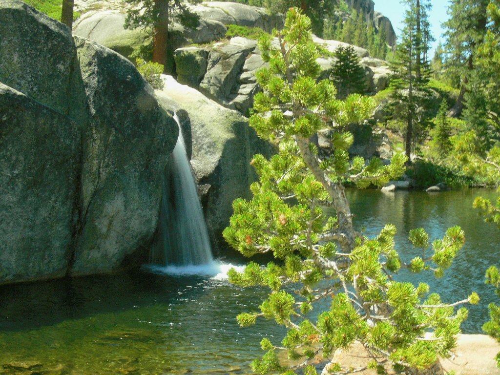
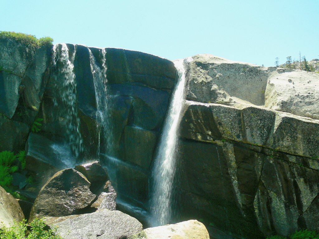
Square falls
Prickly Phlox
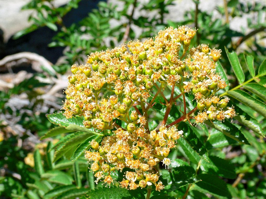
Mountain Ash
Sierra Penstemon
Yes, John, it's nearly over
§: This proved to be a grand adventure, half of which was
cross-country. The flower displays were very nice.
And, of course, sharing new places with friends always is a great pleasure.
Dave's GPS generated this map:
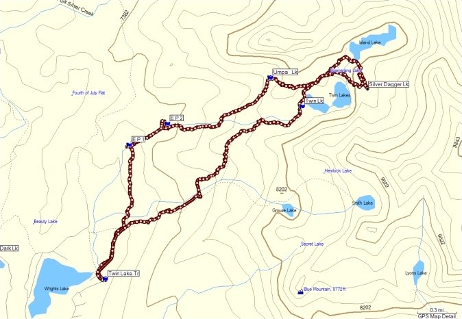
Our route (clockwise)
| Scenery |  |
| Difficulty |  |
| Personality |  |
| Adventure | |
| Flowers | |
| Solitude |  |
