
Tahoe NF
|
Grouse Ridge Road Tahoe NF |
May 14, 2007
There are six miles of bumpy road to the Grouse Ridge trailhead.
Just past the 4-mile mark, an SUV is stuck in the snow on the first
of three long switchbacks. The driver and his companion seem either
to be hoping for divine intervention or contemplating a strategy for
digging themselves out. As they don't appear to be in any real
trouble, I judge it unlikely that I could provide meaningful assistance.
Had the person been alone, I would have offered help.
Roadblock or not, I have driven 85 miles for a hike. This being a spring scouting expedition, it's time to scout! Parking adjacent to a lone backpacker who is preparing a trek of his own, I don my pack and a sweatshirt and take off straight up the hill, knowing that the road awaits me there.
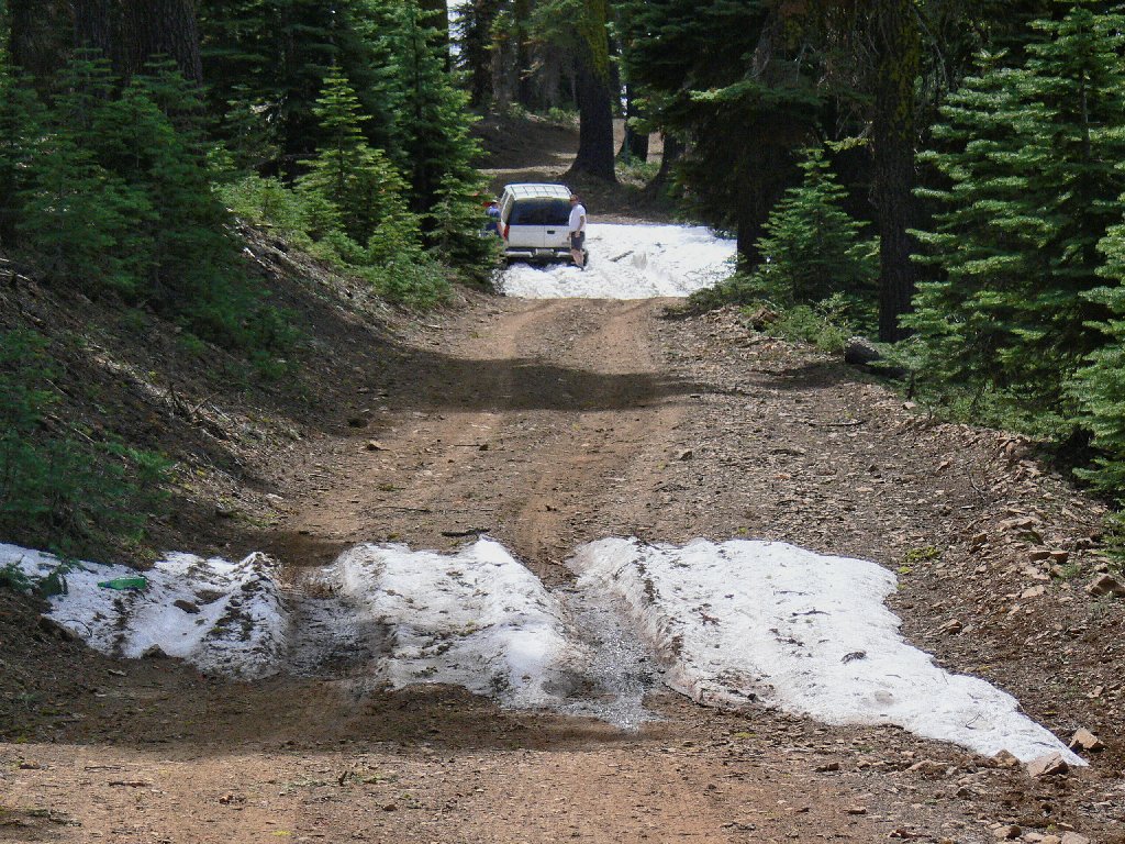
Roadblock
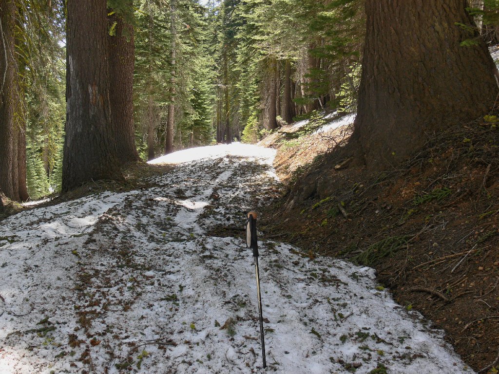
Half a mile up the otherwise clear road, it becomes apparent that further passage would have been impossible for any vehicle but a snowmobile. Having not walked a snowy route such as this in decades, I find it to be a lot of fun. After a time, I stop trying to pick my way around the drifts; the snow is nice and hard on the roadway, and walking atop it is a crunchy breeze.
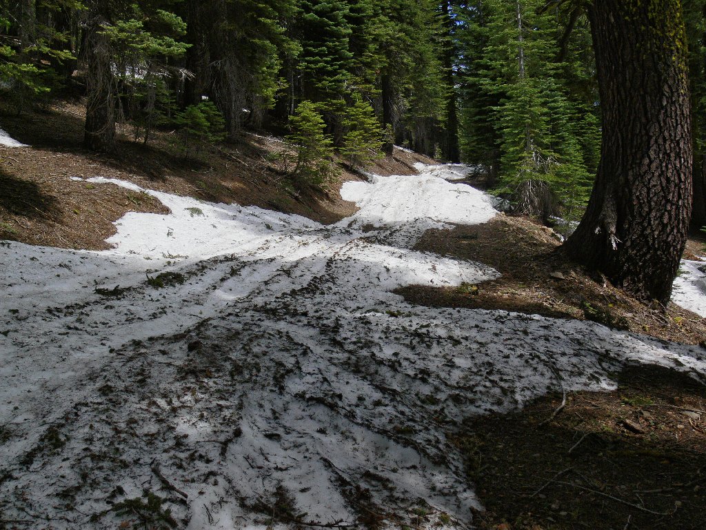
The rest of Grouse Ridge Road
As I approach the lakes basin overlook, suddenly the route is less obvious. There is nothing but snow everywhere! Knowing that the road turns left somewhere around here, I continue undaunted in that direction, admiring the view of Black Buttes along the way.
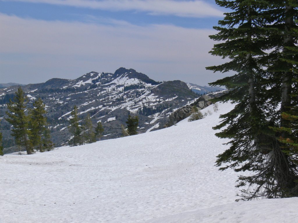
Snowfield and Black Buttes
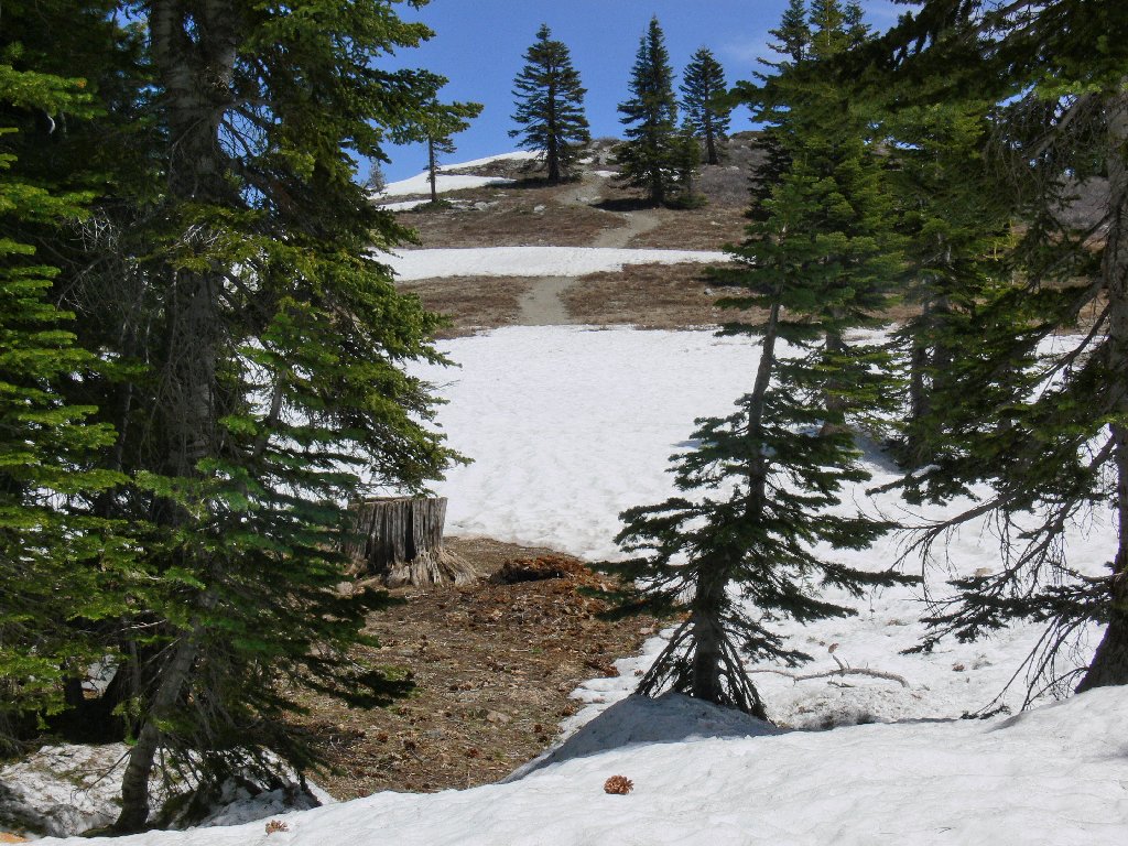
I pass by the campground potty, eventually reaching the trailhead at road's end. It looks as if it wouldn't be difficult to continue into the basin, as there is less snow down below. It seems right to stop here for the day, however, as I have been feeling somewhat lonely ever since leaving the car. The snow and isolation must have something to do with it. In any case, the hiking will be much better later in the season.
The end of the line for today
Below lies frozen Sanford Lake in a nice setting. Other lakes are visible; some are ice-covered, some are not.
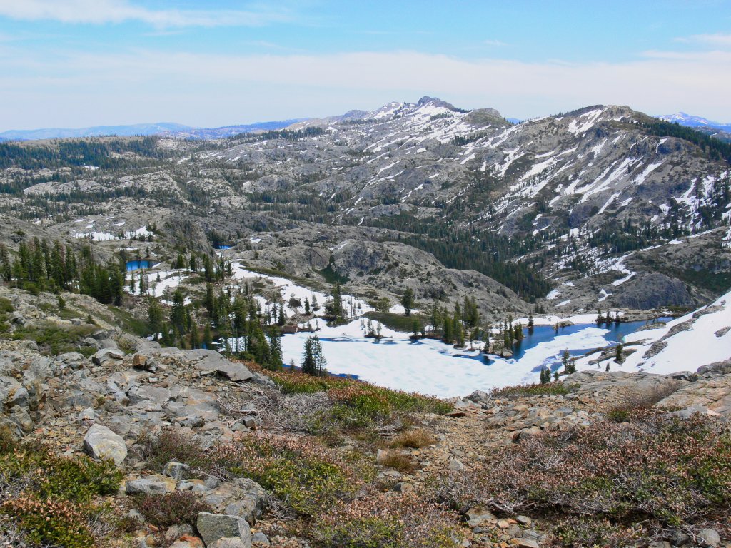
Sanford Lake on the right
Frozen Downey Lake at center left
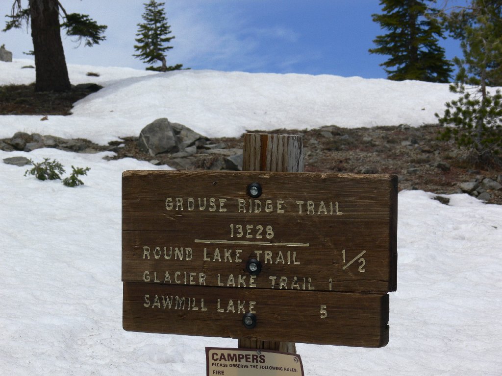
As I commence the return trip, the ridge trail beckons. There should be a good picture or two up there.
Trail up the ridge
This is a reasonable cross-country hiking area, although significant
ups and downs can be involved. Due to the relatively treeless nature
of the landscape, it is virtually impossible to lose one's way.
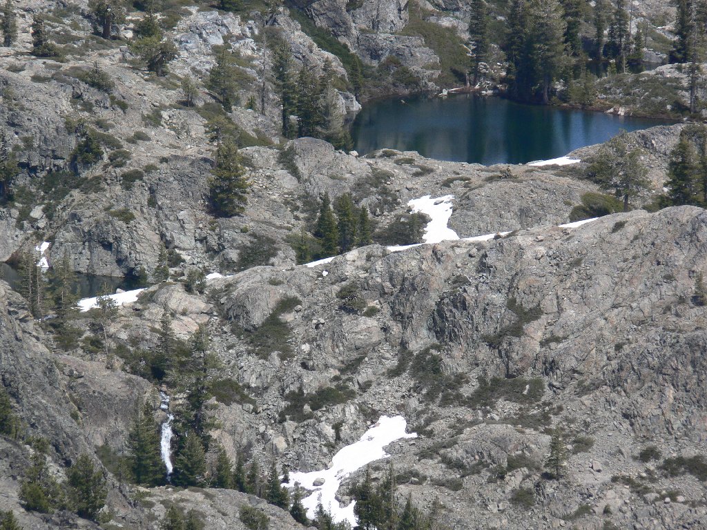
The small waterfall in this telephoto view is on the same Granite Creek
that cascades southward toward Interstate-80 near the junction of
SR-20. By late June it will have dried up.
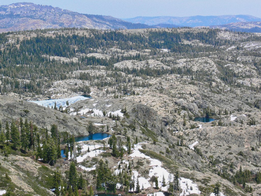
A nameless lake in the basin
The return trip is equally as pleasant as the adventure going in. I feel quite pleased with myself right now.
All things considered, a pretty nice walk
§: Back at the car, I see that the overly ambitious couple
and their stuck SUV are gone. Doubtless those folks are pleased
with themselves as well for having solved their problem. I never
did see that backpacker again.
| Scenery |  |
| Difficulty |  |
| Personality | |
| Solitude |  |
